This Adventurous Age

Adventures travelling and working around Australia.


Leave a comment

2000 Travels November 16

THURSDAY 16 NOVEMBER     KALBARRI

Before breakfast, I wrote a letter to K, informing him that we would not be arriving home on the 14th, after all, but going to Healesville instead. I requested that he let us know a suitable arrival time for us, and also let us know how much the water rates were, when the bill arrives. I reminded him to make sure they left my photos and negatives of their wedding, and to put the cats into our room, on moving day. With the cats’ propensity for getting into boxes and vehicles, I could see them getting moved, too!

I then walked to the shops for fresh rolls, and a new film, and to post that letter.

I phoned Healesville and booked us into a drive through site for the 14th. I also booked us into the Coffin Bay Caravan Park – there was no problem about sites at the time we wanted to visit there.

It is all seeming horribly final!

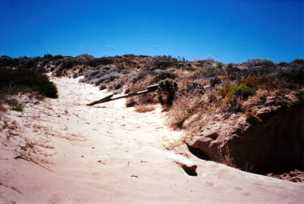
We drove out of town the way we’d originally come in, for a short way, then took the unsealed road to the river gorges in the National Park.

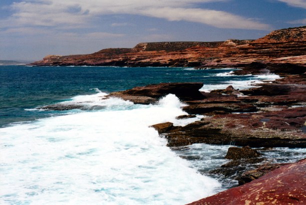
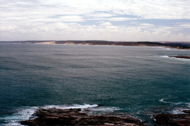
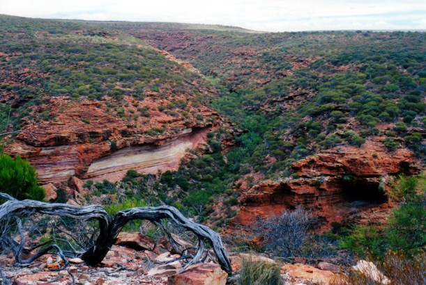
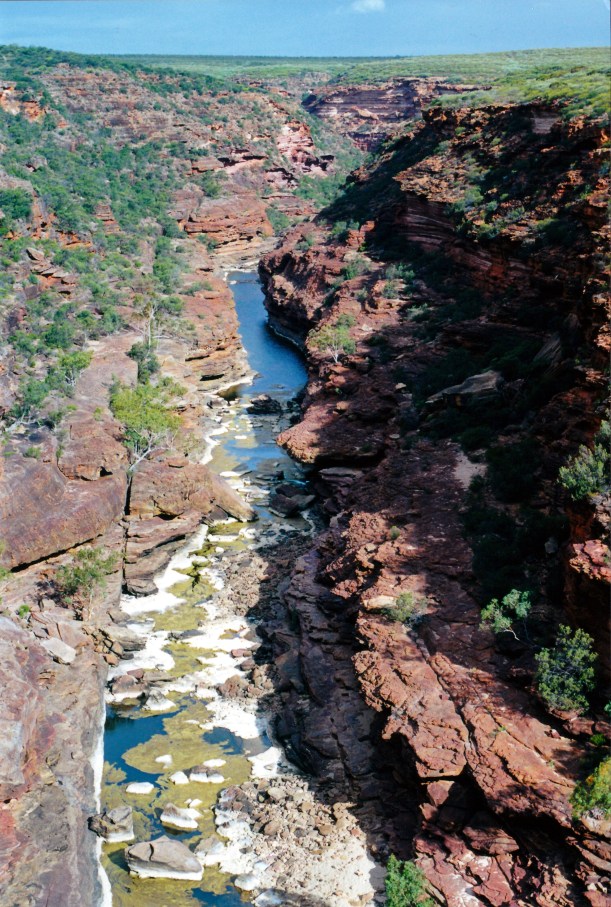
First stop was at the Lookout, where the river was moderately cut into its valley. The river was a greeny colour, the valley walls red. Because the Murchison flows through sandstone layers here, the erosion has been spectacular, creating steep sided valleys and gorges.

11-16-2000 01 Murchison Gorge from lo.jpg

Murchison River and Gorge from Lookout

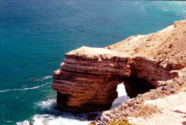
Next stop was the Natural Window, where one looks through a dramatic hole in the rock cliff face, at the river and valley below.

11-16-2000 03 Murchison R at Natural Window.jpg

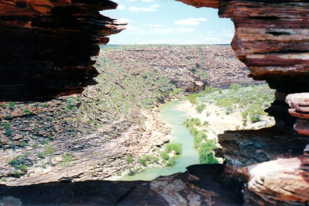
Murchison River through Natural Window

We set out to walk the Loop Track, an 8km circuit, graded moderate – which in WA means quite hard. The track follows a great bend or loop in the river so you arrive back where you started.

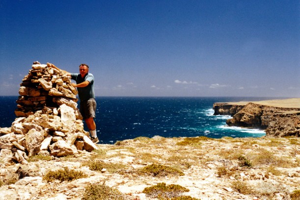
The track started out along the top of the ridge, above the gorge, where walkers had built cairns along the cliff top – like at Barnett River Gorge track. There were good views of the deep gorge.

11-16-2000 05 Murchison R from start of walk.jpg

Murchison Gorge at the start of the walk. The track follows the ridge to the left of the river
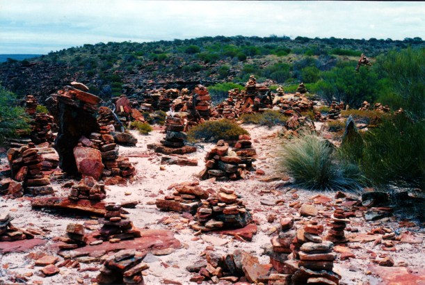
11-16-2000 09 many cairns.jpg

Many cairns

Then the track descended to the river level – quite a straight forward descent. However, it did occur to me that what goes down must at some stage, go up again!

11-16-2000 10 gorge walk tk

Rugged country

11-16-2000 06 river and cairns

Cairns mark the descent to the river. Can see the way we’ve come along the gorge rim

The track then followed ledges alongside the river, through the gorge. This was harder going. A couple of the sections were not very enjoyable, given my dislike of heights and narrow ledges!

11-16-2000 12 in murchison gorge.jpg

We followed ledges through this part of the gorge. This was a nice wide ledge, unlike some!

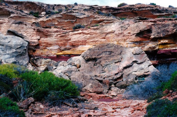
We ate lunch sitting on a rock ledge, admiring the striking outlook over the river and the layered cliff walls.
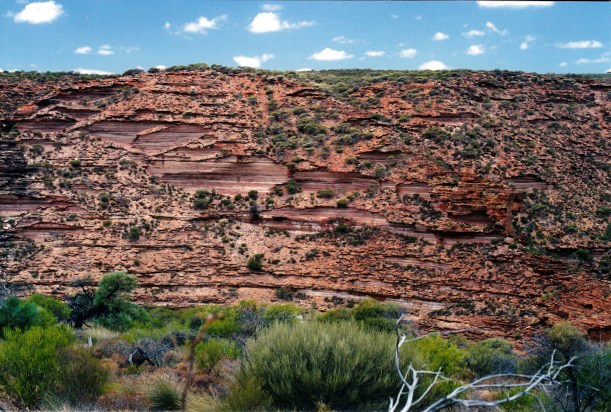
11-16-2000 11 unusual rock wall Murchison Gorge

Gorge wall

Carrying the backpack was making my back ache quite badly – more so than usual – and the heat down in the gorge, with no breeze to alleviate it, was making me tired, too, so John took the backpack for the last part.

The climb back up to the Natural Window was not too bad.

The bloody RAAF was inescapable! They were doing a practice rescue in the Gorge, and so the chopper was all about during the last part of the walk, making noise and stirring up lots of dust. We watched it land, from back up at the Natural Window.
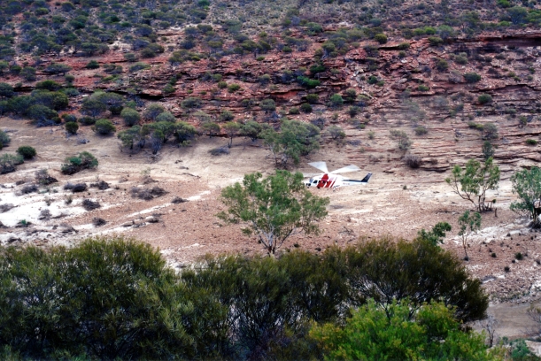
11-16-2000 13 more RAAF games.jpg

More RAAF games!

We were pretty tired by then. Fortunately, some cloud had come over and there was some wind up top to make conditions a bit cooler. We even had a few spits of rain.

That walk took us four and a half hours. It would probably be the last decent walk of the trip.

We then drove to the Z Bend – so named because of the river course there – and did the 1km walk to the Z Bend Lookout. This was different again.

11-16-2000 14 z bend.jpg

The Murchison River at the Z Bend

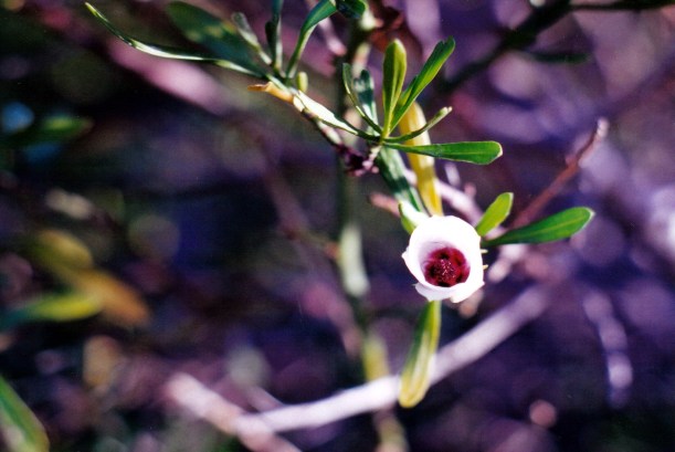
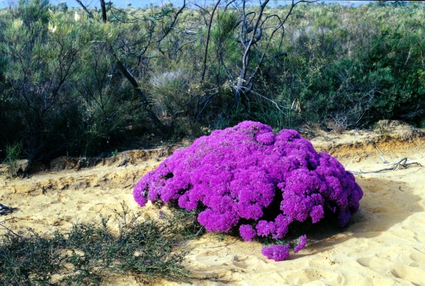
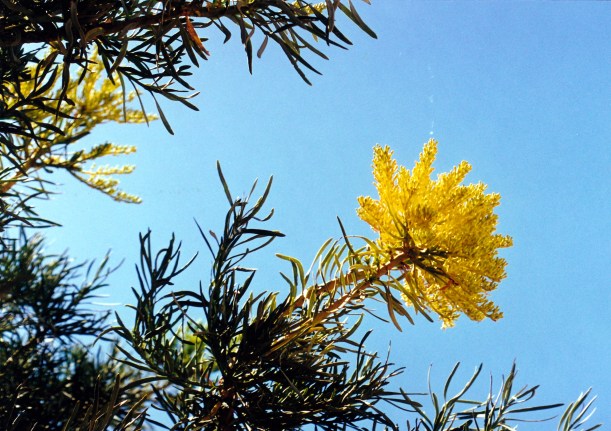
The wildflowers were brilliant. It would be most interesting to be in these parts for a whole spring season, one year.

11-16-2000 15 wildflowers.jpg

11-16-2000 16 grevillea.jpg

This was the seventh National Park we have entered in WA, since buying the annual pass, back in Kununurra, so we have “saved” $63 in entry fees. That puts us ahead by $12 on its cost. It was, of course, meant to see us through maybe nine months of WA touring, which will not now happen,  but it still has saved us a bit.

Whilst driving back to town, we decided we’d buy a new fridge to replace the broken down home one, which is over twelve years old. We also decided we’d look for a new mattress for the bed at home, similar to the one in the van, which we both find extremely comfortable.

Called at the shops for some V8 juice, to make “soup” for tea. We were too tired to go to the sausage and burger cook-up, put on by the park. I made a soup out of the juice, tomato, onion, garlic. John cooked himself whiting and chips. I had a small salad.

Overall, it was a great day of exercise and scenery.

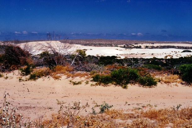
This whole Kalbarri area was totally new for us, as we bypassed it in ’93.


Leave a comment

2000 Travels November 15

WEDNESDAY 15 NOVEMBER    KALBARRI

Hot and windy again. I am getting the idea that this is the norm, here, at this time of year!

I walked down the street again, in the morning, just for the exercise and for something to do while John slumbered.

After breakfast, we drove to the “coastal gorges” – gorges found in the seaside cliffs to the south. These were pretty spectacular cliffs.

We drove to the most southerly first, with the idea of working our way back to town. These were the Natural Bridge and Castle Cove. From the sort of open “gorge” that is Castle Cove we viewed Natural Bridge – rather a Port Campbell like formation, as was the nearby Island Rock. The high, layered rock formations were well worth seeing, though.

11-14-2000 natural bridge.jpg

Natural Bridge

11-14-2000 island kalbarri coast.jpg

Island Rock

Then we moved a short way back to the Shell House – a sort of high bluff, very layered, and wandered about on the cliff tops.

11-15-2000 Kalbarri coast.jpg

Spectacular layered sandstone cliffs

Next was Eagle Gorge. Here we walked down a valley to a small inlet and rock ledges. There were great views of the layered sandstone rock from here.

Drove on to Pot Alley – love the name – and sat in Truck eating our lunch and taking in the views. We saw a couple of dolphins cruising past. There were lots of crayfish pot markers out, and one cray boat went past. Today was the opening of the crayfish season, and it was obvious!

11-15-2000 Pot Alley.jpg

In Pot Alley

We drove to Rainbow Valley – not far from town now – and walked the Rainbow Valley – Mushroom Rock circuit. It took us an hour and was worth doing – there were good layered sandstones of varying colours. The return part was up a little valley with lots of wrens about.  It was pleasant exercise, if a bit hot.

11-15-2000 Rainbow Valley.jpg

Rainbow Valley

Tea was the last of the gazpacho, pasta and a tomato sauce.

The RAAF helicopter went out after dark. This was dramatic, with red and blue flashing lights, spotlights, as well as the noise. They warmed up the engines first, for about ten minutes! He came back after an hour and practiced landing in the dark – not once, but several times!


Leave a comment

2000 Travels November 14

TUESDAY 14 NOVEMBER     KALBARRI

It was still hot and windy.

The RAAF took off – it did not buffet the van as much as we had feared. When he came back later in the day, he landed further up in a more open area, and was then about 75 metres from the van.

11-14-2000 lift off.jpg

While John was still in bed, I walked to the shops for a paper. On the way I happened upon the daily pelican feeding. Apparently, years ago, a local fisherman took to throwing fish scraps to pelicans every morning, when he cleaned the night’s catch. The result was a group of habituated pelicans that turn up at that same time every day to be fed. The duty is shared by locals. It was quite quaint. The pelicans were fairly polite about it all.

After breakfast, we went touring. I wanted to visit the wildflower display place, being very conscious that we are well and truly into wildflower season in these parts. However, it was shut.

We drove up Meanarra Hill, behind the town, from where there were some good views across the town and over the surrounding country.

Then it was to the shops, for lunch rolls.

After lunch, we went to bowls. It was social bowls, but we still had to wear whites, which rather peeved me. The triples team I was put into drew one game and lost the other by one. The team John was in came last! I was pleased with my game – on grass, and not having played for a while.

It was a hot afternoon and I was very tired by night.

Tea was gazpacho, steak, mushrooms, potato, zucchini.


Leave a comment

2000 Travels November 13

MONDAY 13 NOVEMBER     KALBARRI

It was another hot and windy day.

After breakfast, we went to the Rainbow Jungle – a parrot display and breeding/conservation place. It was excellent and worth every bit of the $20 we paid to go in.

11-13-2000 rainbow jungle window.jpg

Themed stained glass feature at Rainbow Jungle

Their landscaping was very good, as was the building and layout, and the use of water features was brilliant. That was all nearly as engrossing as the birds – but not quite.

11-13-2000 rainbow jungle pool.jpg

Water feature at Rainbow Jungle

We really liked the walk through area where the parrots flew freely around. Particularly interesting were the Princess Parrots, which sound a bit like bellbirds.

However, some of the caged birds looked a bit miserable. It was hot in there and some of them were moulting, which made them look sad.

It proved impossible to get a decent photo of the parrots – they moved too fast!

The establishment seems to be doing a good job of breeding up some threatened species, though we doubt whether these would ever be able to be released into the wild.

We spent about three hours there, in all – it was engrossing. We ate our lunch there.

11-13-2000 rainbow jungle reptile

This critter did keep still for me!

Had to do a small grocery shop.

Then we followed some rough tracks alongside the river, upstream from the town, to the big river bend. John had a brief fish there. I found the drive along the river interesting.

Back at camp, I went off for a shower. I was naked and wet when there came a huge, loud, engine noise, right overhead! It sounded low and frightening and I thought something was going to crash right on top of the ablutions block. I wasn’t sure whether to rush out as I was, or take the time to become decent! I hurried the rest of the process and emerged, to find it was a big RAAF Rescue helicopter, that had landed about 50 metres from our van!

It seemed the RAAF was here for a week, for exercises. We could have had some notice, I thought.

11-12-2000 kalbarri camp.jpg

Up close and personal with the RAAF

Tea was gazpacho, followed by a spicy chilli prawn stir fry.

John phoned K about sending mail. K made it clear that he did not want us home on the 14th, but preferred us to stay out of the way until they’d packed and gone. He said the fridge had broken down again, he hadn’t had time to arrange repairs, so put it out in the shed. The heating had also broken down, but he’d had that fixed “by a mate”. That did not auger well! John was pleased to be going home to check out these broken things.

After discussion, we decided we would not arrive home until after they had moved out, but have a night or two at Healesville and wait till the all-clear!

We revised our schedule and decided that we simply do not have time to go south of Perth at all, now. We did see a little bit of those parts in ’93, though there was lots that we missed. Of course, we had planned to spend much of early 2001 in the south west of WA.


Leave a comment

2000 Travels November 12

SUNDAY 12 NOVEMBER     KALBARRI

It was still windy in the morning.

Before John woke up, I walked to town to buy the Weekend Australian. It was a good walk.

After breakfast, we went for a short drive, along the coast to the south, to Red Bluff Lookout. As we left the town, could see Red Bluff looming as a rise in the distance.

From the Bluff there were good views back along the coast to the north, along the cliffs. It was a bit hazy though. We could see over the town and the river mouth. This looked as though the entrance could be rather hazardous for boats.

11-12-2000 coast nth of Kalbarri.jpg

Kalbarri coast. River mouth inlet is off to the right

The day was hotter and more humid than I would have expected.

After lunch, John went to bowls.

I read the paper and made a batch of gazpacho. I phoned V and had a good chat, mostly about Hamelin. There seem to have been some changes since their time there, but not major ones.

John had a pleasant time at bowls and won a bowls polishing cloth with the Kalbarri club logo on it.

I found out that we’d only won a $29 prize in the Lotto draw of 11/11. So much for the theory of lucky numbers!

Tea was gazpacho, and citrus stir fry pork with cashews. Nice.


Leave a comment

2000 Travels November 11

SATURDAY 11 NOVEMBER   HAMELIN POOL TO KALBARRI   294kms

After breakfast, John topped up the fuel tank from a jerry can, thinking that we had really used up a lot of diesel yesterday.

Apart from that, the rest of the pack up and departure was quite routine.

11-11-2000 hamelin - drink.jpg

This little guy was trying to get a drink? Or catching insects?

I took a photo of the Telegraph Station before we left.

11-09-2000 02 hamelin telegraph station.jpg

Old Telegraph Station, Hamelin Pool

We stopped at Overlander Roadhouse, when we reached Highway 1, and filled up – at $1.24cpl.

As we travelled south, the roadside vegetation became gradually taller and greener, and eventually we came into sections where there was cropping – wheat – in the distant paddocks.

Crossed the Murchison River – not a very large water course – at Galena Bridge.

Not far south of the river, we turned off the highway to go towards the coast.

Reached Kalbarri about 11.30am.

We parked the rig close to the shops, found a chemist and put John’s script in for filling – it had to be done today, as he had run out of his Celebrex. We waited while it was made up, then went and bought rolls for filling for lunch.

We set up at the Anchorage Caravan Park, for $18 a night. We’d liked what we’d seen of the township, there was some walking we wanted to do, so we booked in for a week and got the seventh night free.

The park was on the northern edge of the town, up on a hill above the Murchison River, which entered the sea just a bit further down. The outlook was really pretty.

Set up, had lunch and settled down for a relaxing afternoon.

John slept for a couple of hours.

I walked to the town along the river side path, which was a lovely walk, although it was very windy.

I’d been hearing amplified noise from the town direction so curiosity had taken me that way. The loud speaker system at the boat jetty was broadcasting the annual blessing of the cray boat fleet. The cray season opened later that week. Obviously, cray fishing is a significant industry here. There was some very low quality entertainment happening there.

John was awake when I got back from my investigation. We walked up to the bowls club, so he could find out about any coming events.

For tea John had whiting and salad, and I contented myself with Greek salad.

It was a really windy night.

11-11-2000 to kalbarri


Leave a comment

2000 Travels November 10

FRIDAY 10 NOVEMBER     HAMELIN POOL

I was up early and walked around the area, enjoying the solitude. It really is a lovely place.

We left the caravan park at 7.30am and drove back towards Denham for a little way, to the corner where the road to Useless Loop goes off. Waited there, as arranged, for the talkative guy and his family. They did not show up. We were quite relieved, because we really do not like being constrained by other people.

The road was good gravel, until the Useless Loop turn off. What a strange name for a place! There is gypsum and salt extraction works there, and a little township for the workers. No access for anyone else though – it is a closed town. The salt extracted from here is supposed to be the purest sea salt in the world!

Initially we drove through low eucalypt and acacia type scrub which was quite attractive, but on  Tamala Station that changed to arid saltbush type scrub.

11-10-2000 tamala rose.jpg

Tamala Rose

We saw a wild mallee fowl – first one of those we’ve seen.

We passed the turn off to Tamala Station – apparently they had begun to take campers, so we marked that down for future reference – in the unlikely event of further travel this way.

After the Useless Loop turnoff, the road became rougher and eventually turned to sand, where we needed 4WD and the tyres let down.

11-10-2000 03 steep point tk.jpg

The start of the 4WD required area

The track crossed a causeway over Useless Bight.

11-10-2000 01 blind bight.jpg

Blind Bight

11-10-2000 02 useless loop causeway

Causeway crossing Useless Bight

There were some spectacular sand dune vistas – some of these big dunes did not appear to be fixed by vegetation, and so would be moving. There were views of seas that were, in turns, bright blue, browny green, and dark blue. Much variety and a really interesting section of today’s trip.

11-10-2000 04 track & dunes

Sandy track in foreground; shifting dunes in background

We passed a big, empty-seeming stone house and wondered what its story was.

11-10-2000 06 new house carrarang owners.jpg

Grand stone house

Then we came to the Ranger’s base. There was no one there to collect our $20 access fee.

We drove on across the narrow peninsula of land, to the Zuytdorp Cliffs – just dramatic and awesome. The flat limestone surface of the land ended abruptly at the cliff edges, which in places were 200 metres high.

11-10-2000 07 by Zuytdorp Cliffs.jpg

At the Zuytdorp Cliffs – land’s end

The sea was pounding in below us. It was windy there.

11-10-2000 09 zuytdorp cliffs.jpg

Zuytdorp Cliffs

The Zuytdorp Cliffs were named for a Dutch sailing ship that was wrecked in the area in 1712. Back then, ships used to sail from Europe around the Cape of Good Hope (no Suez Canal in those days), and catch the prevailing westerly winds – the Roaring Forties – to speed them across the Indian Ocean. They would then turn north – for the assorted European colonies of Asia. If someone miscalculated and left the turn north too late, the result was an encounter with the arid and inhospitable west coast of Australia – which usually ended badly for all concerned!

11-10-2000 11 Zuytdorp Cliffs south.jpg

Zuytdorp Cliffs – looking south along the indian Ocean coastline

We then drove sort of northwards, to Steep Point – the western most point of the Australian mainland.

11-10-2000 08 steep point

Steep Point in the distance

We added a stone each to the little cairn there, and took photos – of course – by the sign board that told us where we were, in case we’d just rocked up there by accident!

11-10-2000 10 cairn

The western-most point of the Australian mainland

So – we had now visited all four of the extreme points!

11-10-2000 13 wendy.jpg

There were people fishing at Steep Point. Some were using balloons to fish off the cliffs. We hadn’t seen that before. The balloons carry their fishing rig clear of the base of the cliff. I wondered how many failed attempts they’d had before they got that right!

John decided to find a beach, or non-rocky water area for us to have lunch and for him to fish.

We took a side track that was ok, and then parked at the top of the last bit of the track, and walked down a steep little dune face to the water’s edge. John then decided he could drive down that, to save carrying gear any distance. I was very dubious, but he proceeded to come down.

11-10-2000 16 where john just had to drive.jpg

John just had to drive down here to the sea

There were the rusting remains of a 4WD vehicle at the bottom of the track, near the water, which I pointed out to John. He got cross about this, and went to drive back up the dune, to show me I was wrong. However, he got stuck towards the crest, and several further tries at it didn’t move him any further.

11-10-2000 17 wreck 4wd.jpg

Old 4WD wreck illustrates the fate of those who are too adventurous!

Next was an attempt to winch out. Of course, there were no trees or rocks to help. There was a track closed sign by another track at the top of the slope, so we attached the winch rope to that, but it pulled out of the ground!

11-10-2000 14 winching

So close to the top, but stuck and trying to winch out using a barrier

11-10-2000 15 winch attachment

Now we have to repair the barrier, as well………

We dug some sand out – quite a lot of sand, it felt like. Put down shadecloth strips in front of the wheels. We went and gathered what little bits of rock we could find and added these to the shadecloth strips – the addition of the rocks enabled him to just get to the top, on a re-run up from the bottom.

11-10-2000 18 where bogged

And that’s where he was stuck!

All that took about an hour, and it was hot work.

Apart from being stuck out there in such an isolated place, and thus the likely cost of a recovery effort, I was concerned about how high the tide would rise, so there was a sense of a limited time to get ourselves out.

I was cross at what I regarded as stupidity on John’s part, in the first place.

Thus, we had a late lunch, at a little beach area that was much safer to access. John fished and caught two whiting there. I went for a walk along the beach area. Saw a reef shark there, about a metre long, nosing about in the rocks, close to shore, and a big school of fish, heading off into the deeper water channel.

It was a very pretty area, but wind blown sand was annoying.

Then it was time to start heading back.

There was still no-one at the Ranger base, but we met the Ranger’s wife further on. She’d been to Useless Loop for supplies. She was a very nice, chatty lady. She was driving a Defender 130. She said they’d done several sets of wheel bearings, due to the sand. They now had self greasing ones? Not sure how that works. She did not want our $20 as we were not staying the night.

She told us that the stone house complex we’d wondered about was a holiday house for the owners of Carrarang Station. Carrarang was a nearby station, kind of between Tamala and here. It was, she said, on a freehold patch of land, so even if a National Park was set up in the area, the house would stay. They’d had German stone masons build it. We thought the house certainly had brilliant views, but was isolated.

The ranger couple was employed by the salt company – the area was not yet a National park. She said she loves it out there. They hope that an Edel Land National Park will be set up soon, there.

The drive back was fine. We had to stop after negotiating the sandy sections, to pump up the tyres again.

11-10-2000 05 track

Tracks were a mix of sandy and stony

We reached the caravan just on dusk. The sunset was pretty.

Tea was the whiting he’d caught today, for John, and leftover salads for me.

It had been a long day, especially for the driver, but (mostly) a good one. The round trip was 350kms.

I was very glad we’d made the effort to go out there.


Leave a comment

2000 Travels November 9

THURSDAY 9 NOVEMBER   DENHAM TO HAMELIN POOL   116kms

I got up at 7am and went for a walk along the shorefront and main street. It was very enjoyable at that time of day.

Then I was hailed by the young guy who’d befriended us, as I went by where they were staying, and spent half an hour chatting with him.

John was up when I got back to the van.

Breakfast, pack up, hitch up were all routine.

We did a few things in the township, on the way out. Some bakery purchases. John talked to a real estate agent who spied him looking in the window. I bought Lotto tickets, because there is a draw coming up on 11/11! Lucky number for us – we hope!

I went to the CALM Office and bought the brilliant aerial view poster of the Shark Bay area. It was not cheap, but I really wanted this memento.

We stopped in at Whalebone Bluff, not far off the main road, where there was a little bluff and an informal camping area. It had great views, but they were not quite as spectacular as those at Eagle Bluff.

11-09-2000 eagle bluff area.jpg

Whalebone Bluff

Then we stopped at Shell Beach, which is as the name suggests, a great expanse of tiny cockle shells, instead of sand.

11-09-2000 01 shelly beach.jpg

Billions of tiny cockle shells at Shell Beach

We noted the vermin proof fence across the Peninsula at that point. Because the Peninsula is so narrow here, and because of the sea surrounds, it was considered a promising place to try to eradicate introduced predators like cats, and foster a recovery in numbers of some of the threatened native animals of the area.

We booked into the Hamelin Pool caravan facility, for $14 a night. We got to choose where to set up. Unfortunately, some of the best i.e. shaded sites, were already occupied. We were annoyed later when these turned out to be day trippers visiting the stromatolites, and who left after doing so.

However, we managed to find a place with a bit of shade, to set up.

11-09-2000 09 hamelin camp.jpg

Our camp at Hamelin Pool

The tap water was salty. The power goes off at 10.30pm.

The Telegraph Station precinct looked much better than I’d remembered it, from ’93. The Telegraph Station was built in 1884 and was a major link in the communications chain from Perth to parts north. The Post Office for the Shark Bay area was also here, for years. And it was a cargo landing and loading point in past times. So it is quite an historic place.

I recognized much that V had described in her letters. The two caravans that housed the staff when they worked here, were still there.

11-09-2000 08 vee's one time home

Was the staff accommodation when my daughter worked here

The surrounds were well kept.

The ablutions block was ok – I have been in plenty that were more primitive than this one.

A couple about our age were managing the place. There did not seem to be any other workers there, but we are out of the tourist season.

After setting up and having lunch, John had a sleep.

I wandered over to the tea room shop where I bought a polo shirt and some other touristy oddments.

After John woke up, we walked through the shell quarry to the stromatolites.

The shell quarry is a place where blocks of solidified cockle shells were quarried for building with, both on site here and in Denham. I thought it was similar to the limestone block quarries of the SE of South Australia.

11-09-2000 04 shell block quarry.jpg

The shell block quarry

Shell block had been used to mark one lonely grave – a man who drowned in 1911.

11-09-2000 05 grave Hamelin Pool.jpg

Lonely grave with shell block marker

The stromatolites, although not particularly exciting to look at, are of great significance as living fossils, a truly ancient life form.

11-09-2000 06 stromatolite view Hamelin Pool.jpg

The stromatolites of Shark Bay

All this area has been taken under CALM management and looks good. There were informative and interpretative signs and a board walk over the stromatolites themselves, to prevent damage. I remember, in ’93, just being able to walk all over them!

11-09-2000 07 Hamelin stromatolites and beach.jpg

The whole area is much more pretty and attractive than I remembered it. I could see why V liked it here so much.

11-09-2000 03 tent camp area Hamelin Telegraph Station.jpg

The tent camping area – and old Post Office signs featured

The sunset, which we glimpsed from the van, looked to be wonderful. I hoped we’d be back tomorrow in time to see it properly.

By late afternoon it had become rather windy, and chilly enough – just – for us to need long trousers and windcheaters.

Tea was assorted salads and tinned fish.

There was no TV here! We listened to the radio and to CD’s – very pleasant.


Leave a comment

2000 Travels November 8

WEDNESDAY 8 NOVEMBER     DENHAM

Today, for a change, we explored in the other direction from Denham, back the way we’d come in. We did not intend to visit Monkey Mia whilst here, which is the main reason tourists come here. We had done that in ’93, and fed dolphins. It was a unique experience to do once, but we feel no compulsion to do it again.

We drove to Eagles Bluff, a promontory from where one looks across the inlet to the distant next peninsula across, and the settlement of Useless Loop. The views from Eagles Bluff are entrancing, because of the different colours of the sea, and for the marine life.

11-08-2000 sea & sky Eagle Bluff.jpg

Contrasting sea colours

We watched sharks and mantas and stingrays and schools of fish below us. There were lots of cruising sharks. It was a fascinating display, enhanced by the different water colours – due to weed and rocks?

11-08-2000 eagle bluff fish schools.jpg

Schoold of fish in the water below us

11-08-2000 eagle bluff view.jpg

We ate lunch in that area, at one of the informal camping spots, overlooking the sea. It certainly would have its attractions as a camp spot, if one needed no facilities and could cope with the wind that often blows.

11-08-2000 sea contrasts.jpg

Eagles Bluff area

The young couple we’d encountered yesterday, at Big Lagoon, turned up here, and we got chatting – again! They’d gotten bogged yesterday, out near Bottle Bay. He said it was his fault – he didn’t have his tyres deflated enough. (I’d thought so!)

When we told him our plans, he proposed joining us on a drive out to Steep Point, on Friday. He wants to do it, but with the baby he wants the security of another vehicle, I think. Getting bogged must have given him a fright. He had been to Steep Point before, with some mates, but wanted to show it to his wife. We told them we would be camping at Hamelin Pool, and they could meet us there at 7.30 to 8 am on Friday morning.

After our fill of Eagles Bluff, we headed back towards  Denham, detouring down a couple of short tracks to the sea, to take in the varying views.

11-08-2000 shark bay heritage area.jpg

11-08-2000 shark bay wh area.jpg

Then decided to drive out to look at the wind turbines, and then on to the creek outlet from Little Lagoon to the sea. Little Lagoon is just north of the town.

11-07-2000 02 wind power.jpg

Back in town, at the Post Office, picked up the letter with John’s new Celebrex script, from our doctor.

Refuelled Truck – $1.23cpl.

By nightfall, it was windy again.

Tea was a bit of a mish mash. We had the last of the gazpacho. John had leftover savoury mince and pasta. I had a packet curried pasta.

A couple of days ago, a man swimming at Cottesloe Beach, Perth, was killed by a shark. This event has generated some of the most ridiculous talk-back radio I have ever heard! An appalling number of callers were asking for the systematic eradication of all sharks! Have they never heard of concepts like the food chain, ecological systems and the like? A hunt was mounted for this white pointer, but it has not been found. No doubt it has resumed its normal diet of non-human marine creatures. How many sharks are killed by man, every day?

Up in the Kimberley, a croc jumped out of the water at a man fishing in a boat, and bit his shoulder. Rather un-croc-like behavior. Most anti-social, so it has been captured and taken to a croc farm. With the early onset of the wet season up there, the croc mating and nesting season would be early too.

I will be sorry to leave Denham – another wonderful spot where we could have stayed considerably longer. I could gaze on these sea views for a long time! The whole Shark Bay heritage area is truly special. John really liked it too and reckons he could live here!

My daughter was really fortunate to live in this area for several months, in ’98.


Leave a comment

2000 Travels November 7

TUESDAY 7 NOVEMBER     DENHAM

After breakfast, refuelled Truck. $1.23cpl.

Went out to Big Lagoon again, because John was keen to try some more fishing.

I did some bird watching for a while, then tried the fishing.

We caught some whiting.

A younger couple, with a baby, turned up and stayed a while. He tried fishing, briefly – and was very chatty. They then headed off to go to Cape Peron. He said he knew all about sand driving, and had let his tyres down “a bit”. Hmmm…..

Ate lunch out there.

There was a build up of cloud through the afternoon.

11-06-2000 05 composition.jpg

Still life in sand

We stopped fishing and both walked around the lagoon shore, because I’d convinced John it was quite special. Walked around the corner that we could see from our fishing point and found there was an even bigger continuation of the lagoon around there. It really is big!

11-06-2000 08 big lagoon beach.jpg

We were intrigued to see emus wading out in the water. Didn’t know if the water was actually drinkable for them, or if they were cooling their feet, or just doing so because they could!

11-07-2000 01 emus wading.jpg

Emus paddling

Eventually, we drove back to the old homestead, with an idea of looking for birds around that watering point, but it was a bit late, so we didn’t try that for long.

For tea, John had flathead, I had a Greek salad.

The night was very windy, and then it RAINED! I couldn’t remember the last time we’d had rain – think it was back in Qld a few months ago?