This Adventurous Age

Adventures travelling and working around Australia.


3 Comments

2007 Travels May 8

TUESDAY 8 MAY     ARKAROOLA

Today was more overcast. I hoped that was not ominous.

We got up slightly later than usual, perhaps due to lower light levels, and didn’t get away from camp until 10-ish. Later than ideal on a day of planned walking.

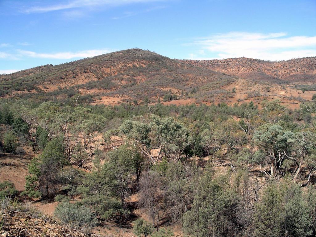
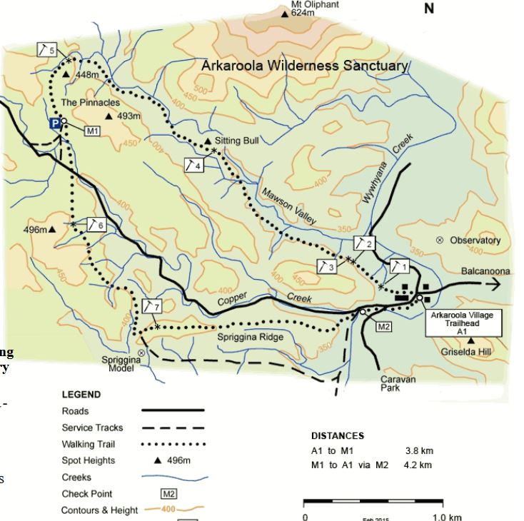
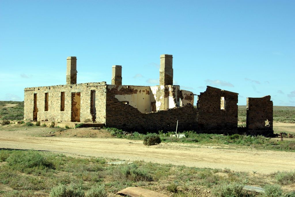
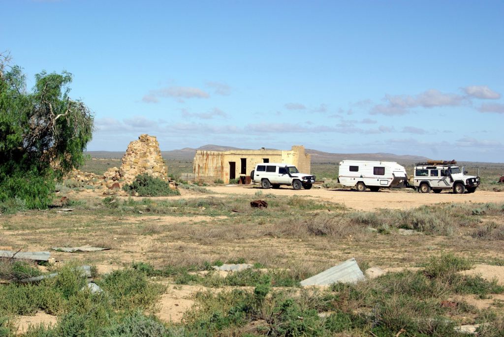
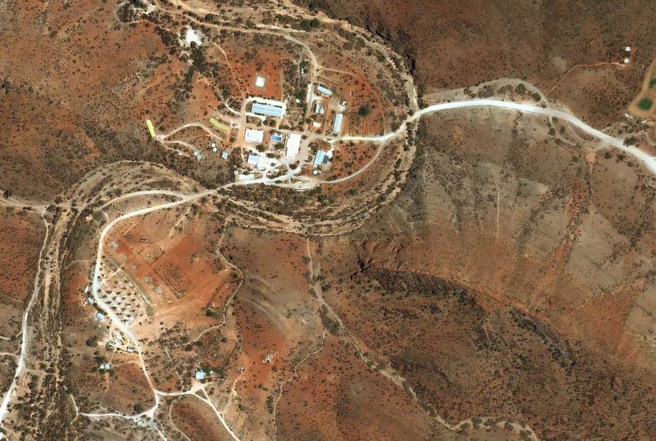
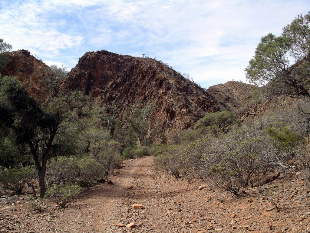
We drove back south to the National Park, and took McTaggarts Track in as far as Grindells Hut.

This relic from the earlier pastoral period stands in a natural pound, surrounded by bare ranges and with a fabulous outlook. It actually has a rather grisly history, at odds with the beauty of its setting, involving the murder in the area of a local pastoralist, possibly at the hands of his father in law – Grindell.

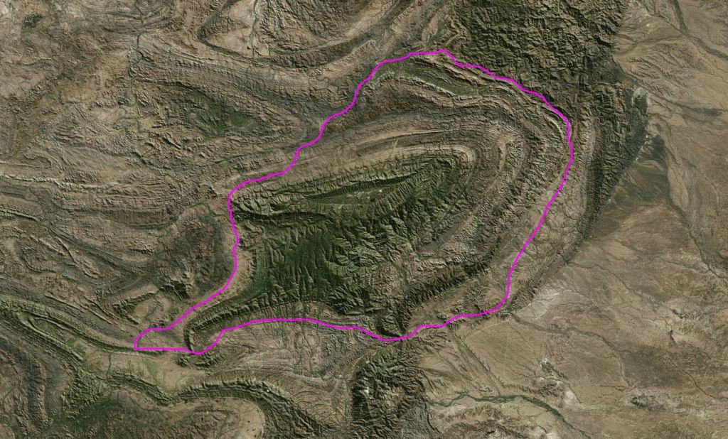
Left Truck at Grindells Hut and set out to do a circuit walk – along Balcanoona Creek to the junction with Worturpa Creek (where we reached from the other direction the other afternoon). Then would follow that creek up past Weetootla Springs, to McTaggarts Track. This would be easy, but scenic walking, along some of the road we had driven in on, and take us back to the Hut and Truck.

Track alongside Balcanoona Creek

Yet again, the practice didn’t quite follow the theory!

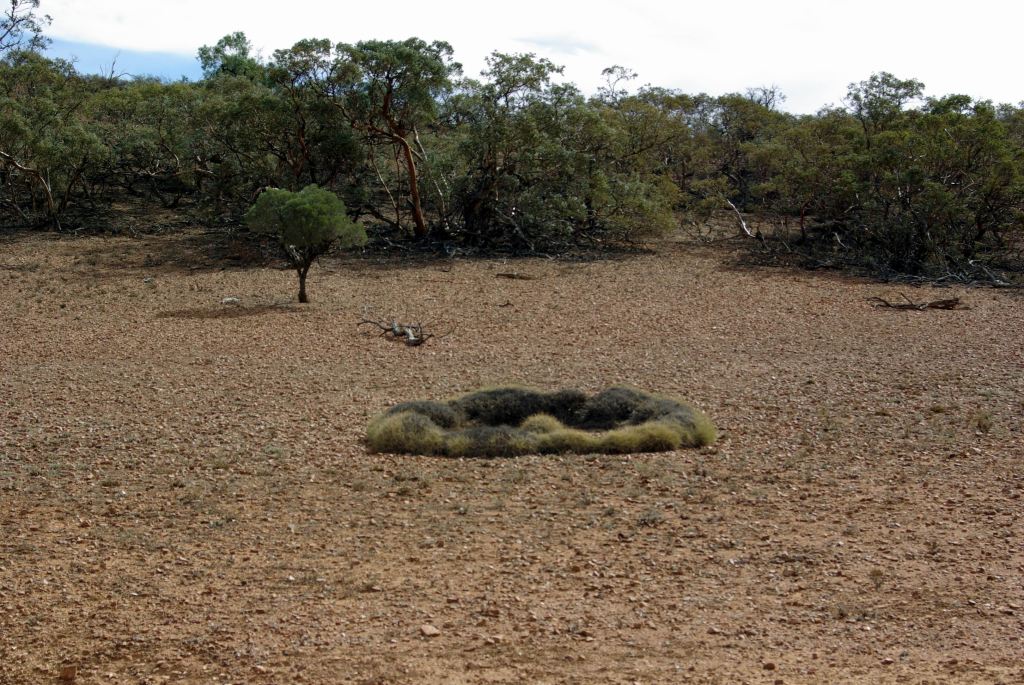
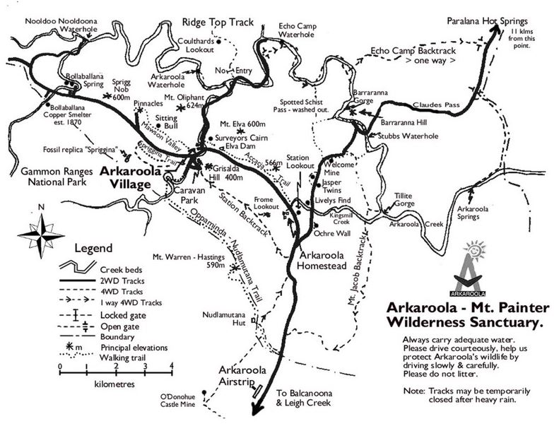
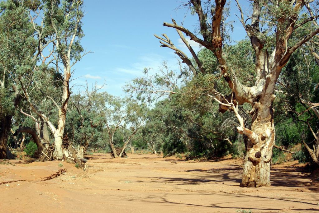
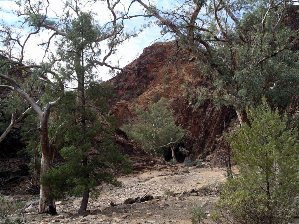
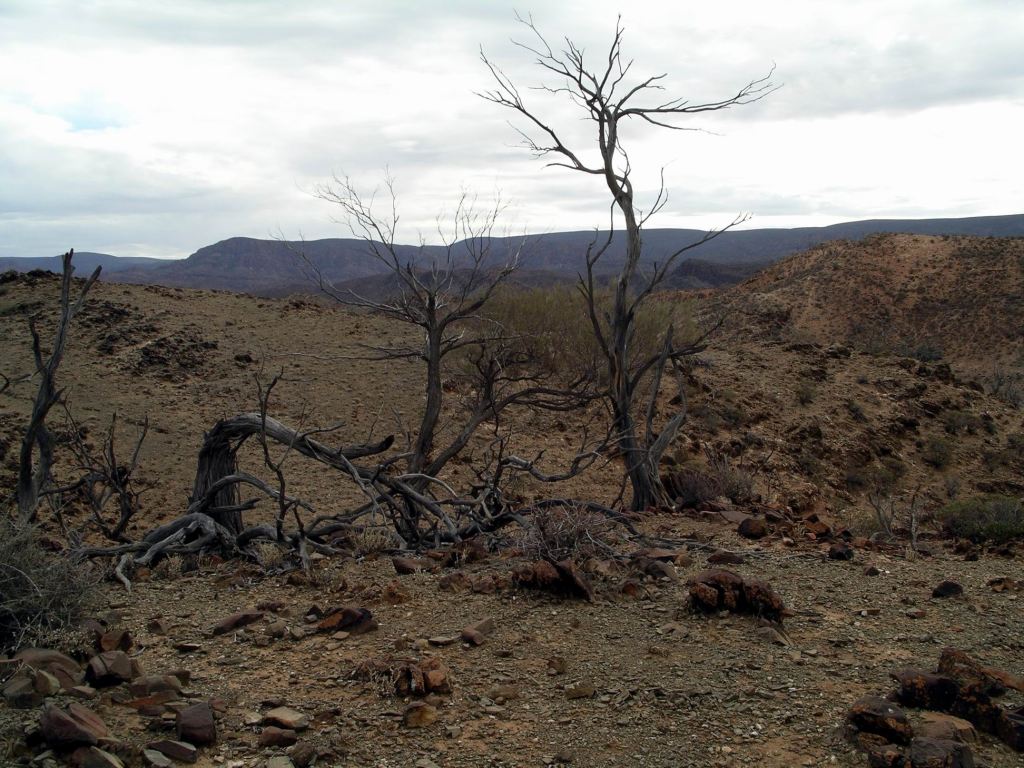
The walk from the hut, along Balcanoona Creek, was really pretty, as was the way up Worturpa Creek to the Weetootla Springs. When it is so arid, such occurrences of water in the landscape are extra attractive.

Following Worturpa Creek

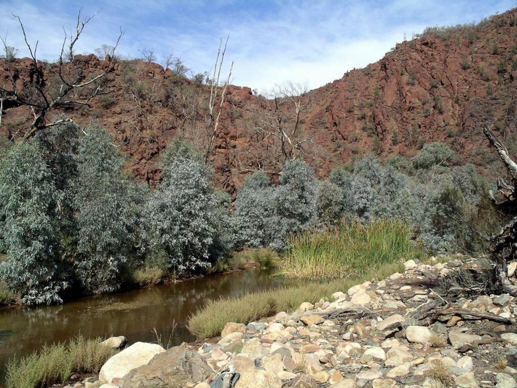
The Springs were like a set of rock gardens, with water features. Not for the first time in such a setting I had the thought that I’d love to be able to replicate them in the back yard! There was a lovely selection of plants growing around the little pools.

A rock and water feature like this would be great in the back yard!

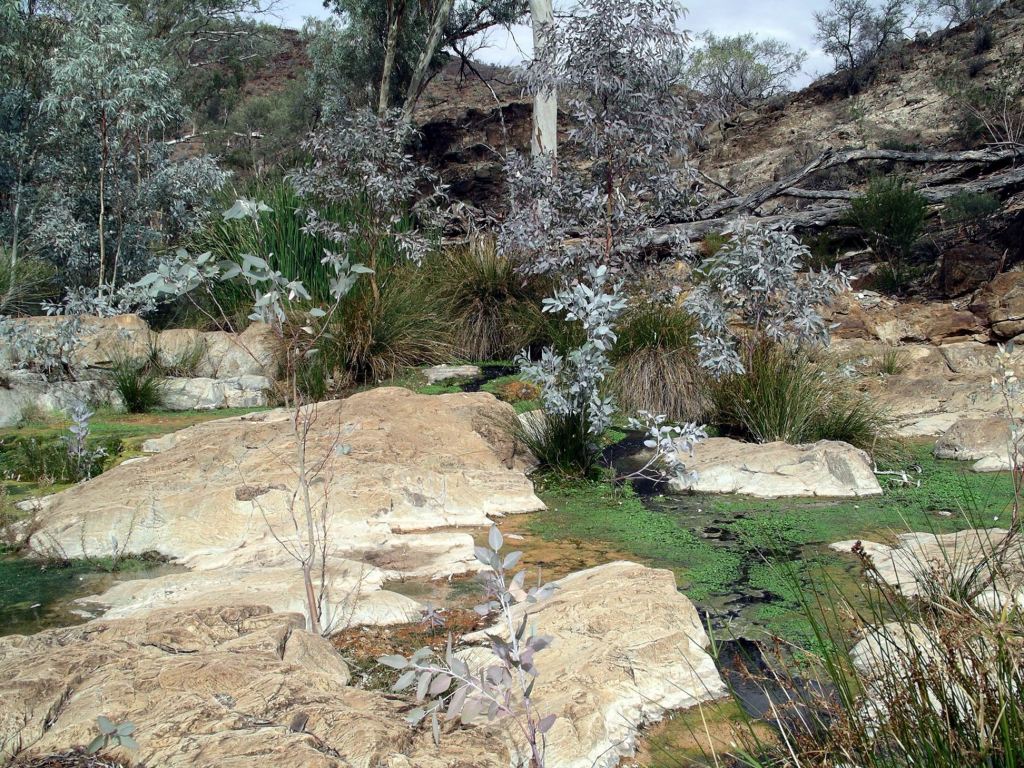
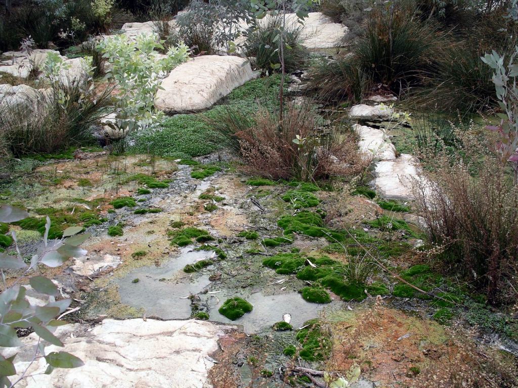
We browsed about the Springs for a half hour or so before it was time to move on, with the bulk of the walk still ahead of us.

We were invaders in his territory – Yellow Footed Rock Wallaby

The very fit M was in the lead, and in possession of the map, and we followed her as she crossed the creek and set off.

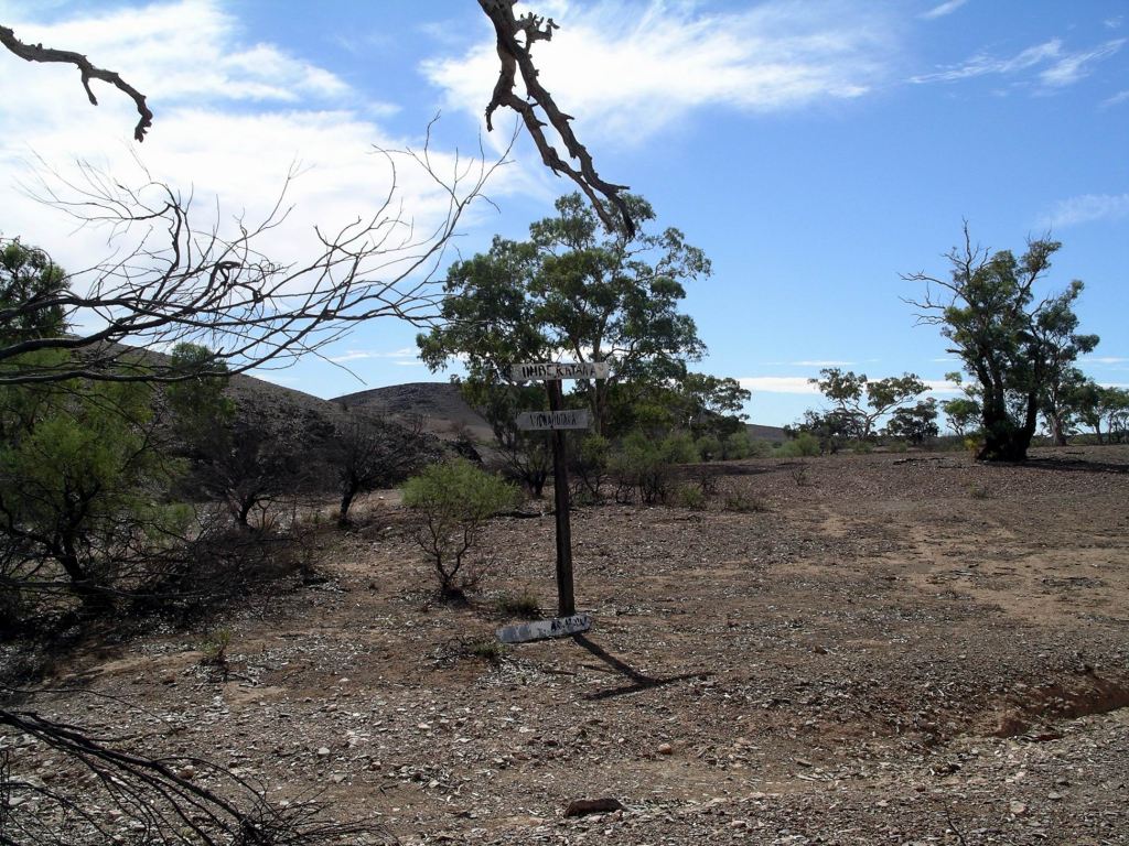
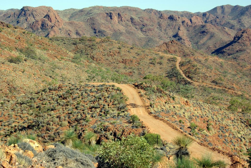
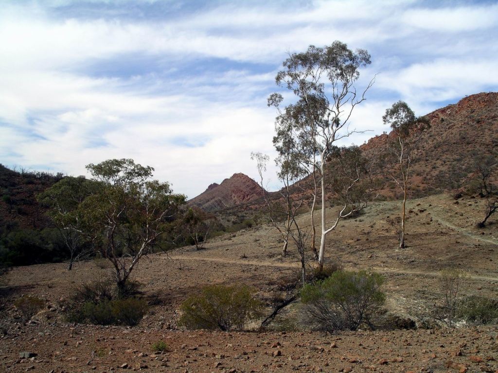
After the Springs, the track soon went on to open, steep hillsides, and could be seen sidling across the steep slopes ahead, for quite a way. I’d thought, from my memory of the track map, that we would be following a shaded creek valley, not playing mountain goats on this sort of going. But the leader – and the map – was very quickly too far ahead to argue with!

Looking back at Weetootla Springs

Eventually M stopped to let the two of us catch up, and have a rest, and a consult. We realized that we had, in fact, taken the wrong track back at the Springs and were now well and truly along the Monarch Mine Track. At least, we knew where we were, even if it wasn’t where we had intended to be! There was not much choice now but to push on.

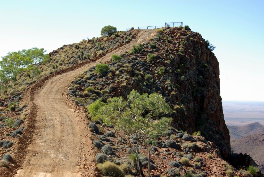
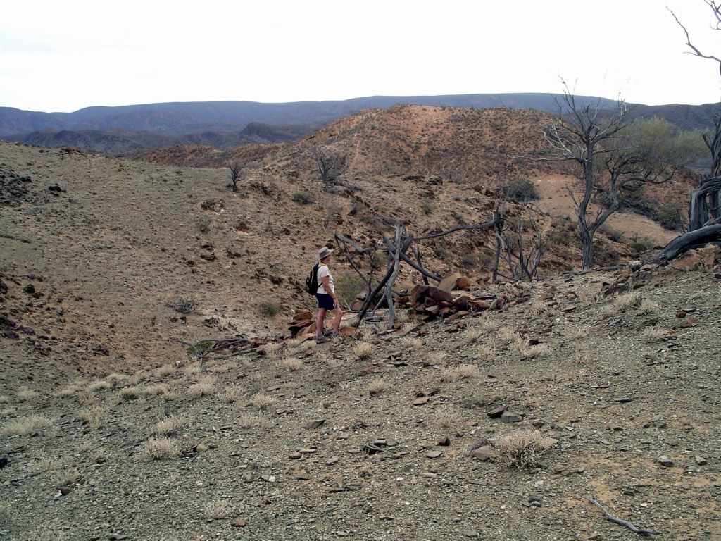
I do not like these tracks that are long climbs up ridges, on narrow trails, with big drops below. Don’t do uphill well and heights make me dizzy. So this section of the track was not very pleasant for me. In such terrain, one can’t take their eyes off the track to look around at the country – I am often prepared to take the risk of tripping over a rock, to gaze about, but not when the landing is likely to be a very long way down.

Track up on the hillside, disappearing into the distance. I did not sign up for this!

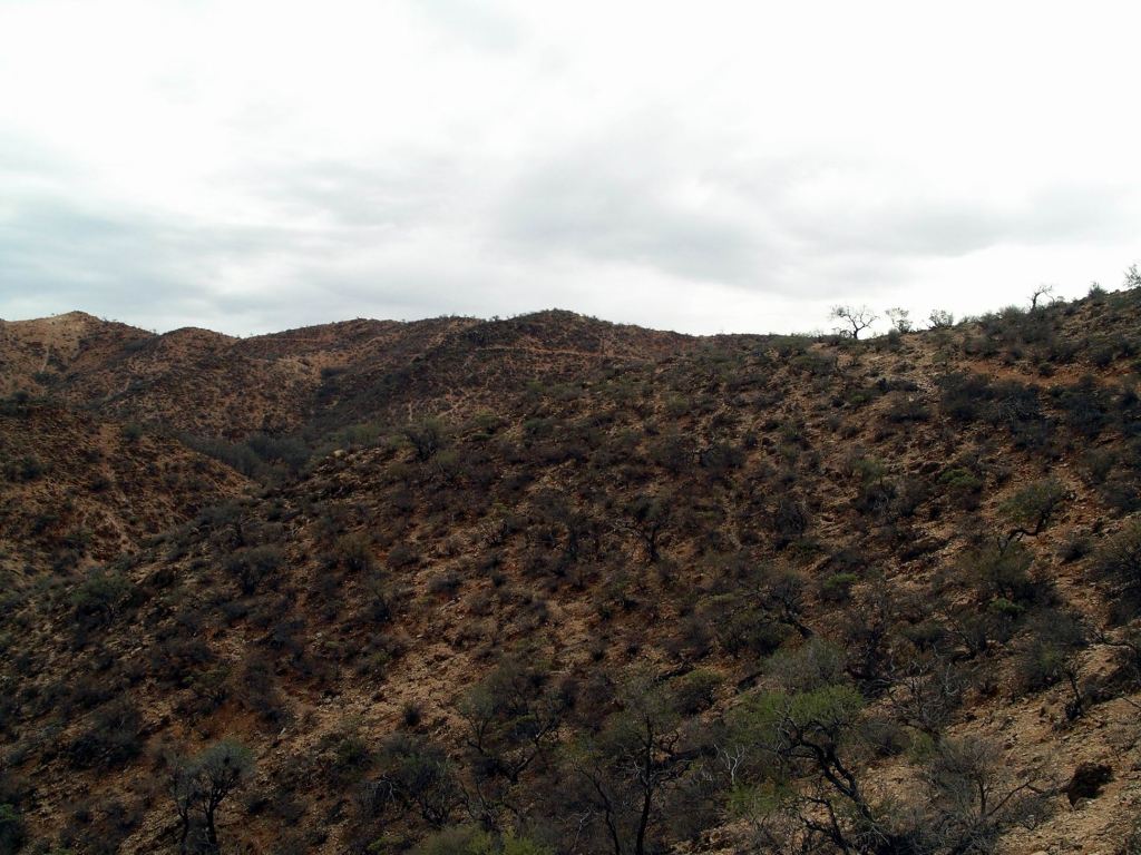
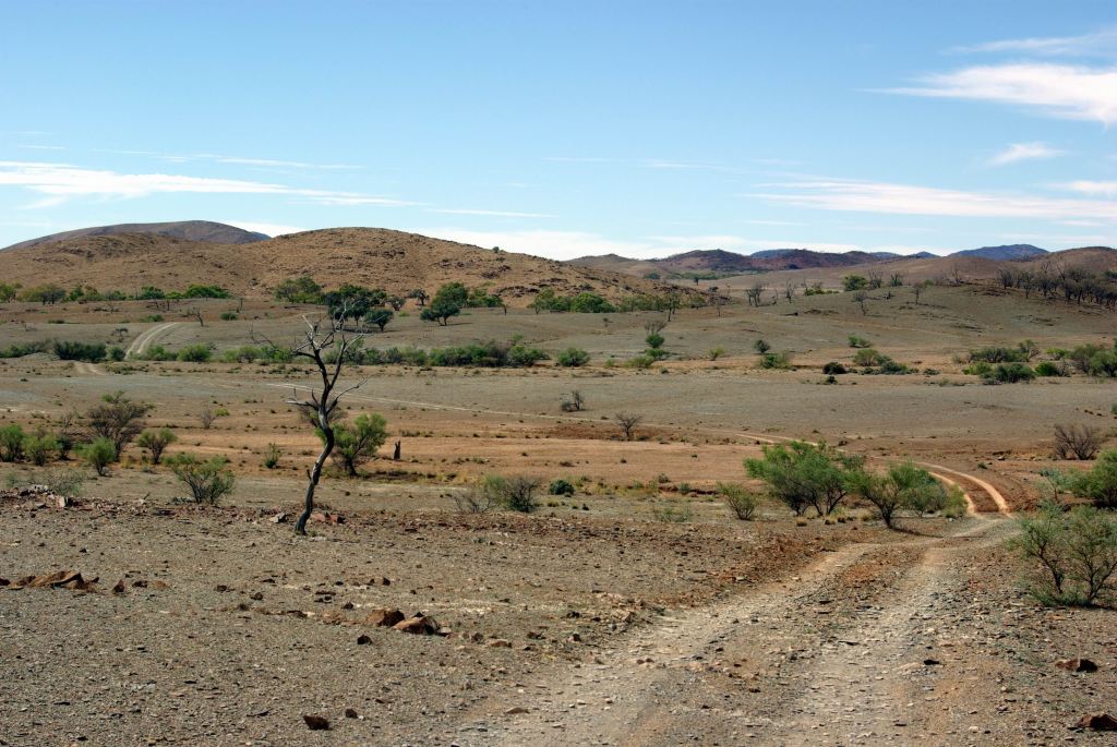
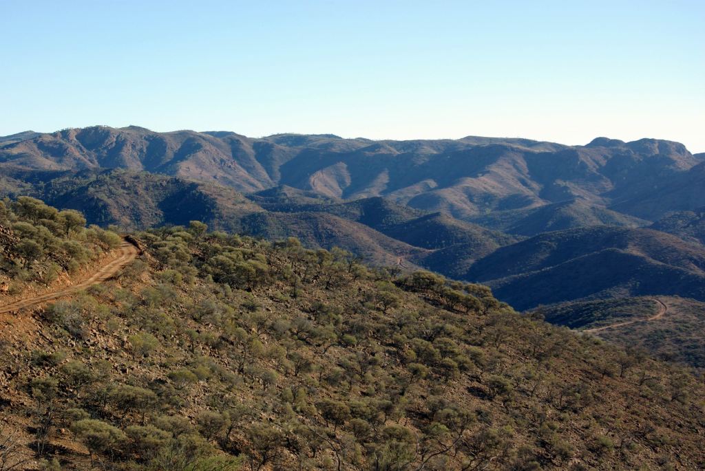
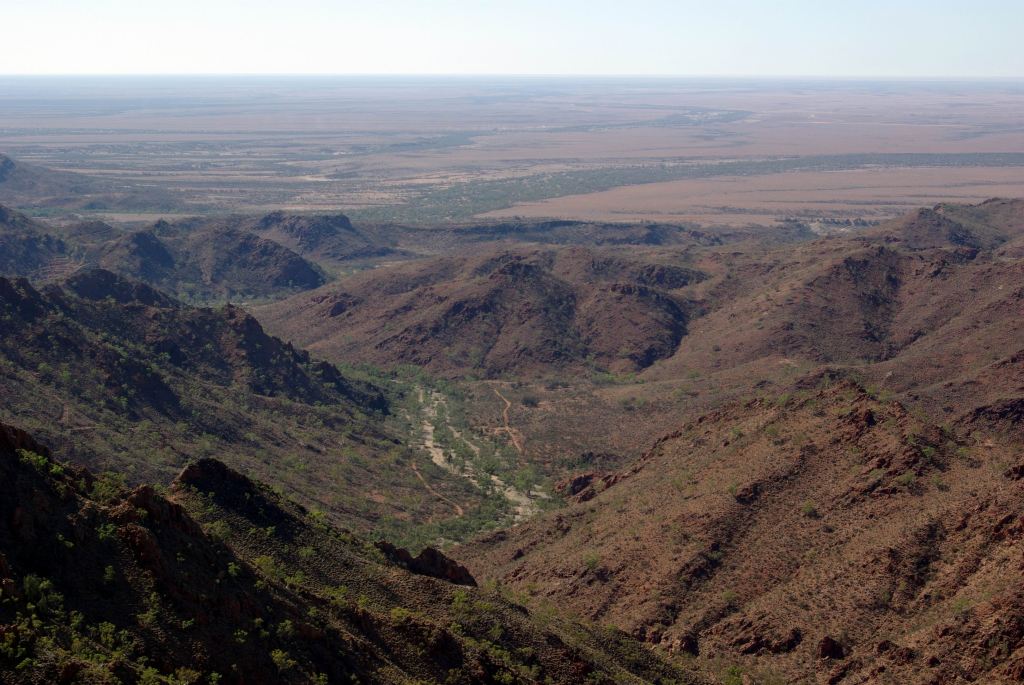
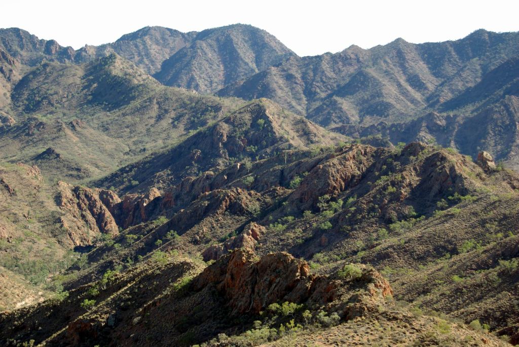
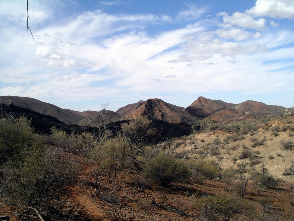
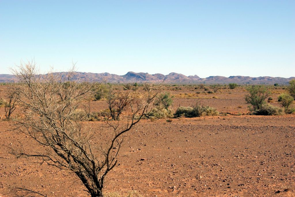
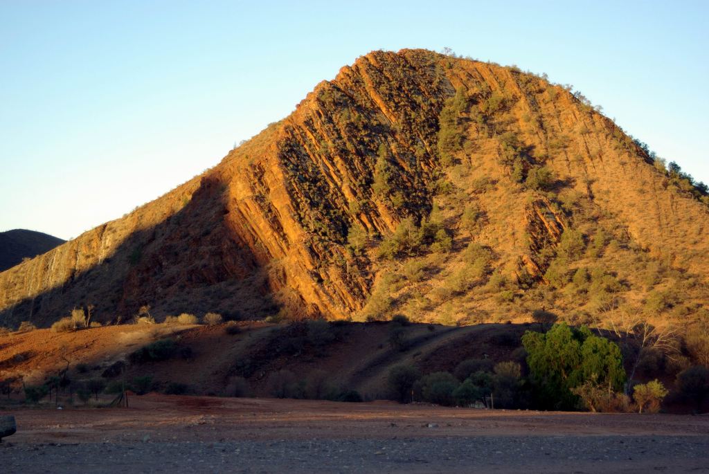
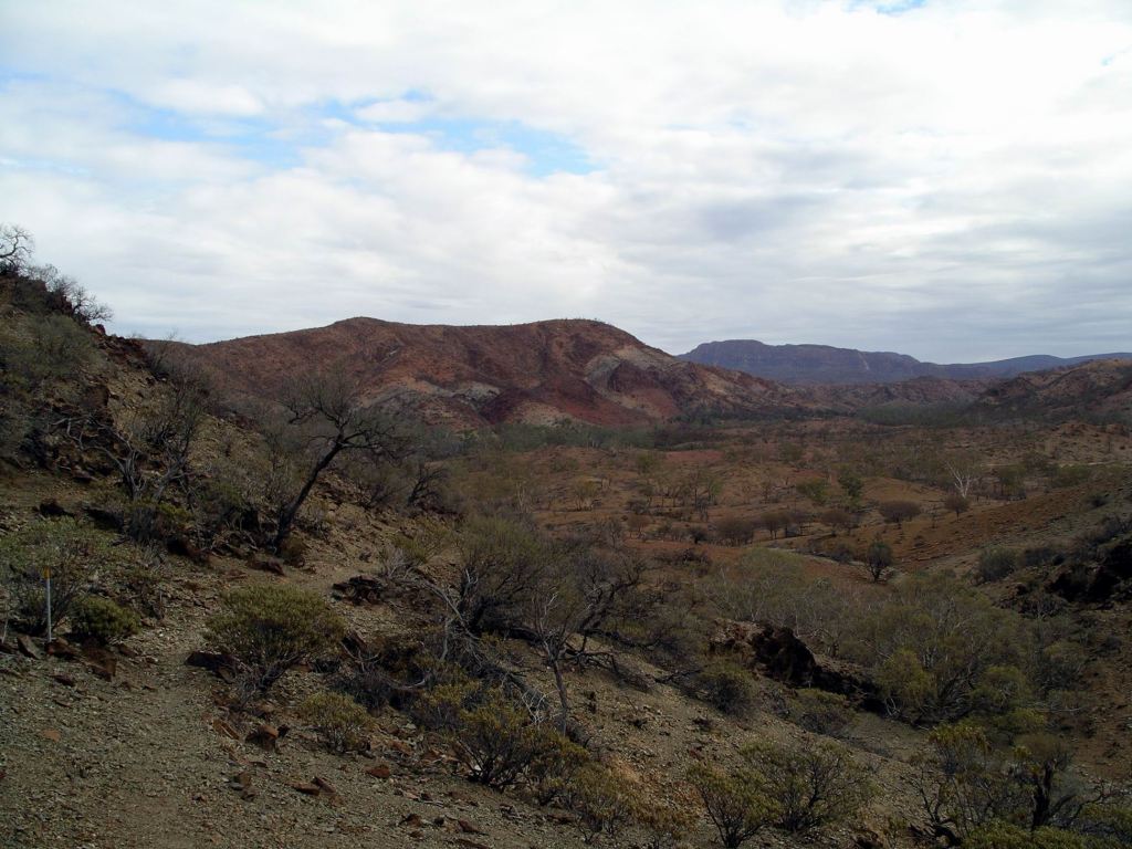
Eventually we reached the top of the ridges where we could look across to and down on the rugged and  dramatic ranges that surrounded the central pound.

The others well ahead of me – as usual…..

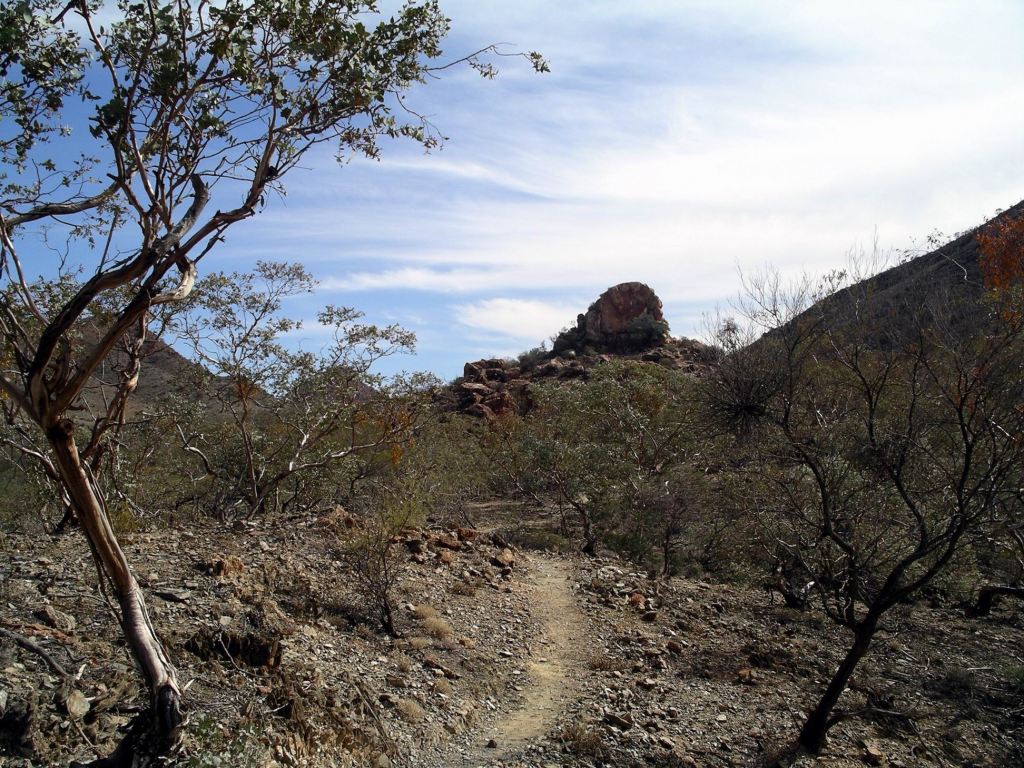
Found the mine remnants. This had been a copper mine – a very small operation that only went for a couple of years. The little ore they did find must have been taken out by horse, or donkey. There had never been a roadway up here!

Monarch Mine

The mine was yet another indicator of how far men were prepared to go and the hardships they would endure, to chase precious metals. It struck me that we’d experienced two ends of a spectrum, this year: the vast open cut iron ore mines of the Pilbara, compared to this little mine, probably operated by only one or two men. The contrast could not have been greater.

Ate our packed lunches up here.

Reptile near the Monarch Mine

From the Mine, the track descended on more gentle terrain back to Grindells Hut. Downhill, I like!

We must have walked about 11kms. John was very pleased with how he went on the tough terrain. My Achilles was not happy – I hoped I’d not fired it right up again. I reckoned our walking muscles were getting into shape – fast!

Last section – down in the pound….

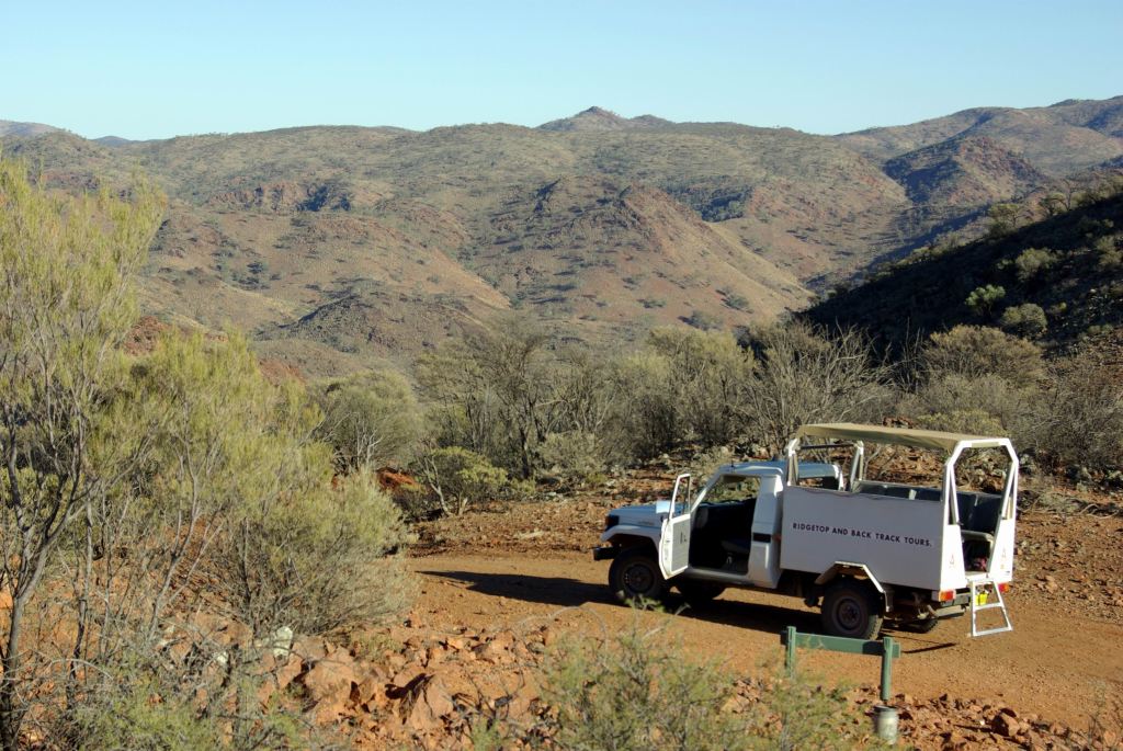
Then, since we were here and there was still some of the afternoon left, we drove the “inner circuit” – along the one way Worturpa Loop Track to Gammon Yards and via the loop track back to the Lochness Well camp area. The scenery was interesting and there were some pleasant stands of cypress pine trees.

That entire loop is one way only – which should in itself be a give-away that it would be no picnic! It had some “interesting” 4WD sections. I definitely do not like places where you climb a steep hill towards what is obviously a vertical drop at the top – with no indication whether the track, at the top, turns right, left, or goes straight on! Until you are right on it! The long, block like nose of Truck did not help either. M was following us, in her Troopy, and did fine with the driving – but having us in front was a bit of a guide. To date, her 4WD experience had been on much more flat country, like Arnhem Land, not on roller coaster tracks. I reckoned we would fix that while we were here!

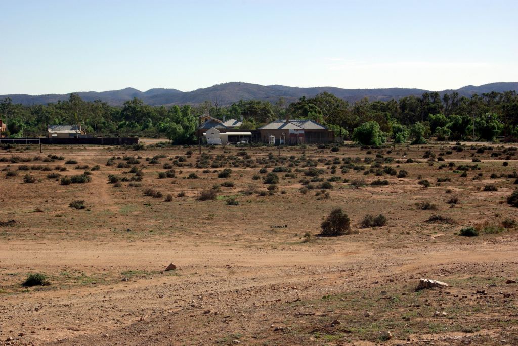
The Lochness camp area was by Balcanoona Creek, with some vegetation – mostly cypress pines – around it. No facilities, but a pleasant spot.

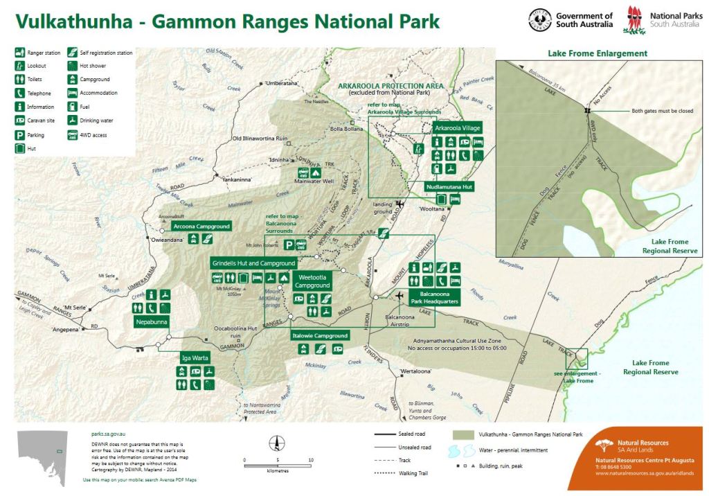
Then back out McTaggarts Track to the Arkaroola road. It was getting dark by the time we turned back onto the main road.  Made a quick stop to gather some more firewood, heaving it up onto the roof rack, where the mesh base of this would stop it falling through – the best sort of roof rack to have!

Had our usual campfire before bed – weary bodies sitting about it, dissecting the day’s experiences.

I was trying to work out how many years it had been since John and I had done a walk this long and demanding? Maybe 2002 – five years? No wonder we were feeling it!

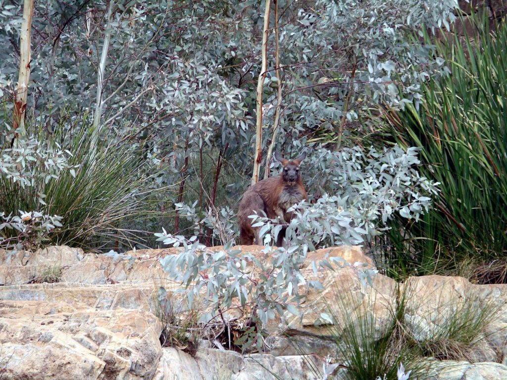
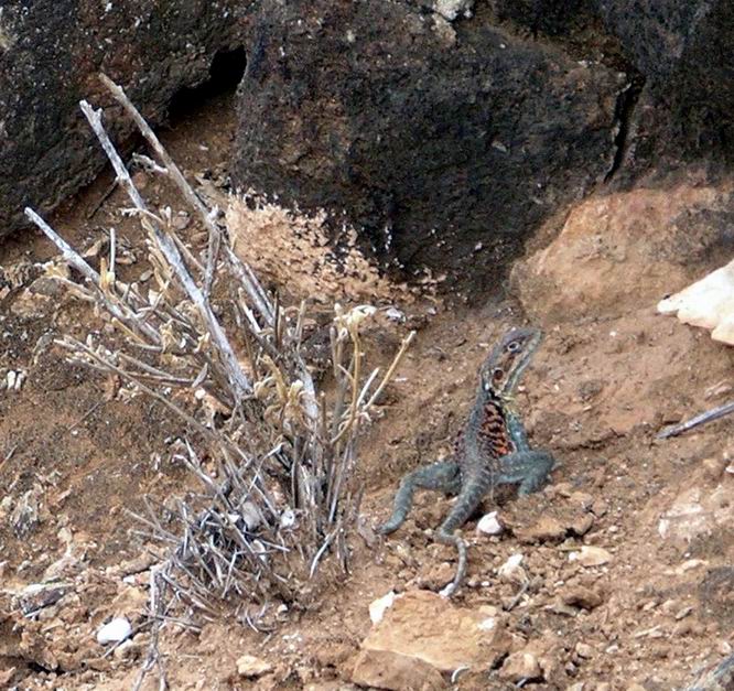
We packed a lot into today, including a couple of notable wildlife encounters: a yellow footed rock wallaby at Weetootla Springs (no hairy nose!) and a most unusual reptile with patches of bright orange and black patterning, on the very dry hillside near the Monarch Mine.

Knowing that there was still so much of interest to do here, we decided to extend our stay – due to end on Friday – by another four days.


Leave a comment

2007 Travels May 7

MONDAY 7 MAY     ARKAROOLA

There was some light cloud about today.

We’d decided, around the fire last night, to have a driving day today, and explore an area to the west where we had not been before.

John went and fuelled up Truck – $1.50cpl here!

We took the “back” way to the west, towards Umberatana. The plan was to loop around the northern part of the National Park, then at Yankaninna ruins, take the 4WD Idninha Track back east, into the Park and cut through to the Arkaroola road that way, either to Bolla Bollana or further through the Park to the McTaggart Track. It could be a possible circuit of some 100kms.

Did not stop to look at features close to Arkaroola – saved those for another day.

An isolated and unexpected spinifex ring

The route was not as much used as we had anticipated. The distances shown on our map were way out, and the roads were not as “important” as the map made them look! They were supposed to be 2WD tracks, but I knew a lot of drivers of same who would freak out if faced with these. Signposting was not great, either, and there was one point somewhere around Umberatana where I was really unsure if we were going the right way.

One of the very few signposts

But it was attractive travelling, with the ranges in the distance and with lines of low scrub marking creek lines – dry now, of course. The road undulated, twisted and turned, so there was always a new vista.

Change of road surface on the flats

There were some gates to deal with too.

At Yankaninna, we had to invent Plan B, because the track into the National Park was closed. Found out later that the landowner on the western border of the Park did not want people accessing the Park across his property – so he just shut off the road! So, Plan B became to keep on going in a big circuit around the outside of the park – a very much longer drive than we had anticipated. It was either that or go back the way we came, which seemed a bit tame.

The intention was to find the track that passed through those hills….

Stopped for our lunch break at Arcoona Creek – a point where the road we were on brushed against the National Park, and where there was a campground. It would be a pleasant, if remote, place to camp; certainly unlikely to have many, if any, fellow campers. There was shade but no facilities.

Cypress pines at Arcoona Creek

We walked around the place a bit and climbed up a ridge to get a view over the campground, before setting off again.

Arcoona camp area down there

Passed Mt Serle Homestead, then joined the Copley-Balcanoona road, near Angapena and turned east.

Called in at the Iga Warta community store, having decided it would be desirable to have some marshmallows for our campfire. They had some in stock, too.

Both Iga Warta and the Nepabunna comunity appeared clean and well run.

Continuing east, the section of road through Italowie Gap was particularly scenic.

We called in at the National Park Headquarters at Balcanoona, mainly to find out about any other track closures that might be waiting to ambush us. There were none. Came across an echidna there – it was trying hard to pretend we were not there.

It was late afternoon when we got back to camp, having driven some 180kms. Just a little extra adventure, beyond what we had expected.

Our approximate route on today’s drive (Zoom)

Spent another evening around our campfire – sampling toasted marshmallows – followed by an early night. After today of sitting and driving, we decided upon a more active day tomorrow.


Leave a comment

2007 Travels May 6

SUNDAY 6 MAY     ARKAROOLA

We had an early start this morning, getting up at 6.45am, to get fed and ready for the Ridge Top Tour, which departed from the Village at 8am. We walked up there from camp.

The Ridge Top Tour, which cost us $99 each, is a special feature of Arkaroola and worth every cent. In my opinion, it was a must-do for every visitor to Arkaroola.

The resort’s special open backed 4WD vehicles traverse tracks across some of the most ancient landscape parts of the place. The open sides also facilitated tourists taking photos.

Apart from a short distance at the start, the route is not open to the public – the only way to travel it and see some truly spectacular country, is by this tour. Given the rather “hairy” nature of parts of the route, it is not surprising that they do not allow unsupervised travel on it. One puts a lot of faith in the track knowledge and driving competency of the tour guides!

John and I had done this tour before, on a previous visit, but this whole area was new for M, and we were more than happy to have the four and a half hour experience  again.

The whole journey was so unique and so breathtakingly spectacular. This was one experience that was made for superlatives.

The route climbed the tops of ridges, with vistas to Mt Gee and Mt Painter, then ultimately climbed steeply – and I mean steeply – with sheer drops each side – to Sillers Lookout.

Sillers Lookout. The vehicle goes up there and turns around!

Here were 360 degree views, back over the ridges we’d traversed, across the Freeling Heights and the deep Yudnamutana Gorge, and over the flat country to the east and Lake Frome.

Dry salt Lake Frome in distance; Yudnamutana Gorge in foreground

Here also was where our driver had to execute a multi-point turn around, without us on board, in a very restricted area.

Mt Painter was the site of the early uranium discovery and workings 1923-24, and then later 1940’s workings.

The track we had taken on the Tour was actually built by Exoil NL when they were exploring the area in 1970. Arkaroola were able to take it over and keep it as a very special experience.

We had morning tea provided at Sillers Lookout, where we spent about half an hour. Then retraced the route to the Village. This was not a track to be driven at any speed, incidentally! Crawling along definitely called for.

Morning tea at Sillers Lookout

On the tour, we learned that kangaroos have a hairy nose; euros and wallaroos have a partly hairy nose; wallabies have a dog like nose. Identification by this method does assume that one is close enough to the critter to inspect said nose!

There had been recent renewed prospecting for uranium in the region, which was of concern to the Arkaroola people. Marathon Mines was rumoured to have found good quality uranium under Mt Gee. But because of some Heritage listing, they would have to tunnel under, for about 8kms, to get at it. Even the prospecting and sampling was causing obvious damage – we saw signs of this in places along the track, as well as places where sample bags were stacked, awaiting transport. Some of the Ridge Top Tour route is outside the actual Arkaroola property. It was mining companies in the 50’s that first put in a number of the tracks around Arkaroola.

Angled rock beds evidence of a convoluted geological past

The whole area was very dry. The last really good rains had been in 1974! But that is within the normal climate parameters for this area. There was a small amount of rain a little while ago.

We arrived back at the Village at 12.30pm.

After a quick lunch at camp, we unloaded the stuff carried in Truck  on the back passenger seat and in the floor well – stored it all in M’s tent. Then the three of us were able to pile into Truck, drive back down the Balcanoona road, then drive the 13km track into Weetootla Gorge camp ground and trail head, in the Gammon Ranges National Park.

From the camping area, we walked along Balcanoona  Creek, criss crossing it a few times, then through the little, narrow gorge section that is called Hells Gate and on to the junction where Worturpa Creek came in on our right.

Walking track beside Balcanoona Creek

There was a small waterhole in the creek there – very pretty.

We retraced our route, back to Truck. It had been about a 5km walk, in total. The sun had been at a good angle to show the valley features.

More of that tilted rock strata

It was an attractive walk, and comfortable going. We were “wearing in” our walking muscles again.

On the drive back, we stopped and collected some firewood from the roadside. It was convenient just to be able to throw branches and small logs up on top of the roof rack – with its sides, the timber would stay there for the drive back.

Back at camp there was a brief flurry when M could not find her watch. After much hunting about, it was found at the back of the back seat in Truck – must have fallen out of her pocket while she was riding in the back seat.

Then more seriously, John could not find his wallet anywhere. This was a step up from the regular “Have you seen my glasses?” This caused a huge hunt and a degree of panic, especially as he couldn’t really remember when he last had it.

Eventually John walked up to Reception with the intent of posting up a notice. But the wallet was there! Some wonderfully honest person had found it lying by the side of the road out to the south, driven back to the Village and handed it in. John worked out that he must have left it on the shelf-like front mudguard of Truck and driven off. Eventually, after a few kms, it had vibrated off and fallen by the road side. That was a real scare!

After tea, we sat around the camp fire that John had lit in our fire pit, watching the moon rise, studying the stars, and dissecting the day that was. It had been a big day.

I was already into camp mode – yawing my head off by the campfire, going to bed between 8 and 9pm. Back home bed around midnight was my norm. It must be all the fresh air and exercise – plus not spending much time under artificial light – made me really tired, really early. Or just in synch with the natural world?


Leave a comment

2007 Travels May 5

SATURDAY 5 MAY     ARKAROOLA

It was a hot, sunny day, with just some scattered light cloud.

After breakfast, we walked up to Reception, at the main complex. Maybe the campground was a bit further away than 500 metres?

We looked at displayed information and collected walk leaflets. Booked ourselves in for tomorrow’s Ridge Top Tour.

Decided to do the walk that went along the Mawson Valley to the Pinnacles, and return by the Spriggina Track. It was an 8km circuit – a reasonable stroll! After walking back to camp to get organized with things like first aid kit, drinking water, muesli bars, cameras, our proper walking boots, we then had to walk back to the village centre again, to the trail head. So that was a kilometre walked, before we’d even started!

The first part of the trail paralleled a little, dry, creek. It was attractive and photogenic, with a surprising variety of vegetation – almost none of which I could name. Mt Oliphant was off to our right.

Mt Oliphant

Around half way to The Pinnacles was the granite outcrop of Sitting Bull, named by Douglas Mawson in 1945.

Sitting Bull

The track flanked Sitting Bull and soon we could see The Pinnacles – similarly, granite. These were all intrusions, or plugs, exposed when the softer surrounding land was worn away.

Track flanking Sitting Bull on the way to the Pinnacles
Pinnacles

From The Pinnacles, we followed a track back to the Bolla Bollana road, crossed that, taking a trail towards the Spriggina fossil replica, then followed low ridges back to the campground. Taking this trail meant that we avoided walking back on the road, but it was more open, hot and less attractive than the first part of the walk had been.

On a flat area below the trail, so walkers could look down on it, Reg Sprigg had built a much enlarged replica of the Spriggina, an ancient fossil that he discovered in 1946, west of Beltana. It was like a worm and was the first animal fossil discovered to have a definite head. It was one of a most significant group of fossils found around the Flinders Ranges area, called the Ediacara Fossils – for the geological age when they crawled around on the sea floor. They were the first multi-celled animals to appear on Earth, some 600 million years ago.

The Spriggina replica (Zoom)

From the last part of the trail, as we came along the ridge, there was a really attractive view of the campground, with Griselda Hill behind it.

The campground and Griselda Hill

John found the latter part of the walk hard. Neither of us was very fit, after the ailments of the past few months. The shingles that John contracted, back in February in the Pilbara, really knocked him about. I was hoping that a recent cortisone injection had finally fixed the troublesome Achilles tendon that plagued me all last year. I was pleased with how it stood up to this walk – a positive sign. M, of course, the former PE teacher, was totally fit and agile!

The route of our walk

We had a late lunch back at camp and relaxed in shade there for the rest of the afternoon.

M drove up to the mechanic’s to collect her repaired tyre. They had found there was a hole in the inner tube, caused because some drongo at the tyre service place, back home, had left a valve cap inside the wheel when her new tyres were put on, last week! Why is it so hard to get competent workers?

There were notices up, that the Gammon Ranges National Park, to the south, would be closed for feral and weed control work, in a week’s time, so we would have to do all that we wanted to, there, before then.

As we pored over maps and brochures, I was already suspecting that a week would not be long enough, here.

Tonight, sitting outside, we faced the other way and watched the moon rise over the hills. The moon always seems larger, here. The stars are certainly brighter.


Leave a comment

2007 Travels May 4

FRIDAY 4 MAY   BROKEN HILL TO ARKAROOLA   500kms

Today was my son’s 33rd birthday. We’d acknowledged that before we left home.

We packed up and hitched up as efficiently as we could, with a big trip ahead of us today.

It was a long day of driving – on the Barrier Highway to Yunta, then on dirt roads north past Frome Downs Homestead and Balcanoona, and on to Arkaroola. The roads were firm gravel and, for the most part, pretty good to drive on. Some of the sign-posting, or lack thereof, left a bit to be desired.

Topped up the fuel again at Yunta – now, in SA it was $1.29 cpl.

Some 34kms north of Yunta were the Waukaringa ruins. We spent about an hour browsing around these.

Hotel ruins Waukaringa

In the 1880’s, a gold mine was established here and a township grew up rapidly, as tended to happen when there was a promising find. By 1890, it had a population around 500 people. As the gold petered out, the population dwindled. The hotel licence, however, was not surrendered until 1964.

The skeleton of the old hotel was the most obvious ruin, but there were others, plus mining relics, scattered around and up on the low ridge where the actual mines were.

It was evident that the area around the hotel ruins was sometimes used by campers.

Further on, we stopped to eat lunch, near the dry Wilpena Creek ford, just beyond Frome Downs.

Of course, after we started off again, there was a spot that would have been better, with a few trees by another dry creek.

Although we were traversing flat, stony country, in the distance to the west, was the line of the Flinders Ranges.

Flinders Ranges – well to the west of our road.

The road crossed a gas pipeline, from the Moomba gas fields near Innamincka. Here was a bit confusing. A road runs alongside the pipeline and it looked like we should go right, but the correct way was straight ahead. For once, I got it right!

As we progressed north, the flat, barren, stony plains were replaced by more rugged country, with more ranges apparent. This really was an interesting drive. We crossed a number of dry creek beds, many with low trees and scrub growing along them, and then red gums.  Essentially, we were skirting the western edge of the dry salt Lake Frome, but at a distance sufficient that we could not see it.

Balcanoona, once a sheep station, is now the base for the Rangers of the Gammon Ranges National Park, which takes in country mostly to its north and west. Arkaroola, where we were heading,  is about 30kms north of Balcanoona, and just on the eastern edge of the National Park.

I had hoped to stop at the Ranger Base, to see if I could get any information about the National Park that I didn’t already have, but John wanted to push on. He could see the end to the day’s driving almost in sight!

We got into Arkaroola mid-afternoon, so we had made good time. We parked near the Reception area of the outback  resort that is Arkaroola and booked ourselves into their campground. As well as this, they had motel style units and some cabins – so a range of accommodation. The campground was about 500 metres distant from the Village hub.

Our powered site cost $20 a night and, because we booked in for a week, the 7th night was free. M was only charged $15 a night, because she was travelling solo – so many places will not make that concession, even though it seems fair. John and I had visited Arkaroola a few times previously – it was a place we loved – but this was a first for M. Hence the longer stay.

We had a pleasant area, designed to take two outfits, on the top level of the tiered campground, with a great view across the very scenic area to Griselda Hill and the surrounding ranges. The camp ground felt very much as if it was in a pocket, surrounded by stark and rugged hills.

Griselda Hill, from our camp

The campground was gravel surfaced, as one would expect in such an arid area.

Our site had a fire pit and BBQ plate and there was a bore water tap. We did not hook up to the latter, as we preferred the better quality of our own tank water, but filled containers from it for washing up. The nearby amenities were dated and basic, but spacious and clean. Let’s face it – really, all one needs are a clean and functional toilet and shower. Frills are able to be dispensed with.

We set up for our extended stay. The afternoon wind made putting up M’s living tent a bit tricky. We needed the 4 inch masonry nails that John carries, to anchor the tent ropes in the rock hard ground. From memory, it was actually one of our earlier tent based camping trips to Arkaroola, that got him into the habit of carrying the masonry nails – for places like this where tent pegs just did not have a hope!

Whilst M slept in the Troopy, it was not set up inside as a camper. For overnight stops she made do with her camp stove on a small folding table, but when staying longer, set up a tent for cooking and living in. This system had evolved over the previous couple of years of travel, but she was yet to get the right mix of convenience and comfort. A work in progress.

 The van had travelled well. With the pressure scoop hatch open, and cardboard taped across the vent in the lower door, very little dust had gotten inside, though we’d done about 300kms on dry and dusty surfaces.

Almost immediately upon arrival at our site, M’s front tyre went flat. After setting up, we changed it and she took it up to the resort complex to the mechanic facility there, for repair.

We sat outside together, to eat tea, and stayed there for a while, after. We hadn’t thought to gather firewood on the latter part of the drive here, but would rectify that sometime soon.

Arkaroola Resort complex at top, campground lower left, showing formal sites, with large unstructured camp area beyond it. (Zoom)

Unseen by us, the full moon rose behind us, but we were busy admiring the myriad of stars spread out above us. The skies here were so clear that Arkaroola has two proper astronomical observatories.

We finally felt like we were getting away from the rat race again!

Arkaroola has an interesting history. It sits in the midst of a really ancient landscape, buckled and tortured over time. Some of the geological structures here are 1.6 billion years old, pre-dating animal life on Earth. Europeans moved into the area in the 1860’s, chasing copper, as happened in other parts of SA too. As was common, the mines did not last long, but their relics are dotted about the area now.

From the early 1900’s, it was a sheep run, in very marginal country.

The ancient rocks of Arkaroola contain unusually formed radioactive deposits and “hot rocks”. Uranium was found and briefly mined from 1910 – with great difficulty given the terrain. The events of WW2 led to a revival of uranium exploration and mining on Arkaroola.

In 1968, the Arkaroola Pastoral Lease was bought by the Sprigg family, with the aim of setting up a Wilderness Sanctuary. The very interesting and talented geologist, Reg Sprigg had visited the area with mineral survey parties and with (Sir) Douglas Mawson of Antarctica fame.  He became convinced of the unique nature of the area and  the need to act to conserve it. Back then, such private sanctuaries were unusual, but the government of SA was not prepared to buy the property.  A huge effort was then made to get rid of the feral animals that infested the place and threatened both its fauna and flora. The development of the tourism aspect of Arkaroola was a means of partly funding the place, but also showing visitors its special qualities. The Sprigg family still runs Arkaroola.

In this region, of course, the Flinders Ranges and Wilpena Pound are the best known tourist destination. The more rugged and arid Arkaroola and Gammon Ranges are much less visited – in part, because of the unsealed access roads, in part perhaps because visitors assume they have “done” the Flinders Ranges and hence there is no need to look further. They don’t know what a superb area they are missing!


Leave a comment

2007 Travels May 3

THURSDAY 3 MAY     BROKEN HILL

Today we drove out to Silverton, 25kms to the NW. We had been here before, but it was new territory for M. Much of this trip was going to be about introducing  her to new places.

Silverton began, as the name suggests, with a silver mining rush in the late 1800’s. However, it was soon eclipsed by the richer finds in Broken Hill. Most of the population left – often moving their houses to Broken Hill, too. But Silverton refused to totally become a ghost town, and in recent times has been rejuvenated by becoming a base for some notable artists, and the setting for films.

Looking to central Silverton! Hotel to left.

Today, there’s a handful of permanent residents, one hotel, and it is one of the go-to destinations of the region. It has also been used as a film location – the hotel is associated forever with Mad Max! We came here first – separately – in the late 1960’s. It remains a quirky, favourite place.

Apart from some old buildings – in various stages of repair – there is superb arid country scenery around the area.

When here last, in 2005, I took a heap of photos of the old Broken Hill-Silverton railway alignment and siding “station”. The place is a photographer’s dream.

We visited the usual – for us – galleries: Peter Browne’s and the Horizon Gallery, which was my absolute favourite of all the ones on offer in Broken Hill and Silverton.

Sculpture on the wall of the Coin Carvery

John was attracted to the coin-carver’s unusual gallery. Essentially, the “background” sections of older coins were cut out, leaving the rim (frame) and the featured centrepiece. This was then gold or silver dipped. The man needed a special permit to destroy currency!

John bought his daughter a birthday present – a coin that had been cut out and gold plated. It was really nice.

Silverton was a very “arty”, quirky place. Maybe the aridity and vast vistas of this area somehow feed the creativity of the people who live here?

Up on the hill, at the Browne Gallery, we ran the gauntlet of some strange critters.

Bought some cute postcards to send to the grandchildren, and a tin VW with an emu painted on it, for the coming first birthday of grandson. It could maybe be a collectors piece for him, rather than a toy?

I was very tempted to buy a wire “sculpture” of a chook, and a wire and metal cat sculpture – but resisted. It took a great effort, I might add!

John bought a set of large, old, door keys, that he thought he could mount on some turned wood and turn into an unusual decoration for an outside wall.

The Browne Gallery was in a rather lovely old house, up on a rise, overlooking the township. It was worth the trek up there just for the outlook alone.

We then proceeded to spend too long at the Horizon Gallery. Here, I could not be strong, and bought a framed Bronwyn Stanley Woodroffe print. It was of the Pinnacles peaks, near Broken Hill, with an eagle soaring in the foreground. It would be shipped to us in October, when we were home to receive it. That would make two of her works we now had, and two of her husband’s. Magic works, they all are.

The gallery still had several other works that I could easily buy! I purchased eight picture cards, with the idea that these could be framed – singly or as sets – for us, or for gifts. Or else, I could just use them to write notes to people.

While browsing and making decisions, we got talking travel with Bronwyn and the subject of house sitters came up. I ended up telling her we would consider house sitting for her, up here, for short spells, in the future. We could enjoy some time spent in this region.

Drove out to the north of Silverton for about 10kms, and ate lunch at the Umberumberka Reservoir, built in the early 1900’s to supply water to Broken Hill. It had water in it – an unusual sight in this dry country.

Stopped at the Lookout over the Mundi Mundi Plain where the vast plains stretched in all directions. Perhaps for someone new to outback travel, this outlook would be impressive, but we had seen a lot of vast country in our travels.

Back in Silverton, we went walking along the dry Umberumberka Creek bed, which was lined with majestic old river red gums.

Debris piled up behind trees shows that the creek does sometimes flood

There were lots of hollows in these ancient trees, to be homes to birds and critters.

In a part of the creek that had been the most recent to dry up, there was a large patch of red mud curls – very artistic looking. From a distance, they resembled leaf litter.

Back in Broken Hill, we went to the Post Office and sent off the birthday presents bought today, and postcards to the grandchildren. Checked at the mail centre there – the package with the fridge thermostat had not arrived yet. Since the fridge now appeared to be working perfectly after its regassing, I did a redirection notice to have it sent on to home.

We shopped for food supplies, to last for some time. We had a bit of a dilemma. In theory, we should not take fresh produce into SA. But we were planning to turn off the highway at Yunta, and head north to Arkaroola. There were no shops along that way. We would be taking the purchased fruit and veg a long way distant from the crucial agricultural areas of SA.

Refuelled Truck – $1.30cpl.

John discovered that the other side back indicator on Truck had no globe in it, either! I was not sure how I had missed its non-functioning, in our checks – my reputation was tarnished, somewhat. He was incensed enough to phone the dealer’s service centre to complain. They were very apologetic and gave him the usual spiel about apprentices ! Hey – isn’t the work of these supposed to be supervised?

Yet again, we wondered what else had been missed, or done sub-standard.


1 Comment

2007 Travels May 2

WEDNESDAY 2 MAY   MILDURA TO BROKEN HILL   300kms   

We had been able to remain hitched up last night – big tick to the caravan park – so there was not much to do to get on the road again.

But before we left, once it was past 8am, John consulted the local phone book and started phoning refrigeration places, to find one that could deal with our kind of fridge. Past experience suggested that it was either gas or thermostat. After some initial phone calls, we were able to drive straight to a place that would check it all out, parking in the laneway at the back of the business. The unit was found to need re-gassing, which was efficiently done. It did not take long – all remarkably hassle free. Maybe things were going our way now?

I wondered if all the extreme heat that the van had been in, last year, had caused a loss of refrigerant, somehow?

Crossed the mighty Murray, into NSW. Refuelled at Buronga – still $1.30cpl.

The very good Silver City Highway carried us north, with no dramas. Once away from the influence of the Darling River and the availability of irrigation water, the country quickly became flat, dry grasslands, with  patches of red sandy soil showing through. There were enough patches of scrub and stunted trees to keep it vaguely interesting.

We stopped at the rest area at Lake Popiltah, about the half way mark, to eat the sandwiches I’d made this morning. M usually only had a piece of fruit for lunch – she believes in simplified travel!

Lake Popiltah was dry, and from the look of the grass growing in its base, had been that way for some time. It is one of a series of shallow depressions, sometimes filled from high water in an anabranch of the Darling River, to the east. Since the flow of the Darling was heavily controlled by irrigation schemes and diversions, even in good years, the lake was more often dry than not.

The dry bed of Lake Popiltah

The large rest area would probably be fine for an overnight camp, with plentiful shade trees, including some of the cypress pines that I love, and a view out over the dry lake area. There was plenty of room to spread out. There were long drop toilets – rather “on the nose”. The rest stop was close to the road, though, and traffic noise might be obvious at night. However, it was great for a lunch break.

Lunch stop Lake Popiltah Rest Area

I can’t say that the southern approach to Broken Hill is all that attractive, skirting as it does the first of the large mining operations. I navigated us through to the Broken Hill City Caravan park, on the Adelaide road.

After discount, our site cost $22.50 a night. The sites were fairly small, the surface was wood chips – a good idea in this arid environment, where grass is not feasible. Wood chips do not get tracked into the van like small gravel does. Gets my tick of approval.

Since it was only mid  afternoon by the time we had set up, (Broken Hill operates on SA time, so we’d gained time) we decided to check out some galleries. Drove to the Boris Hlavica photography gallery where I had, on our last visit, bought a superb photo of Lake Eyre at dusk. I wanted to see what might be new there, and show the works to M. Although she had been through Broken Hill before, she had not been here. I managed to be quite disciplined, and bought only a card to send off for step daughter’s birthday.

We then tried to find a couple of advertised galleries that sold aboriginal art works. One was closed, and the other had moved. By this time, we couldn’t be bothered trying to track it down, so went back to camp, for the usual leisurely end to the day.


Leave a comment

2007 Travels May 1

TUESDAY 1 MAY     BENDIGO TO MILDURA     415kms   

Grandson got to do his routine of waking up grandma – early! We had the expected cuddle in bed, before he had to go in for breakfast, and we got organized. It always surprises me, the simple things that give little kids so much joy.

We pulled out of the Bendigo driveway about 8.30am. Although coming across town yesterday, in what was after-school traffic, had been somewhat tense, the bonus for today was that we were on the “right” side of town, only a few blocks from the highway to the north west.

It was very foggy for the first hour or so, as we drove up the Calder Highway.

Stopped at Wedderburn to refuel – $1.30cpl.

Stopped at Ouyen, eating the sandwiches that I’d made this morning, and making coffee with hot water from the thermos carried in a basket in Truck. This always contained items that could be needed for a roadside break – plates, mugs, a knife, wipes and so on. It saved having to open up the van for such stops.

Ouyen has a very pleasant rest stop, centred around a feature made from a huge Mallee root. Looking at this, one could see why clearing this Mallee scrub country was such a challenge for the early settlers – and why the stump jump plough was invented. This machine, invented in the late 1800’s, as the more arid Mallee lands were being opened up, simply lifted up the plough blades when they hit a stump, and dropped them down again when the plough was over the obstacle.

Our overnight destination in Mildura was the Desert City Caravan Park. After discount, the powered site cost $20.70. This park was conveniently located within easy walking distance of a major shopping centre. Having been very good and not carried vegetables or fruit into the exclusion zone, we needed to stock up a little, here, on fruit and greens, so we made a brief foray over to the supermarket.

Sat outside in pleasant late afternoon sun, just chatting.

On Sunday, I’d cooked three chicken maryland pieces. These were rather a traditional first meal on the road for us. Marinated in lemon juice, sherry, soy sauce and garlic, then baked, they were really tasty – and kept well in the fridge. With some coleslaw – also made on Sunday, they were an excellent meal. I would not be catering, most of the time, for M, but some times when we were just overnighting in a place, it saved her having to unpack her cooking stuff from the Troopy.

Our fridge was definitely not cycling properly.


Leave a comment

2007 Travels April 30

MONDAY 30 APRIL   HOME TO BENDIGO   225kms    

After the usual flurry of last minute organizing and packing, we managed to leave home about 12.20pm. I might add that the usual last-minute flurry was not mine!

Our house sitters considerately kept out of our way while the last bursts of packing were done. We had done the “handover” yesterday, after their arrival. I had every confidence in this couple, T and A, who had been full time housesitters for several years, and who were solidly booked up a couple of years in advance.

It was really convenient to have sufficient rooms in the house for them to have their own area, whilst here. However, we did have to evict M for last night, as they would be occupying “her” bedroom, with its double bed. She slept in her Troopy, parked up on the lawn area in front of the house – getting into practice again, she said.

I’d thought, over the last couple of days, as I was packing the van, that the fridge was not working properly, that it was running too much. Perhaps the thermostat needed replacing again? John found and phoned someone who could supply a thermostat; it would be mailed to us c/o Broken Hill Post Office.

Part of the setting out ritual, every day that we were towing the van, was to check that all the exterior lights were working. This could really only be done after Truck and van were connected up and manoeuvred out onto the flat ground of the road in front. This time, they weren’t! Naturally. We did not have too many trips where there was not some setting-out drama.

John’s investigation showed that there was no globe where there should have been one, in the tail light of the Truck. And this after last week’s service by a proper Land Rover dealer! It really filled us with confidence that the vehicle had been properly prepared for the remote areas to come – NOT! In theory, having Truck serviced by accredited Land Rover dealers should provide us with confidence that tradesmen who know what they are doing, work on our vehicle. Over the years, we had received some great service from various interstate service centres, but the ones in Melbourne had proved distinctly lacking, unfortunately. And we had tried most of them, at some stage.

John was able to put in a globe, from the stock of spare fuses and globes he carried, so we were not too delayed. Even that did not work at first, but he applied RP40, liberally to the area, and that fixed it.

Through all this mini drama, M waited patiently with her Troopy, parked a bit further up the street.  

We stopped for lunch at Yarra Glen, parking up a side road from the main street, and walking to an excellent bakery.

After that, it was the usual run to Bendigo. Up and over the Range and down to Yea, then the picturesque but winding stretch to Seymour – where we inevitably finished up with a tailback of several vehicles behind us, but with nowhere to pull over and let them past. Minor road to Tooborac and then good highway for the last stretch, through Heathcote to Bendigo.

The roadside gum trees were looking really stressed, much more sparsely foliaged than normal. The effects of the last few drought years were really showing up.

I navigated us across town, to daughter’s. Over the years of visiting here, I’d come to know a route that avoided the centre of the city, with its heavier traffic, trams and traffic lights. But it was a route one needed to know, rather than a signposted one, so I just hoped that M was able to keep us in sight. Back in the gold rush years of the later 1800’s, Bendigo had developed in a somewhat ad hoc manner, dictated by the locations of reefs and mines, which now meant roads at strange angles and an illogical layout.

We set up in daughter’s driveway. Backed Truck and van down the slope, as close to the back yard fence and gates as we could get – and heavily chocked behind the van wheels! M was then able – just – to fit the Troopy in front of us. Staying hitched up meant that we had to put up with sleeping in a van that was distinctly higher in front than at the back – and we had a crossways bed! At least M had her head pointing uphill.

This driveway is a lot steeper than it apppears in the photo!

We enjoyed a pleasant evening with the family – dinner and lots of chat. I collected early Mothers Day gifts. Grandson was, of course, pleased to see us again, even though it was less than two weeks since we’d hosted a family get together for daughter’s 35th birthday. We talked with him about the trip we were doing, explained why we wouldn’t be seeing him for five months, and promised him lots of postcards from interesting places. He had – with some discreet help – kept a collection of every postcard we had sent him, to date. He went through it, very proudly, with us.

It was a chilly night – got down to about 7 degrees. Well, this was what I’d longed for, a few months ago!

In my occasional wakeful periods through the night, decided the fridge was definitely running too much, given the chill of the environment. What a pest.


3 Comments

2007 Travels February 9

FRIDAY 9 FEBRUARY     HOME

Unpacked, washed, tidied away our stuff. Reckoned the only use I would have for my boots now, would be gardening!

The place seemed strange without a resident cat. We were missing Spook cat. M had to have him euthanized while we were away this time. We had been expecting that. He lived to a very old age, for a cat. She had buried him by the climbing roses, beside the pool.

It was a great relief to be home. John could sleep and rest, and try  not to have the shingles get any worse. He had a bad dose of it.

The three of us started throwing around ideas for this year’s extended trip. I’d long had house sitters booked  for five months – May to September….. M had not yet been to the Kimberley, so that seemed an obvious destination – more of WA!

PILBARA POSTSCRIPT

A month later, on March 8, Category 4 Cyclone George caused major damage and destruction at RV1, two people died and a number of others were severely injured. One of the people killed was sheltering in the same donga we’d slept in, the previous month. Our manager friend was injured, but survived.

Cyclone destruction (from media)

The winds were so strong that there was even some damage at RV 2, so much further south.

The resultant enquiries, inquests, law suits went on until 2015. They basically took two lines – why the damage was so severe, and why the camp had not been evacuated before the cyclone hit. (For anyone interested, assorted reports can be found via internet)

RV1 was rebuilt for the duration of the rail building project – but not by the company we’d worked for.

In mid-2007, we received a phone call from WorkSafe WA, about interviewing us as part of their enquiry into the disaster. We were travelling at the time, in the Kimberley, and said we would be back home in Melbourne, later in the year. We heard no more from them.

I could not help but think that this ancient and superb country had taken some revenge for its destruction by mining.

ANOTHER PILBARA POSTSCRIPT

Late last year, at RV1, when Fortescue shares on the Stock Exchange were only a few dollars, John wanted me to buy some of those shares. I did not take the opportunity, because I felt that so much money was being expended, in a way that seemed quite reckless. The image stuck had stuck in my mind of one day at RV1, when a plane was doing repeated low passes over the site. R said it was “just” Twiggy Forrest having a look at progress. I’d wondered what it had cost for him to do it that way?

So, I couldn’t have faith then in the iron ore mining venture actually making money. What did I know? It wasn’t long before those shares hit $80.

Win some, lose some…….