This Adventurous Age

Adventures travelling and working around Australia.


Leave a comment

2004 Travels July 1

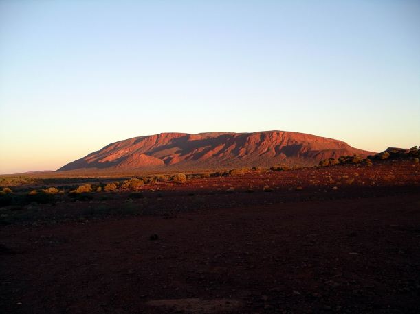
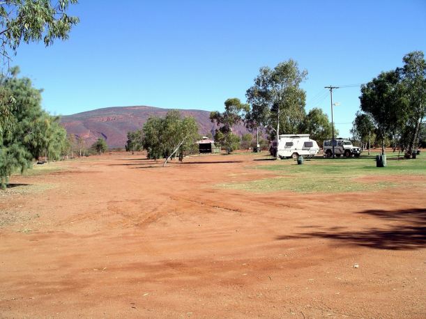
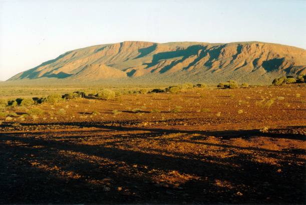
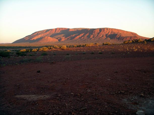
THURSDAY 1 JULY     KENNEDY RANGE NATIONAL PARK

It was another lovely day.

Resize of 07-01-2004 02 Kennedy Ranges valley.jpg

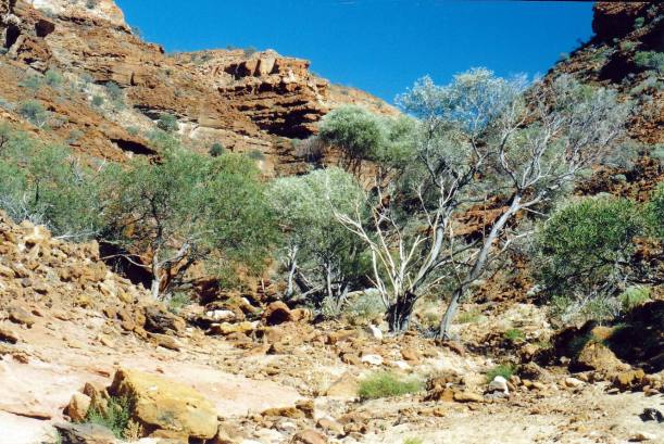
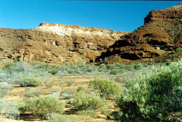
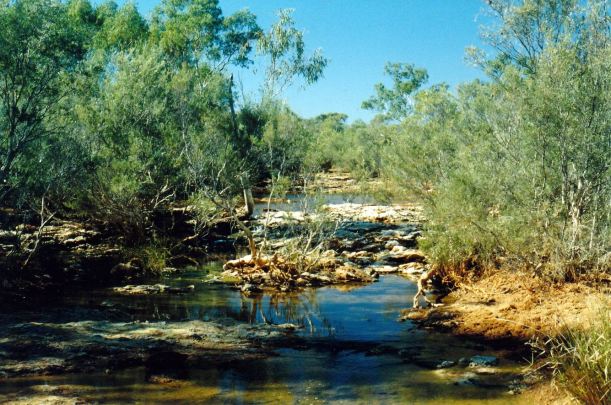
We walked north to the next track and to a small water pool under a big rock wall. There were lots of tadpoles in this drying pool. It would be a race against time to see which made it to frog stage before this pool dried up.

Resize of 06-30-2004 01 track to north Kennedy Ranges.jpg

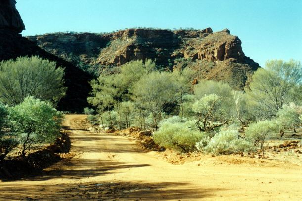
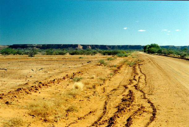
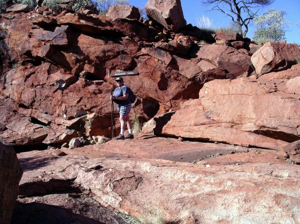
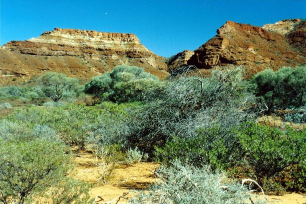
Track to the northern section

Resize of 07-01-2004 03 Kennedy Ranges contrasts.jpg

All round, it was a walk of about 8 kms. Very pleasant.

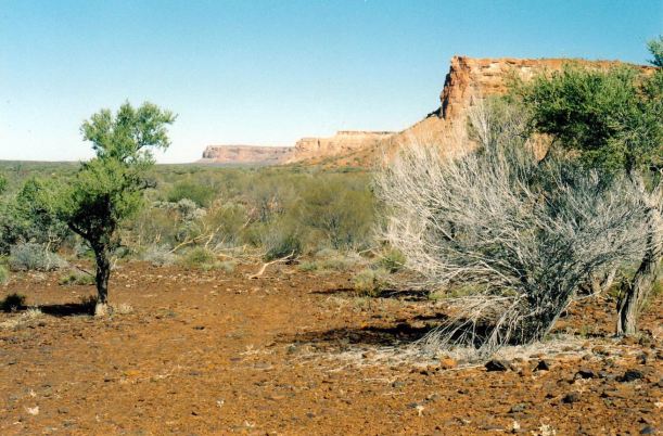
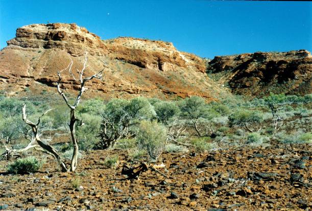
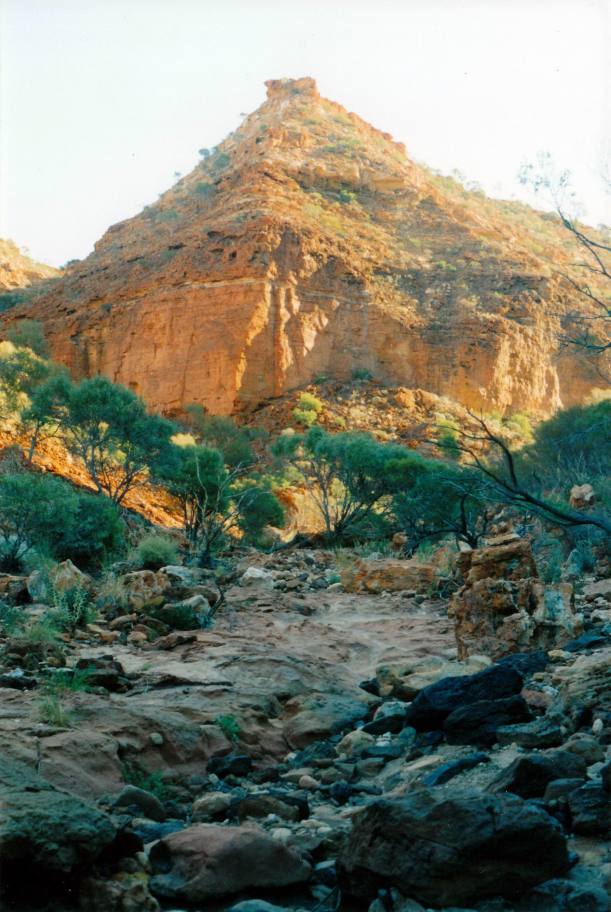
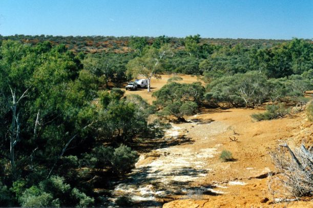
After lunch, we drove along the same track and right up to its end.

Resize of 06-30-2004 03 on Kennedy Ra walk.jpg

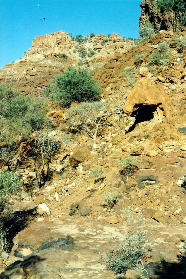
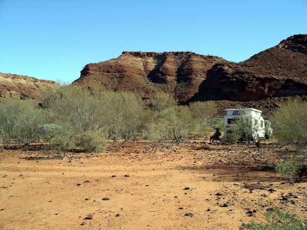
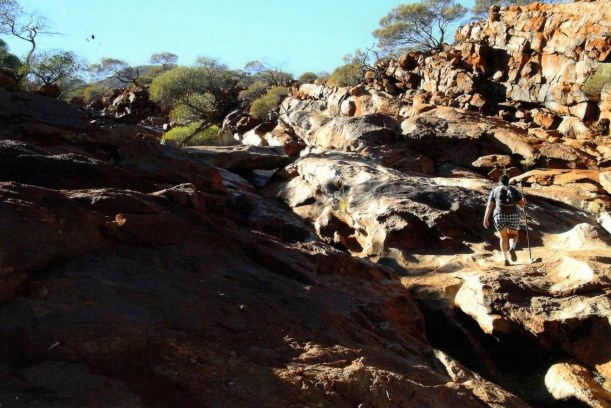
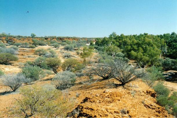
Along the dry creek gully there, were scalloped and shaped, honeycomb style rock formations. These had obviously been shaped by erosion – water and wind, I supposed. They were intricate and fascinating, and we spent a couple of hours wandering around there.

Resize of 07-1-2004 pattern.jpg

Resize of 07-01-2004 04 Kennedy Ranges rock patterns on walk.jpg

The other Trakmaster left today, before we got up this morning. Thank heavens. I don’t think they stayed long enough to properly appreciate the place, though. Still, he could add it to his “been there” list, which does not mean explored or appreciated.

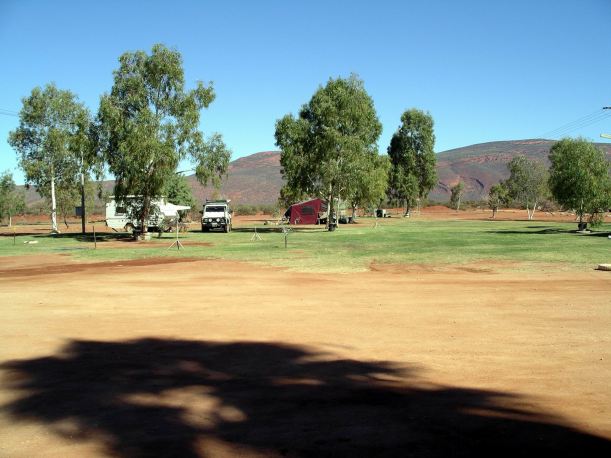
Now, it was just us, the Swiss couple and a couple with a camper trailer. The Swiss seemed to be people like us, who lingered when we could, and go out and about every day, fully taking in the place.

Resize of 06-29-2004 07 camp Kennedy Range Nat Park.JPG

Unfortunately, this peace was not to last. About 5pm, a tag-along group arrived. The bane of those who like out of the way places! There were eight to ten outfits, and they set up all around us. They put their camp kitchen next to the Swiss. It did not have to be that way – they could have gone to the other end of the campground.

The boss guy made a point of coming over and asking if we felt invaded? I said “YES”. At least, he was a little bit apologetic.

It was a group whose catering was done for them, obviously feeling very intrepid and adventurous. I wondered if they realized how much they were pitied by independent travellers. Follow the herd! Stick to the itinerary. Don’t make any decisions of your own.

The Swiss were overwhelmed and decided to cut their stay short and leave in the morning. We were going then, anyway.

We sat round our little campfire again, after tea, trying to ignore the group noise nearby. It was not the lovely, remote peace of the last two nights.

The regional map we had indicated that there were a couple of camp areas on the western side of the Range. We did not have time to go exploring around that side, this time, but had certainly seen enough here, to make that a definite interesting prospect for the future.


Leave a comment

2004 Travels June 30

WEDNESDAY 30 JUNE     KENNEDY RANGE NATIONAL PARK

Today was a lovely, blue sky day. Not too hot for activity.

Resize of 06-30-2004 kr np

Current CALM map

We drove to the southern walk.

Our information and the (little) map we were using was contained in a book on National Parks, and on the touring map of the region we’d bought. We had not found any of the usual information about this place. Too new and too far out of the way, perhaps.

This walk was into another creek gully.

Resize of 06-30-2004 southern walk

Valley of the southern walk

We climbed around a deep hole that had water in it, and reached a dry waterfall. The track went up and around it.

Resize of 06-30-2004 10 Kennedy Ra NP old seabed signs.jpg

I baulked at a narrow ledge under an overhang – too high up for me. John went on and up to the end of the track. He said it was lovely. I was quite happy sitting on my rock just gazing at the bush while I waited.

Resize of 06-30-2004 as far as wendy goes

Track kept going beyond the waterfall – I didn’t!

Resize of 06-30-2004 john climbing up

John going up the wall…….

Resize of 06-30-2004 climb

Canyon wall

We then drove along a faint track to the south, around the bluff, which turned out to be knife thin. At the seeming end of the track, we stopped and collected some firewood. It was probably an old track from mining exploring days – there was no sign of it having been used for a long time.

Resize of 06-30-2004 view sth along kennedy ranges.jpg

Kennedy Range stretching to the south

Resize of 07-01-2004 distant hill.jpg

Country east of the Kennedy Range

In the later afternoon, after a late lunch, we walked from the camp area, around to the next valley to the north, where the ground was covered with shattered extruded lava, and was black. There was another pretty little creek there.

Resize of 07-01-2004 01 Kennedy Ranges spectacular.jpg

Resize of 07-01-2004 cave maybe.jpg

A cave in there?

While we were out, another Trakmaster van came in. It parked quite close, next to us, of course.  Why is it, with a whole empty campground, people feel the need to snuggle up? It was a dual axle model, from WA. We did not warm to our new neighbours.

After tea, we sat round our little campfire, talking to each other and looking at the bright stars. We saw a satellite crossing the sky.


Leave a comment

2004 Travels June 29

TUESDAY 29 JUNE   MOUNT AUGUSTUS TO KENNEDY RANGE NP   272kms

John coughed very badly through the night, but said he was feeling a bit better this morning. I just felt tired, from lack of sleep!

We left about 9.30am.

On the way out of the property, we diverted to look at Cattle Pool on the Lyons River. There was more water in it, this time, and it looked a lot more attractive.

Resize of 06-29-2004 02  Lyons R waterhole.jpg

Lyons River pool

We drove west to “Cobra”. There was no fuel available there, despite it supposedly having same. It was a good thing we had filled up at Mount Augustus.

From there, continued sort of NW, then turned south on the Gascoyne Junction road.

From “Cobra”, this had been new ground for us, just as had been the drive from Mullewa to Landor.

The unsealed road was generally fairly good, though in places where it ran close to the Lyons River, there were lots of dips and floodways, and the going was slower.

Resize of 06-29-2004 03 Lyons R dry area.jpg

This dry country can have violent floods

It was quite scenic – just enough isolated hills and outcrops to maintain interest.

Resize of 06-29-2004 rough road.jpg

The road is across the centre of this photo!

We stopped for morning tea at a crossing/ford of the Lyons River. There was a rather pretty, large water hole there.

Resize of 06-29-2004 01 Lyons R ford

Lyons River ford

After some time on the Gascoyne Junction road, we turned west again for the run of a few kms to the campground in the Kennedy Ranges. Here, these had the appearance of a flat topped higher area from the distance, but became more rugged in appearance as we got close to the campground.

Resize of 06-29-2004 distant kennedy ra.jpg

Distant Kennedy Range

The Kennedy Ranges, which stretch for a long way north-south, are very spectacular. They are an eroded former land level, so are mesa like. They are of sedimentary rock, with some lava intrusions, which make different features.

Resize of 06-29-2004 04 Kennedy Ranges approach

Approaching the Kennedy Range National Park

The little campground was basic, but alright. There was a pit toilet. With only one other couple there, in a slide-on camper, there was no problem finding a good place to park the rig.

The campground faced the Range and a big gully cut into it. The sunlight on the Range was dramatic.

Resize of 06-29-2004 07 camp Kennedy Range Nat Park.JPG

After setting up, we went for a walk up the big creek gully. It was dry, of course.

Resize of 06-29-2004 05 near Kennedy Ranges camp

The gully/gorge was very interesting because of the rock patterns, the shapes, the erosion forms. We walked quite a way up the rocky creek bed, including around one rock fall. It was good exercise.

Resize of 06-30-2004 02 The Temple Kennedy Ra NP.jpg

We enjoyed the evening. No “people” sounds at all, just the wind through the mulga. And crickets, or something similar. The stars were so bright.

About 3am, the other couple – Swiss – woke us up. It gave us quite a fright, to have someone knocking loudly on the van door at that hour. They had locked themselves out of their camper! Toilet call, it was implied. They wanted to borrow scissors to cut their way back in through the flyscreen of the popup roof flap. John,  having hastily put on some clothes, went off with them to help. They managed it – he was not young, but still rather agile. Oh, the merits of a bucket, inside, at night!

Resize of 06-29-2004 to KR.JPG


Leave a comment

2004 Travels June 28

MONDAY 28 JUNE     MOUNT AUGUSTUS

We decided, this morning, to stay an extra day, as John was feeling really poorly with the cold. It had gone to his chest, and he was coughing all the time.

We spent a really quiet day. Reading and sewing for me. John spent some of it asleep.

We drove the road right around the base in ’93, and visited the other features, so felt no compulsion to do so again, with John feeling the way he did.

Resize of 06-27-2004 02 Mt Augustus view from camp.JPG

The mountain is the backdrop to the camp ground

I went up to pay for the extra night, and found that we had been charged previously at the unpowered rate. It should have been $22 a night. I paid $20 for the extra day, because that was all the money I’d taken up to the office with me. The backpacker employee didn’t care!

This was a very slack place. Apart from the staff attitude, there were no tourist sales items available – not even postcards.

In the time that we had been here, there had been a steady movement of people in and out. It seemed most people stayed two nights only.

Resize of 06-27-2004 03 Mt Augustus from camp area

Today, two sets of walkers – one lot our age and the other in their 20’s – went up the mountain. Both lots had little CB radios, so they could communicate with a third member of each group, left behind at camp. Through the binoculars, we could see them on the top.

Resize of 06-27-2004 mt augustus detail.jpg

The ones our age were hobbling about camp, later. I could relate to that!

Resize of 06-27-2004 07 Mt Augustus panorama.JPG


Leave a comment

2004 Travels June 27

SUNDAY 27 JUNE   MOUNT AUGUSTUS

We got up at 8.30am. Twelve and a half hours in bed!

I felt better than I expected to. Had some leg twinges and behind one knee hurt. John’s legs were sore. This was a measure of how much older and less fit we had gotten, since ’93.

We had a quiet day at the van, though John did stir himself to get under the van and grease some suspension bits.

Resize of 06-27-2004 01 camp Mt Augustus.JPG

Camp at Mt Augustus

He refuelled Truck – $1.40cpl.

I read and sewed. Talked for a while with a Perth couple camped nearby.

Think John might be getting the cold. He had a sore throat yesterday, and was sneezing a lot today.

Near sundown, we drove out to Emu Hill Lookout, to see the sunset on the rock. Because it has more vegetation on it, the mountain does not have quite the visual effects that Ayers Rock can produce.

Resize of 06-27-2004 04 Mt Augustus dusk from Emu LO.jpg


But, as the shadows lengthened, the red light on the mountain was pretty special.

Resize of 06-27-2004 08 Mt Augustus sunset.JPG


Leave a comment

2004 Travels June 26

SATURDAY 26 JUNE     MOUNT AUGUSTUS

Today’s goal was to do the walk to the summit of the mountain. It was a 12km return walk, of varying degrees of vertical.

Resize of 06-26-2004 mt a .jpg

Mt Augustus – right hand peak is the summit

The walk was divided into four sections: starting with a 1.5kms gentle climb; then 1.5kms of steep uphill walking; then 2.7kms on a gentle slope; finally 300 metres of really hard going. The blurb said it takes 6 hours to do.

Resize of 06-26-2004 track map

(from CALM brochure)

We did the walk, successfully, in 1993, but I still remembered it as tough! I was younger, and fitter, then.

We drove round to the walk start, and were on the track by 9.30am. This was probably at least ninety minutes later than we should have been.

There were two possible routes for the first part of the walk. The Rangers Track was the most straightforward, having been formed and smoothed out a bit. It followed the gully side, fairly high up above the gully floor.

The alternate route was the Gully Track, that followed the creek bed up and involved much boulder hopping and uneven ground. It was described as only for the really fit! John was determined that we should go up the Gully Track – he reckoned that was the way we’d gone last time. Well, there was not any of that part of the walk that was familiar to me – and I think I would have remembered it! But it was undoubtedly picturesque and photogenic.

Resize of 06-26-2004 01 Mt Augustus Gully Track.jpg

Gully Track

There was a point, part way up the Gully Track, where we could cut across onto the Rangers Track, but John wanted to stay on what he thought was the more interesting route!

White dots daubed on the rocks showed the way. Sometimes, in the jumble of boulders, one had to hunt around for the next one.

Resize of 06-26-2004 wendy going up

Resize of 06-26-2004 08 Mt Augustus Wendy

Decision point

There had been four other people level with us on the Rangers Track, at the point where the two diverged. Later, we found they were well over an hour ahead of us – that was the way we should have gone.

Resize of 06-26-2004 09 getting higher on Mt Augustus.jpg

Gully Track – boulder hopping

Resize of 06-26-2004 g track.jpg

As we battled our way up the gully, some wonderful outlooks opened up, over the surrounding country.

Resize of 06-26-2004 13  view from Mt Augustus track.jpg

Resize of 06-26-2004 04  good section of gorge track.jpg

Resize of 06-26-2004 05 john going up.jpg

Beyond the Gully Track

By the time we’d finished the Gully Track and emerged onto the gentler slope section, John’s legs were a bit unsteady. We discussed whether to turn back then. I really wanted to keep going, although  I was rather leg weary too, and that was what we decided to do.

Resize of 06-26-2004 10 Mt Augustus summit.JPG

Summit still seemed a long way off. Track went up the ridge in the foreground

Just before the start of the last, really steep, 300 metre ledge to the top, we met the other four people, coming down. They had been on the summit for well over an hour and had left it 20 minutes previous.

That was a measure for us, because they were going down. It would take us at least 30-40 minutes to gain the top. John’s thighs were cramping really badly. It was 2.30pm. Going the way that John had chosen had really consumed so much time. The issue had become whether we had enough time to go on to the top – assuming John could even make it – and still get back down before dark. Even the Rangers Track was not a route to be trying to do in the dark. We knew we had seen the views from the summit before.

Resize of 06-26-2004 14 track goes up ridge.jpg

We made it up into the saddle at the top of the ridge

Resize of 06-26-2004 stark.jpg

So, we turned around, 300 metres short of the summit, and went back down as quickly as we safely could. The descent was not all that easy, either! There was no debate that we would use the Rangers Track. That section was unrelentingly steep, and quite loose and risky underfoot. Much concentration was needed and one needed to watch their footing the whole time. John had some cramp episodes on the way down. I do better at downhill than he does.

Resize of 06-26-2004 11 on Mt Augustus somewhere.JPG

On the way down

We got back to Truck at 5.15pm. Dusk was falling, so we had been right to turn back when we did. We had been on the track for over eight hours. Although we’d both carried water – I had four litres in my day pack when we started, I think we were both a bit deyhdrated, John especially.

What we should have done was follow the guidelines in the Park literature: if wanting to do both alternate tracks, use the Rangers Track to go up, and the Gully Track to come down. John had not wanted to do it that way round, of course.

Resize of 06-26-2004 pano.jpg

I was footsore. Right then, I decided to retire from walks that involved “up” – forever.

Back at camp, I made a very quick and easy tea. As usual, after strenuous exercise, I was not hungry and just had some soup. John followed that with baked beans on toast.

After tea, it was hard to walk, as we stiffened up.

We were in bed by 8pm!

I had a strange night. It was almost like being delirious. I woke up every couple of hours and needed to keep flexing the very sore legs and feet.


Leave a comment

2004 Travels June 25

FRIDAY 25 JUNE   MURCHISON SETTLEMENT TO MT AUGUSTUS   390kms

Today’s was a really interesting drive. North of Murchison Settlement, we moved into slightly less flat country, with more interesting stream crossings.

Resize of 06-25-2004 04 wooramel river.jpg

Wooramel River

We stopped for a while at the Wooramel River crossing, walked around, took some photos.

Resize of 06-25-2004 03 truck near Wooramel R

Resize of 06-25-2004 02 Wooramel R nth of Murchison.jpg

Wooramel River

Then stopped at Bilung Pool for lunch.

Resize of 06-25-2004 05 Bilung Pool 2.jpg

Bilung Pool

These occurrences of water in the otherwise semi-arid country, act like magnets. A little stream that would be unremarkable in, say, Victoria, assumes great significance up here.

Resize of 06-25-2004 07 rapids near Bilung Pool.jpg

At Bilung Pool we chatted for a while with another couple with a van, who pulled in behind us.

Bilung Pool would be a very pleasant place for an overnight stop – or longer – if we came this way again.

Resize of 06-25-2004 06 Bilung Pool

Could be a pleasant camp at Bilung Pool

Resize of 06-25-2004 01 north of Murchison Settlement

The road was surprisingly good – all unsealed, of course.

At “Glenburgh” we took the road past “Dalgety Downs”, north west to “Landor”.

By now, we were in the upper reaches of the Gascoyne River basin, and the little floodways and stream crossings – mostly dry – became quite frequent.

Resize of 06-25-2004 by tk north.jpg

Near “Landor” we met and turned north onto the Meekatharra-Landor road. We had used this route in 1993, to go from Meekatharra to Mt Augustus.

Crossed the upper Gascoyne River – multiple channels.

Resize of 06-25-2004 08 near Landor HS

On Landor Station

There were a few aboriginal driven cars around the Burringurrah community, about half way between Landor and Mt Augustus.

We reached Mt Augustus about 5pm. The mountain was even more impressive than I remembered. It looms large from the camp ground, and can be seen from about 160kms away.

Resize of 06-28-2004 mt aug auerial

Satellite image of Mt Augustus (from Google)

Mount Augustus is actually the world’s biggest rock, reaching about 717 metres above the surrounding land. This is supposed to only be the top third – the other two thirds stretch below! Geologically, it is a monocline structure – a great fold of rock which protrudes through the surface – as opposed to Ayers Rock, which is a monolith, where the ground was worn down around it.

Mount Augustus is so much bigger than the better known – and more accessible – Ayers Rock. Mount Augustus is about 8km long and to drive around it is 49kms. It is really old – at least 1000 million years.

Resize of 06-26-2004 mt a

Mt Augustus area (from CALM brochure)

The “resort” – really just a camp area, with a few dongas too, on a station – does not seem to have changed much (progressed) in the eleven years since we were last here. It was kind of tatty and poorly maintained – but was $18 a night for a powered site.

The place is licensed. John bought a slab of beer – he forgot to do that in parts further south – whoops. Cost him $50. Diesel was $1.40cpl. The place appeared to do a sound trade in selling alcohol to aboriginals – presumably from the community we passed.

We set up on an area with a very welcome surround of grass.

Sat outside before and after tea. just watching the changing light on the mountain, and rejoicing in being in a remote place again.

Resize of 06-25-2004 to ma


Leave a comment

2004 Travels June 24

THURSDAY 24 JUNE   MULLEWA TO MURCHISON SETTLEMENT   210kms

I had read some tourism promotion material for new drive routes – Outback Pathways – through these parts of WA, and it was this that had given me the idea of going to Mt Augustus this way. From Mullewa north to Gascoyne Junction was being called the Wool Waggon route – because it passed through sheep grazing country. Historically, wool bales were carted over these tracks.

Refuelled at Mullewa – $1.12cpl.

Set out on the road north – the Mullewa Carnarvon road. There was a new iron ore mine at Tallering Peak, so we encountered  several big trucks on the road, which was sealed for that distance. After that, it was gravel – wide and mostly fairly smooth, and there was very little traffic.

Resize of 06-24-2004 03 Outback Pathway near Murchison.JPG

Outback Pathway – Wool Waggon Route

We were soon into mulga country.

Crossed our old friend, the Greenough River, a bit north of the Tallering Reserve.

We stopped to have lunch at the bridge over the Murchison River. This stream actually rated a bridge; our other watercourse crossings had been floodway type. Even the Greenough River crossing was basically a low causeway over pipes.

Resize of 06-24-2004 04 Murchison River

Murchison River and bridge

We had quite a wander around at the Murchison River – not in any hurry today. There were some holes in an eroded bank area; outside one of these holes was an assortment of little bones, presumably the leavings of the hole’s resident.

Resize of 06-24-2004 05 Lair of a carnivore Murchison River.JPG

The lair of a carnivore

Stopped again to have a look around the restored Well 9 on the DeGrey Mullewa Stock Route. This featured a long trough that stock would drink from. It was filled from the underground water table via a bucket and windlass – hand operated. Filling the trough for stock would have been a long and hard task – one bucket at a time!

Resize of 06-24-2004 06 restored Well 9 Mullewa stock route

Well 9 – trough, windlass, bucket on rope.

Today was a wonderfully easy one, after the long one yesterday.

We got into Murchison in the early afternoon.

Murchison Settlement consisted of the Shire offices, a couple of other buildings, and a roadhouse with attached caravan park. Murchison Shire billed itself as the Shire without a town.

Refuelled – $1.35cpl. Some 200kms had seen a rise in fuel price of 23 cents a litre!

The little caravan park was fine. $10 a night. We were the only people there.

Resize of 06-24-2004 07 Camp Murchison Settlement.JPG

Camp at Mutchison Settlement

After minimal set up – we stayed hitched – we went for the “Botanical Walk” – a 700 metre track around the area. At least they were trying to provide something for the visitor to do.

I was almost better – just a little head congestion left.

We discovered that the roadhouse generator ran all night! Obviously, the settlement was not on the power grid.

Resize of 06-24-2004 to mr


Leave a comment

2004 Travels June 23

WEDNESDAY 23 JUNE   PERTH TO MULLEWA   550kms

We managed an early departure from Perth. I was feeling better than yesterday.

Returned north on the Brand Highway to Geraldton, stopping only for a couple of coffee breaks, and to eat our lunch in a roadside parking area. I think we both wanted to keep going, just to reassure ourselves that we were actually on  the way again!

Friend M phoned just as we were entering Geraldton, to check if our prior arrangements, to meet up, were still ok. Back before we left Melbourne, we had arranged to meet up with her in the coming mid-year school holidays and take her touring in the Pilbara. She had bought herself a mobile phone, so that should facilitate our communications.

After John and I discussed it a bit, I phoned her back to see if she would prefer to meet us in Exmouth, rather than Karratha, now that we were so far south of where we’d planned to be. But the hire car tour she had organized with a friend was too far advanced to change now.

We refuelled in Geraldton. $1.09cpl.

John decided we would continue on to Mullewa. Maybe, once past Geraldton, we would start to think we were making progress?

We had driven that way in 1993, on our way to try metal detecting (unsuccessfully) around Yalgoo. So it was not new country to us, but pleasant to travel through.

Went into the council run Mullewa Caravan Park. $16 a night. The park was fine for an overnight stop – the amenities were good, and clean. We did not need to unhitch.

Resize of 06-24-2004 01 Mullewa camp.JPG

There was a noticeable aboriginal presence in the township.

I was definitely recovering well from the cold.

Resize of 06-24-2004 02 Mullewa camp morning

Resize of 06-23-2004 to mullewa


Leave a comment

2004 Travels June 22

TUESDAY 22 JUNE     PERTH

I felt a bit better today, at least in the morning.

We had to go back to the specialist in South Perth for test results and verdict.

The traffic seemed very heavy on the freeway. Maybe it just felt that way because of the heavy rain?

Resize of 06-17-2004 perth in rain.jpg

Perth in the rain

The doctor did not have the blood tests results back yet, but felt it was probably Sjoengrens. John was to get liquid tears for dry eyes and Biotene stuff to counteract a dry mouth – neither of which he had mentioned having! The specialist would send the results on to our doctor, but said there was nothing more he could do.

The good news was that he saw no reason why we could not continue with our travelling.

Drove back to camp with mixed feelings. It was not great that John appeared to have a chronic disease, but we decided to think as little as possible about that and just focus on enjoying the rest of this year’s travels.

Collected the library books and took them back. At Karrinyup shopping centre, we claimed the doctor’s bills refunds from Medicare. Bought the things required for John from a chemist. Had lunch at the shops and did a few more bits of shopping.

Refuelled at $1.02cpl.

In a sunny break back at camp, took down the annexe roof.

We went for a – hopefully last – walk around the gardens of the caravan park.