This Adventurous Age

Adventures travelling and working around Australia.


Leave a comment

2004 Travels July 20

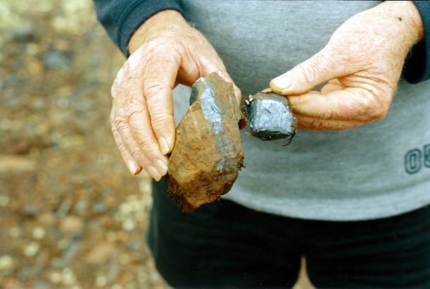
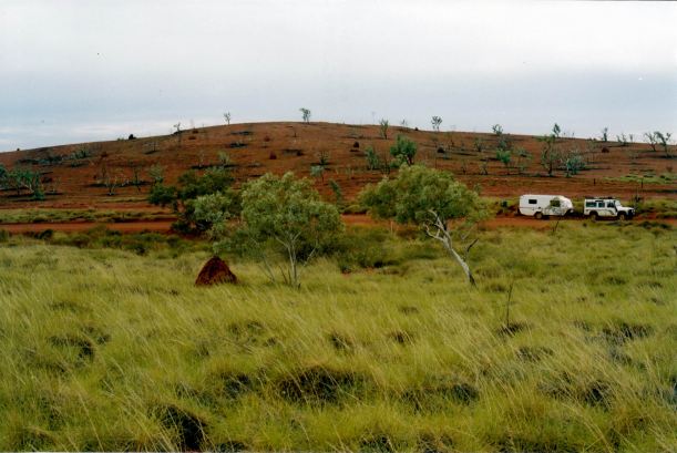
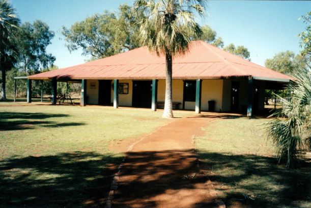
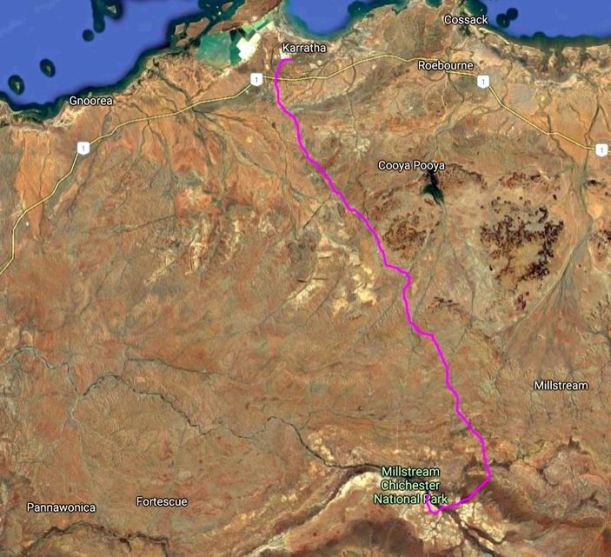
TUESDAY 20 JULY     KARIJINI NATIONAL PARK

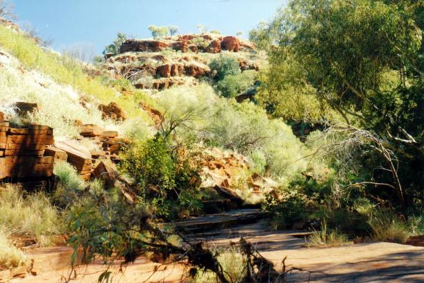
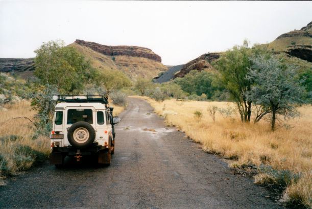
After breakfast, drove the almost 70kms to the Weano Gorge area. This is a most spectacular part of the Park. At Weano, four gorges radiate: Weano, Joffre, Red and Hancock Gorges.

Resize of 07-18-2004 karijini.JPG

Park map – from CALM brochure

John and I had camped here, back in ’93 when that was still possible, and there were hardly any people about! How things had changed in just over a decade.

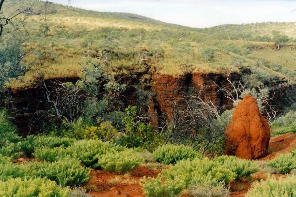
From the car park, we walked to Junction Pool and Oxer Lookouts. The views from both were incredible – they seem to take you right into the very heart of the Pilbara.

Resize of 07-20-2004 02 Weano Gorge looking down.jpg

Looking down into Weano Gorge

At Oxer Lookout, it was possible to walk out on a narrow neck of land to get a really extensive view from the end. I allowed M and John to do that!
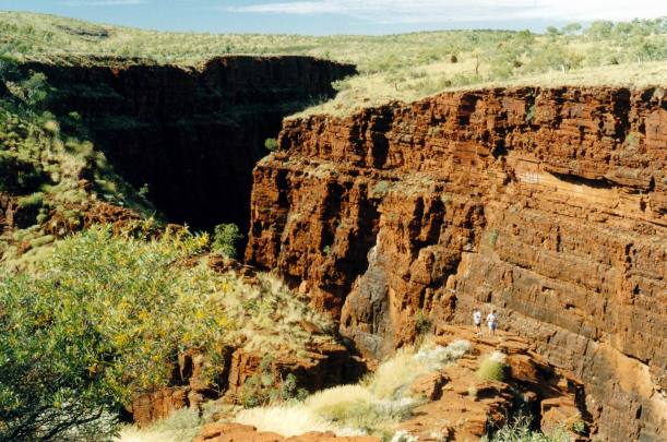
Resize of 07-20-2004 04 Oxers Lookout.jpg

Out on a ledge!

I had to admit that I found it rather surprising that people were still able to walk out to this point. There were warning signs about the risks, but I suspected the time was probably not too far off when it will either be banned altogether, or there will be protective fencing.

Resize of 07-20-2004 05 John at Oxers Lookout.jpg

No – he didn’t climb a fence – it just ended there!

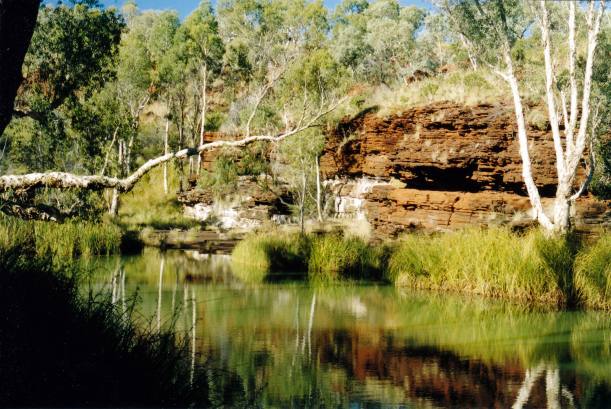
We decided to try the Weano Gorge walk, which John and I had done in ’93, when we reached as far as the Handrail Pool, beyond which one needed to swim and have specialist climbing gear.
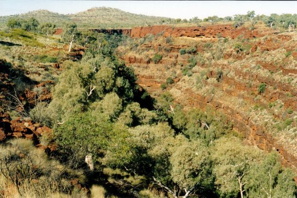
Resize of 07-20-2004 01 Weano Gorge Karijini.jpg

Weano Gorge

There were heaps of people about. I hate school holidays! But I guess that this, along with Dales Gorge, are the two iconic places in Karijini that everyone visits now. I liked it better back when Karijini was not on every tourist’s radar!

Resize of 07-20-2004 07 weano.jpg

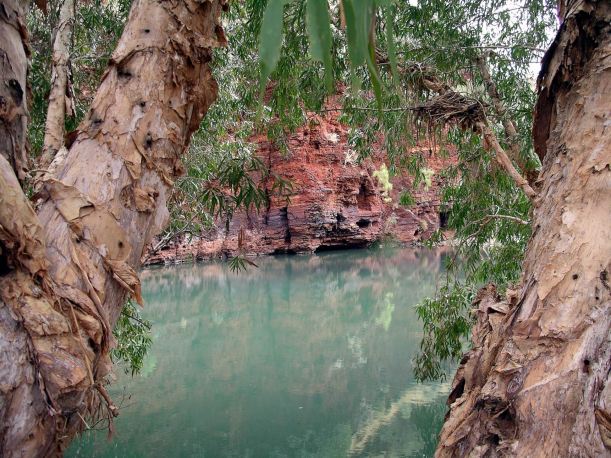
Obviously, being a gorge, there was a steep route down into it, before the walk and scramble along the base. There was quite a bit of water in the bottom of the gorge, and one had to keep to the sides, scramble around on ledges – or get wet feet.

Resize of 07-20-2004 10 Wendy in Weano.jpg

I got part of the way along – not as far as last time. We came to a point where we had to climb around the water on a little ledge. With the camera, and carrying the day pack, I couldn’t be bothered taking the risk of slipping into the water, so I opted to stop and wait there while the other two went on. Also, I thought there would be water running in the chute section that I knew was further up, and it would be slippery. It was. John stopped there, but M went on, all the way to the Handrail Pool.

Resize of 07-20-2004 06 John going down Weano Gorge.jpg

Getting deeper into the gorge

After that, went back the same way.

Resize of 07-20-2004 09 John and Mem in Weano Gorge.jpg

Had a little sit around at the pool that was further along from the path down – watching some kids swim. Then we tackled the climb back to the top.

We did not even think about tackling the Hancock Gorge walk! We’d done some of it in ’93 and I remembered it as very steep, and with a route along the base that involved climbing and ledge work. That gorge was where an SES rescue worker drowned, at Easter, after rain further back created a flash flood.

We drove back around to Joffre Gorge and Lookout. Had lunch there.

Resize of 07-20-2004 11 view from Joffre LO.jpg

Resize of 07-20-2004 12 view from joffre LO 2

Views from Joffre Lookout

Some revolting grub of a tourist had crapped at the edge of the path! I wondered if it had been someone camped there illegally overnight?

Resize of 07-20-2004 13 at top of Joffre Falls.jpg

Joffre Gorge, seen from the top of the falls

We began the walk down into Joffre Gorge.

Resize of 07-20-2004 17 Joffre Gorge view down.jpg

Looking into Joffre Gorge


Got about half way down, and then it became too much climbing – and too high up – for me! John wasn’t too keen either. So M went on alone and got down to the bottom.

Resize of 07-20-2004 14 Mem descending Joffre Gorge

Going down!


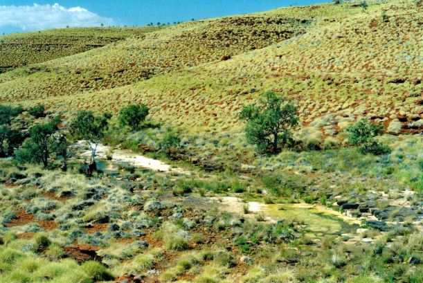
While she was doing that, I explored around the top – it was really pretty above the Joffre Falls.

Resize of 07-20-2004 20 karijini creek

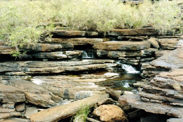
Creek above the Joffre Falls

Joffre Gorge had its  own unique characteristic, in that the walls had the appearance of rock stacks, and there was a lot more vegetation growing on the walls.

Resize of 07-20-2004 15 Joffre Gorge rhs.jpg

Unusual terraced walls of Joffre Gorge

M was pleased she’d managed the climb down and back up the gorge, but admitted that, in places, it had been close to her limits!

Resize of 07-20-2004 19  joffre gorge.jpg

At the top of Joffre Gorge

Our last venture for the day was to the lookout over Knox Gorge. This was a great lookout, where we could look straight down into the gorge. We watched some walkers down in the gorge. It seemed very deep.

Resize of 07-20-2004 22  Knox LO view.jpg

Knox Gorge

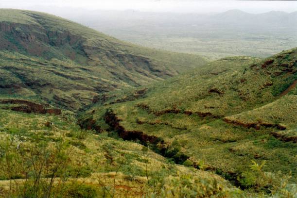
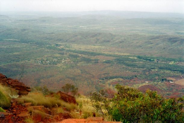
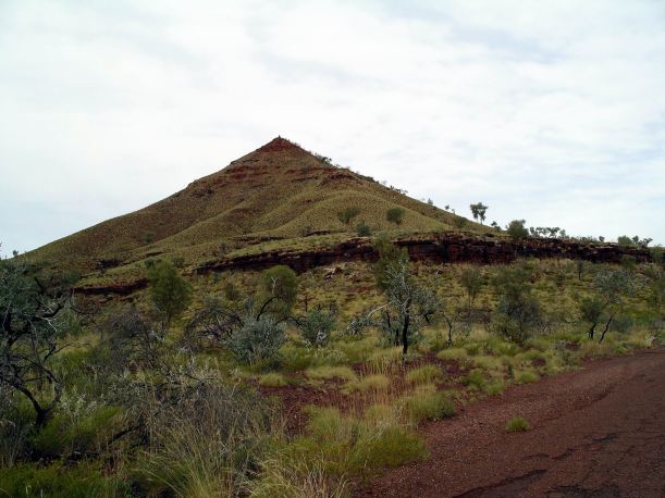
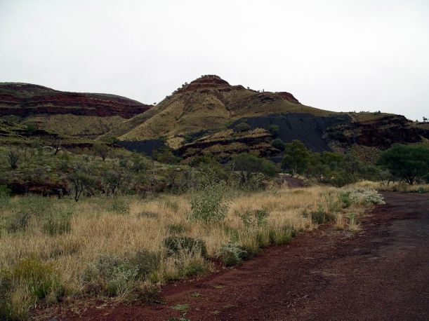
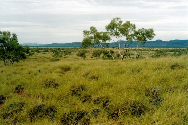
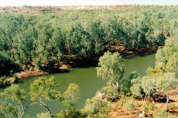
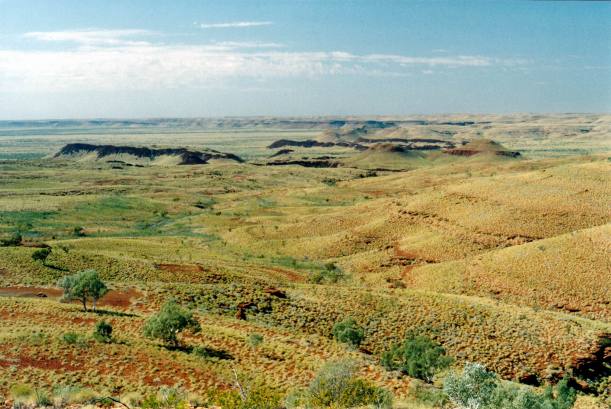
The day had not been just about the various gorges visited All around us were the captivating panoramas of the Pilbara.

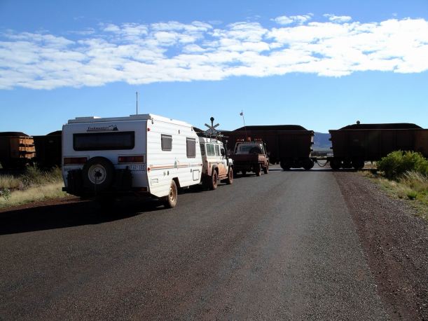
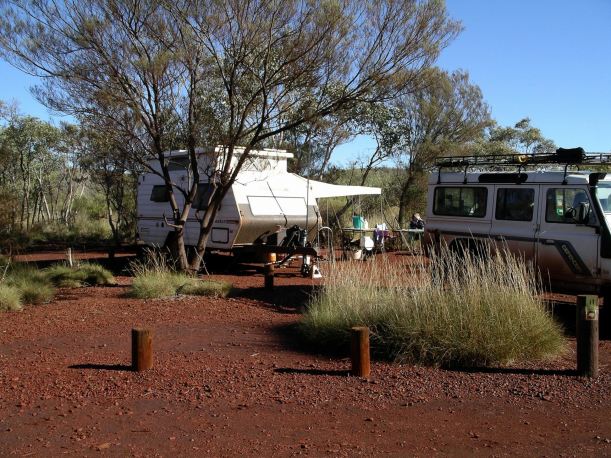
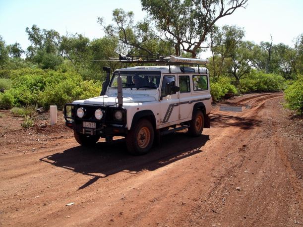
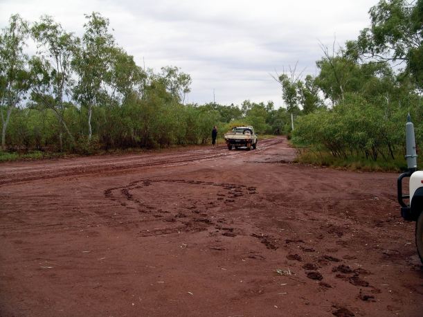
Back at camp, John topped up  the Truck fuel from the jerry cans.

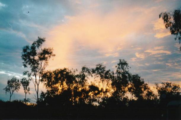
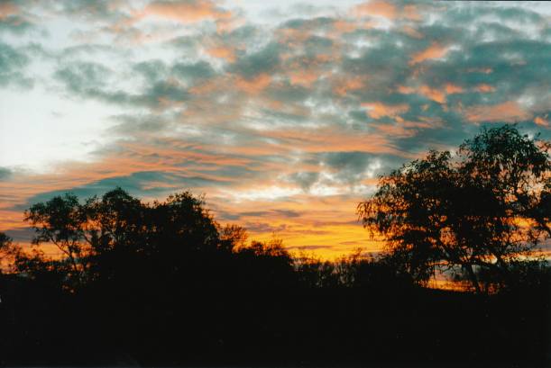
We had yet another glorious sunset.

Resize of 07-21-2004 24 Karijini sunset.jpg

After tea, sat outside enjoying our surrounds and talking over the highlights of the day. It became clear that the other two were challenged by the idea of walking Knox Gorge tomorrow. The fact that we had not done so today was really niggling at them. So it looked like that would be part of tomorrow’s agenda.


Leave a comment

2004 Travels July 19

MONDAY 19 JULY     KARIJINI NATIONAL PARK

The day promised to be great – blue skies, But not too hot for walking.

Resize of 07-19-2004 03 Dales Gorge walk setting out.jpg

We set off through the campground again, walking to the Circular Pool end of the gorge. Took the steep track down into the gorge, then walked along the bottom,  to Circular Pool.

Resize of 07-19-2004 02 ck gorge.jpg

There were quite a few other people on the track and in the gorge – it is a very popular area.

We admired the Circular Pool for a short time, then retraced the way we’d come, as far as the track we’d come down. Continued on past the bottom of that, staying along the gorge bottom, beside the creek.

Resize of 07-19-2004 04 walk through dales gorge.jpg

Resize of 07-19-2004 04 Dales gorge and creek

In places along the track, where people’s legs had brushed against the rocks at its side, we could actually see strands of blue asbestos!

Resize of 07-19-2004 08 asbestos.jpg

Some asbestos layers in here. Interesting pattern on rock top looks like a map of intersecting gorges.

Fortescue Falls was an attractive feature, but there were too many people there. It was impossible to take a photo that did not have people in it.

Resize of 07-19-2004 05 Fortescue falls  Dales Gorge.jpg

Fortescue Falls

There were also a number of the yobbo variety, doing show-off jumps from ledges up on the rock walls. When one sees what some idiots do in the gorges, it is amazing that there are not more accidents and need for rescues!

Resize of 07-19-2004 06  in Dales Gorge.jpg

Continued on, along to Fern Pool, with its cascades. This was a lovely place. There were people swimming here, too.

Resize of 07-19-2004 11 f falls.jpg

Fern Pool

Dales Gorge was the most accessible part of Karijini, plus there was the campground there, so we should not have been surprised at having to share it with so many others. Pity, though…

The climb back up to the top again was not too hard, even for this hill hater. That was definitely the best way round to do the circuit.

Resize of 07-19-2004 15 Fortescue Falls from climb out of Dales Gorge

Fortescue Falls seen from the climb up out of the gorge

Had lunch back at the van, then drove to Kalamina Gorge. There, we walked down a steep but short track, to the gorge base.

Resize of 07-19-2004 18 Kalamina Gorge Karijini.jpg

Kalimna Gorge

From there, we walked along the gorge floor, as far as Rock Arch Pool.

Resize of 07-19-2004 19 Kalamina Gorge Temple Hole.jpg

Temple Hole

It was a most attractive gorge, and quite easy walking for most of it. The walls were high and steep and the gorge quite narrow in parts. On a couple of places, we had to follow rock ledges around.

Resize of 07-19-2004 21 Kalamina Gorge.jpg

The Rock Arch was a hole through a section of the gorge wall.

The climb down and the same back up, was easier than at Dales Gorge.

It was a bit late in the day to get great photos of the walk in Kalamina Gorge, unfortunately.

Resize of 07-19-2004 09 Kalamina Gorge

It was a walk well worth doing – and it was away from the crowds!

I was definitely leg weary by the end of the day.

The campground was full up. The old Visitors Centre area was being used as an overflow area – or holding pen! Yet again, we had been lucky.


Leave a comment

2004 Travels July 18

SUNDAY 18 JULY   TOM PRICE TO KARIJINI NP – DALES GORGE   110kms

John had taken seriously the notice about being early to secure a camp site, so we were up early, breakfasted, packed up  and away by 8.30am. Quite an achievement for us!

We were held up at the railway crossing by the caravan park, by an ore train.

Resize of 07-18-2004 01 Ore train Karijini.JPG

The drive was very scenic, either surrounded by the red Pilbara hills and ranges, or with them in the distance. It was all sealed, apart from the last few kms into the camp area.

We got to the campground at 10am. There were campground hosts checking people in and allocating sites. They gave us an excellent, long site that would accommodate both the van and tent – in the generator area, as we requested. It was not too far to walk to the nearest long drop toilet – but far enough away not to be able to smell it!

Resize of 07-19-2004 01 Camp Karijini Nat Park.JPG

The camp area was really attractive, with plenty of trees and scrub about, and sites not too close together. It cost us $5 a night, per person.

After camp was set up, we drove about 12kms, back to the Visitor Centre. This was an unusual structure – all stark lines – made of rusted looking metal, that is the colour of the gorge walls of Karijini. It was very well done.

Resize of 07-18-2004 02 Karijini NP Visitor Centre

Karijini Visitor Centre

We got information on walks, looked at their displays, bought ourselves a polo shirt each, some postcards, magnets, and a bookmark for the young grand daughter.

After lunch back at camp, walked the 2km Dales Gorge Rim Walk. We walked through the campground to get to that – very pleasant.

It was an excellent introductory walk. Lots of white trunked snappy gums contrasted with the red of the earth and hills.

Resize of 07-18-2004 03 Dales Gorge Karijini NP from rim.jpg

The view from the gorge rim, down into the gorge, was beautiful. Right down in the gorge, cypress pines lined the creek.

Resize of 07-18-2004 dales gorge from rim walk

That walk made us eager to tackle the longer walk, down into the gorge and through  it, tomorrow.

Resize of 07-18-2004 dg from r walk

We ran the generator for a while after getting back to the van, to make sure they were sufficiently charged.

Ate tea sitting out under the van awning  and stayed out there until it was bedtime, listening to the bush and campground noises, and gazing at the stars.


Leave a comment

2004 Travels July 17

SATURDAY 17 JULY     TOM PRICE

Today was cold, with drizzly rain. There was cloud down over Mt Nameless, so it could not be seen from town.

Went to the shopping centre. I was after a Weekend Australian, but they did not get it here until Sunday.

Topped up the fuel again – $1.09cpl. Refilled the jerry cans too.

John found a place where he could do a computer download.

Basically, it was a mess about day. We spent quite a bit of it sitting around the van, just talking.

Resize of 07-14-2004 white .jpg


Leave a comment

2004 Travels July 16

FRIDAY 16 JULY     TOM PRICE

Today was grey, cloudy and fairly cool for these parts.

I did some more washing.

John phoned C at Trakmaster, to get him to send a new battery charger to us, at Port Hedland. He also confirmed that he could link our batteries directly to the portable charger that we carry. This solved the power problem, temporarily.

Refuelled – $1.10cpl.

Drove up Mt Nameless, the peak that looms over Tom Price. The 4WD track to the top was still the very steep and somewhat challenging ascent and descent that I remembered from ’93. It felt a lot safer in the Defender, though, than it had in the old Hilux.

Resize of 07-16-2004 01 going up mt nameless.jpg

Going up Mt Nameless – from the passenger’s viewpoint!

The views were alright from the top, but would have been much better on a sunny day – it was windy and freezing up there!

Resize of 07-15-2004 tom p from top

Tom Price township from Mt Nameless Summit

Resize of 07-16-2004 02 Tom Price CP from Mt Nameless.jpg

Tom Price Caravan Park below, to left

Decided to go visit Wittenoom Gorge, which we’d heard was really attractive, while one could still access it. Our thinking was that, on such a still, damp day, there might not be asbestos fibres floating around!

Wittenoom, of course, was notorious for having been the site of blue asbestos mining, which caused drastic health problems amongst its workers. The mining ceased in 1966. The settlement that existed up in the gorge where the mining occurred, was demolished and removed. But the tailings heaps remained.

The township of Wittenoom was several kms away from the mine area, on flatter land at the start of the gorge.

Had to go back the way we’d come in, yesterday,  for about 100kms, through Rio Tinto Gorge, then turn east on the Munjina road, for about 27kms to the Wittenoom township.

Resize of 07-16-2004 23 Tom Price Wittenoom rd gorge section.jpg

Rio Tinto Gorge

We went to the Information Centre/gemstone shop in the old town. There was an excellent display of minerals and gems – one of the best I’d seen.

The shop lady told us that there were only a few houses still occupied in the town. The government was trying hard to get all residents to leave – on health grounds. However, the handful of residents who remain disputed the health risk in the town, being as it was, out on the plain and away from the gorge where the mine was.

It was official policy not to give out information about Wittenoom, put it on maps, or have signposts to it.

The shop lady pointed out something I had not known – that blue asbestos occurs throughout the Pilbara. She claimed that iron ore mining activity around Newman would be putting asbestos fibres into the air in those parts! Had no idea if she was correct in these claims, but it was rather a scary thought.

Resize of 07-16-2004 07 blue asbestos.jpg

Blue asbestos

We bought postcards and magnets. John bought some stones, including a little introductory kit for grand daughter, that had stones mounted and named.

Left the township and drove up into Wittenoom Gorge itself.

Resize of 07-16-2004 03 rd into Wittenoom Gorge

Road into Wittenoom Gorge – mine tailings on the hillside

One could see why the remaining locals were entranced by the place – the scenery was just brilliant.

Resize of 07-16-2004 21 Wittenoom peak.JPG

Resize of 07-16-2004 22 Wittenoom scene.jpg

It really was an abomination, to have such a deadly mine (or any mine for that matter), in such a beautiful place.

Resize of 07-16-2004 09 Wittenoom asbestos tailings.JPG

Mine tailings on the hillside

The group Midnight Oil made the song “Blue Sky Mine” about this place.

The road into the gorge, once sealed, was breaking up in places, but was still quite negotiable.

Resize of 07-16-2004 13 Wittenoom Gorge road remnants.jpg

Resize of 07-16-2004 19 Wittenoom green contrasts.JPG

There was plenty of evidence of blue asbestos. There were huge tailings dumps on the sides of the hills, near where the mines had been.

Resize of 07-16-2004 tailings.jpg

Tailings dump

Tailings had been used in the road making around the former settlement – there were clumps of blue asbestos on some of the surfaces.

Resize of 07-16-2004 06 blue asbestos fibres.jpg

We looked around the old mine settlement site. There was not much there now, except broken concrete slabs. But the layout was clear.

Resize of 07-16-2004 04 Wittenoom Gorge old township area.jpg

Old settlement site

Resize of 07-16-2004 12 Wittenoom Gorge was town here.jpg

Found some lovely waterholes, up against rock walls at the gorge sides. The water was an unusual milky green colour.

Resize of 07-16-2004 15 Wittenoom magic.JPG

Although access to here was from the northern side of the ranges, Wittenoom Gorge is actually downstream from the really popular Karijini gorges – Weano, Hancock, Joffre and Knox. The stream through the gorge flows into the Fortescue River. One assumes that after rain events, it carries asbestos fibres down into that river.

Resize of 07-16-2004 18 Wittenoom Gorge Cathedral Pool.jpg

Cathedral Pool in Wittenoom Gorge

Exploring Wittenoom took us most of the day. Then it was time to return back the way we’d come.

Resize of 07-16-2004 mine piles.jpg

Resize of 07-16-2004 interesting peak.jpg

The clothes I’d hung out this morning were almost dry.

The caravan park was bursting at the seams.

John wanted to stay here another day, to relax a bit! Normally, taking our time was not an issue for us, but we felt some pressure to keep going, to give M as varied a time as we could. Whatever it was that was causing the face to swell up seemed to have gone away again.

I was able to extend our stay by a day.

We had excellent fish and chips for tea, from a shop in the central shops complex. They were quite expensive, though.


Leave a comment

2004 Travels July 15

THURSDAY 15 JULY   MILLSTREAM TO TOM PRICE   270kms

It was a grey and cloudy day.

The campground was still closed, as we left. We were so lucky to have been able to spend the time there, that we did.

Resize of 07-15-2004 01  Deep Reach closed access as we leave.jpg

After some discussion, we had decided that remaining on the Roebourne-Wittenoom road might be a safer option than returning to the railway access road, given all the rain there had been. It meant a longer drive, but that was preferable to the potential embarrassment of getting bogged on a private road!

The scenery became progressively more interesting through the drive. The eastern parts of the Pilbara were more rugged than where we had been.

For a while we ran parallel to the Chichester Range.

Resize of 07-15-2004 02 Hamersley Ranges near Mt Florance HS

Near Mt Florance homestead, there was an area of contrast, where one side of the road had been burned, the other not.

Resize of 07-15-2004 03 near Mt Florance burnt and unburnt.jpg

Contrast between burnt and unburnt country

The roads we travelled on were mostly unsealed, but in reasonable condition.

Resize of 07-15-2004 04 Wittenoom Tom Price rd

Crossed our old friend, the Fortescue River, on another long, slightly built up causeway. Clearly, a prolonged heavy rain event would close all sorts of roads in these parts!

Turned south-ish at the junction of the Wittenoom and Nanutarra roads. We then had to drive through the Rio Tinto Gorge – one vehicle width and very narrow. It would have been “interesting” if we’d met a vehicle coming the other way! It goes for several kms.

Just after that, we tried to go in to Hamersley Gorge. Part way down the access track was a wide turning point and a sign saying no caravans beyond that point. This was still quite a distance from the gorge, so we decided against walking the rest of the way.

Resize of 07-15-2004 05  track to Hamersley Gorge.jpg

Track to Hamersley Gorge

Decided to have lunch at the turn around area, anyway. Just to make life harder, another van came in and parked there too, which made our reversing out, to leave, quite difficult.

Resize of 07-15-2004 06 no vans past here Hamersley Gorge track

No vans past this point!

The Tom Price Caravan Park was very full. We managed to get a site – small – though. It was right up in the back corner of the park. $22 a night. We felt crowded all the time we were there, especially in the amenities, which were Atco type. Not amongst the better places we’ve stayed!

Resize of 07-15-2004 07 camp Tom Price.JPG

Tom Price camp

After setting up the camp, I did some cleaning up of the van – Millstream mud!

M and John showered. I washed a couple of loads of grotty clothes, then had my shower. It was welcome after the muddy days without.

We drove into town to the Information Centre and shops.

There was a notice up saying that the Dales Gorge camping area in Karijini National Park, was very busy and would-be campers should get there very early, to obtain a site.

While tea was cooking, the power pole “died”. Overload from the four vans hooked up to it, we suspected. After this, our battery charger was no longer working! If we could not fix the problem, it would not be long before we would have to turn off the fridge, which worked exclusively from the batteries.

Resize of 07-15-2004 to tp


Leave a comment

2004 Travels July 14

WEDNESDAY 14 JULY     MILLSTREAM NATIONAL PARK

As we were getting ourselves organized, this morning, two Rangers drove in – indigines. The lady one was quite aggressive in the way she addressed us and without asking for any input from us, stated she was going to issue us with fines for being in a closed campground!

I could actually understand her attitude. There are travellers who disregard all sorts of signs and instructions, and then become quite threatening when challenged.

We explained that permission had been given. Obviously, though, no-one had notified anyone else about this. Eventually, she agreed to radio in to base and check our story. Then, everything was alright, and we breathed great sighs of relief.

The Rangers mellowed up then. She told us there was a little olive python living around our camp area! We hadn’t seen it at all, but I imagined that any sensible reptile was well snuggled up somewhere dry.

She told us she had lots of qualifications and was embarking on a PhD on campground management. That was a subject I would find fascinating.

After that little drama, we drove to the Millstream Homestead, located by the Millstream Creek.

As with many of our National Parks, this area was originally a pastoral lease, dating from the 1860’s. The Homestead we were visiting was built in the 1920’s, as a family home and the hub of the very large property. CALM acquired the place in the 1980’s and turned it into the Visitor Centre and headquarters for the National Park.

On the way there, we passed the overflow camp area and thought it very open and ordinary, away from the river. But it was not muddy!

We also visited the lookout that gave views across the Fortescue River and was also a bit of a vantage point across the surrounding country.

Resize of 07-14- deep reach.jpg

The old homestead area was so interesting. I loved the wide verandas around the house – so necessary for coolness in the high summer temperatures of these parts.

Resize of 07-14-2004 10 Millstream Homestead.jpg

Millstream Homestead

There was a separate kitchen building – also quite typical of that pioneering period. Made of corrugated iron – less prone to catching fire – it had a high roof and ventilation to help remove accumulated heat.

Resize of 07-14-2004 12 old kitchen at Millstream HS.jpg

Kitchen building at the Homestead

At the Visitor Centre, we bought a T-shirt each, with a nice design on the front.

From the Homestead, we did the short walk around the place. There was still evidence of cyclone damage around. We were invaded by the contents of a large tourist bus and so set off to do the 750 metre walk to Chinderwarriner Pool.

Resize of 07-14-2004 11 Chinderwarriner Ck at Millstream

Chinderwarriner Pool

Resize of 07-14-2004 creek plants.jpg

The walk was pleasant, but some interpretative signage at the end would have been of benefit.

Resize of 07-14-2004 the creek


Drove to the lookout over the river and across to Crossing Pool, then did the Snappy Gum Drive  around to Crossing Pool, on the other side of the river. Had our lunch there.

Resize of 07-14-2004 09 Crossing Pool Millstream Chichester NP

Crossing Pool

Went back the way we’d come, past the Homestead, and back to camp.

It was a very enjoyable day’s outing – much variety.

Resize of 07-14-2004 mum and bub

Mum and baby at Millstream Homestead

Resize of 07-14-2004 ch creek

Plants growing in the creek at the Homestead

At our camp now, it was dry enough the walk along the river bank and look out across its breadth – but carefully! It would still be too wet for tents.

Resize of 07-14-2004 05 Millstream Deep Reach

Deep Reach

In the late afternoon, there was a ruckus in the reeds near the van. Maybe the olive python hunting dinner?

Throughout our time here, we could hear, faintly,  the ore trains in the far distance. We were probably about ten kms from the nearest point of the railway, but the hills and valleys seemed to funnel sound.

The sunsets were very pretty.


Leave a comment

2004 Travels July 13

TUESDAY 13 JULY     MILLSTREAM NATIONAL PARK

No rain through the night – good!

The ground was drying out well. But the track in was still very muddy, and most camp sites were still slippery.

The conditions of our stay would allow us one drive out and back, today, so we decided to visit the Chichester section of the National Park.

We carefully replaced the barrier chain across the track, as we left.

Resize of 07-14-2004 02 Millstream road closed.JPG

The first 35kms were retracing our route in, back as far as the rail road.

It was a relief to see that the heavy rains had not brought the river up over the causeway.

Then there was a 10km section of road through the range. This was sealed, but one vehicle width only and very winding and steep. Could see why it was stated to be unsuitable for caravans, though a small one like ours could manoeuvre through – but meeting any oncoming traffic would pose problems.

There were some great panoramas opened up as we wound our way through the range.

Resize of 07-13-2004 01 Chichester Range area.jpg

From the Mt Herbert carpark, we did the short walk up the mountain. 600 metres each way and the gradient was fairly easy. There were good views to distant peaks and over the ranges.

Resize of 07-13-2004 valley from mt herbert

Then we walked the 4.8km return walk to McKenzie Springs. It was most enjoyable.

Resize of 07-13-2004 03 on McKenzie Springs track

Track marker (camel) on McKenzie Springs track

The day was quite warm and fine, now.

Resize of 07-13-2004 02 McKenzie Springs walk

There were lots of birds around the springs. This was once a watering hole for camel and bullock trains. The springs and the little creek fed from them, which further down contained the Python Pool, were really pretty.

Resize of 07-13-2004 06 pool at McKenzie Springs

We must have been into the early part of the wildflower season in these parts, with a number of different plants in flower.

Resize of 07-13-2004 04 Sturt Pea on Springs walk

Desert Pea

We saw some spotted firetails – a new bird!

Resize of 07-13-2004 05 McKenzie Springs

McKenzie Springs

Resize of 07-13-2004 08 Mt Herbert and Truck.jpg

Mt Herbert from Springs track. Truck is a tiny speck in the carpark!

After some time exploring up and down the creek at the Springs, we returned the same way to Truck, then drove further around the twisting road to Python Pool. From the carpark there, we walked about 100 metres to the actual pool, taking our packed lunches to eat there.

After the peace of McKenzie Springs, Python Pool was rather an assault on the senses. It was too crowded with people, being a place where children could swim. There were far too many noisy kids there!

After lunch, checked out the nearby camp area at Snake Creek – pretty ordinary. But it was, at least, open for camping, hence the hordes at Python Pool.

Resize of 07-14-2004 reptile.jpg

Reptile with striped tail, by the track

Retraced the route, back to our solitude at Deep Reach, peopled only by us and acrobatic corellas.

Resize of 07-13-2004 10 Deep Reach near camp

Deep Reach, near our camp

John topped up the fuel tanks with the diesel from the jerry cans on back of van.

Given the crowds at Python Pool, we concluded that it had been worth the rain, mud and temporary inconvenience that had given us this place to ourselves!

Resize of 07-14-2004 sky


Leave a comment

2004 Travels July 12

MONDAY 12 JULY   MILLSTREAM NATIONAL PARK

By morning, the rain had lessened to showers only, but it had been heavy and steady through much of the night.

M had survived the night, quite cosily.

The campground was a real mess – all mud. All the other campers packed up and slipped and slid out. We thought about going, but really wanted to try to see the place. I had wanted to come here ever since we had to miss it on the ’93 trip.

Resize of 07-12-2004 03 Deep Reach tracks made by departees

Tracks and slush made by departing campers

Then two Rangers arrived and told us they were closing the campground.

Resize of 07-12-2004 12 Millstream Ranger closing camp.JPG

Rangers closing the campground

It was on river silt, which was why it went to slop so quickly. We explained that we’d only just arrived yesterday, and looked sad, and they relented and let us stay, with conditions. We had to promise that we would not try to drive anywhere today. We were not to drive in and out more than once a day, after that, providing there was no more rain. More rain would mean no driving at all. Fair enough, we thought.

The Rangers indicated the weather was supposed to clear.

So now we had a campground all to ourselves!

We discovered a pit toilet closer than the one we’d used to date, that we’d been skiing up to!

Resize of 07-12-2004 15 Millstream Mem wading.JPG

The rain stopped. The ground around our camp slowly dried.

We managed to play boules in the afternoon, after a fashion. Couldn’t play a normal game, because the boule just landed with a splat in the mud, and stayed put. But it filled in some time. The boules needed a very good wash, afterwards.

Resize of 07-12-2004 05 Millstream Mem getting water

Getting water to wash the boules

It seemed a really pretty area, from what we could see. It was on a great, deep, wide section of the Fortescue River. There were reed warblers in the reeds, white plumed honeyeaters about, and plenty of corellas. Watching their antics was very entertaining.

Resize of 07-12-2004 07 Millstream Deep Reach camp view

Deep Reach – Fortescue River – by our camp

Deep Reach was one of the most sacred areas of the local indigines; their Warlu serpent lived in there.

Although it was still cloudy through the afternoon, there was no more rain. Looking promising! The solitude was worth the inconvenience of the mud.

Had to run the generator again for a while in the late afternoon, to charge up the batteries. At least, there were no neighbouring campers to be disturbed, although it ran really quietly.

Again, we huddled in the van for our meals. One of us had to sit on the bed – only room for two at the table. But it was comfortable enough. We talked for a little while, after tea, then had another early night.

Resize of 07-12-2004 millstream

Millstream Chichester National Park – from CALM brochure


Leave a comment

2004 Travels July 11

SUNDAY 11 JULY   KARRATHA TO DEEP REACH MILLSTREAM NP   140kms

We left Karratha about 9.30am. This first pack up with a third person and their gear required a little trial and error. Will be faster, next time.

Topped up with fuel on the way out. Still at $1.08 cpl. We put about 10 litres in each of the jerry cans on the back of the van, so our possible movements would not be too constrained by fuel availability.

Drove out to the highway, along it for a little way, then picked up the railway road on its other side. This road was maintained by the company, for access to its rail line, for repairs, checking and the like. Given that there is no direct route through to Tom Price, it was used by company staff going to the mine.

The drive along the Hamersley Iron Road was different. The road was pretty reasonable – unsealed of course. There was not much traffic.

We saw one of the huge, long ore trains and the driver blew the whistle at us. I supposed travellers provided him with some variety in the otherwise back and forth journeying.

One section through some hills was a bit steep and winding – there were no guard rails or the like!

There were rain showers for some of the time, and we could see nasty looking dark cloud, with rain falling, in the distance.

Resize of 07-11-2004 02 near Millstream is that rain coming.jpg

On the railway road – threatening skies

Came to the place where two railways intersected. Ours ran from Tom Price to Dampier. The other from the mine at Robe River, to Cape Lambert, near Roeburn. That one went over the top of the one we were following on a flyover.

When the railway road intersected with the Roeburn Wittenoom road, we took the latter, which took us to a reasonable access road to Millstream National Park. This crossed the Fortescue River – dry at that point – on a long causeway, so we were then on its southern side.

At the entrance station to Crossing Pool, where I’d intended to camp, found it was now day use only, due to cyclone damage from “Monty” back in March.

So we continued on to the Deep Reach camp area. The track in there was very sloppy.

The camp area was fairly full, so there was not a great choice of sites in this fairly small area, but we found a good looking spot, backed up to the reeds and the Fortescue River, with a small patch of grass for M’s tent. The ground was fairly dry – it looked as if some campers had not long left. Maybe the approaching nasty looking weather had something to do with that?

Resize of 07-12-2004 09 Millstream camp site.JPG

Millstream Deep Reach camp site

The clouds were definitely threatening and it began to rain, lightly, so we set up very quickly. Then it teemed down. There was soon very slippery and sloppy red mud all round us.

Going to the toilet – some distance away – became tricky, and messy – mud, water, the risk of slipping over, even with walk sticks.

Resize of 07-12-2004 01 Millstream damp camp

Change of mind!

We’d arrived about 1.30pm. Spent the afternoon and evening all huddled in the van, damp and cold. With this experience of touring, M might just decide to defer her retirement plans!

John had to go to Truck and break out the generator and get it going – for the very first time – because there was virtually no solar input. He remembered how to do it and it started first time. So, buying it was now justified!

Resize of 07-11-2004 03 generator christened

Generator first use

I wondered if the river would rise if the rain didn’t let up? That was not a comfortable thought!

Staying here cost the National Park camp fee – $5 each, per night.

An early night was in order. M paddled over to her little tent on its small island of grass.

Resize of 07-11-2004 to mnp.JPG