This Adventurous Age

Adventures travelling and working around Australia.


Leave a comment

1999 Travels November 29

MONDAY 29 NOVEMBER     WHITE BEACH

Today is the start of our 100th week on the road! Hopefully, there will be at least 100 more!

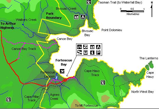
We set out to drive to Sloping (Slopen on some maps) Main, an area and settlement near the Saltwater River Coal Mines site, but facing west. There is a lovely curved beach there, with the totally unsuitable name of Stinking Bay.

I was rather intrigued by the two versions of the name and initially assumed that some early explorer or settler couldn’t spell “sloping” correctly! However, found out that the first farmer to settle there – in the 1820’s, before Port Arthur was even established, was a Mr Slopen. Hence Slopen Island, etc.

We had a little cruise around and look at the Gwandalan shack/village area by the bay. Even though this is really not very far from anywhere, it feels quite remote. There are the usual magic views – in this case, across to Sloping Island, with the arm of land that is the eastern shore of the Derwent, hazy in the distance.

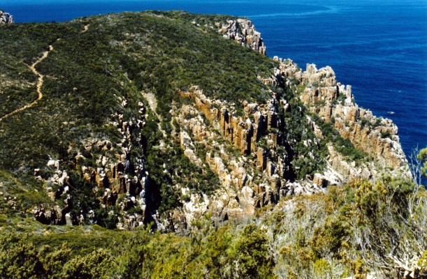
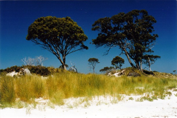
Left Truck parked by the long, sandy beach at Sloping Main and walked along its length to the end – about 3 kms. Then followed some rough vehicle tracks towards Lagoon Bay. They took us to Lobster Point, where there were even better views across Frederick Henry Bay, past Sloping Island.

11-29-1999 Lobster Point & Slopen Island.jpg

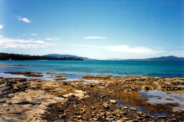
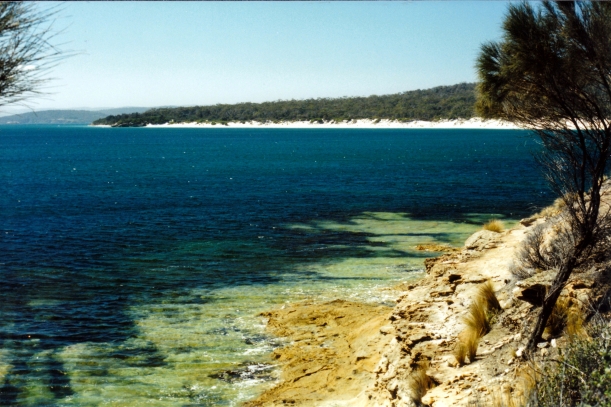
Lobster Point, with Sloping Island behind it

11-29-1999 Lagoon Bch from Lobster Point

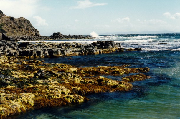
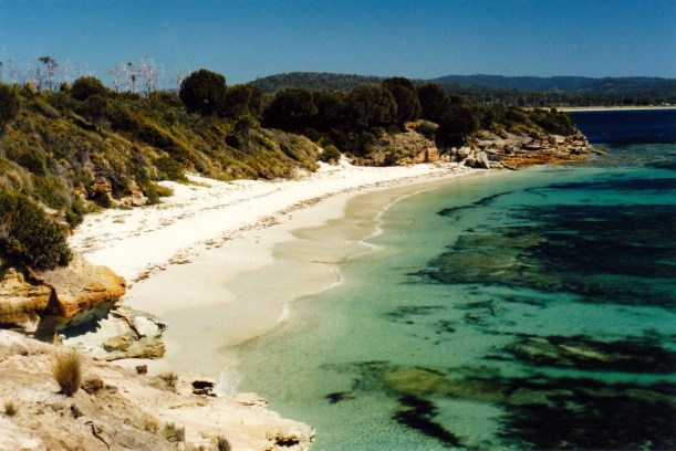
Lagoon Beach from Lobster Point

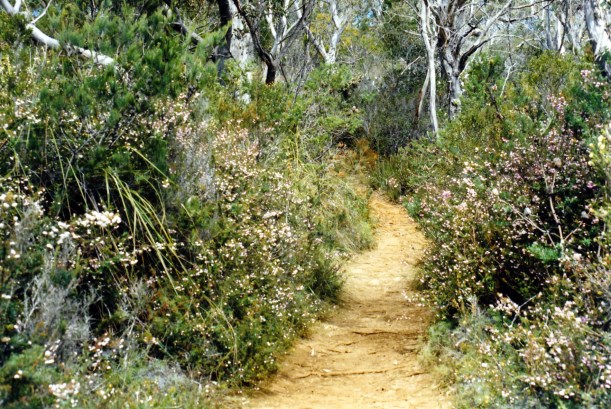
John decided that, since our walks book said there was a track that followed the coast, and he saw some tape that seemed to mark this, that was the way we would walk back. It went through a lot of bracken and cutting grass, and was not really a track. It was a hot day, and I was in shorts, but luckily had my knee high gaiters on, as the way looked really snaky. My legs did get a bit scratched and I didn’t enjoy that section much. The coastal scenery was great, though.

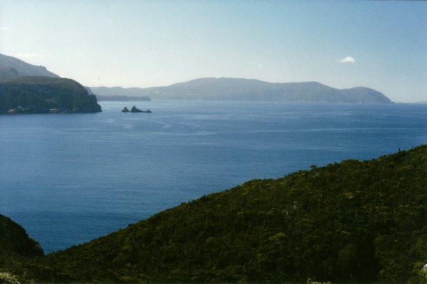
We walked a short stretch of beach in a little cove called Whalebone Cove, before eventually emerging back onto the main beach.

11-29-1999 whalebone Cove and slopen main bch.jpg

Whalebone Cove, with Sloping Main beach in the distant background

11-29-2999 on beach

A critter on the beach

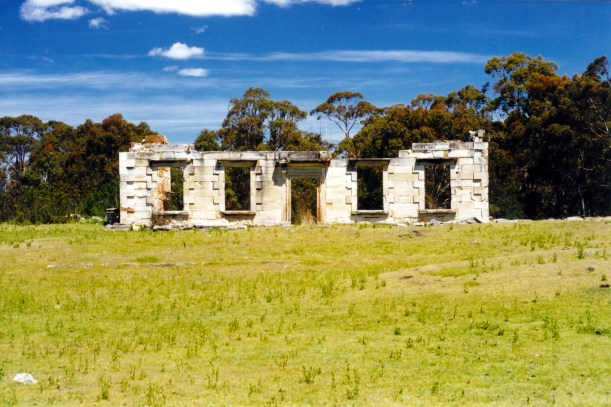
We returned along the beach to Truck. This had been another reasonable length walk, and an enjoyable one, overall. The Tasman Peninsula is so varied. The many visitors who only visit Port Arthur do not realize what they are missing!

11-29-1999 slopen main beach.jpg

The outlook inland, as we walked along the Sloping Main beach

Tea was a herbed lamb stew with pasta spirals. It was very nice.


Leave a comment

1999 Travels November 28

SUNDAY 28 NOVEMBER     WHITE BEACH

We had a leisurely morning reading the papers, and the like. After yesterday’s exertions a quieter time today was called for!

After lunch, John went off to play bowls with C. He came back about 5pm, saying we were to go to the motel, for a drink, which we did. Met C’s wife, who made some snacks to go with the drinks. We were there for about an hour, mostly talking about the local area and a bit about our travels. C used to be a professional fisherman.

Tea was penne pasta with a sauce made from grated zucchini and garlic, cooked with butter and cream.


Leave a comment

1999 Travels November 27

SATURDAY 27 NOVEMBER     WHITE BEACH

We had a rather slow start to the day, which, given our plans for the day, was not the best.

Mid-morning, drove to Fortescue Bay, in the Tasman National Park. This involved crossing the Peninsula, towards Port Arthur, then turning off the Arthur Highway onto the unsealed but good gravel  Fortescue Bay road. We followed that, through tall forest, to its end at the bay.

Fortescue Bay reminded us rather of parts of Wilsons Prom, in Victoria. There was a pleasant little campground there, which was clearly popular, being a weekend. There was a Ranger in place there.

Our goal for the day was to do the walk to Cape Hauy, which the books said was a 4 to 5 hour walk.

11-27-1999 cape hauy

Cape Hauy consists of the columnar dolerite rock that has created some of the most spectacular Tasmanian landscapes. We had encountered this in the past, in the Cradle Mountain National Park, when we walked the Overland Track. Around the Tasman Peninsula it has resulted in really tall sea cliffs – some rising about 300 metres, abruptly, from the sea. Off the end of Cape Hauy are a couple of rock stacks – The Lanterns, and a really narrow vertical sided rock column called the Totem Pole, that is a challenge to intrepid rock climbers.

11-27-1999 02  cape hauy tk.jpg

The fluted dolorite columns of the coast, and our track

It was a rather demanding walk. In places, the track was quite close to steep drops.

11-27-1999 coast view from cape hauy track

Looking south, towards Cape Pillar, from the Cape Hauy track

The track followed the coast, at the start, for a short while. Then we turned away from that and climbed up and down, across to the narrow Cape section. Much of this was heath lands. There was one really steep downhill section – it would be uphill on the return trip and so not something to look forward to. It was really hard on the legs – it is a long time since I have done anything that tough. John managed really well.

Excellent views and scenery made it a worthwhile exercise, and there were lots of wildflowers in bloom, to add to the beauty. We saw three tiger snakes along the way – dubbed it a “three snake walk”. That is going to be our grading system for Tasmanian walks, from now on!

11-27-1999 01 cape hauy tk wildflowers

The early part of the Cape Hauy track – wonderful wildflowers

The last section of the walk, going up and along the Cape, was quite open and exposed, with wonderful outlooks. We ate our packed lunch at a point along here.

11-27-1999 04 view nth from Cape Hauy track

The outlook to the north, from a section of the Cape Hauy track

At the very end of the Cape, we did not tackle the last little section, which was signposted steep and dangerous. It would have taken us down almost to the level of the water, and given some excellent views – but we would have had to climb back up too! The views from the top were quite good enough for us!

11-27-1999 05  cape hauy.jpg

Cape Hauy

11-27-1999 06  sign.jpg

This was as far as we went!

Anyway, we knew we had to do that rotten uphill climb on the way back. The walk took us five hours in all. We did not encounter any other walkers on the track, rather surprisingly.

11-27-1999 07 more sign

Junction of the Cape Hauy and Cape Pillar tracks

We really felt a sense of achievement after the walk. It was about 10kms.

Back at the van, a hot shower on the weary bones was most welcome.

Tea was tinned tuna, and salad. I was too tired to cook much, and neither of us was very hungry.

We noted that the caravan park is busier, as people came into some of the permanent vans for the weekend.


Leave a comment

1999 Travels November 26

FRIDAY 26 NOVEMBER     WHITE BEACH

We did the shopping for the coming week. in Nubeena. We did not need much. The range at the store is rather basic, but adequate.

We collected our mail, which contained some bills, a letter from my brother – nice to receive – and a notice about N’s estate. Seems John will inherit more than he thought – he will certainly have no problems buying a new lathe and a big TV set, with it, when we are home again.

Today was rather cool and windy.

After lunch, we decided to investigate Roaring Beach – the next one to the west of here. The Roaring Beach Road starts at Nubeena, soon becomes unsealed,  and sort of follows the coast around, for a little way, then takes a winding, up and down, course through farm land and forest, for nearly 30kms. It was an interesting drive on the narrow road. There are some very isolated homes and farms out along that road.

We parked at the end of the road, where there were sand dunes and a path to the beach. At the back of the beach was a creek lagoon, caused by the creek mouth being blocked by a sandbar. We had to walk across the creek on a narrow plank.

11-26-1999 track to Roaring Bay.jpg

On the walk to Roaring Beach

We found Roaring Beach a nice little one, somewhat marred by a dead seal on the rocks at one end.

11-26-1999 roaring bay

Rocks at the end of Roaring Beach

Returned to the van, then went out to get fish and chips for tea, in Nubeena. I found them rather greasy, but John really enjoyed his, including a “proper” potato cake – not easy to find in Tassie!


Leave a comment

1999 Travels November 25

THURSDAY 25 NOVEMBER     WHITE BEACH

We had a quiet day, today.

John tried – unsuccessfully – some fishing from the nearby beach.

We drove to Taranna – on the main road to Port Arthur – to buy strawberries from a roadside stall we’d seen, coming through on Tuesday. John’s idea. Bought a big punnet of seconds, for $2 – ho0wever, they later proved not to be as nice as we’d hoped. Probably not worth the nearly 60kms drive!

Returned from there via the Nubeena Back Road, which is unsealed and goes up over the hill tops and steep slopes, giving some good views. This whole Peninsula is jam packed with great scenery. I just love that just about everywhere we go, there are  water views.

Later in the day, John went to suss out the bowls club in Nubeena. He arranged to bowl on Sunday with C, the owner of the local motel.

Tea was pork and vegie stir fry, and rice, followed by strawberries.

12-06-1999 White Beach sunset 2.jpg

White Beach sunset


Leave a comment

1999 Travels November 24

WEDNESDAY 24 NOVEMBER     WHITE BEACH

The day was quite warm and sunny, so it was perfect for exploring.

We retraced yesterday’s route to Premaydena, then turned west on the Saltwater River road, headed for the Coal Mines historic site, with its ruins of the convict establishment there.

11-24-1999 the ruins Saltwater R.jpg

Ruins of convict settlement at Saltwater River Coal Mines site

Once, this was, as the name suggests, a coal mining operation, initially worked by convicts. It began in 1833, three years after Port Arthur was established as a place of secondary punishment for the worst of the convicts and those who offended again in the colony. Saltwater River received some of the worst from Port Arthur!

In 1833, all needed coal was shipped from NSW – a costly exercise. The Coal Mine here was the first mine set up in Tasmania. Mining here actually continued beyond the convict era, until about 1877.

The settlement here had convict accommodation, plus that for the necessary overseers, military and administration. There was obviously mine infrastructure as well, such as jetties for shipping the coal.

11-24-1999 Coal Mines ruins at Saltwater R.jpg

Was this a superintendent’s residence?

Parts of several buildings still exist. I first visited here in the summer of ’69/70, rather by accident, as Port Arthur was the focus of tourist activity in the area, then. I was surprised to find such a substantial set of ruins open to all comers, with no supervision or direction. Since then, there has been an attempt to prevent further deterioration of the ruins, which I am pleased to see.

It is a very photogenic area, with the superb bay in the background. Like other places in Tasmania, there is the juxtaposition between the idyllic natural environment and the unspeakable degradation of much that occurred here in the convict era.

11-24-1999 saltwater river ruins

We wandered around, exploring. It is possible to venture into the ruins. We went into the solitary confinement cell block and inspected the very small cells there – which were underground, then.

11-24-1999 cell block saltwater ruins.jpg

This was an underground cell block

11-24-1999 cell

Inside a solitary confinement cell

Ate our picnic lunch, sitting on the grass, looking over the bay.

Walked to Plunkett Point, where the main jetty used to be. John gathered some mussels from the rocks there, for fishing bait. Then we followed tracks up the hill to where the mine shafts were – it was underground mining. Up here there was an old boiler – steam power was eventually introduced here.

11-24-1999 boiler by coal mine shaft.jpg

Steam boiler at the mines site

Followed another track back down to the ruins.

We then drove up to the ventilation shaft, a little distance away, and walked up to the top of Mt Stewart, the highest point. We encountered a large tiger snake beside the track, but it slid slowly away. The effort was worth it for the views.

11-24-1999 from Mt Stewart towards Lagoon Bay

From Mt Stewart, looking to Sloping Main and Lagoon Beach

By now, it was getting late in the afternoon, so we headed back.

On the way, we noticed some interesting looking houses for sale, right by the sea, at the little nearby Saltwater River settlement. Found them later, in a real estate guide we picked up. Some were $180,000-$200,000, which seemed rather tempting. However, there is no reticulated water supply on the Tasman Peninsula – it is all tank water – which is rather off-putting. But it would be a glorious area to live.

Tea was the salmon I bought yesterday, pan fried, with salad. It was beautiful and worth the cost.


Leave a comment

1999 Travels November 23

TUESDAY 23 NOVEMBER   HOBART TO WHITE BEACH   132kms

We got away about 10am. Had to stop at Glenorchy for diesel – 77cpl – then for wine and a paper. All this was not the easiest exercise with the van on the back, and it would have been better had John taken Truck out alone and done all this before hitching up.

We crossed the Bowen Bridge, then took the highway down the eastern side of the Derwent, to the Tasman Highway. This took us east, through Cambridge, then across the scenic Pitt Water inlet to Sorell. The inlet must be quite shallow because most of the two crossings – Midway Point is a spit of land between them – were on causeways, with only one small section a bridge. From there the way was still east and south, through predominantly farm country, to Dunalley.

We made a slight detour at Dunalley, to visit the Fish Market – with locally caught produce. I bought some Tasmanian salmon.

Here we crossed the Denison Canal – a canal made to allow smaller boats east-west access, without them having to go all the way around the coast of the Tasman Peninsula. The quite narrow canal has a swing bridge so boats can go through.

We followed the Arthur Highway, towards Port Arthur, as far as Taranna, where we turned east and took the Nubeena Road. Just through this little town, we turned right, for White Beach Caravan Park.

The roads had, for much of our way today, been narrow, winding in parts, and not great for vans. There were some steep hills too, like the one coming down to Eaglehawk Neck. But it was a lovely and varied, scenic drive, much of it by water.

We liked the look of the caravan park very much and booked in for a week, to start. It was $15 a night, with the seventh night free. We chose an almost-sea-front site, in a grove of native trees and shrubs which should provide some shelter, as it is obviously often windy here – and was today! It was a nice grassy site, too.

11-26-1999 camp white beach.jpg

Our White Beach site

We set up for an extended stay. It was our intention to spend some time here, as we felt there was a lot to explore. The walking book I had indicated there was some excellent walking in the area, too.

At the Park office, I tried to arrange to get the Age newspaper delivered there every day – not easy, it seems. Didn’t see why it was that hard, since they obviously get the Tasmanian papers, and so far we had found the Melbourne ones as readily available.

Later in the afternoon, went for a walk on the beach here – up to a small jetty at the end nearest us, where there was also a boat launching area. Then we turned around and walked right along the beach to its other end. It was quite a decent walk and very pleasant. There were a lot of Pacific Gulls and plovers on the beach. The outlook out to sea is across to Bruny Island in the distance and beyond that the peaks of southern Tasmania. There are headlands and little islands closer to us. It is a beautiful outlook.

11-23-1999 Bay at White Beach.jpg

The bay at White Beach

Tea was a shepherds pie.

Discovered that the TV reception is not great, even though it is co-axial cable linked to the van – that was supplied by the park, when we booked in. However, John seems rather philosophical about this.

Also discovered that the showers required a 40cents donation in a slot, to deliver hot water for about six minutes. Given the lack of a reticulated water supply, guess this was fair enough, to control usage. We would have to start accumulating 20cent pieces though!

11-23-1999 hobart to white beach.JPG


Leave a comment

1999 Travels November 22

MONDAY 22 NOVEMBER     HOBART

I went to the cricket with John. It cost $30 for me. I was concerned that this would be rather a waste if the match ended as quickly as looked likely. My fears were unfounded.

As John had been, I was surprised at how near the action was, how close to us the players came, and how much could actually be seen. Bellerive really is more like a country oval than a big city one, in that respect.

It was all much better and more interesting than I had anticipated. That said, one day was enough for me.

Adam Gilchrist and Justin Langer put on a record breaking batting partnership to get Australia out of an almost impossible situation. It was quite thrilling.

The match went on until mid-afternoon, with Australia winning, which was a real turn-around. So it turned out to be an excellent day for me to go to the cricket. I doubt I would see any better in my lifetime.

The only unenjoyable part of the day was the behaviour of some of the crowd who were drunk and revolting.

We went back to the van quite exhilarated.

Took down the awning and did some preliminary packing, for departure tomorrow.

Tea was broad bean and garlic sauce with pasta. It was very nice.


Leave a comment

1999 Travels November 21

SUNDAY 21 NOVEMBER     HOBART

As usual, I dropped John off at Bellerive.

I then drove to Richmond, via Cambridge. I stopped along the way to take photos of the opium poppy fields. These were not very fortified – just normal fences and warning signs, which rather surprised me. The poppy flowers are white – another surprise, as I expected them to be coloured. They actually look quite drab. Opium poppies, from which painkillers like morphine and codeine are made, have been a farm industry in Tasmania since the 1960’s – a very useful cash crop for the farmers licensed to grow them.

11-22-1999 opium poppy.jpg

Opium poppy fields

I parked Truck in central Richmond, then walked around the historic town for several hours.

Richmond dates from the early 1800’s. The bridge over the Coal River was built by convicts in the 1820’s. The Catholic Church that features in most photos taken of the bridge, dates from 1836. The town is very atmospheric. There are so many original old cottages, commercial and office buildings from the colonial period.

11-21-1999 richmond

Richmond Bridge and St John’s Church

I spent some time at the Catholic Church – St Johns, and at the Anglican graveyard, with its really old graves.

11-22-1999 richmond anglican cemetery and church.jpg

The Anglican graveyard at Richmond

Bought a filled roll for lunch.

Browsed in a bookshop and bought a book on Clarendon House, south of Launceston – where some of my  pioneering ancestors were farm workers in their early days in the colony.

It would have been better to have avoided the weekend to visit here! There were lots of people around. Poor planning on my part! If John comes here for a visit, with me, we must try to ensure a week day.

11-22-1999 richmond bridge

Richmond Bridge and the Coal River

I drove back to Berriedale via the Grasstree Hill Road, to Risdon, and across on the Bowen Bridge. It was a very narrow, steep and twisty road, to Risdon.

Had a couple of hours back at the van, reading, then it was time to go collect John from the cricket.

I found a place to park, not too far from the main entrance to the ground, then walked to the entrance to wait for John to emerge. The match went overtime, so it was 6.30 before people began coming out of the ground.

I could not believe how many spectators were drunk! There is obviously no monitoring or policing  of this at such events. There were even a couple of men staggering out the gates, vomiting down their fronts as they went! Hideous.

The early evening drive back to the van was easy enough.

Tea was cold roast chook and salad.

John was insistent that I go to the cricket with him tomorrow, for the last day. Even though Australia was in a poor position and looked like losing  quickly on the day. I was rather reluctant, especially given the crowd behaviour I saw yesterday, but he was determined.


Leave a comment

1999 Travels November 20

SATURDAY 20 NOVEMBER     HOBART

Another day of cricket. We followed the same routine in the morning. There was more traffic around Bellerive – obviously there was a better turnout to the cricket on the weekend.

After leaving John, I drove to the Hobart Botanic Gardens. Or the Royal Tasmanian Botanical Gardens, to give them the proper title. These are located beautifully and centrally, at the city end of the Tasman Bridge, separated from the Derwent River only by the Domain highway. I’d already found out from some of my tourist literature, that I could park right over the road from the gardens  in Lower Domain Road.

I spent a couple of hours there, walking around. Found the Conservatory excellent, likewise the fuchsia area. The Japanese Garden was interesting, though not in the same class as Toowoomba’s.

11-20-1999 Botanic Gardens Conservatory 2.jpg

Conservatory at the Botanic Gardens

Mount Wellington dominates Hobart, because it is visible from most parts. There were good views of it from the Gardens. I finished another film at the Gardens.

11-18-1999 mt wellington from bot gardens.jpg

Mt Wellington from the Botanic Gardens

On the way back to camp, dropped the finished film in at Glenorchy, and bought the paper.

Spent my usual sort of afternoon – reading the paper, preparing food. Made a vegie and barley soup and put on a chicken to roast, with vegetables, in the electric frypan. Turned all this off when I had to go and pick up John from the bus depot, after he phoned.

He was not happy with the bus travel, this time – there had been lots of drunken yobbos on the bus and he had not felt at ease. Don’t blame him! We agreed that I would collect him direct from Bellerive tomorrow afternoon. Tea will be cold, so it is easy from that viewpoint.

He is still determined to go to all five days of the match!