FRIDAY 1 JUNE ALICE SPRINGS TO DEVILS MARBLES 405kms
So now it is officially winter. That seems such an artificial designation in parts north.
It felt so good to be leaving town, and heading bush again. John didn’t get anywhere near the amount of bowls he’d intended – certainly not enough to justify the time spent here.
Today, it was straight north on the Stuart Highway.
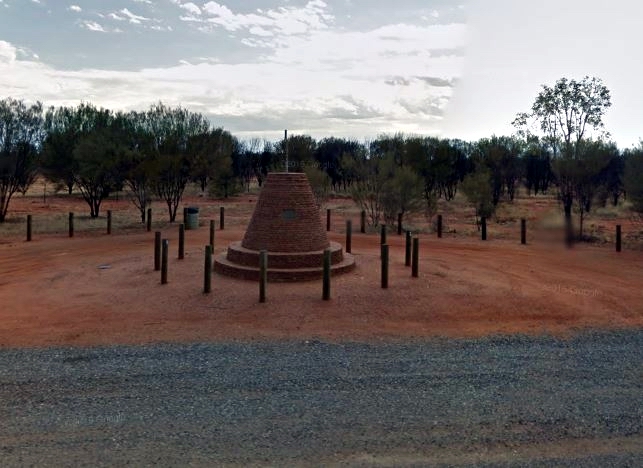
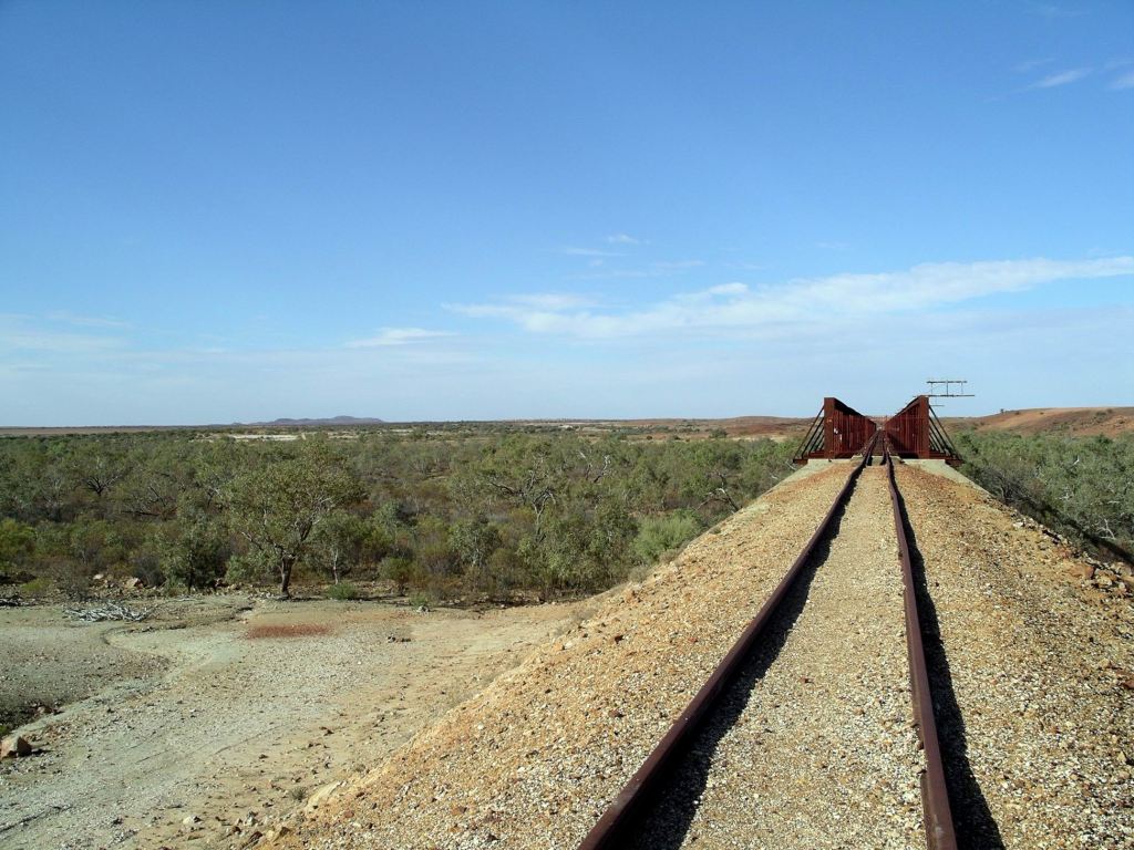
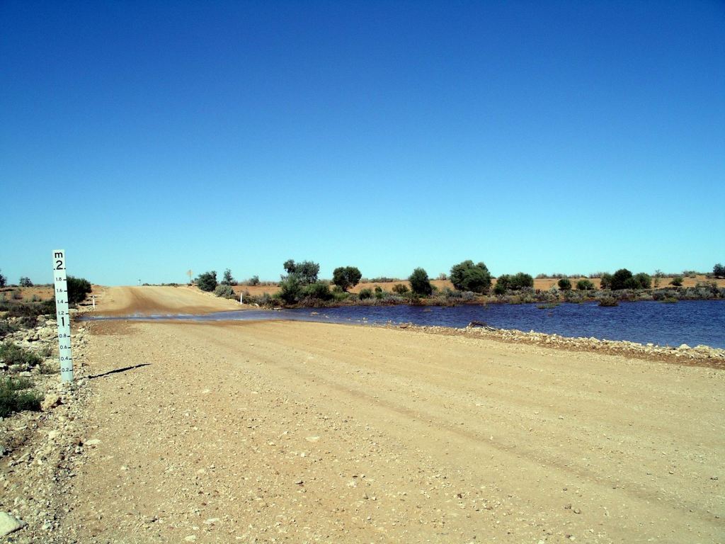
An initial slight climb for some 20kms, brought us to the highest point on the Stuart Highway – about 792m above sea level. Downhill all the way north now ………. with a few slight local variations!
Marker at the highest point on the Stuart Highway
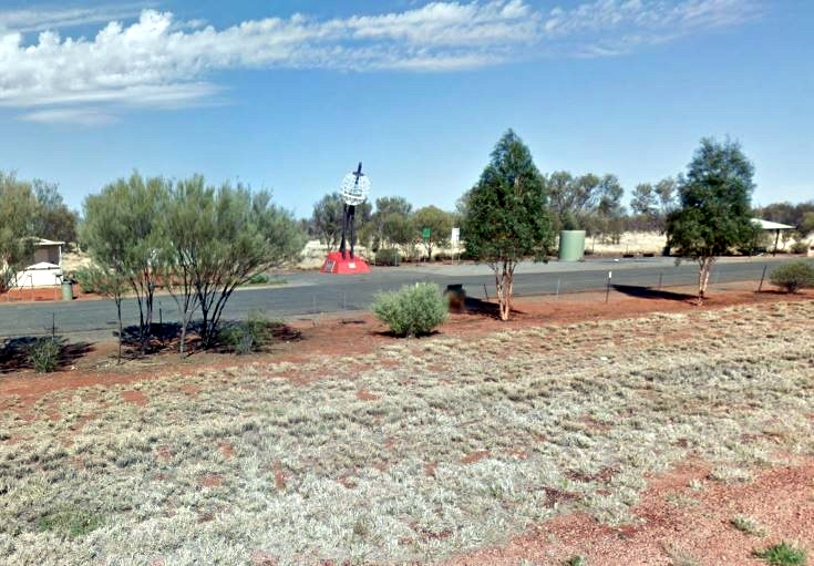
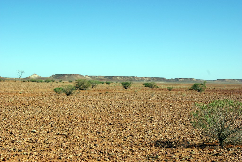
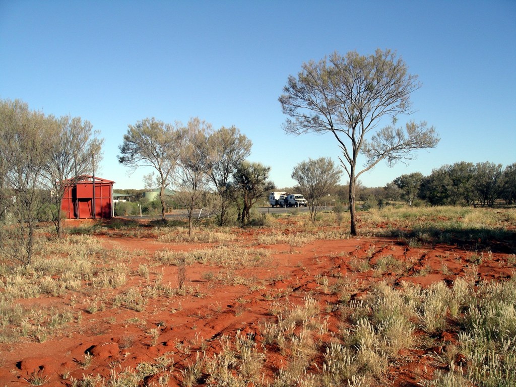
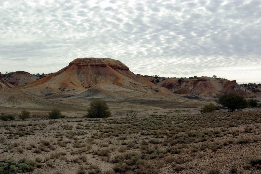
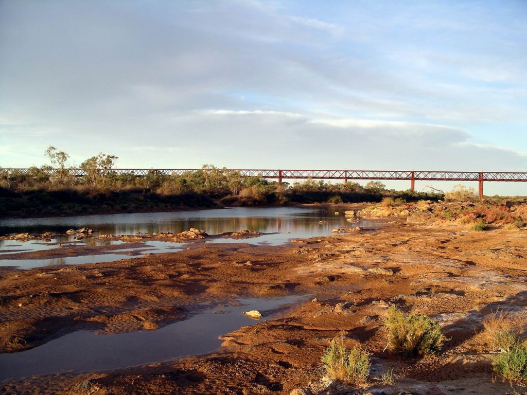
Crossed the Tropic of Capricorn a bit further north of Alice Springs. This landmark is easy to overlook here, because it is part of a rest area.
Tropic of Capricorn Rest Area
Back in the tropics again! That really makes me happy.
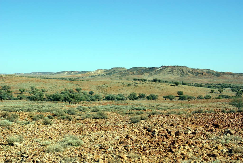
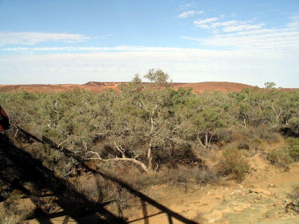
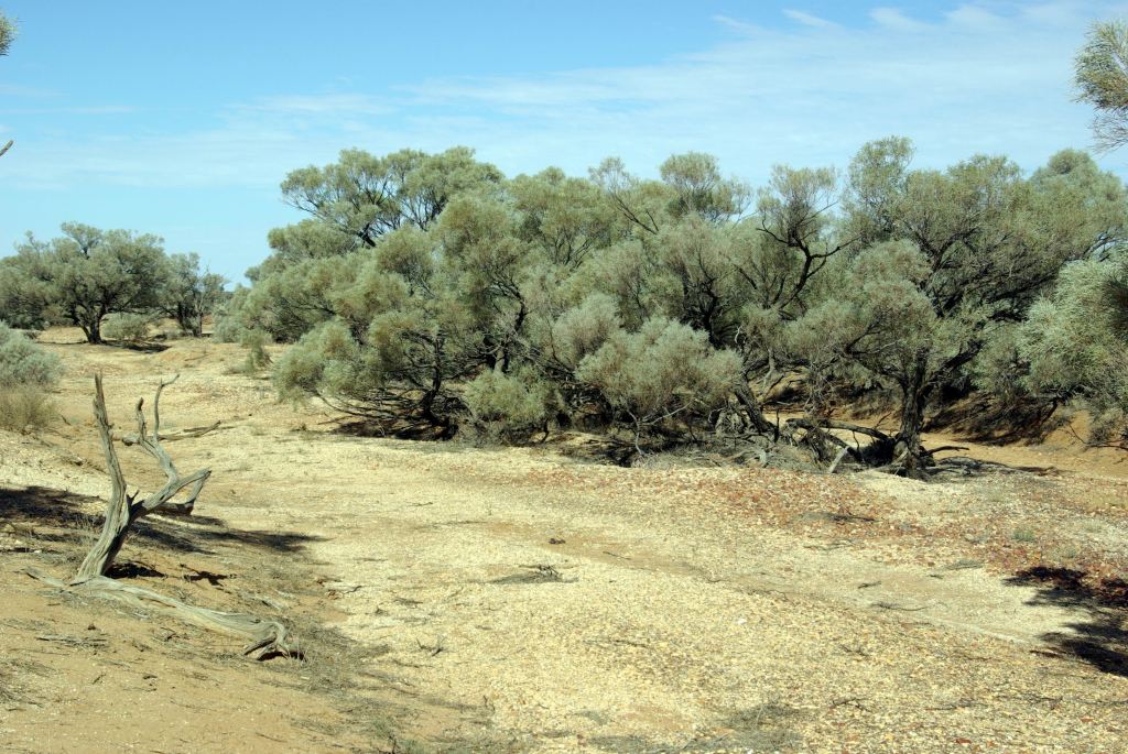
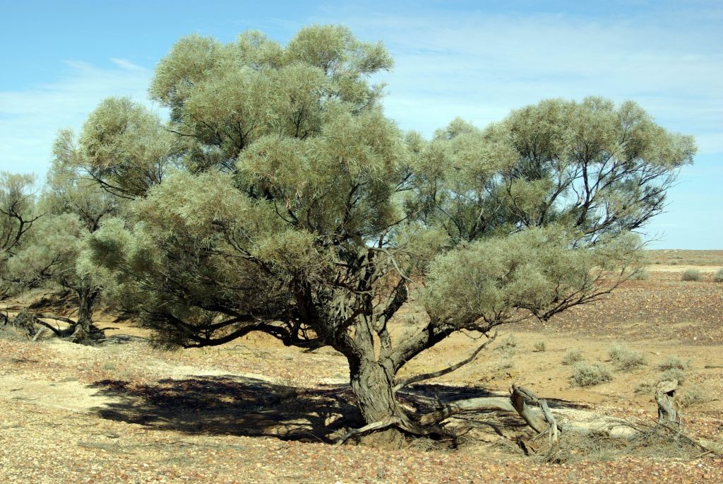
The 400kms drive north was varied enough to maintain interest. Often, there were low ranges or lines of hills in the distance. There tended not to be too many dead straight sections, either. So the route was not a boring one, despite having driven it before.
We found that Wauchope had the best fuel price, by a long way, in that stretch north of Alice. $1.65cpl. Had previously fuelled up at Barrow Creek – $1.74cpl. We needed to keep the tank topped up as much as possible because of tomorrow’s planned deviation.
I was conscious of this Barrow Creek roadhouse having attained notoriety by being the place that British backpacker Joanne Lees was taken to when rescued after the possible murder of her boyfriend in 2001. That all remained somewhat of a mystery, despite a man having been convicted and jailed.
A little further north we would pass the spot where this event occurred, but of course there was no marker to show where it was.
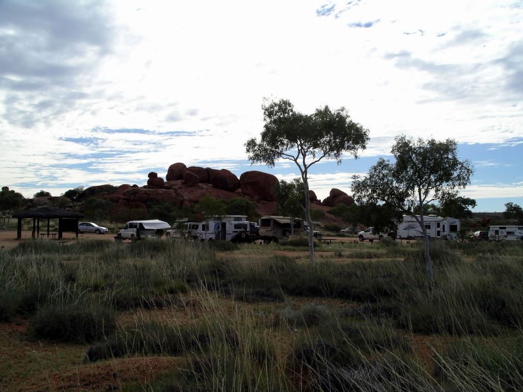
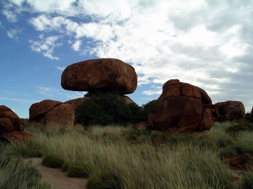
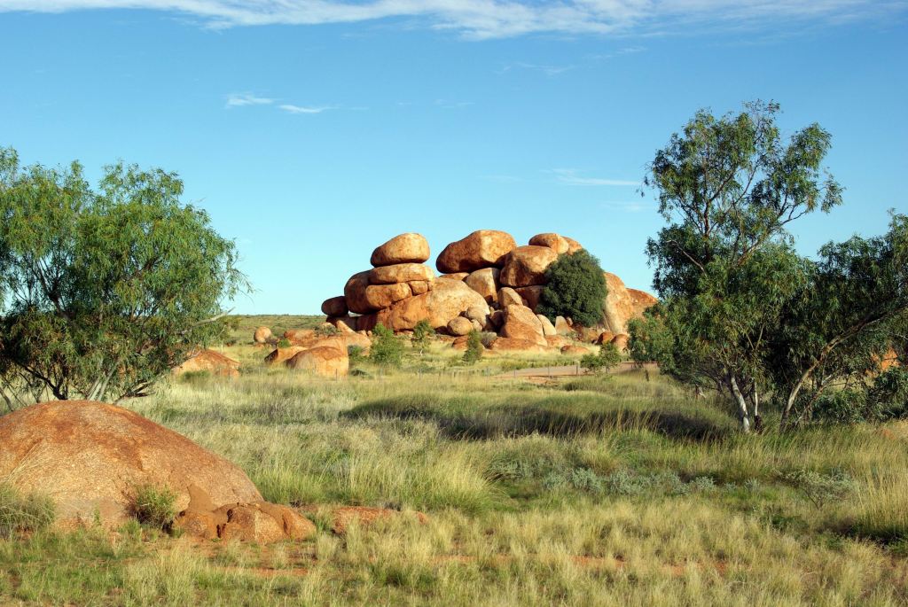
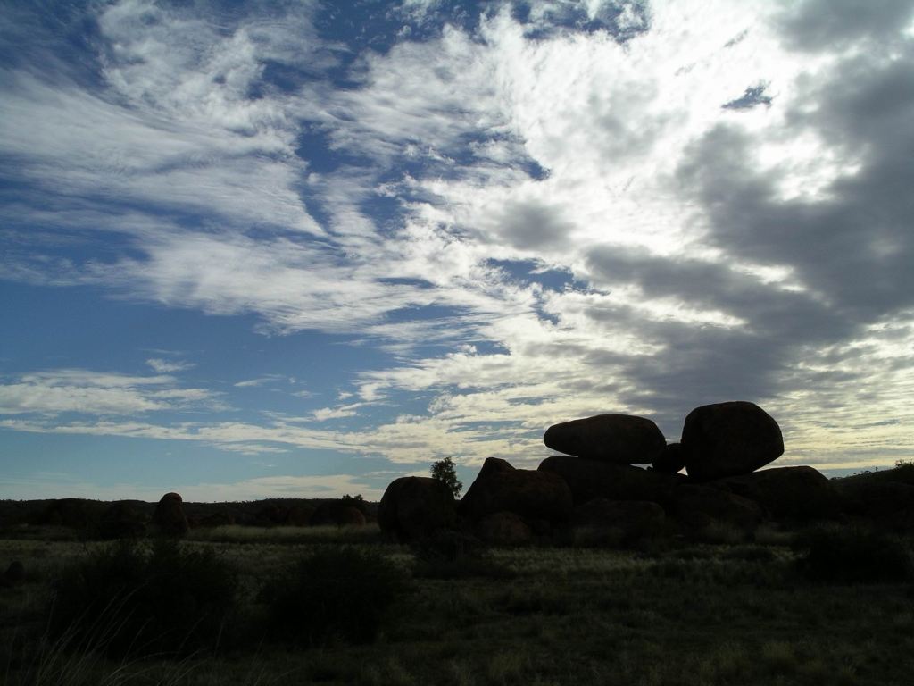
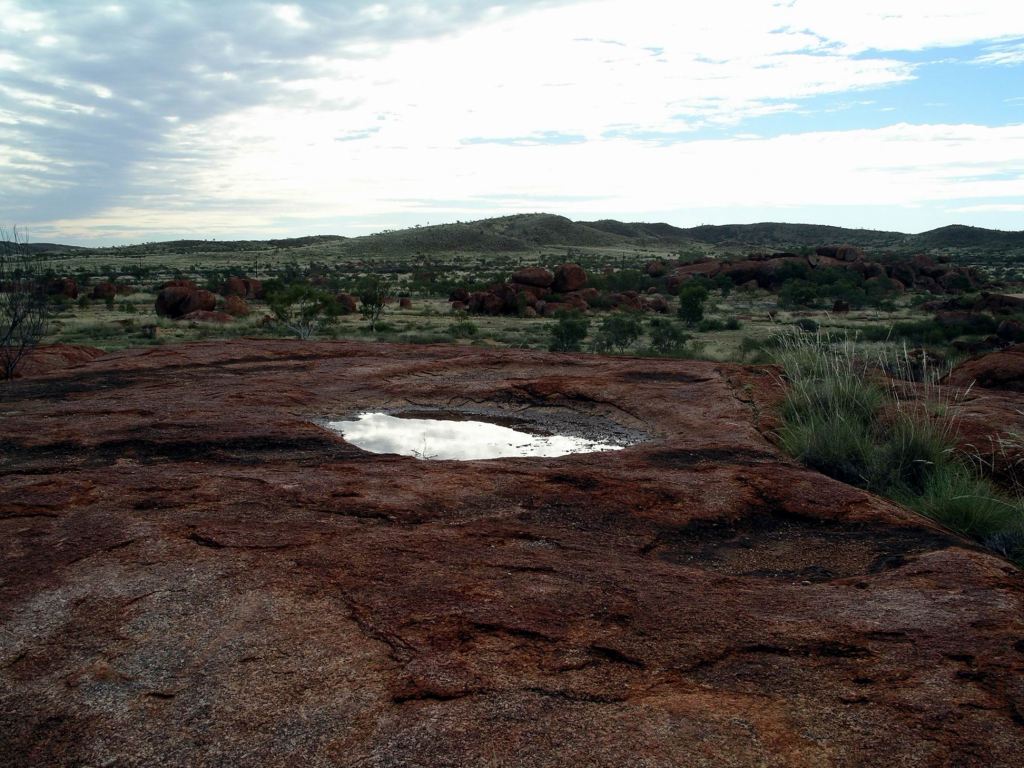
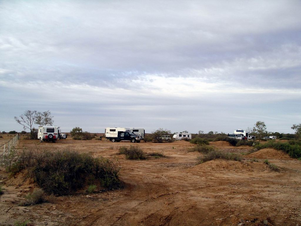
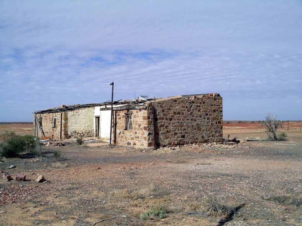
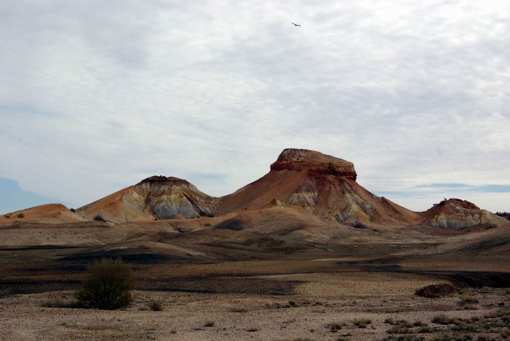
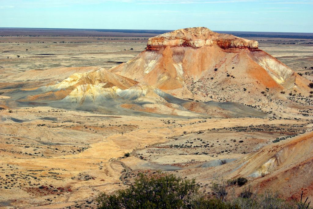
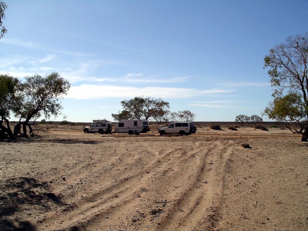
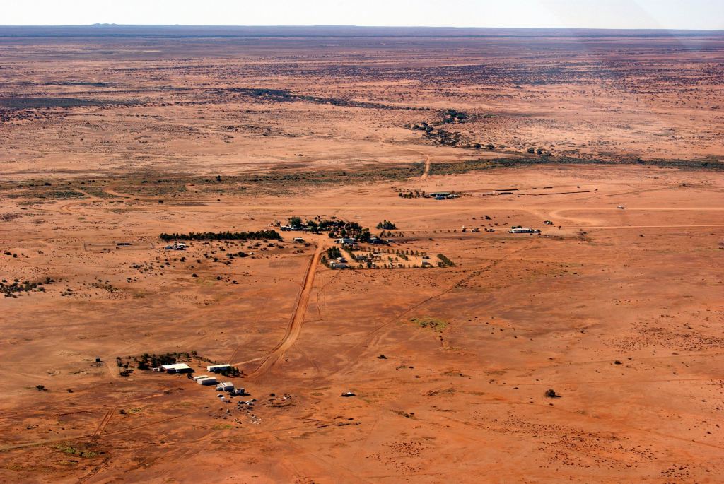
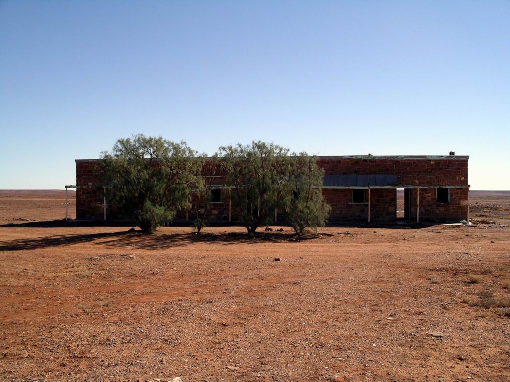
Arrived at the camping area at the Devils Marbles just after 3pm. It was already quite crowded, but we were able to slot in together to a camp spot, albeit much closer to the very smelly long drop toilet, than we would have liked!
Devils Marbles camp area – best to get here early in the day!
The fees for tonight’s stay were $6.60.
Campers were confined by barriers to the designated area -which was sensible in an area like this. Otherwise, like ants, they would have over run the whole place.
By about 4pm, the later arrivals were cruising the camp area, destined not only to miss out on any halfway decent spot for the night, but any spot at all! This was not a place at which to arrive later in the day.
There were some low tables as well as the rather unpleasant toilets.
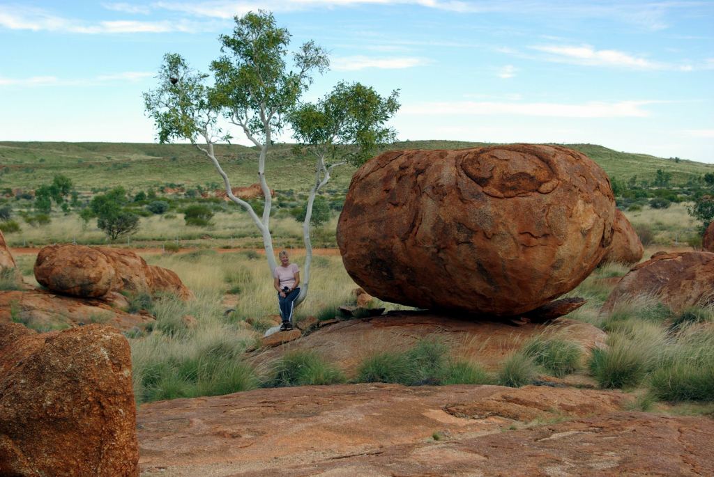
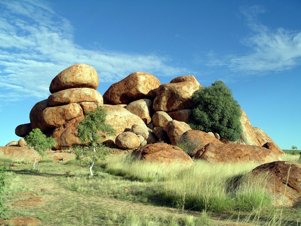
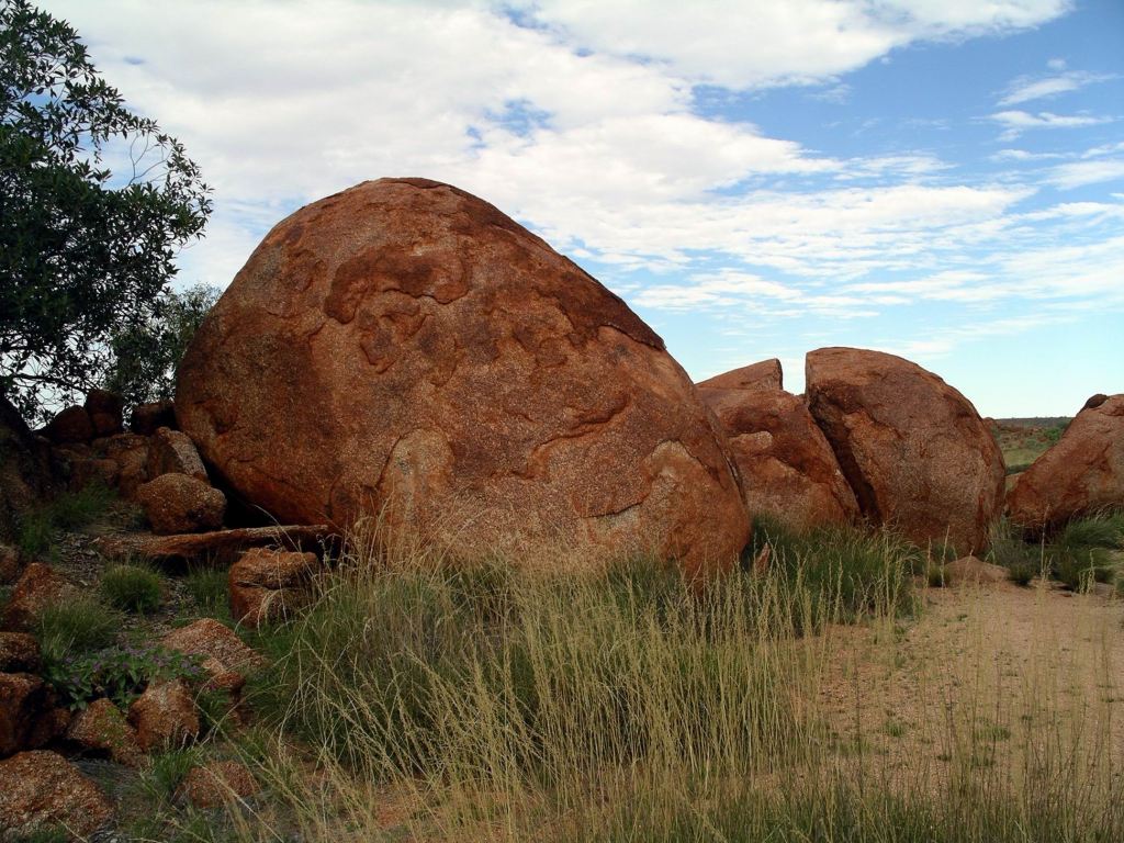
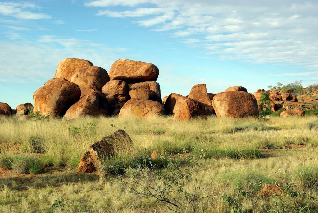
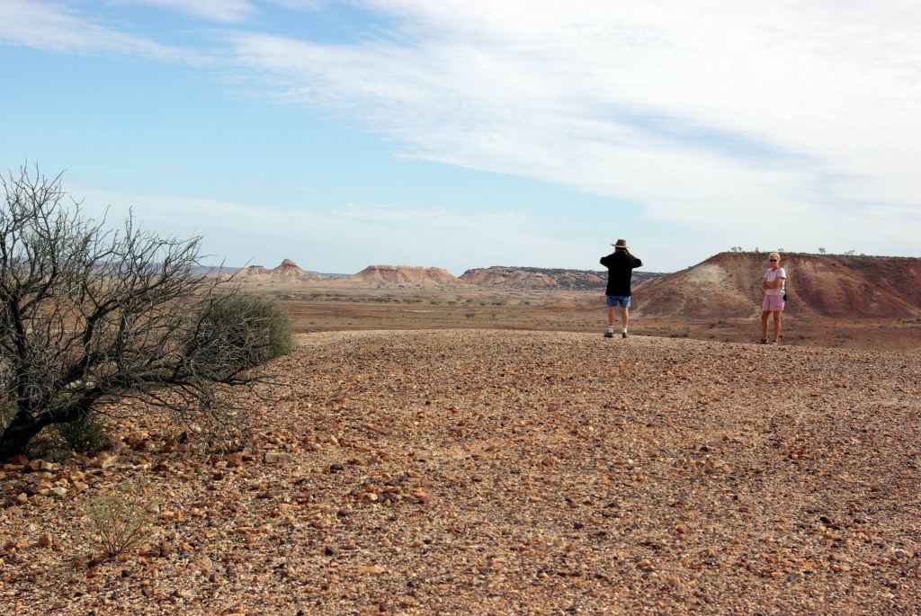
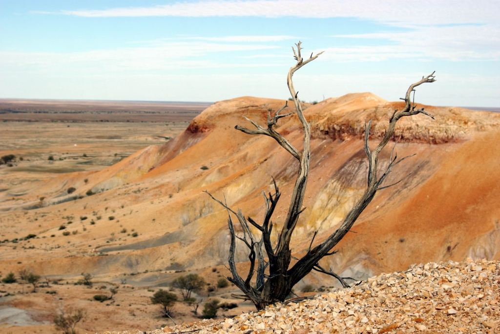
After the usual basic set up for an overnight stay, we went walking, spending a couple of hours wandering around and between the Marbles rock formations.
Gravelled paths wound through the spinifex.
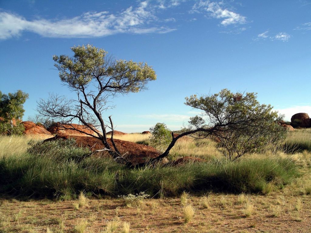
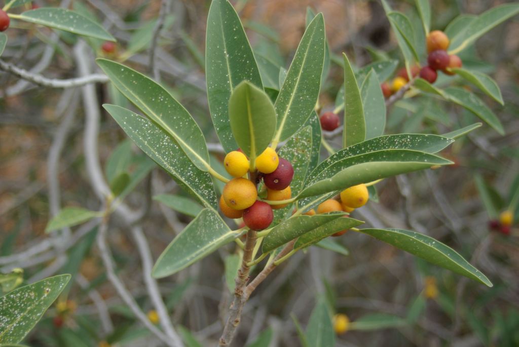
There were some small gum trees and shrubbery growing, in places. Some of the shrubs had fruit on them which, us being woefully deficient in identifying much of the native flora, we could only guess was a native plum?
Was this a native plum?
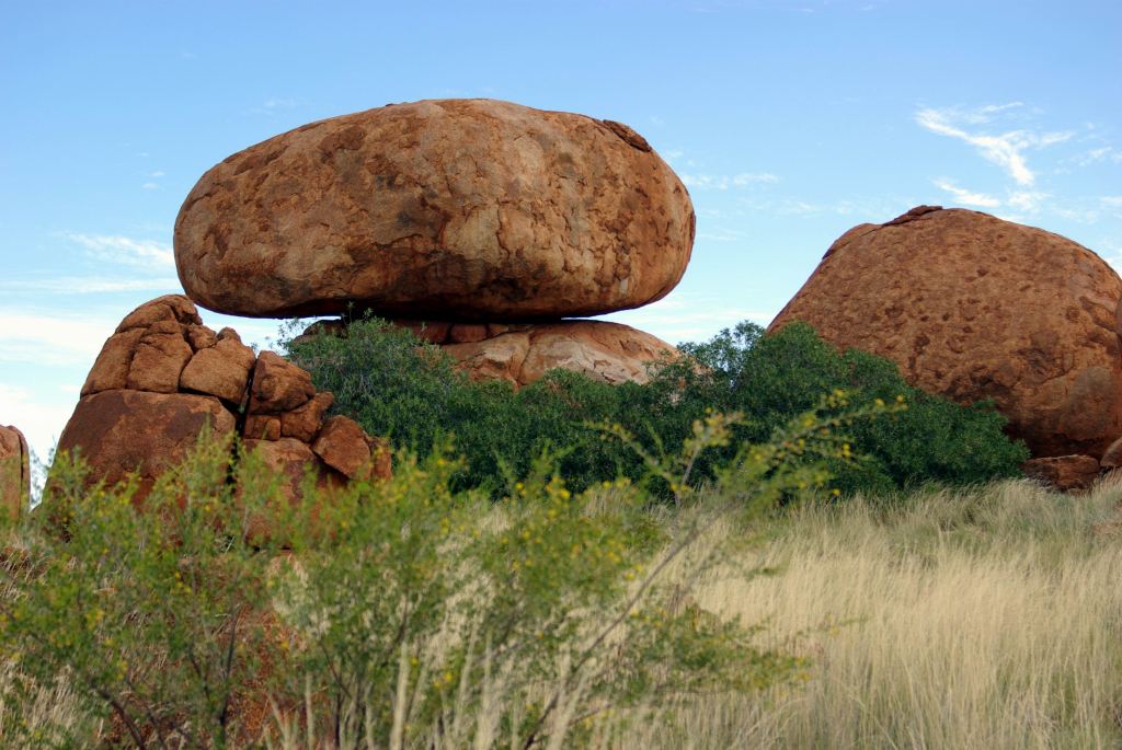
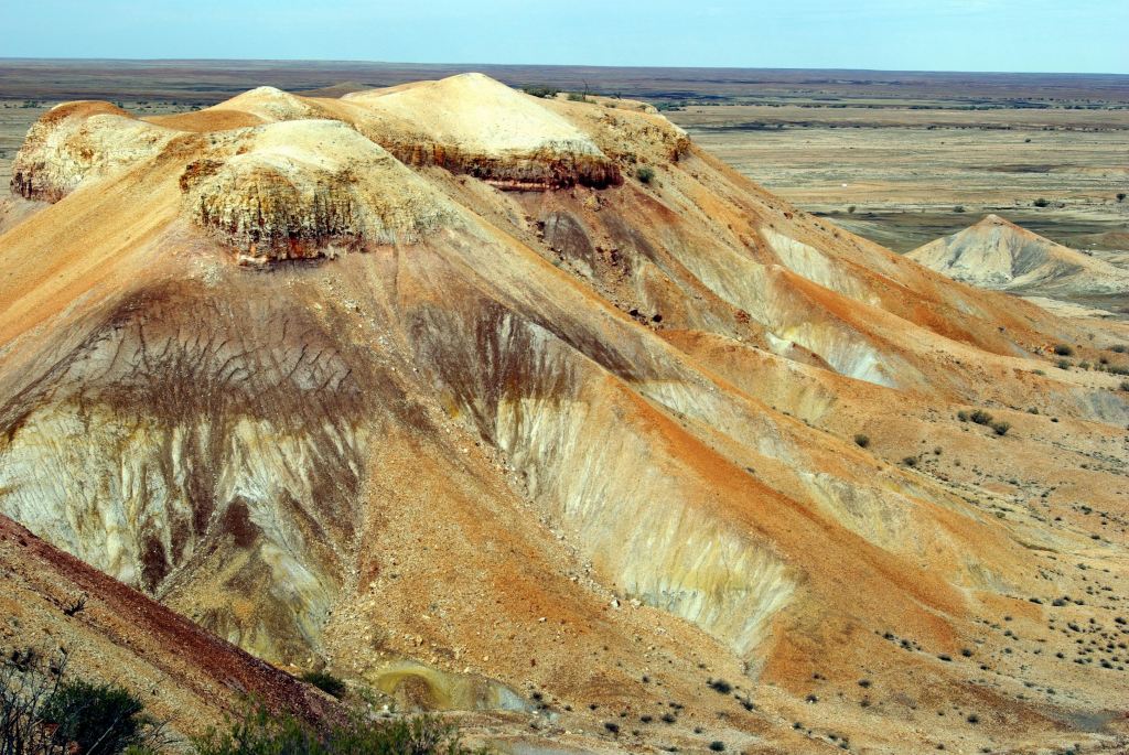
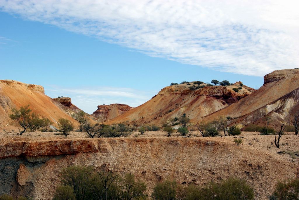
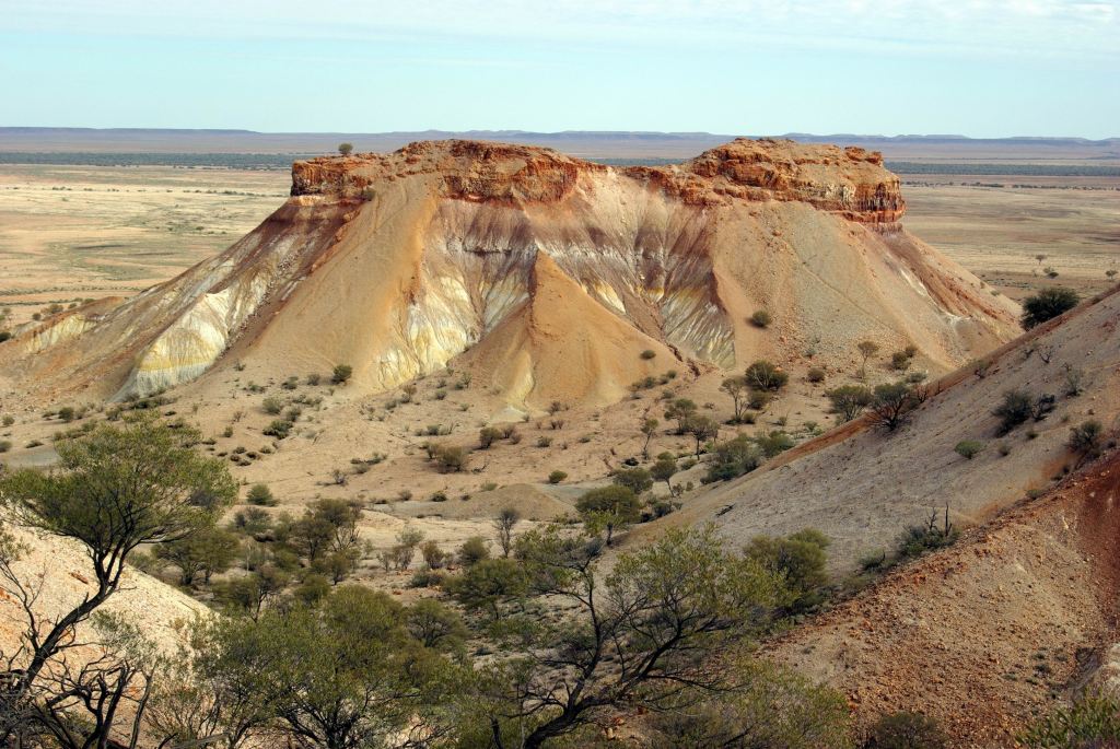
The Devils Marbles were originally formed as molten granite intrusions up through weaknesses like cracks, into overlying sandstone, where the granite cooled. Over time, the sandstone has eroded away, leaving the blobs of granite as the feature we see today.
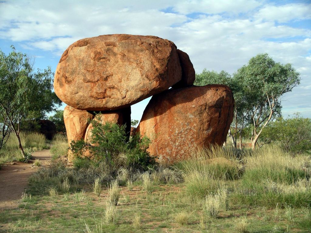
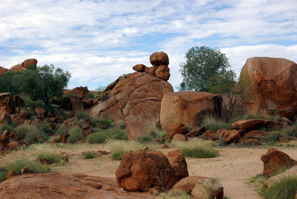
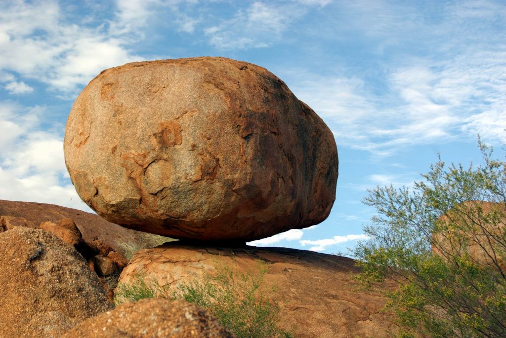
The granite formations were fascinating- many varied shapes and configurations, and balancing rocks – all of them begging to be photographed!
There were some interesting contrasts, too, with the red rocks and the vegetation growing around them.
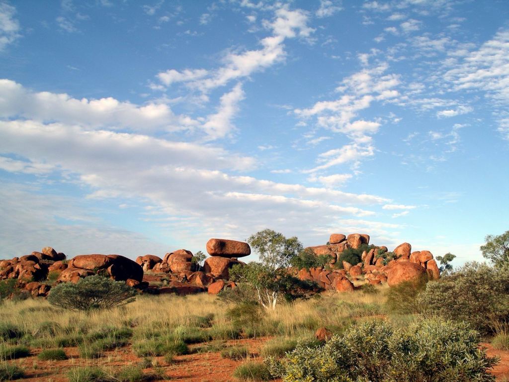
The rock formations were spread out over a fair sized area – it took a while to follow the paths that wind all through the spread.
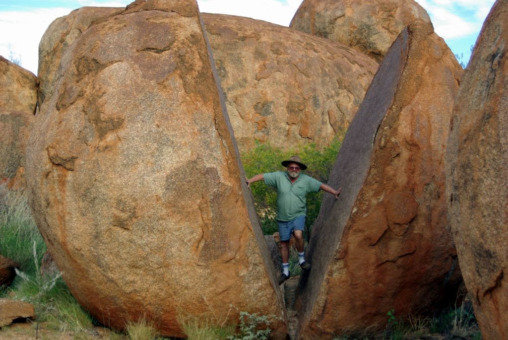
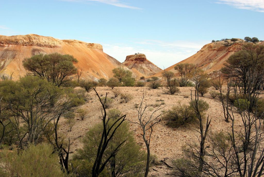
There was a smaller section of Marbles across the other side of the access road. It did not seem that quite so many of the visitors bothered to walk that far, but we did, and were rewarded by the sight of some interesting split rocks.
Probably one of those photos everyone takes!
There were a couple of small rock pools on sections of the flatter, sheet like rock that occurred in parts.
The aboriginal story explaining this feature is that an ancient Dreamtime ancestor walked through here, making a hair-string belt as he went. He dropped clumps of the material along the way and these became the rock shapes. To be truthful, what came to my irreverent mind was an ancient enormous wombat-like mythical creature, wandering about, leaving his droppings to become stones!
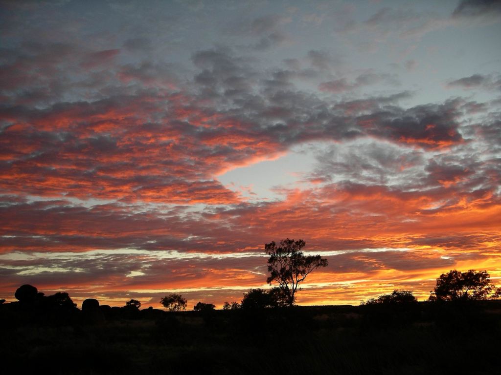
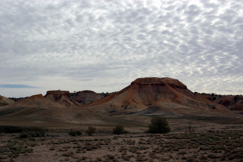
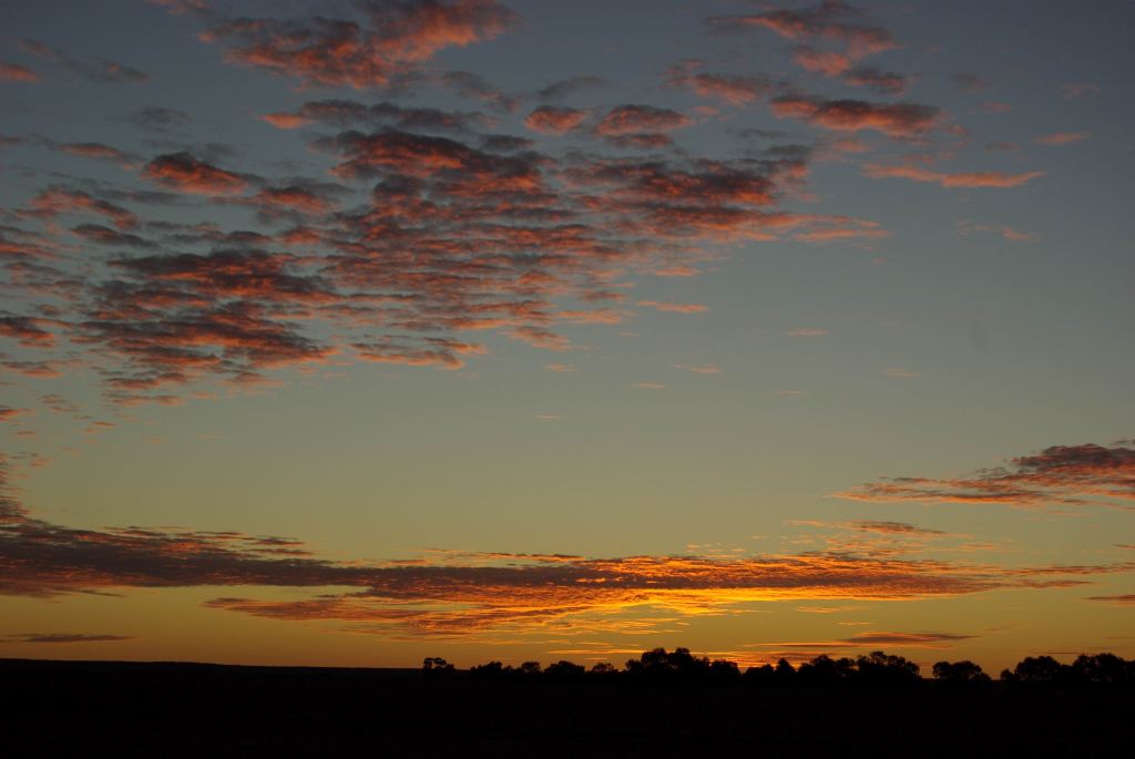
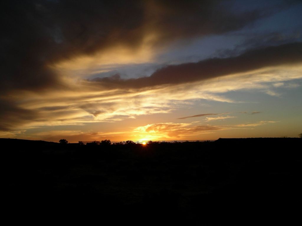
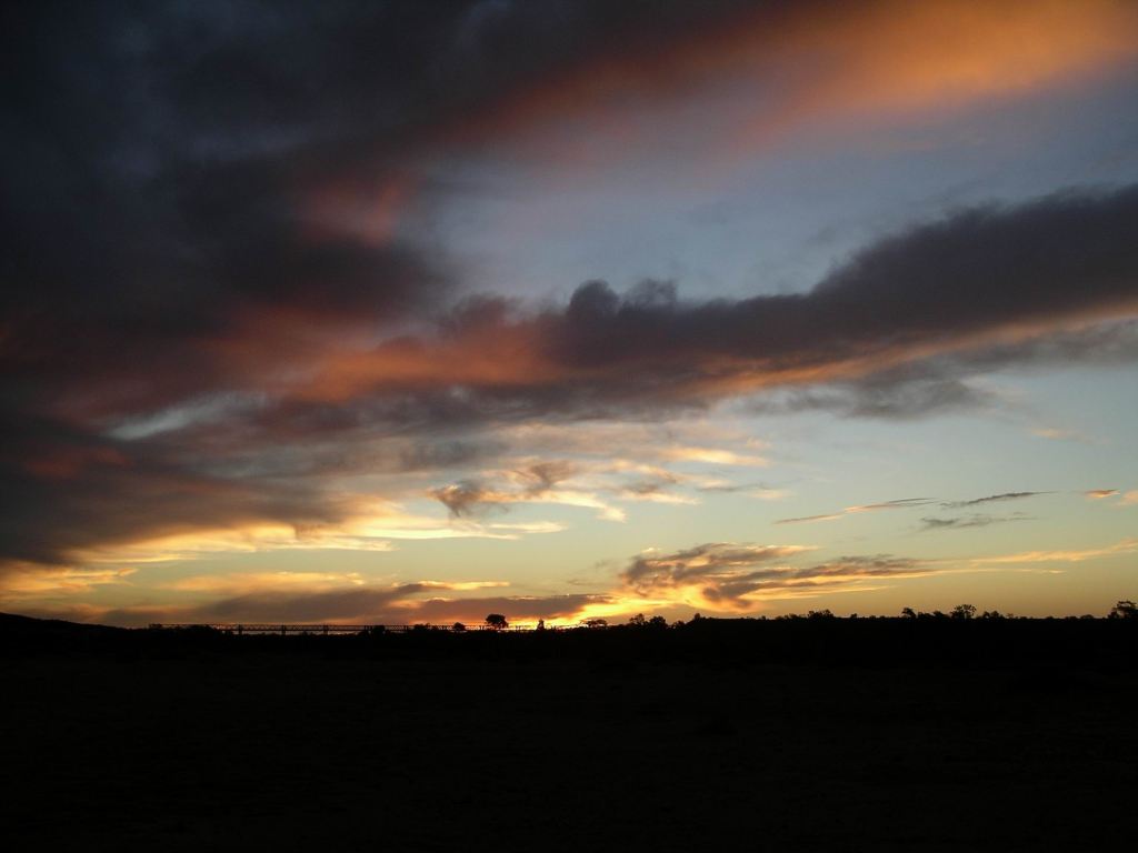
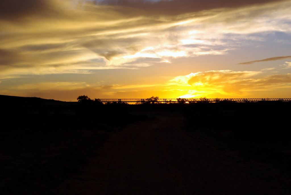
The sunset was brilliant.
Received a text message from son – from Darwin! Obviously, he was on business with the Darwin branch of the motorhome company he worked for.
Back to the shops…..the Skins were in! Bloody expensive for what was, basically, a set of stretchy long johns!
Decided to – finally – do something “touristy”. It was not easy to find something we had not previously done. Not to be misunderstood – places like Simpsons Gap and Standley Chasm are excellent, and should be visited by travellers to the Centre. But once seen, they become the places where the crowds are, and we wanted different.
John donned his new Skins, to see if they lessened the pain in his hip.
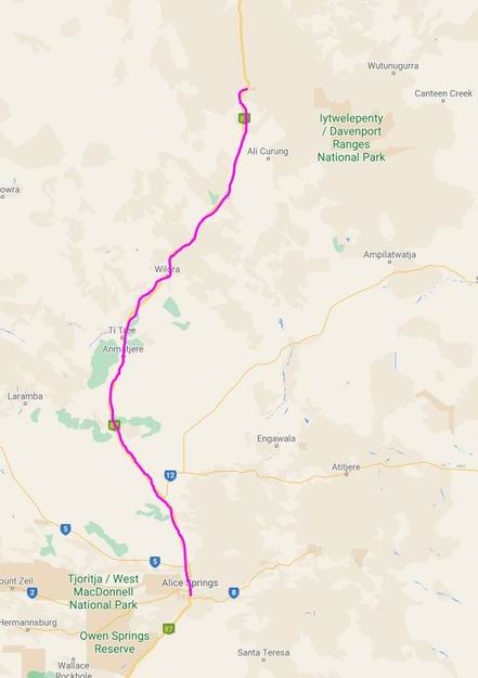
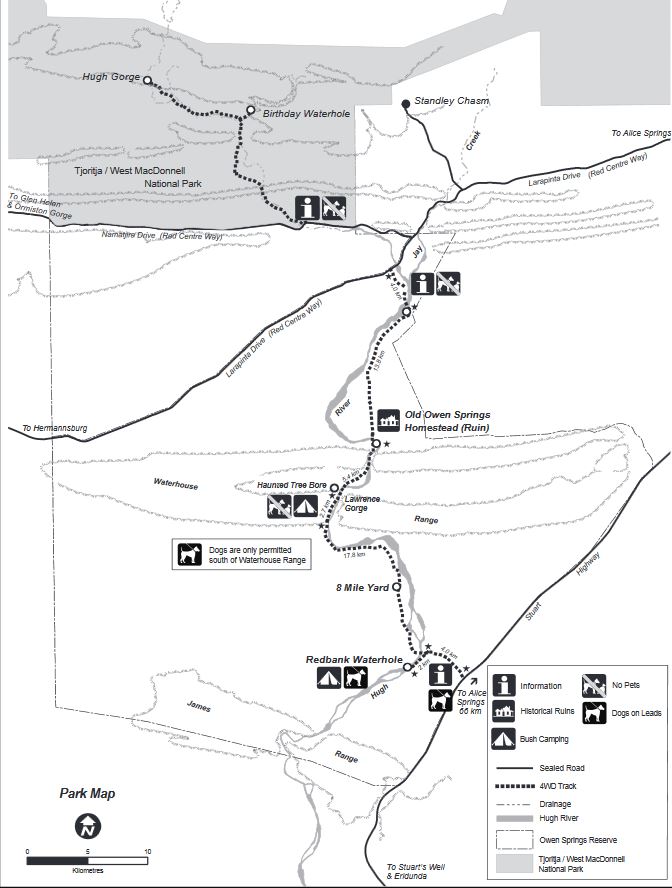
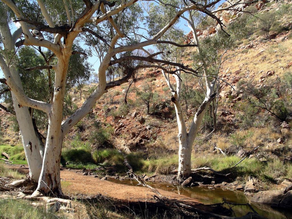
Drove out Larapinta Drive and then Namatjira Drive and, within the Owen Springs Reserve, turned north along a track that took us to a parking area, from whence we could walk to Birthday Creek Waterhole.
This Reserve, formerly Owen Springs cattle station, had only been open to the public since 2003, so was not yet widely known about. It straddled Namatjira Drive, with the larger portion stretching from that to Larapinta Drive. Basically it encloses a section of the Hugh River – at this time of year really a series of waterholes.
We thought about trying to tackle the 4WD section between the Drives, but decided on a walk instead – some exercise!
We parked up then walked along the Birthday Creek Waterhole Track, following the Hugh River.
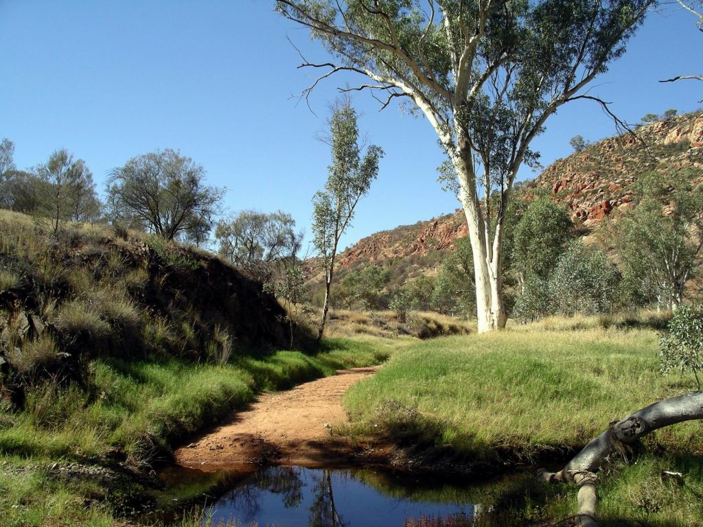
This was “quietly” typical Central Australia – meaning it wasn’t the dramatic country of much of the Western Mc Donnell Ranges. Great clumps of grasses grew at the sides of waterholes along the river, where pools remained from the last decent flows, which could have been years rather than months ago.
Hugh River
The local river red gums, so often featured in art works of the Centre, with their white trunks, were ever-present.
Central Australian red gums
It was really pleasant walking on mostly flat terrain, a bit sandy underfoot, at times.
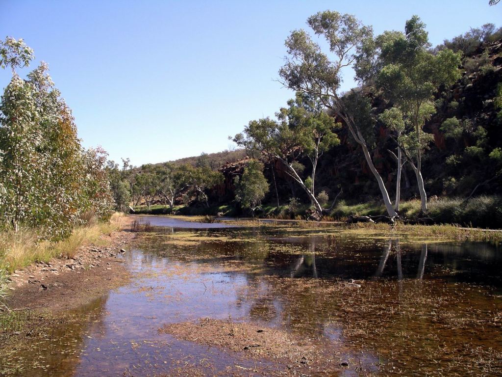
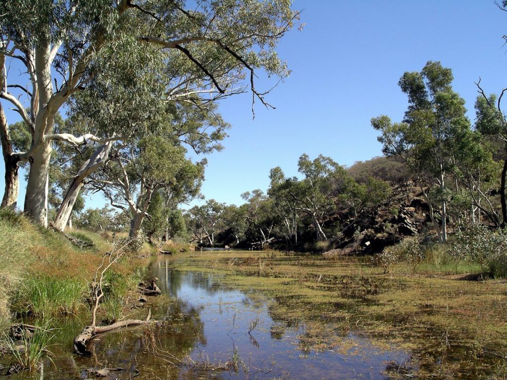
About ninety minutes walking brought us to Birthday Waterhole – the best part of 10kms from the vehicles.
Birthday Waterhole
Birthday Waterhole was worth the walk, in a low key sort of way. The outcropping rocks in the water were decorated with long white streaks – indicative of the birds that had rested there, possibly fish-hunting cormorants.
We ate our packed lunch there, overlooking the water.
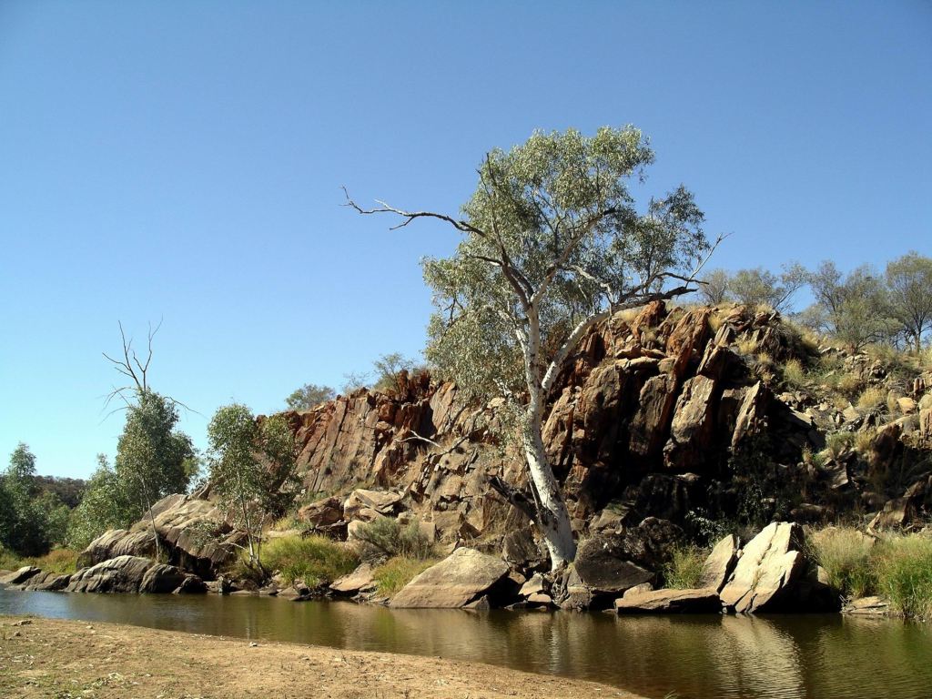
John and I then retraced our way back to Truck. That was far enough for us, probably about an 18km walk. But M opted to walk on further, for another hour, to reach Hugh Gorge, which she reported, later, was a lovely small gorge, but similar to the others along the range.
We returned to town to do a final stock up of supplies, for what could be another extgended period between supermarkets. Refuelled again at Woolworths – the price had gone up to $1.42 cpl.
M arrived back at the caravan park about the time we got back from the shopping.
We all felt as though our spirits had been lifted by the walk today.
John thought the discomfort in his hip was somewhat eased by the Skins.
It was 1 degree again, through the night. Brrr some more!
I woke with a headache and feeling generally out of sorts, due to poor sleep.
We drove into town where I collected the new battery for my camera, which had arrived in. That was good service. But it was a costly item!
Bought the weekend papers – great to have them again. Had another Subway lunch.
Then it was off to bowls in the afternoon. A local man and I beat John and M. John did not play well – I have yet to be convinced that these new bowls suit him. In a minor stroke of genius, I offered him the use of mine, for tomorrow, and I would stay at camp with my sore foot…..
Thinking he was doing the cook a favour, after her hard day at bowls, and because he really loves take away chicken, John went and bought Red Rooster chicken meals for tea. Mine did not look at all well cooked, but – for the sake of peace – I ate it.
We watched some TV for a while. The dreaded Imparja, with its nightly entreaty to children to brush teeth before going to bed.
Yamba the honey ant (Imparja)
I was missing the bush and the nightly campfires!
SUNDAY 27 MAY ALICE SPRINGS
In the morning, I had a major stomach upset. Knew I shouldn’t have eaten that chook! Spent most of the morning haunting the amenities block…..
John and M went to bowls after lunch. John did use my bowls and apparently played better with them.
I downloaded camera cards to the lap top and sorted and named them. It was the first chance I’d had to really look at what I’d taken over the past few weeks. I was pleased – think I’d taken some good photos, to date.
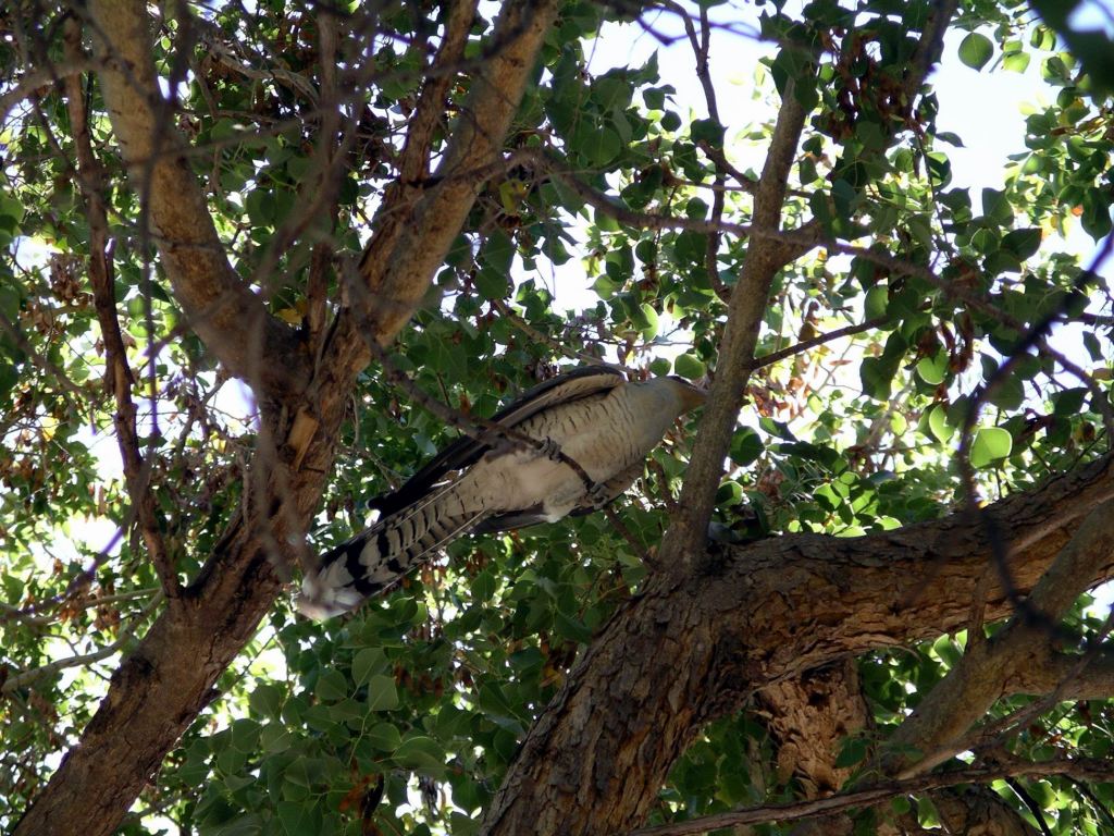
In the afternoon, there was an audience gathering by a tree near our van. There was a juvenile channel-bill cuckoo there, causing much interest, because it was way out of its supposed range and season and hence a novelty in Central Australia. Because it was a cuckoo, we wondered whether its unsuspecting surrogate parents migrated to this area, and it came with them? Normally, these birds are only present in northern Australia in the Wet Season – they are also locally called Storm Birds, for that reason. So this was one very lost bird!
I made Zucchini Slice for tea, for the bowlers, using the electric frypan as an oven. It took a couple of hours to cook, but turned out alright. I had a little soup, only!
MONDAY 28 MAY ALICE SPRINGS
I was still feeling poorly, this morning, but improved a bit later in the day.
I read, and did embroidery for much of the day. My foot was also still a bit sore.
John and M walked into town, intending to get some exercise, and to buy a piece of roasting pork for dinner. They both had a craving for same. I was distinctly uninterested in things food, right now!
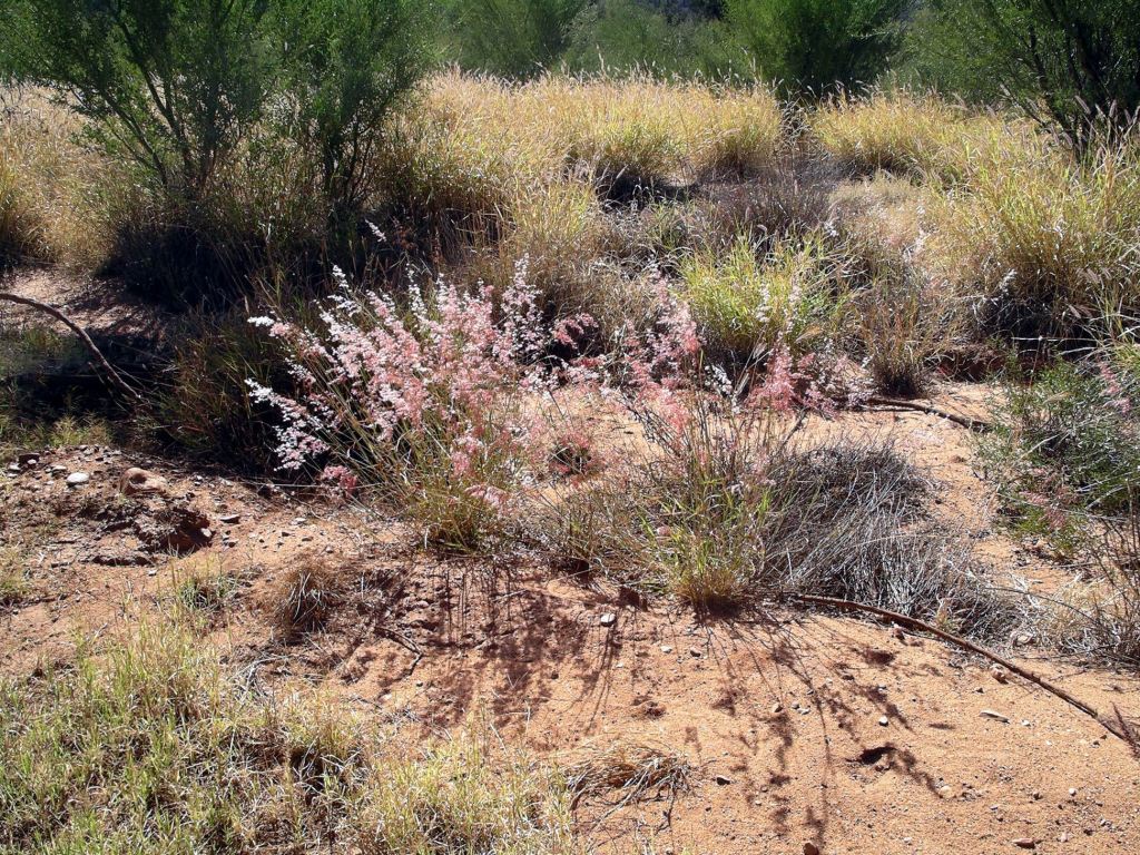
Attractive, pink topped local grass
There was a good walking/bike path from out here, through the Heavitree Gap and into town. They were away for ages, most of the afternoon in fact. It turned out that, as they were walking on the path through the Gap, a lady tourist from this caravan park, came off her bicycle. She broke her ankle – quite badly. John and M (both with First Aid training) dealt with her, called the ambulance and waited with her. Guess that was going to drastically affect her holiday!
It was a long walk anyway, even without that delay. So, by the time they returned, it was too late to cook the piece of pork they brought back. It was the last thing I felt like, anyway. No – make that second last, after chicken! I cooked them some fried rice and I had some soup.
I had an early night – hadn’t been a great couple of days.
It was quite humid and much warmer than the previous nights. Then, it unexpectedly teemed rain, for about twenty minutes, and there was some thunder. It was quite pleasant, at night, cosily tucked up, listening to the rain on the roof.
My leg ached a lot through the night.
TUESDAY 29 MAY ALICE SPRINGS
After breakfast, drove into town again. Although there are some brilliant tourist attractions in Alice Springs, ranging from historic items through to wildlife, we had already visited these on previous stays, as had M. We had also done all the main day walk attractions, like Simpsons Gap. So this period was rather tedious. We were here so John could play bowls, but there were not many days when there was bowls happening!
Alice Springs camp
Decided that there were several aboriginal art galleries that would be interesting to look through. We avoided the very touristy oriented outlets that stocked lots of cheap artifacts and works of unacknowledged origin.
We ended up spending a couple of hours at the Mbantua Gallery, which had excellent displays, both of collected works and works for sale. The items were varied and – we thought – very reasonably priced. Found much to interest us there, but we were really strong and resisted making any purchases, for once. However, lived vicariously, helping M choose a work on canvas to buy.
This Gallery had just released for sale a couple of works by the same Litchfield lady whose works we had bought a number of, last year. There were no prices on them, though. I thought it was reassuring that they had acquired them in the first place.
In a nod to the really cold nights, I went to KMart and bought some track pants – utilitarian ones, not trendy!
John decided to buy a set of Skins, such as sports people had recently taking to wearing, to see if they would ease the aching hip that really needed replacing. The man at the sports store was really helpful in discussing what John needed, but would have to get John’s Medium size in – might be in tomorrow? However, we knew the NT of old, and figured that could mean any time from tomorrow (unlikely) to several days hence – or more.
John and I lazed around camp for the rest of the day. M went off to look at a couple of places she had not been to before.
WEDNESDAY 30 MAY ALICE SPRINGS
It was 1 degree last night. Brrr….
Back to the shops. The Skins had not arrived. There’s a surprise!
I found a fabric/patchwork shop, called “Polkadot”, that stocked some really interesting aboriginal design fabrics. Bought a length of one design that really appealed – to be put away at home against the day when I actually get around to learning how to do patchwork and quilting.
We extended our stay by another day, to wait for the Skins. Considered ourselves fortunate that we could extend on the same sites.
John washed Truck and the van. That took much of the afternoon.
The plus side of the cold Central Australian nights at this time of year is beautiful sunny days.
John spent time downloading emails and dealing with them. It had been a while so this took some time.
I phoned son’s home and connected with daughter in law. Hadn’t been able to get through to either of them last night and wondered briefly if all was well. So it was a relief to speak to her today. I really wanted to find out if grandsons’s parcel, sent from Broken Hill, had arrived. Yes, it had been delivered.
M and I hit the park laundry, early on. We both had loads of grotty clothes bearing some of the Old Ghan Track with them.
After breakfast, drove back into the town centre. M needed to try to track a parcel she’d sent to a friend that had not arrived at its destination, so it was to the PO for her. Later in the day, friend phoned: parcel found. The postie had put it in the meter box!
We drove out to the Head Office of the construction company we’d recently worked for. I met in person several of the people who had only been names on emails, or phone voices, whilst I was Site Clerk over in the Pilbara. It was good to meet up in person. Big Boss was there and we had a chat – mostly about the aftermath of the destructive Cyclone George. Obviously, enquiries were ongoing about that and he said some of the company’s staff had already been questioned. I wondered to myself if we would become embroiled in that, seeing as we were on site virtually throughout the project? BB said that Village 1 was being rebuilt, by a different company. He was adamant that the place had been supposed to be evacuated in the event of a cyclone, and that was why no cyclone shelter had been included in the original plans. He also mentioned that there was a video circulating on the internet, showing men at the camp having a drunken cyclone party – with the walls shaking behind them. It was pleasant to catch up again, even under these rather subdued circumstances.
We had been having issues with the working of the CB radio for much of the trip to date. It was useful to be able to communicate with M, as we were driving, on that. We went to the outlet of the firm that did the comms at the Villages. The boss, who we’d worked with there, was out, so we didn’t get to see him but John bought a new aerial, to see if that fixed the problem.
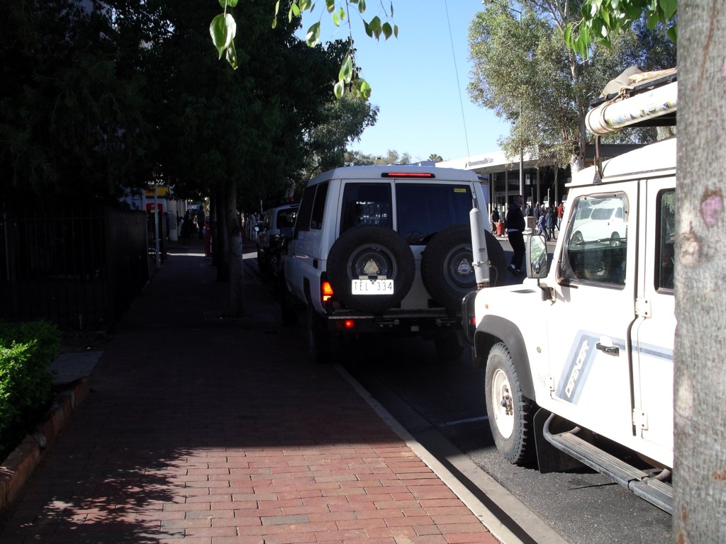
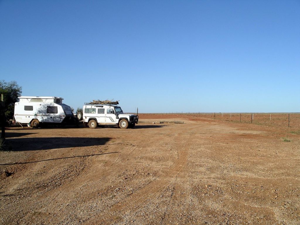
Neither of them scores well on the parking scale!
Our mail was in. John went to collect it, whilst I went to the public toilet nearby. An unpleasant experience, despite the 50c charge to users: the money did not appear to go into cleaning and upkeep!
We all had a Subway lunch, then John insisted that we all go and practice bowls. That made my Achilles start complaining again. John did not do well with his almost new, bright orange bowls. He did better for a few ends after I persuaded him to use mine, light though they were and several sizes smaller. M was rather erratic. She had not been playing the game for long at all.
Fuelled up Truck at Woolworth’s fuel outlet – $1.39 cpl. That did not hurt so much!
There was nothing of note in the mail bag, except for notification that I would receive the $1500 superannuation bonus payment this year. Due to recent Budget measures, that would be doubled. All very good!
I cooked fish for tea – of the frozen packet variety. M and John went off to buy chips to go with that.
There was a flurry then, because John could not find the mobile phone. He had taken it when he went to the PO this morning, but couldn’t remember what he’d done with it after that. There was much hunting, high and low. I had visions of a massive bill being racked up by some opportunist! Eventually, M prevailed upon St Anthony, the patron saint of lost items, and John found the errant item – in his bowls bag! He got very grumpy after all that. I guess we did give him a hard time about it! Glasses, keys, wallet, phone – what next?
It was a really cold night, so I went to bed very early. My heel was very painful through the night, and its matching knee joined the party. Eventually I had to get up and take pain killers.
We had driven this stretch of highway several times before. No drama, not a great deal of interest, a good road.
Refuelled at Erldunda RH – $1.57cpl. John just topped up the tank with 15 litres, to make sure we had enough to get to Alice Springs with no worry. Being at the corner of the road to Ayers Rock, this Roadhouse was always busy.
On to Alice Springs, with no other stops.
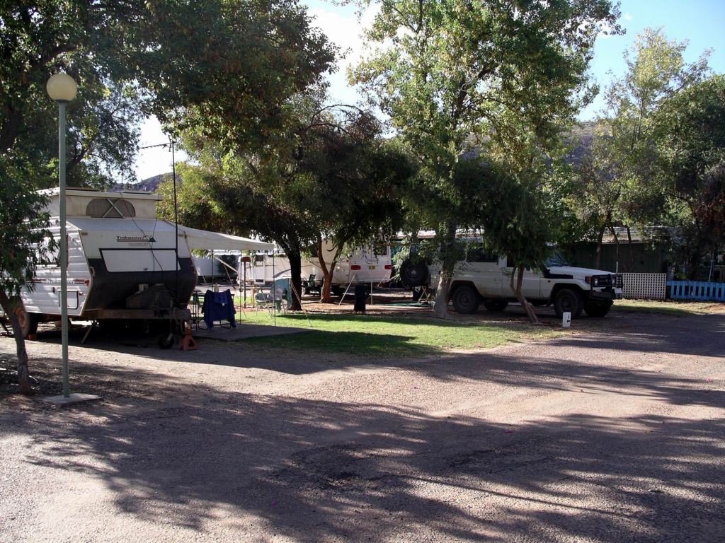
Our powered site at the McDonnell Ranges Caravan Park cost $27 a night, after discount. It is a large park, with modern amenities. Sites were only average size but with good shade trees. We like this park for its cleanliness and for some interesting activities put on for guests, like pancake breakfasts. And – best of all – it was a bit out of town and thus less noisy and, we thought, more secure.
After setting up, we drove off to the town centre and the shops.
M had been having trouble with the lilo she used for a bed in the back of the Troopy – it kept going down and she couldn’t find the source of the leak. She bought some foam from a swag maker, to replace the lilo. Problem solved!
We checked at the PO for our mail – not in yet. Bought some groceries and fresh foods.
At a camera shop, I ordered a new battery for my Pentax Optio camera – so I would be able to have a spare one charged up all the time.
I was looking forward to borrowing some library books and having a reading binge, so went to the town library. Discovered that it charged $25 for non-residents to borrow books – non-refundable. Thought that was a bit steep, but maybe it was a reflection of the nature of the town with a high number of transient tourists.
John found a $5 note in the street, so bought a lottery ticket with it. He sussed out the bowls club and lost no time booking us in for games on Saturday and Sunday. Damn! Suspected that would stir the Achilles’ up again, nicely.
Now that he did not need to conserve the van’s battery power at nights, John played computer games until after 1am.
Another really cold night. At least, with 240v power, we could now run the little electric fan heater in the van.
We were getting pretty good at efficient morning starts, without pressure, after a few in a row.
Continued west on a reasonable gravel road. The Driver – and I – were ever so glad that there was no need to cross the Arkaringa Creek again. But my Road Guide and map did show a number of watercourses to be crossed , so we hoped they were just little, minor ones.
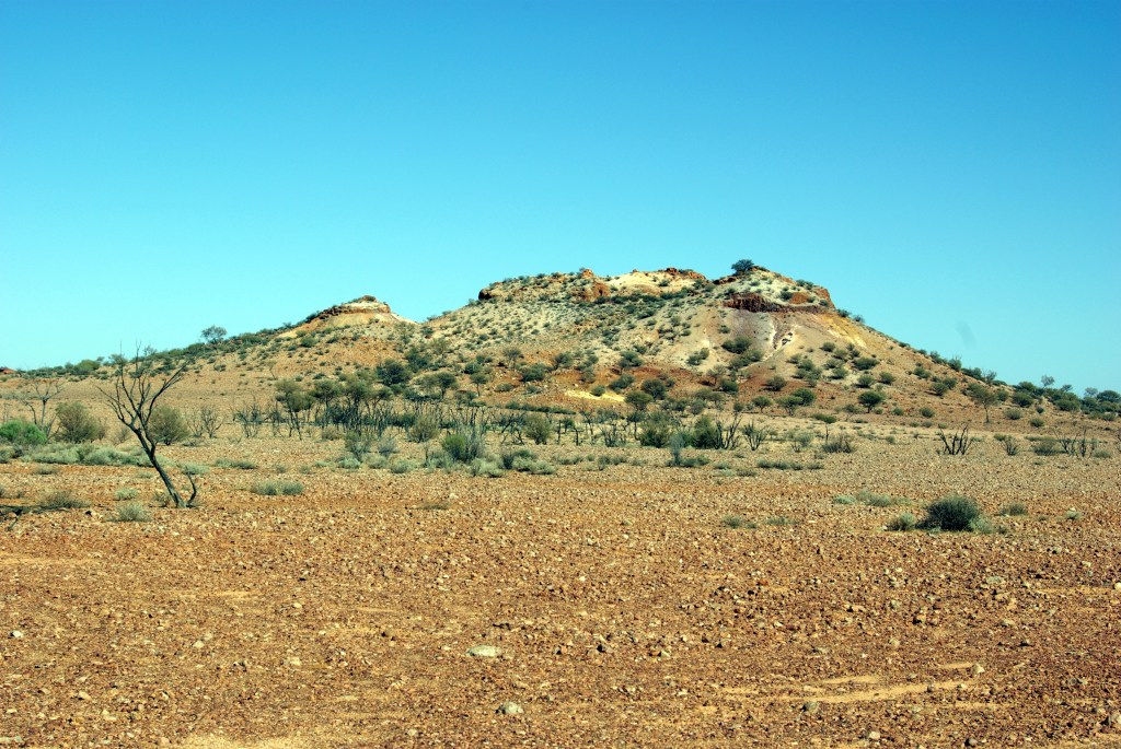
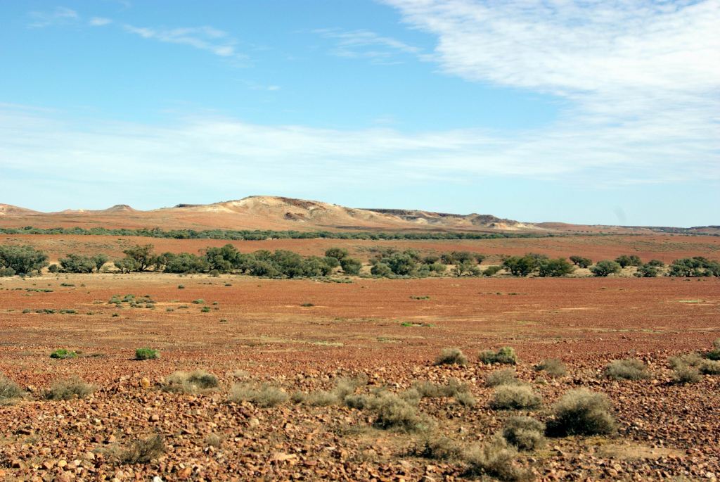
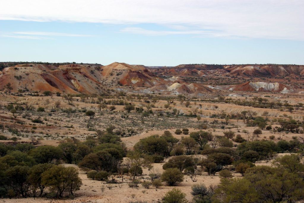
The first part of today’s driving was brilliant for scenery. The mesa like formations of the Painted Desert were replicated in a range that stretched along to the north of our route, and in isolated other formations.
There were regular creek lines with mulga and low trees along them, and lots of wide vistas.
Despite our concerns, there were no more wet and boggy creeks.
We passed the Copper Hills Homestead. This was a small, private, conservation area, excised from Evelyn Downs Station’s normal activities. A camp area had been established there, that I’d read about, back in the late 90’s, at what was reputed to be an especially beautiful area. I had wanted to camp there when we were passing nearby on the highway, a couple of times, but on both occasions John was in a hurry to get south. Now the camp ground was no more, so the opportunity was past. Apparently the place had been bought by a professional person from Adelaide as a private retreat.
Our track emerged onto the Stuart Highway just south of Cadney Park Roadhouse. A sealed road again!
We stopped briefly at the Roadhouse. I phoned and booked us into the Mc Donnell Ranges Caravan Park in Alice Springs, for a week from tomorrow. At this time of year, thought it advisable to book, especially as we had a preference for sites close together. It was a longer time than I would have chosen to spend there, this trip, as we had spent considerable time there before, but John had visions of playing lots of bowls!
Stopped again at the next roadhouse up the Highway – Marla – to refuel. $1.62cpl. It was ridiculous that the fuel cost here – with all the volume it must do – was more expensive than that at William Creek!
Since Cadney Park we’d had the “new” Ghan Railway off to our left, often not far from the road. North of Marla we crossed it on an elevated section of road, not to be seen again until the outskirts of Alice Springs.
We had decided, last night, that we’d try to offset a little of what the week in Alice would cost, by free camping tonight. I thought that the area at Agnes Creek, about 100kms north of Marla, read in my camps book as though it was pleasant, but John was not quite ready to stop then. So, after a slightly tedious run up the highway to the SA/NT border, we checked out the roadside stop there.
The large area was sealed, and there were composting toilets. There wasn’t much in the way of shade, but it was getting late in the day anyway. It would have been much nicer back at Agnes Creek, I thought. However, it would do for the night. We parked up, put out the table and chairs, and considered ourselves set up – at a prudent distance from the toilets!
I was pleased when another van pulled in and set up for the night, and then another one after that. There was some security in numbers, with a main highway so close.
Kulgera Rest Area – on SA/NT border
The couple who came in not long after us had a fire container made from a sawn off gas bottle. Great idea this. The ring stand on the base of the gas bottle meant it could sit on the sealed surface, and have a fire going without doing any damage, or leaving any trace. I wouldn’t mind one of those!
They invited us over, after tea, and we sat round their “campfire”, talking. It was all very pleasant.
The place was not as noisy from traffic through the night, as I had feared.
After a fairly early breakfast, we walked back to the bridge, to view it in a different light from last afternoon. Spent some time wandering about there and also around the northern end of the bridge.
Early morning, AlgebuckinaOur secluded riverbank camp in the morningThe train driver’s perspectiveNeales River from the bridge approach
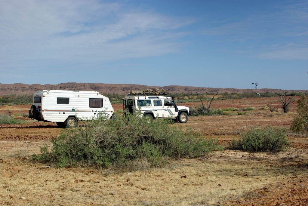
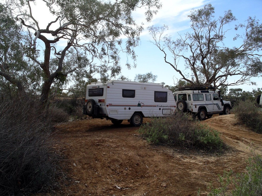
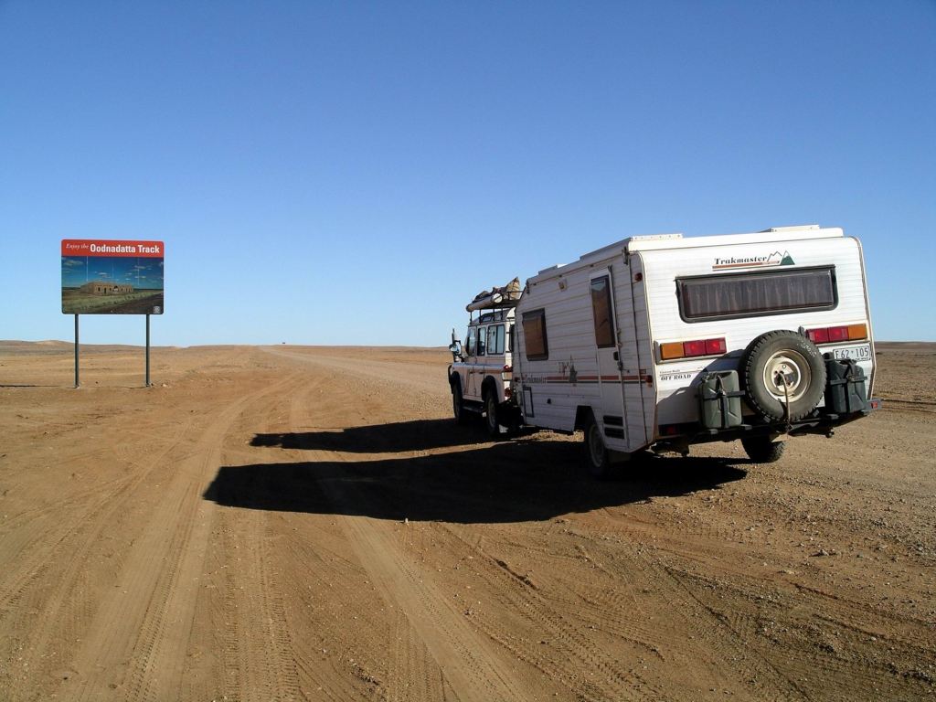
The Trakmaster group was away from camp well before us, as a result. That pleased us – meant they would probably be clear of Oodnadatta before we arrived there. We would not be tailing along in their dust.
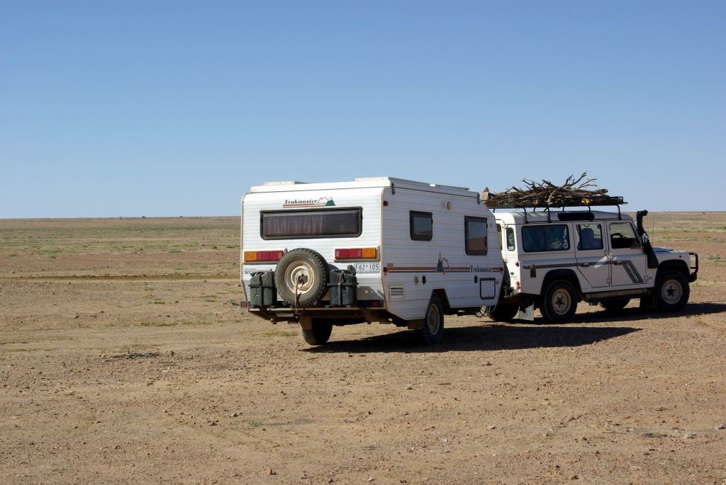
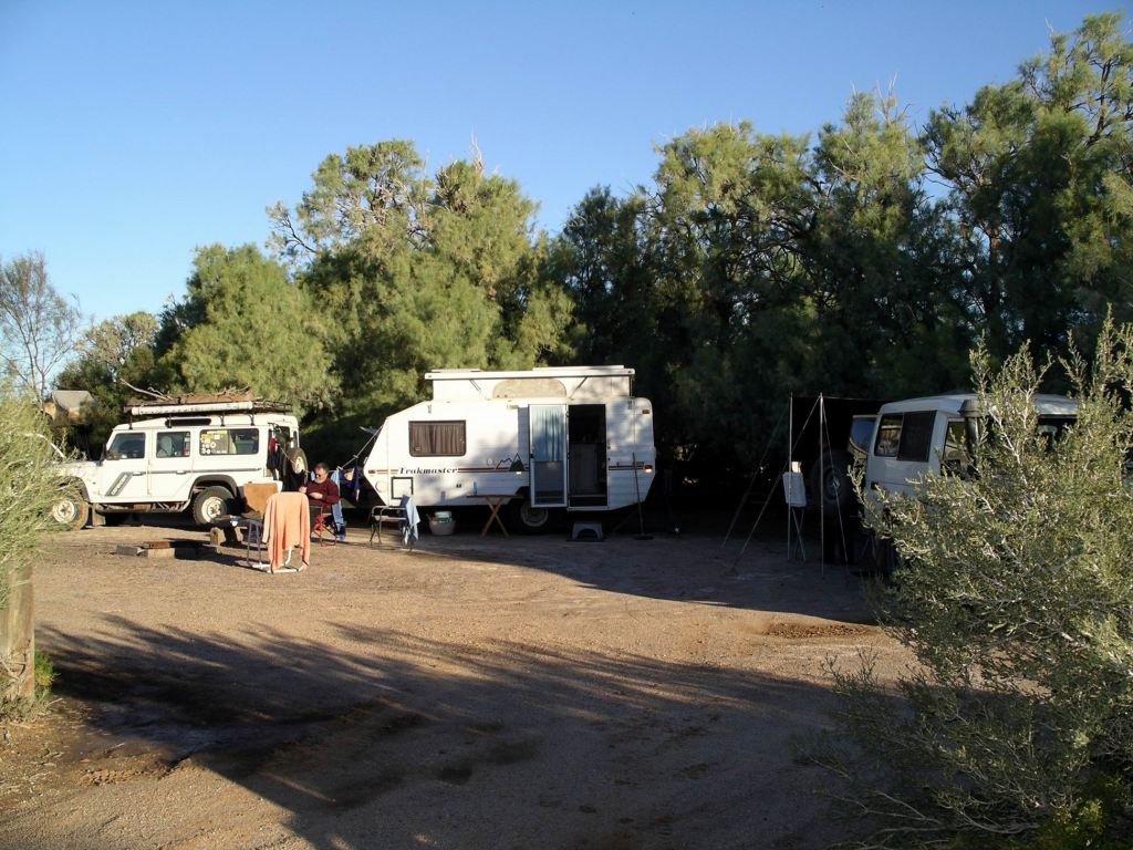
Trakmasters’ camp at Algebuckina
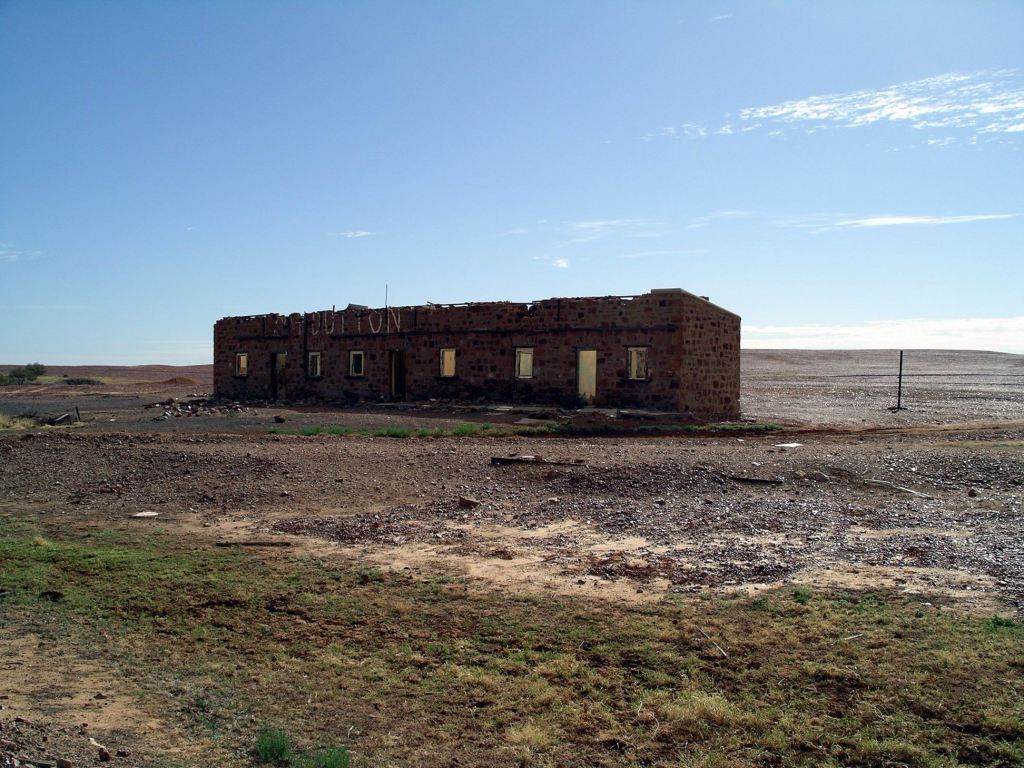
We only had about 60kms to go, to Oodnadatta. Along the way, stopped to have a look at the Mt Dutton Siding ruins.
This siding was in a really open, exposed positionPartly demolished, like so many of the old siding buildings along the Track
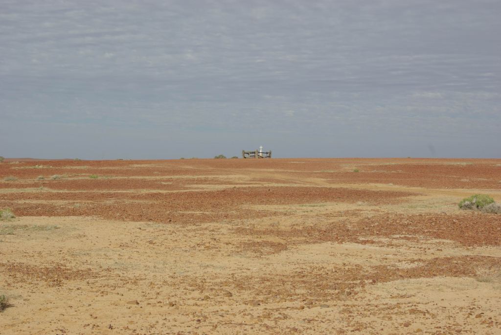
There was one lonely grave here – evocative of the loneliness and isolation of the place.
The desolate graveThe Mt Dutton bore that sustained the railway – and siding – here
And so on into Oodnadatta, like Marree, once a significant settlement on the Ghan Railway line. Now it had shrunk to having about 200 people living there, half of them indigenous.
A lot of travellers – like us – end their time on the Oodnadatta Track at the township. and from there head west to the Stuart Highway on unsealed roads either to Marla or Cadney Park or SW to Coober Pedy. The Old Ghan Track north of Oodnadatta becomes rougher and more of a challenge to vehicles, heading up to Finke and thence on to Alice Springs. We had driven part of that section back in 1999, as part of our trip across the Simpson Desert.
We refuelled at the iconic Pink Roadhouse at Oodnadatta – $1.67cpl.
The establishment of this Roadhouse arose from an interesting history, which originally involved Adam and Lynnie Plate walking down the Ghan Railway track, with camels, in the 70’s. The building and the vintage car in front of it, were painted pink to attract custom, and to stand out in people’s minds. Adam Plate was instrumental in the Oodnadatta Track being so named and becoming a must-do on the list for adventurous travellers. They have done travellers to these parts a great service by placing their distinctive pale pink direction signs all over remote northern SA. We’d found these of great help when we drove across the Simpson Desert’s Rig Road, in 1999.
We browsed the tourist offerings in the Roadhouse. John bought Pink Roadhouse Tshirts for his two grandsons, and a soft, life-sized toy galah for the younger one’s birthday, had them packaged up and mailed from there. I wondered how many mail items had ever been received in Brussels, from Oodnadatta? I bought a stubby holder. M bought a soft toy blue heeler dog – destined to keep her company in “Bessie”, her Troopy.
Despite what we had heard on the road reports, the Road Conditions sign at Oodnadatta said that the Cadney Park road was closed! Bugger!
Then, at the Roadhouse – the source of all accurate information for these parts – we were told that was wrong. The road really was open, but the policeman with the key to change the sign had gone to William Creek for the Cattle Drive start.
So, feeling reassured – and legal – we ventured forth.
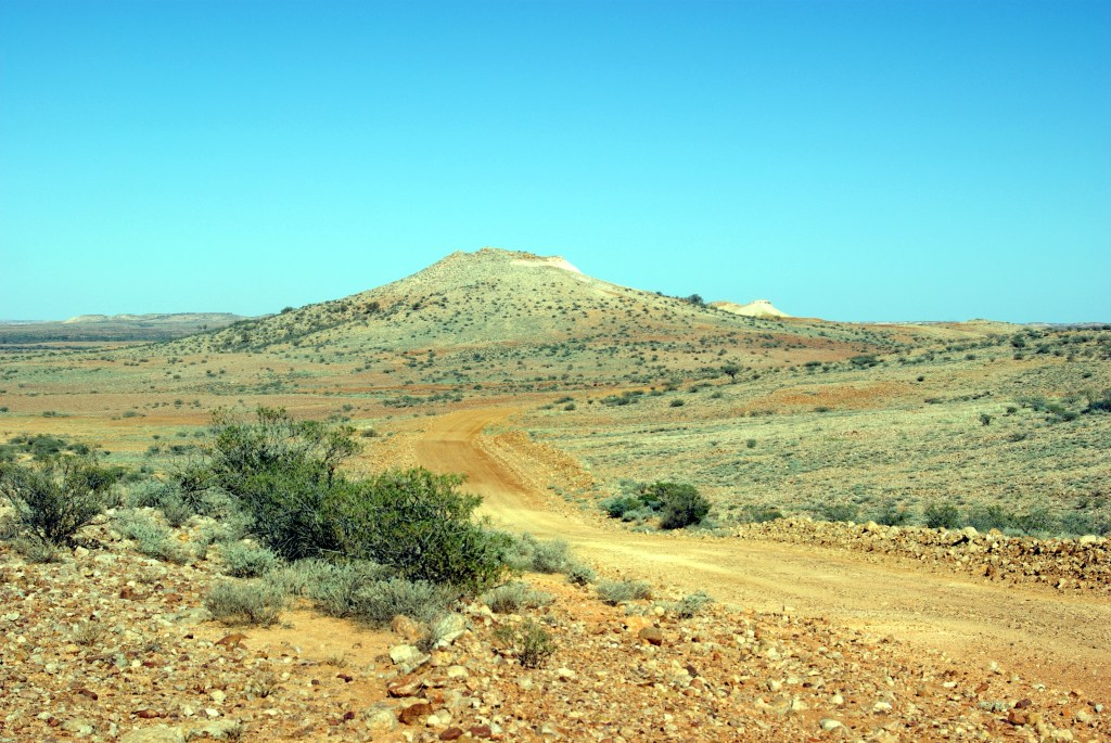
Along the road to Arkaringa
Backtracked for 5kms, then went SW on the Coober Pedy road. It was a good gravel surface. There were a lot of little floodways and creek crossings, some of which showed signs of having been wet, but were dry now.
Regular dry little floodways….
The country had subtly changed and was less desolate.
We stopped by a dry creek bed that was attractively vegetated, to eat lunch.
It was actually a really interesting and attractive spot for a lunch stopA live tree this time!
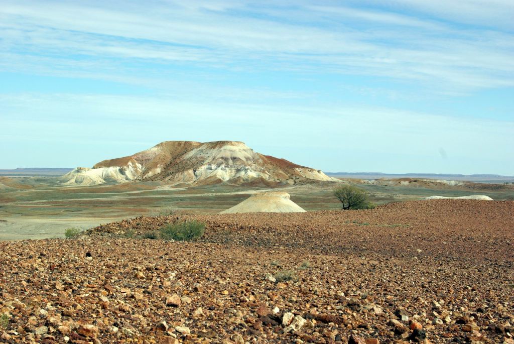
Fifty kms from Oodnadatta, we turned west onto the Cadney Park road. There were starting to be some dramatic, jump-up type hills in the distance. It became obvious that we were heading for these – the Painted Desert.
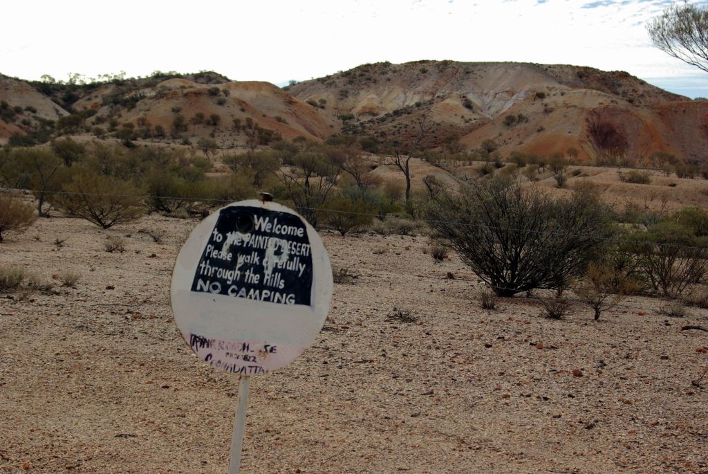
Took a short side track to a parking area for the Painted Desert.
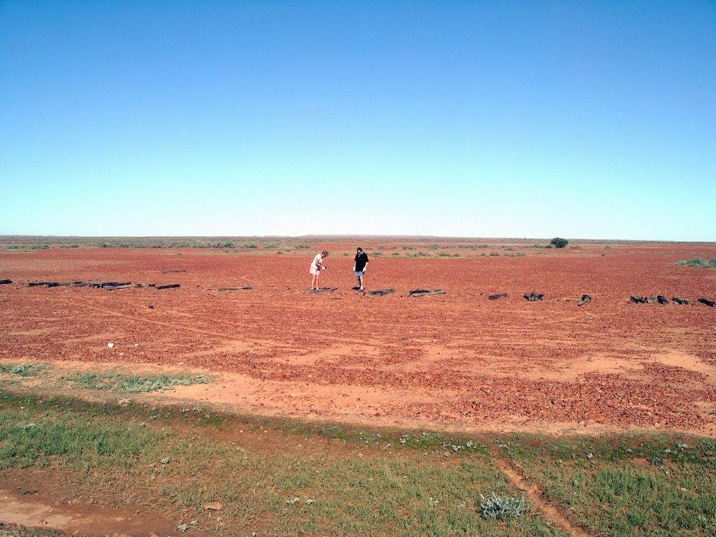
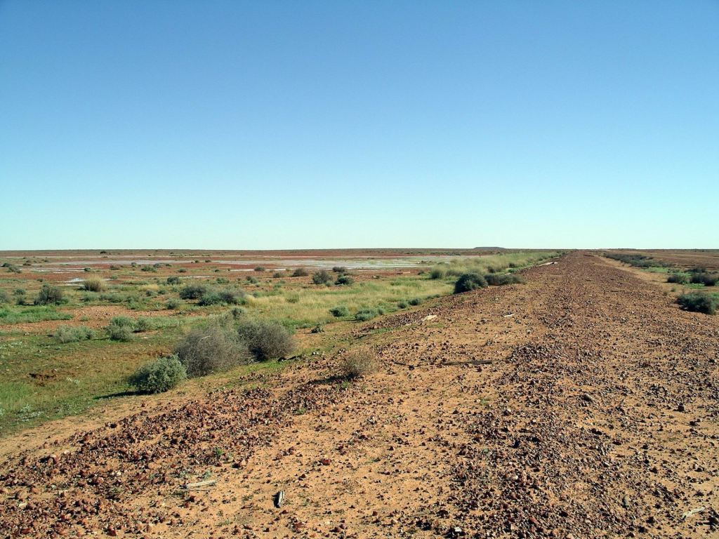
The area was covered by gibber stones.
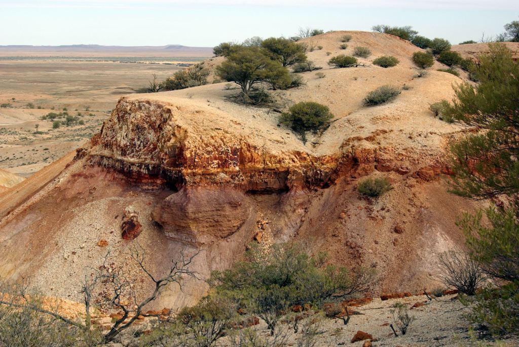
The Painted Desert was once part of an ancient seabed. Uplift and differing erosion rates on hard and soft strata, plus staining from minerals in some of the rocks, have created this rather unique, surreal, and very picturesque little area.
One of the widespread and typical Pink Roadhouse signs
We set out to walk the 2km circuit track that wound around through the hills and gullies.
The varied colours of the mesa formations were strongly contrasting, from deep red-browns, through to white.
I wondered if the indigenous peoples of the area had any particular stories or legends about it?
Some of the exposed underlying rock material looked really soft and fragile. It was clearly easily eroded.
This really was a very different place to any we have visited before, although maybe there was a little similarity to some of the country around Winton, in Qld. It would have to go on my list of my Top Ten Places in Australia. It was so superbly dramatic.
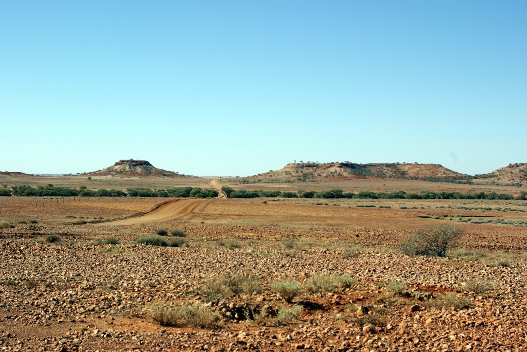
More mesa formations in the distance
I loved the stark dead mulga standing against the bare terrain. Yes, I know…. more dead mulga!
The little walk took us the best part of two hours, because we stopped so often to admire the outlook round the next corner, and the next……and take heaps of photos.
Eventually, we dragged ourselves away to continue on to where we intended to camp for the night, at Arkaringa Station.
It would have been fascinating to spend the night here, and see the sunset and sunrise on the hills, but there was no camping allowed. This is station property, so one should obey their edicts.
The Arkaringa Homestead was only about 12kms away. We had some ideas of returning to the Painted Desert formations for sunset, or sunrise, or both, to take photos. But these ideas were quickly abandoned after we had churned through the quagmire that was the multiple channels of the Arkaringa Creek.
We could see why this road had been closed, until so recently! Actually, we were rather surprised that it was open! The fact that the creek base seemed fairly firm was perhaps the saving factor. But it had clearly been flowing recently.
I was sometimes surprised at what Truck will tow the van through. In this instance, John had put Truck into low range before tackling the wide expanse of the creek ford – and hoping! Perhaps if we hadn’t known that the homestead was quite close – and therefore, presumably help if we got stuck – we might not have braved what looked quite nasty.
So, not wanting to cut up this part of the road any more, we decided to forego returning to the Painted Desert formations.
We paid $15 to stay in the Homestead camp area and were able to plug into power. This was a rather basic place, but the showers and toilets were adequate. Good use of corrugated iron on the building of these…..
Arkaringa Station was owned by the same pastoral company – the Williams’ – that owned Nilpinna, of the sign we’d photoed over on the Ghan Track. Seems they owned a lot of this part of the country!
It was great that we were able to recharge my camera battery, and also John’s laptop, which he had run down playing computer games last night!
Arkaringa camp
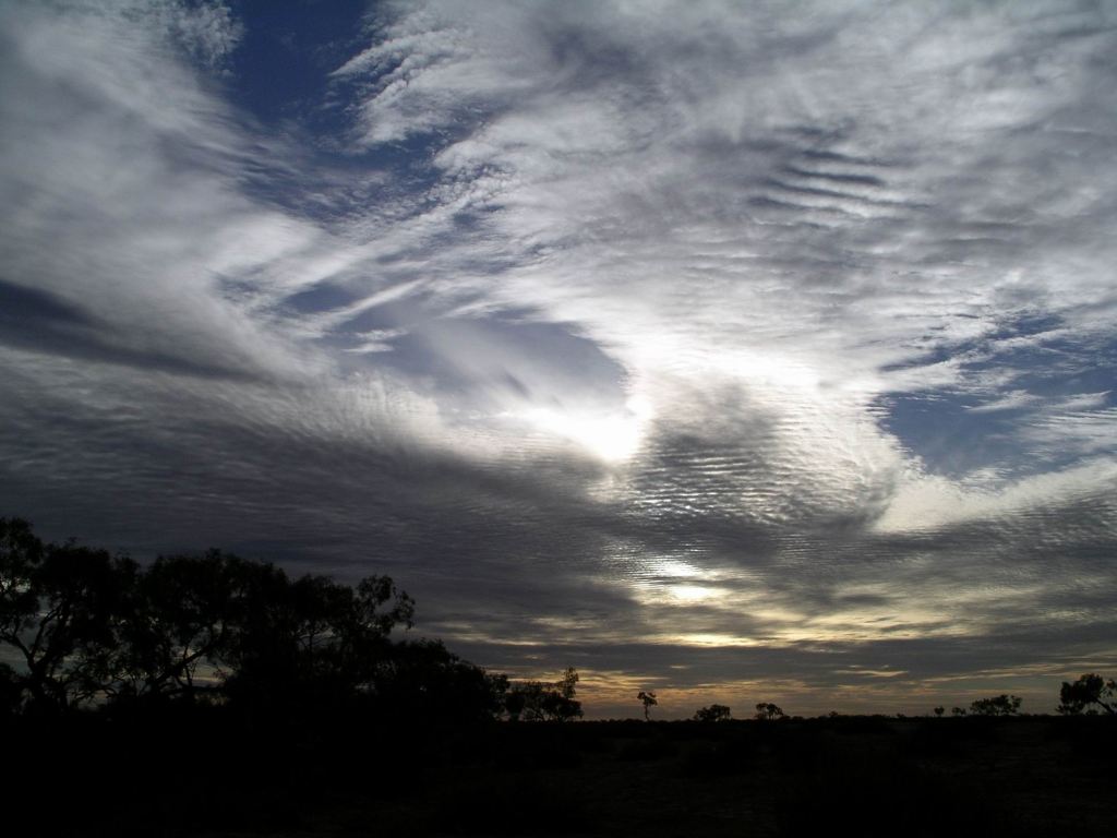
The sunset here was rather interesting, anyway. Vast skies, enough cloud about to make it really interesting.
No campfire tonight.
There was a drilling crew staying in the accommodation section – cabins – who were a bit noisy into the night. Seemed there was a big coal exploration project happening just to the south of here. I hoped that any mining venture in the future did not impinge on this very special environment around here.
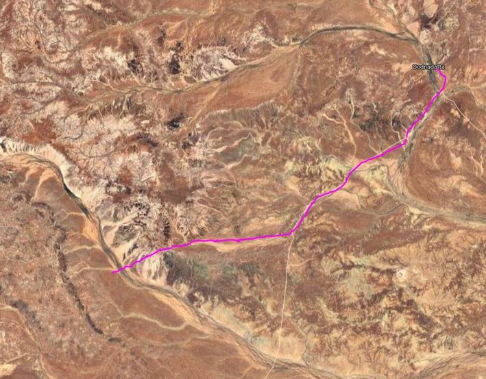
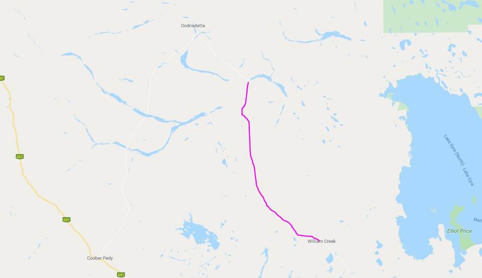
MONDAY 21 MAY WILLIAM CREEK TO ALGEBUCKINA BRIDGE 136kms
Although we did not race to get going in the morning, we did get away before the Trakmaster party – for which we were grateful. Did not really want to be playing tag with them along the Track. Some of their members were doing morning plane flights, so the group waited for them.
Refuelled Truck – $1.56cpl.
In much the same way as the previous days, we continued on up the Track.
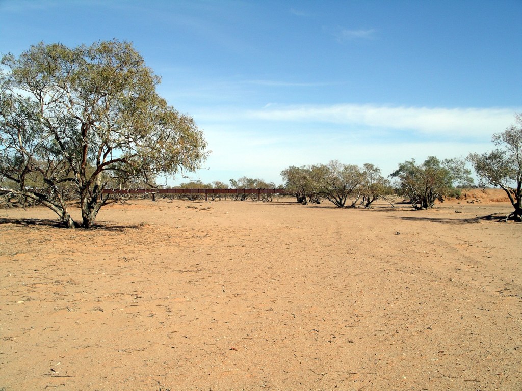
Stopped several times, to look at ruins, scenery and bridges.
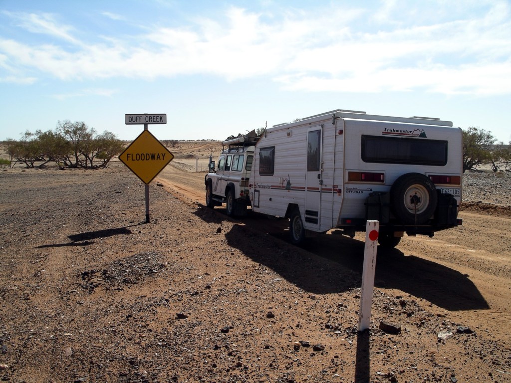
Love the name…….Long rail bridge over the dry Duff Creek
For much of today’s way, there were very low ranges in the eastern distance – the Denison and Davenport Ranges.
The Duff Creek floodway across the Oodnadatta Track
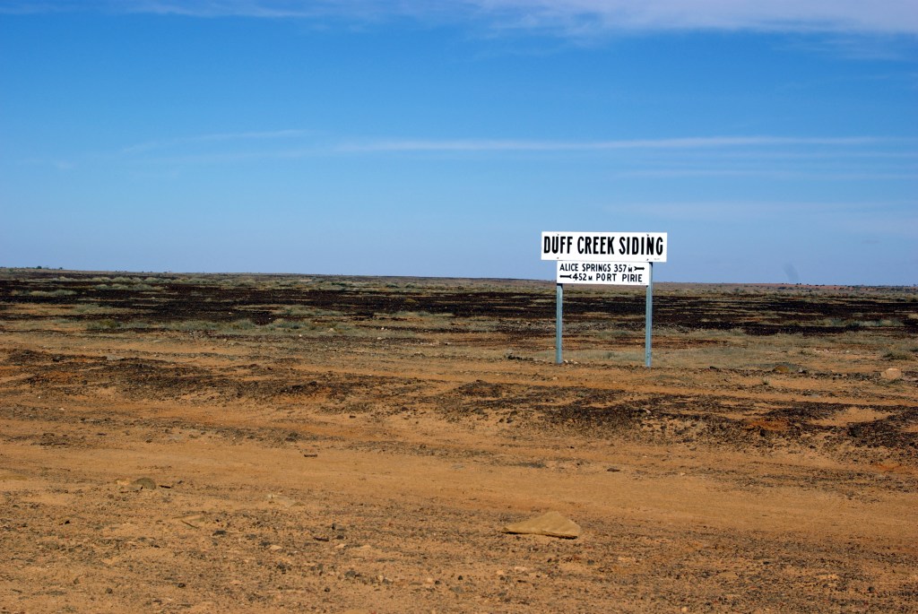
Not far past the Duff Creek floodway, there was an entrance track and sign for Nilpinna – a Williams Cattle Company property of some 5000 square kms. This group was one of the large players on the Australian pastoral scene.
Hard to believe that this was any sort of grazing country…..What’s left at Edwards Creek siding
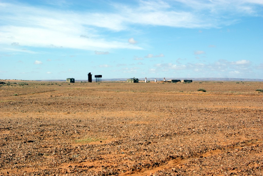
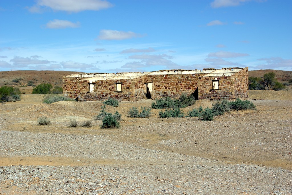
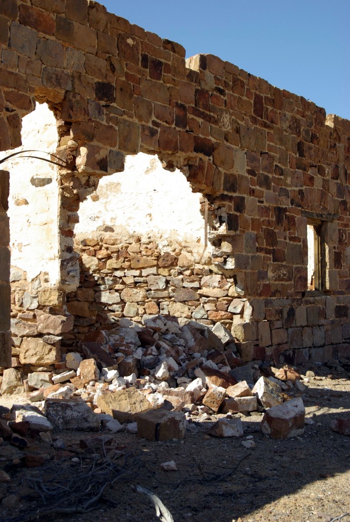
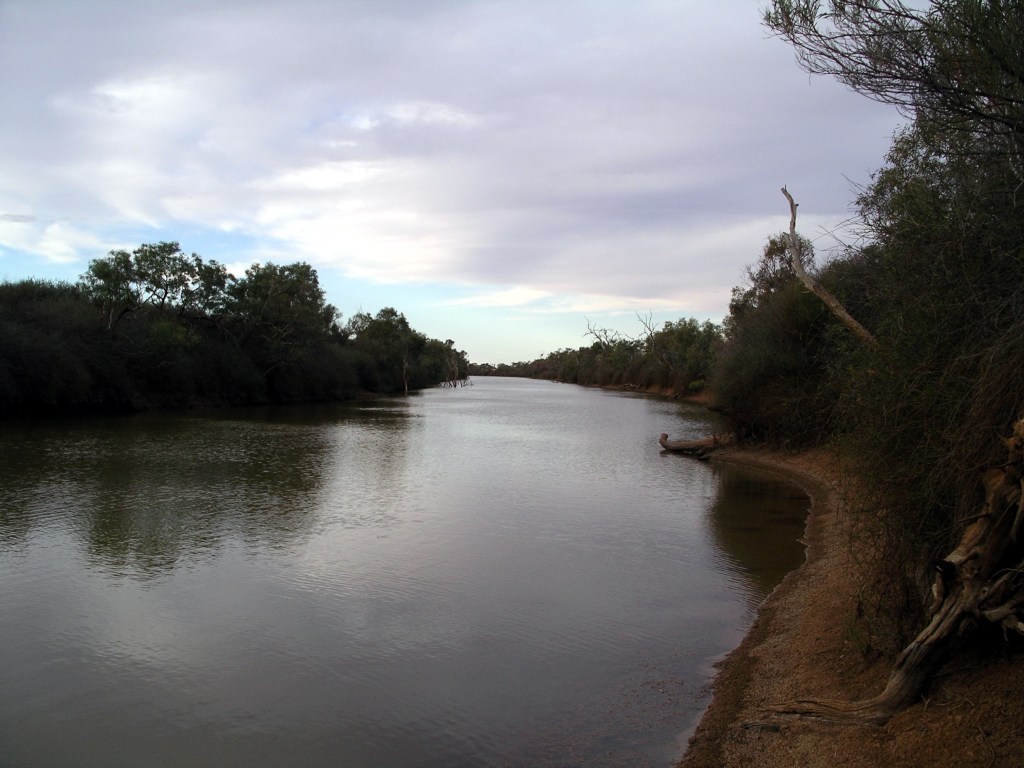
Early afternoon, we came to the Algebuckina Siding ruins and nearby Algebuckina Waterhole, on the Neales River. This really was a river, with substantial lengths of waterholes.
Algebuckina Siding ruinsSome interesting craftmanship in the old stone buildings
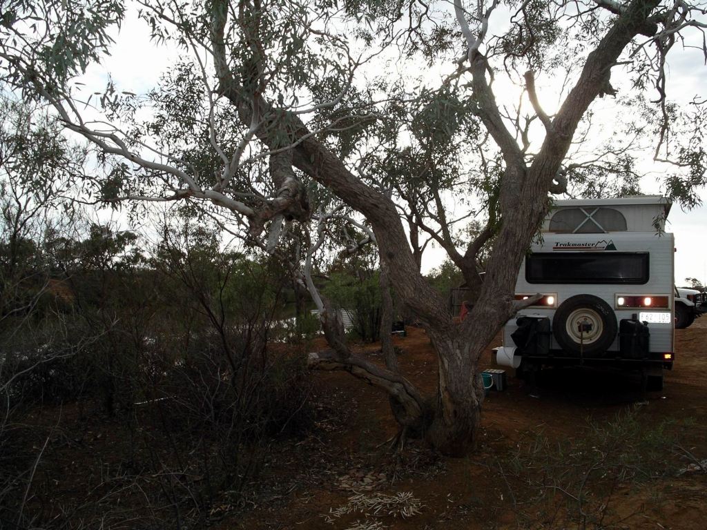
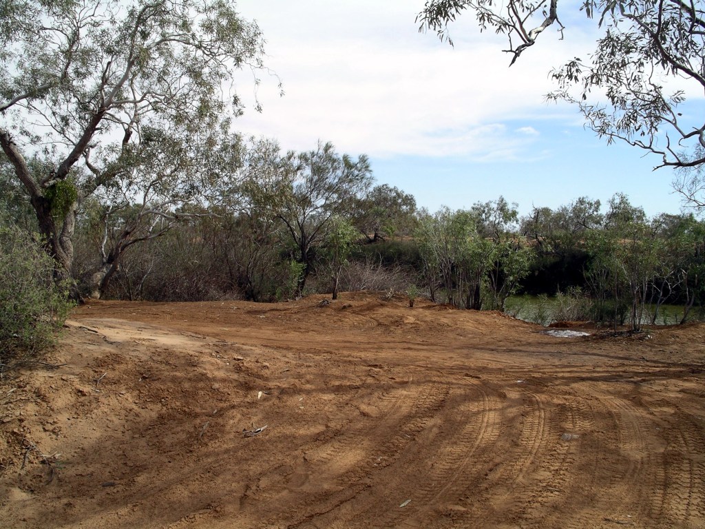
Really liked the look of the bush camping area to the east of the Track. I’d hoped to find it so, rather than go on to stay at Oodnadatta.
There was a spot, right up by a fence that marked the boundary of the camp area, up on the bank above the waterhole, that would just fit us and the Troopy. Prime local real estate it was! It was one of the few spots in the otherwise rather open camp area, that had a water view.
This is the place for a camp……
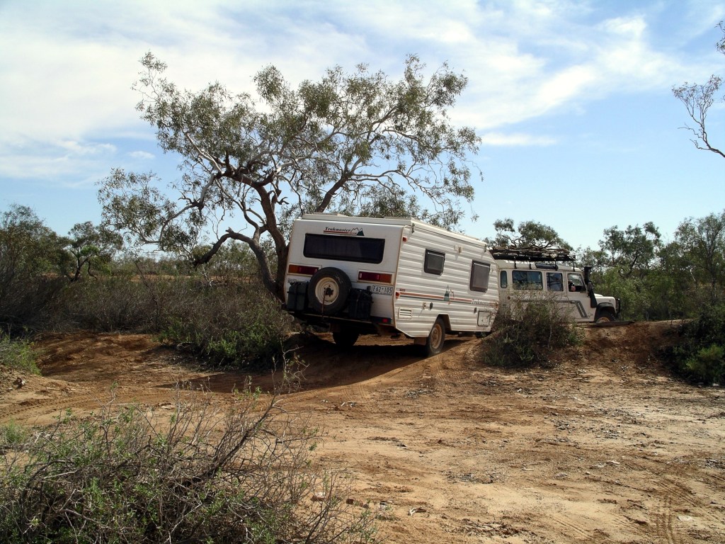
It took a little manoeuvring ( well, quite a bit) to get the van in so that it was reasonably level, and still left room for M to put the Troopy on a flat part of the clearing. Side on to the river, we had a lovely outlook over the waterhole. As well, there was rather a sense of privacy from the rest of the open camp area.
……if we can get the van in there!
There were no amenities of any kind here, so it was out with the spade and head off into the distance to dig a hole in the ground! I noted that my knees were not managing this particular camp activity too well, any more!
Set up overlooking the river. Van level-ish, doesn’t matter about Truck.
The Trakmasters arrived some time after us and set up in various places around the open camp area. Apart from them and us, there were only two other rigs there. I had expected this place would be more popular, but maybe would-be travellers had been deterred by the recent rains.
Algebuckina Waterhole
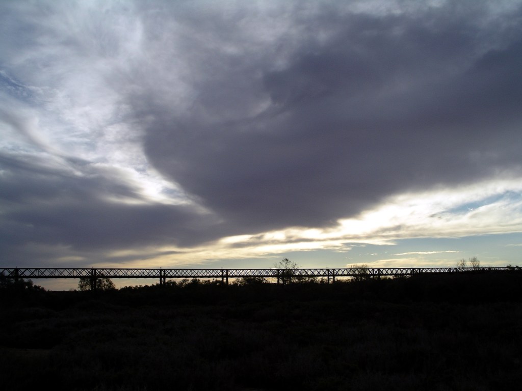
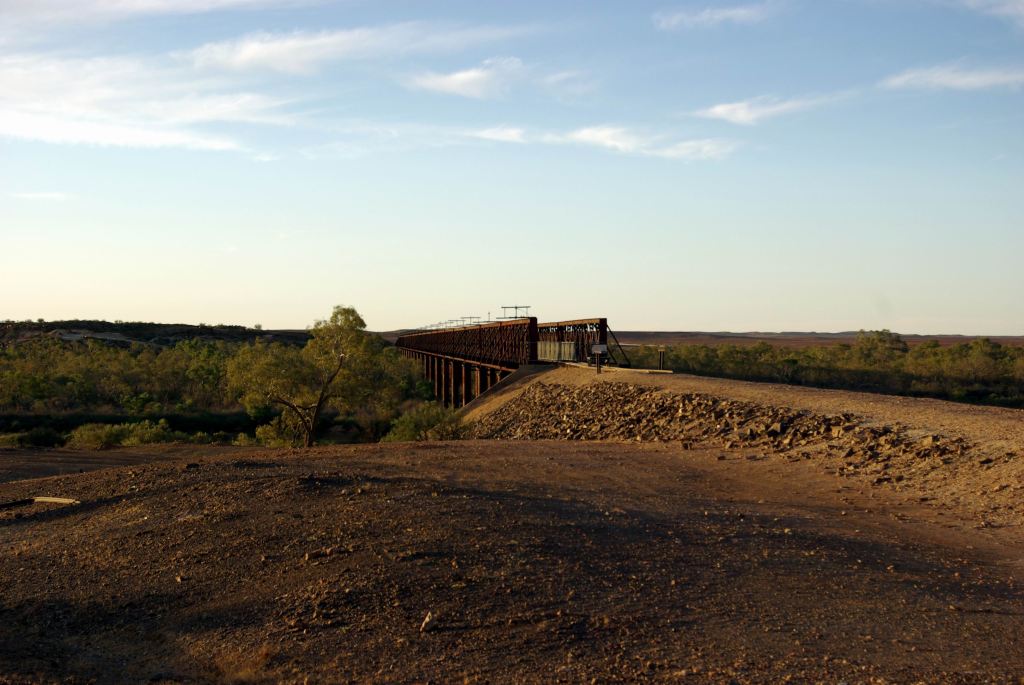
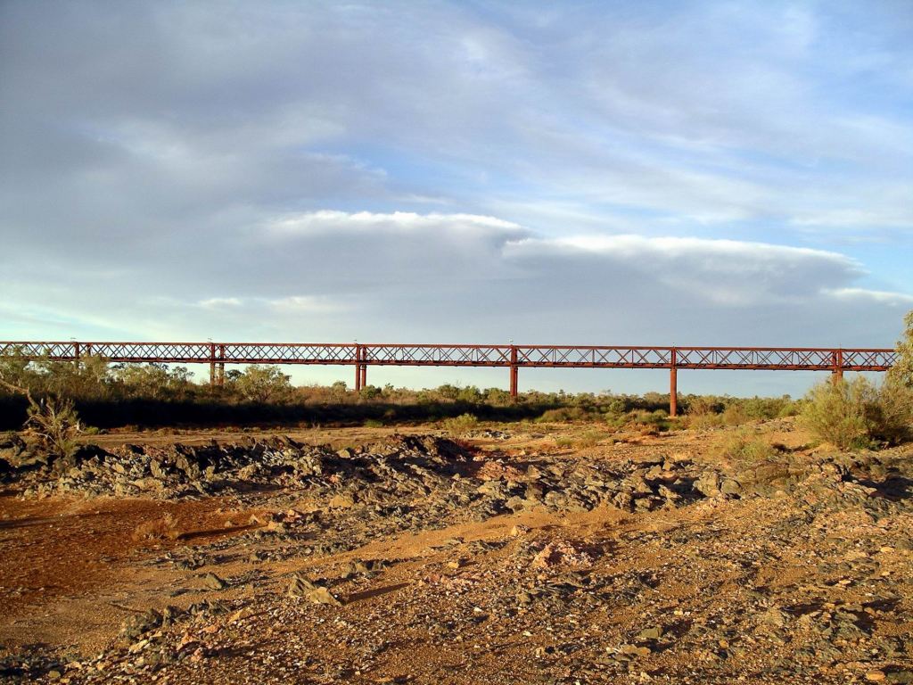
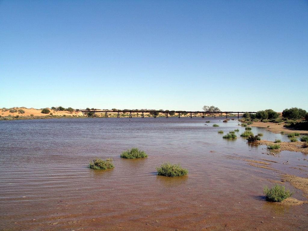
We walked along beside the river and across the Track to the superb old Algebuckina Railway Bridge. It was about a km away from our camp. The ruins of the railway siding that was here, were nearby.
I was surprised that, during the couple of hours we spent around the bridge, exploring and photographing, hardly anyone from the Trakmaster group came along to look.
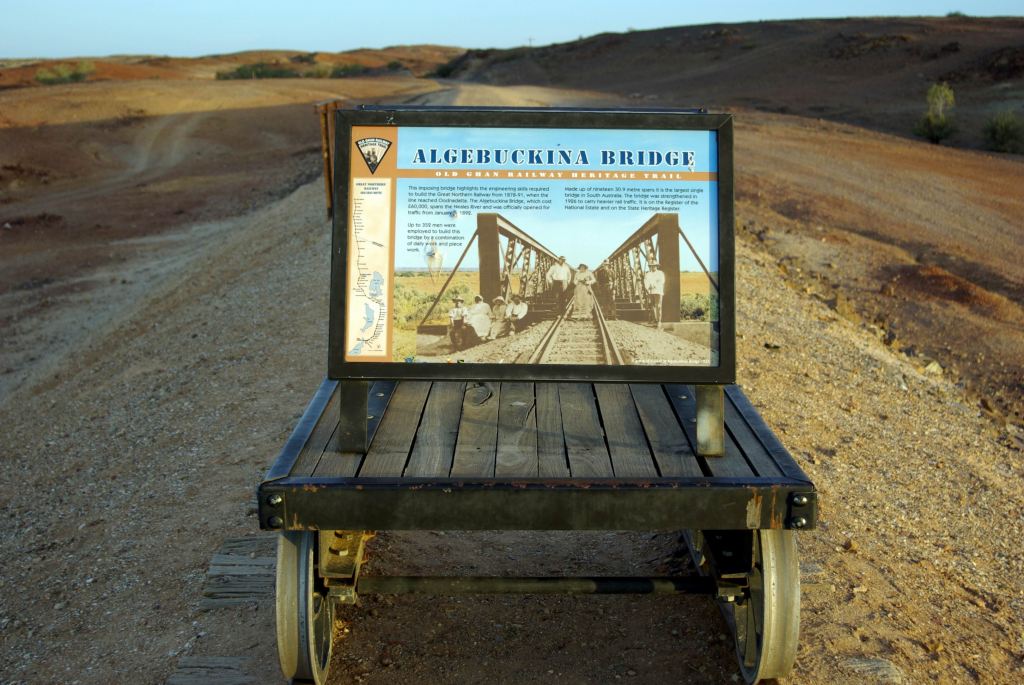
The bridge is high and almost 590kms long. It is a wonderful subject for photos, especially silhouetted against the setting sun.
The bridge was opened in 1899 and is the longest bridge in SA. Despite its height, the big flood of 1974 reached almost to its decks!
The remains of a wrecked Holden were still there, from 1976. The motorist attempted to cross the flooded river, via the rail bridge, by putting down some planks, moving his car onto them, then taking up the ones behind and repeating the process. Unfortunately, the works train came along, while he was only part way across, and ran over his car. He lived. The wreckage was pushed off onto the creek bed below the bridge.
One could think up a new variation on the signs one sees about not attempting to drive through flooded creeks!
We took a heap of photos. It was the sort of place that just lent itself to being photographed in the changing light of late afternoon.
It was dusk by the time we’d walked back to our camp.
Our site even had room for a campfire, in a place where there had obviously been ones before us, so we sat outside for a while after tea, chatting and enjoying looking out over the waterhole. There were some occasional nocturnal sounds from frogs and waterbirds – lovely.
We were hoping that each day that goes by was allowing the Cadney Park track that we wanted to take, to dry out.
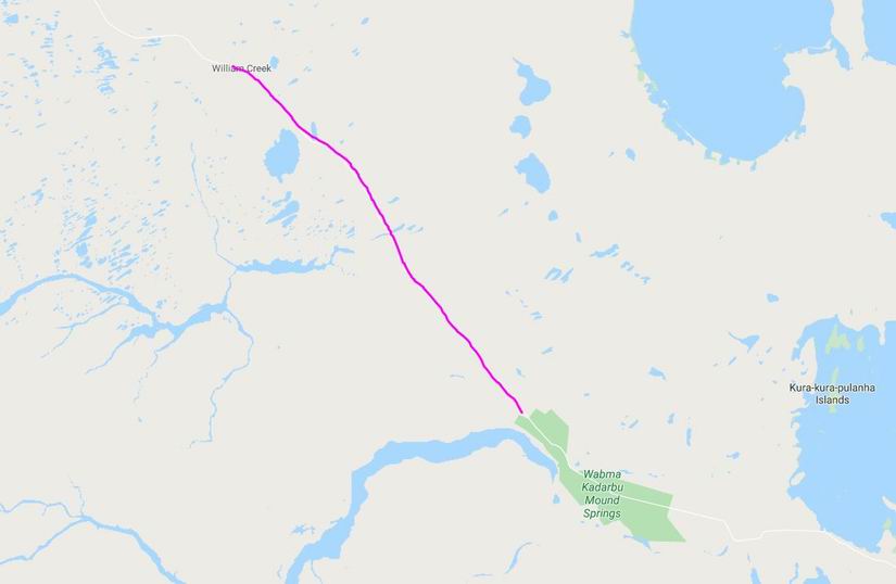
SUNDAY 20 MAY COWARD SPRINGS TO WILLIAM CREEK 80kms
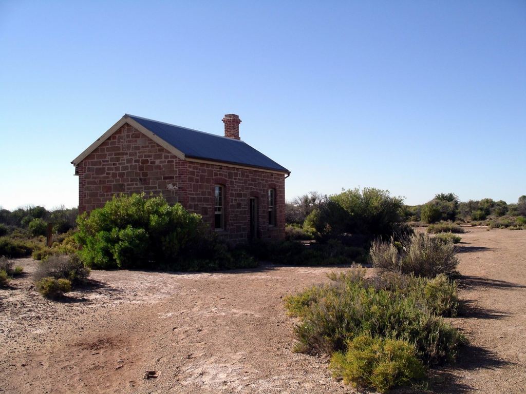
After breakfast, we walked around to view the developments since we were last here, eight years ago. The Engine Drivers’ Cottage was now fully restored and open as a museum, with some really interesting exhibits about the railway, and about this place.
The Engine Driver’s Cottage
The Station Master’s House was the other restored building, and where the owners lived, so it was off limits for viewing, except from a little distance. They certainly have been doing a wonderful preservation job here.
We went for a wander around a section of the old rail route, where there were still some sleeper remains left. A lot of these had been utilized in the building of the camp facilities at Coward Springs; probably more had been utilized as firewood.
Some remnant sleepers on the rail bed
On our first trip this way, John acquired some red gum sleeper from the old route, near here. It had now been made into a pepper grinder that was in regular use at home. I like, when using it, to think about its history…….and feel privileged to have it.
And so onward. The old rail alignment crossed and recrossed the track a few times on this section.
The old Ghan rail bed – and surface water
There was some surface water in places today.
Warriners Creek
Warriners Creek was flowing shallowly across the track. There was a depth measurement sign; it was hard to beleive that water could get to 2 metres deep in this country………However, there was plenty of water under the old bridge there. Clearly, there had been a heap of rain up this way, not too long ago.
Old railway bridge at Warriners Creek
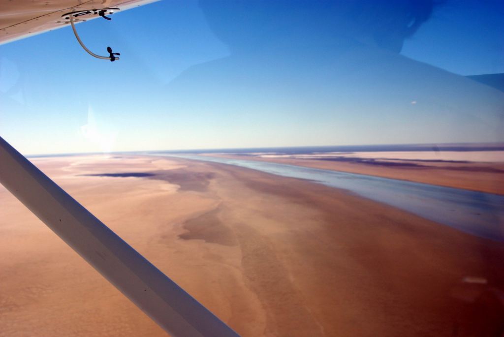
Today’s stage was short, because we wanted to stay at William Creek, so some of us could take a sight seeing flight over Lake Eyre, where we knew water was entering the north-east lake from the Warburton Groove; the flight would also go over the Painted Hills, an area not accessible to travellers in any other way.
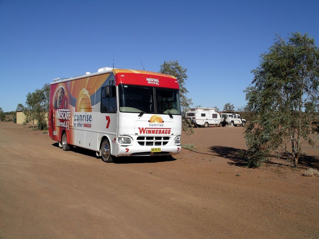
As we drove into William Creek, an unexpected sight was the Channel 7 (TV) Sunrise Bus. It had come to the hamlet to cover the start of the Great Australian Cattle Drive. This was the first that we had become aware that this was happening – and thus there would be a lot of extra people around.
The first of these Cattle Drives – to commemorate the feats of the old time drovers – was held in 2002, the brainchild of boss drover Eric Oldfield, and used the Birdsville Track. Tourists could join the droving expedition for a few days at a time – for a fee. It was so successful that it was repeated in 2005. This third one had moved away from the Birdsville Track, and would drove the cattle from William Creek to Oodnadatta.
By sheer fluke, not knowing about the imminent event, with its associated crowds, we had managed to get in here just before the start – lucky. A few days later and we would have been mixing it with the drove up along the track!
William Creek, with a usual population I could count on my fingers, was SA’s smallest town, surrounded by Australia’s largest cattle station – Anna Creek. Today, this tiny place of one hotel was humming!
We booked into the very new Dingo’s Caravan Park – $20 for our powered site. We thought this place would be removed from the rowdiness of the camping area right by the pub. It looked to have a lot of promise, with a lovely new amenities block. There were no formally marked out sites, only power poles to mark places, so as we were the only occupants of the place, we pulled in each side of one such pole.
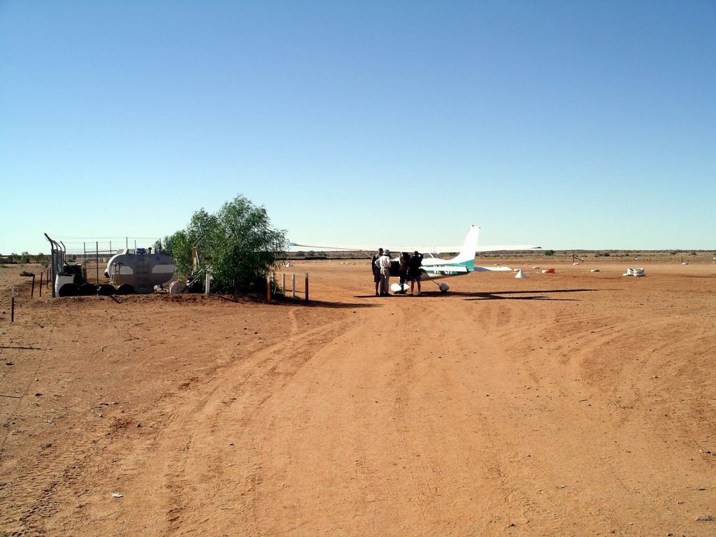
After a very quick basic set up, we walked over to the airstrip.
Wrights Air was the operation offering sightseeing flights from here. A wee bit of negotiating saw M and John offered what we thought was a good deal on flights – $150 for an hour, usual price $180. After they had booked, their flights were upgraded to two hours – for an extra $30 – in order to fill up planes.
All three planes based here went out for the afternoon flight. M and John were put onto different planes. They were very little planes……
Organising to go flying…….
They both got to see Lake Eyre and the Painted Hills (on Anna Creek Station and not open to the public), from the air, but John’s flight went even further – up to the Warburton Groove, in the NE corner of Lake Eyre. He was away for nearly three hours! So, it was a really good deal – and John was given a CD that covered the flight area, too.
William Creek from the air. Caravan Park central, hotel in trees just beyond it
John took along “my” still unfamiliar DSLR Pentax camera to take photos from the plane. Unfortunately, he somehow managed to get the focus all wrong. Results were very blurry.
Water filling into Lake EyreA cattle watering point, with cattle tracksThe Warburton Groove, bringing water to Lake EyreThe Painted Hills and creek channel – reminiscent of aboriginal art depiction.
For several reasons, I do not enjoy being shut up in a small motorized box that leaves the apparent security of terra firma. In other words, I do not usually “do” small plane flights. So, after I’d watched the planes disappear into the distance, I wandered around to the institution that was the William Creek Hotel. This was one of those establishments featuring memorabilia from previous visitors – all over the walls and ceiling. I bought myself a polo shirt – a somewhat cheaper “treat” than the others were having.
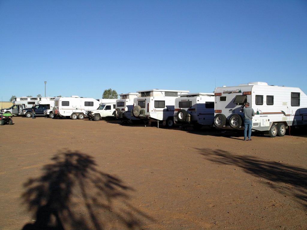
I received a big surprise when I walked back to the camp ground. Our formerly isolated van and Troopy were surrounded – by Trakmaster caravans! Ten of them had somehow managed to sneak into Dodge whilst I was otherwise occupied. It was like we had suddenly been cloned! It was the annual Trakmaster Trek – across the desert to Marble Bar in WA.
Ummm…….mine is in there somewhere!
The fliers arrived back, one at a time, both equally taken aback by the way our van had multiplied in their absence. Both were really exuberant after their flights, and there was much comparing of the experiences. I think M was rather envious of John’s extended flight.
We found out that, when you have eleven Trakmasters all in a row, and very little lighting in the camp ground, it ain’t easy to find “home” in the dark!
Today, we meandered up the first part of the Oodnadatta Track, otherwise known as the Old Ghan Track.
This route followed, broadly, that of some of the early explorers through this way, and was dictated by the availability of water in a series of naturally occurring springs. Because of available water, the Overland Telegraph line to Darwin and thence the rest of the world, was built along this route, in 1872.
Not long after, work began on a railway that was intended to link Adelaide with parts north, and eventually Darwin. Because the steam engines of the time needed supplies of water for their boilers, the railway route followed that of the Telegraph. Railway building began from Port Augusta in 1878, reached Marree in 1884, Oodnadatta in 1891.
From Oodnadatta, northbound passengers had to travel by camel to Alice Springs, until that section of the railway was finished in 1929. It is hard to find much in the way of description about what that was like, but a person must have been really motivated to get to Alice Springs, to undertake that camel ride section!
Railway sidings and fettlers’ accommodation were built at the watering points along the railway. Eventually, water towers were constructed at some sidings, to de-mineralize the bore water.
The railway was prone to floods and track wash aways and hence considerable delays at times. Ghan rail travel could be an unpredictable adventure, with extended periods of passenger strandings not uncommon.
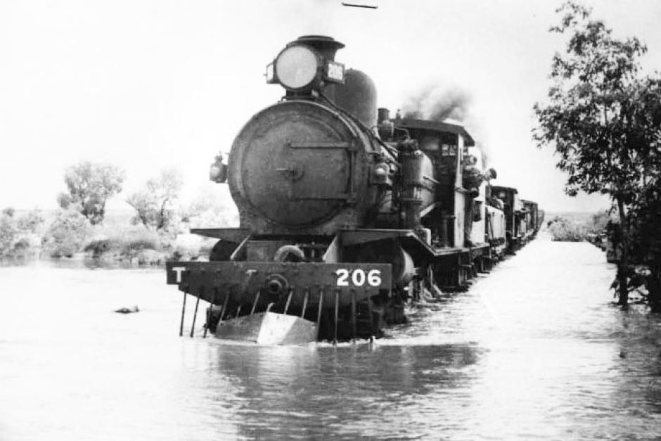
Ghan train in flooded creek (ABC Site)
Because of the importance of camel transport in the region, and the railway’s early associations with same, the railway became known as The Ghan, for the pioneering Afghan cameleers of the inland.
With the coming of diesel powered railway engines, the days of the Old Ghan route were numbered. A road, of sorts, had been constructed from Port Augusta to Darwin during WW2, following higher ground well to the west of the train route. That was to become the Stuart Highway. In 1980, a new rail line was opened that roughly paralleled the highway, and avoided the flood prone sections of the old railway. The Old Ghan line and its associated infrastructure, fell into disrepair; the townships that had serviced the railway, shrank to either ghost towns or small, mostly indigenous, settlements.
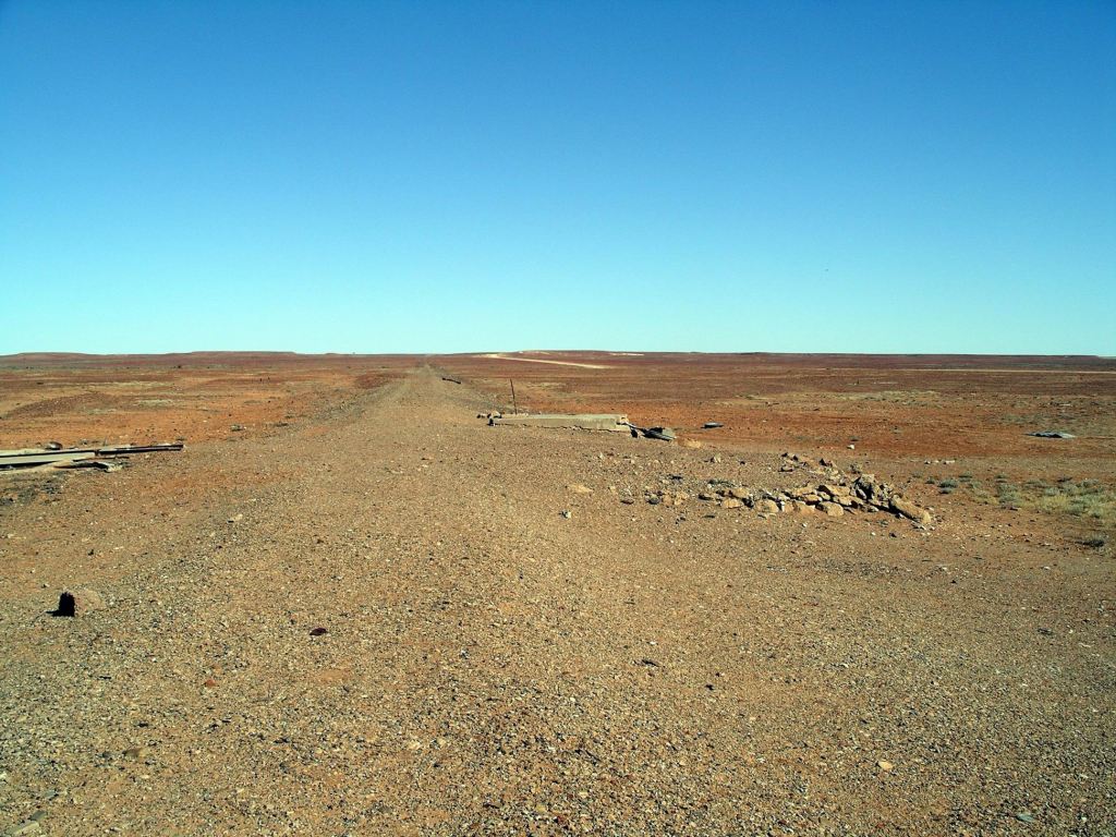
The modern track that follows the route of the Old Ghan Railway is, mostly, a good gravel road.
There tend to be the ruins of a former rail siding every 20kms or so. We stopped at a number of these, wandered about, took photos.
We did the same at some places where creeks (mostly dry) crossed the track – and where there were bridges left from the old railway.
In possession of one of the few trees…….wedge tailed eagle
Although the siding buildings were in various degrees of ruin, they were interesting. Life out here – particularly in the heat of summer – must have been so hard.
What was left of each siding’s buildings had been vandalized and grafittied – this had to have been done by travellers. What is it about some people, who can’t leave a piece of our heritage standing , be it natural or man made, without decorating same with their initials? We really don’t give a damn that Ignorant Joe was here, whenever! Given the good condition of this track, it was not really an achievement to boast about either, by tagging places. It was probably harder driving in suburban Melbourne!
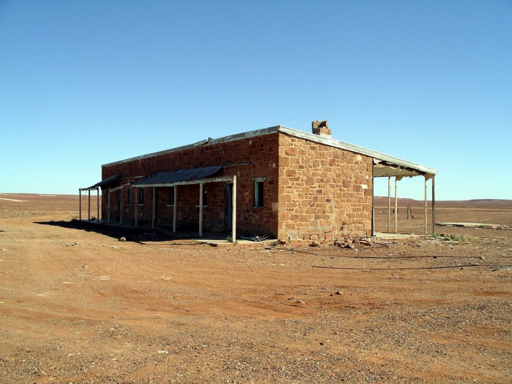
The first of the sidings we stopped at was Wangianna, about 35kms north of Marree. Here, the old fettlers’ accommodation was still in good enough repair for us to be able to see what it would have been like. It was a pity, though, that other structures associated with that siding , had gone.
So desolate…...….yet some trees survived
It was perfectly possible, wherever we stopped by some feature of the former railway, for us to see the railbed of the line. In most of the accessible parts of the line, the red gum sleepers had been removed, as had the rails.
Old rail alignment at Wangianna; our road in the distance
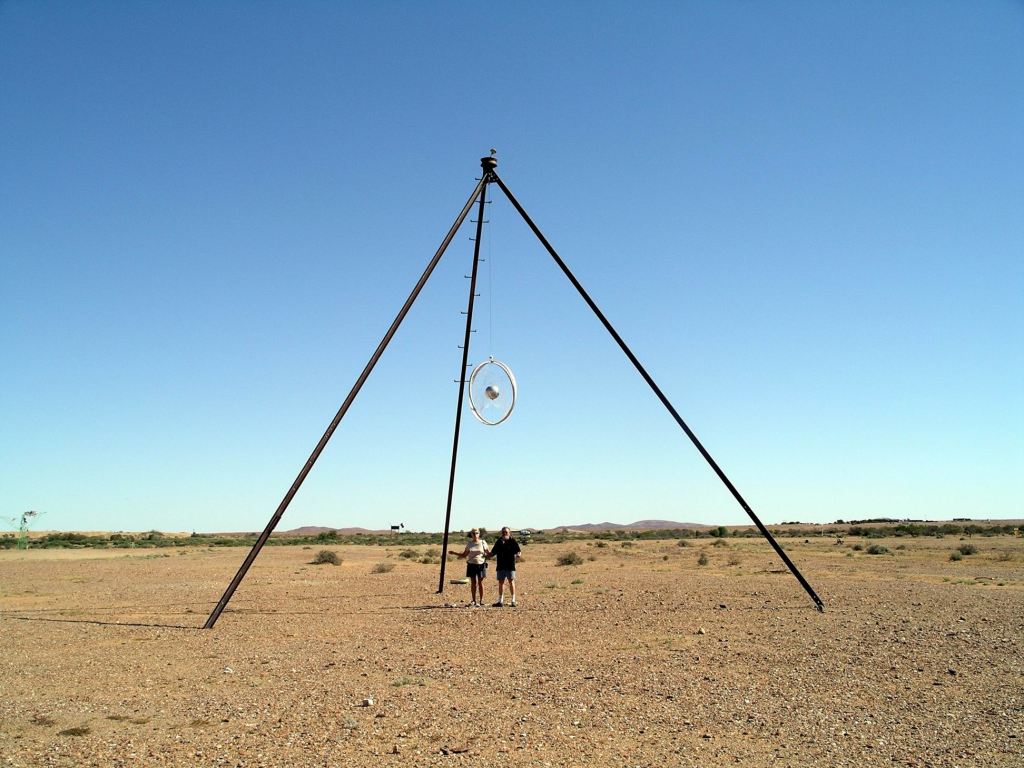
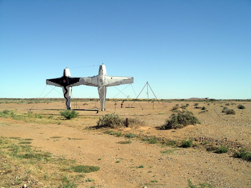
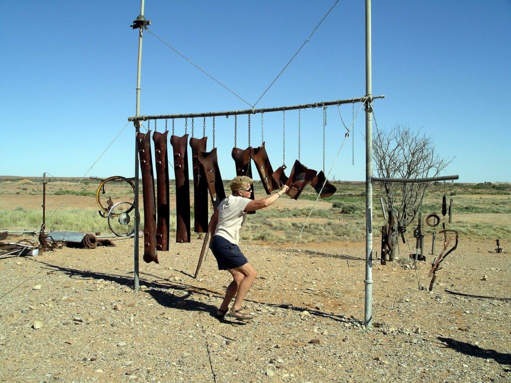
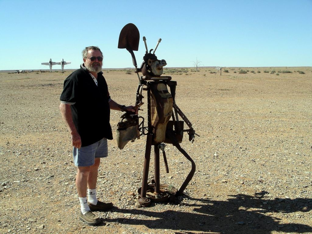
Another 16kms on brought us to one of the most unusual – and most recent – landmarks along the Old Ghan Track: “Plane Henge”, or the Mutonia Sculpture Park.
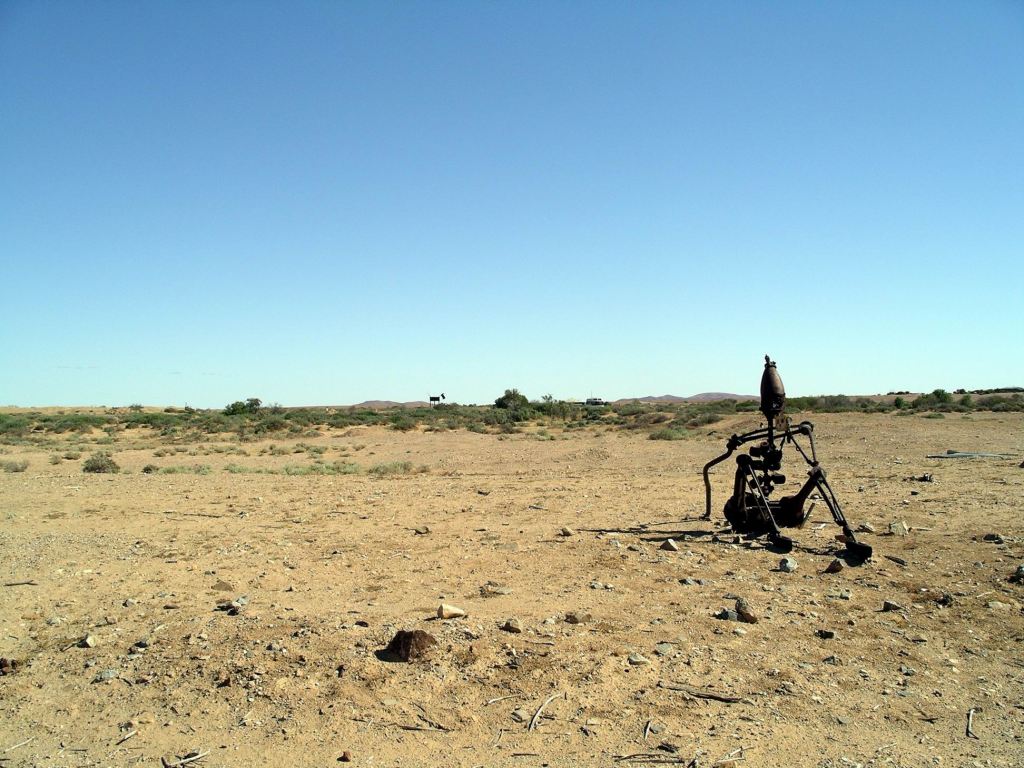
This was the work of a former mechanic, Robin Cooke, apparently inspired by “mad Max”. Here, all sorts of weird and wonderful installations have been created out of waste or unwanted materials.
Down on his luck…..
The most striking of these installations, especially so because of the flatness of the land and hence it being visible for a long way, was the pair of old planes, standing on their tails, wingtip to wingtip. This was the sort of sight that made one doubt their eyesight. As in, “I’ve gotta be seeing things!”
Also strikingly visible was a huge dog/dingo (visible in the background of the photos above).
Some of the pieces were interactive.
Making music – of a sort…..
We wandered about, marvelling at the creativity.
I guess, if one has a vision, the urge must be scratched…….
Further along, the old rail line – and hence our current road – passed right by the shore of Lake Eyre South, so we were able to view that from this point. Now we were travelling with the old rail bed to our right; it had been on the left since Marree, but crossed the road track here.
Lake Eyre South beside the Oodnadatta Track
Curdimurka Siding was the only one where much of the siding as it was, has remained intact. It is owned by the Ghan Preservation Society. A fund raising event, the Curdimurka Outback Ball, is held – somewhat informally – every two years, and reportedly attended by several thousand people.
Curdimurka – restored
Curdimurka was an evocative place to wander about. The flat plain stretched in all directions, almost totally devoid of vegetation.
The old water tower stood stark against the sky, with an associated water tank collapsed at its foot.
The rails of the siding were intact, as was the fettlers’ cottage. Here, despite the surrounding aridity, a pair of swallows had made their home under the veranda.
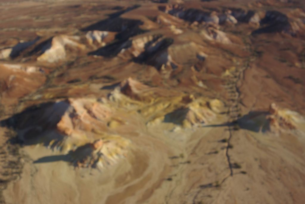
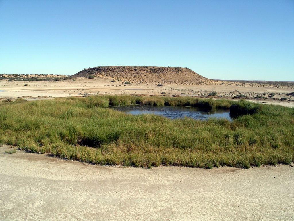
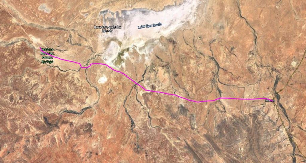
Another 15 or so kms and we were into the Wabna Kadarbu Conservation Park. I can’t say some of these names flow smoothly off the tongue! The point of this Park is to protect two mound springs – the Blanche Cup and the Bubbler.
Mounds springs occur where minerals in the naturally occurring springs have, over time, been precipitated out by evaporation to create a mound, with the spring in the centre of the “cup” thus created. Hamilton Hill, in the distance from the two currently active springs, is an extinct one, and shows the size the mounds can reach.
Hamilton Hill
These springs, like the Dalhousie Springs much further north, are fed by the Great Artesian Basin. In past times, before widespread tapping into this for water supplies, and the consequent reduction of its levels and pressure, there would have been a chain of such springs through this country.
We took the 5km side track into the springs, parked in the designated area and walked to look at the two features. Because of the permanent water provided by the springs here, the surrounding area was patchily vegetated and green – a real contrast to the surrounding country. The line of the short outflow channel from the springs was similarly marked by a line of green.
The Bubbler was aptly named. Through the totally clear water in the spring, we could see the bubbling effect in the sandy bottom, where the underground water was welling up. We’d seen a similar effect in the Bubbling Sands springs at Pungalina, a couple of years ago. There was a viewing platform so visitors could watch this, without trampling the greenery at the edge.
The Bubbler and Hamilton HillWater erupting in the Bubbler Spring
Blanche Cup was more deeply enclosed within its green nest, and did not have the same frequent bubbling happening.
Blanche Cup
After a good wander around here, it was onwards – only a few kms – to tonight’s destination of Coward Springs, which we reached in the early afternoon.
Coward Springs was another of the former sidings. It has been saved from the decaying fate of the other sidings along the rail route. In 1991 it was privately acquired. Then, there was an extensive wetland area here, arising from the uncontrolled outflow of a broken bore, and the ruins of only two of the original buildings – the Station Master’s house and the engine drivers’ cottage. The bore was rectified and capped, leaving only a regulated outflow to sustain a smaller wetland. The two buildings were restored and heritage listed. The campground was set up.
The campground is a wonderful oasis in the dry surrounds. Trees have been planted and bush style amenities built, including hot showers – sustained by a wood burning “donkey”. I suspected that it was the former wooden sleepers of the old railway that were providing me with the luxury of a hot shower!
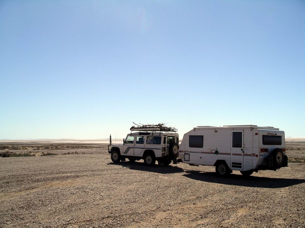
Our night at Coward Springs cost $16. There are no powered sites, of course. The camping is in informal areas, amongst stands of tamarisk trees and date palms. It was very pleasant – the sort of place I would have enjoyed just relaxing at, were it not for a Driver who was determined to get out of SA.
The campground had, obviously, been quite wet recently.
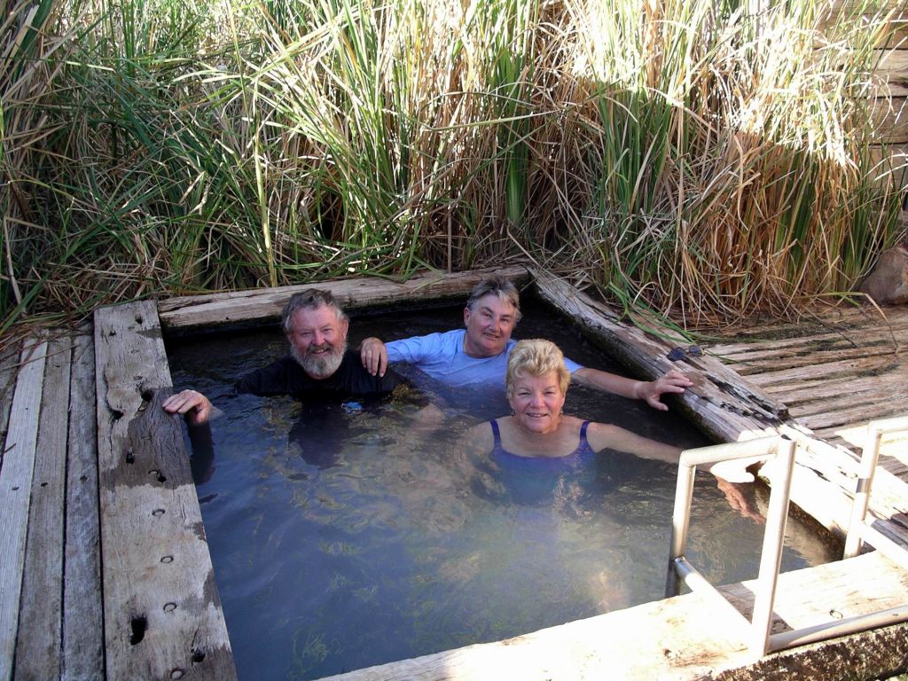
When the old bore was rectified, the owners here built a “spa” pool – the bore outflow runs through this pool and on out to the wetland.
After doing a minimal one night only set up, the three of us spent about half an hour in the warm artesian water of the pool. The water flow felt very strong and seemed very therapeutic. It felt damned cold when we got out, though!
We had a little wander about the campground. It was good that we had arrived early – had the pool to ourselves, and the campground got pretty full by the late afternoon. We’d had our pick of a number of great sites by being early.
We had a little campfire and sat by it, after tea, watching the new-ish moon and listening to the breeze rustling the trees by our site. Life felt pretty good!