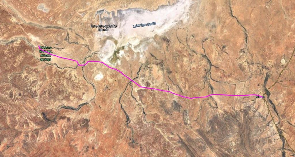
SATURDAY 19 MAY MARREE TO COWARD SPRINGS 140kms
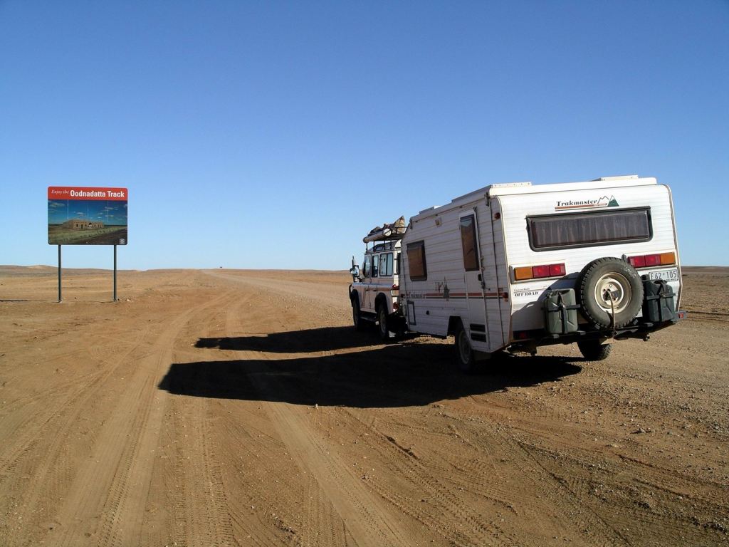
Today, we meandered up the first part of the Oodnadatta Track, otherwise known as the Old Ghan Track.
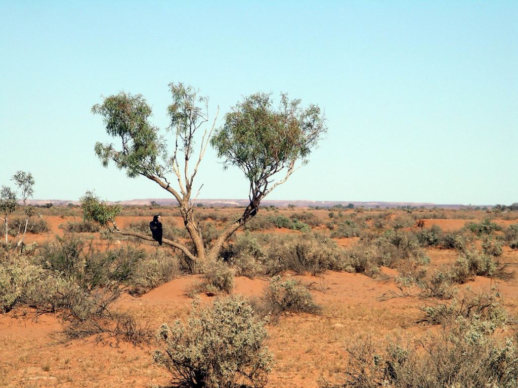
This route followed, broadly, that of some of the early explorers through this way, and was dictated by the availability of water in a series of naturally occurring springs. Because of available water, the Overland Telegraph line to Darwin and thence the rest of the world, was built along this route, in 1872.
Not long after, work began on a railway that was intended to link Adelaide with parts north, and eventually Darwin. Because the steam engines of the time needed supplies of water for their boilers, the railway route followed that of the Telegraph. Railway building began from Port Augusta in 1878, reached Marree in 1884, Oodnadatta in 1891.
From Oodnadatta, northbound passengers had to travel by camel to Alice Springs, until that section of the railway was finished in 1929. It is hard to find much in the way of description about what that was like, but a person must have been really motivated to get to Alice Springs, to undertake that camel ride section!
Railway sidings and fettlers’ accommodation were built at the watering points along the railway. Eventually, water towers were constructed at some sidings, to de-mineralize the bore water.
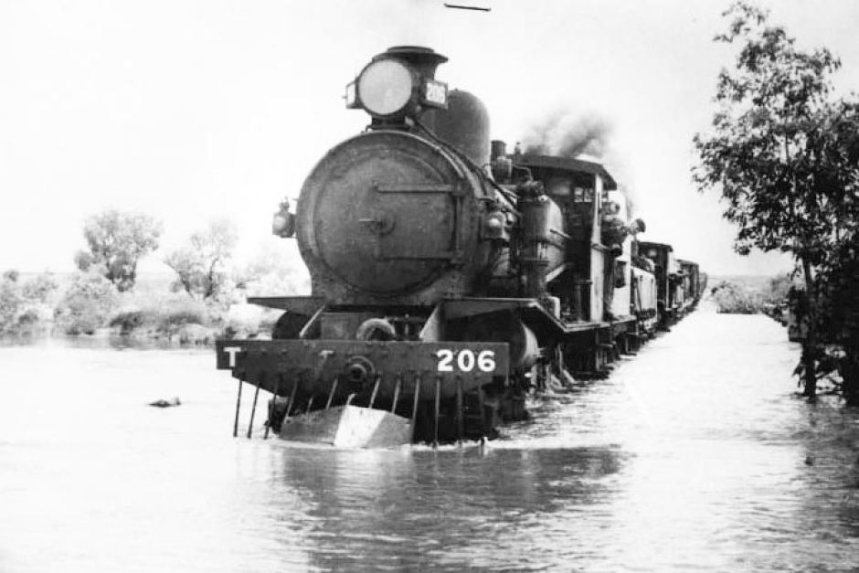
The railway was prone to floods and track wash aways and hence considerable delays at times. Ghan rail travel could be an unpredictable adventure, with extended periods of passenger strandings not uncommon.
Because of the importance of camel transport in the region, and the railway’s early associations with same, the railway became known as The Ghan, for the pioneering Afghan cameleers of the inland.
With the coming of diesel powered railway engines, the days of the Old Ghan route were numbered. A road, of sorts, had been constructed from Port Augusta to Darwin during WW2, following higher ground well to the west of the train route. That was to become the Stuart Highway. In 1980, a new rail line was opened that roughly paralleled the highway, and avoided the flood prone sections of the old railway. The Old Ghan line and its associated infrastructure, fell into disrepair; the townships that had serviced the railway, shrank to either ghost towns or small, mostly indigenous, settlements.
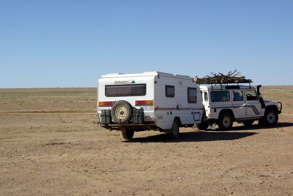
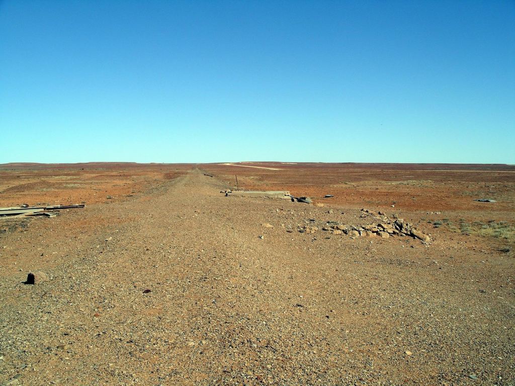
The modern track that follows the route of the Old Ghan Railway is, mostly, a good gravel road.
There tend to be the ruins of a former rail siding every 20kms or so. We stopped at a number of these, wandered about, took photos.
We did the same at some places where creeks (mostly dry) crossed the track – and where there were bridges left from the old railway.
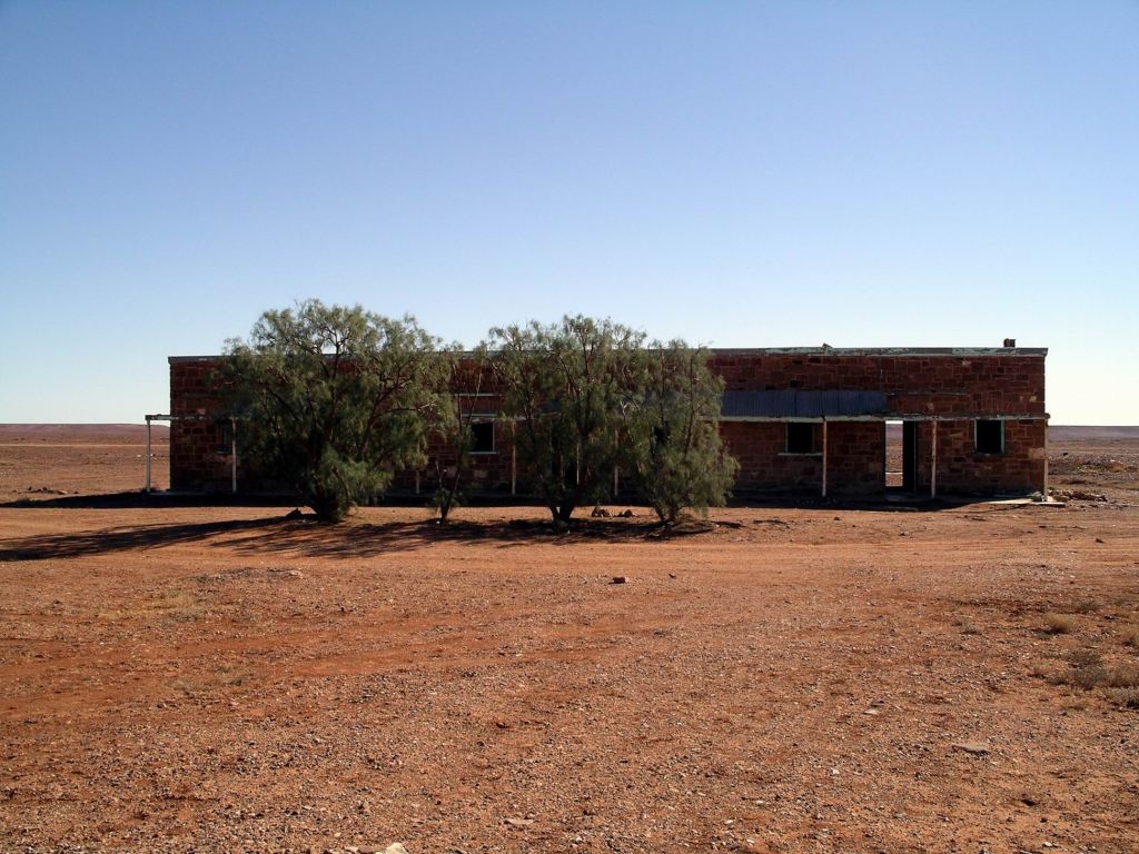
Although the siding buildings were in various degrees of ruin, they were interesting. Life out here – particularly in the heat of summer – must have been so hard.
What was left of each siding’s buildings had been vandalized and grafittied – this had to have been done by travellers. What is it about some people, who can’t leave a piece of our heritage standing , be it natural or man made, without decorating same with their initials? We really don’t give a damn that Ignorant Joe was here, whenever! Given the good condition of this track, it was not really an achievement to boast about either, by tagging places. It was probably harder driving in suburban Melbourne!
The first of the sidings we stopped at was Wangianna, about 35kms north of Marree. Here, the old fettlers’ accommodation was still in good enough repair for us to be able to see what it would have been like. It was a pity, though, that other structures associated with that siding , had gone.
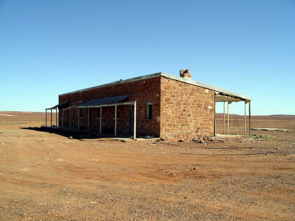
It was perfectly possible, wherever we stopped by some feature of the former railway, for us to see the railbed of the line. In most of the accessible parts of the line, the red gum sleepers had been removed, as had the rails.
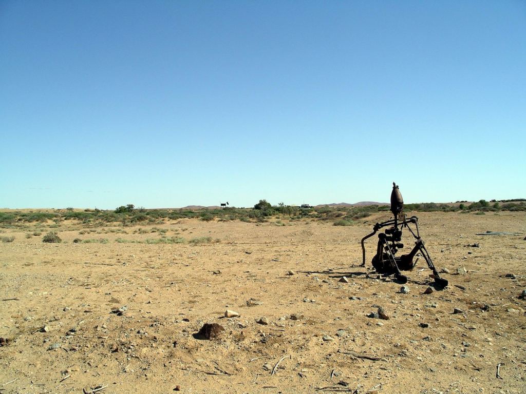
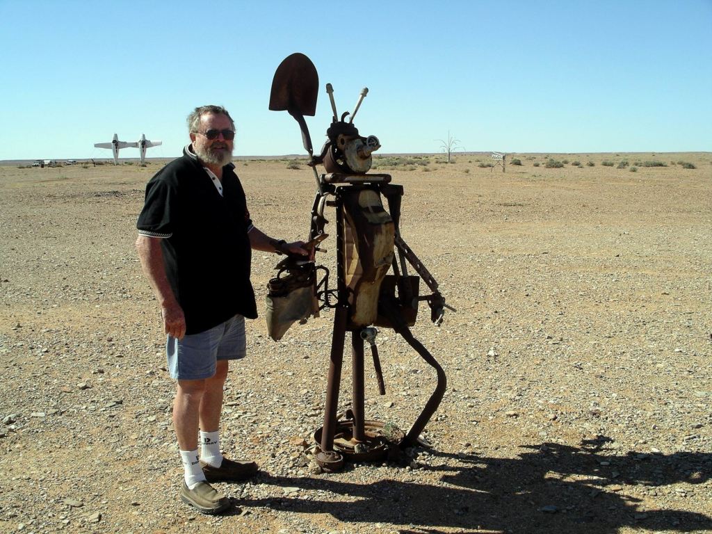
Another 16kms on brought us to one of the most unusual – and most recent – landmarks along the Old Ghan Track: “Plane Henge”, or the Mutonia Sculpture Park.
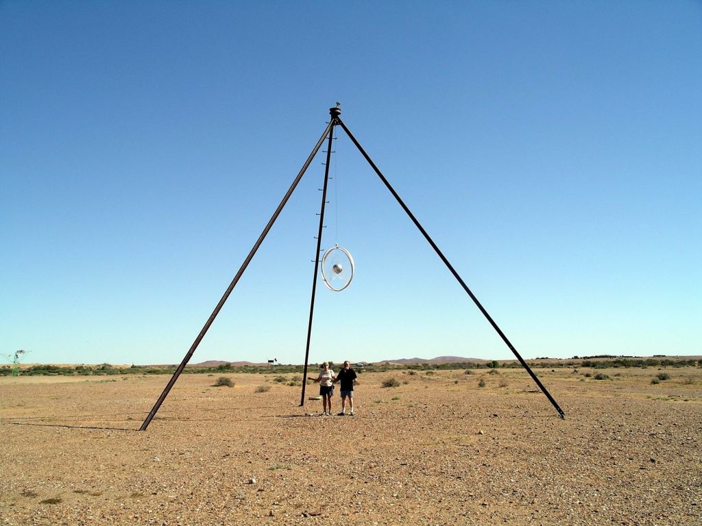
This was the work of a former mechanic, Robin Cooke, apparently inspired by “mad Max”. Here, all sorts of weird and wonderful installations have been created out of waste or unwanted materials.
The most striking of these installations, especially so because of the flatness of the land and hence it being visible for a long way, was the pair of old planes, standing on their tails, wingtip to wingtip. This was the sort of sight that made one doubt their eyesight. As in, “I’ve gotta be seeing things!”
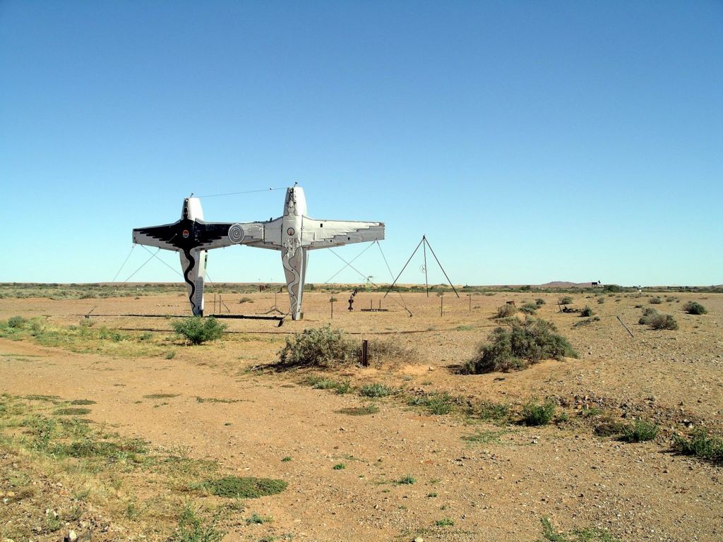
Also strikingly visible was a huge dog/dingo (visible in the background of the photos above).
Some of the pieces were interactive.
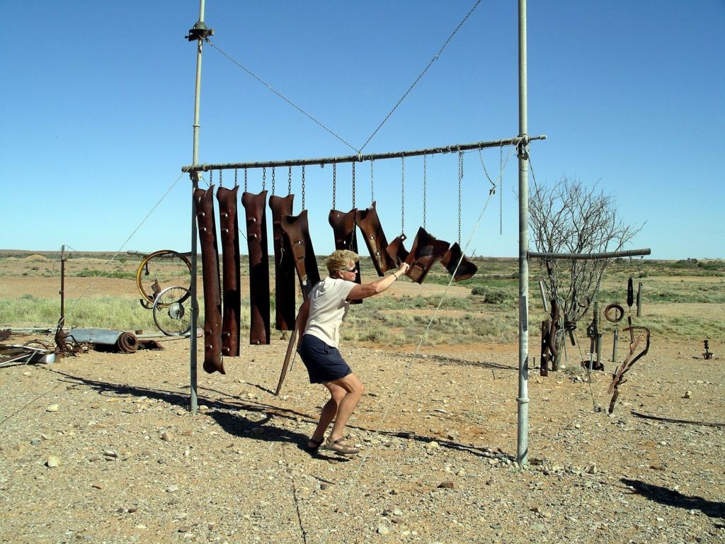
We wandered about, marvelling at the creativity.
I guess, if one has a vision, the urge must be scratched…….
Further along, the old rail line – and hence our current road – passed right by the shore of Lake Eyre South, so we were able to view that from this point. Now we were travelling with the old rail bed to our right; it had been on the left since Marree, but crossed the road track here.
Curdimurka Siding was the only one where much of the siding as it was, has remained intact. It is owned by the Ghan Preservation Society. A fund raising event, the Curdimurka Outback Ball, is held – somewhat informally – every two years, and reportedly attended by several thousand people.

Curdimurka was an evocative place to wander about. The flat plain stretched in all directions, almost totally devoid of vegetation.

The old water tower stood stark against the sky, with an associated water tank collapsed at its foot.

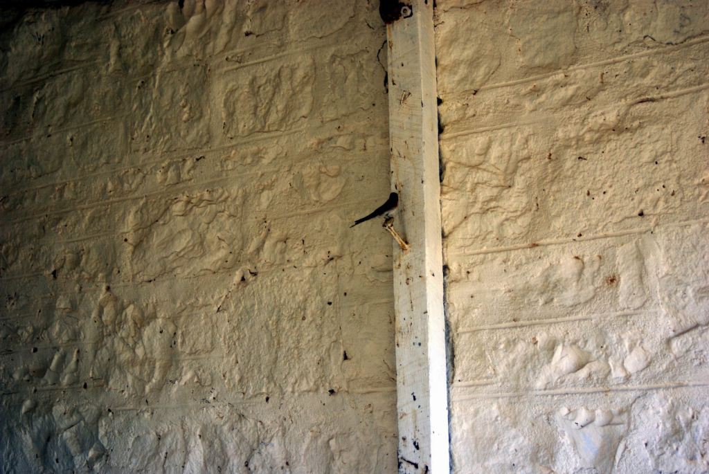
The rails of the siding were intact, as was the fettlers’ cottage. Here, despite the surrounding aridity, a pair of swallows had made their home under the veranda.
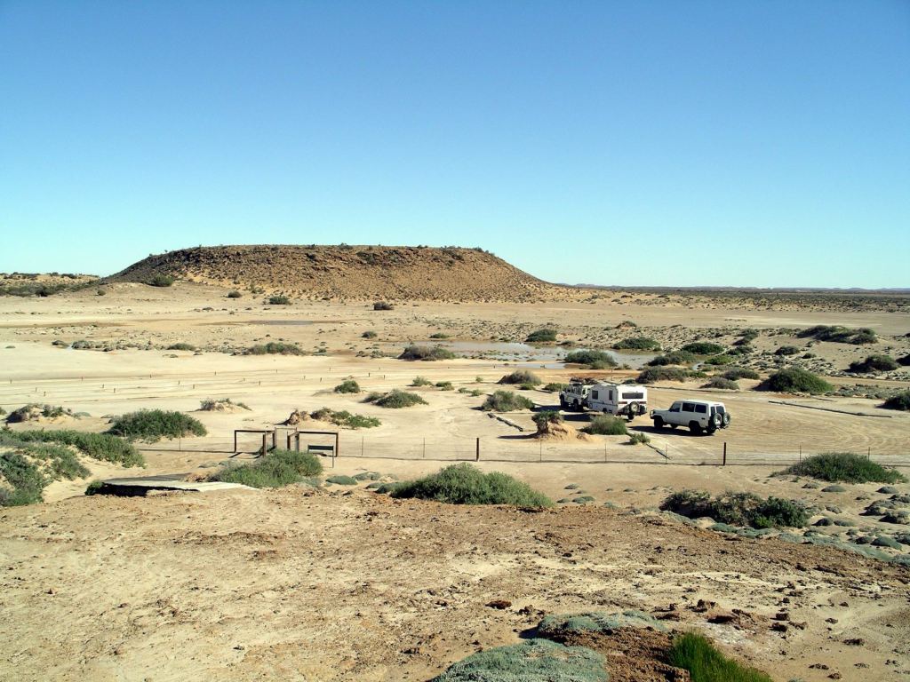
Another 15 or so kms and we were into the Wabna Kadarbu Conservation Park. I can’t say some of these names flow smoothly off the tongue! The point of this Park is to protect two mound springs – the Blanche Cup and the Bubbler.
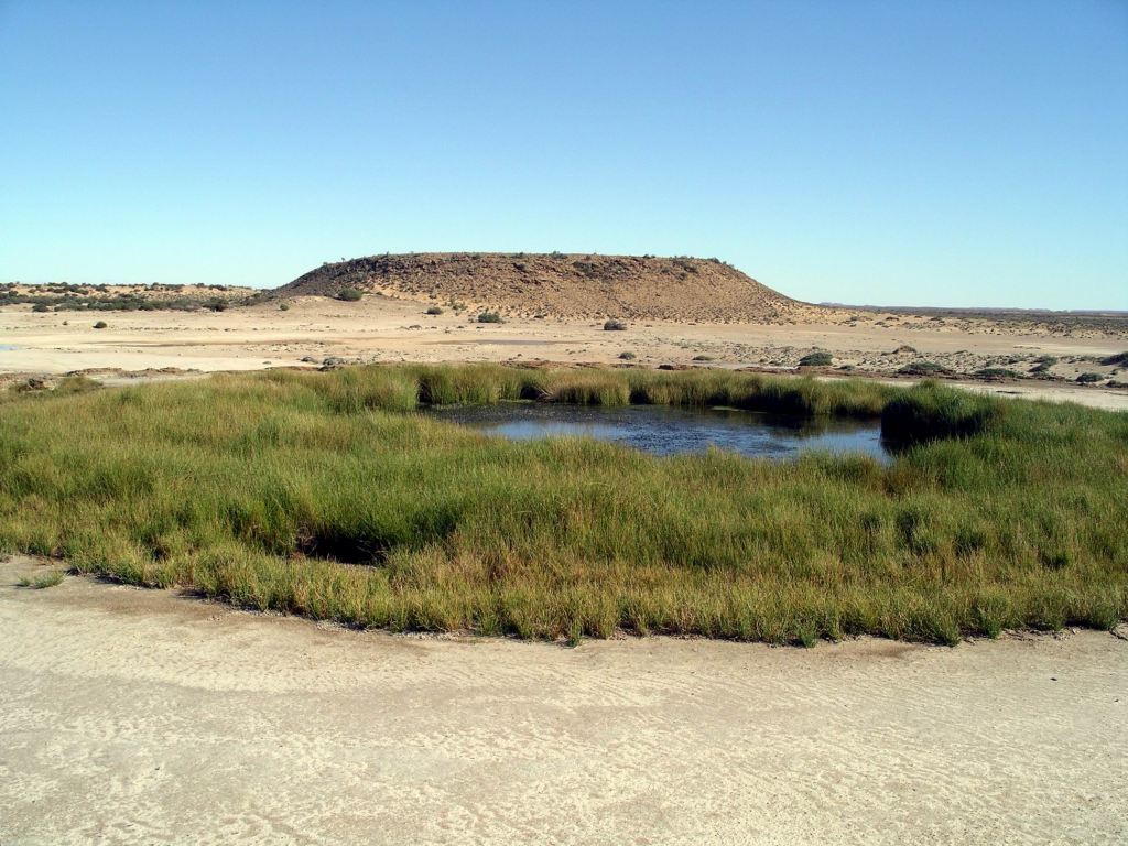
Mounds springs occur where minerals in the naturally occurring springs have, over time, been precipitated out by evaporation to create a mound, with the spring in the centre of the “cup” thus created. Hamilton Hill, in the distance from the two currently active springs, is an extinct one, and shows the size the mounds can reach.
These springs, like the Dalhousie Springs much further north, are fed by the Great Artesian Basin. In past times, before widespread tapping into this for water supplies, and the consequent reduction of its levels and pressure, there would have been a chain of such springs through this country.
We took the 5km side track into the springs, parked in the designated area and walked to look at the two features. Because of the permanent water provided by the springs here, the surrounding area was patchily vegetated and green – a real contrast to the surrounding country. The line of the short outflow channel from the springs was similarly marked by a line of green.
The Bubbler was aptly named. Through the totally clear water in the spring, we could see the bubbling effect in the sandy bottom, where the underground water was welling up. We’d seen a similar effect in the Bubbling Sands springs at Pungalina, a couple of years ago. There was a viewing platform so visitors could watch this, without trampling the greenery at the edge.
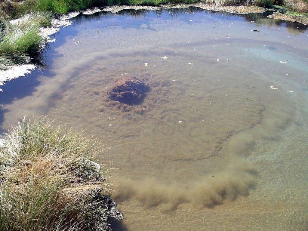
Blanche Cup was more deeply enclosed within its green nest, and did not have the same frequent bubbling happening.
After a good wander around here, it was onwards – only a few kms – to tonight’s destination of Coward Springs, which we reached in the early afternoon.
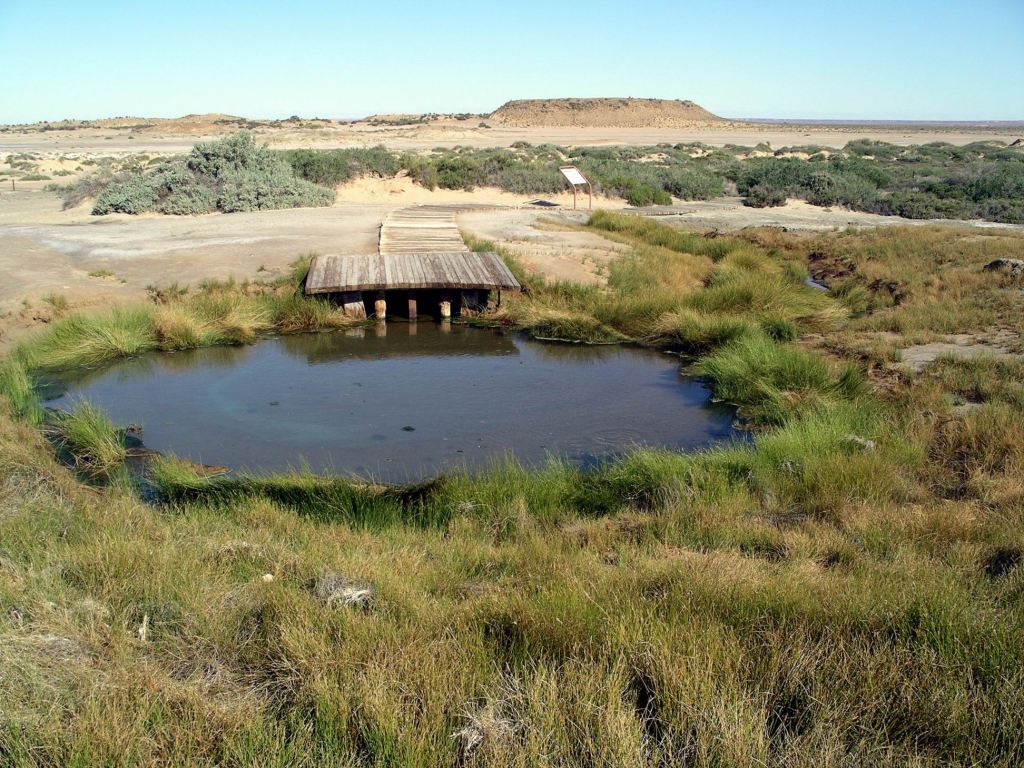
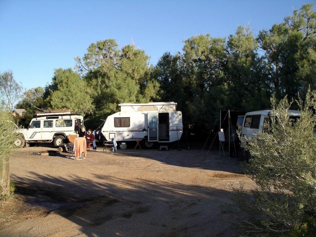
Coward Springs was another of the former sidings. It has been saved from the decaying fate of the other sidings along the rail route. In 1991 it was privately acquired. Then, there was an extensive wetland area here, arising from the uncontrolled outflow of a broken bore, and the ruins of only two of the original buildings – the Station Master’s house and the engine drivers’ cottage. The bore was rectified and capped, leaving only a regulated outflow to sustain a smaller wetland. The two buildings were restored and heritage listed. The campground was set up.
The campground is a wonderful oasis in the dry surrounds. Trees have been planted and bush style amenities built, including hot showers – sustained by a wood burning “donkey”. I suspected that it was the former wooden sleepers of the old railway that were providing me with the luxury of a hot shower!
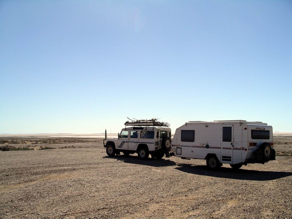
Our night at Coward Springs cost $16. There are no powered sites, of course. The camping is in informal areas, amongst stands of tamarisk trees and date palms. It was very pleasant – the sort of place I would have enjoyed just relaxing at, were it not for a Driver who was determined to get out of SA.
The campground had, obviously, been quite wet recently.
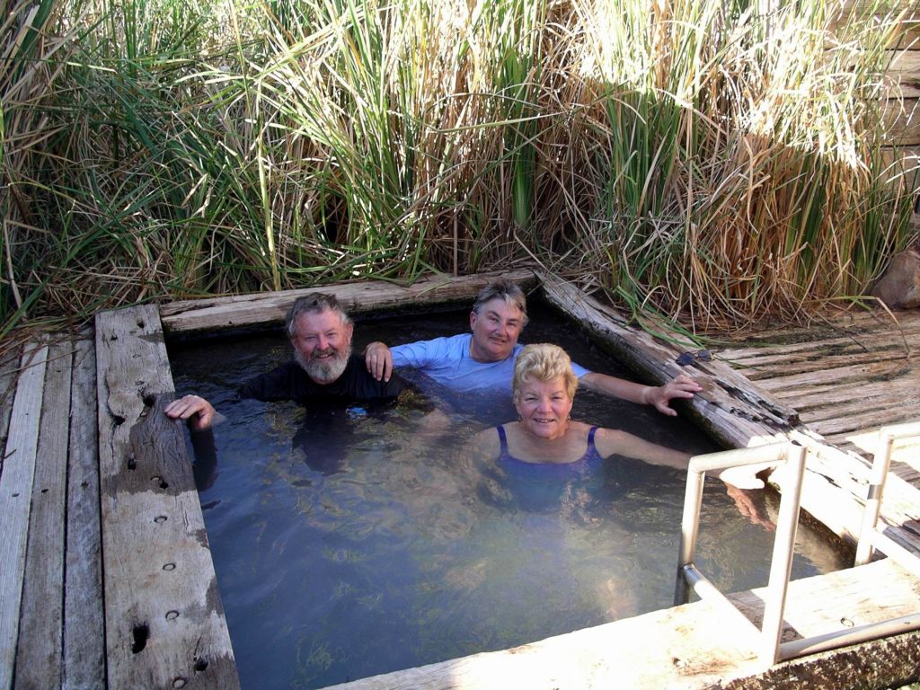
When the old bore was rectified, the owners here built a “spa” pool – the bore outflow runs through this pool and on out to the wetland.
After doing a minimal one night only set up, the three of us spent about half an hour in the warm artesian water of the pool. The water flow felt very strong and seemed very therapeutic. It felt damned cold when we got out, though!
We had a little wander about the campground. It was good that we had arrived early – had the pool to ourselves, and the campground got pretty full by the late afternoon. We’d had our pick of a number of great sites by being early.
We had a little campfire and sat by it, after tea, watching the new-ish moon and listening to the breeze rustling the trees by our site. Life felt pretty good!