SUNDAY 8 JULY KURRAJONG AND PICCANINNY GORGE CAMPS
I had an excellent night’s sleep. Was able to wrap myself in all the bedding, so wasn’t even too cold.
Got up at 7.30am, feeling surprisingly good. No ill effects from yesterday’s exertions. Even the heel/Achilles was only a mild niggle.
I had a relax day at camp – reading, writing, tidying up. Spent ages cleaning out between the expandable links of my watch band, with a knife point. It hadn’t fared well when I slid down a sand bank yesterday, but hadn’t been cleaned for a very long time before that.
I did some washing, by hand, in the wash up container, and pegged it out on the guy ropes. Burnt the burnable rubbish in our fire pit. That would be a bit less to take back out with us, as was required – no rubbish collections or disposal facilities here.
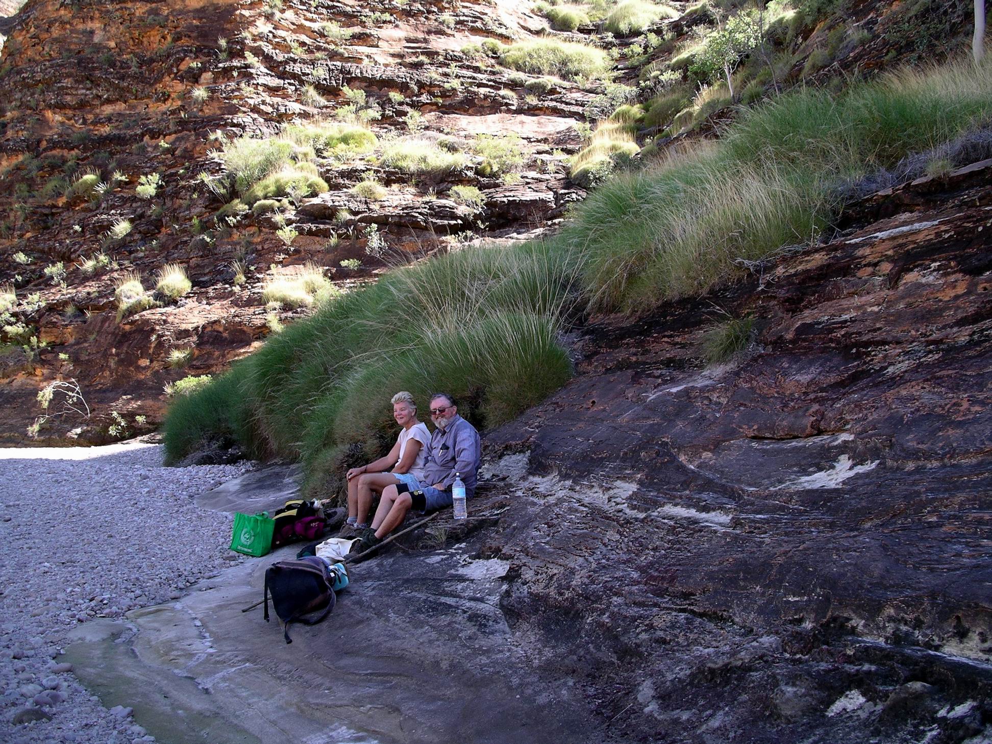
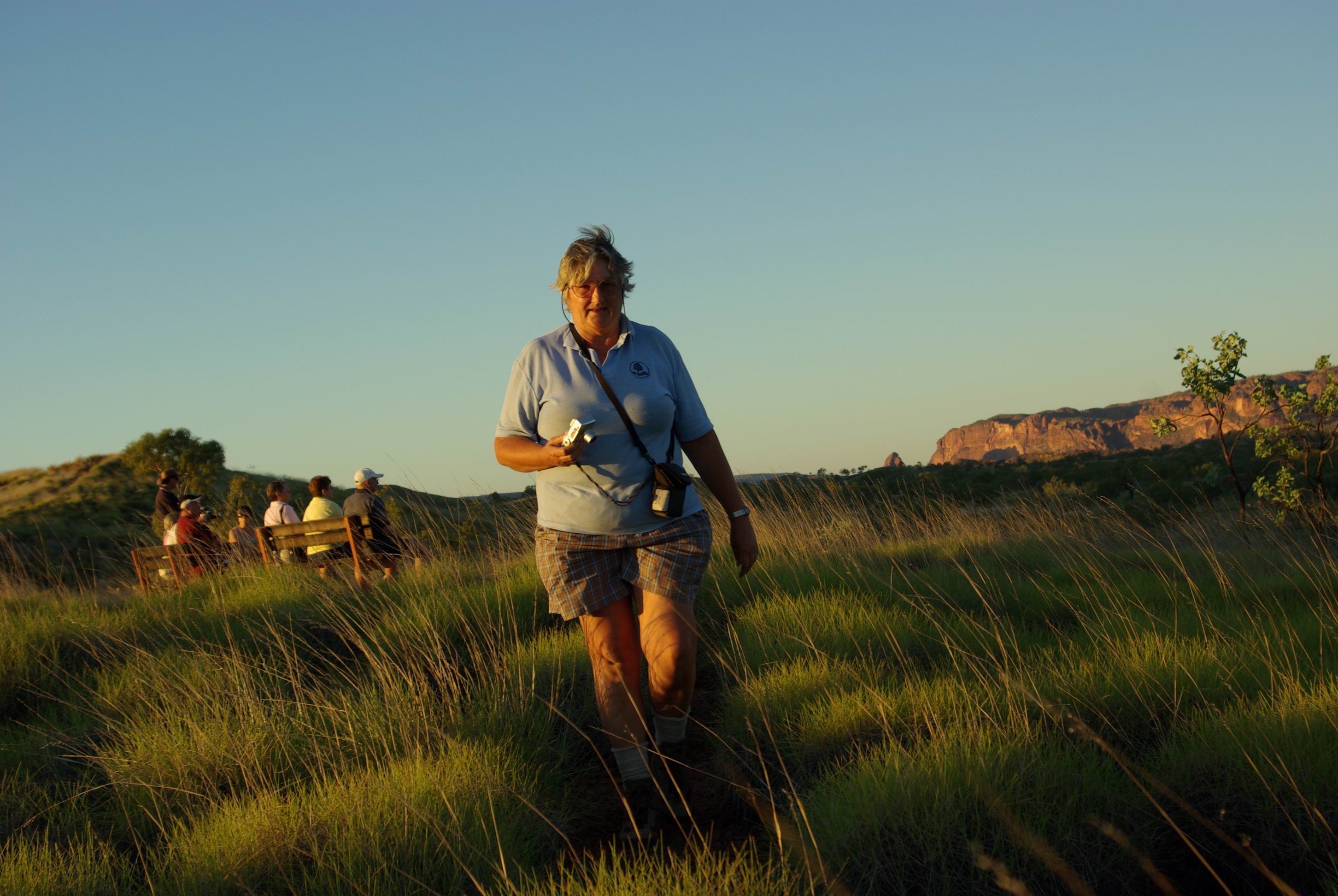
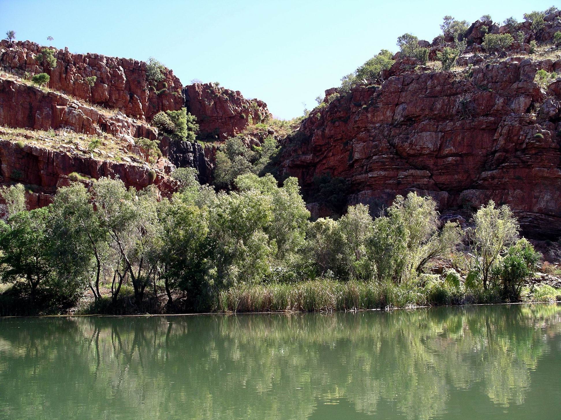
Kurrajong Camp camp
Last night, there was a Defender with a type of built on camper, nearby. This morning I talked for a short time with them, about the vehicle and their experiences with it.
During the morning, all the other campers in the generator area departed – left me feeling lonely, briefly. Two nights here seemed, from my observation, to be the norm – with one big rush around to see the main highlights in a short time. I considered our leisurely way much more enjoyable.
Unusual shaped ant nest – hope it does not presage more rain!
Later in the day, several groups of campers came into the area so I was no longer alone. I thought there was a school group in the bus group area – it sounded like a whole lot of excited teenagers.
The sounds of sightseeing planes, and helicopters was regular – but far enough away not to be intrusive.
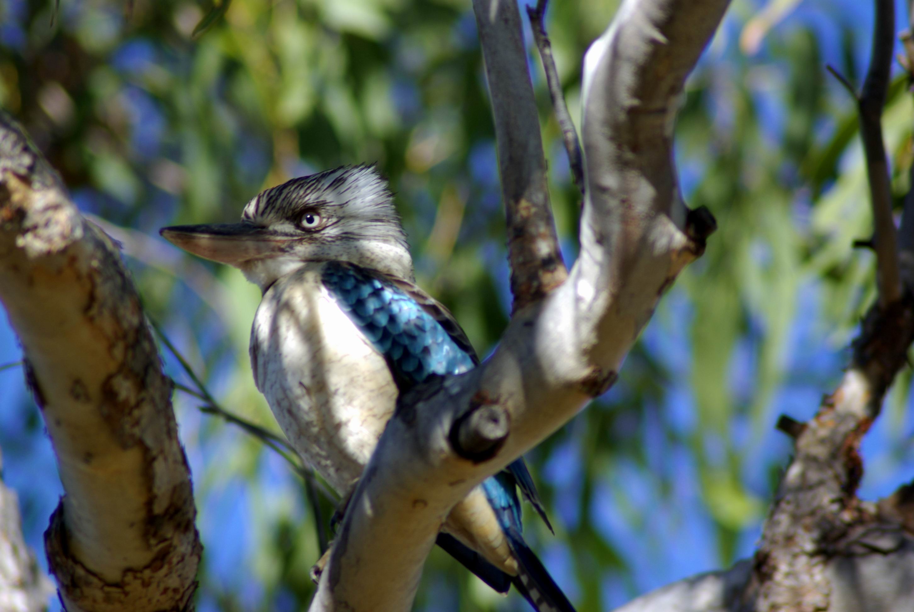
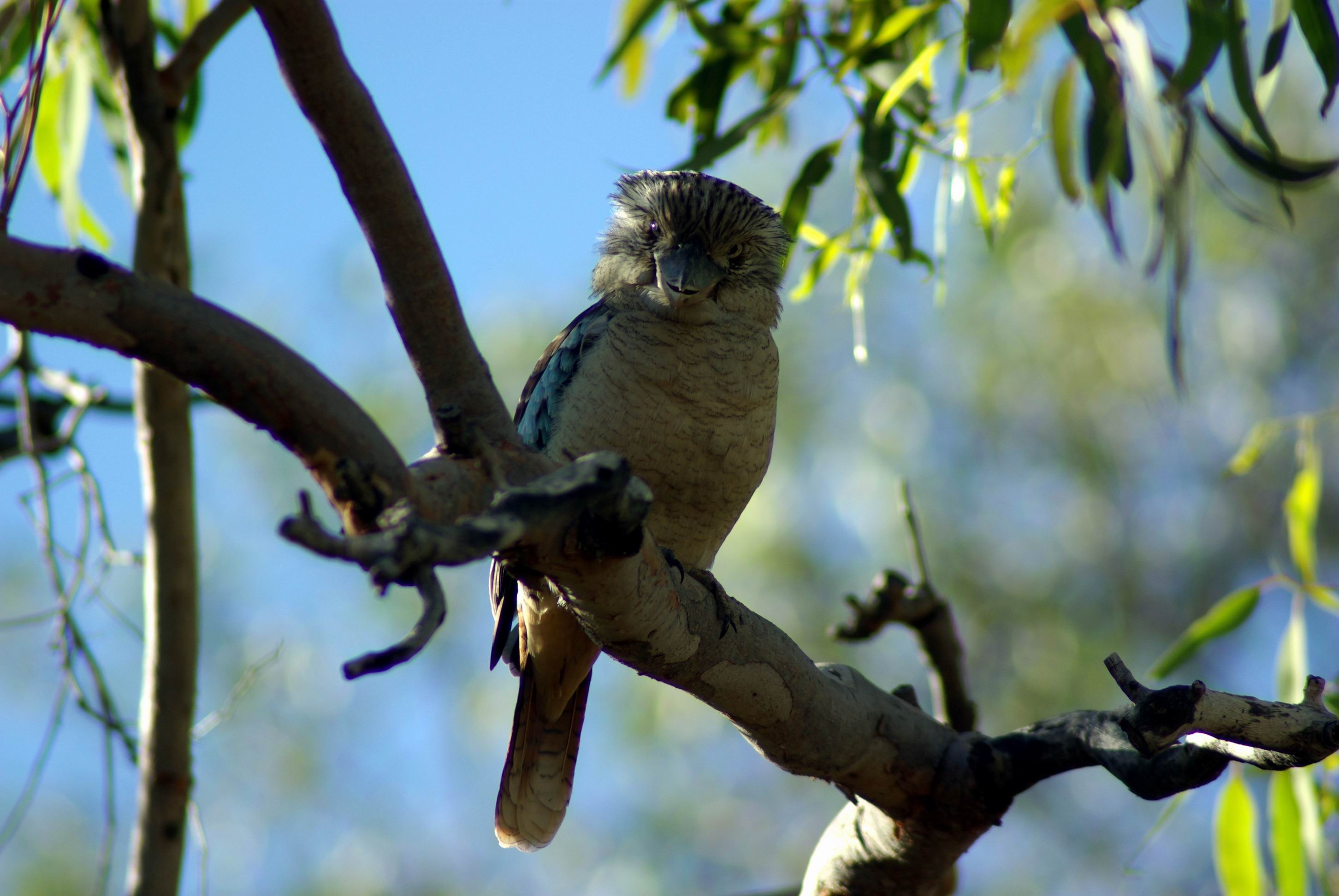
Blue winged kookaburra by our camp
I had another light tea and early night.
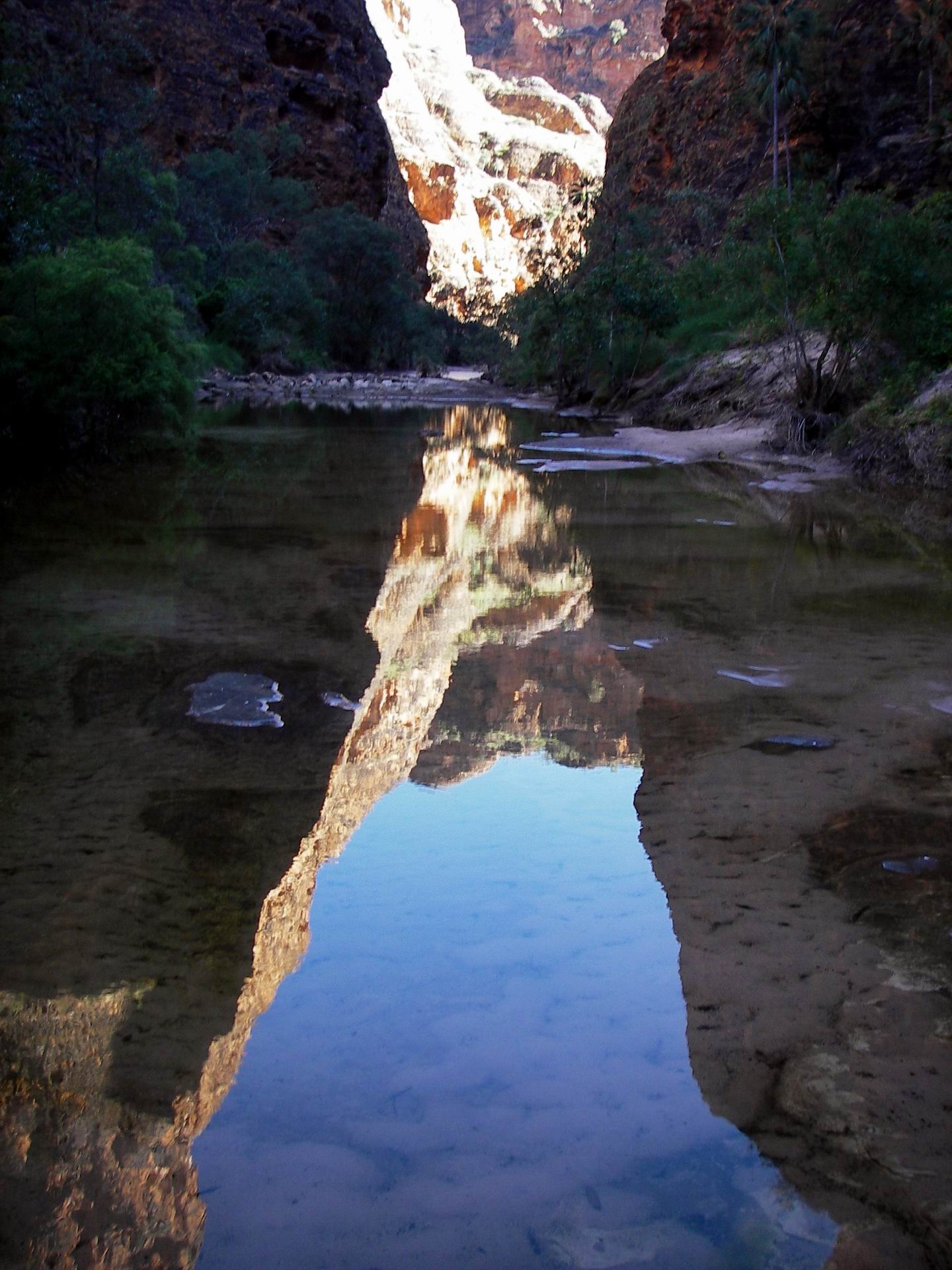
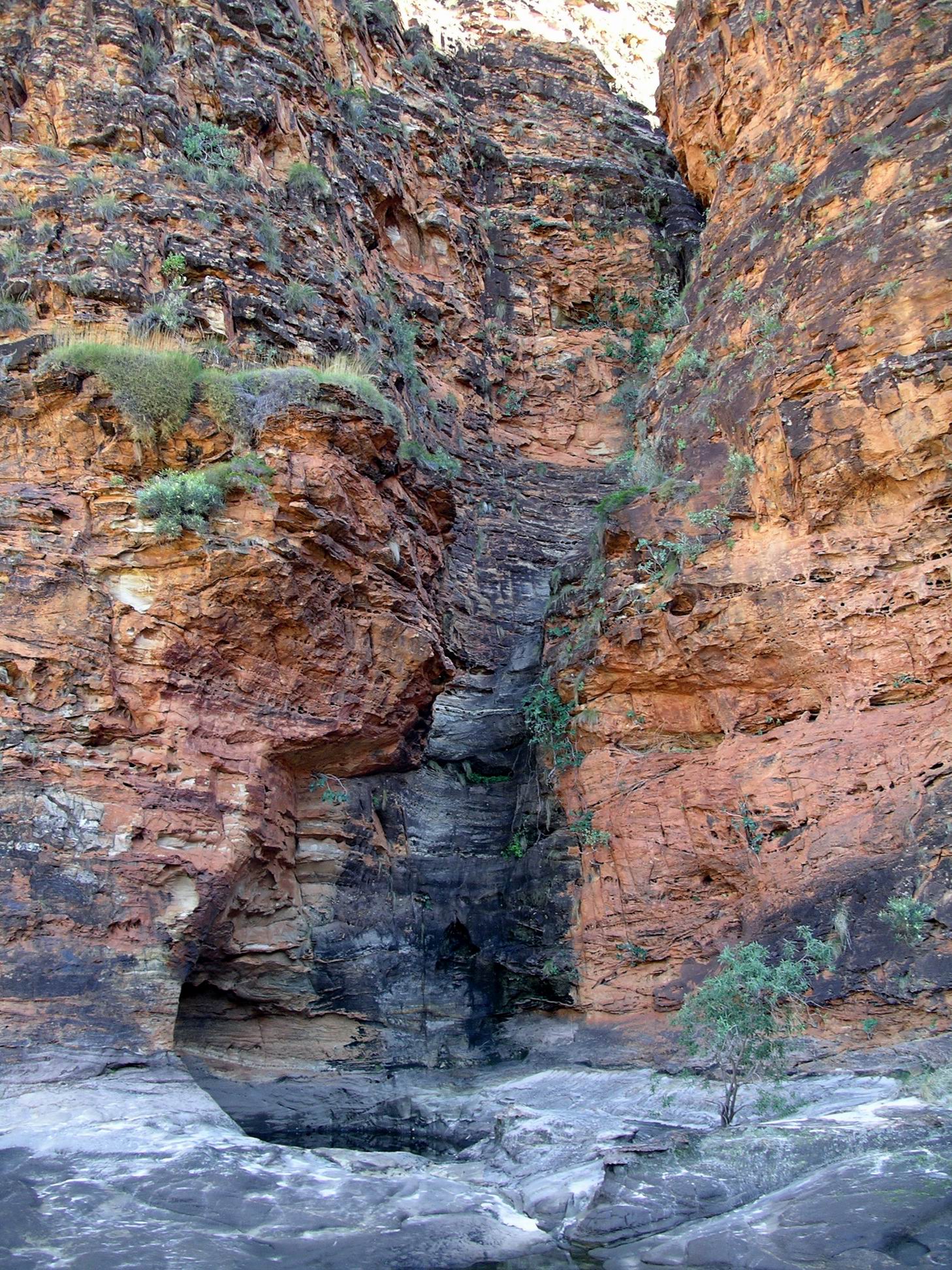
Found out later that the other two had spent the day exploring further up the narrow Piccaninny Gorge, and its side gorges, from their base camp. They went as far as they could go, to the point where serious rock climbing would be needed.
The hikers’ camp up in Piccaninny GorgeEarly morning views up the GorgeWet feet coming up…..No easy way to go…..Just chillin’….
Then they just sat round their camp enjoying the solitude, and wondering if the place was haunted! Last night, they had been really startled by quite eerie whoop-whoop noises, echoing off the surrounding cliff walls, late at night. They thought (hoped?) it might have been an owl’s wing beats – a big owl! But…….
SATURDAY 7 JULY KURRAJONG AND PICCANINNY GORGE CAMPS
Interesting conjunction – the seventh day of the seventh month of the seventh year of the century. Guess it happens once a year for a little while yet.
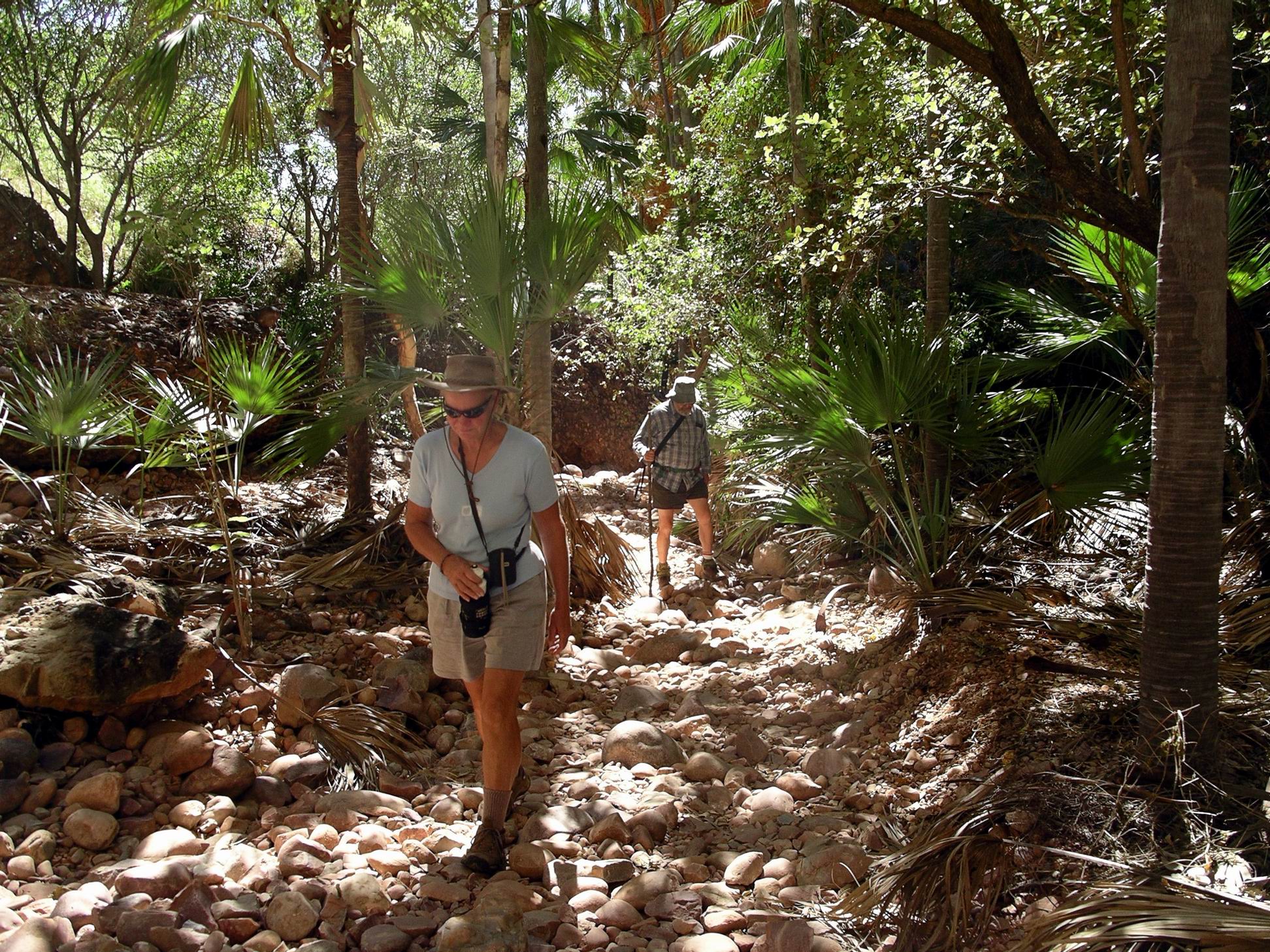
We had a very early start, breakfasted, did final pack, drove the 40kms to the Piccaninny Creek car park in Truck, and were walking by 8am!
Not the most professional looking hiker!
There were few other people around at that hour, and no one else at all after we passed the track turn off to Cathedral Gorge, about 1km along.
Bungles domes and moonTrack skirted occasional rock pools
John did not look anything like a well prepared bushwalker. The green supermarket bag definitely spoiled the image!
He had to stop a few times to make adjustments to his load – some of which was tied to the outside of the day pack. His water bottle waist belt needed regular adjustment – the man has a very narrow derriere, and a significantly larger middle, so it was an easy southward way for said belt.
Near the Cathedral Gorge turn off
I carried lunches for the three of us, an extra 1.5 litres of water for them, and 2 litres of water for me – all in John’s very small day pack. The plan was, that I would walk part way to the Gorge with them, by which time their water bottles would need replenishing with the extra water I carried.
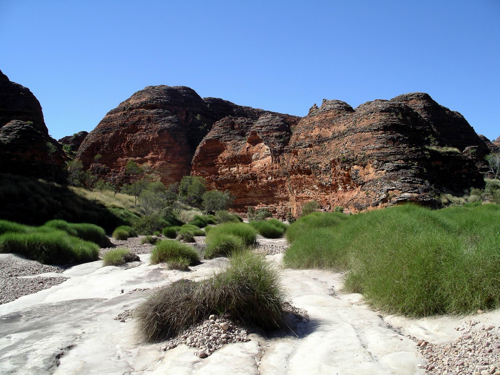
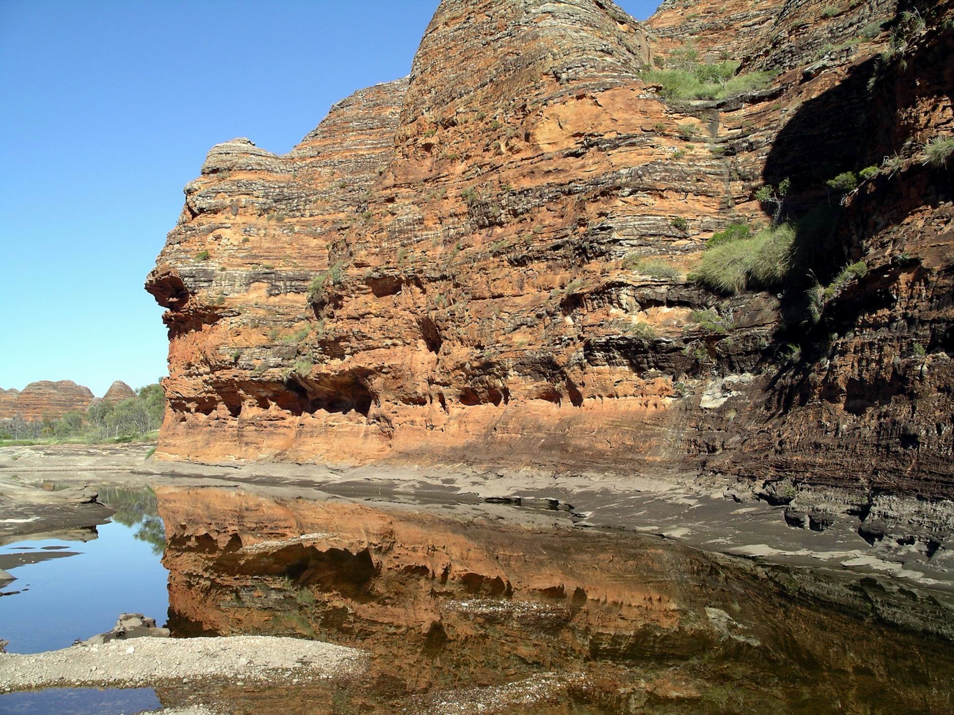
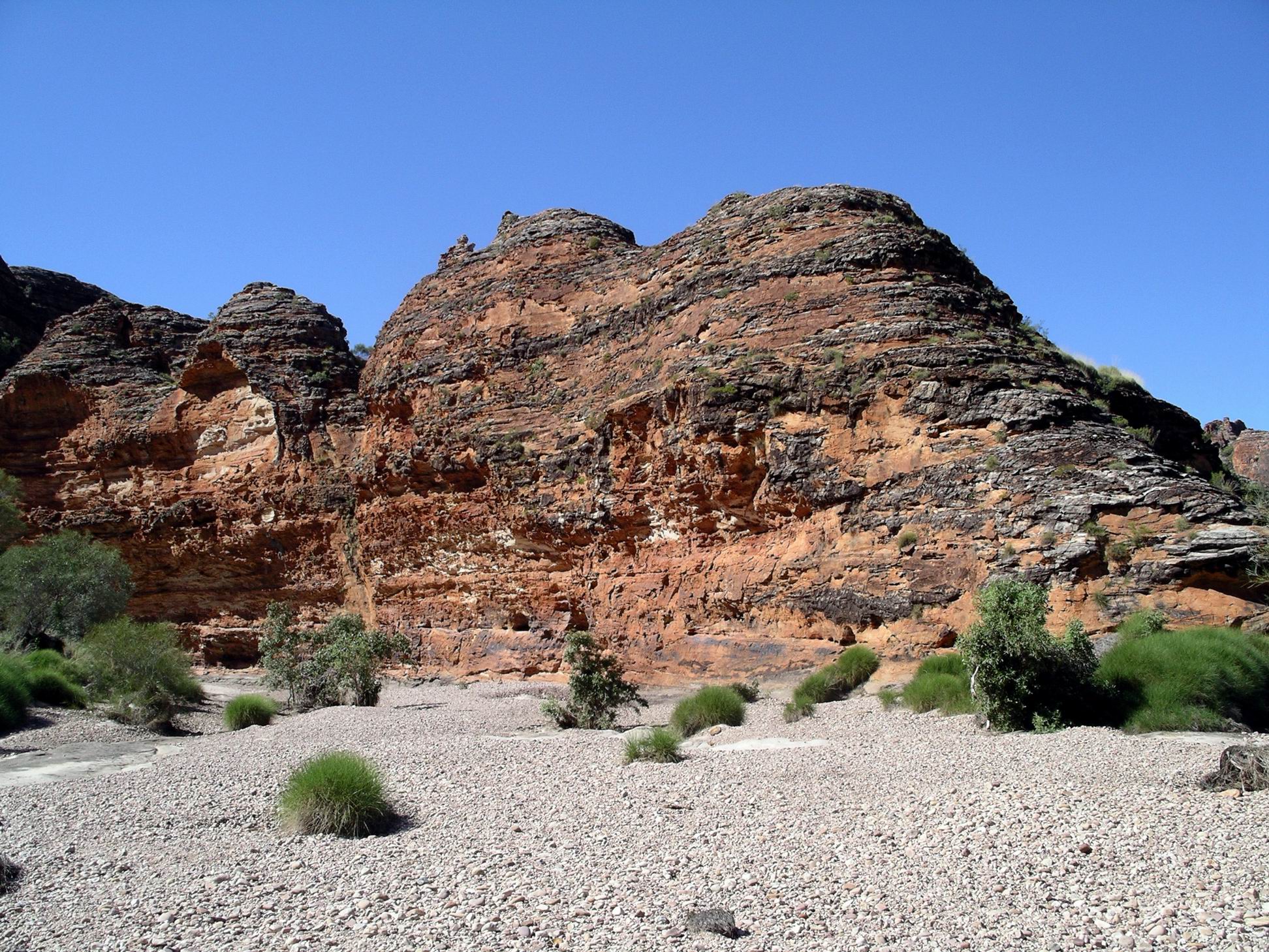
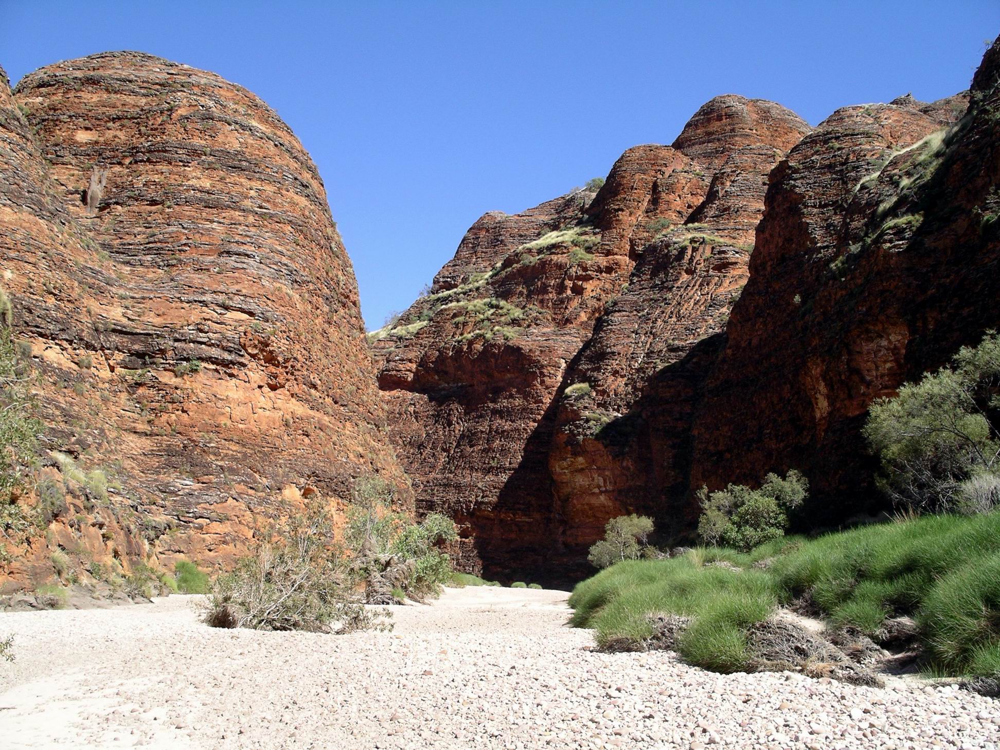
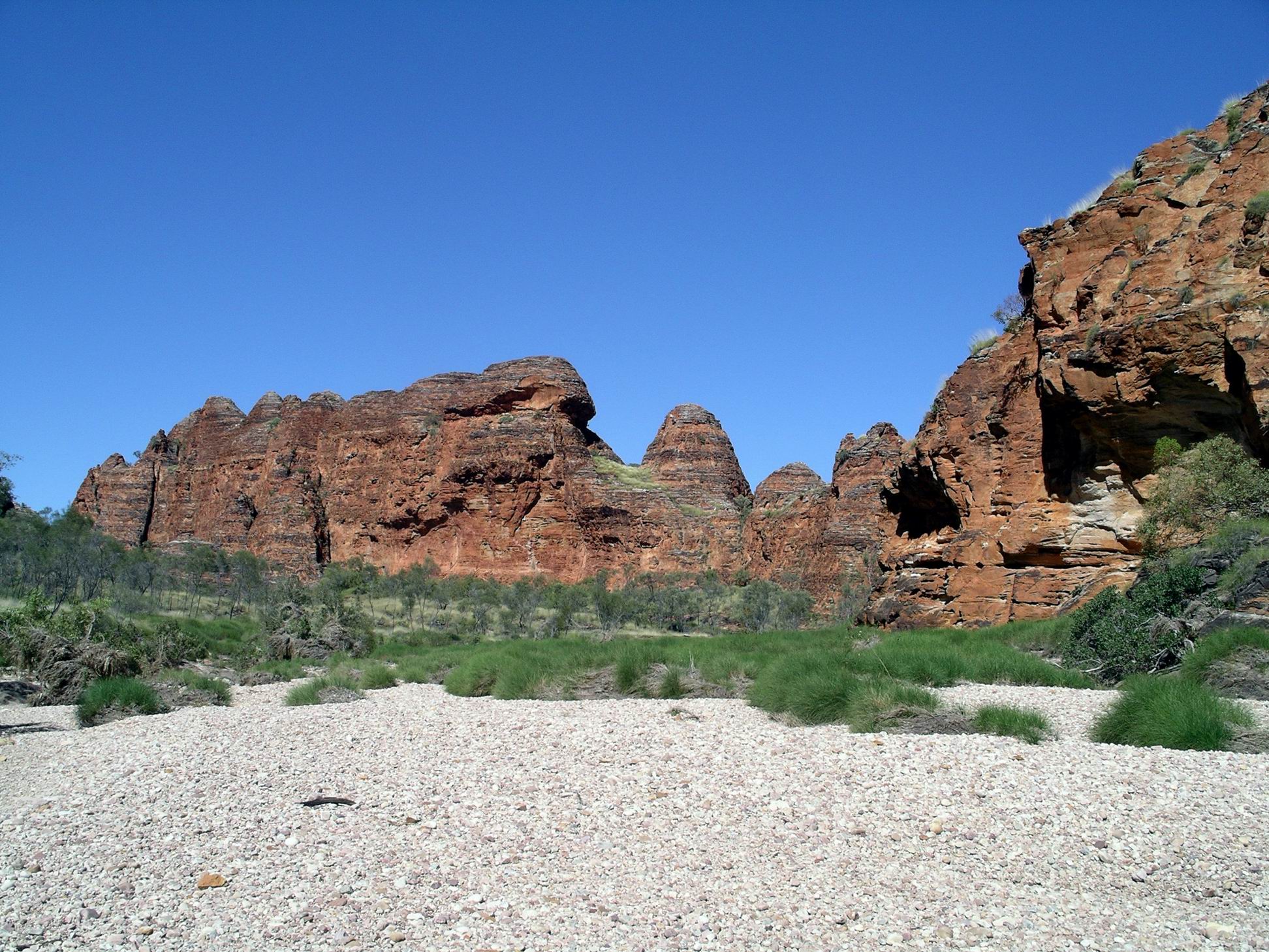
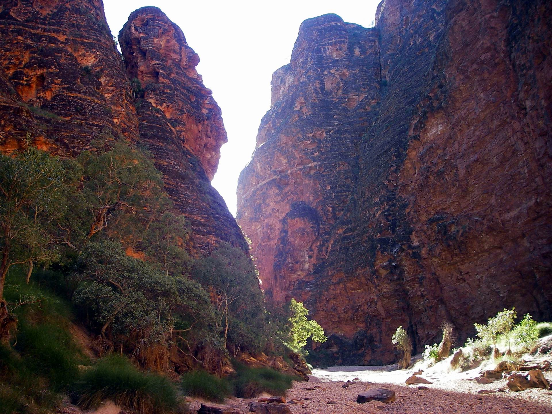
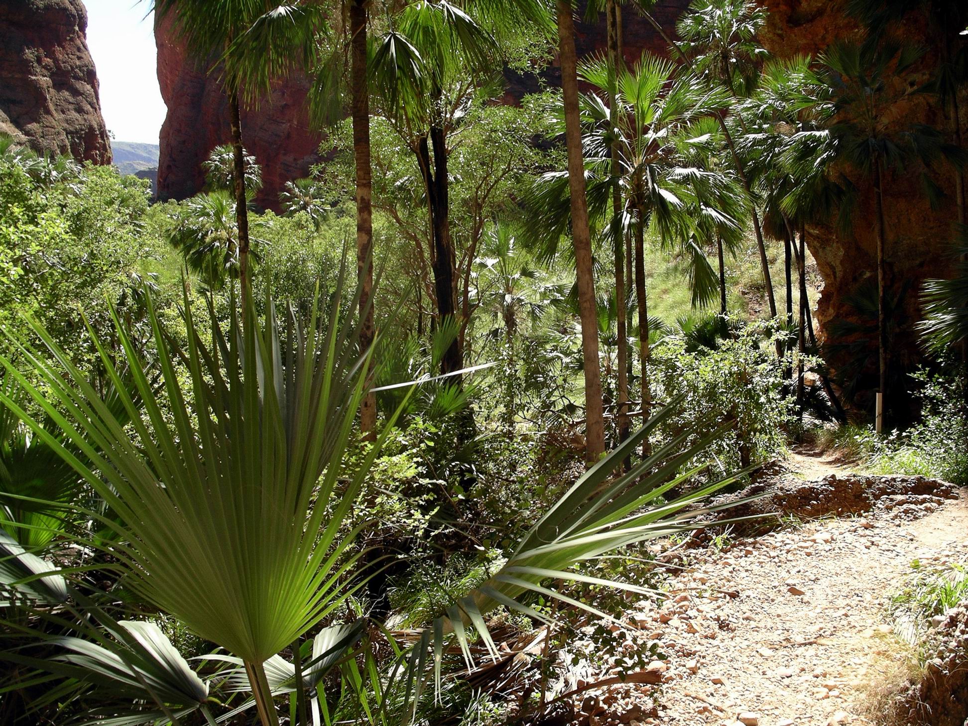
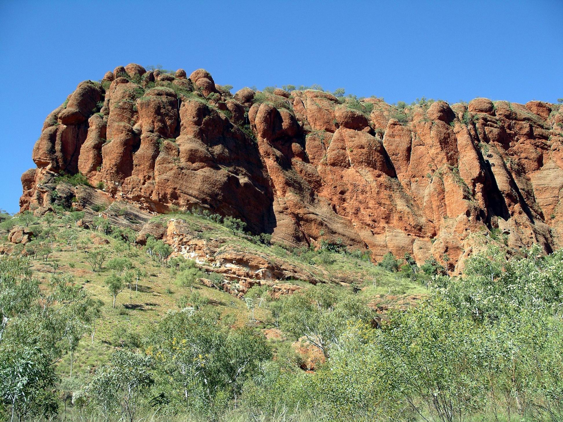
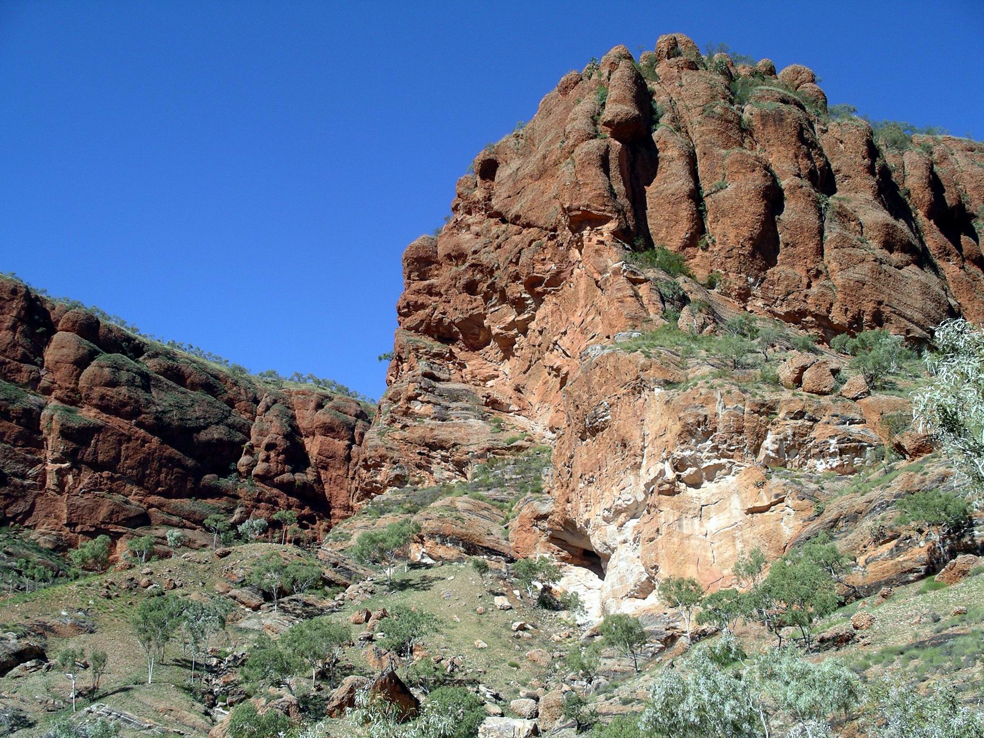
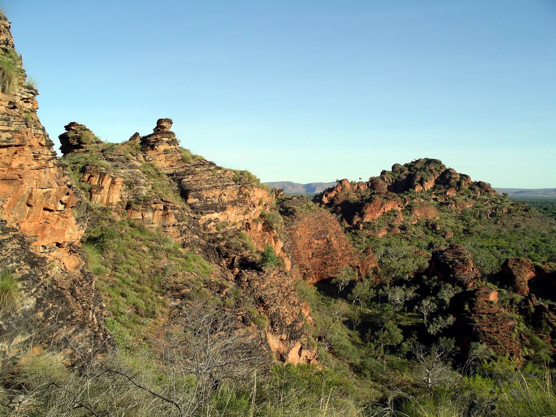
The way was through quintessentially Bungles scenery – the striped beehive domes to the sides of the grey rock bedded creek.
Bungles domes and Piccaninny Creek bedThe way was wide….
At times, the creek valley was fairly wide, with sandy banks at the sides, with spinifex, shrubs and even low trees growing there. At other points, the domes constricted right in and the way was narrower.
Then more narrow……
I stopped a lot to take photos, but was always able to catch up to the others in front of me.
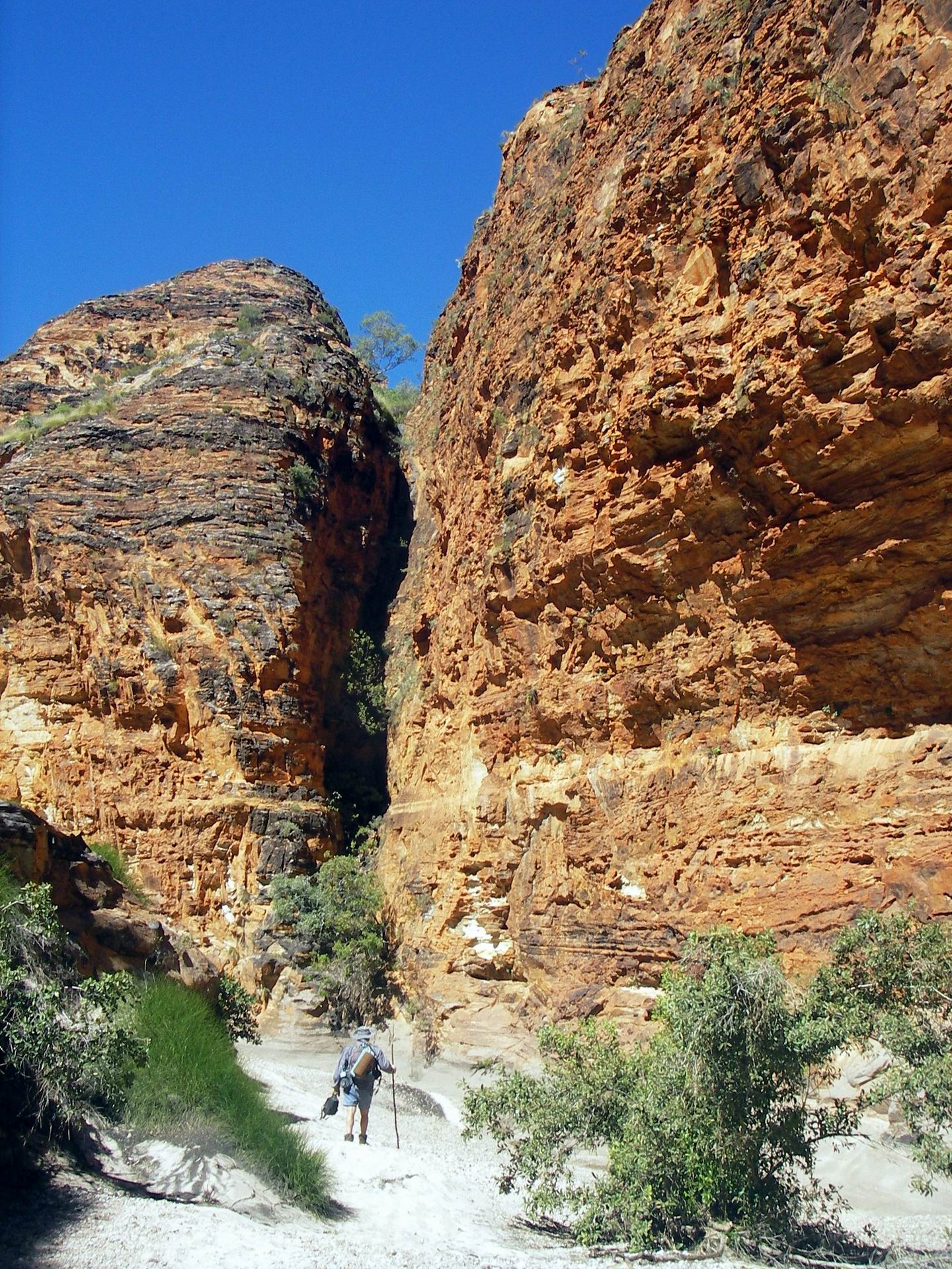
John plodded on – the going was not easy, especially for him. The grey rock of the creek bed was uneven and involved picking a careful path between the deeper erosion channels in it.
John trudging on, in the distance…..Sections like this were hard going….
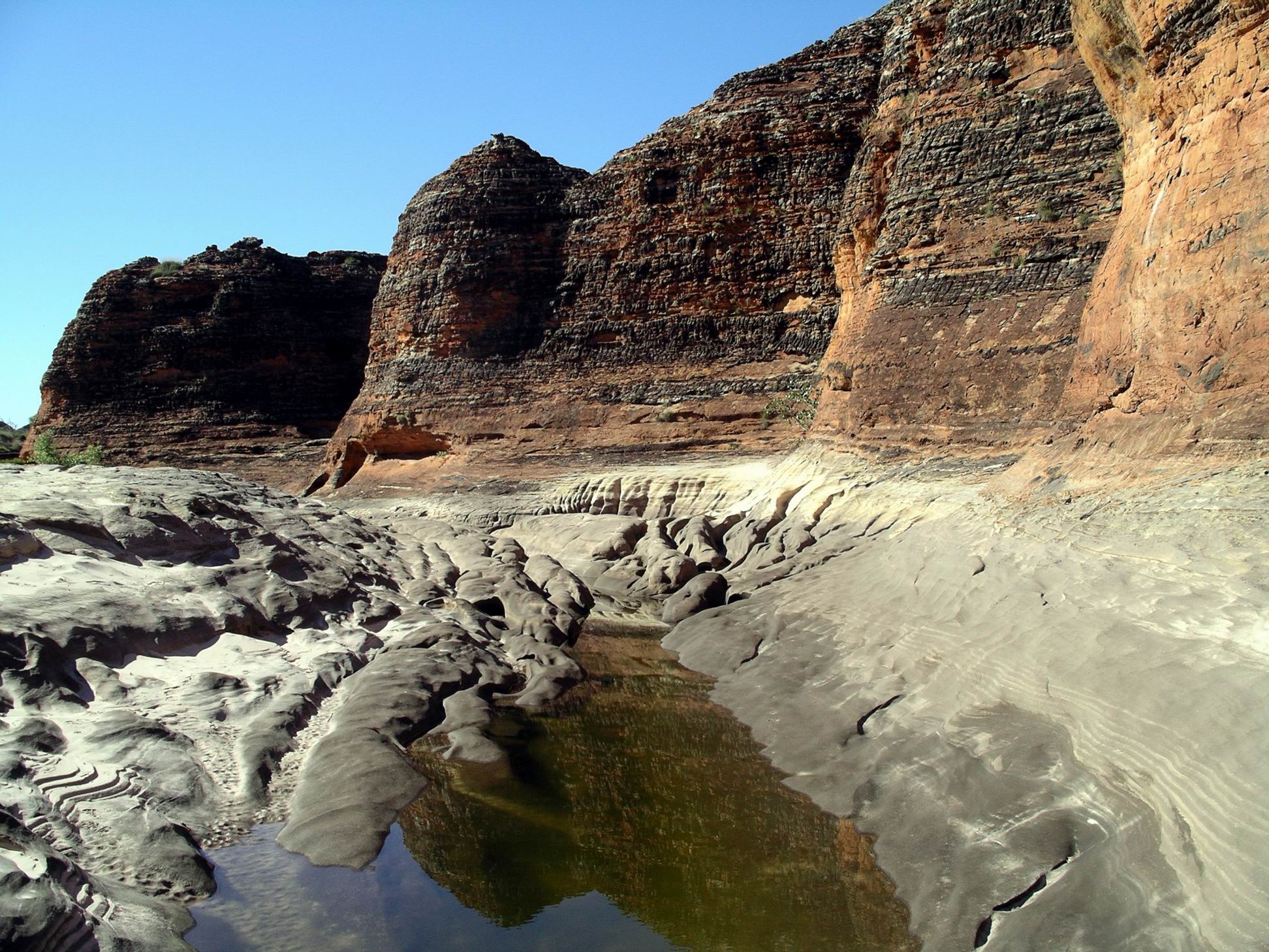
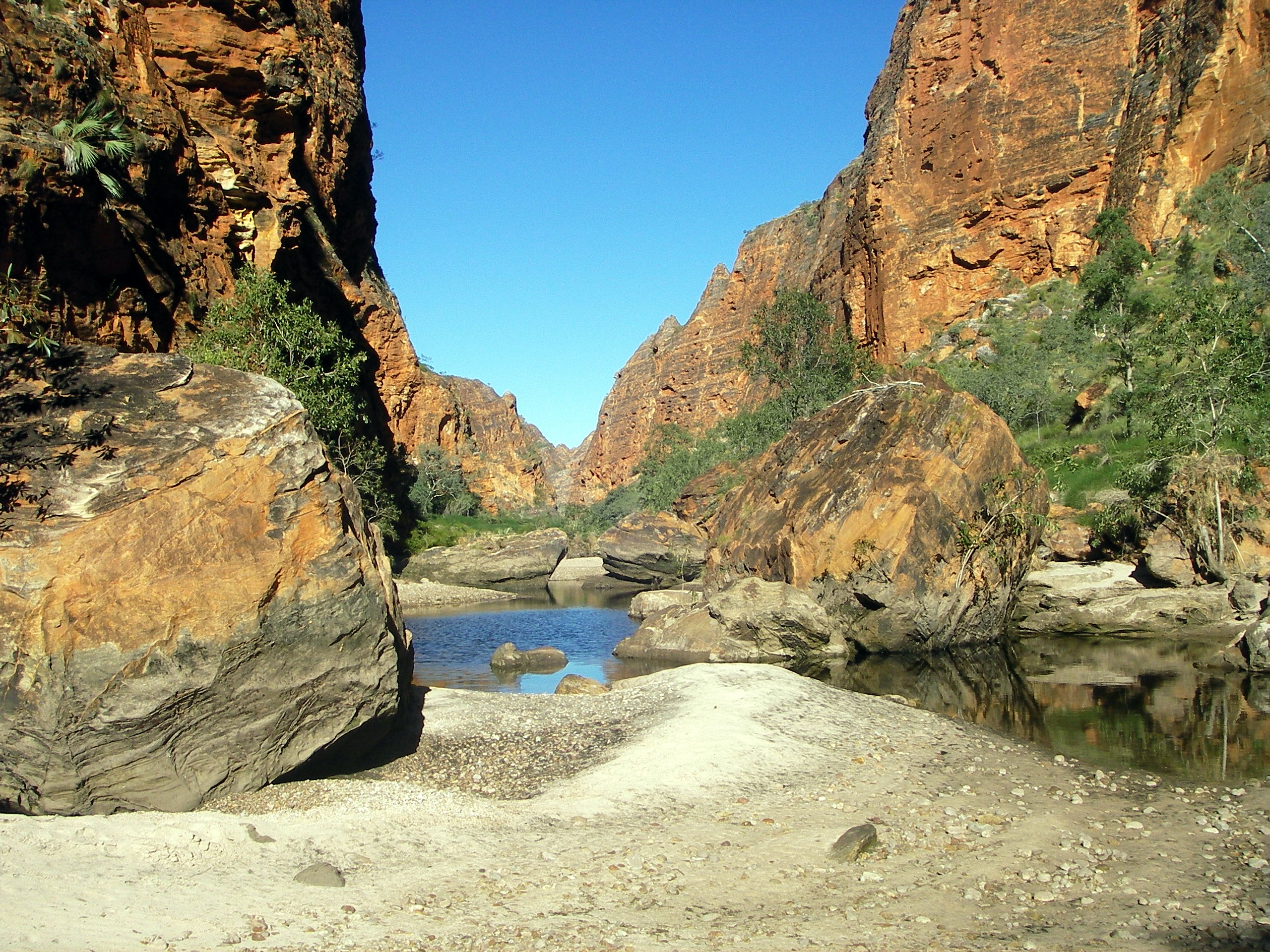
Some of these contained water, in fact there were regular little water holes to add interest along the way. I suspected that, without the recent heavy rains, most of these would have normally been low or empty by July.
We stopped for a break after a couple of hours’ walking. Managed to find a shady place where we could sit in reasonable comfort – such places were not easy to come across in the first few kms of the Creek walk.
The domes that surrounded us all the way were always changing shape. The variety was enormous, but after a while, because they were constant, the impact began to fade, a little.
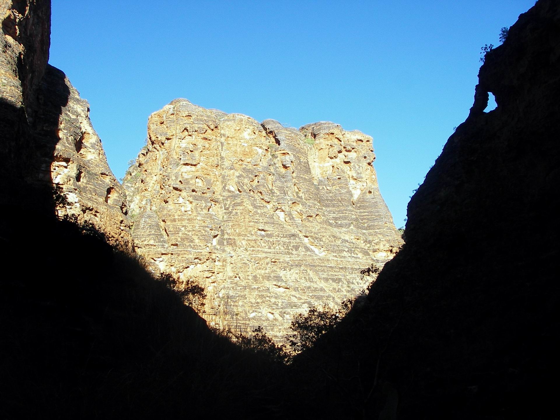
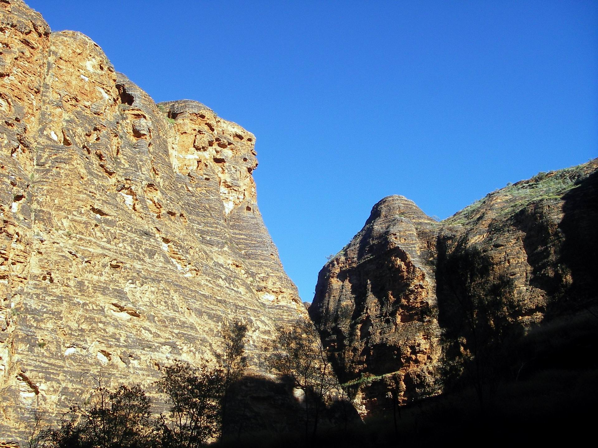
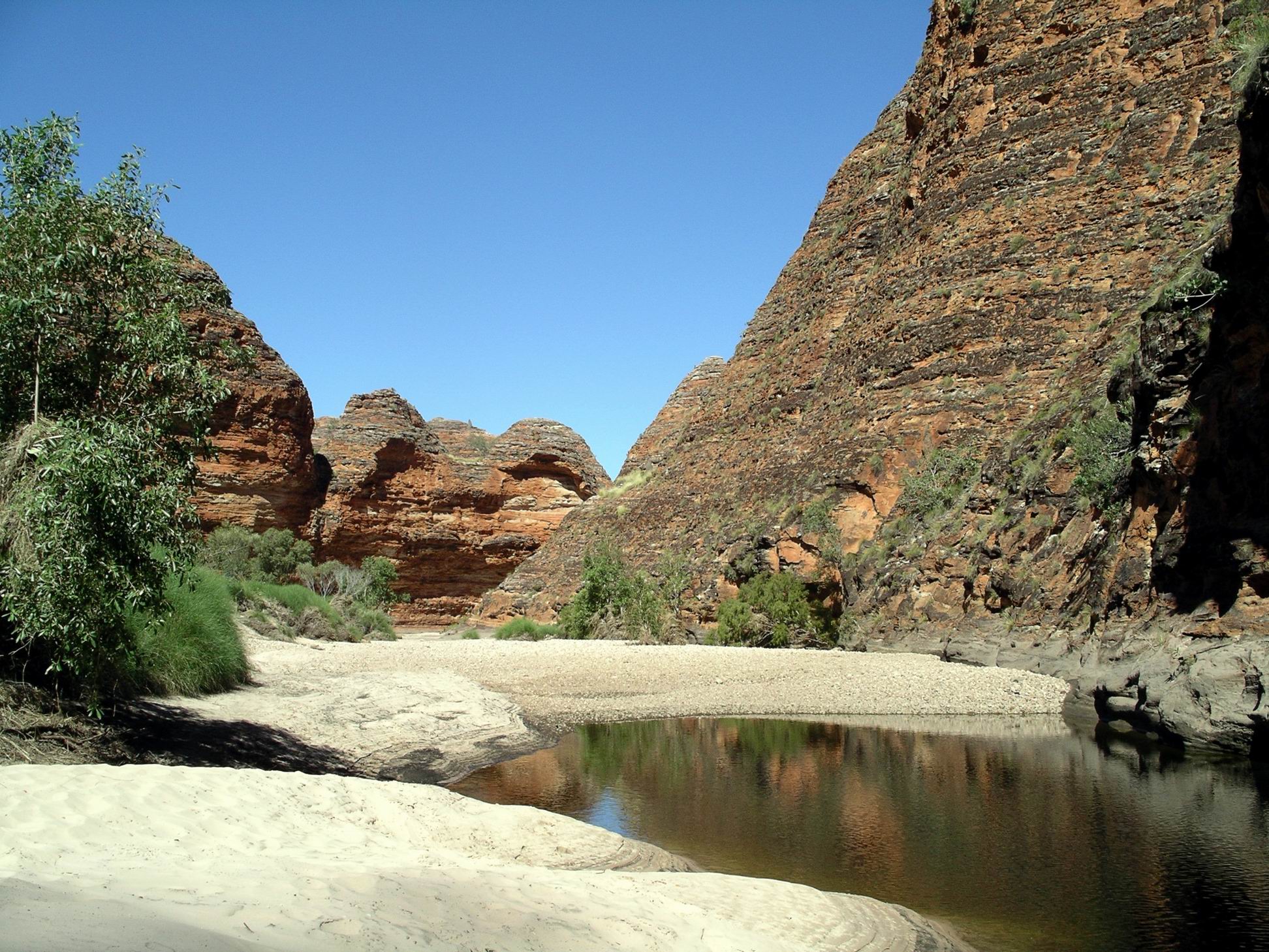
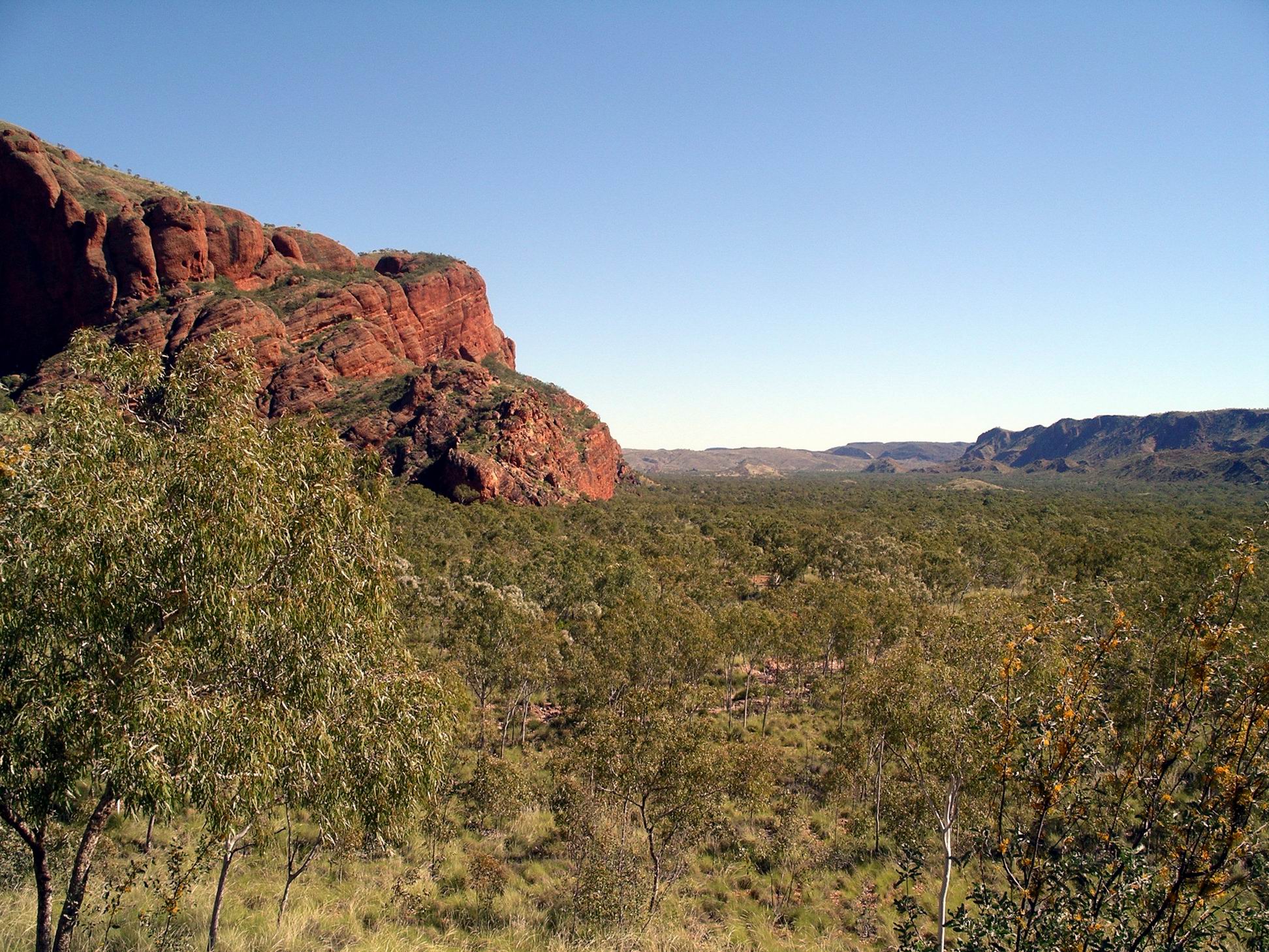
By 11.45am, we were about 7kms along the approximate 12kms to the waterhole up in Piccaninny Gorge, where they planned to camp. I wondered if we were actually quite close to the feature called the Elbow, where the creek turned from heading NE, to NW, and the Gorge began. Certainly, the valley walls had closed in on us.
Waterfall stains in a little side gorge
I had found the sections of sand and loose pebbles that we were increasingly trudging through, very tiring.
Hard walking through these banks of sand and pebbles….
We took an early lunch break at that point. Then, their drinking bottles were filled from the spare 1.5 litres of water I carried, and I packed the empty container to take back with me.
Getting ready to part ways….
We parted company here. They had about 5kms to go to their camp point. It had taken nearly four hours for us to reach here, so I needed to allow at least that amount of time for me to return to the Truck.
It was very tiring, in the hottest part of the day. The heat reflected off the bare rock surfaces of the creek bed.
I had been conscious all along, of needing to pace my consumption of my 2 litres of water, through the day, so I didn’t run out before getting back to Truck. This meant that I was getting increasingly thirsty and probably somewhat dehydrated in the much hotter afternoon conditions.
I took some “short cuts” across the inside of bends, through the spinifex on the creek banks. On one of these sections, got a big fright when I disturbed a large monitor lizard on a sand bank! This made me more aware that, with no other people venturing this far along the creek, and with no one waiting for me back at camp, there would not be help if I came to grief. So I was more careful after that. With hindsight, I probably should have signed out at the Visitor Centre, as a safeguard, but it hadn’t occurred to me. Silly!
Can short-cut right across there, instead of following the stony bed….
All the perspectives were different, going back, so it was really hard for me to gauge how far I still had to go.
This termite mound looked like a Madonna – I must be heat affected!
!
And another…..Looking familiar – near Cathedral Gorge turn off? I hope…..
The sign to Cathedral Gorge was most welcome – and actually came a lot sooner than I was expecting. It was only 2.30pm then, so I’d done the 6kms to that point in just over two hours!
Knowing there was only a kilometre left to walk, that it was relatively easy going, and that I could drink the dribble of water I had left, all spurred me on with fresh energy.
Zoom image of walk landmarks. The grey creek bed really stands out.
By the time I reached Truck, I had definitely had more than enough, and was all “domed out” in terms of taking photos.
Drove back to camp, via the Visitor Centre. There, I bought two COLD bottles of water and a can of lemon-lime mineral water – which tasted like the nectar of the gods!
I relaxed at camp for what was left of the afternoon. My suspect heel was very sore, with a throbbing ache, after the demanding walk. Parts of the rest of me were complaining also.
Had a light tea – cup of soup and some tinned fruit. As usual, after a hard walk, I had little appetite. Was in bed by 7pm!
I hoped the intrepid campers were finding their efforts worthwhile at what was no doubt a very basic camp!
M took the following photos as they walked into Piccaninny Gorge and along it to camp.
More track obstacles….Camped by this water hole in the Gorge….
We froze again last night! Couldn’t really think of what else we could do – if we had a heap of newspapers or spare blankets, could put an extra insulation layer under the lilo, because cold comes up from the ground. But didn’t have any papers, and couldn’t spare any layers from on top of us because the night air was too frigid.
I vowed that, if it was that cold when next we were in any sort of town, I was buying some sort of warm bedding!
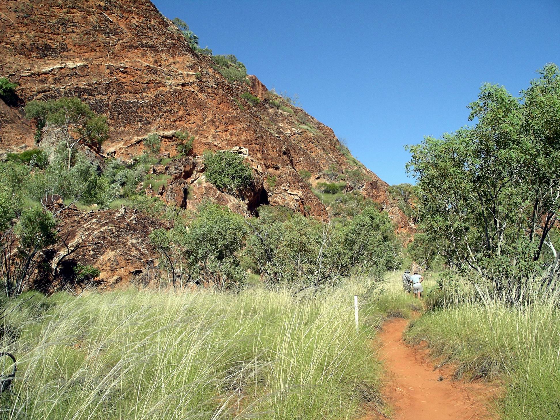
After breakfast, drove to the parking area for the Mini Palms Gorge walk. Like yesterday, we were exploring the area just to the north of our camp area – the closer part. When that section was done, would focus on the further southern part. We needed as much as possible to keep the kms driven to a minimum to conserve our fuel.
The walk into Mini Palms, at 2.2kms each way, was longer than yesterday’s – that was a warm-up!
Walk track to Mini Palms
We started out walking on a smooth, narrow track through spinifex, then like yesterday, faced a section of walking along, sometimes beside, a dried, rocky, creek bed. For a short way we were walking parallel to the range.
Then the track turned and we were making our way towards a narrow gap in the range.
To make our way into this narrow gap, had to scramble through and over a section of really big boulders – bigger than us. These were unusual in that they were made up of lots of smaller rocks, all kind of glued together like some kind of ancient geological cake mix!
Yes, the track went through/over thereTight fit in places!
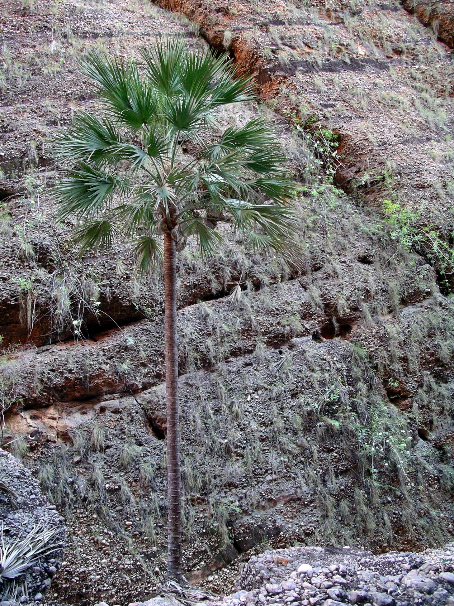
Like yesterday, as we progressed into the narrow valley, Livistona Palms began to appear.
Livistona Palm and unusual growth on gorge wallsLooking back to the gap we came through
We began to steadily climb as the valley sides closed in beside us, until we reached a viewing platform that overlooked a lower level. This was as far as we could go.
Mini Palms
The lower level was a hollow at the head of the narrow valley – the palm hollow.
Only a few little palms trying to grow
Back in ’93, we were able to walk down into the hollow and wander in amongst quite a profusion of small palms. But now tourists could no longer go into that cavern. Most of the palms had been washed away in large floods that poured through the narrow gorge, and now the remainder were being protected, in recovery.
For comparison: Mini Palms chasm floor in 1993The deep gorge that is Mini Palms
From the path near the viewing platform, could look back down the way we came to the narrow valley entrance.
The Mini Palms walk was worth it just for the scenery along the way, even if the palms were a bit feeble now.
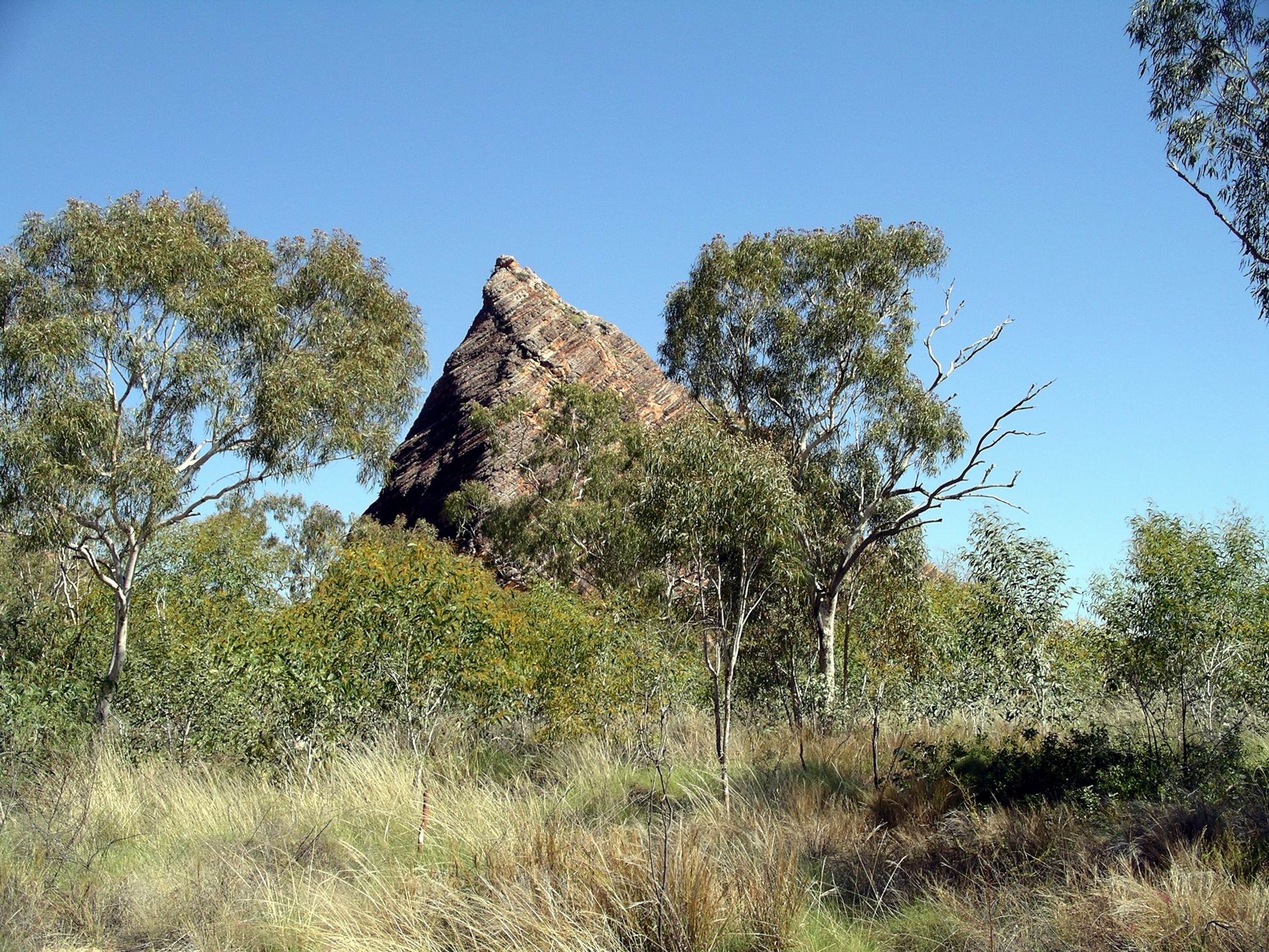
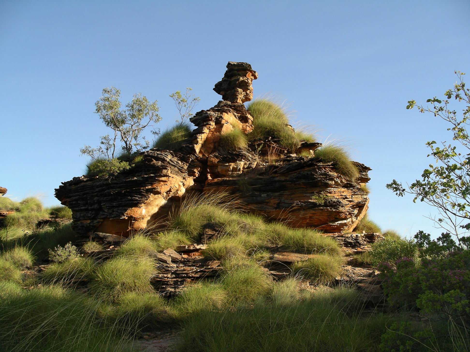
Unusual hill seen from the track
Made our way back the same way – like yesterday, encountering a couple of small tour groups on their way in. Again we were lucky to be ahead of the groups.
Near the car park for the Mini Palms walk
The nearby Frog Hollow walk, which we’d tackled in ’93, and which I remembered as being very good value, was now closed to all access, due to rock falls and the ongoing danger of same. A pity.
Drove past our camp and on to the Visitor Centre at Three Ways, to book John and M in for their walk. They would have to report back in when finished. Browsed the displays and offerings for sale there. Bought each of us a polo shirt – they were really good quality ones. John bought some playing card sets featuring WA scenery, with the idea that he might make a wooden box to contain each set, as Xmas presents.
After lunch at camp, it was time to address the task of trying to fit all the gear and food into two packs. Depending on which way you viewed it, they were either large day packs or extremely small rucksacks! John was using my day pack, as it was a bit bigger than his. It ended up, literally, bulging at the seams. He would have to carry some of his food in a green supermarket carry bag! I thought he had too much food, but as it had been decided between him and M, I didn’t comment. In the morning, John would have to roll up one of our sleeping bags and fit that in. M, of course, had her very compact down sleeping bag; our good compressible down bags were safely tucked up at home! The two old ones we kept in the van for visitor use, were bulky and inefficient – as we’d already found out.
John and M then set about trying to rig up a shower enclosure, using one of our small tarps, under a tree branch from which we could hang our solar shower bags.
Construction phase…..
The theory was sound and I enjoyed sitting back and watching them work the thing out.
Always useful to have a couple of spare tent poles…..
It proved, however, to have a couple of practical oversights, in use. With the sun behind it, in the late afternoon, there was an interesting shadow play for anyone in viewing distance in the campground!
Oops….
Also, the tarp was only big enough to enclose two sides, the rest being, apparently, open to bush only and facing away from our camp area. But, when M was having the first shower, she realized that the “bush” was, in fact, the bus group camp area – and a group had newly arrived there. John opted for his shower after dark! I opted for a top and tail inside our tent, with a bucket of water. Too cold out in the open for this little duck.
Early night again – a big day tomorrow. Without a campfire as a focus, and with the nights so cold, there was little wish to sit about outdoors.
Last night was so cold! Much, much, colder than I expected. It certainly would have been down into single digits. We should have brought the doona from the van with us, instead of relying on the old, unzipped, relatively lightweight cheap sleeping bags.
Tonight, I think we will be sleeping in track pants and windcheaters, and every suitable item I can find will be pressed into service to cover the bed – towels, the picnic rug, spare clothes.
I do not remember Kimberley nights as being this cold.
The new lilo that we bought in Melbourne, to replace the old one that came to let us down gently in the night, is excellent. It did not seem intent on pitching sleepers together in the middle, like the old one did.
We even managed to sleep in a little, after a broken night’s sleep due to the cold.
M seemed rather cross that we were late getting going – she had been up since really early.
Map from current National Park information. Some of the places marked were not open in 2007.
We drove to Echidna Chasm, about 15kms from our camp. Our late start actually turned out to be a positive, because we got there in between the tour group times and had the place almost to ourselves. So we were able to get decent photos, without trying to dodge heaps of people. Also, the light was excellent at that time of the day, in the Chasm.
From the car park, it was a walk of 1km to the end of the Chasm. Initially we were walking in a dry creek bed – rather large, smoothed stones underfoot – through a narrowing valley.
Nice wide creek bed to walk along…..
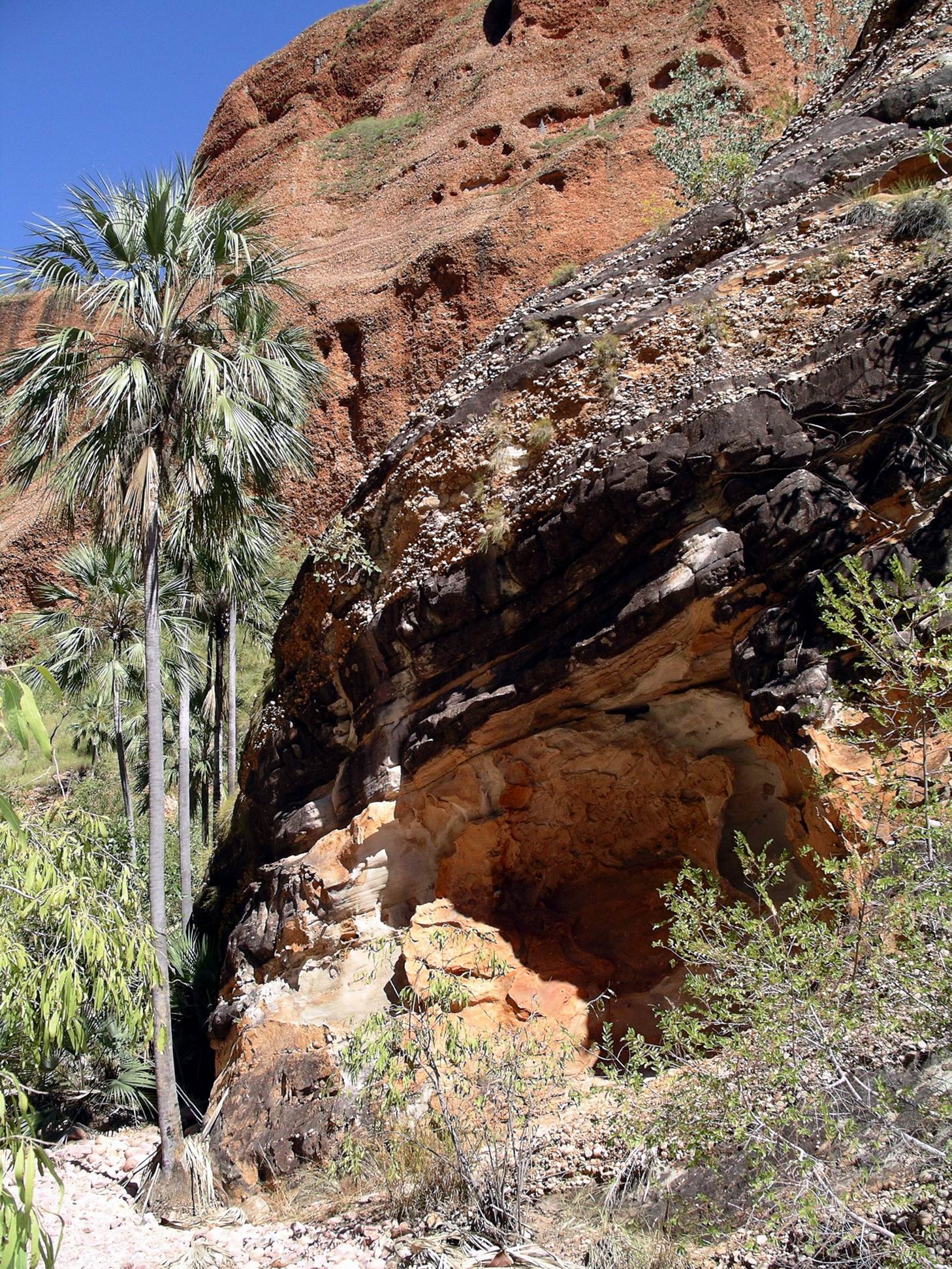
There was plentiful vegetation along the valley – trees, grasses, shrubs, some of which were in flower. As the valley narrowed and darkened, palms began to appear.
Livistona Palms. Conglomerate rock band on top of sandstone. Path to left of palm.Look where walking or look at scenery.Do not try both at once, here!
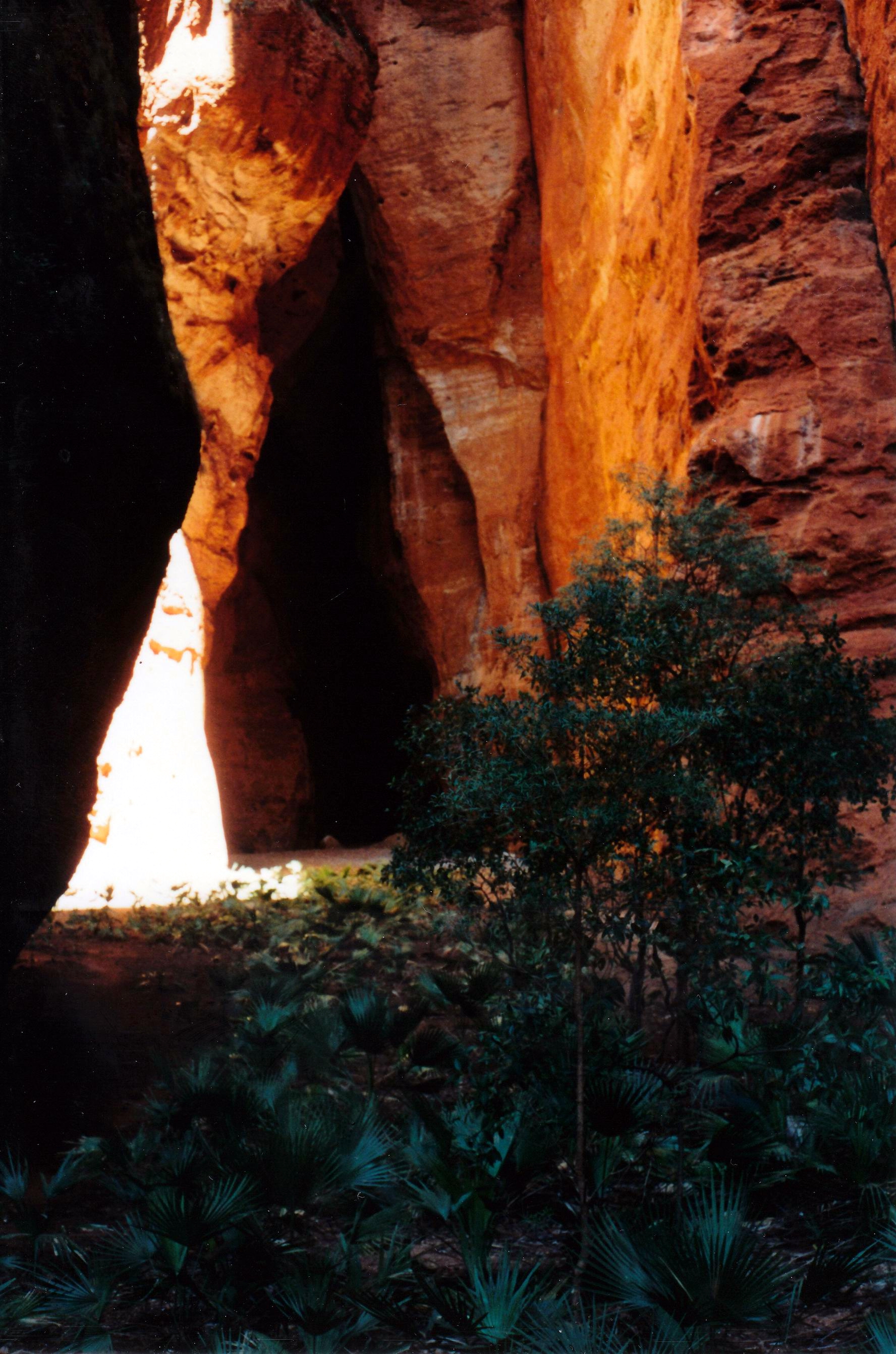
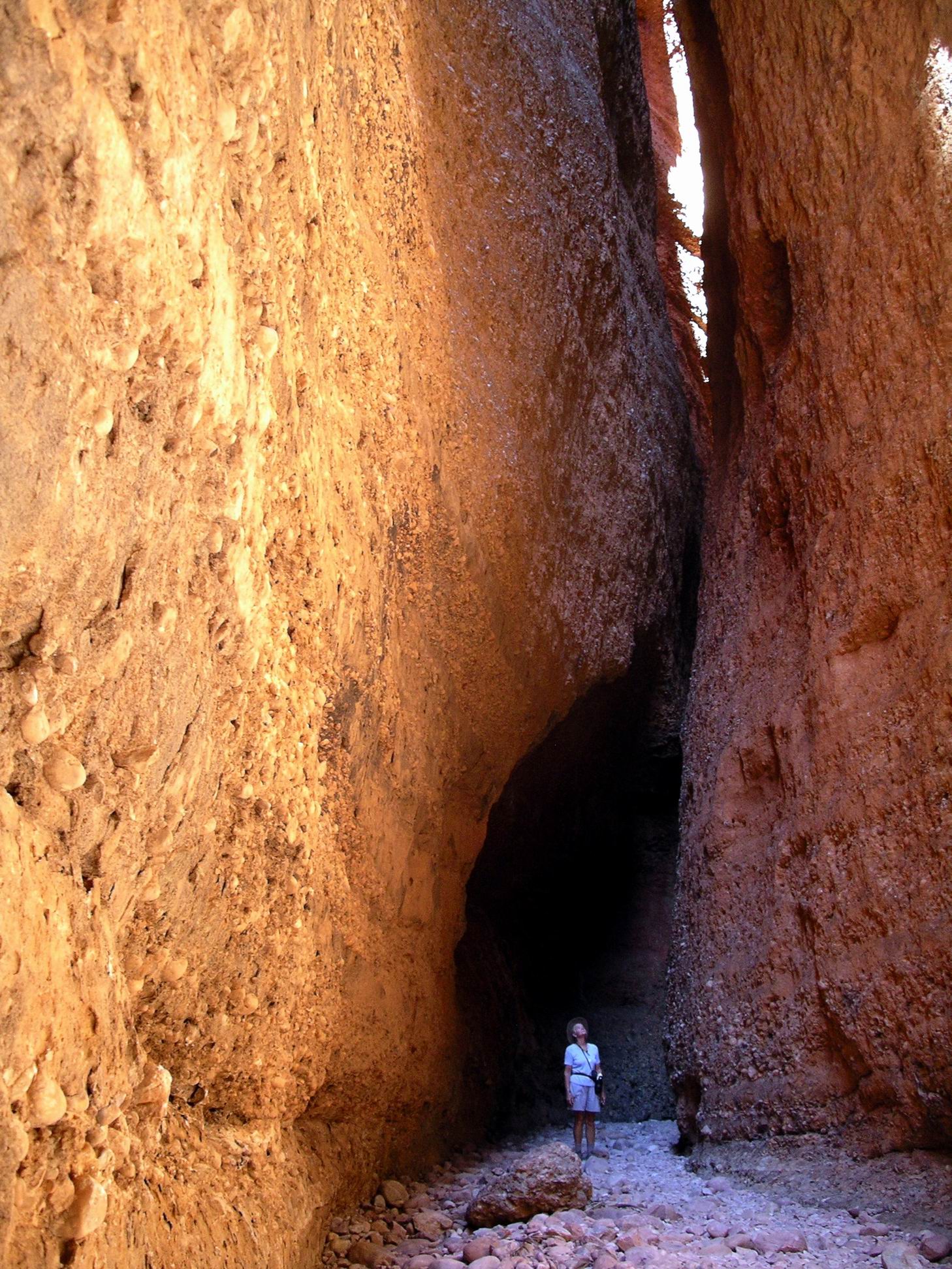
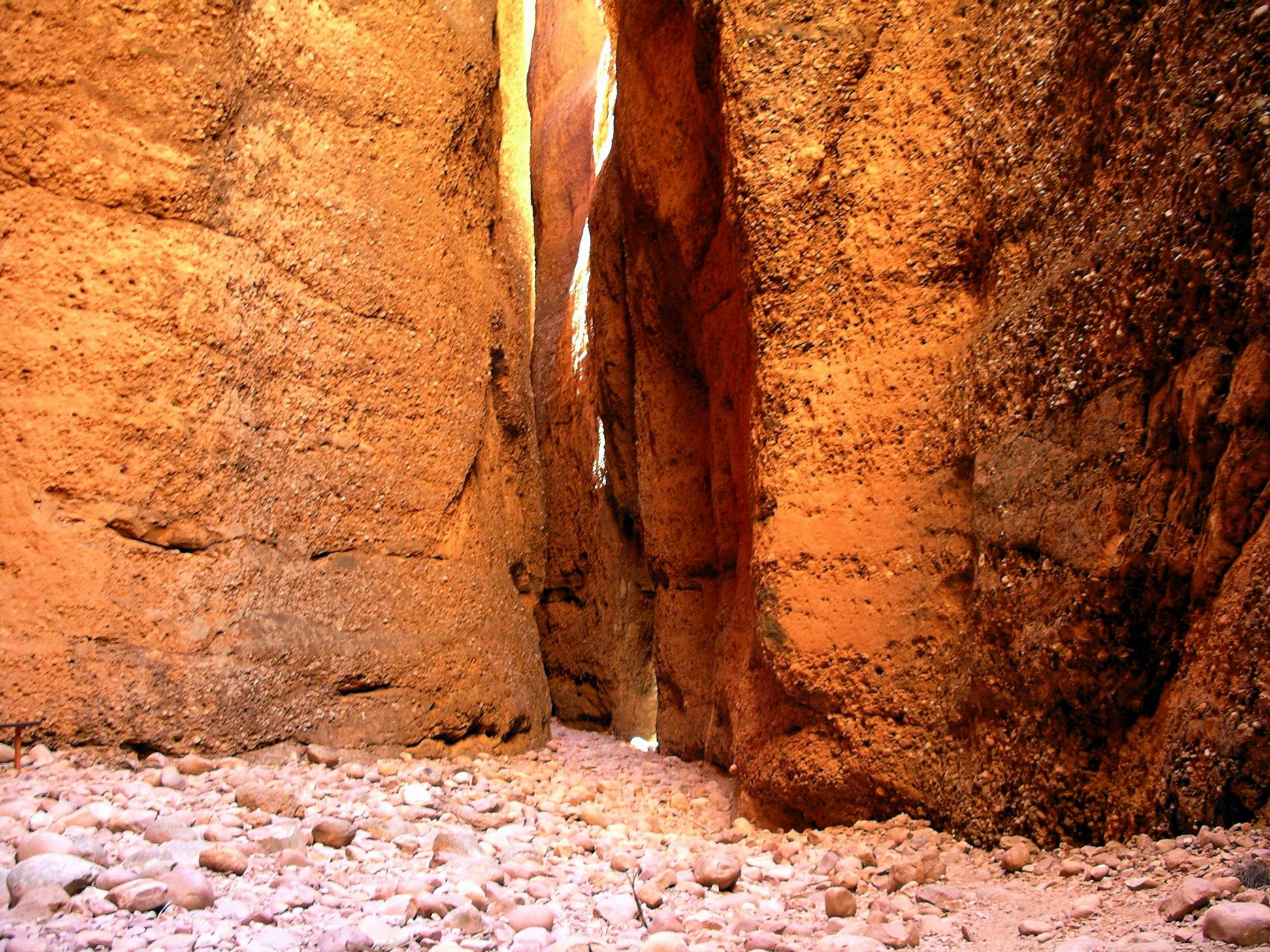
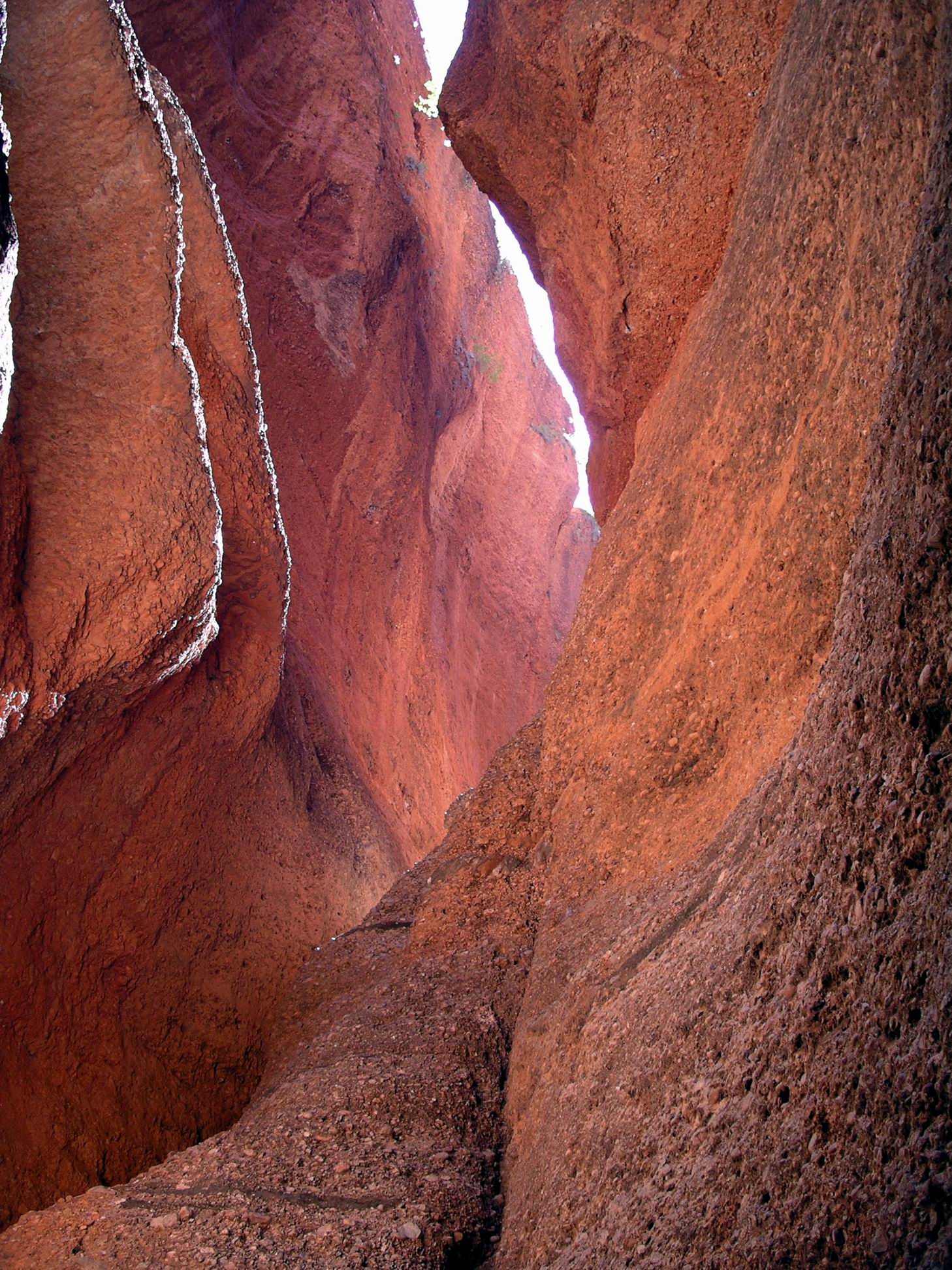
Eventually the narrowing valley swung left and became the Chasm. No more vegetation. Just sheer red rock walls, in places reaching up to 200 metres high. Essentially this feature formed by erosion along a joint or fracture line in the parent rock.
The conglomerate nature of much of the rock was evident in the Chasm.
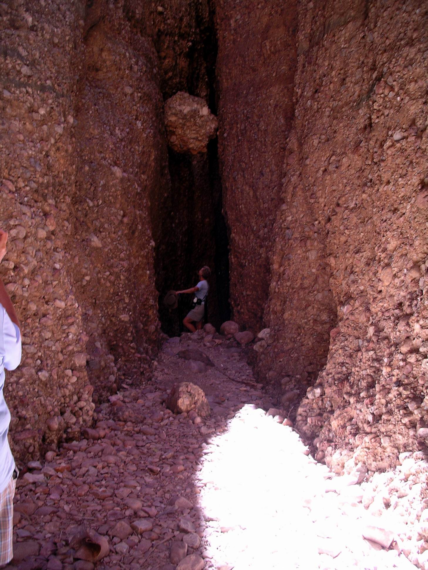
In sections, we were squeezing through really narrow clefts between the walls.
John is dwarfed in there……
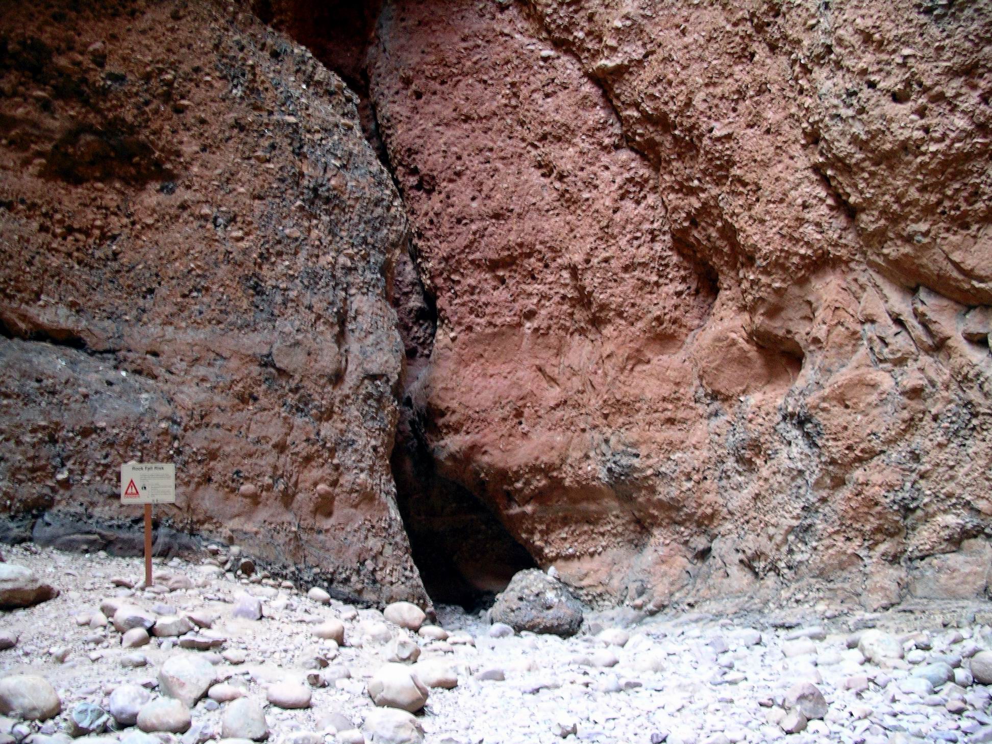
In some of these clefts, if one looked up, there were large rocks that had fallen from above and lodged in the gaps. Signs warned of the hazard from above.
The rocks by the path have obviously come from above…
There had been a sign at the car park, warning of the risk of falling rocks. Now it made real sense……
It was the sort of walk where you hoped the Earth didn’t hiccup while you were in there!
She was wondering how securely that rock was wedged up there!
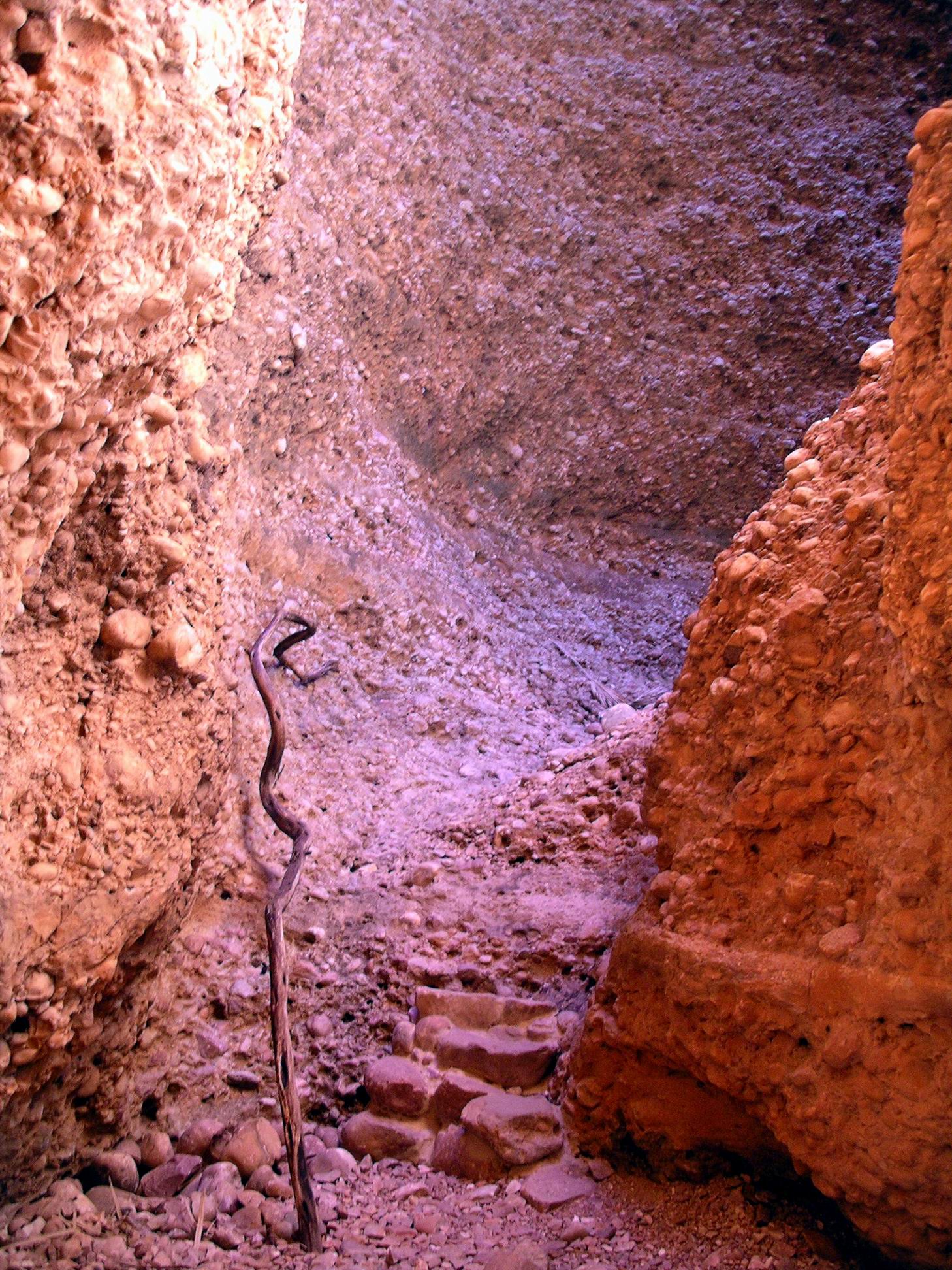
The way through the Chasm ended in a steep little climb around a bend. Someone had lodged a long stick there, to act as a sort of handrail.
Not far around this corner, the whole thing ended up against a blind wall, in a sort of dim little cave.
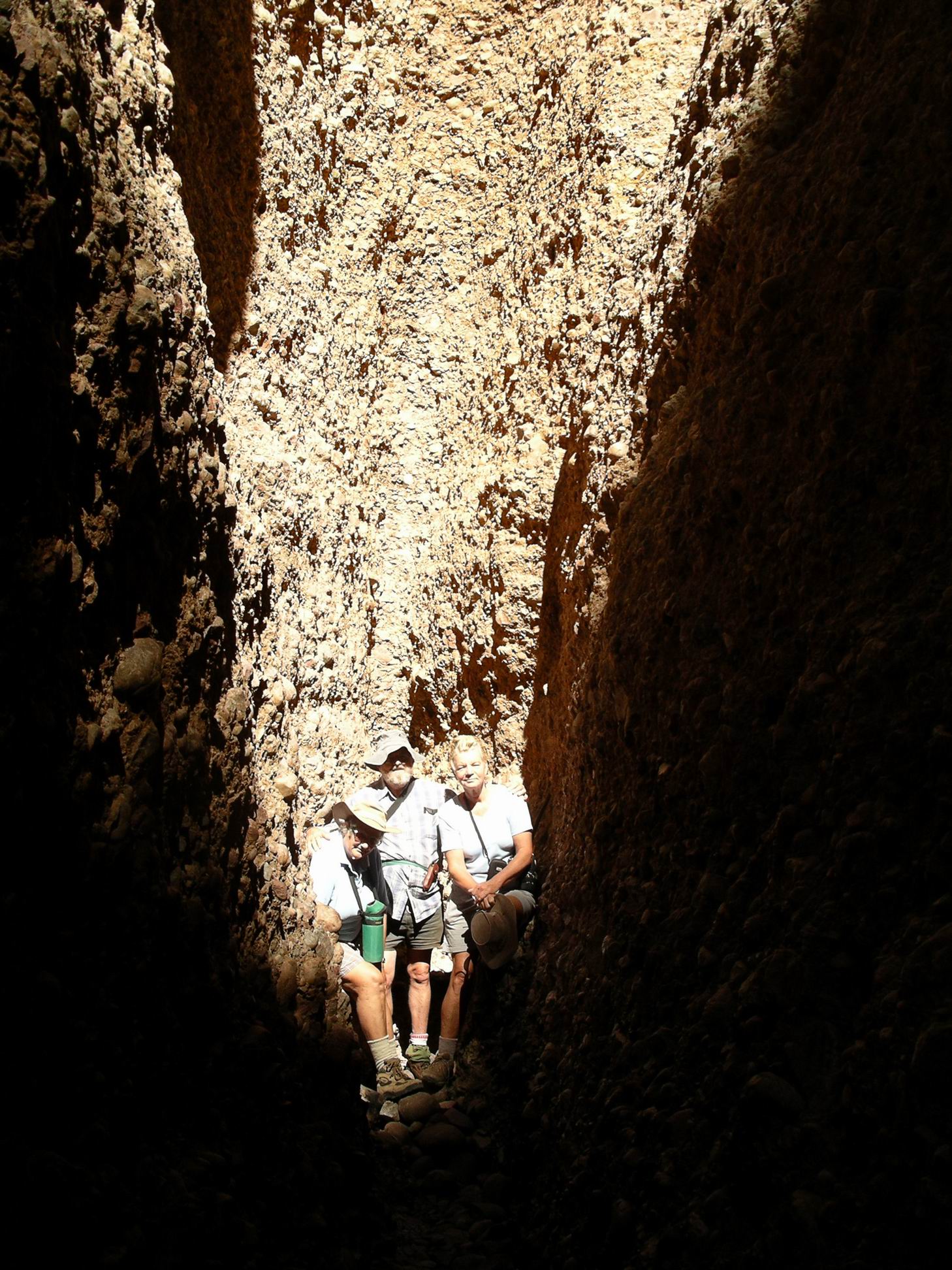
Just about to the end – it can’t get much narrower!As far as we go – tight fit…..
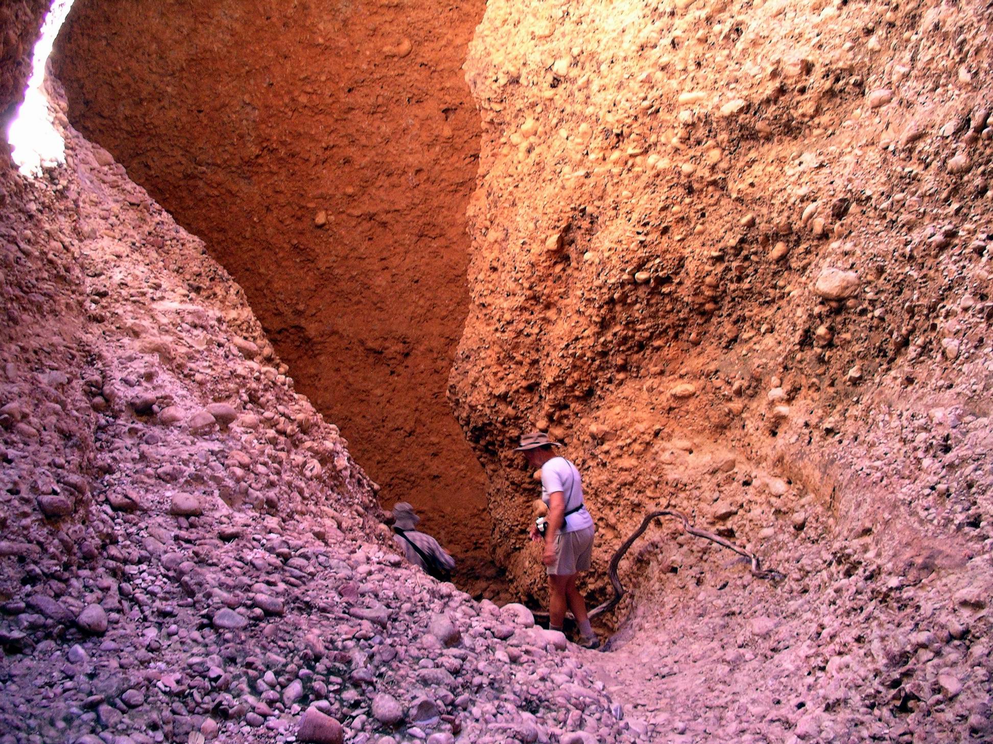
Back the same way we went, encountering a number of people walking in – the start of the afternoon tour groups!
And back we go…..Looking up….
Back almost at the car park, we branched off to do the shorter walk to the Osmand Lookout. As the word “lookout” is usually synonymous with elevated, the walk went uphill.
The lookout is on the little ridge – we did not have to climb these monsters….
This little 200metre side track was interesting for the varied rock formations of the Osmand Range, this section of the Bungles.
Really interesting erosion features on these soft rocksCarpark can be glimpsed between the treesInteresting finger-like formations – and a cave
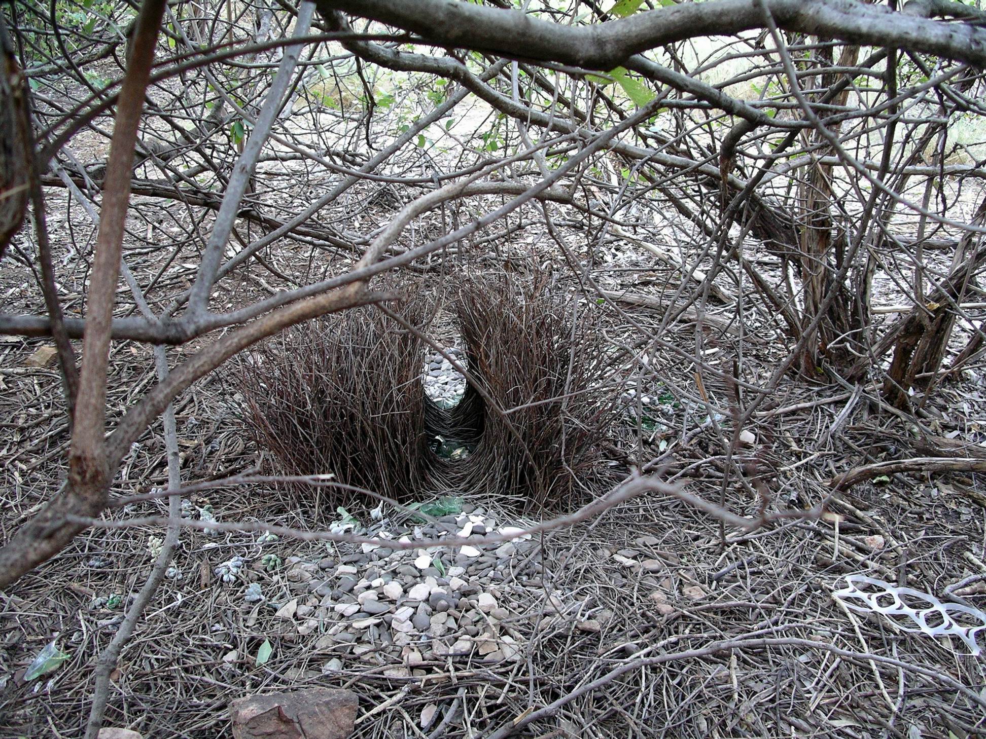
Saw yet another bower – this bird was into collecting smooth white stones. No shortage of materials for him to choose from…
Back to camp, where we had a very late lunch. Lazed about for a bit, chatting over what we’d seen, and what we had planned. John experimented some more with the big camera, taking photos of birds.
Pied butcher bird
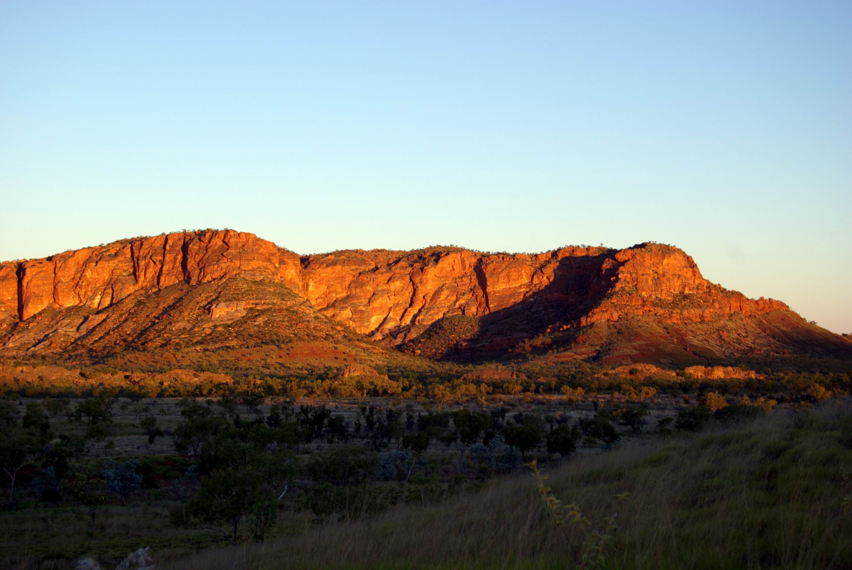
Late afternoon, drove a few kms from camp, to the car park for the Walanginjdji Lookout – another elevated viewing point! Walked up the path to the top of the rise, to watch the sunset, which really lit up the eastward-facing range across the valley from us.
Bungles Range in the late afternoon
There was a viewing seat thoughtfully provided at this vantage point, but it was already fully occupied, so we just wandered about while we waited for the full glory of the sunset. It would have been pleasant to sit down and wait, but spinifex does not make for a sitting place!
Standing room only….
Initially, there was a line of shadow across the valley, just beyond the base of our ridge. Then, as we watched, this shadow line crept across the valley towards the far range, whilst the latter changed colour.
Finally, the shadow crept up the distant range, turning its deep red to grey then black.
Time to pick our way back down to the vehicles, while we could still see at all.
Late light tea and then another early night. I wasn’t looking forward to trying to sleep in the cold.
WEDNESDAY 4 JULY KUNUNURRA TO KURRAJONG CAMP, BUNGLES 310kms
We got up early, but did not get away from Kununurra as early as I’d hoped.
Because John had gotten mired down yesterday, in trying to sort out his technology stuff, things that should have been done yesterday – like tying down the roof rack contents – had not been done.
Then John had to call Telstra to get the new phone scenario sorted out. Today, they told him that the new phone could keep the old number, after all! Talk about left hand not knowing…..A new sim card would be sent to our home address. We did not, after all – and again contrary to previous advice – have to send either phone back to them.
There had been much angst and time wasted over the whole business. Note to self – in future, absolutely insist that any technology changes are done at home and well in advance of any planned travel!
We had to hitch up the packed van and tow it around to the Park’s storage area, which was beyond the waterfront unpowered camp area, but overlooked by some powered sites higher up. This part of the Park was securely fenced with a really high mesh wire fence, so I was reasonably content about the security of the van. I put on the Treg lock that stops the van being able to be hitched up. John sprayed our very powerful ant spray on the ground all around the perimeter of the van.
After all that, left town about 8.30am.
The highway west, then south, from Kununurra is such a scenic drive, with the stark red ranges always present – near or far. We had, of course, travelled this way last year.
Stopped at the roadhouse at Warmun – formerly Turkey Creek – to top up the fuel at this last available outlet, knowing that given our plans, we would need every drop! $1.60cpl.
The place was humming – I was surprised by how many travellers were here. I noted that they now had a fenced van storage area here, that looked well patronized. Still, for a long period like we were planning, I thought Kununurra was the best place to have left ours.
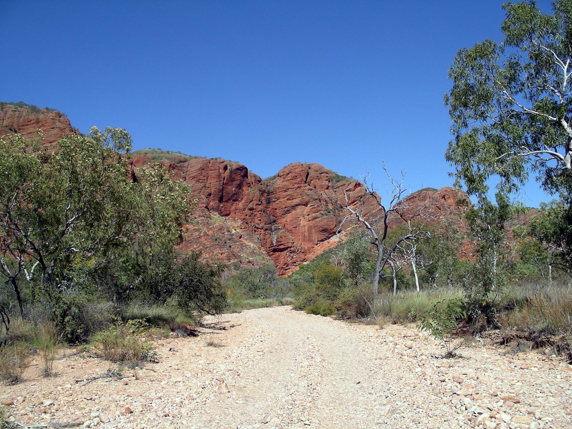
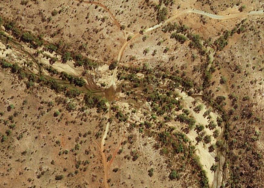
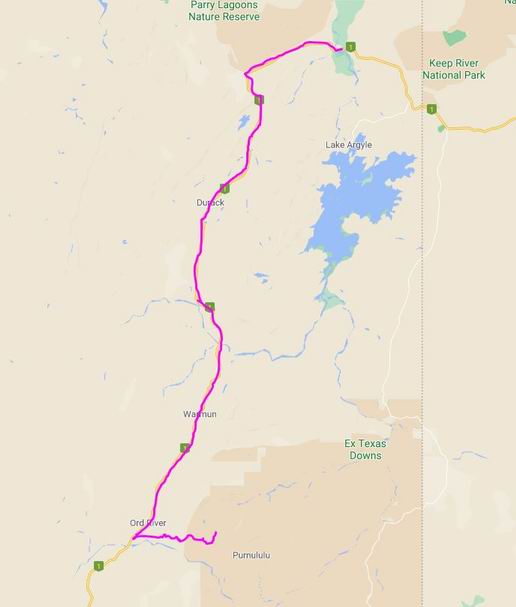
We travelled about 250kms on the highways, before turning onto the unsealed road into Purnululu National Park – the Spring Creek Track.
Not far along the track, we came to the Fletcher Creek crossing. This was nearly the end of our Bungles expedition! After all the rain, it was quite wide, with a noticeable current, and muddy brown in colour – obscuring any idea of the nature of the creek bed.
We joined other vehicles parked up, waiting to watch someone else drive it! Logic said that since the track was officially open, this crossing must be do-able, but it looked pretty marginal to me. Eventually, a vehicle appeared on the far side and headed towards us. He took a curving path and made it without mishap, though it became obvious that the creek bottom was very uneven as he tilted about. His vehicle only looked to be in about 60cm deep water – we could manage that. With its rubber matting floors, a little water ingress was not a big deal for Truck; the rear contents, the HF radio unit and the air compressor controller, were all some 10cm higher than the footwell level for us, as the floor was stepped.
So we ventured in – with us in the lead and M waiting till we got through, and watching the line we took. We must have crawled over some fairly large rocks under the water – certainly got up some distinct leaning! The rocky bed wasn’t firm, either – a couple of times it felt like we slipped sideways off rocks. But got through unscathed, as did M when she followed us. Funny how the angle of tilt feels so much greater when one is sitting in the vehicle, rather than just watching on…..
It was clear, despite our success, that this crossing was obviously deterring the majority of would-be campers. No one seemed to immediately follow us. Maybe our crossing looked as bad as it felt!
Fletcher Creek as it normally is. For us, it extended bank to bank (Zoom)
After that, the track was quite good – a pleasant surprise as it had a reputation for often being rough. We covered the 52kms from the highway in about 90 minutes, to the Ranger Station/Three Ways corner.
We decided to go to Kurrajong Camp area; the alternative – Walardi – was much closer to the helicopter base, with its attendant noise. It cost us $20 a night to camp (unpowered of course), plus an entry fee of $3. Because John was going to be out of camp, up at Picaninny Gorge, we were only charged a $15 camp fee for each of those nights! Not cheap, for a National Park!
We booked for a week in all. That would, we thought, allow us to visit all the special sites, do the walks, and for M and John to have their two nights away, and then recover afterwards, which I suspected would be needed.
At Kurrajong Camp, we set up in their designated generator section – wanting to be able to re-charge camera and laptop batteries, if needed. This area was large and pleasant and had hardly any other campers. Across the little creek, the non-generator, “quiet” area was quite crowded, and really not quiet at all. I think we may have stumbled on a useful campground strategy!
I wondered how many of the campers here were recent arrivals, and how many were still waiting for Fletcher Creek to go down before leaving, after a prolonged stay?
It was a pretty camp area, with the nearby range red in the afternoon sun. The little creek behind us was dry. The pit toilets were not too far to walk, were alright for their type, and there were water taps not far away.
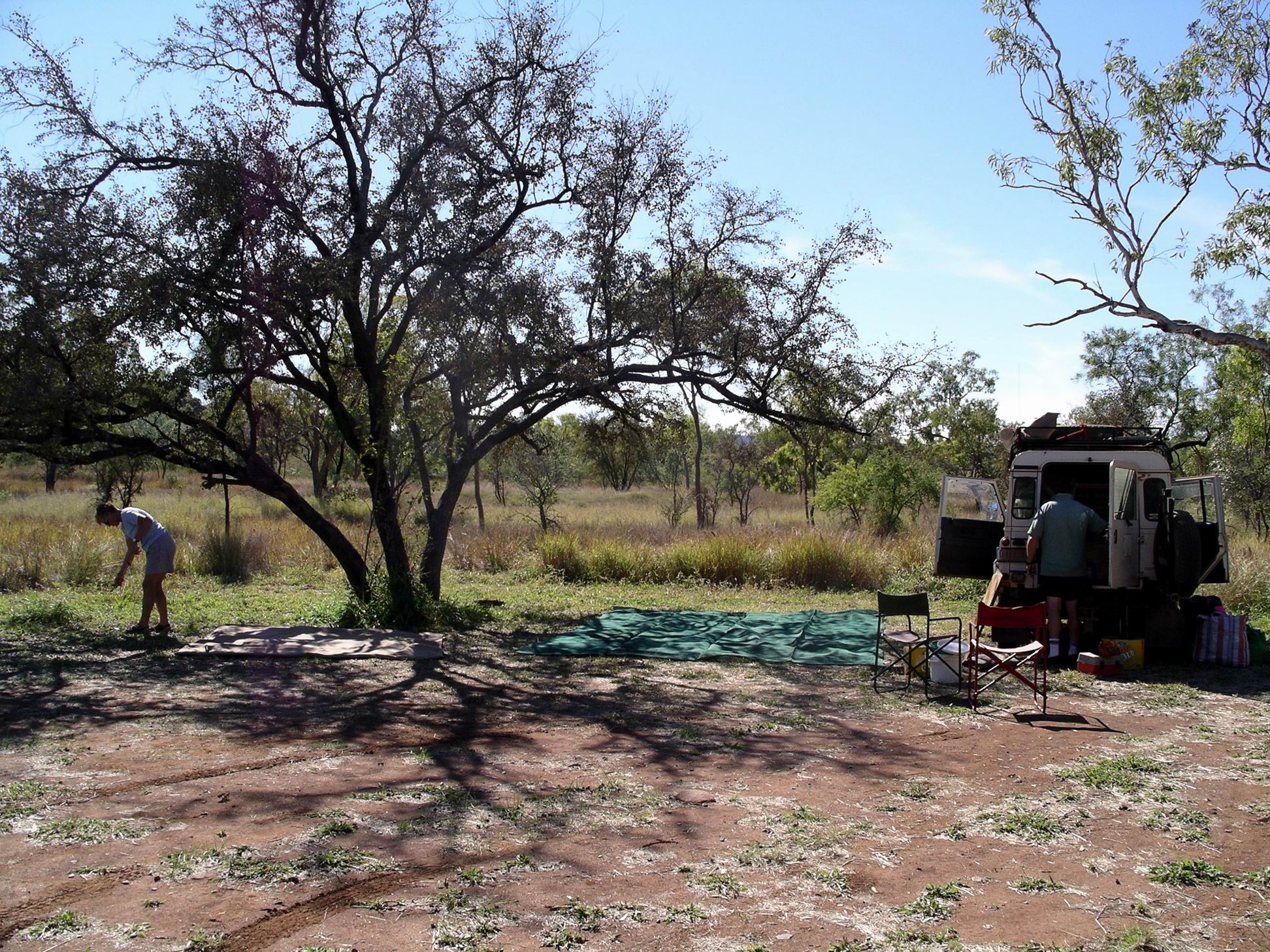
It took us a while to set up our camps. Our big tent was relatively easy to put up, as these things go, and we had done it many times before, so knew what we were doing. But it did take time to unload the gear from Truck and set it up – like the plastic crates of foodstuffs, in the tent. Had to blow up the lilo we slept on – the Truck air compressor did that. Then I had to make that up with underblanket and sheets, and open up the sleeping bags that would be our top coverings.
Setting out the shade cloth that went under the tent floor
The camp gas stove, outside tables and chairs were set up. The Chescold fridge was unloaded and placed in the shade of the tent, and its gas bottle attached and fridge lit.
Then we felt we’d earned a beer or two before cooking tea. So good to be out in the bush again.
It was a really dark night – no moon to speak of and no general urban light.
Back to the shops, to collect our packaged meat, and to buy fresh fruit and vegies.
We needed to visit the camping gear shops to see what useful gear we might be able to acquire, without breaking the bank.
Bought John a 3 litre camel pack (a water bladder that fits inside a day or back pack). Carrying water would be a challenge on the gorge walk, because there is no reliable drinking water there.
Bought him a small, light, lilo, a light weight plate and bowl and a few similar items. We also bought some dried hike food.
I really thought that we should have bought him a rucksack, but the cheapest that was any good at all was $199, and he baulked at that.
From 1998, until just last year, we always carried on our travels, our two old hiking rucksacks, a hike tent, small meths stove and associated hike gear – just “in case”. Of course, this year, they were safely in a shed at home……
There was much packing through the afternoon.
Shuffling contents……
I attracted some disbelieving looks from surrounding campers, as I tore up newspapers into different sized squares and individually wrapped all our potatoes, onions, oranges, carrots, grapefruit, apples. It took ages, but I’d found in the past that this effort was worth it – the unrefrigerated produce lasted much longer that way – and if a piece did go bad, it did not spread to the other items. I packed all that into cardboard cartons that we’d obtained from the supermarket.
Our clothes went into two soft luggage bags; these normally travelled empty, flat, in Truck. At least, we had brought those from home with us.
Our Chescold gas fridge was to be the refrigerator for most of our joint chiller items. M’s 12v Engel fridge was largely given over to freezer storage of our meat.
Took down the van annexe roof, packed up the floor matting and packed away as much as we could.
John tried to activate the new phone. It was not easy to work, and he did not really have time for detailed reading of the manual – in any case, as far as he is concerned, manuals are the very last resort when all experimentation fails!
I tried to send an experimental text message to daughter, to test it out – John not knowing how to text – but it didn’t seem to work.
The old phone kept on working, even though it was not supposed to – because the new phone was supposed to have its number! At night, I phoned daughter, who said that the strange text message (from me) had come in to her on a totally unfamiliar number.
John promptly phoned Telstra, who told him we couldn’t keep our old number, in spite of being told we could, by the salesman. Typical. John was told he would have to phone and sort it out tomorrow.
I was not happy. I was extremely unhappy…..
Phoned son and really urged him again to consider joining us, at some point, in the Kimberley, to take a break from his marital woes.
I woke up feeling perfectly fine, which was a pleasant surprise.
The caravan park had a dedicated area where residents could do vehicle work, including an oil change, so John and M did an oil change on both the vehicles – M with tutelege from John. It was a messy job.
While they were doing that, I went to the Park office, and arranged for the van to be stored here. It would be parked in their storage area, for $3 a day. Very reasonable.
We did a big food shop. At the butcher’s shop, M and I put in our orders for vacuum packed meats, which we would collect tomorrow. It was all meats minus bones – steaks, sausages, mince, chicken thighs. I learned the hard way, on a trip years ago, not to cryovac meat with bones that could pierce the plastic! Green chops anyone?
When we checked at the PO, the new phone had not arrived. Not good. We had been here long enough, without having to wait round for something like that! In fact, I would refuse to do so.
At the Visitor Centre, we bought Permits – as vaguely dated as we could manage – for Kalumburu, in case we did manage to get up there. At the moment, that road was still not open.
Refuelled Truck – $1.52cpl.
John phoned Telstra about the missing phone. They had sent the package to the caravan park, not the PO! Slight breakdown in communication right there! He collected it. He activated the new computer internet connection – much faster. At least that was positive. Not that there would be much in the way of internet signals where we were going for the next month or two.
We started the long packing process. Some gear, food and clothes had to be moved from van to Truck, and packed appropriately. Some stuff would move from Truck to van, mostly to be squeezed in under the bed. Truck would need rearranging so we could access things differently. Basically, unpack everything and start again! We knew from prior experience that this would be a long and tiring job.
We sat round at Happy Hour, discussing what we would do whilst in the Bungles. M really wanted to do the walk to Piccaninny Gorge, and camp up there for a night or two. Well, she would have to camp at least one night, because it was about 15kms each way. John decided he really wanted to do it too. Unfortunately, we did not have enough of the right gear for all of us to do it. M’s small hike tent would sleep two at a squeeze, but definitely not three, for starters. I actually did not mind too much the idea of minding the camp and having a bit of time on my own!
Apart from that, it was decided we would try to visit all the accessible features of the Bungles – and would stay long enough to do so. If we were making the effort to get in there, we would make it worthwhile! It would not be a short stay…..
Today it was official – the Kununurra area had just smashed all previous rainfall records for June! The previous record had been 15.2mm – but we had just tallied up 98.9mm! The average for June was just 4.0. Where we go, so goes the rain…….. It was also a new record low temperature June.
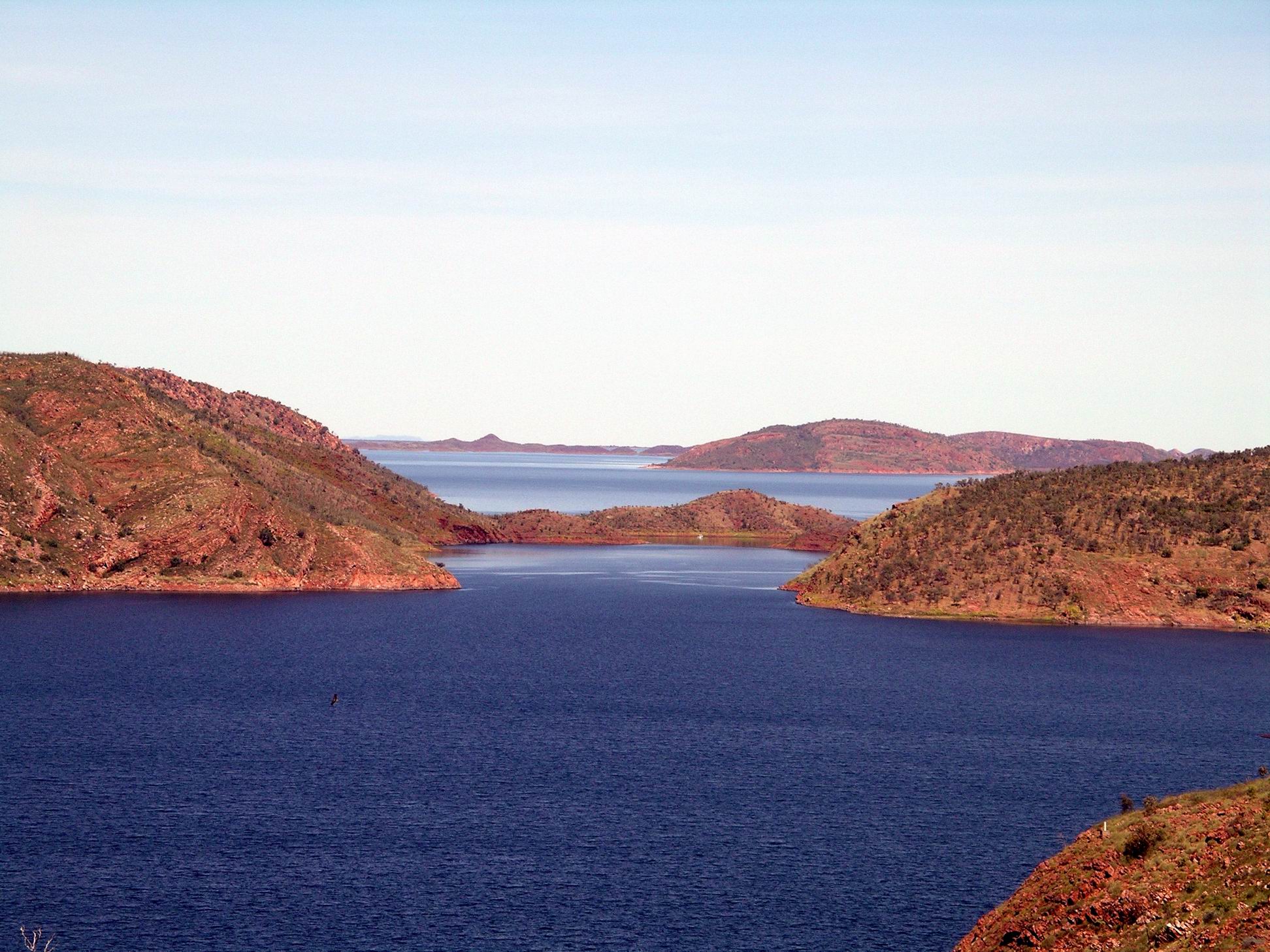
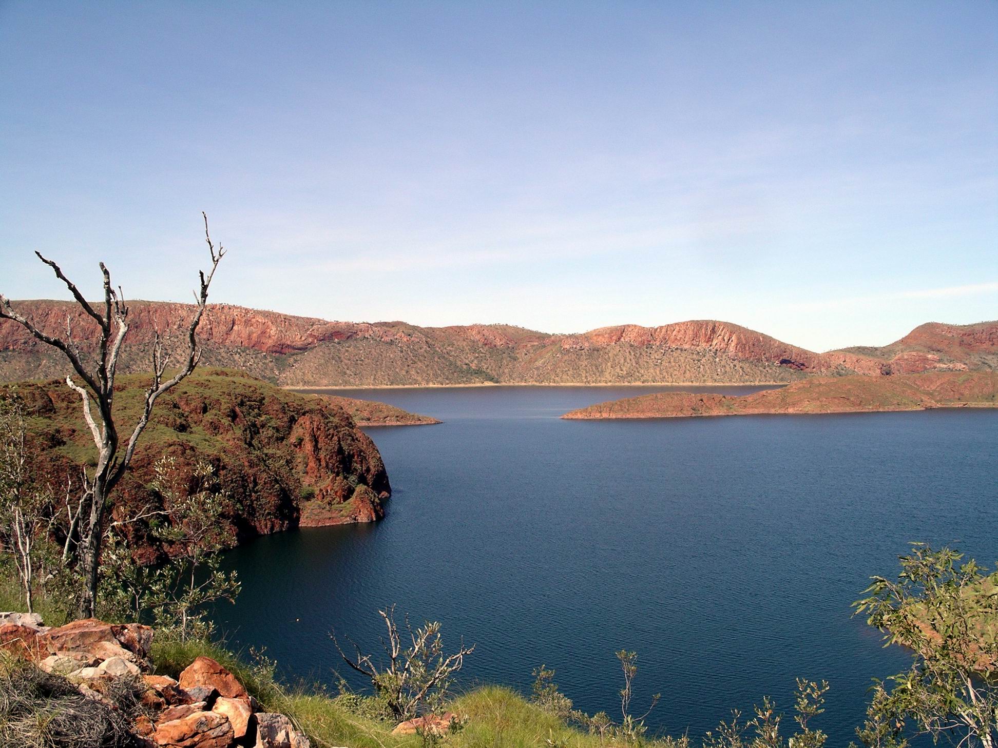
After the usual morning getting-going routines, we drove out to Lake Argyle Resort.
Lake Argyle – only the very small northern end
There is only the one road out to there, leaving the highway back east of Kununurra, almost to the NT border. The day was much nicer than when we’d passed this way over a week ago!
The drive out to the resort, dam wall and surrounds was well worth doing, just for the scenery along the road.
Out there, we did a little walking – to a couple of lookout areas.
Dam wall and one of the lookouts
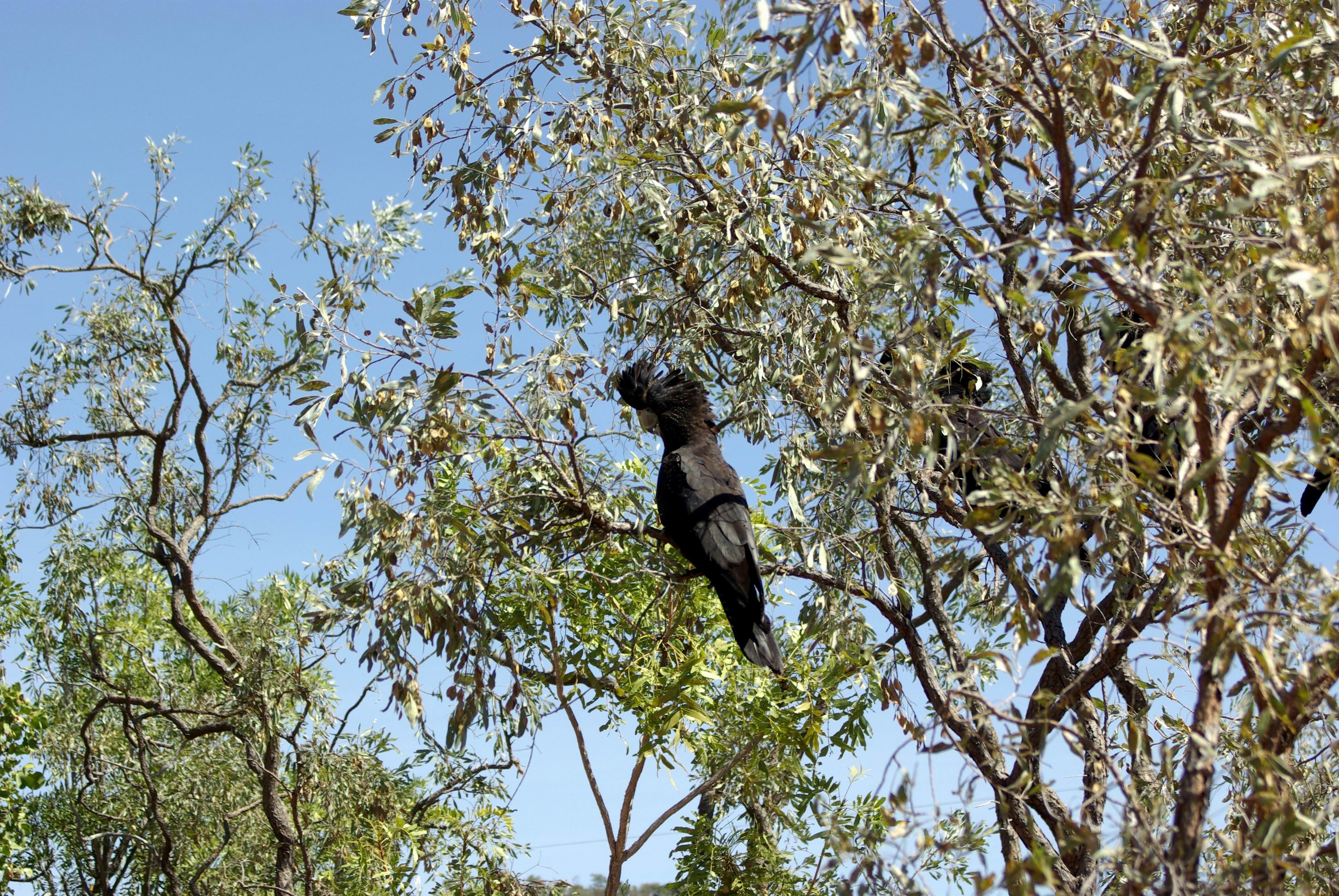
At one of them, we were distracted from the views by a noisy group of red tailed black cockatoos, feeding in the trees, quite close to us.
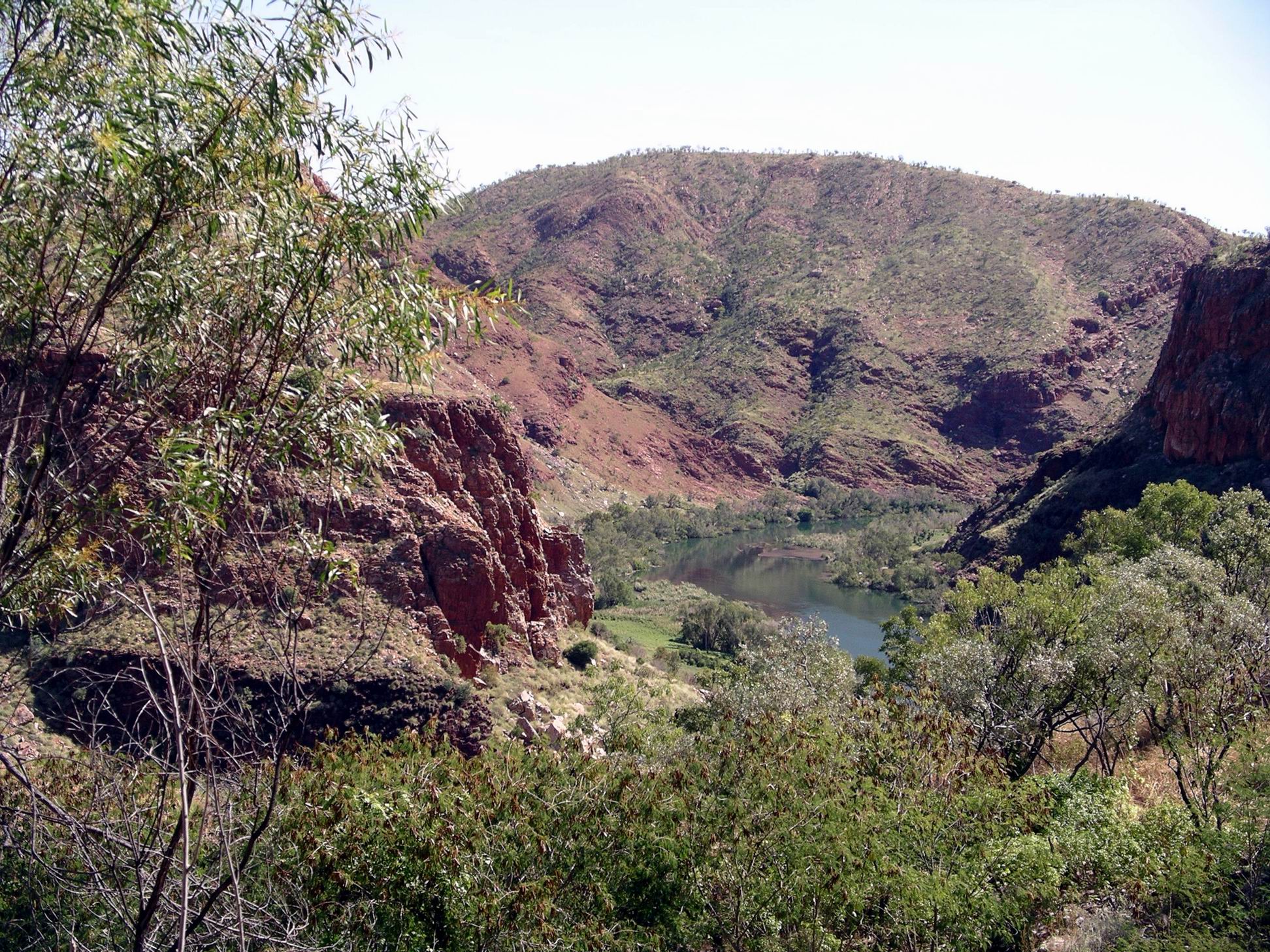
From one of the lookouts, we could see down over the Ord River, to where we had cruised up yesterday.
Ord River – a section we’d travelled on yesterday
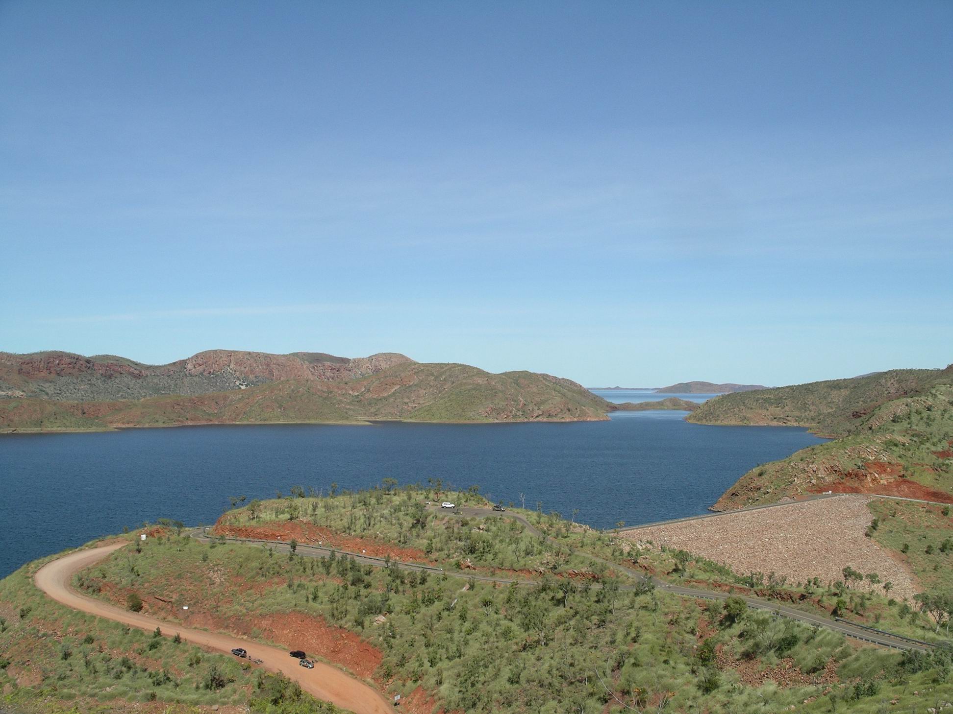
Drove across the dam wall to the far side, parked near the boat landing, and wandered around for a bit longer than we’d had time to do, yesterday.
Ord River Dam wall – such a small structure to hold back so much water
It really is such a small dam to hold back such an enormous volume of water! What struck me as noteworthy was that Patrick Durack was suggesting damming the Ord, decades before it happened.
John wanted us to have a fish and chip lunch at the Argyle Tavern, where they served the silver cobbler fish. As we’d previously discovered, this was the more palatable – marketable – name for the catfish caught in the Lake!
I was feeling a bit off colour before lunch, and was even more so after the meal, which was very greasy and tasted like the cooking oil was rank. It was a pity, because we’d talked this up to M, and because we had really enjoyed previous meals of this fish, even buying some for the van freezer. Not this time!
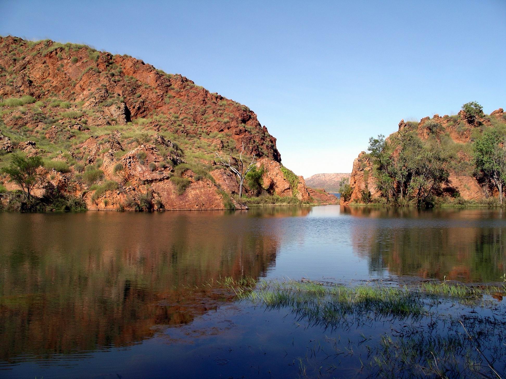
On the way back, stopped at the Stonewall Creek crossing and wandered about there for a little while. It was just being an ordinary creek, without a great deal of water. It was hard to describe to M what it was like when raging with overflow waters.
Our other destination on the return trip, was Mirima National Park, close to town. This is only small, but contains unusual rock formations and great short walks through them. The rocks are the banded sandstone formations similar to the Bungles – and like Keep River.
We walked through the valley between the rock formations and up to a lookout over Kununurra and its surrounding farmed plains.
One of the rock formations here has a name that both amused and fascinated me, the first time ever we came here – translated from the indigenous as Head Lice Dreaming. I love it.
Head Lice Dreaming
Came across a bower belonging to a Great Bower Bird. It was always interesting to see which types of items individual male birds collect to decorate their bowers. This one had found some pale green glass – it looked like he was still experimenting with this. Presumably he had also brought the plastic drink can insert, to try out?
I went to bed very early, feeling very flu-ey. I couldn’t work out how much was due to the awful lunch, and how much was some illness.
John had to cook his own tea. I think it finished up being baked beans from a tin!
We walked to the boat departure area which was close by the caravan park, to be there at 11.15. Left at 11.30 for our Triple J tour up the Ord River.
There was a lovely, clear blue sky and it was not too hot.
Afternoon tea was provided as part of the tour, but travellers were encouraged to have their lunch before departure – so we’d had a slightly more substantial than usual, late breakfast. Took bottles of water with us.
This tour was so excellent. The different sections of the river that we traversed, over the 55kms each way, provided plenty of contrasts – and scope for many, many photos! Thank God for digital!
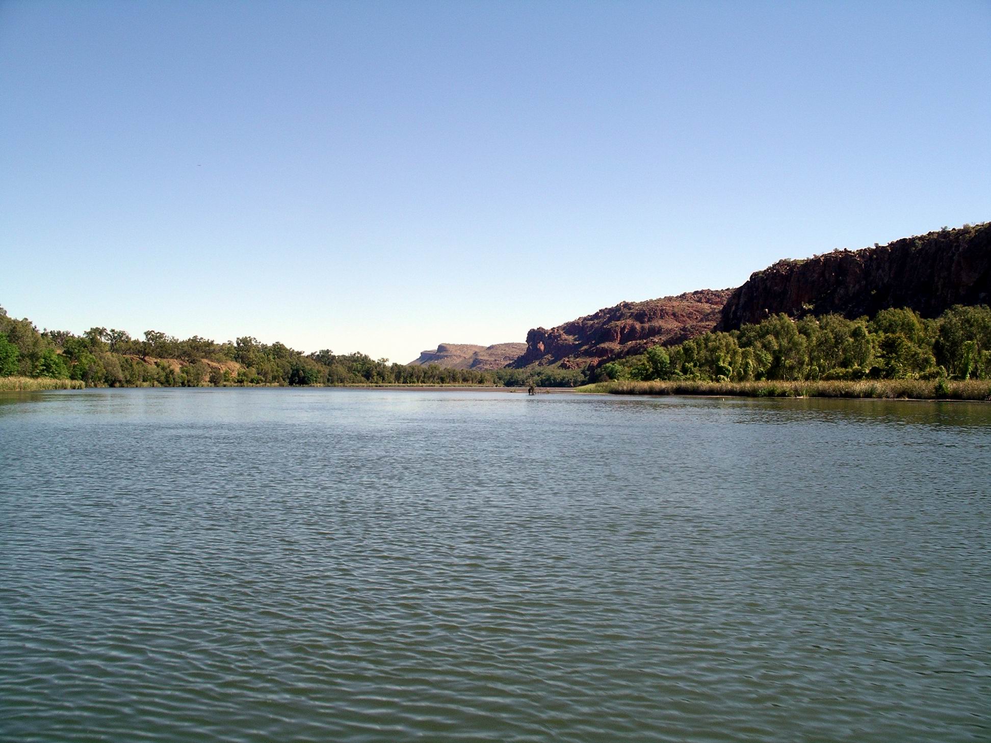
The first section was Lily Creek Lagoon, part of Lake Kununurra. Then it was out into the river proper – large and placid, with distant ranges.
Gradually, this section became less civilized/settled, and the river gradually narrowed, with the outlook ahead of the boat becoming dominated by rocky ranges.
The river entered a broad gorge through the Carr Boyd Range.
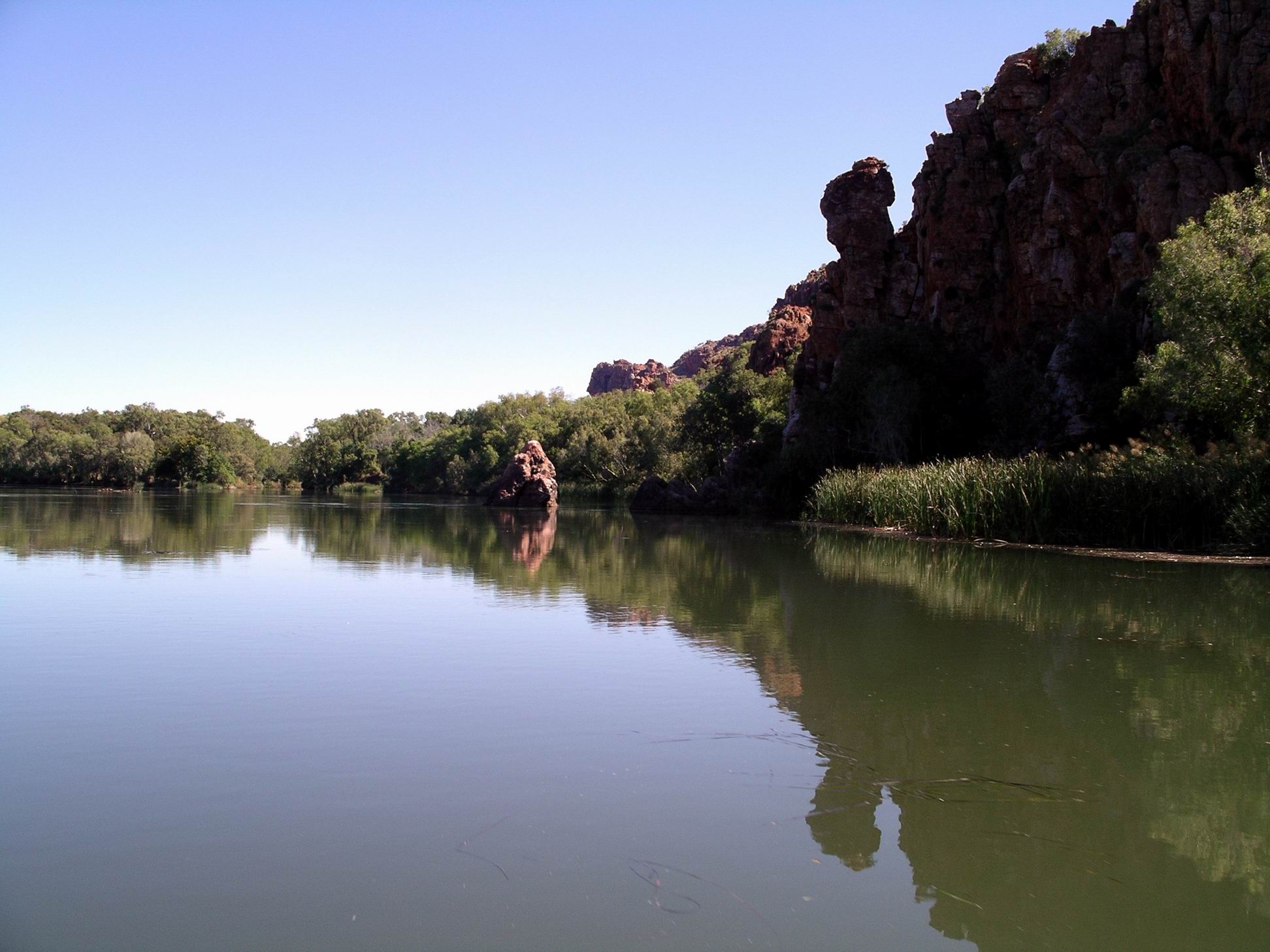
Here, the vistas were shorter, as the river wound around bends, and were dominated by red rock walls, whose varied shapes were interesting in their own right.
The reflections on the river surface added another dimension, and in some ways were more worth photographing than the actual subject matter that was being reflected. I was so pleased that the weather conditions today helped make these so good.
There began to be areas of shallows, sandbanks, little islands in the channel.
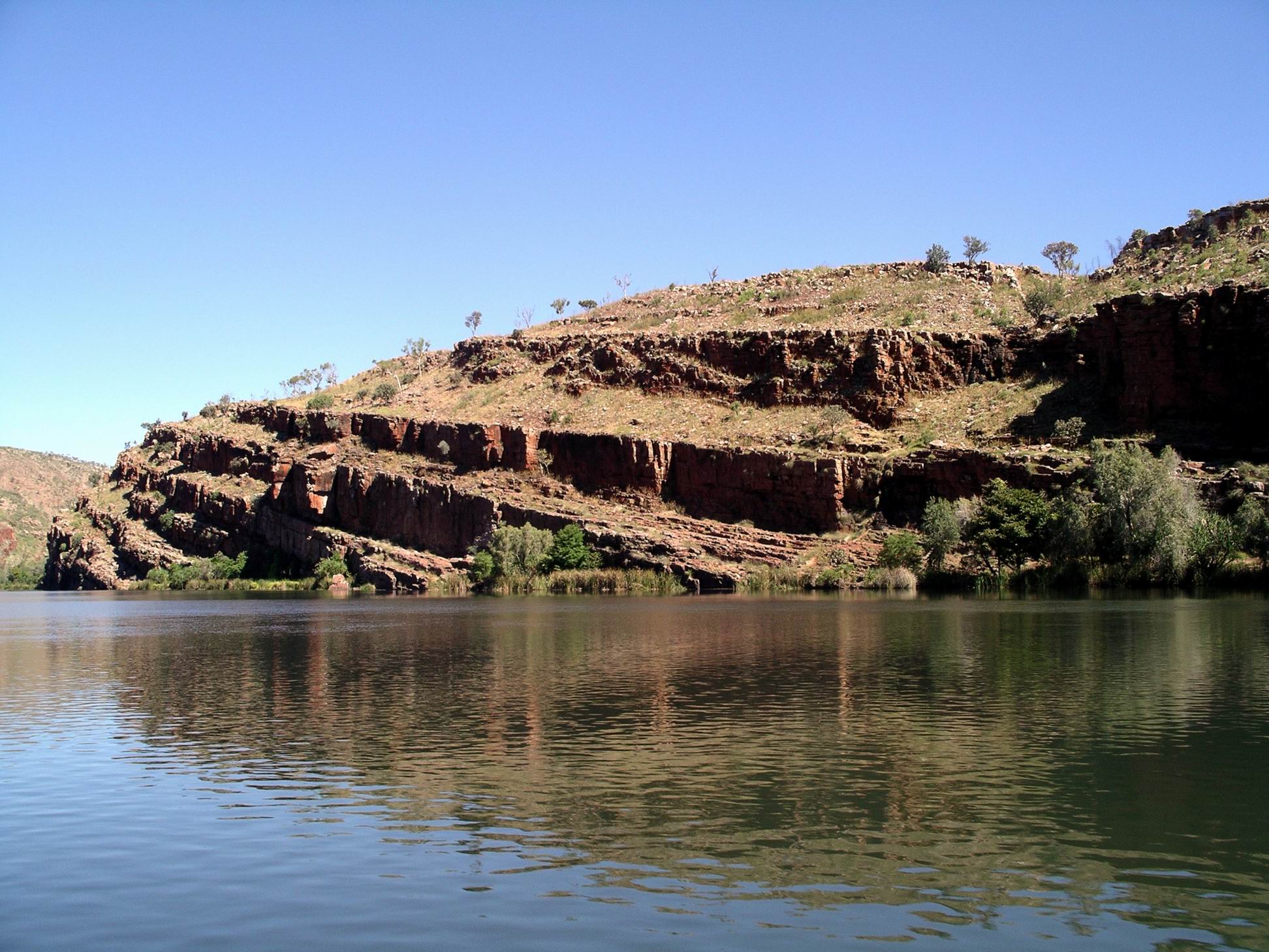
Some sections of more shallow “rapids” were a reminder that, before the building of the Ord River Dam, and the one at Kununurra, the river’s behaviour here would have been totally different. Trips like this would probably not have been possible for much of the year, if at all.
Finally, there was the section of river below the dam wall, which loomed high above. This part of the river was quite fast flowing, because of the outflow from the little hydro electricity generating station. The outflow pipe was gushing water.
Dam wall – built across a very narrow, deep valley
The Ord River Dam that created Lake Argyle was finished in the early 70’s, in order to better store and regulate water flow for the downstream irrigation areas, and allow expansion of the farmed area. The hydro electricity scheme went in during the 1990’s. It only looks a little plant, but generates the power for Kununurra, Wyndham, and the Argyle Diamond Mine.
Hydro generation plant outflow with only one of the three outlet pipes operating
The whole place deals in massive and impressive statistics! We were told that Lake Argyle stores a water volume of something like 29 Sydney Harbours. I did remember, from when we did the sunset tour in 2000, being astounded by the size of the lake – and we were only on one narrow end. The boat operators on the Lake must have the same sort of certification as ocean ship operators – Lake Argyle is regarded as a sea!
We were also told then that they didn’t really expect the Lake to fill completely, that it was supposed to take several years to reach the part capacity forecast – and then, in the wet summer of 73/4, it filled to overflowing, catching them all by surprise.
Perhaps even more impressive is the fact that this dam wall that holds back so much water, is made of local rock, and clay – no cement at all! And it is such a tiny structure, comparative to the size of the impounded lake behind it.
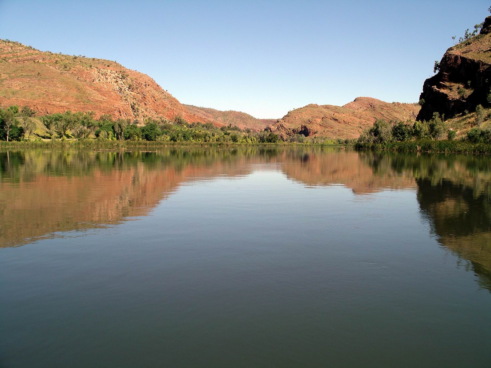
After a short stop at the boat landing below the dam wall, we commenced the return trip down river. With the water flow this time, instead of against it.
The perspectives going back were quite different, so the trip did not become monotonous.
On the way back, we nosed into where Stonewall Creek entered the Ord, quite a distance downstream from the Dam. This is the spillway from the Lake, at overflow peaks. We had, on a previous trip, explored this creek at the point where the access road to the Argyle Village, crosses it, and seen it in full spate with raging floodwaters from the Lake.
The gorge of a tributary creek
We tied up at a little landing in a grotto-like area, where there was a little trickling waterfall, for afternoon tea. Nice it was too – pumpkin scones and a banana sponge, with tea and coffee. This was one of the places that canoe-based campers could stay, when travelling the river. That would actually be a great way of exploring it, over 3-5 days, but it would be hard work going upstream! Somewhat sadly, beyond our abilities and inclinations (mostly) these days.
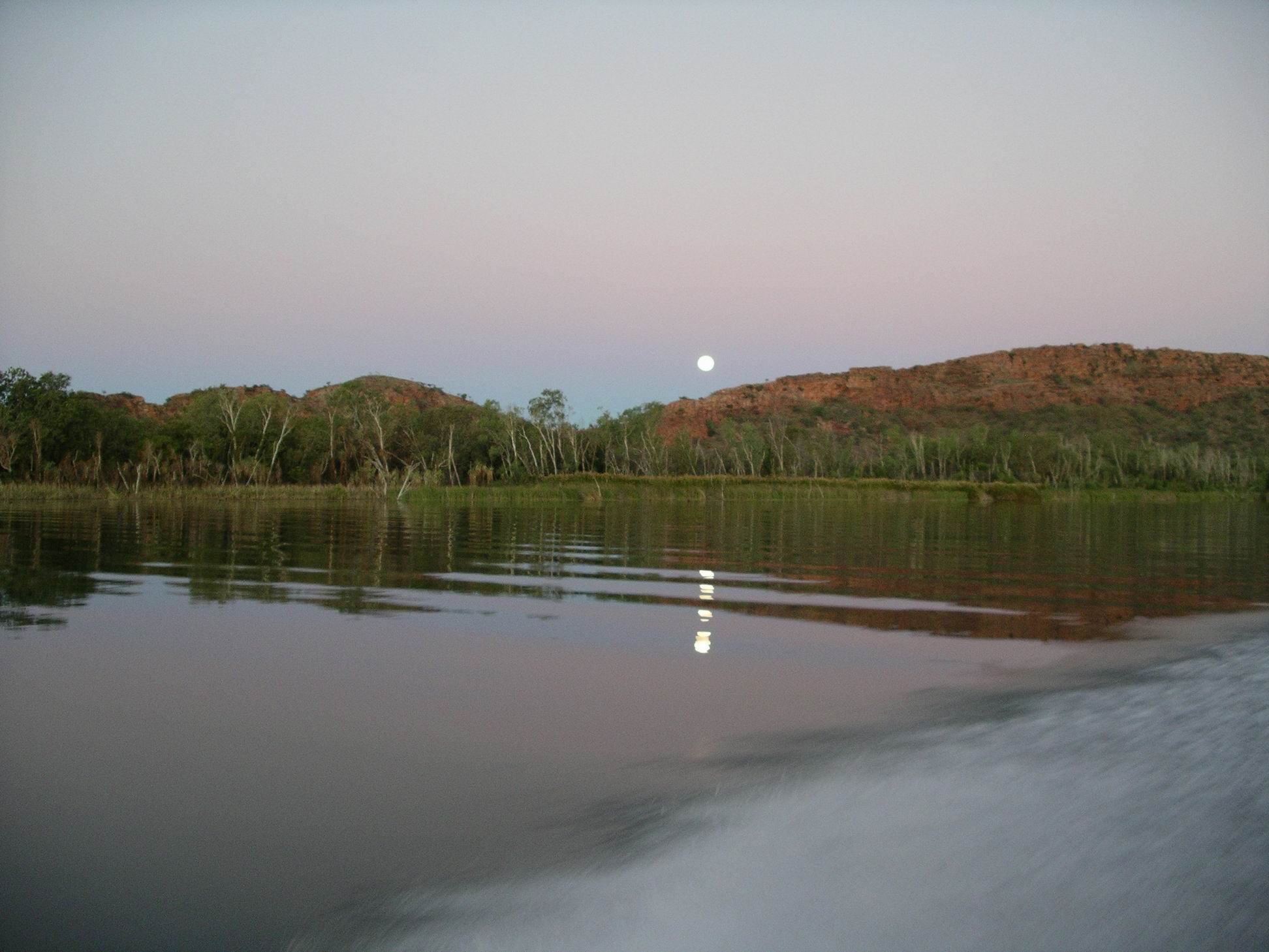
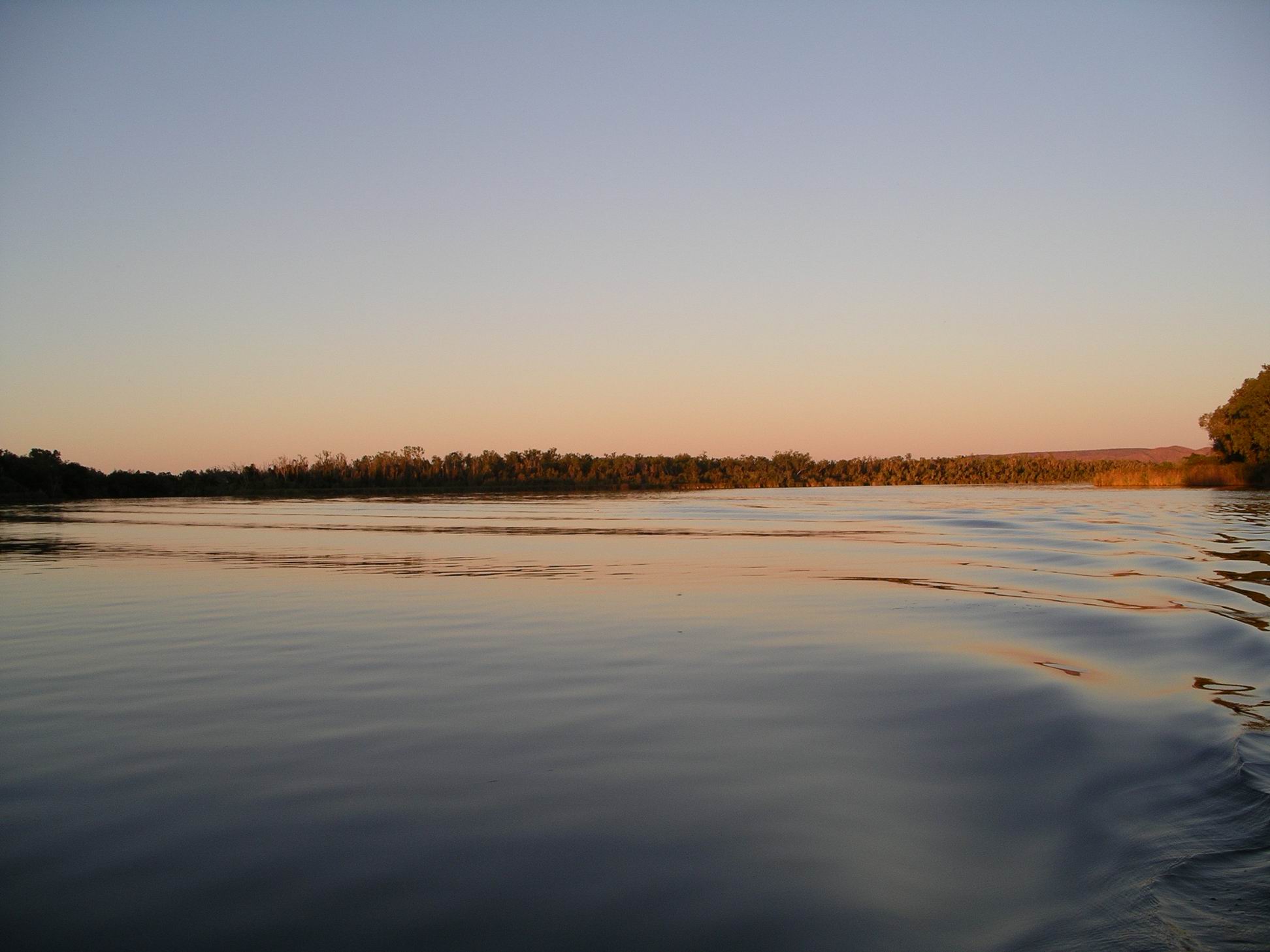
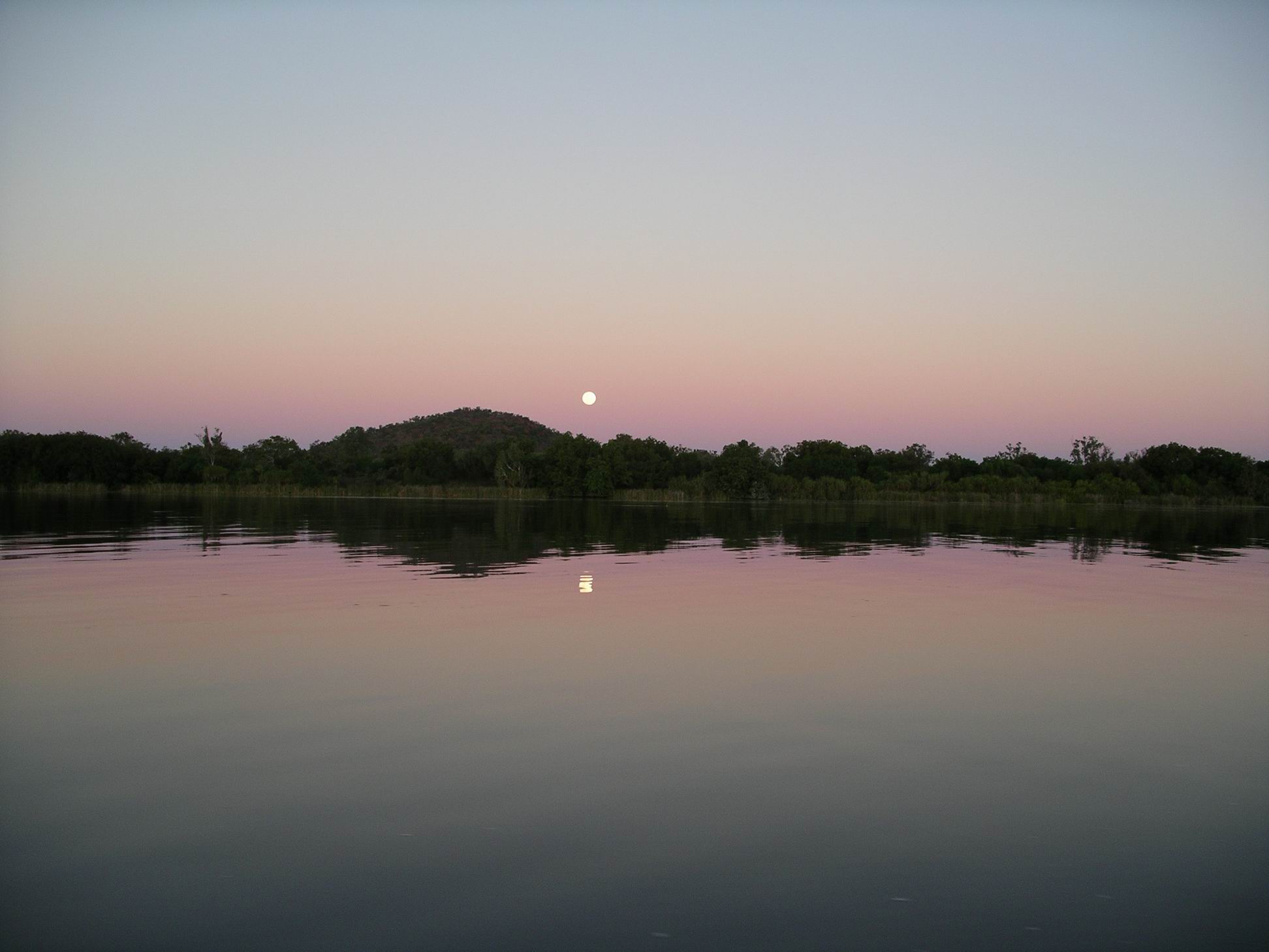
Also different on the way back, was the light, as we approached late afternoon, then dusk and finally sunset and moonrise over Lake Kununurra as we came back to dock.
Moonrise over the Sleeping Buddha
It was very chilly for the last half hour or so, as the sun went down. The sunset and moonrise reflections on the lake surface were quite special, though.
That graduated blue-pink-grey horizon that is so typical of dusk in these parts
In all, a great trip, excellent value for money. One I’d be very tempted to do again, if we do another trip this way.
In our absence, M went off driving exploring, on the back tracks to the west of the Ord – Parrys Creek way. She visited Black Rock Falls and Middle Springs and the western side of the Ivanhoe Crossing.
Phoned son at night, to keep a check on him. We talked about him possibly meeting up with us, up this way, for a break, once his move of house had been done.
A fine day. Good – I hoped all those dirt roads we would soon be traversing, were drying out fast!
For us, the main event of the day was that we collected our sandblasted and repainted roof rack. John was extremely pleased with the job that was done on it. However, collected was the operative word. We were shown it, paid for it, and then left to replace it into position ourselves! This took us a while – it was a bloody unwieldy object! Truck is high. We had to be careful not to scratch the sides of Truck.
The road into the Bungles was re-opened today. Guess there would be a number of campers very happy to be able to leave there now! But although the Gibb is open, the Kalumburu road that gives access to the Mitchell Plateau area is still closed, so there would still be stranded groups at the Mitchell Plateau, King Edward River, the Kalumburu area camps, and Drysdale River.
Still having a few more days to go here yet, should enable the initial rushes of travellers to the Gibb and the Bungles, to clear through the camps and get ahead of us.
Did some minor shopping for the weekend meals. Fish and chips again tonight. Didn’t reckon we would be having our Friday night feasts again, for quite some time.