
SATURDAY 30 JUNE KUNUNURRA
We walked to the boat departure area which was close by the caravan park, to be there at 11.15. Left at 11.30 for our Triple J tour up the Ord River.
There was a lovely, clear blue sky and it was not too hot.
Afternoon tea was provided as part of the tour, but travellers were encouraged to have their lunch before departure – so we’d had a slightly more substantial than usual, late breakfast. Took bottles of water with us.
This tour was so excellent. The different sections of the river that we traversed, over the 55kms each way, provided plenty of contrasts – and scope for many, many photos! Thank God for digital!
The first section was Lily Creek Lagoon, part of Lake Kununurra. Then it was out into the river proper – large and placid, with distant ranges.
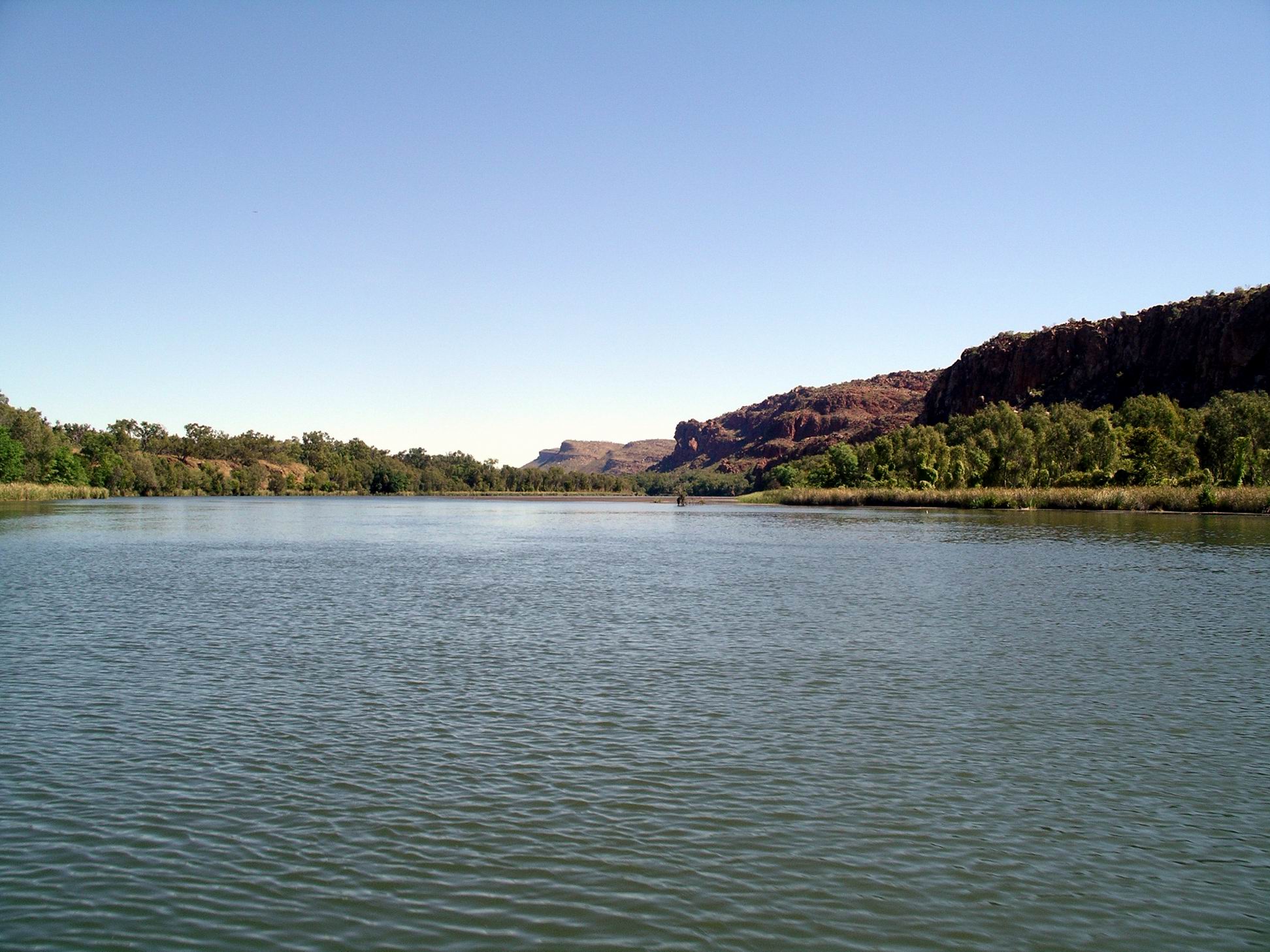
Gradually, this section became less civilized/settled, and the river gradually narrowed, with the outlook ahead of the boat becoming dominated by rocky ranges.
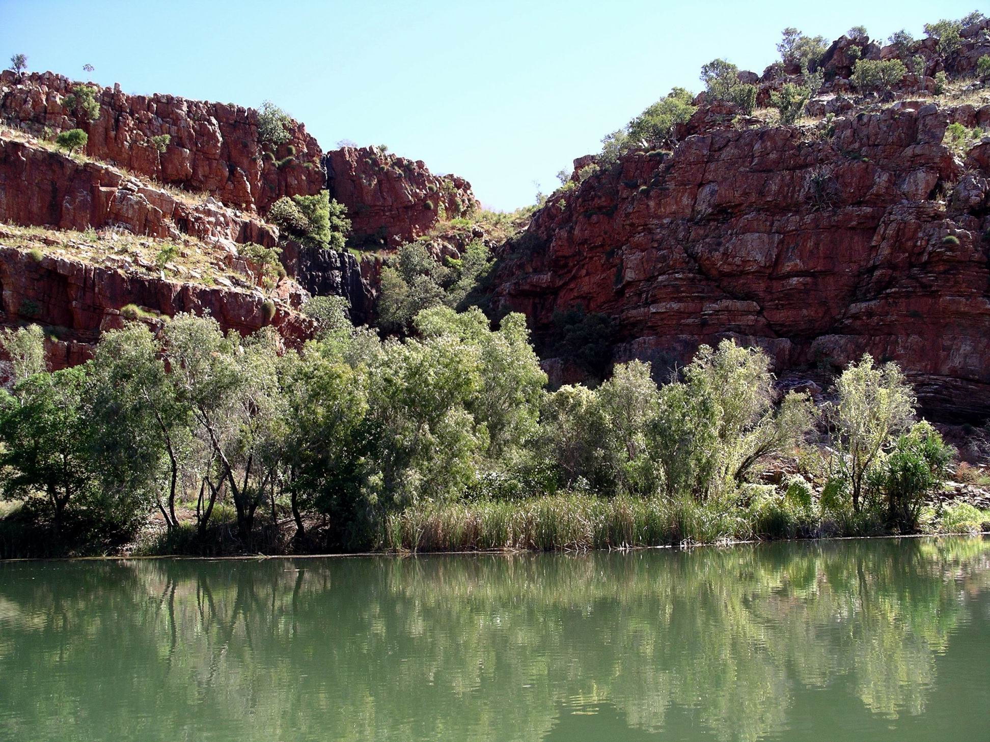
The river entered a broad gorge through the Carr Boyd Range.
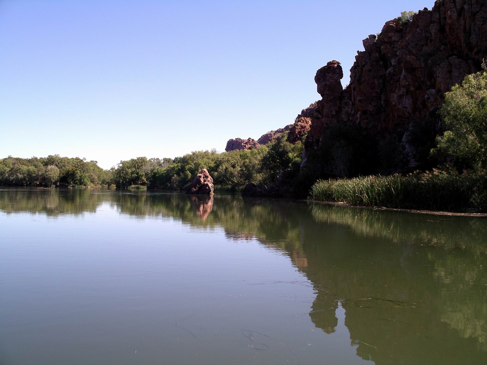
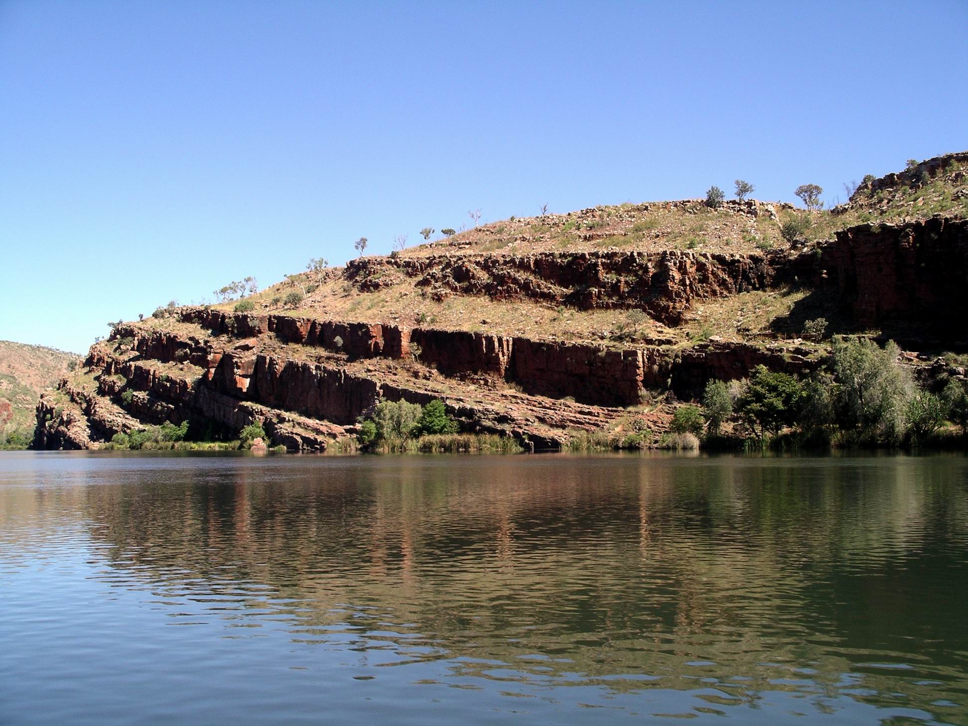
Here, the vistas were shorter, as the river wound around bends, and were dominated by red rock walls, whose varied shapes were interesting in their own right.

The reflections on the river surface added another dimension, and in some ways were more worth photographing than the actual subject matter that was being reflected. I was so pleased that the weather conditions today helped make these so good.

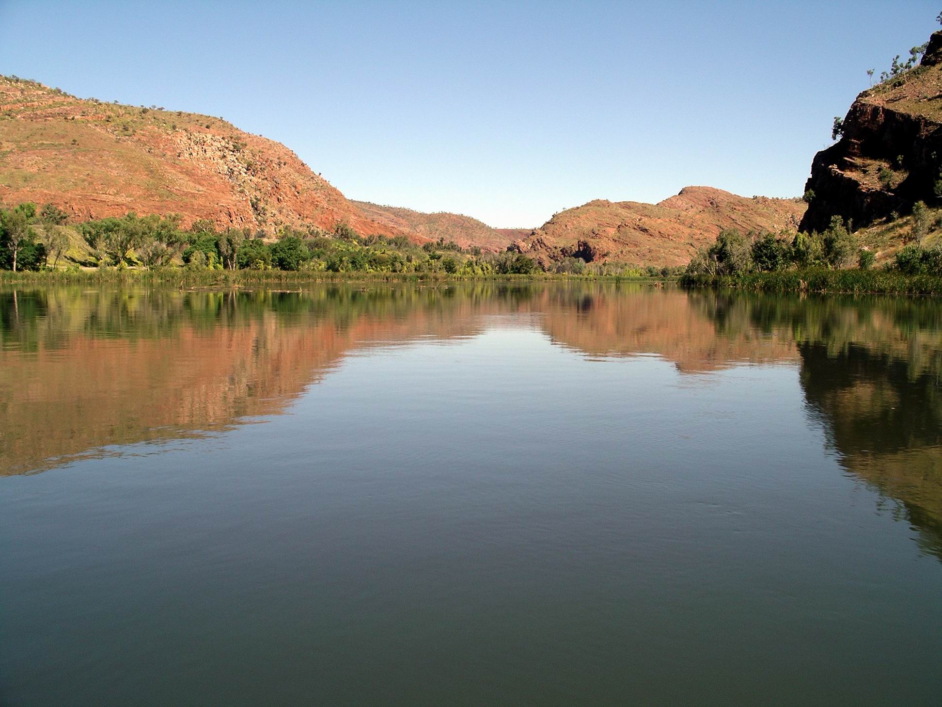
There began to be areas of shallows, sandbanks, little islands in the channel.

Some sections of more shallow “rapids” were a reminder that, before the building of the Ord River Dam, and the one at Kununurra, the river’s behaviour here would have been totally different. Trips like this would probably not have been possible for much of the year, if at all.

Finally, there was the section of river below the dam wall, which loomed high above. This part of the river was quite fast flowing, because of the outflow from the little hydro electricity generating station. The outflow pipe was gushing water.

The Ord River Dam that created Lake Argyle was finished in the early 70’s, in order to better store and regulate water flow for the downstream irrigation areas, and allow expansion of the farmed area. The hydro electricity scheme went in during the 1990’s. It only looks a little plant, but generates the power for Kununurra, Wyndham, and the Argyle Diamond Mine.

The whole place deals in massive and impressive statistics! We were told that Lake Argyle stores a water volume of something like 29 Sydney Harbours. I did remember, from when we did the sunset tour in 2000, being astounded by the size of the lake – and we were only on one narrow end. The boat operators on the Lake must have the same sort of certification as ocean ship operators – Lake Argyle is regarded as a sea!
We were also told then that they didn’t really expect the Lake to fill completely, that it was supposed to take several years to reach the part capacity forecast – and then, in the wet summer of 73/4, it filled to overflowing, catching them all by surprise.
Perhaps even more impressive is the fact that this dam wall that holds back so much water, is made of local rock, and clay – no cement at all! And it is such a tiny structure, comparative to the size of the impounded lake behind it.
After a short stop at the boat landing below the dam wall, we commenced the return trip down river. With the water flow this time, instead of against it.

The perspectives going back were quite different, so the trip did not become monotonous.

On the way back, we nosed into where Stonewall Creek entered the Ord, quite a distance downstream from the Dam. This is the spillway from the Lake, at overflow peaks. We had, on a previous trip, explored this creek at the point where the access road to the Argyle Village, crosses it, and seen it in full spate with raging floodwaters from the Lake.
We tied up at a little landing in a grotto-like area, where there was a little trickling waterfall, for afternoon tea. Nice it was too – pumpkin scones and a banana sponge, with tea and coffee. This was one of the places that canoe-based campers could stay, when travelling the river. That would actually be a great way of exploring it, over 3-5 days, but it would be hard work going upstream! Somewhat sadly, beyond our abilities and inclinations (mostly) these days.

Also different on the way back, was the light, as we approached late afternoon, then dusk and finally sunset and moonrise over Lake Kununurra as we came back to dock.
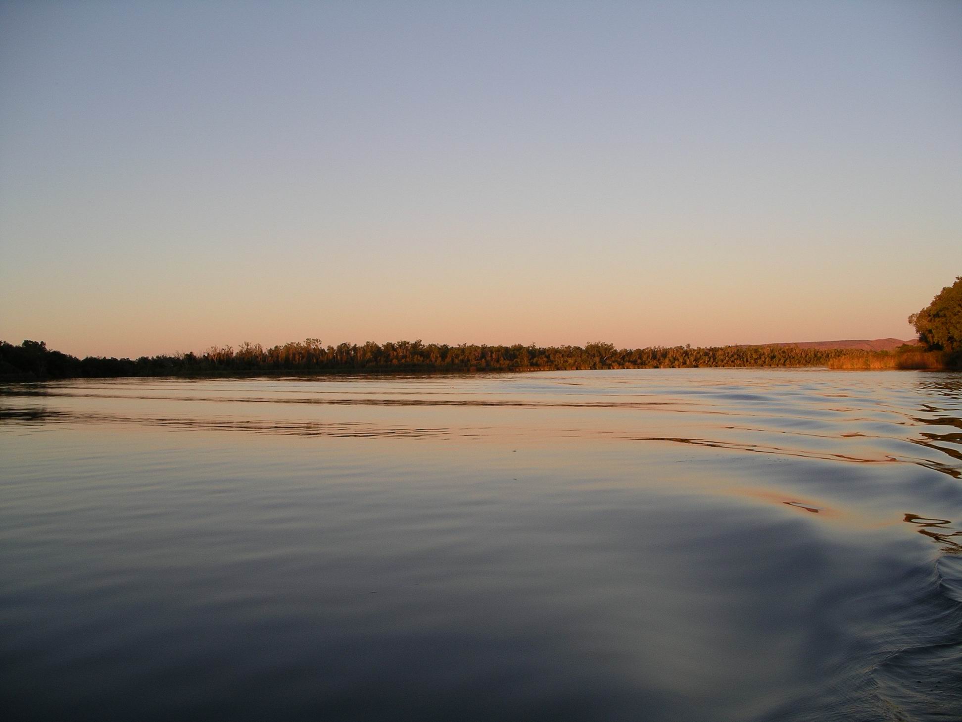
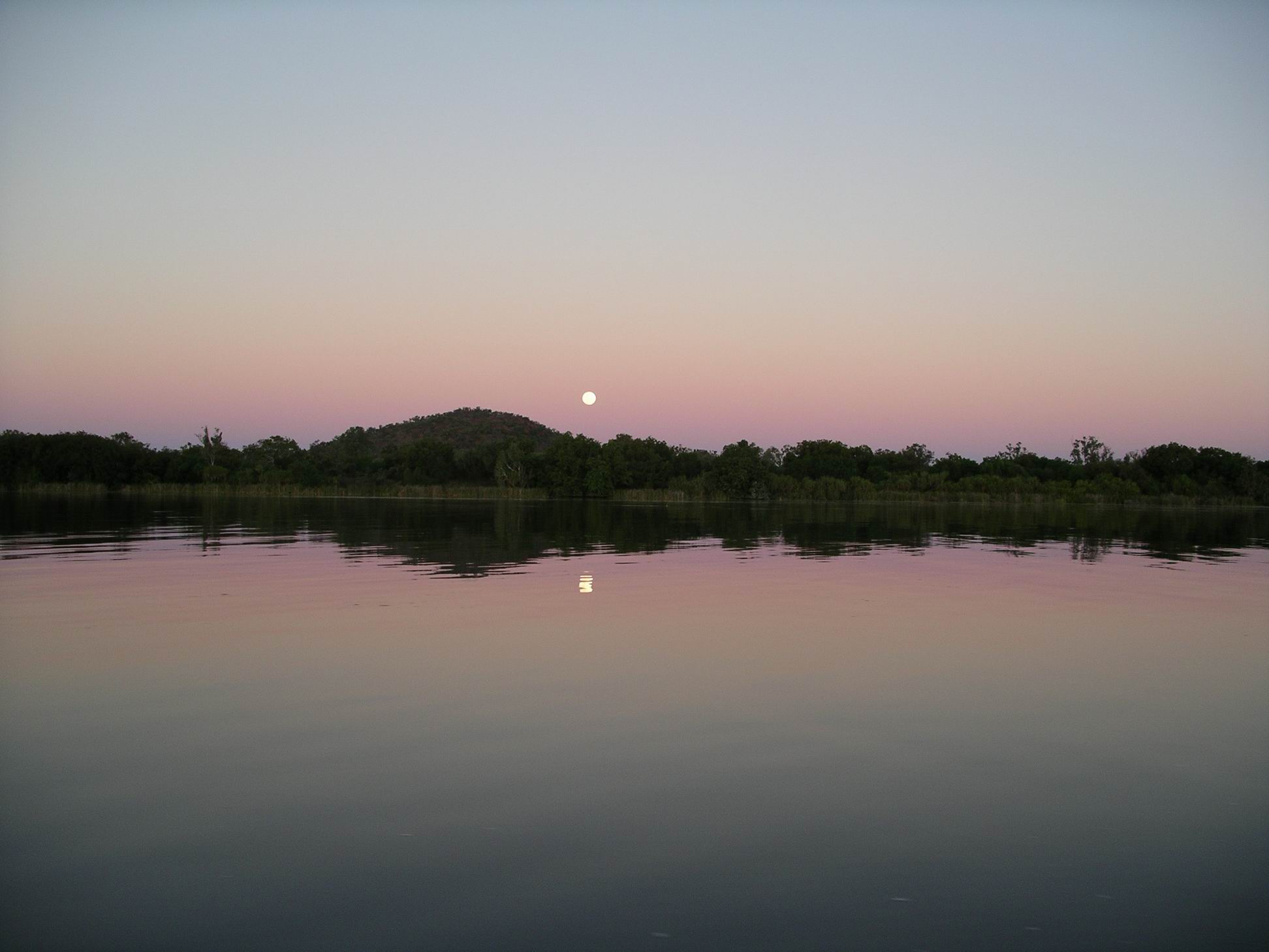
It was very chilly for the last half hour or so, as the sun went down. The sunset and moonrise reflections on the lake surface were quite special, though.


In all, a great trip, excellent value for money. One I’d be very tempted to do again, if we do another trip this way.

In our absence, M went off driving exploring, on the back tracks to the west of the Ord – Parrys Creek way. She visited Black Rock Falls and Middle Springs and the western side of the Ivanhoe Crossing.
Phoned son at night, to keep a check on him. We talked about him possibly meeting up with us, up this way, for a break, once his move of house had been done.
