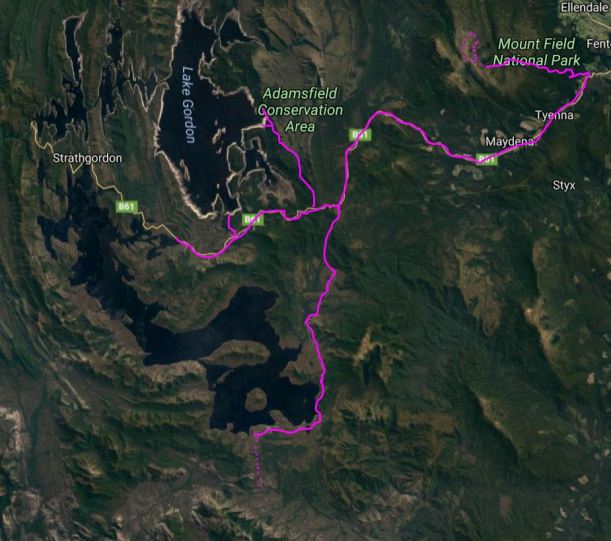
THURSDAY 17 FEBRUARY NATIONAL PARK
Today was big walk day!
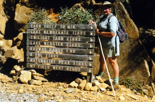
We managed to get a reasonably early start, for once, drove the 15kms or so up to the Lake Dobson car park, and started walking at 10.25am.
Our route started out along the Pandani walk, that we’d done before, but soon branched onto the Urquharts Track – a link track that cuts between large bends in the (closed) road up to the ski huts, and so saves some distance. This track was an easy, gradual gradient. By contrast, the road section that we had to walk next, was quite steep.
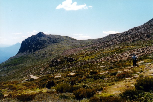
From the ski hut complex and the road’s end, we set out on the Snowgums Track and on to the tops, proper. The track was rocky in places, in other sections it was marshy enough to need board walk sections.

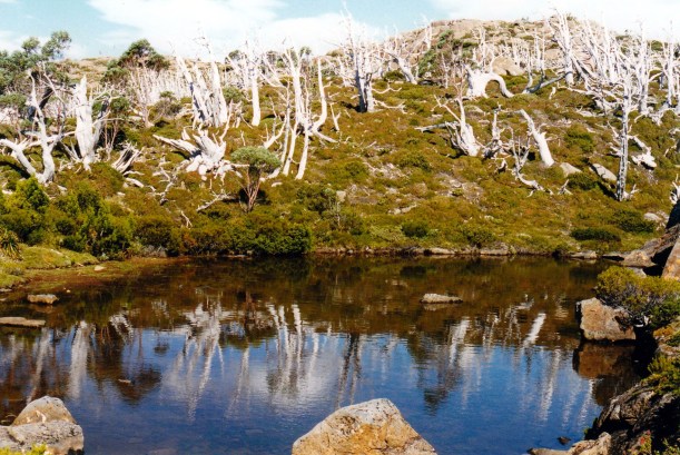
On the Snowgums Track
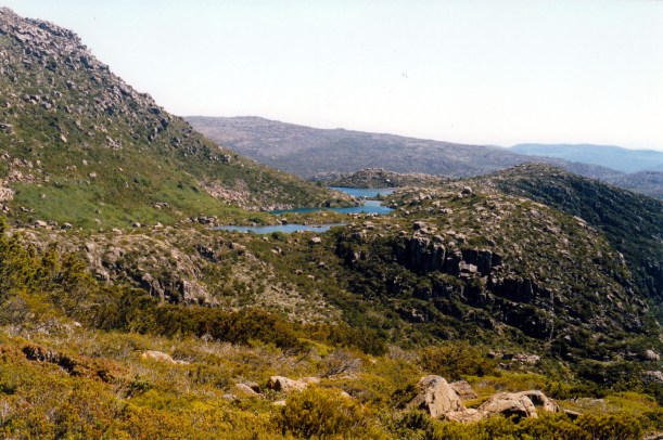
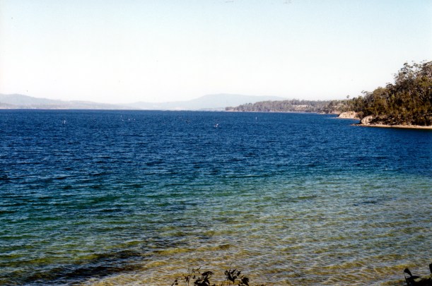
Took a short side track to Seal Lookout, which gave a great view over Lake Seal, now well below us, and some of the area we’d walked on one of the day trips up here from Hobart. This added about half a km to the walk.
We were passing, and being passed by, a young Swiss couple who were doing an overnight walk to Mt Field West. They were more heavily loaded than us, but were faster walkers!
At a track intersection, further along, was the junction of the track to Tarn Shelf with that along the Rodway Range – the way we were going. Later on, all going well, we would arrive back at this junction, via Tarn Shelf, to complete a circuit.
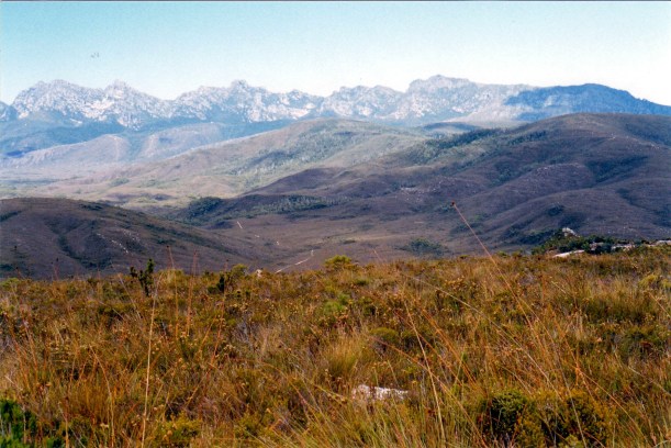
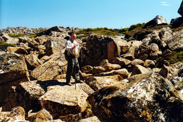
From here, we ascended into a massive boulder field, through the Lions Den – a narrow route through, over and around, huge boulders. John managed these very well.
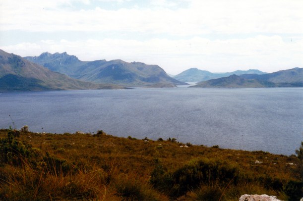
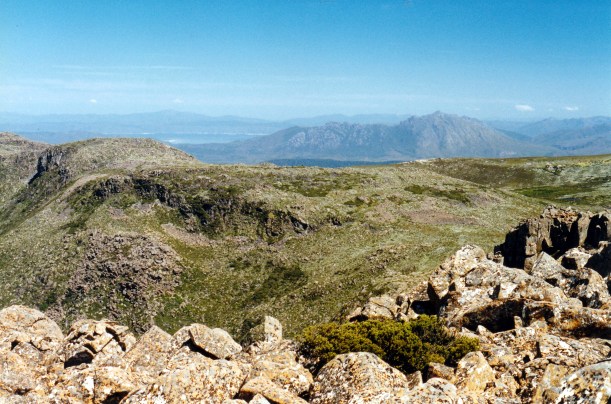
At the top of the ridge, we could see ahead to K Col below us, with the track descending through the boulder moraine field, to the col, with Mt Field West, Lake Gordon, and some of the high peaks of the south west, in the distance. The panoramas were worth the effort to get here, but we would be going higher still.
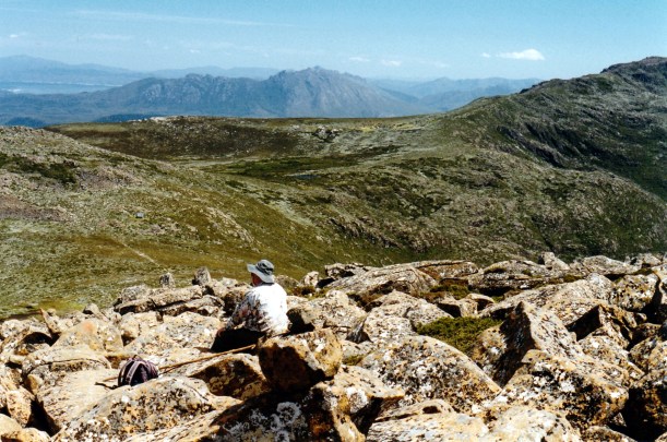
Our lunch stop was not long after the Lions Den, atop the boulders of the Rodway Range. We sat, admiring the incredible outlook and looking down on the hut at K Col, which looked really tiny in the distance. Spectacular country!
We clambered down through the boulder field to K Col. A col is a saddle between ridges and peaks – a feature formed by glaciers; this area, like much of central Tasmania, has been shaped during past glaciation. The valleys leading down from the col would have had glaciers in them – like rivers of ice. The boulder fields we had been walking through are moraines, where the rocks being ground along by ice were dropped when the ice melted.

Looking back up the boulder field to where we had lunch, on the ridge
We clambered down through the boulder field to K Col. A col is a saddle between ridges and peaks – a feature formed by glaciers; this area, like much of central Tasmania, has been shaped during past glaciation. The valleys leading down from the col would have had glaciers in them – like rivers of ice. The boulder fields we had been walking through are moraines, where the rocks being ground along by ice were dropped when the ice melted.
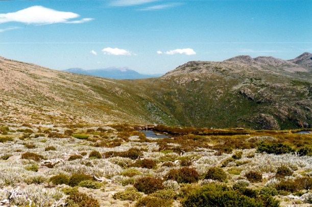
After a short swampy section, we came to our turn off to Newdegate Pass. The main track continued on to Mt Field West. Our track skirted just below the boulder and scree fields of the Rodway Range, and was wet and muddy in parts.
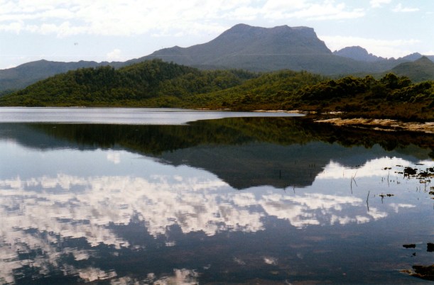
Then, we commenced a steady climb up to Newdegate Pass. This area was wonderful – lots of little tarns at different levels, with The Watcher peak at the back. There were great colour contrasts – lots of vivid green cushion plants and browny tarns.
We could not linger at the Newdegate Pass area. It was after 2pm by then, and John was getting concerned about how far we still had to go. The boulder work had been really hard on him and we did not know how challenging the rest of the way would be.
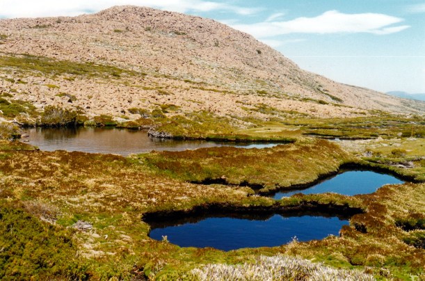
Newdegate Pass and The Watcher
Mount Field West from Newdegate Pass
The track down from the Pass to Lake Newdegate and Tarn Shelf was steep and rocky and very hard on the legs – and knees, in particular.

Boggy track to Tarn Shelf
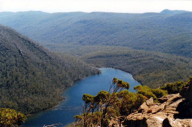
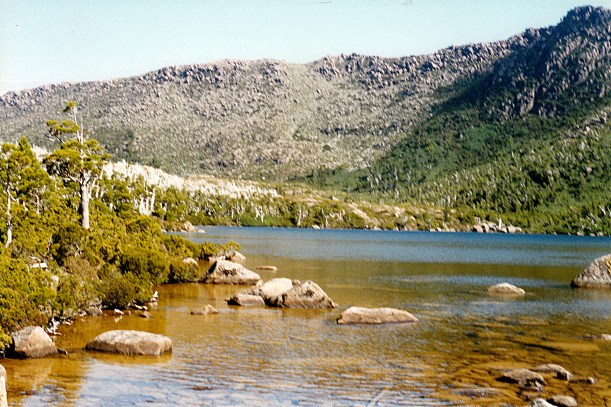
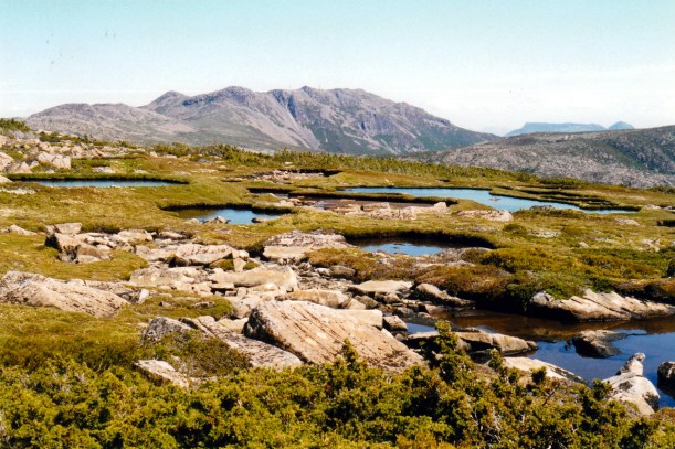
We had a brief stop at the Lake – it was one of the larger ones in this section, and very pretty, in rather a basin amongst the hills. One could see how it had been scooped out by ice action.
Then we had to plod along the Tarn Shelf, both getting very weary. My knees were hurting – unusual for me. There were, as the name suggests, lots of little lakes and tarns, but we really did not have time to dwell and admire many of these. Tarn Shelf is another of the places whose name has long intrigued me – finally I was there!
I’d expected Tarn Shelf to be rather flat – like a shelf! But there were quite a few short and sharp ups and downs, which added to our tiredness.

Beside Johnston Tarn
I ran out of the second film I’d taken, and had no more, which was a great pity. There was a lovely orange-y coloured lake that John wanted a photo of – I think it was Tarn Lake – but I had no film! Using a 24 exposure film is a pain, but often that is all one can get.
There was a steep climb up to the Rodway Day Hut – a real sting in the tail of this walk – then up again, to the track junction we’d passed this morning. Then the walking was easier – across the top, then down to the huts and the road. The walk down the steep road was unpleasant and treacherous, with feet sliding out on the small gravel. We were glad to reach the Urquharts Track and an easier final leg to Truck, which we reached at 6.45pm.
So the walk had taken us about eight and a quarter hours! The distance was almost 12kms. It felt like about 25kms! We’d taken our normal water bottles, plus the two smaller ones – and drank the lot along the way. Although there was plenty of water in the lakes and tarns, we did not want to resort to drinking that, without boiling it.
It was a tough walk, but one with absolutely magic scenery and it gave us a real sense of something special achieved.

We shared a can of coke between us, in the car park, and chatted with a couple from the camp ground; they’d walked up Mt Field West and returned back the same way they’d gone, getting back to the car park the same time as us. They’d opted to return via the Rodway Range track, because they knew how rough the K Col – Newdegate track was!
It had been a hot day down below, and was pretty warm walking, too, but up top was a bit cooler, even with a bit of a breeze.
On the drive back to camp, we rehashed the walk. I think we were both a bit euphoric from the experience.
It was to be chow mein for our late tea. We alternated the cooking of it between us both – one cooking and the other going off for a very welcome hot shower.
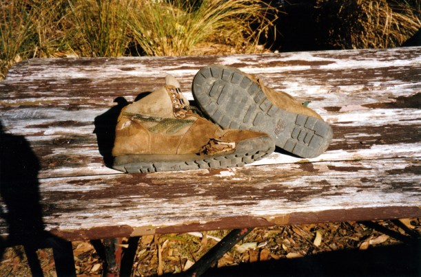
The Hi-tec boots, that I’d acquired from John, in exchange for the ones that had been dad’s, died an honourable death on today’s walk! A big hole appeared in the side; the tread was already very thin in parts of the sole. Definitely no longer usable. I photographed them, for posterity, and consigned them to a rubbish bin in the camp ground. Between the two of us, we had walked them a few hundred kms. I would now need to use my heavier Hi-tec walk boots until we get back to Melbourne where I may be able to get another lighter weight pair. My cheap Dunlop sneakers are also showing much wear – they will not last much longer, either.
After tea, checking the walk notes and books, we were a bit miffed to read that the Tarn Shelf circuit was rated “moderate”.
John had a blister under his big toe. My legs were stiff and aching. Bed was most welcome!