
FRIDAY 18 FEBRUARY NATIONAL PARK
This was to be a driving day, not one for walking – theoretically, at least! We set out to drive to Scotts Peak Dam, at the southern end of Lake Pedder.
The original Lake Pedder – a small one by comparison with the present lake – was the subject of a significant environmental protest movement, before its damming in 1972. At that time, The Hydro Electric Commission of Tasmania had enormous influence in the State, to the point where it was seen as controlling governments – both Labor and Liberal. Many Tasmanians believed that the ongoing welfare of the state was dependent on HEC activity. The HEC in the late 60’s wanted to expand electricity generation by creating more and larger dams.
Lake Pedder was a glacially formed lake, with a beautiful quartzite sand beach. It was inaccessible, except by foot, and was a half way point on the challenging extended walk from Port Davey to Maydena – which took, on average, three weeks to complete. The lake was the focal point of a National Park.
The HEC proposed building three dams that would create a huge impoundment of water, drowning Lake Pedder in the process. Despite protests and the rapid growth of a movement to Save Lake Pedder, and the attempted intervention of the new ALP Whitlam Government in Canberra, the Tasmanian Premier revoked Lake Pedder’s National Park status and the dams were built, creating Lake Gordon and a huge “new” Lake Pedder, linked by the McPartlan Canal.
Lake Pedder as it is after the dams were built. The original lake was around the corner of the narrow channel
Although Lake Pedder was lost, awareness of the values of the Tasmanian wilderness was well and truly raised. The Lake Pedder protest groups evolved into the Tasmanian Wilderness Society and eventually Green political parties. By the time, a decade later, that the HEC proposed damming the Lower Gordon and Franklin Rivers, the environmental movement was able to prevent this happening.
The dams construction and the building of the hydro electricity generating plant meant that a road was built from Maydena – previously the end of the road – to the generating plant at Strathgordon, and another – unsealed though – south to Scotts Peak Dam, creating access by vehicle to parts of the south west wilderness where none had been.
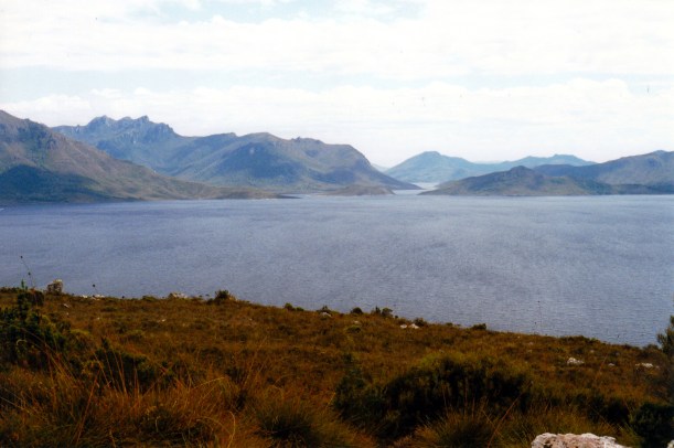
The scenery on the way to Scotts Peak Dam was magnificent, particularly the views of the Frankland Range and the Arthurs. The road ran beside Lake Pedder at times; reflections of surrounding peaks, in the water, were great.

Mt Anne from the Scotts Peak Dam road

Lake Pedder and the Frankland Range
We stopped briefly at Edgar Dam, where there was a pleasant bush campground which we later decided was nicer than the Huon campground at the end of the road south.
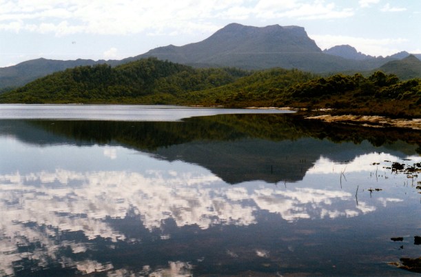
Reflections in Lake Pedder at Edgar Dam
We also stopped at Scotts Peak Dam lookout.

Lake Pedder at Scotts Peak Dam Lookout
The road ended at the Red Knoll Lookout. We ate lunch there, soaking in the view across Lake Pedder to the valley that led to where the original lake was.

Hard to beat this for a scenic lunch spot
After lunch, the temptation of the distant vista of the Arthurs was too great to resist, and we decided to go for a walk towards them, along the track to Port Davey.
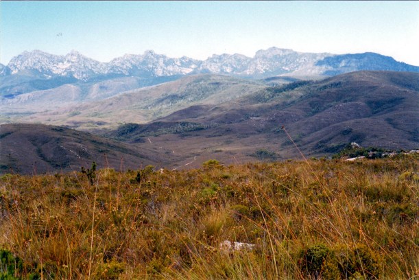
The Western Arthurs and the Port Davey Track
We walked south for about 80 minutes, probably getting some 5kms along the track. I think we almost reached Junction Creek, before we turned around and backtracked. It was easy walking, in plain and marsh country, with a lot of board walked track. It was quite hot. Ahead of us there was an absolutely superb panorama across to the Arthurs. looming not that far away. We met a couple of groups of walkers coming in from walks in the Arthurs.

Boardwalks prevent track deterioration – and wet feet!

As far as we went – last creek before Junction Creek
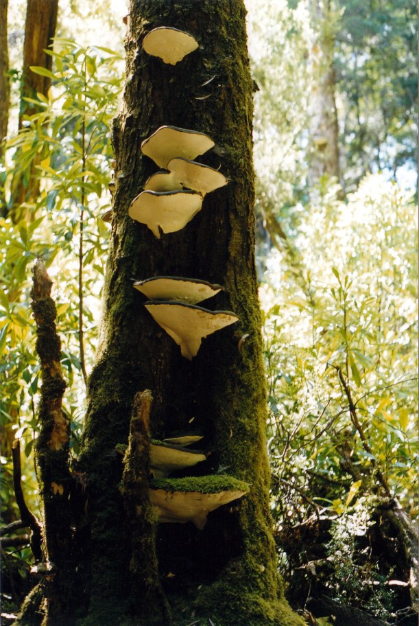
Interesting fungi by the walking track
The walking activity got rid of most of the stiffness from yesterday, without being too strenuous.
We got back to the van at a reasonable time, having driven 179 kms today, and sat outside having a couple of beers and watching the campground activity. There were four Dutch people camped next door and they were very intrusive, sitting right under our open van window and talking loudly. Despite the people, this was a pleasant place to be.
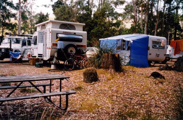
Camp and wild life
The resident pademelons were not shy, quite happily browsing round our camp, despite the noisy neighbours. We discovered that some species of wildlife left its calling card on the camp seat we were using. Not sure that pademelons jump up on such things – it may have been a possum.

Something was marking out its territory!
Tea was fried potato slices with fish; John had fish from the freezer that he caught at Nubeena. I had a piece of frozen oven-bake fish, cooked in the frypan too.
John had found that he got better TV here by bringing the aerial in through the roof vent – along with any bug that wants to come in that way! However, there was only SBS and Southern Cross available here. So we played cd’s instead of watching TV – lovely! It is a too rare treat for me to be able to have music in the van.
It was a hot night.
