This Adventurous Age

Adventures travelling and working around Australia.


Leave a comment

2007 Travels June 14

THURSDAY 14 JUNE     BULLITA CAMPGROUND

After the usual fairly slow morning start, some daily exercise was called for.

Close to our camp was the point where vehicles attempting the Bullita Track circuit, would cross the East Baines River on a series of flat rock shelves interspersed with patches of river pebble beds. Right now, the lower sections of that crossing were too far under water to be passable.

We were able to pick our way, rock hopping, across the river. It was a bit easier for us on foot than it would have been for a vehicle, because we could jump from rock to rock, that varied greatly in height and size. Even so, we got wet feet! The actual vehicle crossing here swings around in an arc, but we took more of a straight line, because much of that arc was deep water.

Rock shelves of the Bullita crossing

The vehicle line was marked by posts in the river with blue markers on. The rule was that one must keep to the left of the markers.

Bullita crossing, with track marker post

After the river, we aimed to walk at a steady pace for an hour, along the Bullita Stock Route. The vegetation over here was quite open, having been fairly recently burnt, with some termite mounds and lots of boabs to look at, including one huge and venerable old specimen.

After the stipulated hour, turned around and walked back.

The walk was pleasant, before the day got too hot. The track was reasonably level, so we could – kind of – walk and look around at the same time.

Back at the crossing, M was in front, as usual, and surprised a croc, sunning itself on a rock. With hindsight, she thought  it was a freshie.  At the time, they both moved a bit too quickly for a good look!

The Bullita crossing of the East Baines River, at low water (marked in pink) (Zoom)

Felt virtuous about making the exercise effort, but lazed about camp for the rest of the day. Spent some time bird spotting. There was so much birdlife here.

During the afternoon, a Britz  hi-top 4WD camper arrived in camp, and set up at some distance from us. We spoke briefly with them – a young couple from Europe.

It was another lovely night, with a sky full of stars. They were so brilliant up here.


Leave a comment

2007 Travels June 13

WEDNESDAY 13 JUNE     BULLITA CAMPGROUND

I enjoyed my lone early morning sit outside, contemplating life, before M emerged from the Troopy and, eventually John from the van.

I made packed lunches, based on Ryvita biscuits, cheese and salami.

We drove back towards the highway for 8kms, then took the Limestone Gorge Track as far west as the Calcite Flow.

The Calcite Flow really stands out in this Zoom image

Beyond the car park here, the former track into Limestone Gorge was closed, due to Wet season damage. Judging by the extent of the wreckage we saw, the closure may well be permanent.

What happened when a track became a river!

Walked the 600 metre (return) Calcite Walk – very interesting. Just around here is grey karst limestone formations  and under here is a shallow cave system – The Bullita Cave is one of the longest cave systems in the world!

Grey karst limestone outcropping

The Calcite Flow appears as a white, solid creek, formed, I guessed, when dissolved calcite was precipitated out of water as it evaporated. But I could be wrong on that! Either way, it was a striking looking formation.

Calcite Flow and unusual erosion terraces on the hillside
Calcite Flow – solidified limestone

This whole bit of country was quite strange and different. The hillsides had small ridges that gave a terraced appearance, on which boabs were growing.

Reef-like formation, karst outcropping

Fossilized stromatolites occurred too. Limestone country, caves, stromatolites – definitely reminiscent of Pungalina, though I didn’t see any areas there that looked quite like this.

Left the vehicles at the Calcite Flow parking area and set out on foot for the Limestone Gorge camp ground, 2kms away, walking along the closed “road”. This resembled a rocky, dry creek bed much more than anything a vehicle could traverse.

Track to Limestone Creek Campground

In sections there were remnants of a sort of cloth matting substance that had been put down to try to reduce erosion of the track. Clearly, it hadn’t worked!

Despite the rough surface, the walk was enjoyable, with Limestone Creek flowing close by in places.

Limestone Gorge campground appeared little maintained and mown, now that there was no vehicle access. It would have been an attractive camp area, with the limestone ridges encircling part of it, and with the creek and East Baines River forming two boundaries.

Zoom view showing Calcite Flow at R, track beside and in Limestone Creek, and the campground at the stream junction

The creek here formed a long, small waterhole here, supposedly swimmable, though I wouldn’t trust it! Large boulders and rocky shelves beside it provided us with the perfect spot to prop for lunch. However, it seemed that a large water monitor lizard agreed about that – and we were intruding in its dining room. It kept careful watch over us, whilst dipping in and out of the creek.

Really clear Limestone Creek water – deceptive, because it was deep enough for a swim, here

Refreshed, we took on the 1.8km Limestone Ridge loop walk, from the campground. As the name suggested, this took us up onto the ridge behind the camp area, from where there were good outlooks over the eroded valleys of the limestone karst country, and down over the camp ground.

Limestone Gorge walk

The walking track wound around and took us back to the start. It was a walk worth doing.

I did wonder how much longer this little, slightly rough walk track would be maintained, if vehicle based visitors remained permanently excluded.

This boab still had all its leaves

Then it was the return walk along the rock beds that once were the road. The afternoon was getting hot by now and with the heat reflecting up from the light coloured rocks, the last km or so of the walk back was less enjoyable!

Altogether, we walked nearly 7kms today. That was enough!

As we approached the Bullita campground, there was the usual little bit of suspense – would we still have this place to ourselves? Or would we have neighbours? We were still the only campers here. Lovely!

Campfire and star gazing. Just the way I like to spend evenings.


Leave a comment

2007 Travels June 12

TUESDAY 12 JUNE   VICTORIA RIVER R/H TO BULLITA CAMPGROUND   130kms

Today our destination was in the western section of the Gregory National Park. This is the second largest National Park in the NT, but was only declared less than twenty years ago. This larger section preserves some pastoral history of the region, but also has some special landscapes.

We drove about 80kms west on the Victoria Highway, then turned south onto the Bullita Track. This was unsealed, but reasonable going albeit a bit rough in spots. The creek crossings required some caution, sometimes being in little gullies.

There was one creek that surprised John by being deeper than it looked – we were not doing as we should have by checking and maybe walking crossings first. It was only a small creek, but about 3 foot deep! We made an enormous splash as we hit and ploughed on through – more by momentum than anything else. We were through before John had much of a chance to react. Didn’t seem to be any ill effects…. There was more than one good reason why M was content to follow us!

We were clearly back in boab country. These trees, with their weird shapes, are fascinating, and are just such an intrinsic part of the Kimberley experience.

After about 50kms, came to the Bullita camp ground.

This was a very pleasant, basic camping area, by the East Baines River, with a toilet and water tank. Camp spots were delineated by bollards. After finding it so pleasant, decided we’d need three nights here, and paid accordingly. Didn’t have quite the exact change needed, so put $20 in the envelope. Slight tip for the Ranger!

We set up where we had a fireplace and table. Also had a collection of fruit bats in the trees not far away – they were very noisy, but to us that was nice “bush” background sound. There was no one else here.

Bullita camp

The campground surrounds were reminiscent of our Safari Creek camp at Pungalina, in 2005. Similar climate and vegetation zones of course – the monsoon affected savanna grasslands and tropical riverine vegetation.

After setting up camp, we walked to the nearby stockyards and the former homestead.

Bullita

Bullita was once an outstation for the pioneering pastoral Durack family. It was never a stand alone property in its own right. Various important stock droving routes passed through what is now the National Park – some of them for moving stock between various Durack holdings.

The Bullita Homestead was not a grand old building in the pastoral traditions of the south. Rather, being a “back block” outstation, it was a glorified tin shed! It would have been a very hard life style here, even into the 1970’s. Actually, for the Park staff, it would be no picnic today, and they have more modern accommodations.

Of note, near the Homestead, was a big old boab tree, with a Durack name carved into it, and 82 – the question arises, was this 1882, or 1982?

The stock yards were interesting. John, of course, was interested in their construction. Bloodwood, found around here, was used, as was lancewood from further south, along  the Murranji Stock route. This was the timber commonly used for posts and uprights in these parts, and would have involved considerable effort to get it here.

The finished stockyard here was regarded as an exemplar for a drafting stockyard, where cattle were to be sorted into different categories.

An information board explained their layout and place in the pastoral saga of the area.

Totally strangely, and most incongruous, next to the stock yards, was a modern Telstra, solar powered, functioning telephone box!

Walked down to the point on the East Baines River, near our camp, where the Bullita Track crosses it. This was definitely not a river for swimming in – crocodiles in there, for sure. It is a feeder stream to the lower Victoria River.

East Baines River at Bullita

A couple of interesting 4WD tracks go out from where we were camped. The Bullita Track follows one of the old stock routes and then makes a circuit. The Humbert Track goes south and is a way through to the Buchanan Highway and Top Springs, or the Buntine Highway that runs between Top Springs and Halls Creek in WA.

On a different occasion, we would have been tempted to go day tripping, at least, on these, but all the 4WD tracks radiating out from Bullita were currently closed. The height of the river here might partly explain that. I hoped this might keep any yobbo type 4WDers away, whilst we were here.

It was lovely sitting around our campfire again at night. It was so quiet here – just the nocturnal critter sounds one would expect in such a place – and the occasional louder “plop” that one hoped was only a large fish.

At dusk, the bats departed  for their evening of feeding.

All was very well with our world!


Leave a comment

2007 Travels June 10

SUNDAY 10 JUNE   SULLIVAN CREEK CAMP TO VICTORIA RIVER R/H   16kms

It had become obvious by the late afternoon, yesterday, that Sullivan Creek was not a suitable place for staying any longer. Too many people too close together. This is the trouble with half way decent low cost or free camp areas. So we packed up and moved on.

After only 16kms, reached the Victoria River Roadhouse. While John refuelled – $1.62cpl – M and I had a quick look around.

The campground looked very attractive and this would be central for walks M and I wanted to do. John was not happy that we’d “messed about” with last night’s camp, only to come 16kms today, before wanting to stop again.  However, we didn’t then know how good this was, or how unsuitable Sullivan Creek would turn out to be.

Our powered site cost $20 a night. The campground was huge and grassy, with plenty of shade trees. It was very pleasant – and not all crowded! There was some TV – but only one channel, relayed from the roadhouse.  

Victoria River Roadhouse camp

 Set up camp, then set off to do the Escarpment Walk, before lunch. Had to drive along the highway for a couple of kms, to get to the carpark, from which the walk started.

Walk goes up to the top of that….

This 3km walk involved climbing up to the top of the scarp. There’s that dreaded word “climb” again! It was quite steep in places. Taking photos provided an excuse to stop and rest my cramping calf muscles – always an issue on uphills.

Along the way were boards featuring some of the stories of the local aboriginals, that explained how rivers (and hence gorges) were made and how rain was made to fill these.

A local tree was flowering profusely at this time of year, and its brilliant yellow blooms were a distraction from the broader scenery.

There were excellent views from the top of the Escarpment, over the ranges, the Victoria River and associated gorges, and over our campground.

Victoria River and Highway 1
Highway, Roadhouse & camp complex, tree line of Victoria River below the escarpment

And what goes up must come down again…….

Just a little rest here…..

After lunch back at camp, we stirred ourselves again, and drove 10kms to the turnoff to the Joe’s Creek picnic area – 2kms along a gravel track. Here was the second walk we wanted to do in this area. This one was only a 1.7km circuit – however, distance is not always the  indicator of difficulty!  It just tells you for how long, roughly,  you are going to be in pain!

Escaprment of Victoria River valley from Joe’s Creek track

From the carpark, in the picnic area, the range rose in a tall semi-circular escarpment. It was worth driving in here just for that outlook.

Joe’s Creek valley – from part way up the walk track

Our path wound through the spinifex and scrub, and then  up a loose rock scree slope, through clusters of Livistona palm trees, to the base of the almost vertical scarp face.

The track along the base of the scarp wall took us past aboriginal art works on overhanging rock sections. One of the figures reminded me of the Lightning Man depictions at Nourlangie Rock in Kakadu. Another, an elongated being with a striped body, was similar to something we’d seen up near Kalumburu in the northern Kimberley. I found it interesting that there were these apparent similarities from across such a widespread area.

Then we descended back through some more scree slope and palms, and wound back to the car park, all the time with those imposing scarp walls encircling us.

Walk track, scree slope, palms
The black scar of a wet season waterfall

This walk had been very scrambly, in sections. John did well, considering. All of us were leg weary by the time we got back to the vehicles.

Since we were close by, decided to take the short 4WD track to the Old Crossing of the Victoria River. It was only in 1970 that the road bridge near the Roadhouse was built across the river. Until then, traffic had to use the Old Crossing – basically a rock shelf in the river. It would have been impassable for significant periods.

Old Victoria River Crossing

It is easy to forget how recently it really was that these regions were opened up to the sort of modern access and travel that we enjoy today.

Our final little sidetrack for the day was to drive down a road near the Roadhouse, that led to a place on the river where boats could be launched, into what was a long reach of the river. We had to walk the last part of this, not being sure if there would be room to turn our rigs around at the end. It was a narrow little road through very tall grass.

Decided to have another, lazy, day here, tomorrow, in this very pleasant spot. John was content to do so, being happy that there was some TV.

Both walks today were excellent, but neither had been easy. The clearly hotter days made exertion that bit more difficult. The nights were still cool, though, and we needed to change into long pants.


2 Comments

2007 Travels June 9

SATURDAY 9 JUNE   DUNMARRA R/H TO SULLIVAN CREEK CAMP   426kms

We left the bitumen at Dunmarra and drove west to Top Springs – some 180kms on a reasonable gravel road. In 2000, we’d camped here but it seemed the Roadhouse at Top Springs now no longer offered camping. The area we’d stayed in was fenced off.

Refuelled – $1.75cpl. Treated ourselves to cold drinks and ice creams. The days were starting to seem hotter.

From Top Springs, the Buntine Highway was narrow and sealed. It was interesting enough, with some low range areas breaking up the grassland sections. Along the way we passed the turnoff to the Birrimba  station, once owned by a lady I knew back in my teaching days, who was an advocate for the needs of isolated students. I wondered idly if her family was still there.

At the intersection with the Victoria Highway, we turned west and thus onto a road travelled before – most recently last year. This time, we had the luxury of leisure time to explore.

Gregory National Park is slightly strange, in being divided into two different sections, with considerable distance between them. It is about 85kms by road between the parts, though south of the highway they are closer. I presumed, from the irregular boundaries, that both sections had been pastoral leases. The section between them was now marked on my road atlas as Aboriginal land. The eastern section contains some of the upper Victoria River and is spectacular range and gorge country, whereas the western part is flatter and has tributary streams of the Victoria River. The Park is regarded as marking the division between the tropical north and the semi arid grassland areas to the south. Thus, like Davenport Ranges, it is biologically diverse.

Pulled into the Sullivan Creek Camp Ground, just inside the National Park, which – according to one of my guide books – was a good place from which to explore that section of the Park. It looked very pleasant – fairly small, with toilet. There was a fireplace and low table in a circular central area, protected from encroachment by vehicles by bollards. The small creek looked lovely.

Sullivan Creek Campground

There were two vans already set up, parked in the most secluded corner of the camp area. We decided to stay and paid our $6.60 into the honesty box provided. Found a place to set up, parallel to the bollards of the central area, with M behind us.

John did not want to pull into any of the nicer, bushy corners, because he wanted full sun on the solar panels. He declared that he would decide where we parked, and that he did not want my input, at all! The result was that he did not get my input – and parked the rig pointing the wrong way, so the van door opened out into the road part, not towards the bollards. Eventually, he realized this, and had to drive away and come back from the other direction. Face was lost!

We wandered about, looking at the creek. It formed a small waterhole here which would be very tempting in hot weather. But it also might not be croc free…..

Sullivan Creek

As the afternoon wore on, a surprising number of rigs arrived, the last couple well after dark. They ended up squashed in everywhere, with later comers just parked on the access road itself. I find it quite incredible, how late some people travel. There had also been a few who drove in, looked, and departed again.

Zoom image of Sullivan Creek Campground

After tea, we chatted for a while with a couple who had set up by a fireplace not far from us. They were travelling with just a vehicle, being workers moving from one place to another,  and set up a foam mattress by the fire, to sleep on. She – an indigenous lady – was an interesting person to talk to. She told us they were moving elsewhere to work because she was sick of her relatives “bludging off us”.


Leave a comment

2000 Travels June 22

THURSDAY 22 JUNE     TIMBER CREEK

We got up about 8am. This is the type of campground where most travellers move on after one night, so there was much activity around us, to wake us up.

After breakfast, I went to the general store – part of the roadhouse complex – for bread. While I was gone, John got talking to the man on the next site, and helped him back his vehicle onto his van. His wife, whom we’d thought on seeing her yesterday was ill, he says is losing her sight and balance; this trip is for her. Of course, there is much that she can’t do, so he doesn’t either.

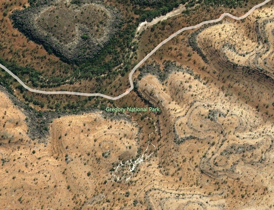
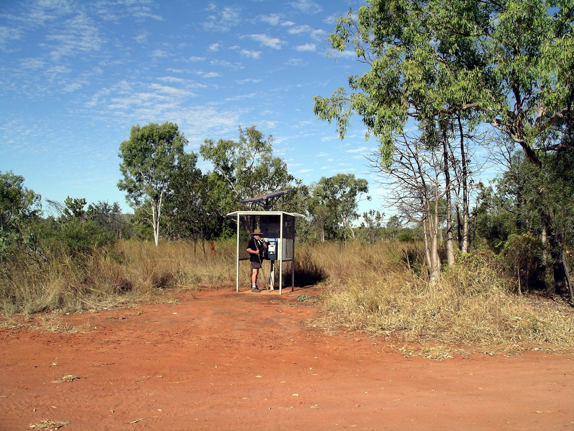
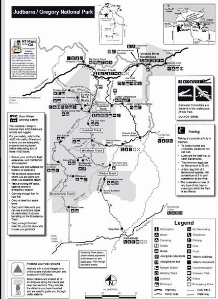
We went to the National Parks Office, here, and collected information about Gregory and Keep River National Parks.

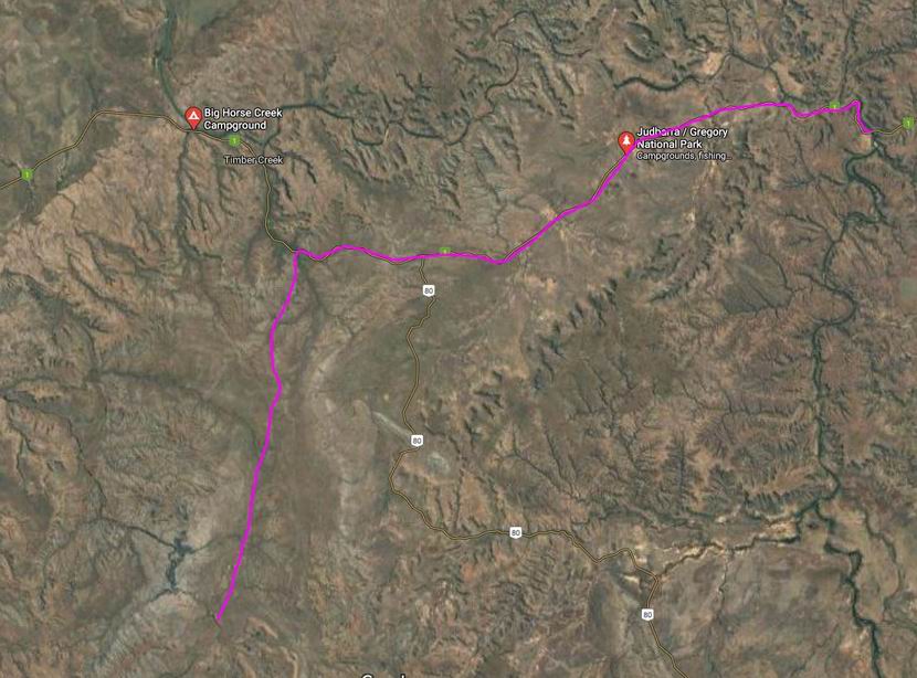
Drove back along the highway for a few kms, then took the unsealed Bullita road, towards Bullita Homestead, which is 47kms from the highway.

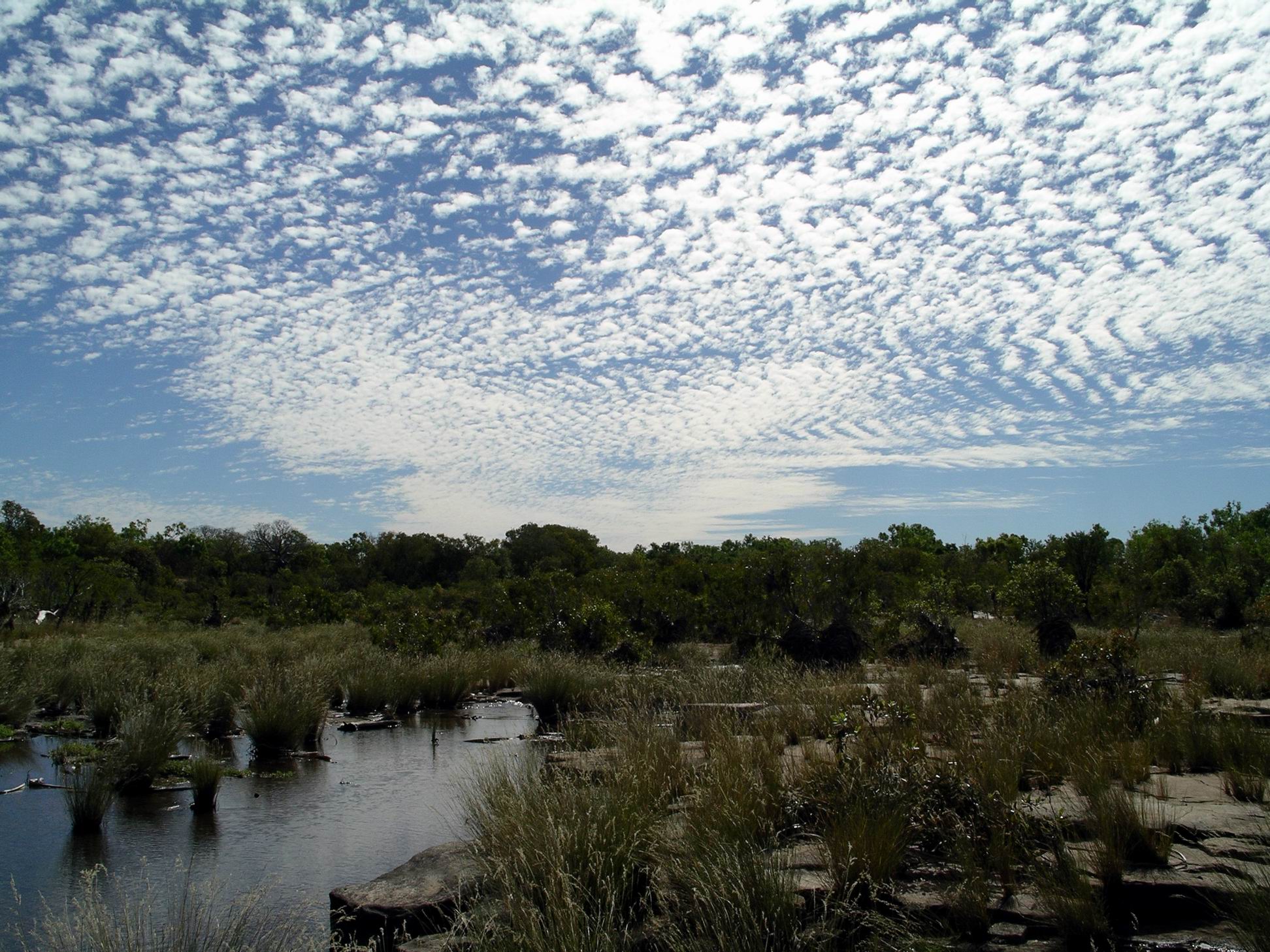
The road was not too bad; there were lots of dips, quite a few with flowing water in. The deepest crossing was probably about 35cm. John stopped briefly in the middle of several crossings to “give the tyres a cool down” – not recommended practice at all, but it gave us views up and down the little creeks.

We spotted two new birds by the track, after getting out of Truck and looking carefully at the movements we saw – both finches: the long tailed and the black faced. There was much other bird life, most of which were familiar varieties. We are getting better at our bird remembering.

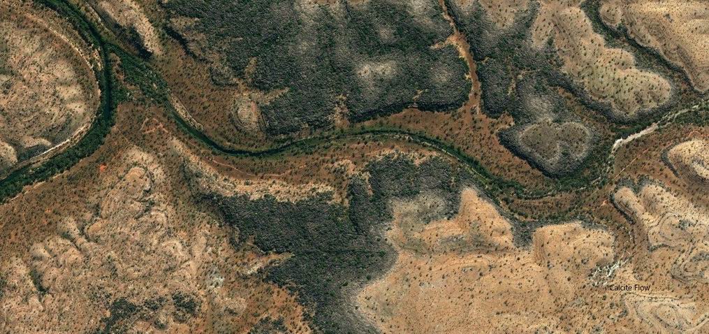
About 40kms down the Bullita road, the turnoff to Limestone Gorge was on the right, and we took that. The Information Board at the start of this said that it was closed beyond the Calcite Walk park area, due to washouts.  When we got to that point, some 6kms along, there was a closed gate across the track.

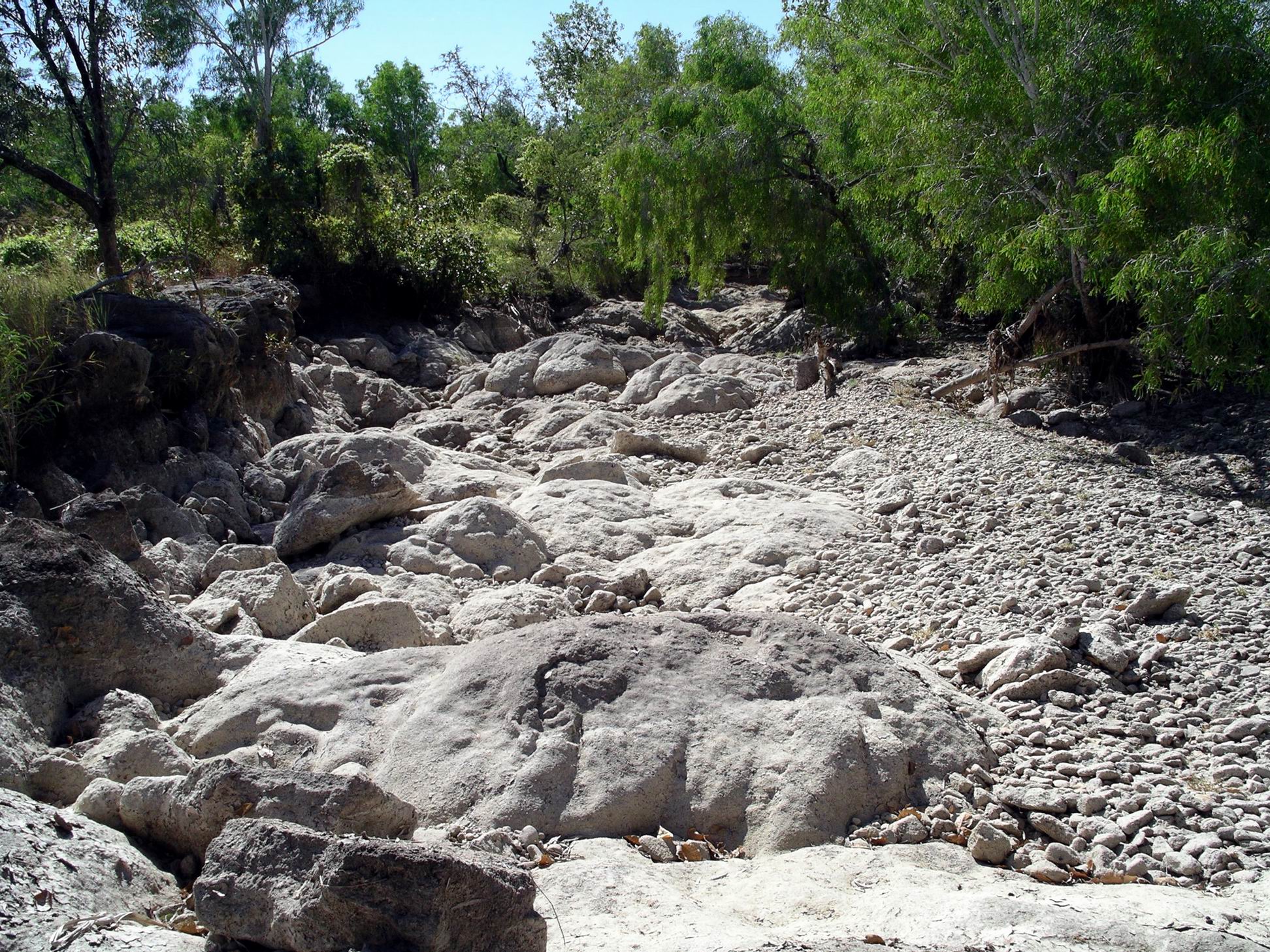
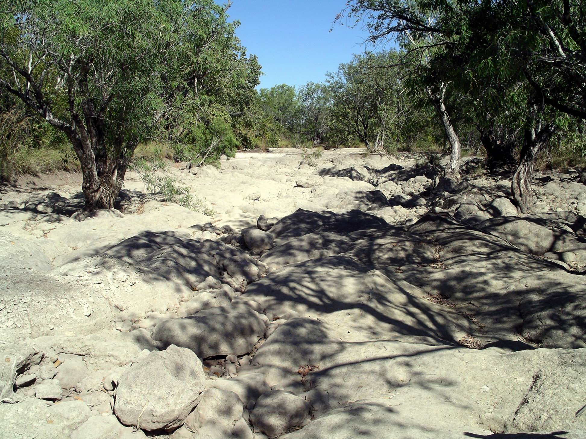
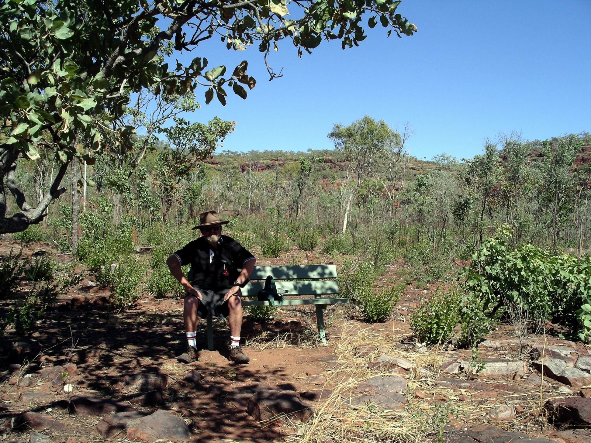
We left Truck parked there and did the 600m Calcite Walk. This took us to a valley where the limestone formations looked like a white waterfall.

06-22-2000 02 calcite near Limestone Gorge.jpg

The Calcite Flow

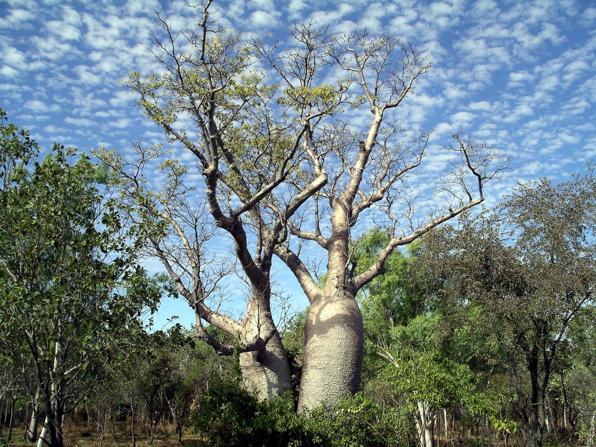
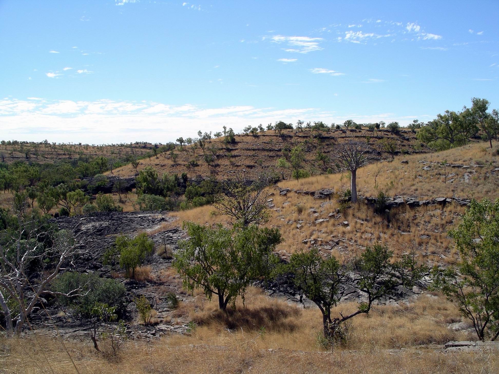
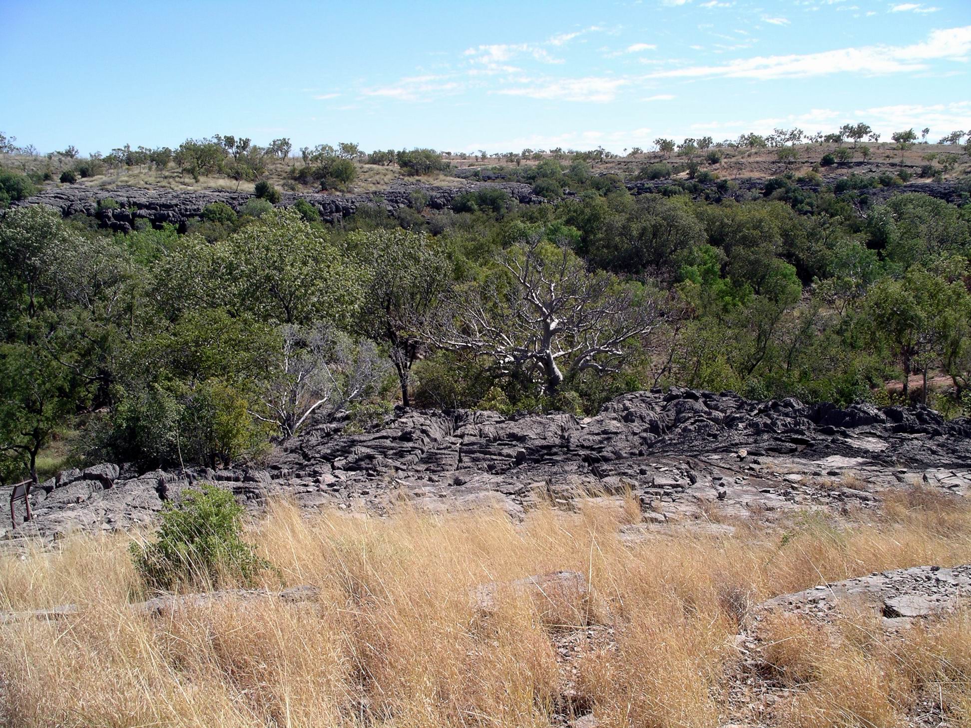
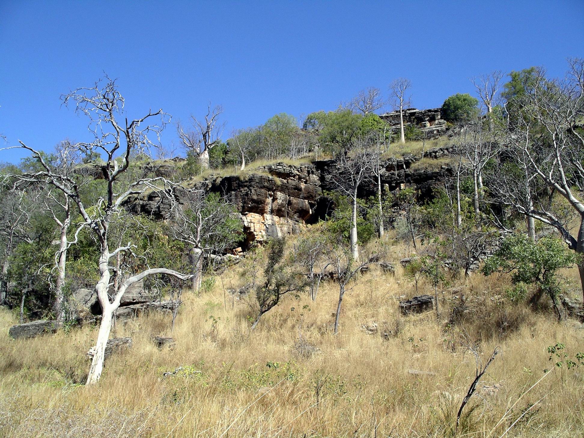
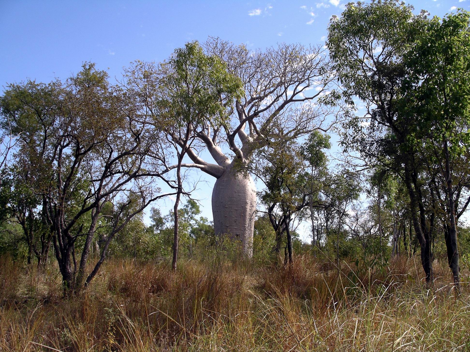
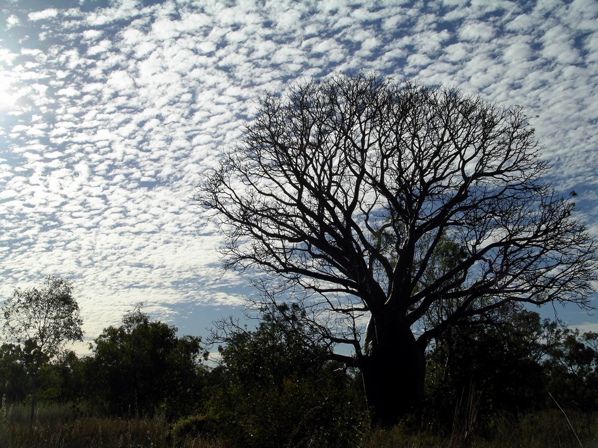
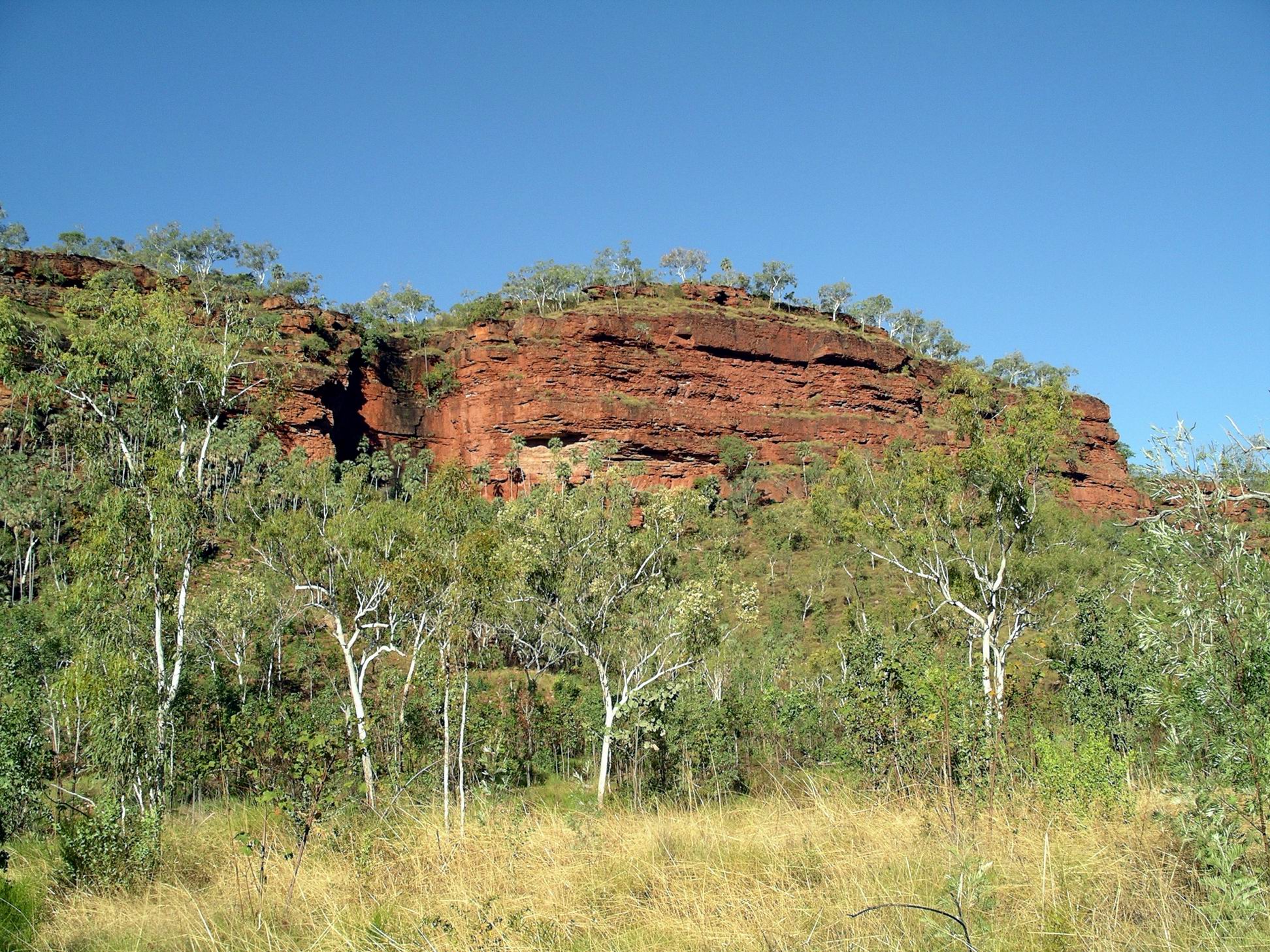
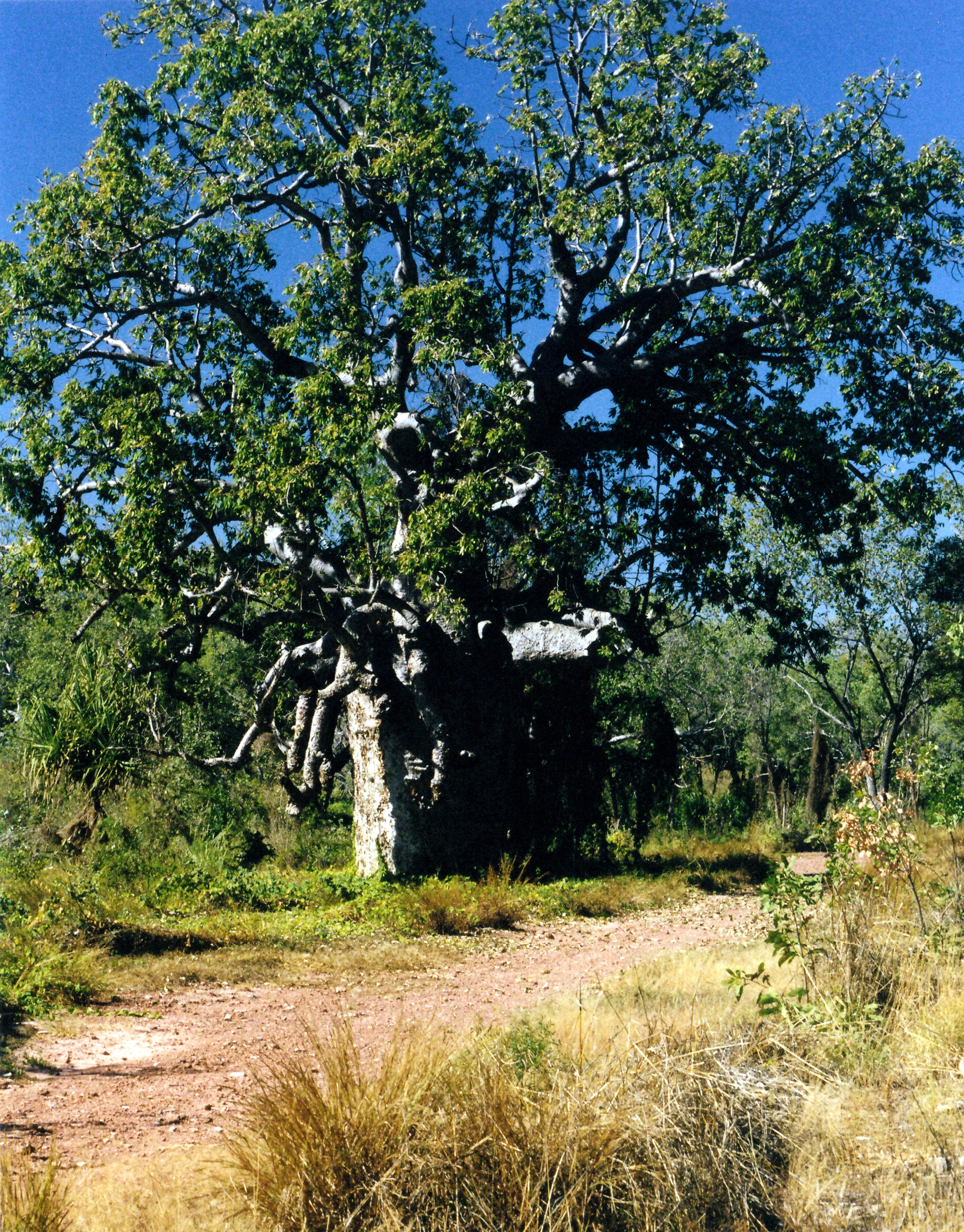
There were occurrences of stromatolites in places. The layered limestone outcroppings on the valley walls were most unusual. I loved the boabs scattered across the slopes. In all, a most interesting and enjoyable little walk.

06-22-2000 01 limestone gorge

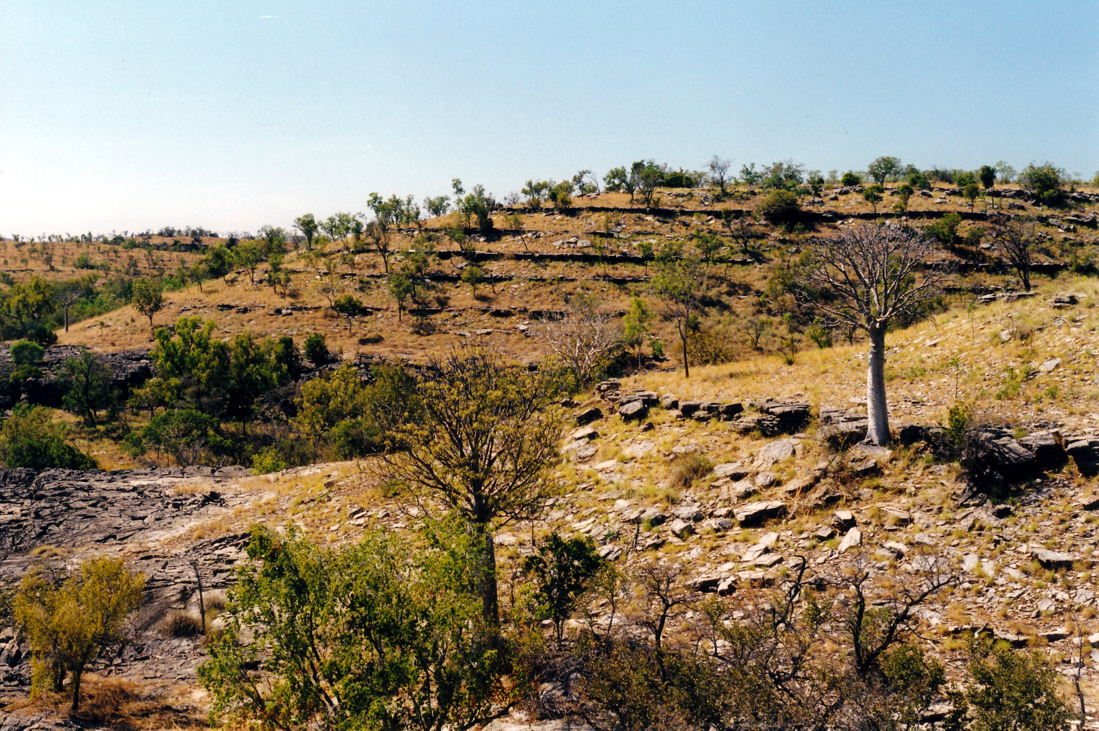
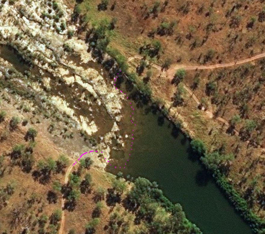
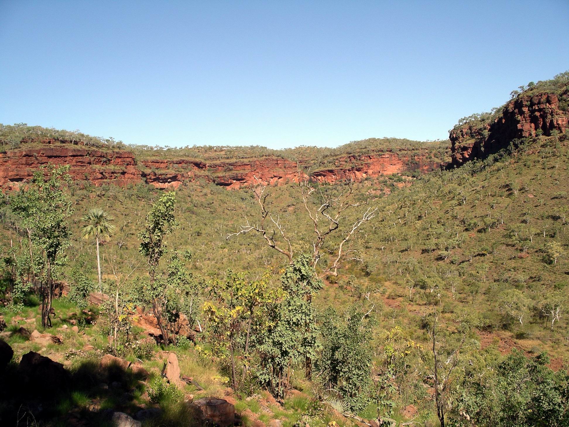
Rock layers created an interesting terraced effect on the hillside

We encountered another traveller who told us that a grader driver had told him you could fish in the potholes in the closed section of the Limestone Gorge track.

We set out to walk to Limestone Gorge – the camp ground there was about 2kms from where we were parked. The closed road really was very badly cut up in a section of a few hundred metres – and there were little fish in some of the larger water filled holes in the road. It was a real mess, and we couldn’t see it being easily or cheaply repaired.

06-22-2000 05 limestone tk closed.jpg

Closed road into Limestone Gorge camp area

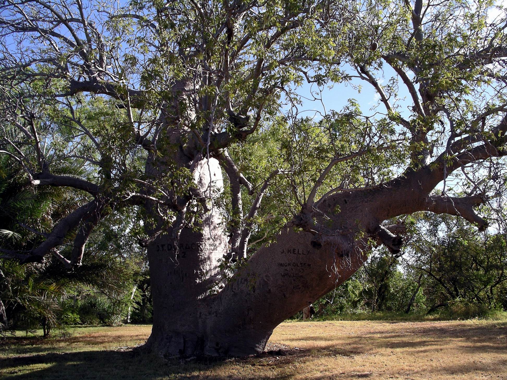
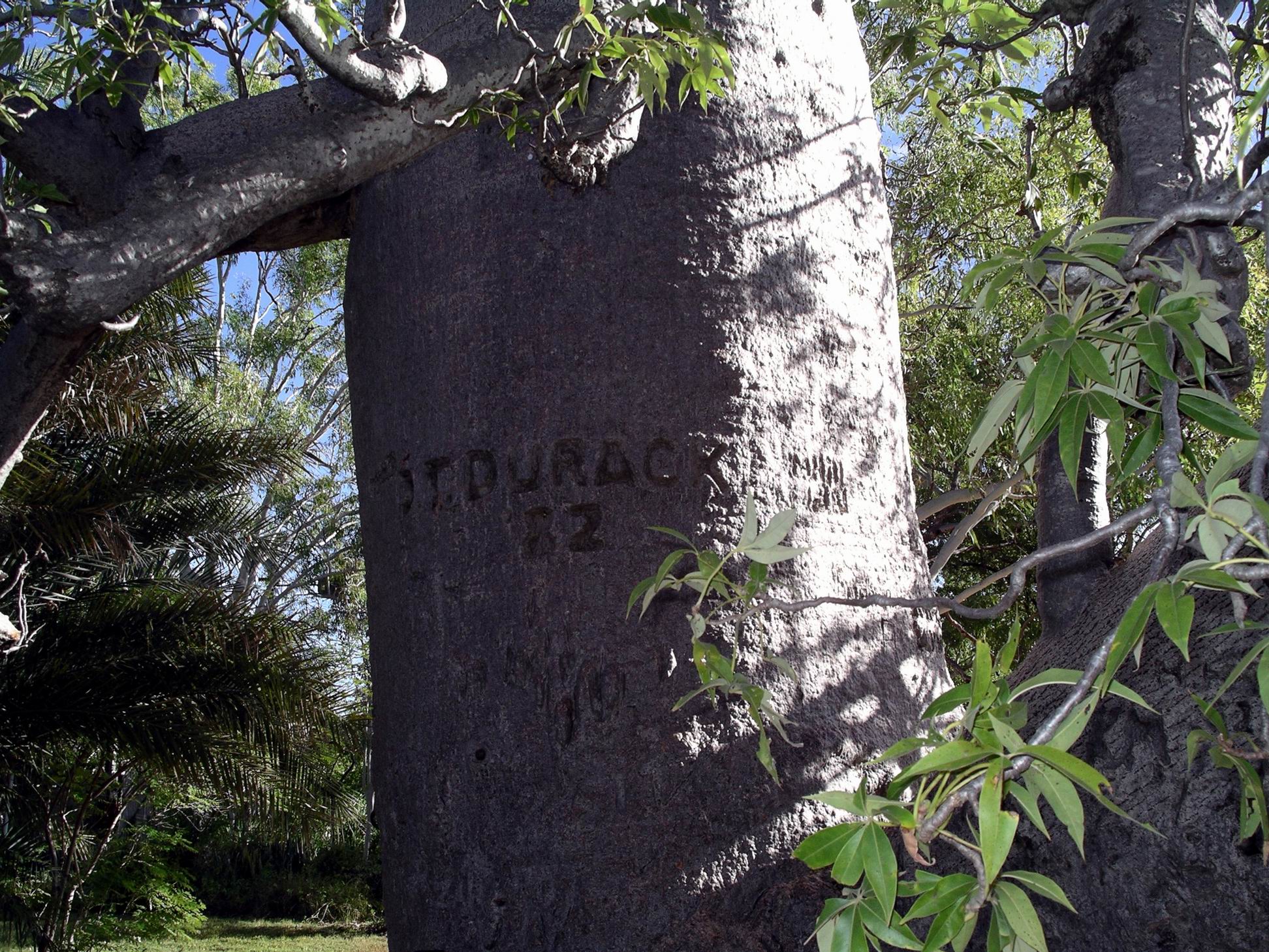
There were some superb old boabs en route.

06-22-2000 06 limestone gorge boab.jpg

Boab tree with massive base

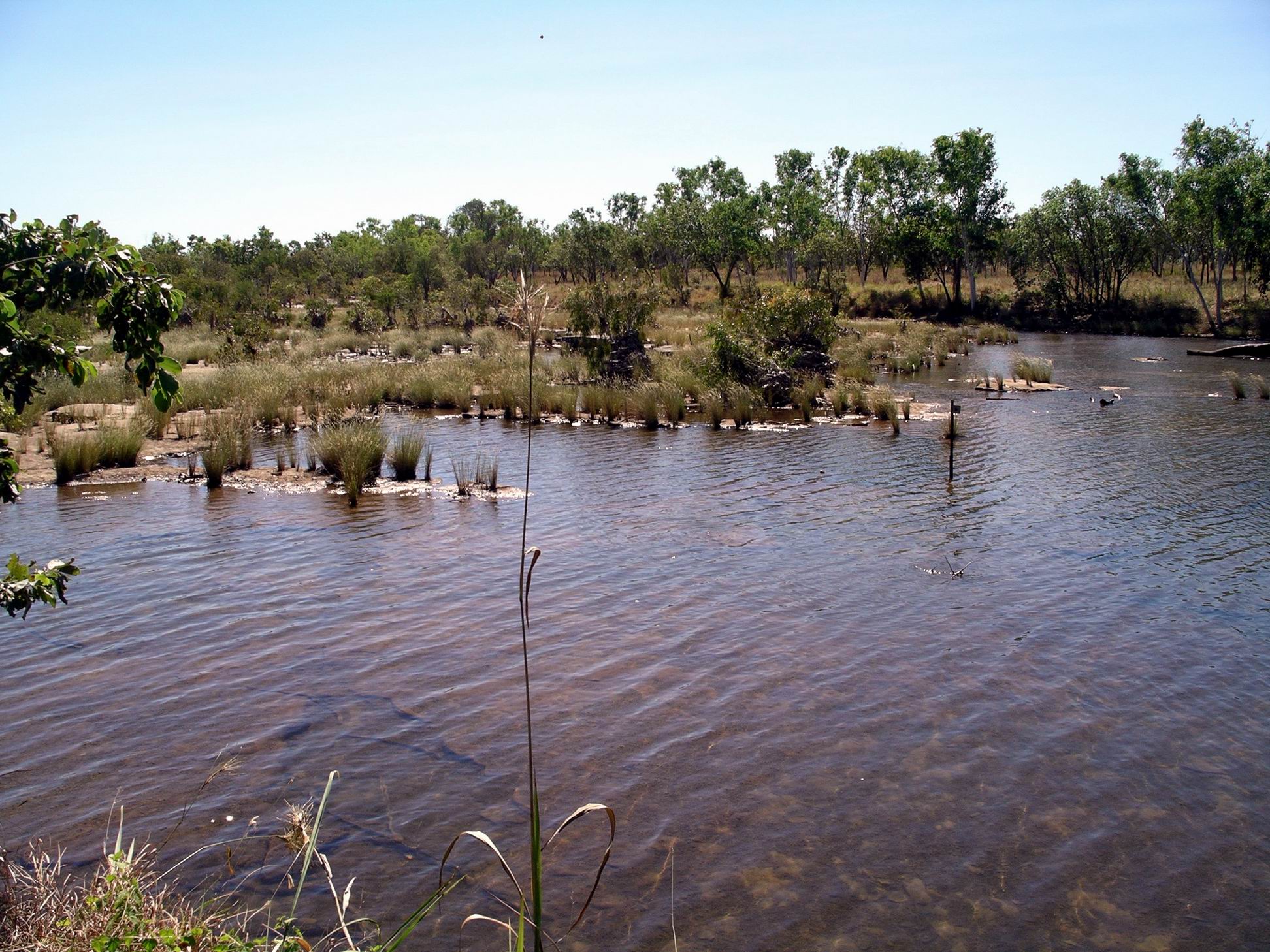
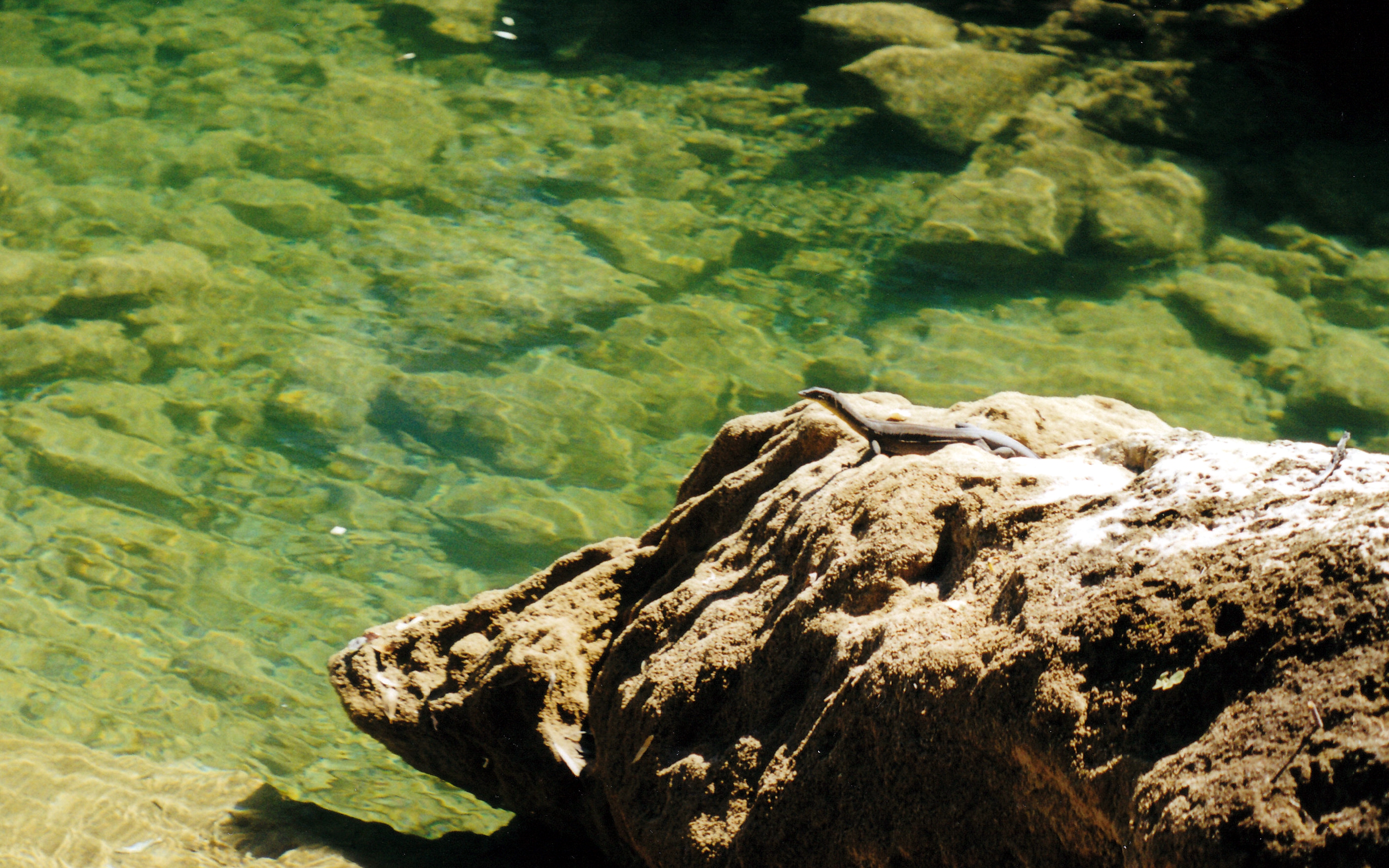
Stopped to eat lunch just short of the campground, beside the Limestone Creek, near little rapids. We were amused by a water monitor sitting on a rock and watching us carefully. He was about half a metre long. Eventually he took to the water, but then crept around in a big circle behind us – cunning fellow!

06-22-2000 04 water monitor Gregory NP.jpg

Water monitor  watching us

We walked on to the campground. This would be a really pleasant place to stay, were it accessible with a vehicle.

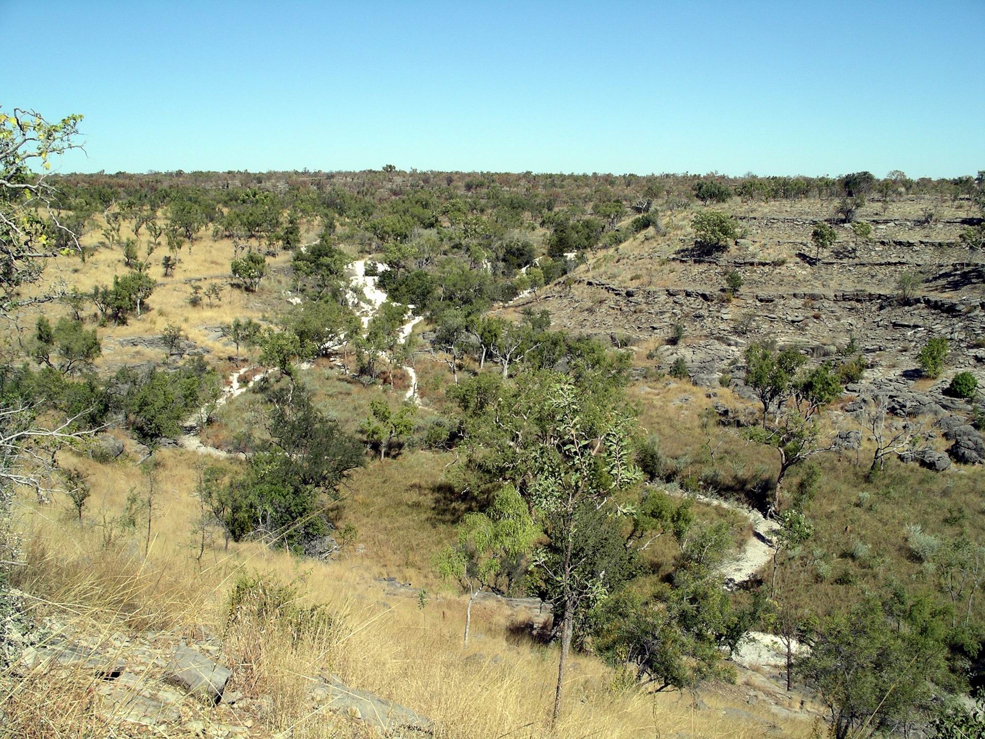
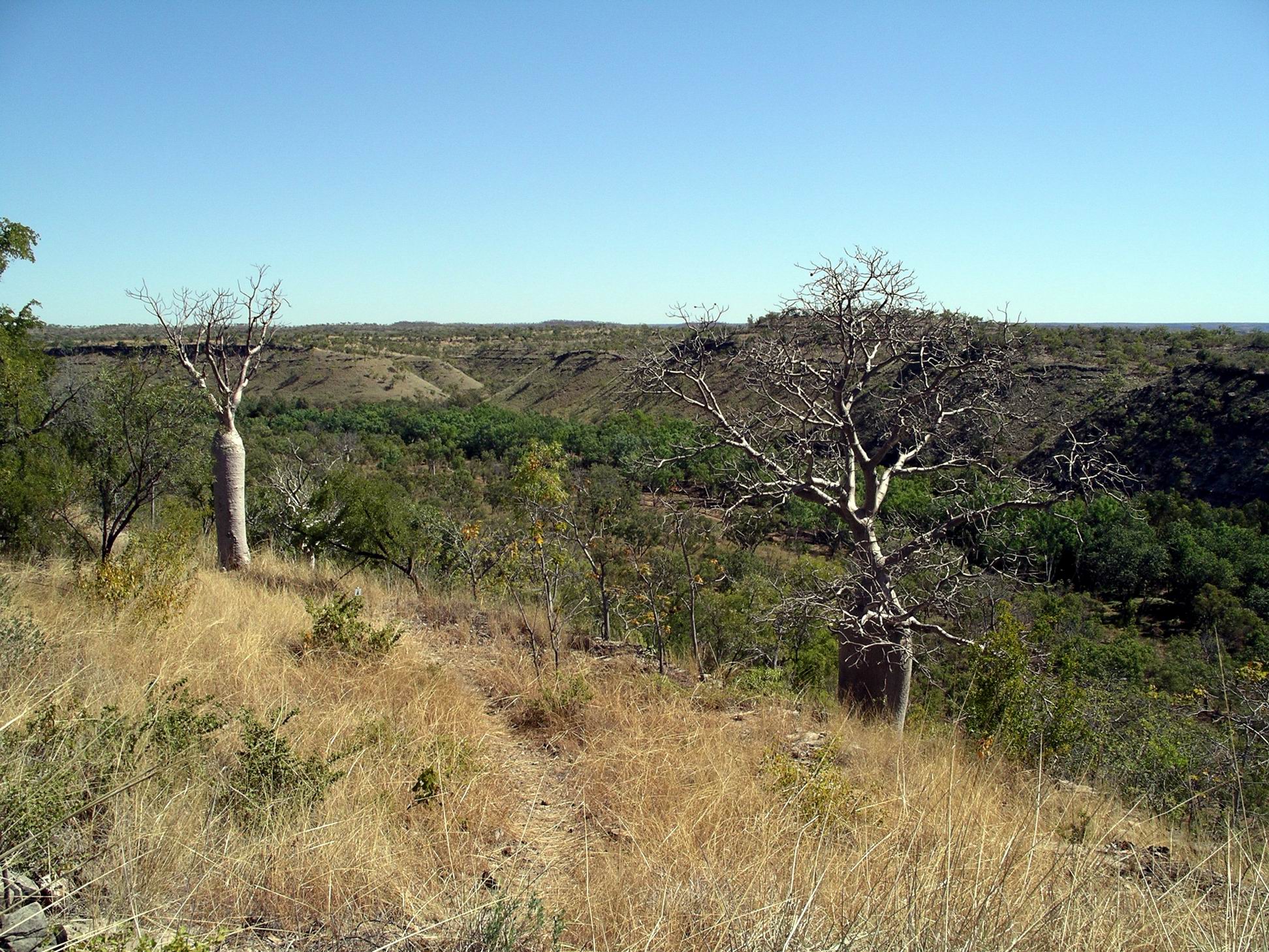
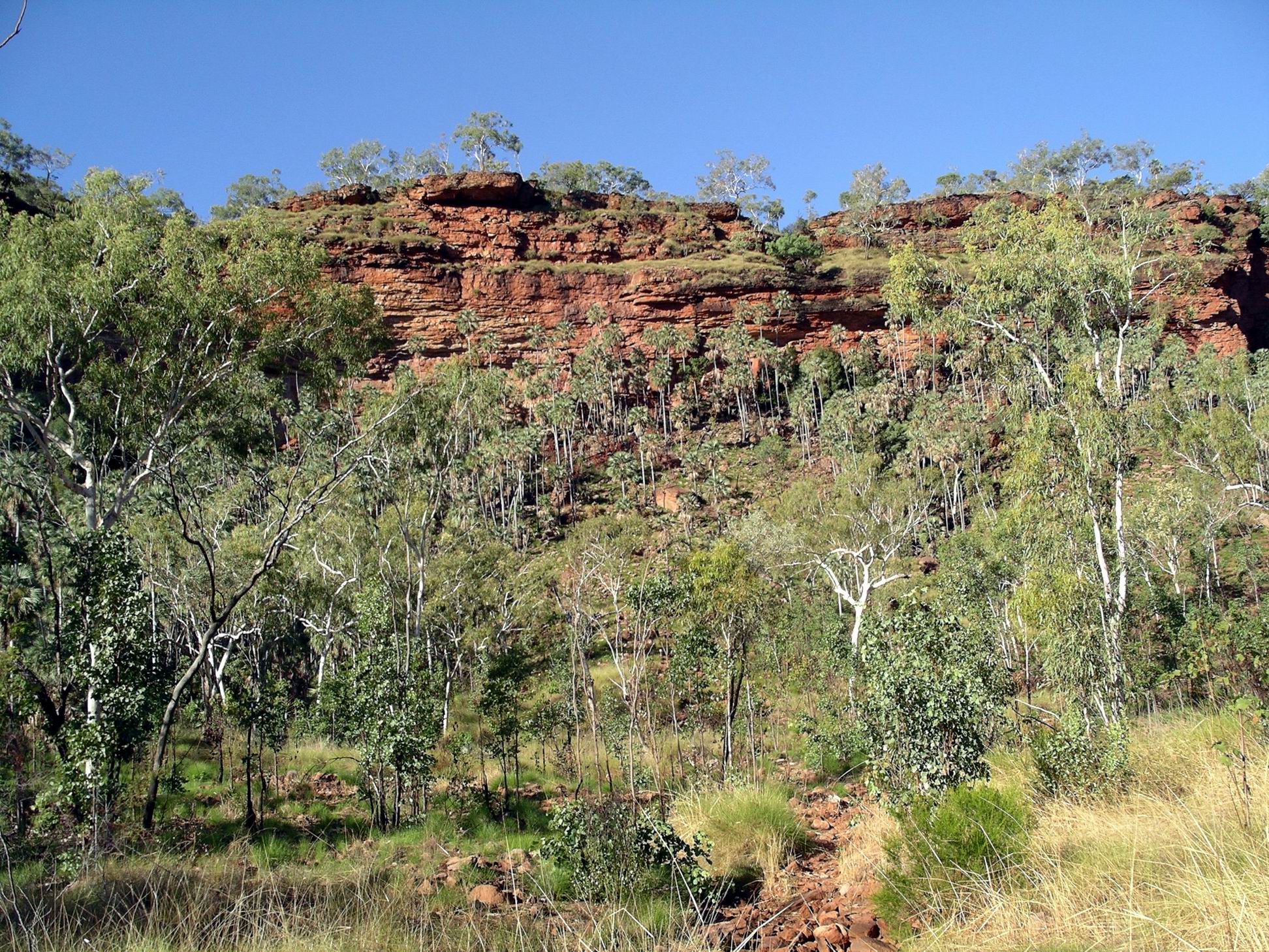
From the campground, we decided to do the Limestone Ridge walk, since we were here. This was a 1.8km loop that was signed as taking one and a half hours, but we found it hot and exposed, and did not dawdle, so it took us 45 minutes. It gave great views over Limestone Gorge – quite impressive.

06-22-2000 03 Limestone Gorge Gregory NP

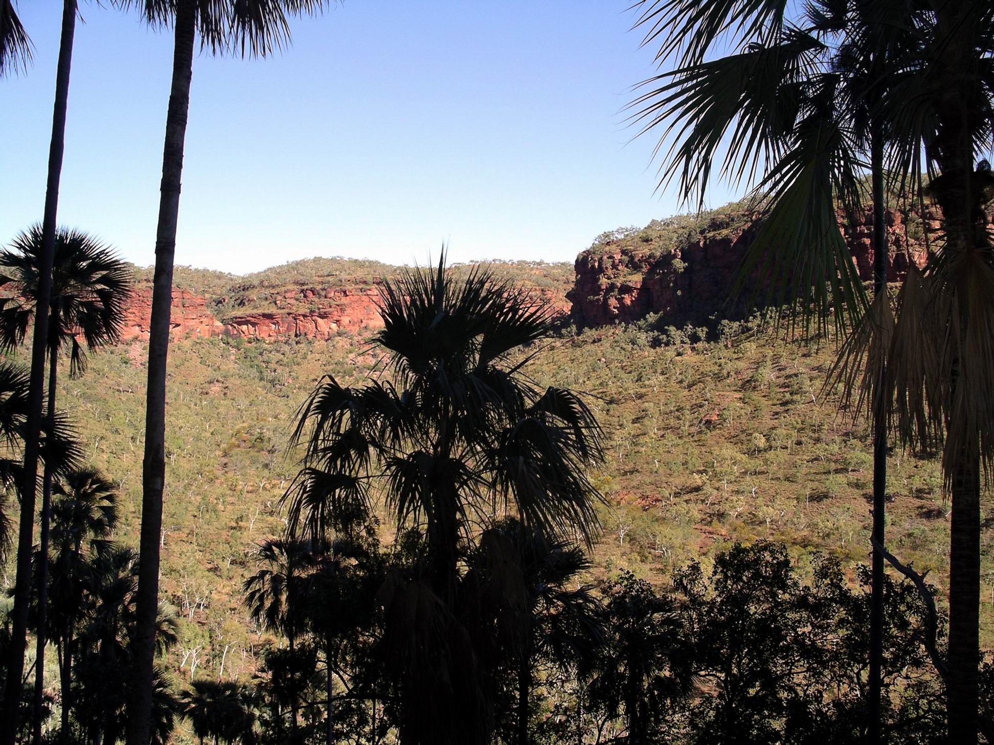
Limestone Gorge, seen from the Limestone Ridge walk track

We had ample water with us, which was good, given the heat of the middle of the day.

In all we walked for two and a half hours, over nearly 6kms and were stuffed by the time we got back to Truck. Our systems have become unused to exertion in real heat.

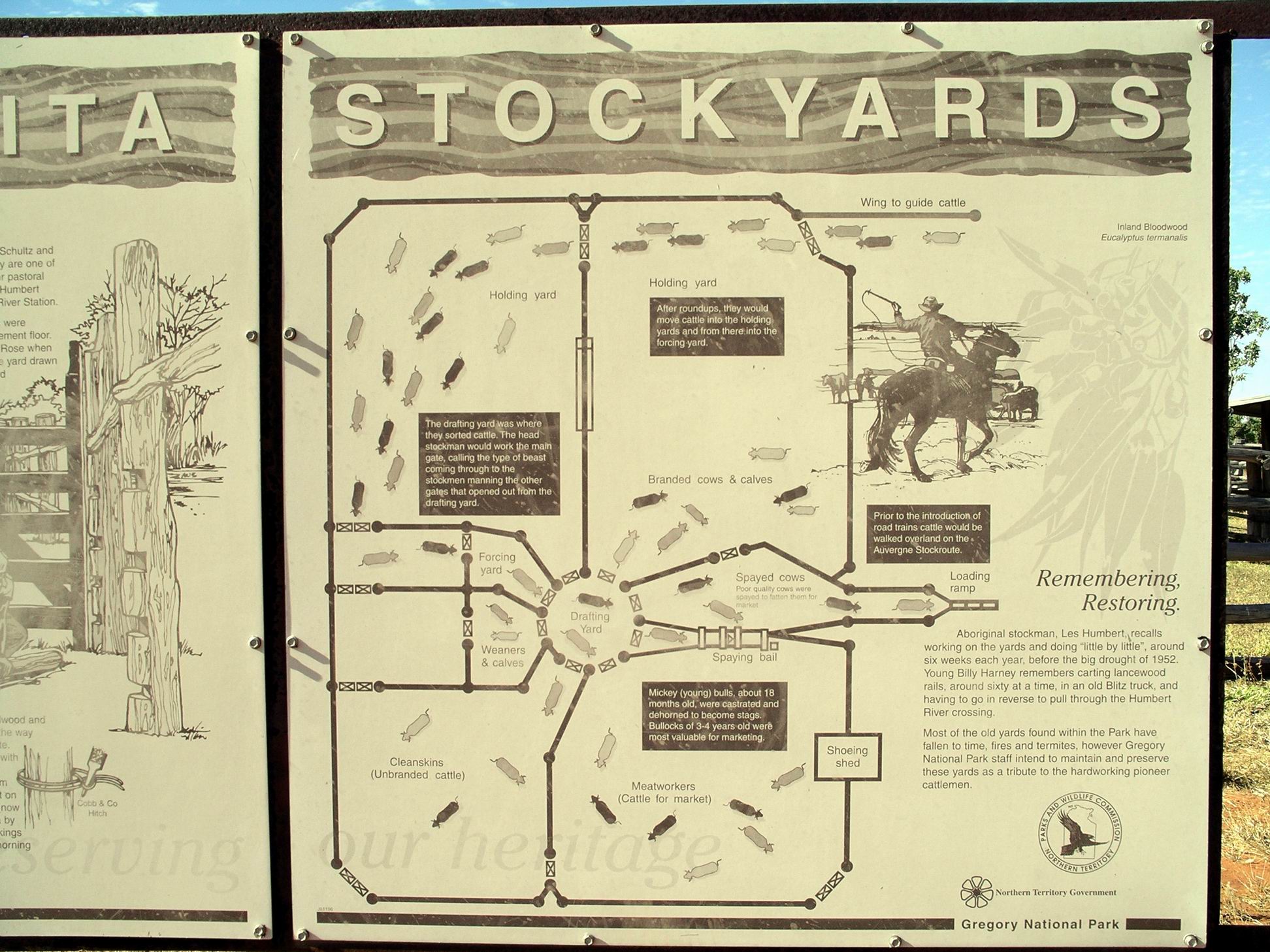
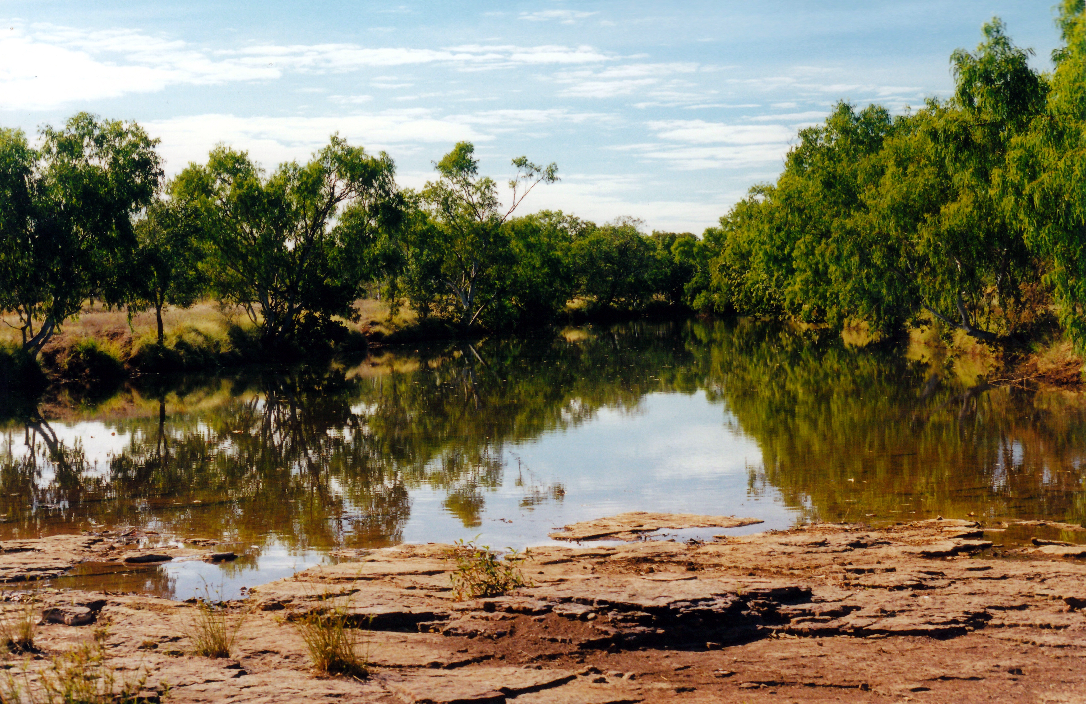
We then drove back to the Bullita Track and down to the Bullita Homestead area. We looked at the camp ground there, which would also be a pleasant, quiet place to stay – just a basic, National Park camp area. There was no one else there.

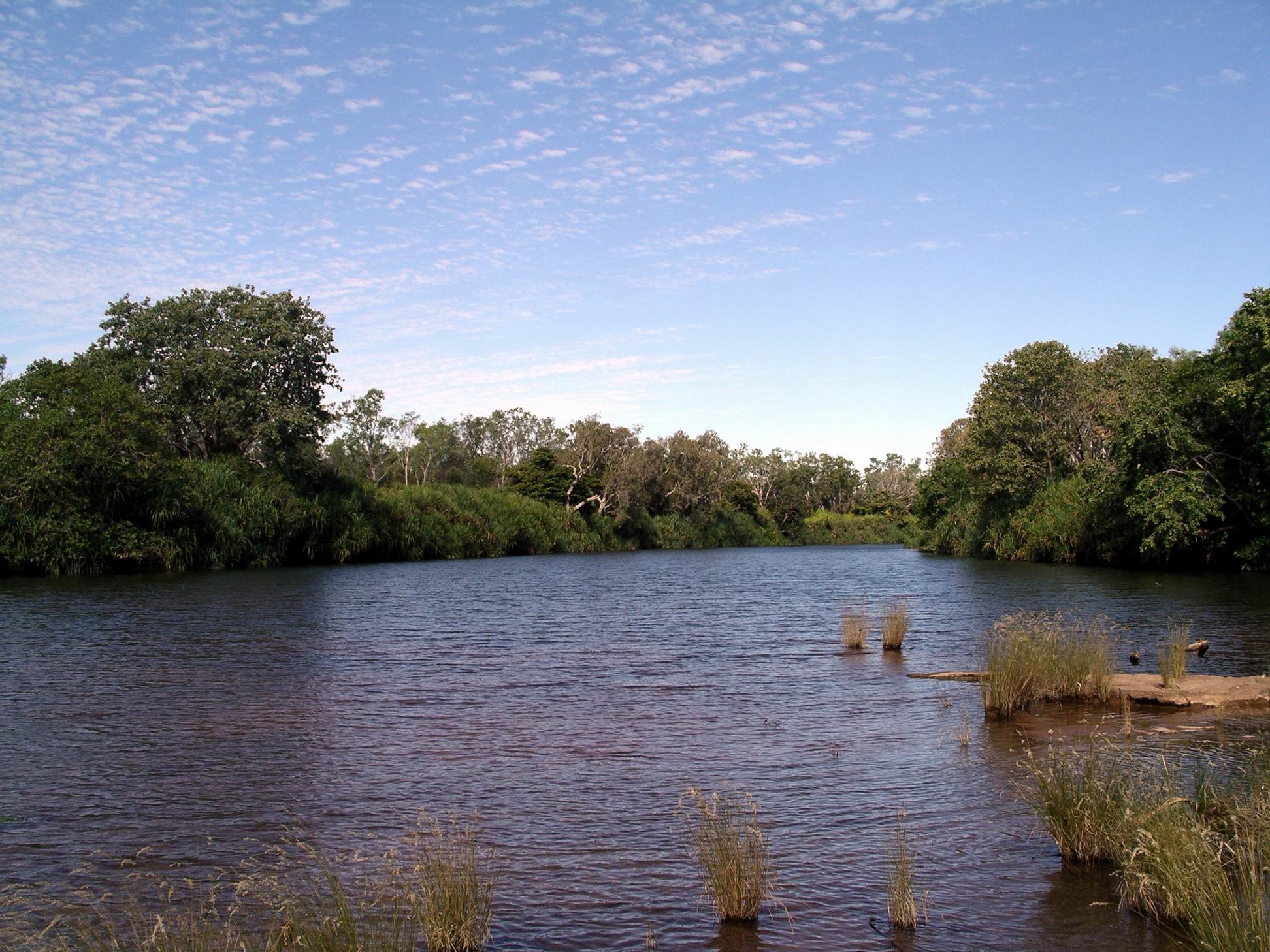
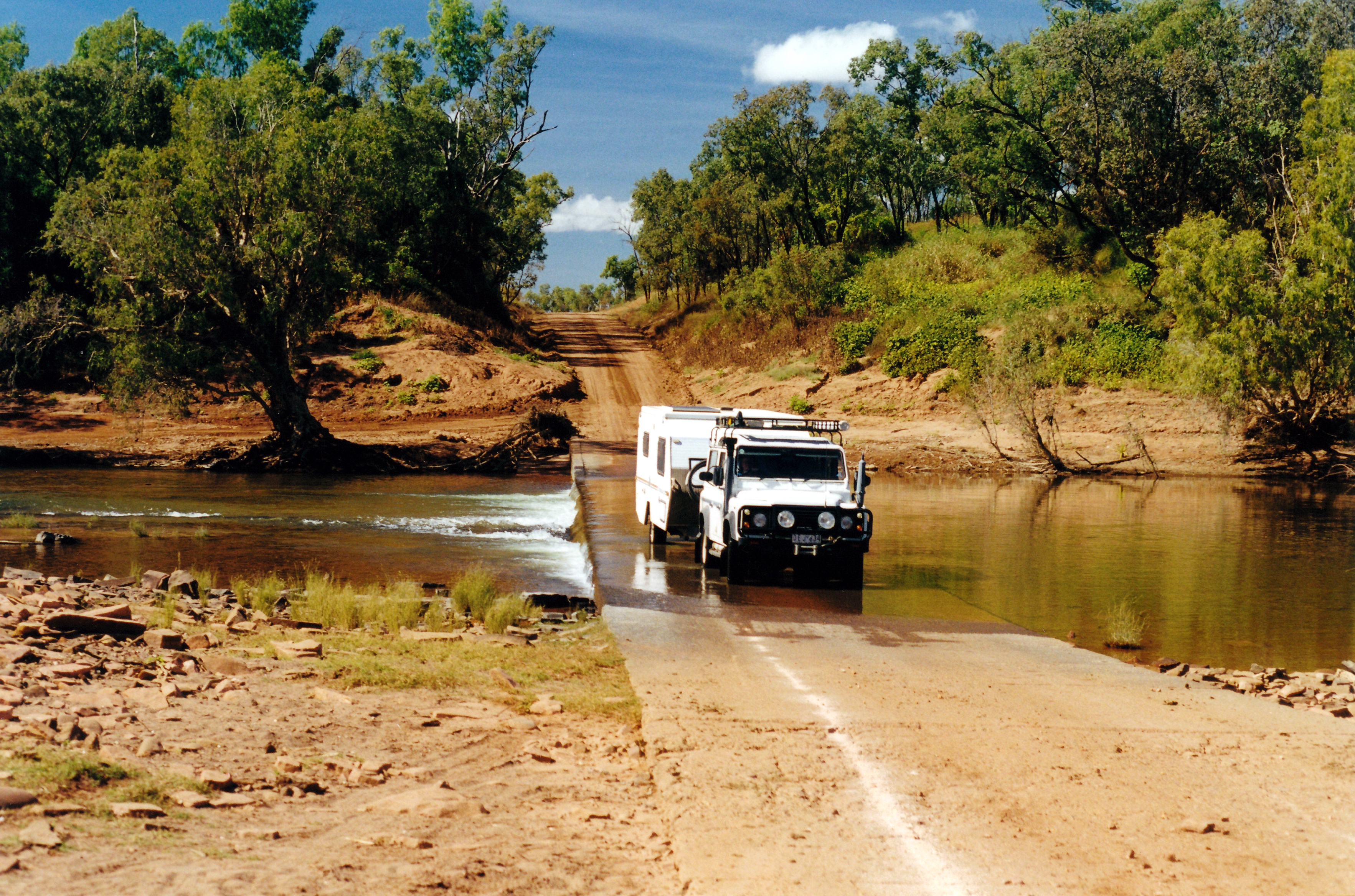
The Bullita Stock Route circuit drive starts there, with a crossing of the nearby East Baines River. We looked at this – with the river level quite high and the exact route through the river rather vaguely marked, it did not look a pleasant prospect. There was no way I would be wading that river to check the way – this is real croc country!

06-22-2000 08 bullita tk at east baynes r..jpg

Bullita Crossing of the East Baines River. Route goes to left of the marker.

It was getting quite late, so we did not stop to explore the old homestead area itself.

Returned to Timber Creek the way we’d come, getting back near dark.

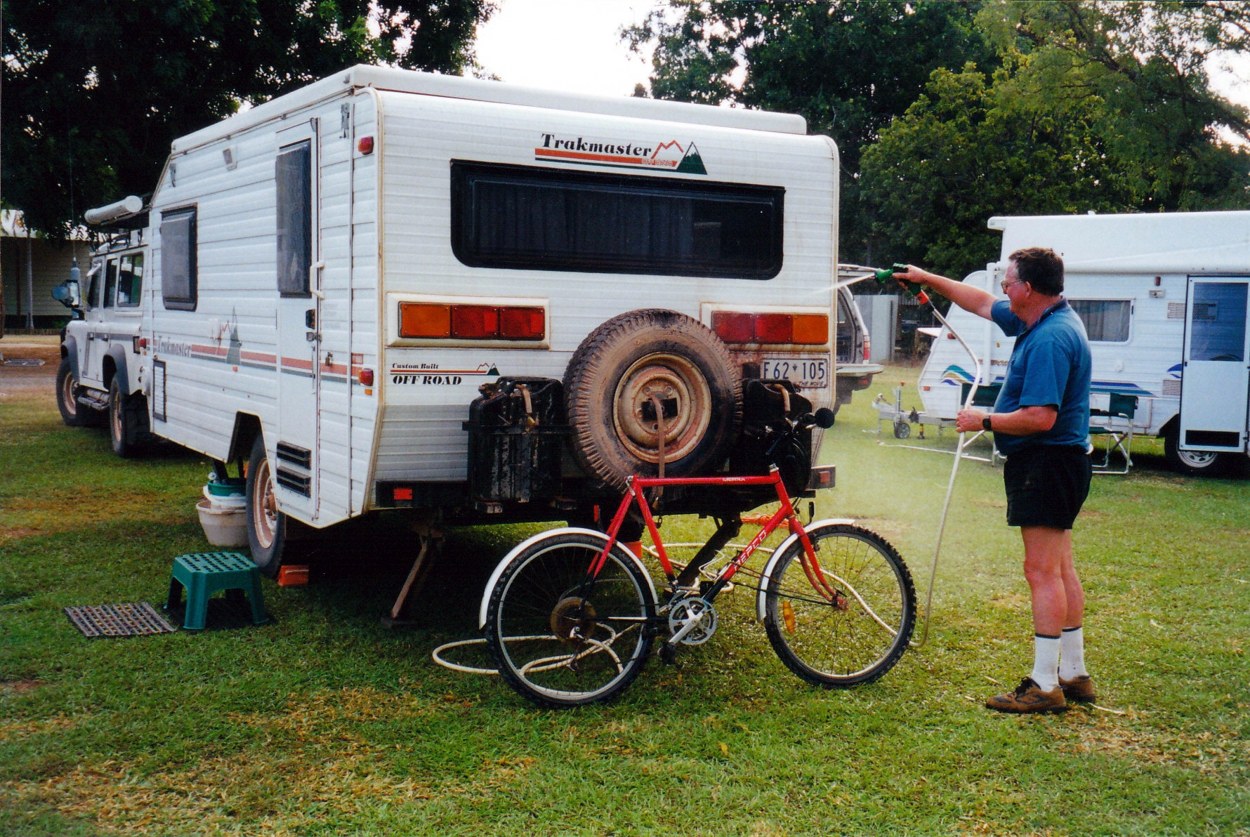
A shower was very welcome after all the hot and sweaty walking.

The night seemed a little less hot and oppressive. Maybe we were beginning to acclimatize? The occasional small breeze that wafted over was lovely.

I couldn’t face cooking the planned sweet and sour pork, so I just cooked up the pork strips with some onion, and John had that with the leftover fried rice. I wasn’t hungry.

We drove 136kms today.


Leave a comment

2000 Travels June 21

WEDNESDAY 21 JUNE   TOP SPRINGS TO TIMBER CREEK   251kms

We were up at 7.30am and away by 9.

John topped up the tank with 20 litres of diesel. The fuel here was 1.13 cpl.  He pumped up the van tyre that had been put on yesterday – it had lost some air overnight – only a few pounds.

Today’s driving was really scenic. After leaving Top Springs, we soon drove into jump-up country, which was much more interesting that yesterday’s fairly flat grass and scrub lands had been. There were more creek crossings, too, the closer we got to Victoria River Downs, and some with significant water in, too, though the crossings were shallow fords.

06-21-2000 04 Dashworth Crossing VRD.jpg

Cement ford over creek on the Buchanan Highway


We stopped at the Dashworth Crossing of the Victoria River, and walked alongside the adjacent waterhole, for some way. It was really lovely.

06-21-2000 02 vrd road

Crossing the Victoria River

06-21-2000 03 Victoria River waterhole

Waterhole on the Victoria River at Dashworth Crossing

There was more traffic today – we met about ten vehicles on the dirt “highway”, over several hours. Most were VRD vehicles.

Victoria River Downs is a very large cattle station that dates from the early days of pastoral settlement of the NT, in the 1880’s.

A few kms after the river crossing, we passed kind of through the settlement that is the station centre. It was like a small town. There were many houses, other buildings, yards, an airstrip. We saw two helicopters there and two light planes.

We decided that, in the rainy season, there would only be air access to the place. at times, given the size of the streams we crossed in the area.

After VRD, the road headed more in a northerly direction. We stopped at the campground at the entrance to Jasper Gorge, and had lunch. This was just into the Gregory National Park. It was a very attractive spot, beside Jasper Creek, a tributary of the Victoria River, which flows through the Gorge.

06-21-2000 06 jasper gorge camp area

Camp area near the entrance to Jasper Gorge

There were pandanus growing there. Hadn’t seen any of those for quite some time!

06-21-2000 jasper gorge.jpg

Jasper Creek at the campground

There were two camper trailers set up at the campground, but we thought the people were off canoeing.

Then we drove on through the Jasper Gorge itself, which was very dramatic, with great towering red walls.

06-21-2000 07 jasper gorge

Jasper Gorge

Closer to the main Victoria Highway, there was burning off close to the road.

It had become increasingly hot and humid through the day – possibly partly a product of us moving further northwards.

The road today was rougher than the one we were on yesterday, and much more stony and rocky. With that, and lots of creek floodways that made dips in the road, it was fairly slow going. We had ceertainly made the right decision to stay at Top Springs last night, and not press on.

06-21-2000 01 Buchanan Hway west of Top Springs

A road that required some caution

Once we reached the sealed main highway, and turned left, it was only about 30kms to Timber Creek – a small settlement beside the large Victoria River.

Timber Creek began as a dock for boats that serviced pastoral stations upstream, around 1900, but really only grew after the Ord River Scheme over the border in WA, began, the highway between that and Katherine to the east was sealed, and a bridge built over the Victoria River for the highway – in the 1970’s. One tends to overlook how relatively recently these parts have become readily accessible to travellers like ourselves.

We booked into the Timber Creek Caravan Park, for $15 a night, for two nights, because we wanted to do a little exploring around here.

John went to the servo and workshop at the roadhouse, to see about a new tyre. The man told him that our Dunlops were wrong for the roads up here! We will see, because this was an issue we had discussed specifically and at length with the Rockhampton dealer before we bought them. John then said we would wait until we got to Kununurra before looking for a replacement. We do, of course, still have one usable spare, for either Truck, or van.

John hosed the van down – it was extremely dusty – before we set up. Setting up was hot and sweaty work!

06-21-2000 washing van.jpg

Looking much more respectable.

I phoned K and reported our movements to the answering machine.

Tea was soup, lamb chops, veggies, yoghurt.

No doona was needed tonight. It is not that long since we were huddled up in our winter gear, around the campfire at Opalton!

We went to bed at 9.30pm – were both really tired.

06-21-2000 to timber ck