After the usual fairly slow morning start, some daily exercise was called for.
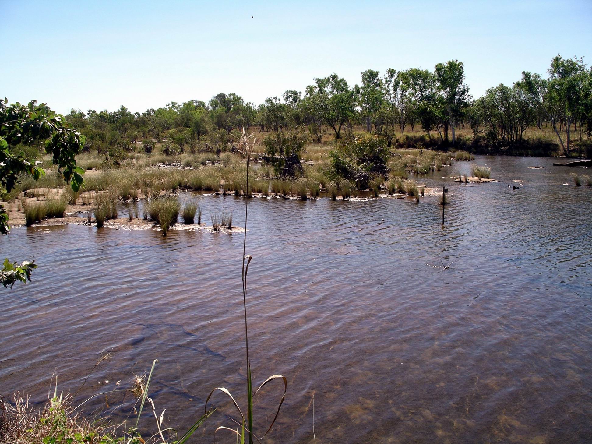
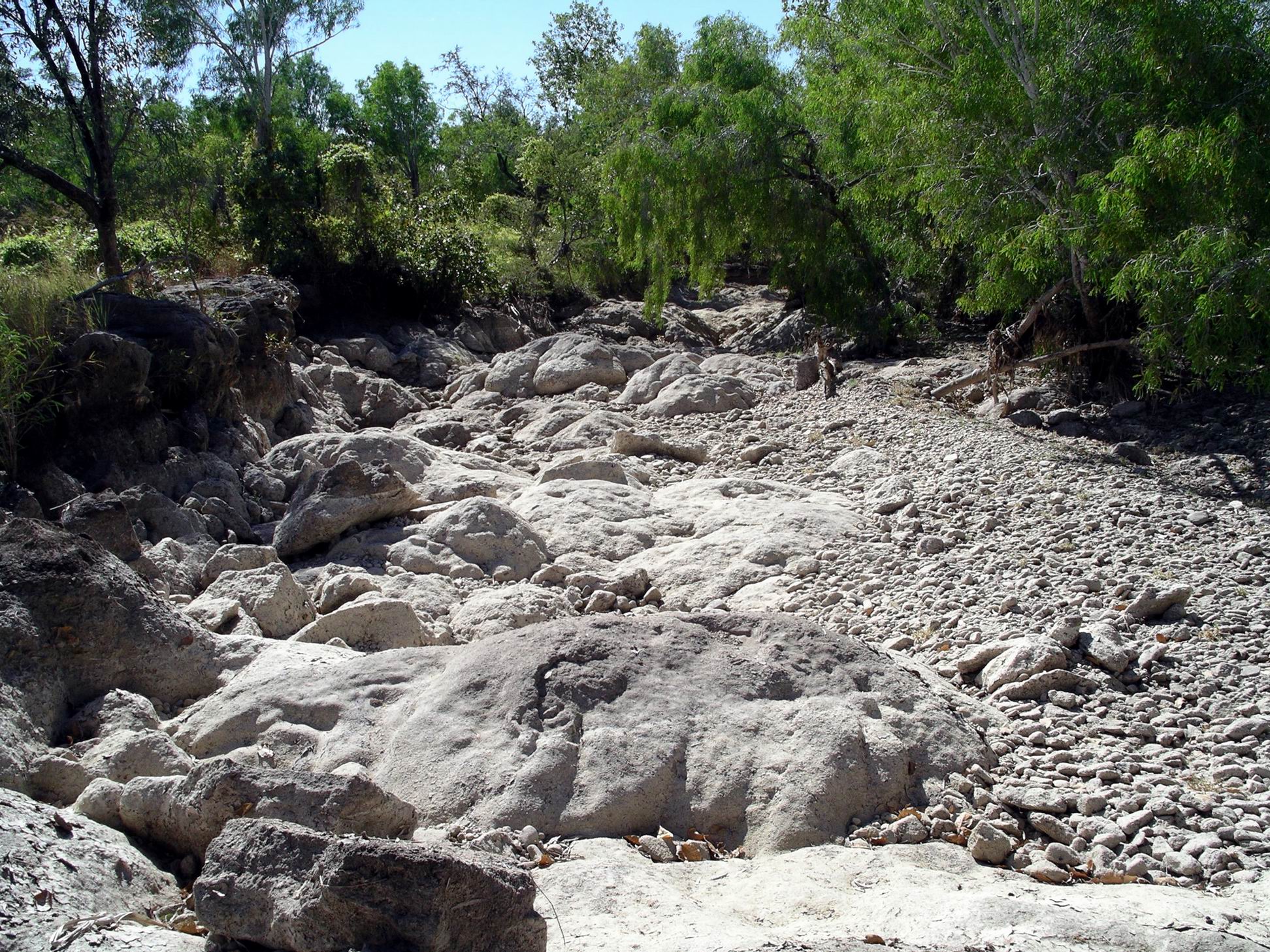
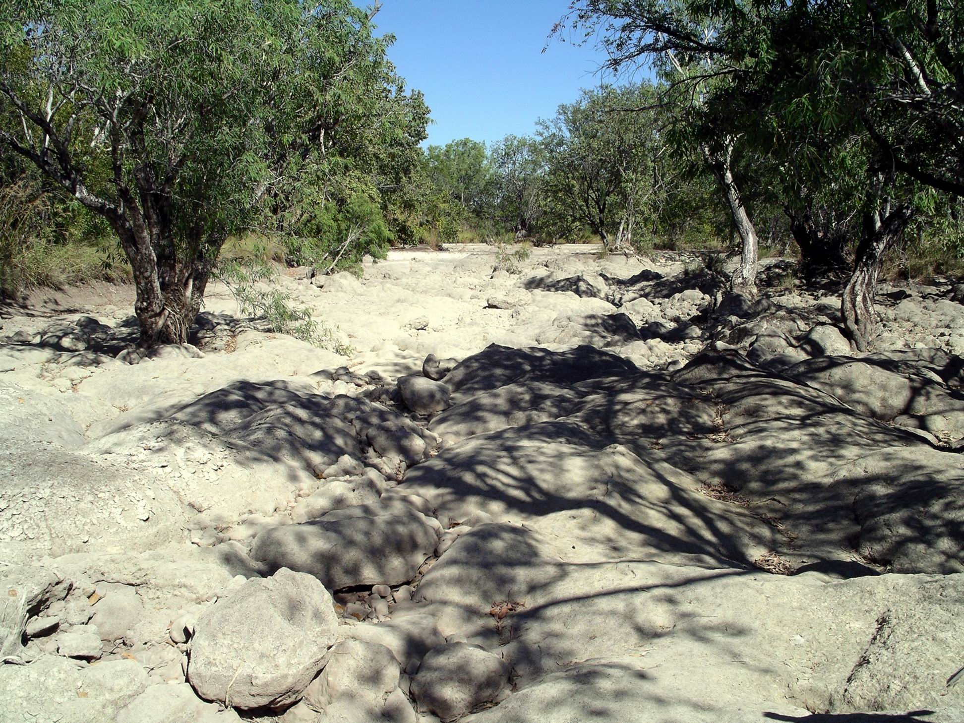
Close to our camp was the point where vehicles attempting the Bullita Track circuit, would cross the East Baines River on a series of flat rock shelves interspersed with patches of river pebble beds. Right now, the lower sections of that crossing were too far under water to be passable.
We were able to pick our way, rock hopping, across the river. It was a bit easier for us on foot than it would have been for a vehicle, because we could jump from rock to rock, that varied greatly in height and size. Even so, we got wet feet! The actual vehicle crossing here swings around in an arc, but we took more of a straight line, because much of that arc was deep water.
Rock shelves of the Bullita crossing
The vehicle line was marked by posts in the river with blue markers on. The rule was that one must keep to the left of the markers.
Bullita crossing, with track marker post
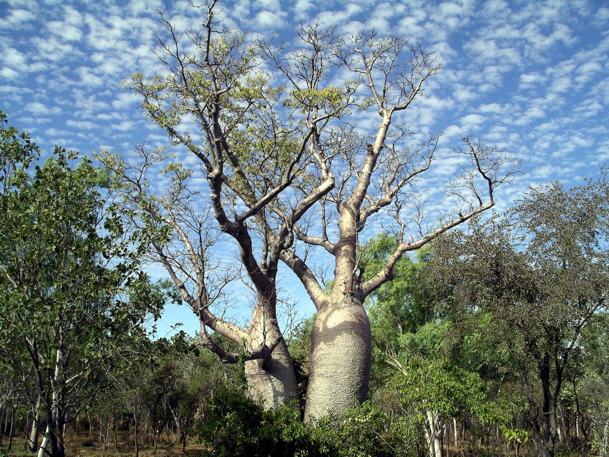
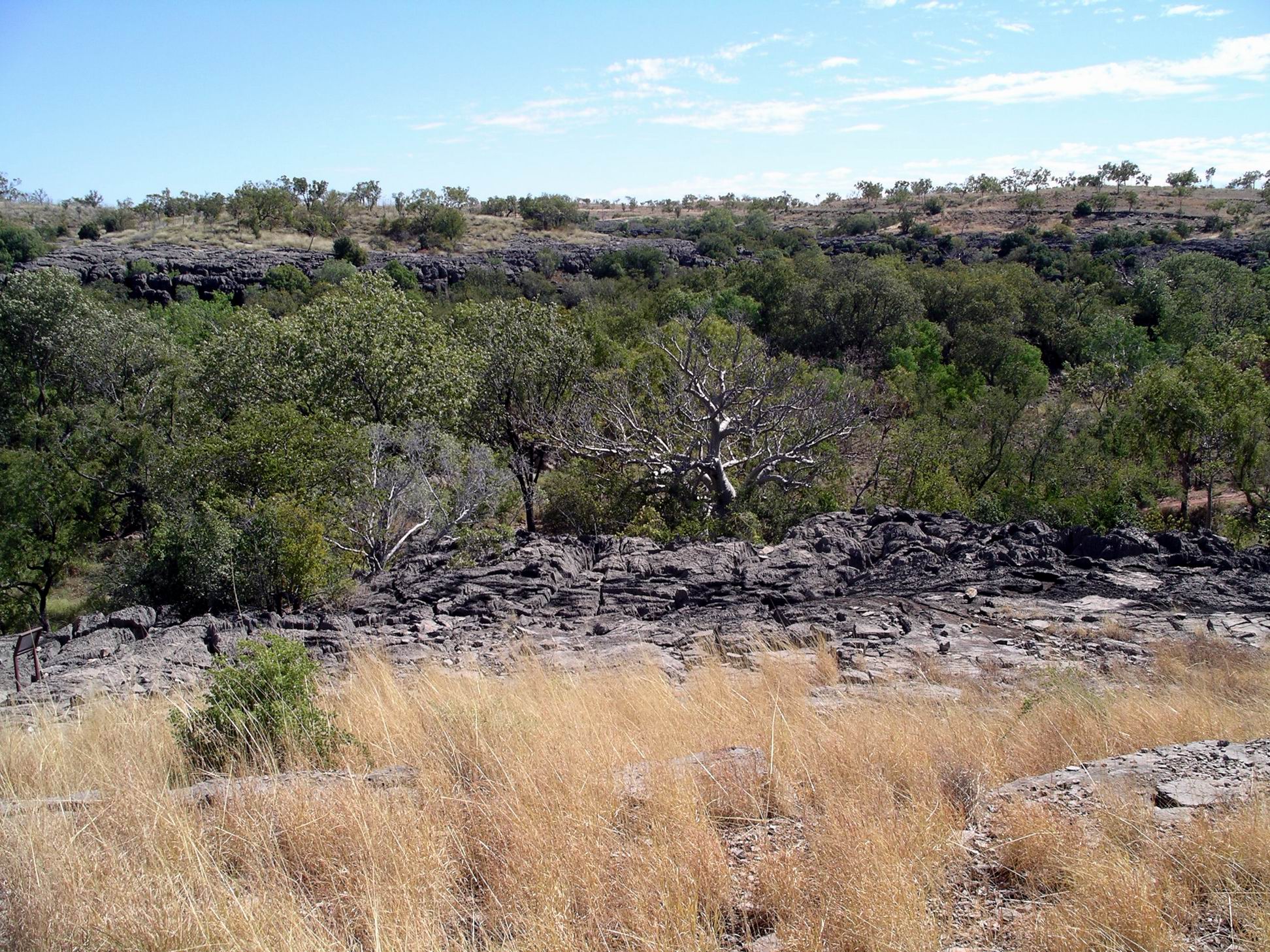
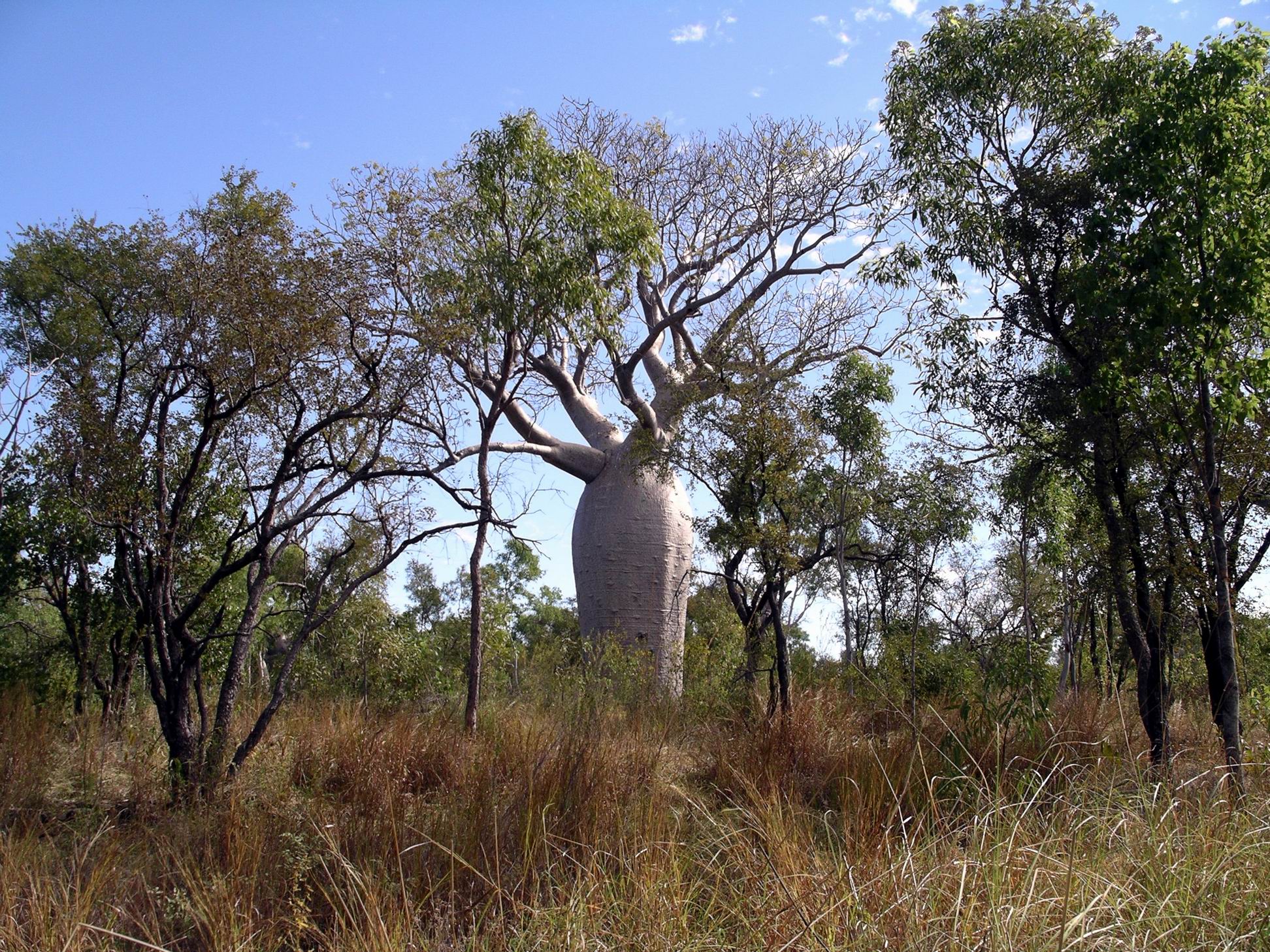
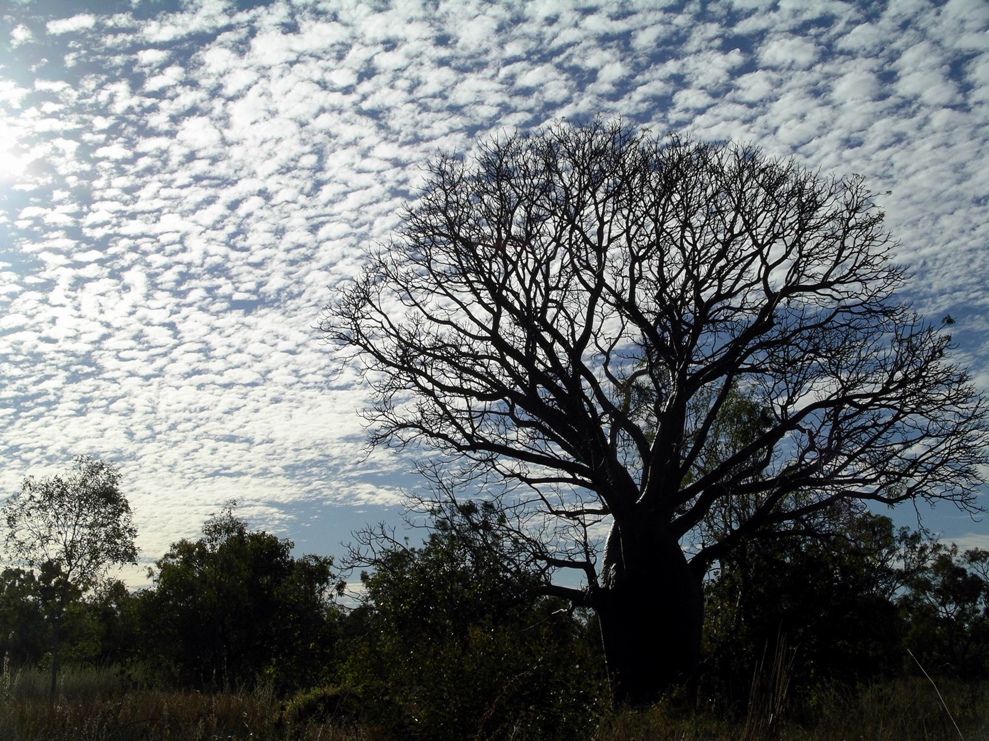
After the river, we aimed to walk at a steady pace for an hour, along the Bullita Stock Route. The vegetation over here was quite open, having been fairly recently burnt, with some termite mounds and lots of boabs to look at, including one huge and venerable old specimen.
After the stipulated hour, turned around and walked back.
The walk was pleasant, before the day got too hot. The track was reasonably level, so we could – kind of – walk and look around at the same time.
Back at the crossing, M was in front, as usual, and surprised a croc, sunning itself on a rock. With hindsight, she thought it was a freshie. At the time, they both moved a bit too quickly for a good look!
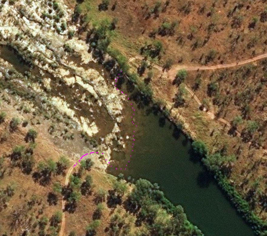
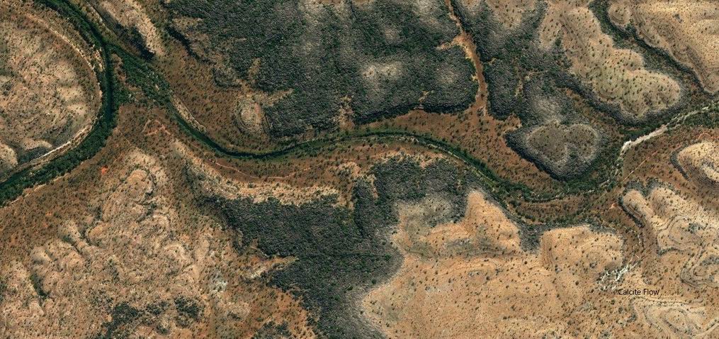
The Bullita crossing of the East Baines River, at low water (marked in pink) (Zoom)
Felt virtuous about making the exercise effort, but lazed about camp for the rest of the day. Spent some time bird spotting. There was so much birdlife here.
During the afternoon, a Britz hi-top 4WD camper arrived in camp, and set up at some distance from us. We spoke briefly with them – a young couple from Europe.
It was another lovely night, with a sky full of stars. They were so brilliant up here.
I enjoyed my lone early morning sit outside, contemplating life, before M emerged from the Troopy and, eventually John from the van.
I made packed lunches, based on Ryvita biscuits, cheese and salami.
We drove back towards the highway for 8kms, then took the Limestone Gorge Track as far west as the Calcite Flow.
The Calcite Flow really stands out in this Zoom image
Beyond the car park here, the former track into Limestone Gorge was closed, due to Wet season damage. Judging by the extent of the wreckage we saw, the closure may well be permanent.
What happened when a track became a river!
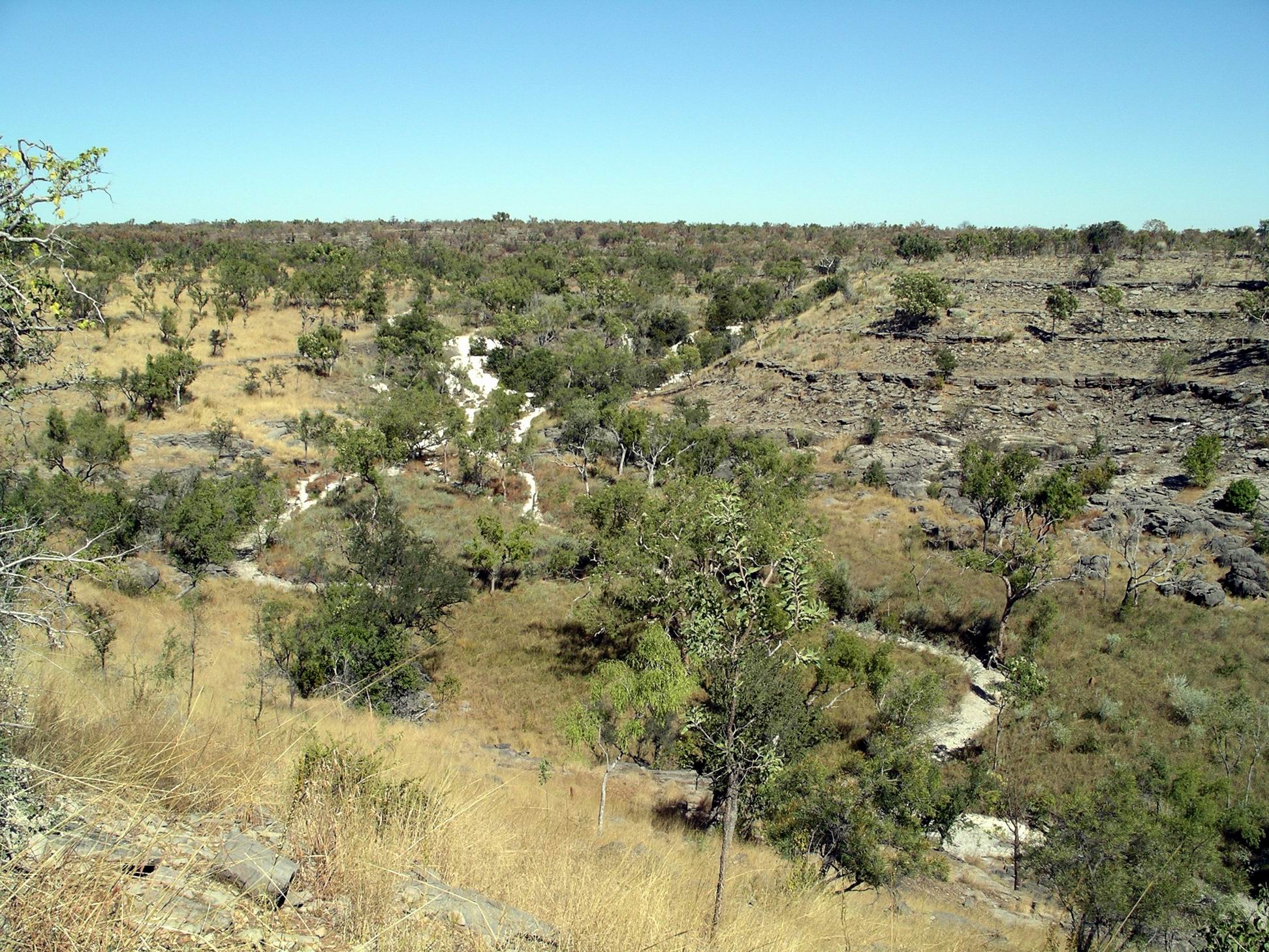
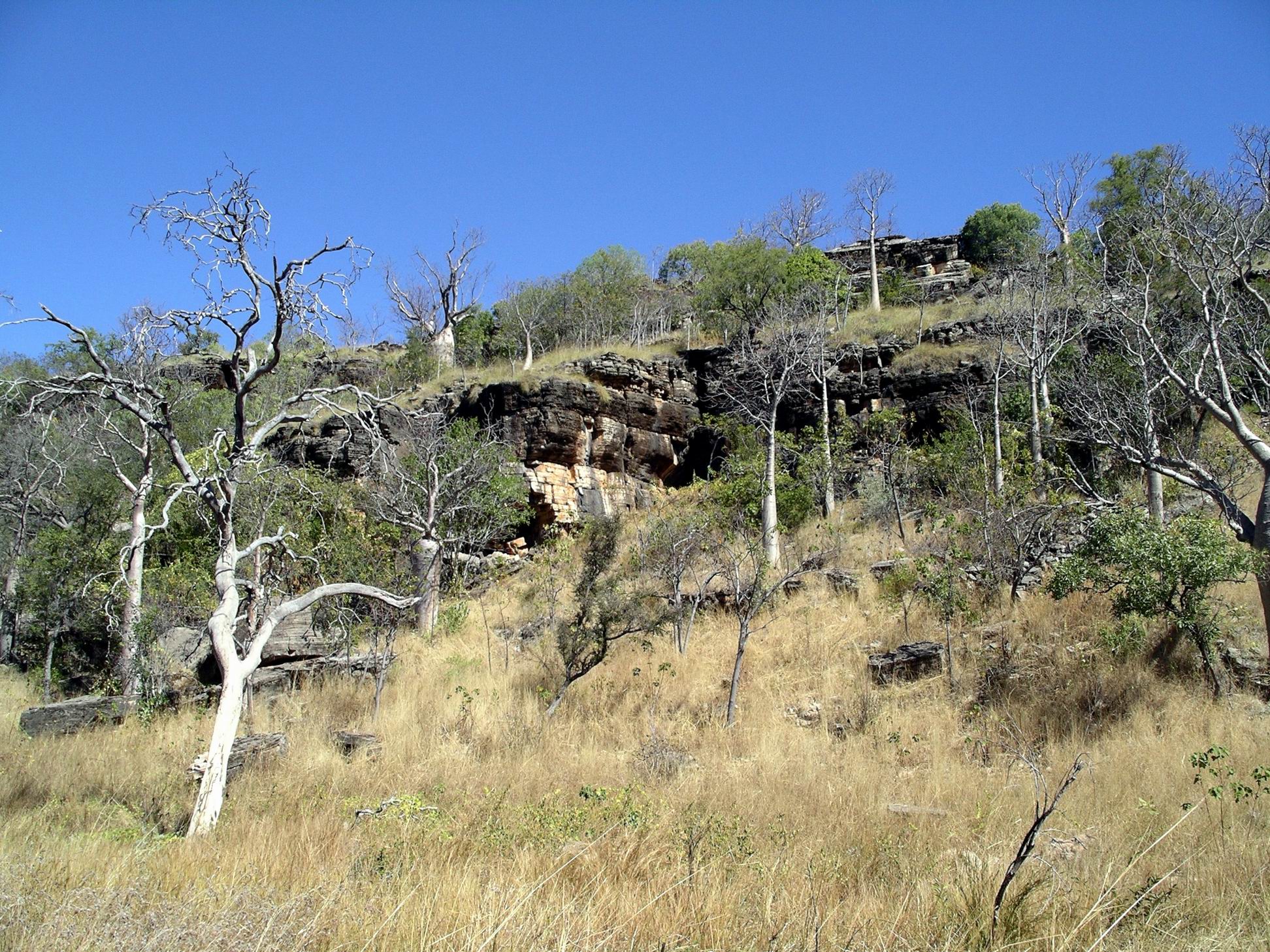
Walked the 600 metre (return) Calcite Walk – very interesting. Just around here is grey karst limestone formations and under here is a shallow cave system – The Bullita Cave is one of the longest cave systems in the world!
Grey karst limestone outcropping
The Calcite Flow appears as a white, solid creek, formed, I guessed, when dissolved calcite was precipitated out of water as it evaporated. But I could be wrong on that! Either way, it was a striking looking formation.
Calcite Flow and unusual erosion terraces on the hillsideCalcite Flow – solidified limestone
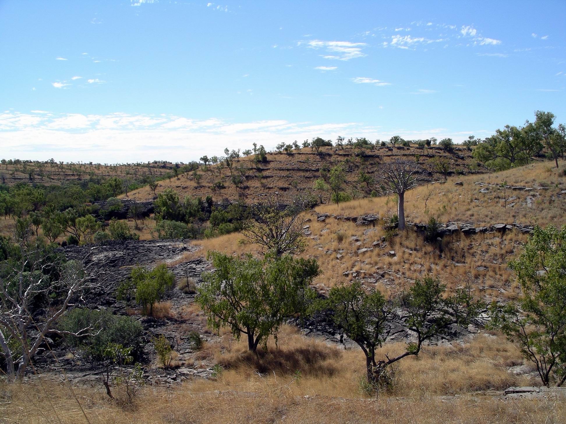
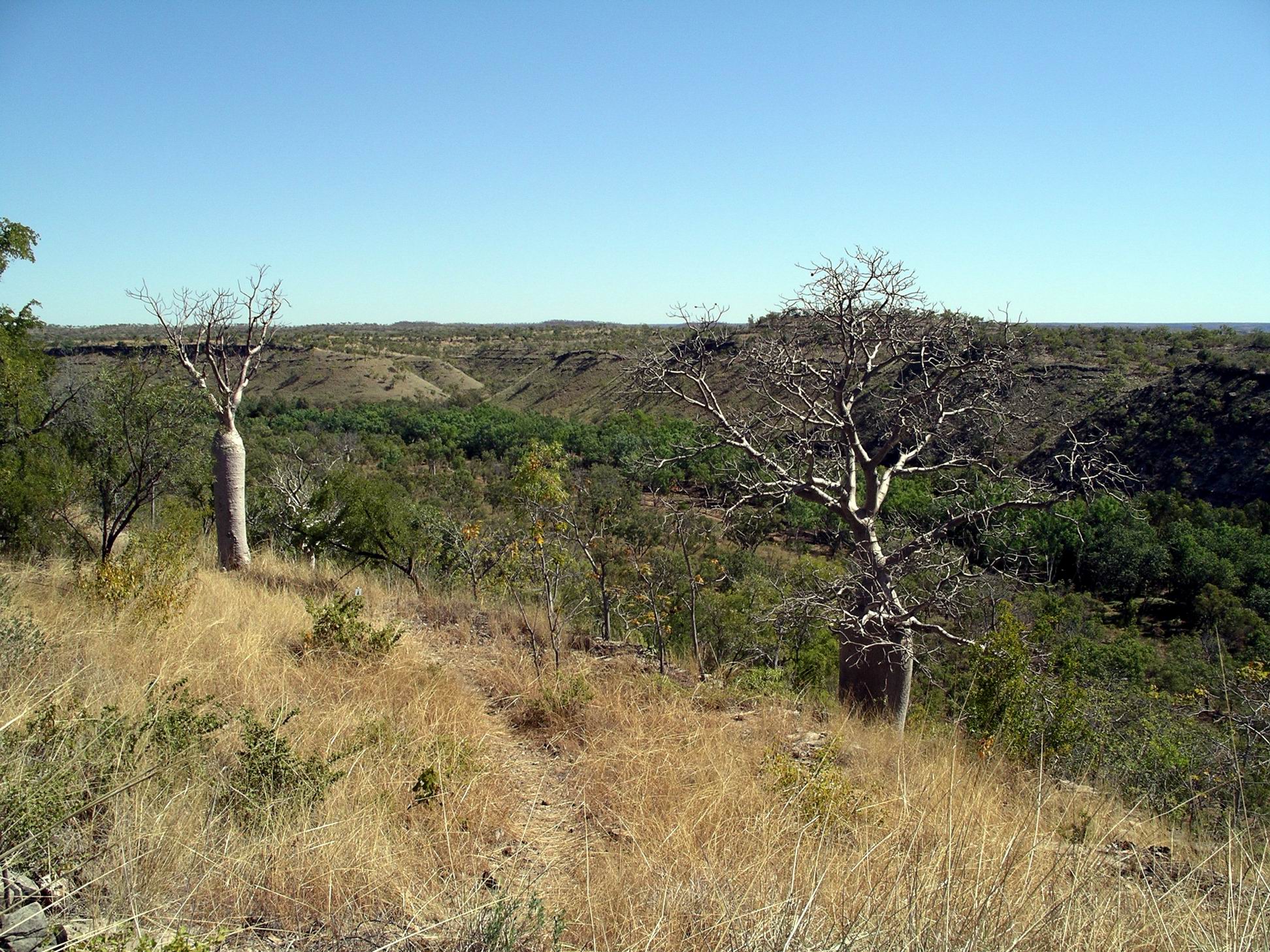
This whole bit of country was quite strange and different. The hillsides had small ridges that gave a terraced appearance, on which boabs were growing.
Reef-like formation, karst outcropping
Fossilized stromatolites occurred too. Limestone country, caves, stromatolites – definitely reminiscent of Pungalina, though I didn’t see any areas there that looked quite like this.
Left the vehicles at the Calcite Flow parking area and set out on foot for the Limestone Gorge camp ground, 2kms away, walking along the closed “road”. This resembled a rocky, dry creek bed much more than anything a vehicle could traverse.
Track to Limestone Creek Campground
In sections there were remnants of a sort of cloth matting substance that had been put down to try to reduce erosion of the track. Clearly, it hadn’t worked!
Despite the rough surface, the walk was enjoyable, with Limestone Creek flowing close by in places.
Limestone Gorge campground appeared little maintained and mown, now that there was no vehicle access. It would have been an attractive camp area, with the limestone ridges encircling part of it, and with the creek and East Baines River forming two boundaries.
Zoom view showing Calcite Flow at R, track beside and in Limestone Creek, and the campground at the stream junction
The creek here formed a long, small waterhole here, supposedly swimmable, though I wouldn’t trust it! Large boulders and rocky shelves beside it provided us with the perfect spot to prop for lunch. However, it seemed that a large water monitor lizard agreed about that – and we were intruding in its dining room. It kept careful watch over us, whilst dipping in and out of the creek.
Really clear Limestone Creek water – deceptive, because it was deep enough for a swim, here
Refreshed, we took on the 1.8km Limestone Ridge loop walk, from the campground. As the name suggested, this took us up onto the ridge behind the camp area, from where there were good outlooks over the eroded valleys of the limestone karst country, and down over the camp ground.
Limestone Gorge walk
The walking track wound around and took us back to the start. It was a walk worth doing.
I did wonder how much longer this little, slightly rough walk track would be maintained, if vehicle based visitors remained permanently excluded.
This boab still had all its leaves
Then it was the return walk along the rock beds that once were the road. The afternoon was getting hot by now and with the heat reflecting up from the light coloured rocks, the last km or so of the walk back was less enjoyable!
Altogether, we walked nearly 7kms today. That was enough!
As we approached the Bullita campground, there was the usual little bit of suspense – would we still have this place to ourselves? Or would we have neighbours? We were still the only campers here. Lovely!
Campfire and star gazing. Just the way I like to spend evenings.
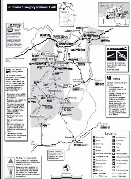
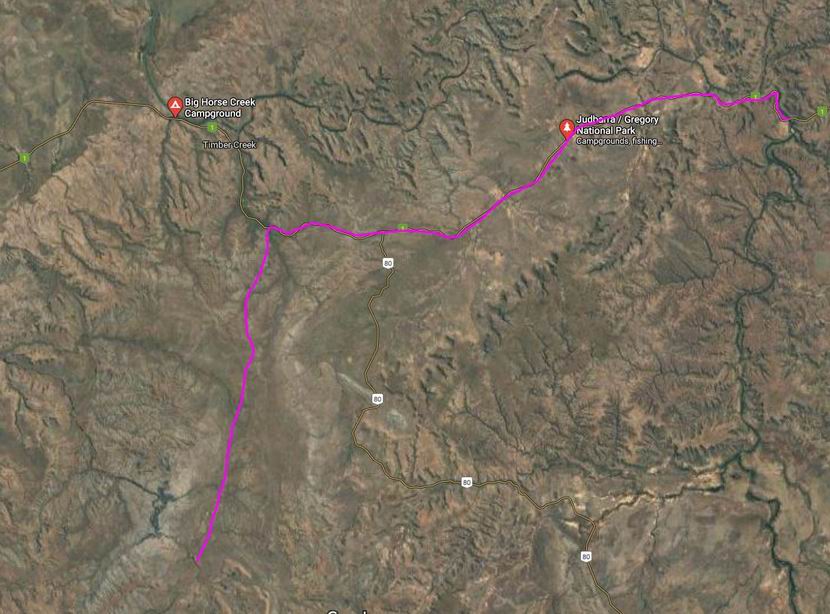
TUESDAY 12 JUNE VICTORIA RIVER R/H TO BULLITA CAMPGROUND 130kms
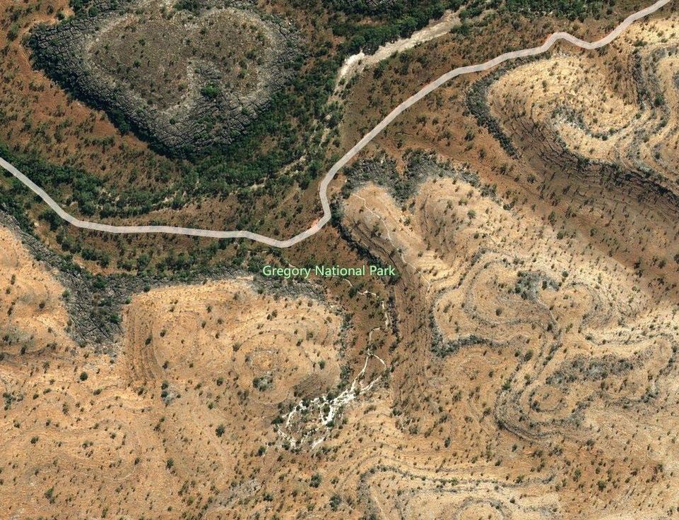
Today our destination was in the western section of the Gregory National Park. This is the second largest National Park in the NT, but was only declared less than twenty years ago. This larger section preserves some pastoral history of the region, but also has some special landscapes.
We drove about 80kms west on the Victoria Highway, then turned south onto the Bullita Track. This was unsealed, but reasonable going albeit a bit rough in spots. The creek crossings required some caution, sometimes being in little gullies.
There was one creek that surprised John by being deeper than it looked – we were not doing as we should have by checking and maybe walking crossings first. It was only a small creek, but about 3 foot deep! We made an enormous splash as we hit and ploughed on through – more by momentum than anything else. We were through before John had much of a chance to react. Didn’t seem to be any ill effects…. There was more than one good reason why M was content to follow us!
We were clearly back in boab country. These trees, with their weird shapes, are fascinating, and are just such an intrinsic part of the Kimberley experience.
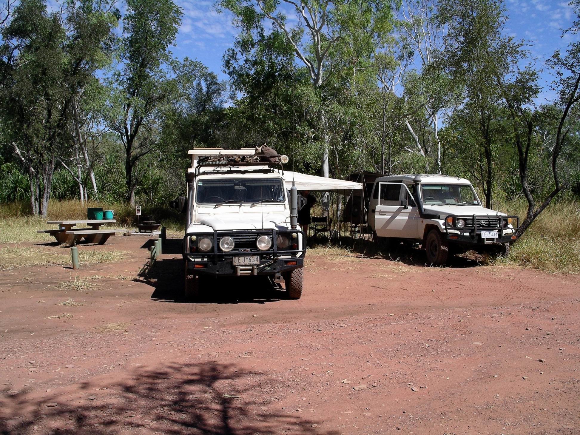
After about 50kms, came to the Bullita camp ground.
This was a very pleasant, basic camping area, by the East Baines River, with a toilet and water tank. Camp spots were delineated by bollards. After finding it so pleasant, decided we’d need three nights here, and paid accordingly. Didn’t have quite the exact change needed, so put $20 in the envelope. Slight tip for the Ranger!
We set up where we had a fireplace and table. Also had a collection of fruit bats in the trees not far away – they were very noisy, but to us that was nice “bush” background sound. There was no one else here.
Bullita camp
The campground surrounds were reminiscent of our Safari Creek camp at Pungalina, in 2005. Similar climate and vegetation zones of course – the monsoon affected savanna grasslands and tropical riverine vegetation.
After setting up camp, we walked to the nearby stockyards and the former homestead.
Bullita
Bullita was once an outstation for the pioneering pastoral Durack family. It was never a stand alone property in its own right. Various important stock droving routes passed through what is now the National Park – some of them for moving stock between various Durack holdings.
The Bullita Homestead was not a grand old building in the pastoral traditions of the south. Rather, being a “back block” outstation, it was a glorified tin shed! It would have been a very hard life style here, even into the 1970’s. Actually, for the Park staff, it would be no picnic today, and they have more modern accommodations.
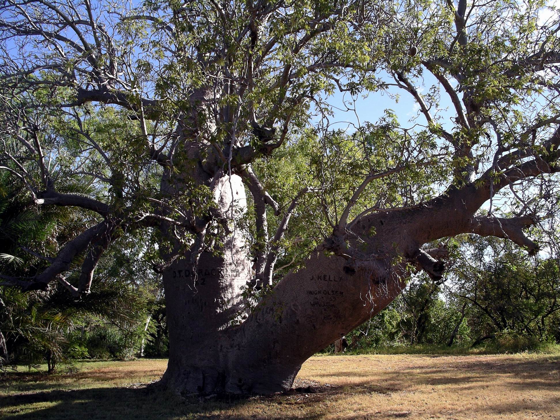
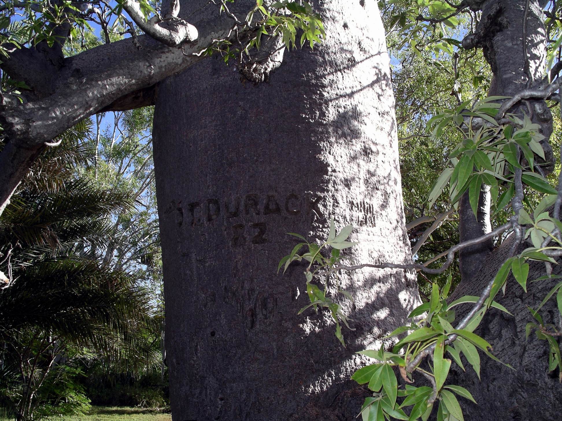
Of note, near the Homestead, was a big old boab tree, with a Durack name carved into it, and 82 – the question arises, was this 1882, or 1982?
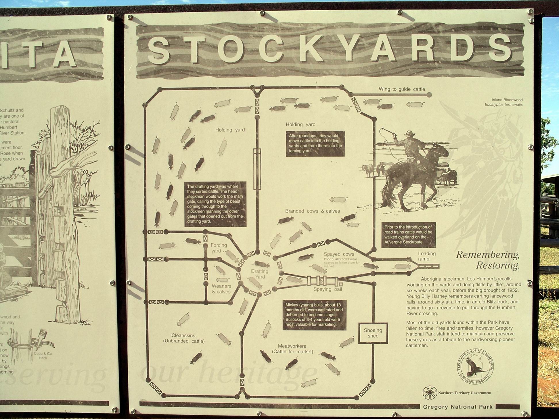
The stock yards were interesting. John, of course, was interested in their construction. Bloodwood, found around here, was used, as was lancewood from further south, along the Murranji Stock route. This was the timber commonly used for posts and uprights in these parts, and would have involved considerable effort to get it here.
The finished stockyard here was regarded as an exemplar for a drafting stockyard, where cattle were to be sorted into different categories.
An information board explained their layout and place in the pastoral saga of the area.
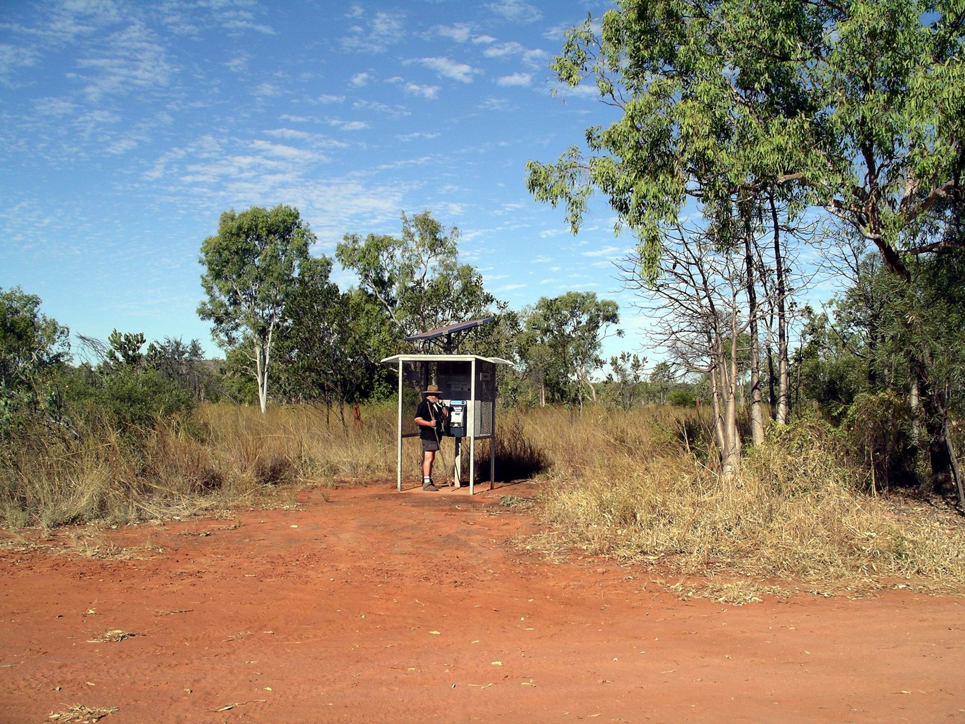
Totally strangely, and most incongruous, next to the stock yards, was a modern Telstra, solar powered, functioning telephone box!
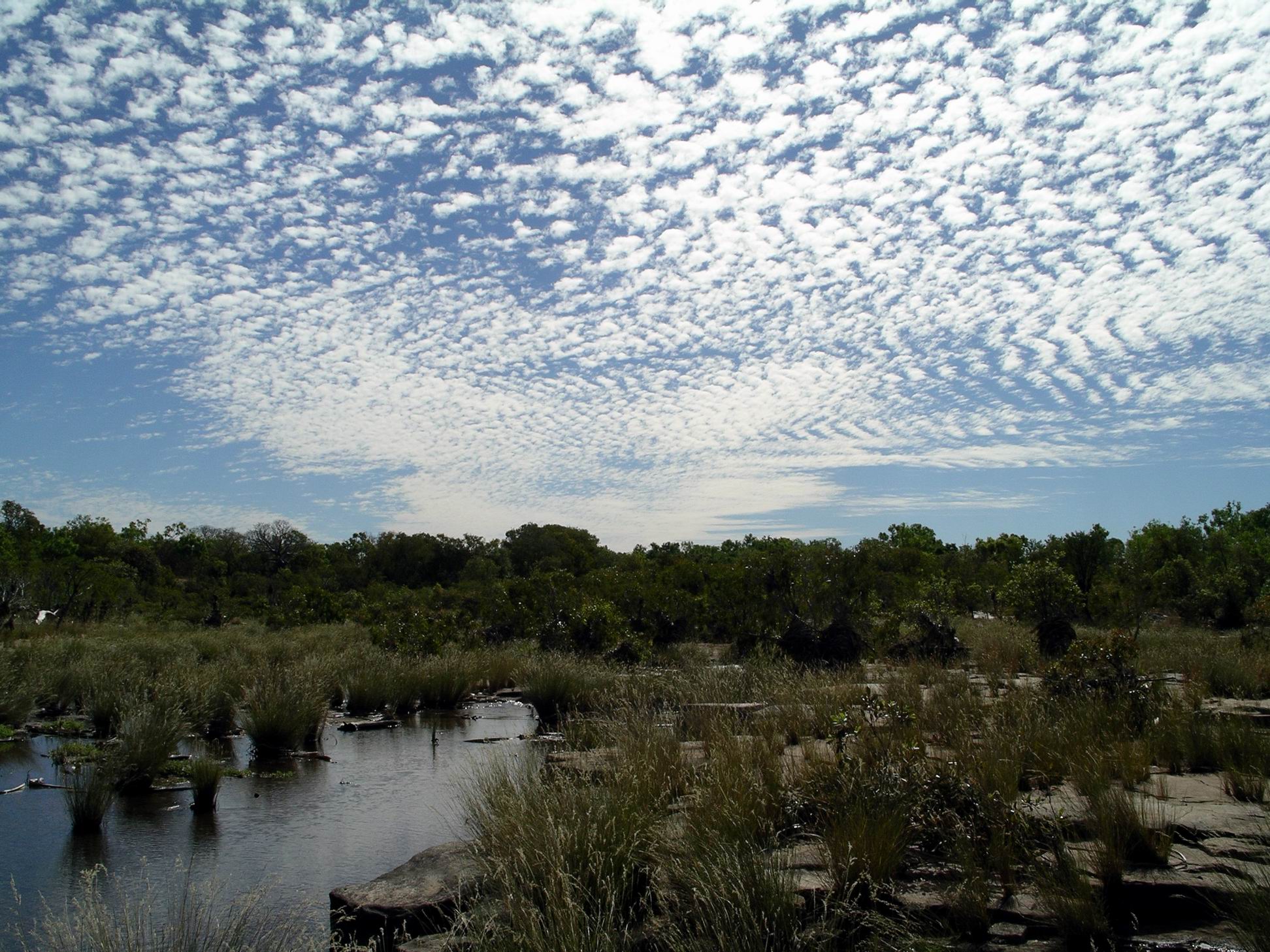
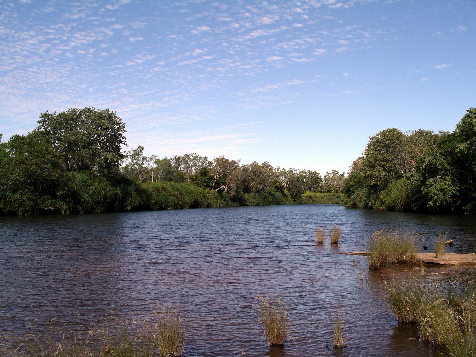
Walked down to the point on the East Baines River, near our camp, where the Bullita Track crosses it. This was definitely not a river for swimming in – crocodiles in there, for sure. It is a feeder stream to the lower Victoria River.
East Baines River at Bullita
A couple of interesting 4WD tracks go out from where we were camped. The Bullita Track follows one of the old stock routes and then makes a circuit. The Humbert Track goes south and is a way through to the Buchanan Highway and Top Springs, or the Buntine Highway that runs between Top Springs and Halls Creek in WA.
On a different occasion, we would have been tempted to go day tripping, at least, on these, but all the 4WD tracks radiating out from Bullita were currently closed. The height of the river here might partly explain that. I hoped this might keep any yobbo type 4WDers away, whilst we were here.
It was lovely sitting around our campfire again at night. It was so quiet here – just the nocturnal critter sounds one would expect in such a place – and the occasional louder “plop” that one hoped was only a large fish.
At dusk, the bats departed for their evening of feeding.