This Adventurous Age

Adventures travelling and working around Australia.


Leave a comment

2002 Travels June 17 – August 2

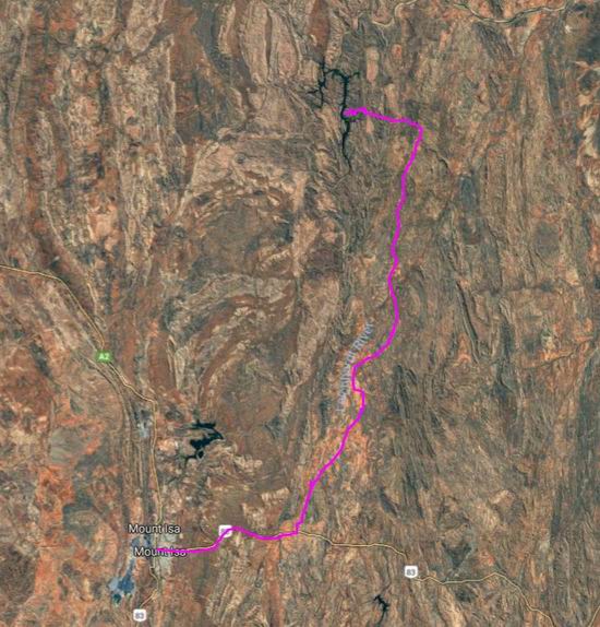
MONDAY 17 JUNE TO THURSDAY 2 AUGUST   ADELS GROVE

Because there was little variety in our days here, it is better to describe the time in sections.

Adels Grove history

The 30 hectare site was first occupied in 1904 as a Miners Homestead lease. Because of this origin, it remains rather an anomaly in this region of vast pastoral leases.

Albert De Lestang took up the property in the 1920’s. For a time it was known as The Frenchman’s Garden. He began collecting tropical species and established his own botanical garden, containing a wide variety of species – over 1000 by 1939. A system of little channels irrigated much of the gardens from the creek. He also grew vegetables and supplied locals and passing travellers from a small shop.

Resize of 06-21-2002 04 Frenchmans irrigation maybe.jpg

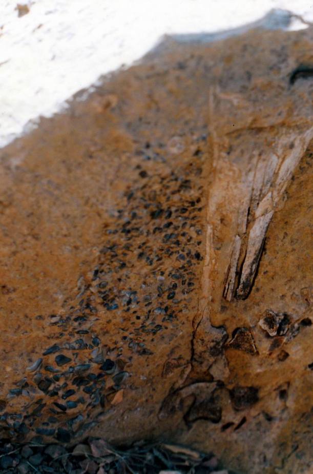
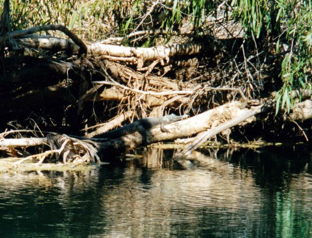
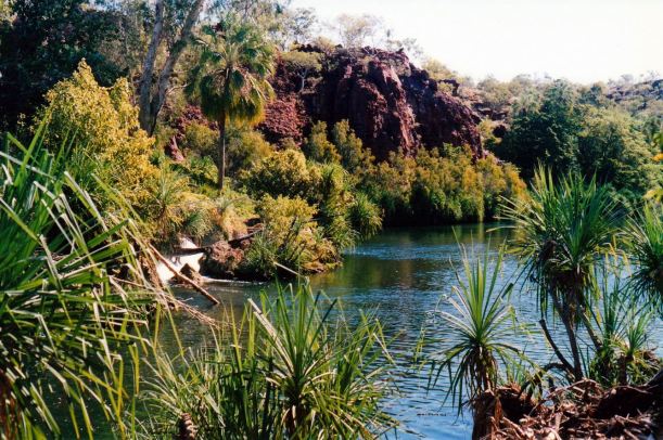
This relic may have been part of the Frenchman’s irrigation system

It is unclear whether he was formally commissioned by the government to experiment with the growing of plants in the tropical environment, but he was certainly well known in botanical circles, and supplied seeds and specimens widely, including to Kew Gardens.

In the 1950’s a fire destroyed his buildings, papers and some of the gardens. It was not an enterprise that he could rebuild at his advanced age, and he died in an aged care home in Charters Towers in 1959, aged 75 and probably still devastated at his losses.

What we knew as “the grove” was some of Albert’s irrigated gardens. There were still some undulations in the ground that were remains of his channels, flattened by time and campers.

Resize of 07-09-2002 05 gap to lawn hill gorge from lookout hill.jpg

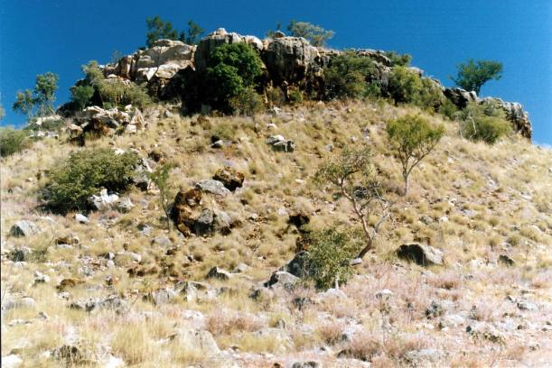
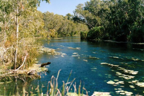
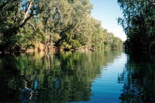
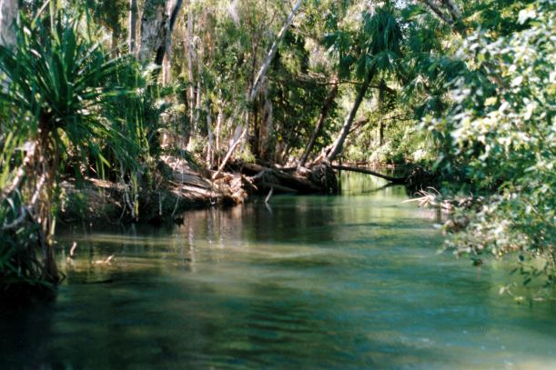
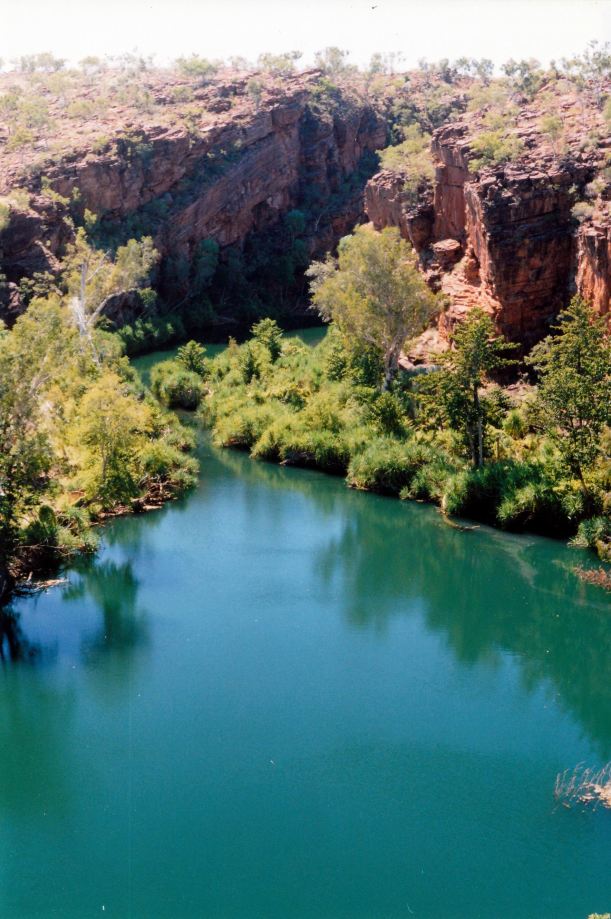
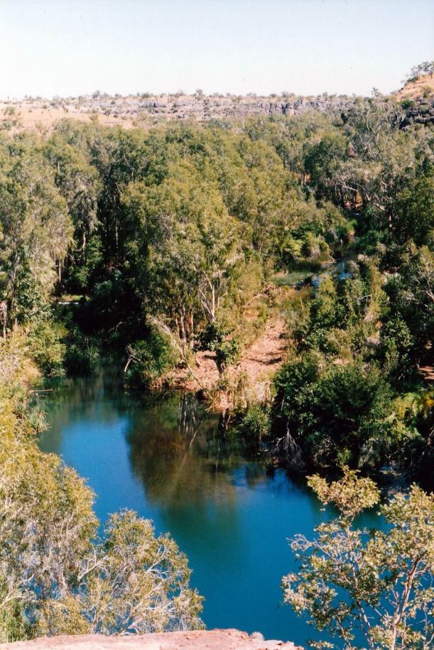
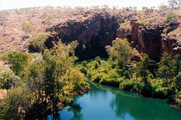
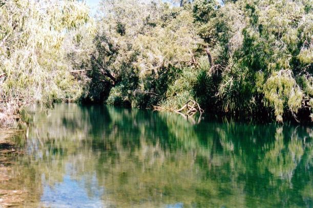
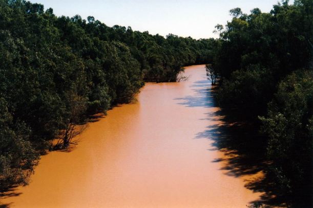
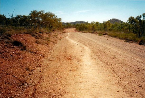
The oasis effect that Lawn Hill Creek has in this otherwise dry area

After Albert’s departure, the area was neglected and sometimes occupied by prospectors. Floods, storms, termites and general neglect killed off all but the most hardy plants.

In the 1980’s, Adels Grove was bought by a couple, who developed a campground. By 2000, this was described as a collection of mostly tin structures, old caravans, and the like. At least one of Albert’s sheds remained. There had been an amenity block built for the campers, of local stone and cement, water tanks and “donkey” style wood burning water heater put in. By 2000, deteriorating health led the couple to sell to a consortium of people from Mt Isa, who were involved in one way or another with tourism in the district.

One of the purchasers had been involved, since the early 1980’s, in running small group tours to Lawn Hill and the Riversleigh fossil fields. To provide overnight accommodation on these tours, he had been permitted by the owner of the Riversleigh Station lease, to establish a bush camp on the station, near the Gregory River. By the late 1990’s, he had resident managers running this tent camp at Riversleigh.

During the 1990’s, as part of the process of gaining local aboriginal consent to the establishment of the Century Zinc Mine, west of Gregory Downs, two large pastoral leases were purchased by the mining company, to be handed over to the aboriginals – Lawn Hill Station and Riversleigh Station. The latter included the land that the tourism tent camp was on and the operator was informed that the aboriginals would take back that camp and run it themselves.

While all this was eventuating, the people involved with that camp, and friends working in tourism in Mt Isa, formed a company and bought Adels Grove. They felt quite justified in removing from the Riversleigh camp all of the movable infrastructure that they had put in there, moving it to Adels over the summer of 2000-2001. The gate to the Riversleigh area was locked; the proposed aboriginal camp venture there never happened.

The Riversleigh camp managers moved to Adels as resident owner/managers, and had their first tourist season in 2001.

The place as it was when we worked there

The place, by all reports, was rather run down when the group bought it. By the time we went there, much work to improve it had already been done. There was obviously much potential, if tourism should develop further in the area.

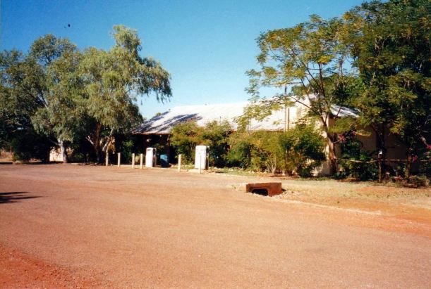
We initially went there as tourists, so our first impressions were of the office area, and the campground. From the office area, a gravel track led off to the campground, passing the construction area, and another donga building, hidden behind a bamboo fence. This was the cool storeroom and kitchen.

Resize of 07-17-2002 02 John and Eleanor and original shop office Adels.jpg

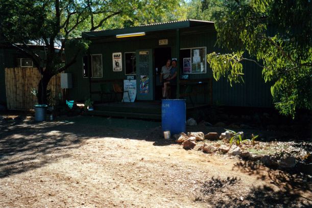
The original shop/office. The bamboo screening hid the coolroom donga

The building under construction would contain the managers’ flat, new Reception area and shop, office, a proper kitchen and coolroom, toilets, and the dining deck. It was clearly a measure of the new owners’ ambitions for the place that the structures that had served the old campground would no longer be adequate.

Resize of 06-29-2002 10 new building from front.jpg

The new building under construction

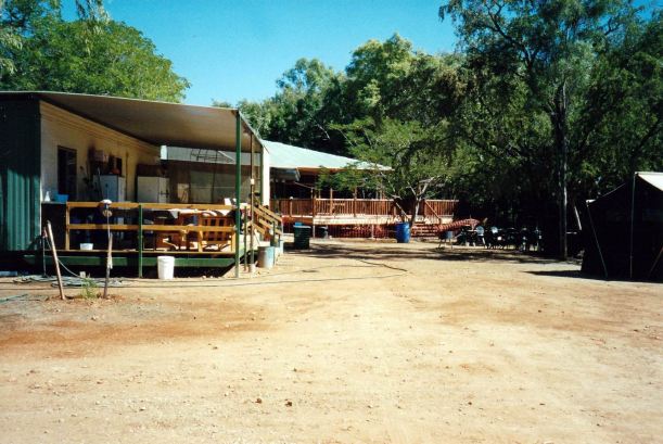
Next to the construction area was an old tin shed – a workshop, with fuel bowsers at the front. To its side, and in an L shape, hidden by some vegetation from the camp ground track, were old caravans and another donga style building. Various staff members were occupying these sleeping rooms. They were fairly run-down looking. In this same area was a fenced off and partially shaded vegetable garden area.

Resize of 06-21-2002 02 workshop and track to Grove.jpg

The tin shed workshop and fuel area

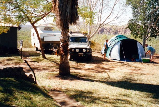
Across the other side of the campground track from the shed area, was a small camping area containing tents set up for the tourist season, for hire, containing made up beds, and with a table and chairs set up at the front. These were set nicely apart from each other, and each had a firepit with BBQ plate, and a tap.

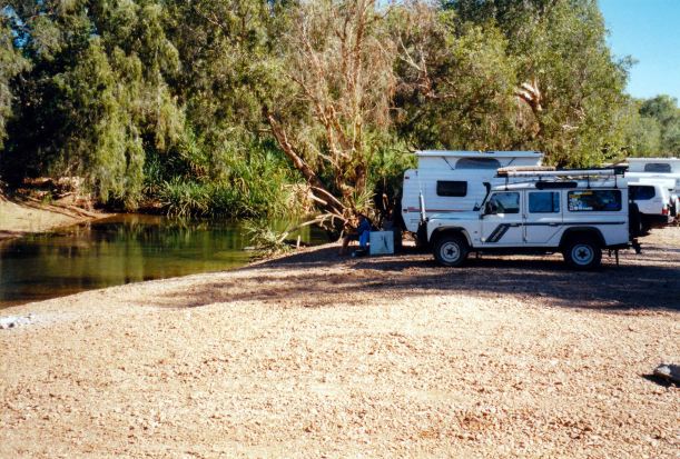
The campground had some fifty sites. The first six or seven of these were on the right hand side of the track – fairly small sites on the rise above the Grove, looking over it and nicely shaded. The remaining sites were shaped into the scrub and trees, reasonable distances apart, and of varying sizes. A few sites a bit apart from the others were designated generator permitted sites. The amenity block that served the campground was nothing fancy – cement floors and tin walls were in evidence – but were adequate, although somewhat stained from the calcium in the water. Hot water for the showers came from a donkey heater that was lit and stoked by the male staff, who had to gather the wood from the surrounding country and chop it. They also cleaned the amenities.

From the campground, one could walk down through the Grove to Lawn Hill Creek. When we started work, only the staff camped down in the Grove, but then it was opened to campers, with small camper trailers or tents only. No generators or pets were allowed down there. There were no formal sites – campers made their own spaces. It certainly became a popular place, with its full shade and closeness to the creek. As this happened, the weeds and scrubby growth were essentially cleared by the campers and the area enlarged.

Resize of 06-29-2002 09 The Grove before mass camping.jpg

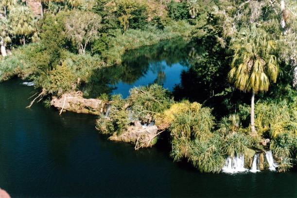
Looking down into the Grove area, before it became a popular camping area

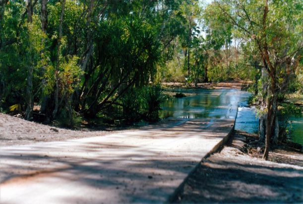
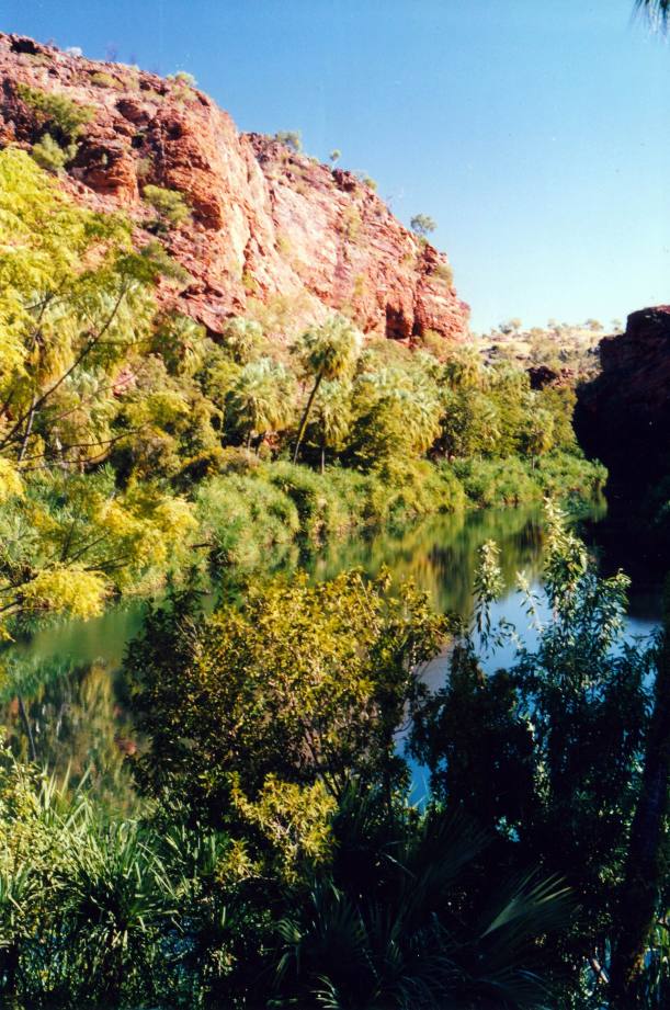
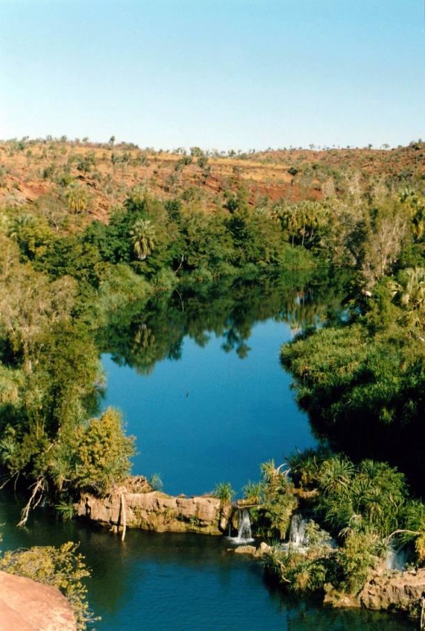
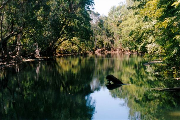
Lawn Hill Creek formed a large, deep waterhole, a few kms long, from beside the Grove, back upstream towards the National Park. There was a swimming platform moored there, and a canoe launch point. The creek curved around the side of the Grove; due to obstructions and wet season flood damage, plus little tufa falls as a barrier, it had split into two or three channels, forming an island. One of these channels formed the shallow swimming area, good for children, just down the slope from the new building and outdoor eating area and providing a lovely outlook from these areas.

Resize of 06-30-2002 01 Adels grove waterhole on Lawn Hill Creek.jpg

Between the office and store donga and the creek was an area not immediately obvious to the camping public, unless they walked up from the Grove. A large, flat, shaded area formed an outdoor dining area, with plastic tables and chairs set up there. This was the eating area for staff, the builders (who, due to remoteness, were provided with food and lodging while putting up the building) and for paying guests in the tented dinner, bed and breakfast section. The coolroom and kitchen donga edged one side of this outdoor eating area. More about the kitchen later – I got to know it well!

Resize of 06-29-2002 01 back of shop and new building Adels.jpg

The back of the shop/office, looking past the kitchen to the new building. Outdoor dining area.

The DBB tents stretched off to the side, facing the creek channel – another section not obvious to the campground public. Beyond these was a long donga containing four bedrooms,  where the builders were staying. Near this was a tin shower block, with four compartments and nearby donkey heater. There were three long drop toilets in that area.

Resize of 06-29-2002 04 DBB tents and creek Adels

The tented accommodation for guests

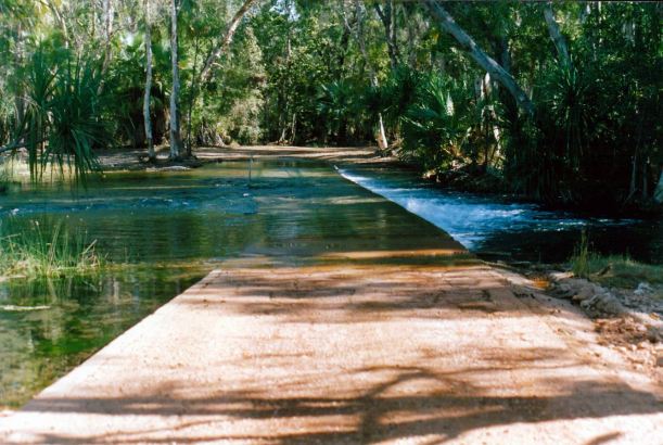
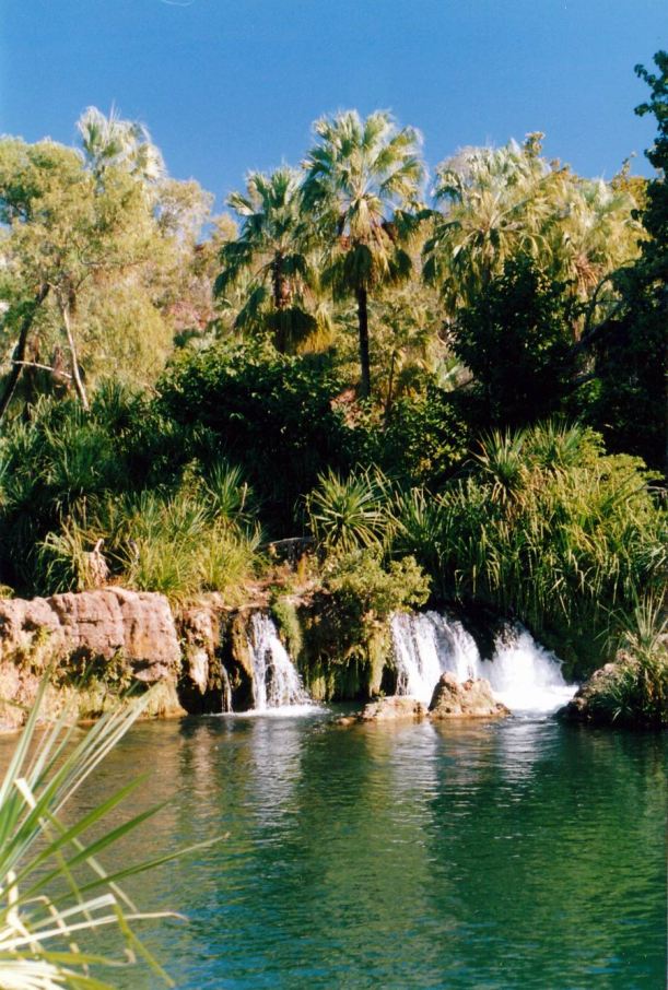
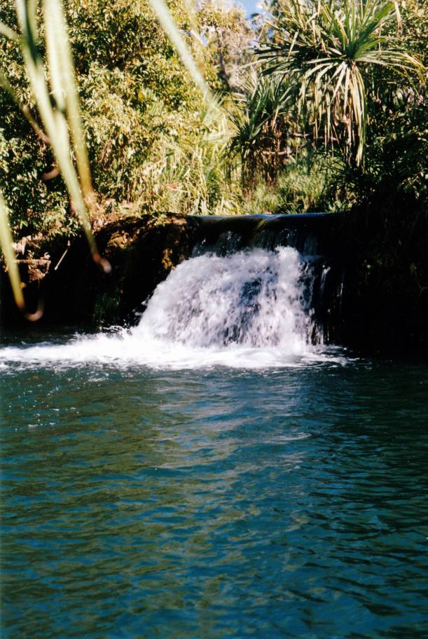
The furthest structure was a small roofed, open air laundry structure, facing the creek. Here, this reformed into one bigger channel again, and there was a lovely little set of falls – the laundry had just the best outlook!

Resize of 06-29-2002 07 the laundry Adels.jpg

Washer woman at work

Resize of 06-29-2002 08 view from laundry Adels

The wonderful outlook from the laundry

Water was pumped from the creek to a couple of holding tanks on high stands, to promote gravity feed to various points. Water was reticulated through underground pipes – PVC – to the campground taps and other water points. Although the edges of each camp site were delineated by small, white painted rocks, and the printed information given to campers requested no interference with the areas beyond, an ongoing problem was campers driving in tent pegs beyond the site boundaries and puncturing the water pipes! Very few admitted to doing so, however! The leak from such a puncture would result in the water tanks running dry, usually overnight, with resultant inconvenience to all. One of the men would be assigned to find and repair the leak.

One of the men’s jobs was to keep an eye on the gauge on the side of the main water tank, and go down to the creek and start the pump when the water level became low. They would then go off and do other jobs until the cry went round from whoever was nearest – usually we cooks – “tank’s full” – when it was overflowing.

Across the other side of the road to the National Park was the airstrip – of a standard able to be used by the Flying Doctor, as well as fly-in visitors.

Beyond that was a track to a rubbish dump pit, at a good distance away.


Leave a comment

2002 Travels June 17

MONDAY 17 JUNE     ADELS GROVE

After breakfast, walked up to the shop/office, where we had a kind of interview with the manager – M – who was also one of the owners of Adels Grove.

If we wanted the work, I would be assisting the cook – despite my total lack of any formal qualifications in that area! This was not what I had envisaged. I was to find out later that the cook was even less qualified by general experience than I!

John would be doing general “men’s work” around the establishment – cleaning, tidying, wood chopping, boiler lighting and the like.

We would work a 6 day on, one day off roster of 8 or 9 hour days – that part was a bit vague.

We would be paid $300, clear, a week, each, get all meals, and be provided with a place to park the van in the staff area down the hill in the treed area closer to the creek. On our walking, we’d seen a small cluster of caravans and campers down there, but not realized they were staff owned. We would be able to plug in to their power supply – our solar would not work  in the very shady area down there. It was generator power, of course, and turned off at night.

The compulsory superannuation levy would also be paid by them, so we had to fill out paperwork to join their super fund company. There was more paperwork for tax numbers and the like. Given all the paperwork, for just two weeks, we thought they must be desperate for staff!

So – we were officially employed again.

Should get to save some of our funds for the next couple of weeks – no site fees, no food to buy, no going anywhere to spend money.

Went back to the van, packed it up, and moved it down into the area they call the Grove. This was an area almost down at creek level, below the buildings and formal camp grounds which are up on a bank. It was once a main garden area for the Frenchman, irrigated from the creek. It is heavily treed – some of them trees he planted – and the shade means that there is little undergrowth. The dirt ground is covered by leaves. Because of the trees, there were lots of birds.

Resize of 06-17-2002 our Adels camp in staff section Grove.jpg

Our van set up in the staff section of the Grove

John ran the long power lead up the hill and into a shed there to plug it in, and connected the hose to a nearby tap. We decided we would be quite comfortable there.

There was a flush toilet and hot shower in a little shed just up the top of the hill from our camp – but these were for the use of M and husband R. (It was he who we’d seen at Site D the other day, being a guide). We used the campground toilets, or the long drop ones that served the tent guests. We used their showers as well – these were in a tin structure, but were very roomy and pleasant.

Resize of 06-21-2002 01 our camp from Grove

Our camp, seen from in the Grove. The old tin workshop was on the rise beyond us.

Then we started work – and worked the afternoon, and thereafter.

Towards the end of our two weeks there, nothing had been said about us finishing up. When I broached the subject, it was indicated that we could stay on for as much of the tourist season as we wanted!

I was loving the place, and quite enjoying the work, and John appeared to be, as well, so we decided to stay.

Phoned Karumba and cancelled our July booking there – but didn’t get the deposit back! It was only a night’s fee, anyway.


Leave a comment

2002 Travels June 16

SUNDAY 16 JUNE     ADELS GROVE

In the morning of another hot day, we decided to go explore the Riversleigh Fossil Site D, some 60kms south of here – road unsealed, of course.

The turn off was not far from Adels Grove, then we proceeded south. The road was heavily corrugated in parts; in other places there were some quite large rocks exposed in the road. It was certainly not fast driving! I thought it must have been quite a while since there had been a grader over that road.

Most of the way was through the grass land scrub land that was like we’d travelled through from Gregory Downs. Savannah woodland country, to use one of my geographical terms. Dry, of course, at this time of the year.

The Riversleigh site is part of the National Park (aboriginal name Boodjamulla NP) and is also a World Heritage Site, because of the importance of the fossils found here. Many millions of years ago, Like around 25 million years, the area was a rainforest area, with plenty of waterways and shallow lakes.

As it is now, the water then was high in calcium carbonate, When the local critters died and fell in the water or mud, their skeletons were preserved – only to be exposed by erosion in more modern times. Riversleigh has provided much information about the evolution of mammals and the exploration of its riches is ongoing.

Fossil presence was noted in the area in the 1960’s, but systematic investigation really only began in the 1970’s.

Site D was one of the first fossil areas found at Riversleigh. Since then, lots of other parts of the area have yielded remains, but Site D is the only section that tourists can access. Adels Grove does offer a tour to the area, but we prefer to be independent, when we can. Also, to save our money!

We drove a short distance past Site D, to have a look at where the track south crosses the Gregory River. The river looked very attractive, and the ford shallow, so we decided to return there to have our lunch, after going round the fossil site.

The site did not look particularly compelling from the road – bit of a low outcrop and a jumble of rocks. From the carpark, followed the track to what turned out to be an entrance and information shelter. It was man made. but done to look like just another rock outcrop – clever. Certainly it was unobtrusive.

Resize of 06-16-2002 01 Riversleigh Info Centre.jpg

Inside the little “rock” outcrop is the information shelter and site entrance

Resize of 06-16-2002 02 inside info cave at Site D

A fossil illustration inside the information shelter

Followed the set walking path around in a big loop. In some places we probably would not have recognized fossils in the grey looking rock, if there hadn’t been information boards! The track climbed gradually and gave some interesting outlooks over the area. The limestone rock around here has weathered into shapes that resemble distorted grey mushrooms, or maybe Darliks?


Resize of 06-16-2002 05 rock outcrops Riversleigh Site D.jpg

The remains of a big bird were fascinating. Apart from some of its bones, there was a fall of small stones that were from its gizzard, where they acted as food grinders. Pictures of “Big Bird” on the information board show it a bit like a short-legged emu.

Resize of 06-16-2002 08 big bird site Riversleigh.jpg

Resize of 06-16-2002 07 big bird fossil remains gizzard stones

The small stones that were in the bird’s gizzard

We now wished we had paid a proper visit to the Riversleigh interpretation centre at the Information Centre in Mt Isa. We hadn’t realized this place was here, nor how significant it is, so there were big gaps in our knowledge, and lots of questions we had.

Resize of 06-16-2002 09 Site D hill Riversleigh

Site D

Because of the time period over which fauna were living and dying in the Tertiary period, around here, combined with the preservation factor of the calcium, scientists are seeing the way creatures evolved, as well as finding ones they had not suspected existed. This work has been going on in earnest since the 1980’s, with annual fossil gathering expeditions.

While we were wandering around, slowly exploring and taking photos, and out of sight of the road and entrance area, a man in a fawn coloured uniform appeared in the distance, and climbed to the top of an outcrop, where he seemed to talk into a hand held radio. We eventually twigged that he was the tour guide from Adels Grove. When we got back closer to the carpark, there was a Coaster mini bus there, and a young woman in a similar uniform. Their tourists were walking on the track in the distance.

We drove to the Gregory crossing, and carefully drove over the first ford section – turned out there were a couple more channels and fords. Took photos, explored, ate lunch. Drove a short distance beyond the river before going back the way we’d come.

Resize of 06-16-2002 12 Gregory ford.jpg

Gregory River first ford

Resize of 06-16-2002 13 Gregory River second ford Riversleigh

Another part of the Gregory River ford

The river area was very pretty We spotted an Azure Kingfisher in a big paperbark tree – very handsome with its bright ginger tummy.

Resize of 06-16-2002 14 kingfisher Gregory ford.jpg

Azure kingfisher

Resize of 06-16-2002 11 Gregory River Riversleigh.jpg

The Gregory River at Riversleigh

On the way back to Adels Grove, stopped to take a photo of the very graphic sign that warns drivers to be on the lookout for cattle. There are few fences in these parts, so cattle on roads are common. Big beasts up this way, too.

Resize of 06-16-2002 15 sign on Riversleigh road.jpg

Does the sign suggest that cattle attack cars?

We were hot when we got back to Adels Grove, so went down to the shallower swimming area (as opposed to the one in the main part of the creek, that has a diving pontoon moored). John ventured in too, and really enjoyed lazing about in the cooler water.

Bought icy poles at the shop and walked back to the van.

Later, as we were sitting outside the van just relaxing, one of the staff ladies – V – came by. She’d come down to ask if we would be interested in working here for a couple of weeks. A couple who had been expected here to work had been delayed, or backed out. She explained they were coming up to a really busy period – the couple of weeks when the paleontologists from the Uni of NSW and the Australian Museum, come to stay here and do their annual “dig” at Riversleigh. Plus, school holidays coming too. She said to think about it and go up and see them in the morning, if we were interested. She seemed really nice.

We had a discussion about the idea and decided we would do it. Something “different” – and the area is just so beautiful. We had the time, before we were booked into Karumba. V hadn’t said what we’d actually be doing – we assumed the same as the staff we had seen working around here: men who clean the campground every day; women who look after the shop/office. V did warn that the pay wasn’t huge.

Went to bed really excited about this prospect of a change! If we find we don’t like it, well – is only 2 weeks.


Leave a comment

2002 Travels June 15

SATURDAY 15 JUNE     ADELS GROVE

It was another hot day.

We tried to get going early, but could have done better!

Drove the rough road to the National Park again.

Hired a canoe. Our timing was actually quite fortunate, as those who had gone out early had finished their time, so we didn’t have to wait.

We opted for a three hour hire, as we intended to try to get right up to the end of the Upper Gorge – where we’d seen from the Lookout a couple of days ago. This would be a 6km paddle altogether.

The canoe was similar to the one we used yesterday. like then, I put John in the front, so I could steer/direct.

Getting into the canoe was easy, because they had a type of built ramp, and the hire man helped.

The paddling was easy as there did not seem to be much current, and the water was totally calm. Going up through the Middle Gorge was really beautiful – in parts, sheer red rock walls rising out of the water. In other parts there were narrow areas of bank between the water and the Gorge walls, where there was lush growth.

Resize of 07-06-2002 05 Middle Gorge from canoe hire area.jpg

The Middle Gorge from the canoe hire area

So it was all red and green contrasts. Even the water was a greeny colour.

The creek water has a really high calcium carbonate concentration, reflecting its origins in limestone rock. It is calcium precipitation that formed the little falls and rapids, like Indarri Falls, the Cascades, and the ones at Adels. In some places, little white clumps of calcium could be seen floating. We had been told that drinking the creek water tends to make one thirsty, because of this.

There was lots of bird noise from the paperbark and pandanus fringes along the creek. We could see archer fish in the water.

After a leisurely and easy paddle through the Middle Gorge, of about 1.5kms, we reached Indarri Falls. Though only a few feet high, they look quite impressive from the water level, with water flowing over in several places across their width.

There used to be a proper canoe portage around the falls, to facilitate taking canoes between the Middle and Upper Gorges, but this was wrecked in the big floods of 2001.

We were able to pull the canoe into the bank and get out, one at a time, without mishaps.

Given our lack of experience at canoeing together, until this trip, and the fact we planned to be getting in and out of the canoe at Indarri Falls, I was not quite game to risk my camera, so we had to be content with our mental images.

We carried/dragged the canoe about 25 metres, along a path, to the access point above the falls. Again, got back in the canoe ok. Felt we were getting quite good at this!

We paddled on, for about a km, eventually rounding a bend and going towards what appeared to be solid vegetation. Had we not already been up on the tops, on our walk, might have assumed that the gorge above Indarri was short and not worth paddling to the end for.

But we had seen from above that there was a narrow channel through the bushy stuff, that opened into the big waterhole beyond it. So there were really two parts to the Upper Gorge.

The narrows through the pandanus and paperbarks was different and extended for maybe 150 metres before it opened out again. The high red rock walls became lower then, especially on our right hand side.

We could see the Lookout hill above, where we’d sat and watched the gorge on our walk.

The gorge ended where the creek entered it – small and shallow and not able to be paddled.

We paddled back the way we’d come – but of course it looked different, going the other way, so was equally engrossing.

Negotiated the detour around Indarri with no hassles – apart from the weight of the canoe. It was heavier than it looked, and quite an effort was needed for the two of us to manhandle along the narrow path.

Resize of 06-13-2002 middle gorge.jpg

Middle Gorge near Indarri Falls

We were quite careful, at the end of the paddle, lining up the canoe with the landing ramp. It would have been embarrassing, after our successful journey, to have fallen out of the canoe in front of the man doing the hiring!

Ate a very late lunch in the Park campground area. It still did not seem all that busy. We remained convinced that Adels was by far the best place to have stayed.

Spent the rest of the day relaxing at the van.

Tea was leftover fish cakes.

Today’s canoeing was one of the best things we have done on all our travels. It was so beautiful, peaceful, and so unique. I remained amazed that this area seemed so little known – or publicized.

Slept very soundly!


Leave a comment

2002 Travels June 14

FRIDAY 14 JUNE     ADELS GROVE

A fine morning led to a hot day. It got to 37 degrees inside the van!

John wanted a loaf of bread made in the machine. I did not want to do this, because the van batteries ran a bit low yesterday – the fridge is running a lot – and I thought they should be allowed to get to full first. But John was determined.

The bread maker finished its operations about 12.30pm. It laboured a lot during the kneading stage – not enough power. The result was a funny shaped, very heavy loaf.

I had a salad for lunch. John had the new bread for a sandwich. He was not happy because I was still using up the grain bread mix – it might break his teeth!  He got me to throw out the 4kgs or so that I had left.

The batteries did not get to full again today, after that power drain.

After lunch, we went up to the shop/office and paid to hire a canoe. Canoes to paddle on Lawn Hill Creek, here at Adels, were on offer, and John wanted some practice before we went paddling at the National Park. He had not really done much canoeing, and none in recent times.

We were given paddles – the canoes were already at the launching place on the creek. Walked down to there. Had to get into the canoe, off the bank, but managed that alright.

The “wobbles” of a two-person canoe worried John at first, but he soon got used to that. The fairly wide, open canoes were really straightforward to manage. I had him sit at the front, so I could instruct him and control the “steering”.

Resize of 07-20-2002 01 on Lawn Hill Creek at Adels Grove.jpg

The broad waterhole of Lawn Hill Creek, at Adels Grove

We had a very pleasant paddle upstream on the large and placid reach of the creek, for quite a distance, until we reached some shallow rapids. The other end of this long reach is at Adels Grove, where there were some small falls and more rapids.

Resize of 07-20-2002 02 from canoe, Lawn Hill Creek at Adels Grove.jpg

Reflections in Lawn Hill Creek

 We saw a small freshie croc, who remained floating about in the water, despite us passing fairly close to it.

Resize of 07-20-2002 03 freshie croc Adels

Freshie croc, sunbaking on log

John found the hard canoe seat and the position he was required to sit in, quite uncomfortable for his hips.

We got out of the canoe with no mishaps of the falling in variety. Returned the paddles to the shop, which was a good chance to inspect their used book exchange, where I picked up three novels in return for a donation into the Flying Doctor collection tin.

Then we walked down to the swimming area that was supposed to be more shallow than the main waterhole – on a smaller creek channel that separates off from the main creek,  around a little island. I went swimming. John watched – he was unsure about swimming in water that might be deep, but I found it actually had some nice shallows too. There was no real current, either. It was really enjoyable.

Resize of 06-30-2002 02 Lawn Hill Ck at Adels

The shallower swimming section of the creek

I made fish cakes for tea.

All this exercise is definitely leading to early nights.


Leave a comment

2002 Travels June 13

THURSDAY 13 JUNE     ADELS GROVE

We were not up and going as early as I’d hoped to be.

The National Park Guide indicated that several of the walks were best done in the earlier morning, or mid afternoon – not in the heat of the middle of the day.

The 10km of road to the National Park was very corrugated and rough. Having to go back and forth on that was going to be one drawback of staying where we were. But the route into the Park is an interesting one, winding between hills.

I’d thought we could do one of the shorter walks, like to the Cascades, to walk ourselves in, and because it was 11.30 when we set out from Adels Grove. I’d packed the makings for a picnic lunch, with the intention of eating it at the National Park camp area.

But John decided when we got there, that we would do the longest walk. out over the sandstone ridges, to the Upper Gorge, and back via Indarri Falls. That was a circuit of a bit over 7kms! So I packed the lightest lunch makings into the day pack and left the block of cheese and the vegemite jar at Truck.

The track climbed very gradually, between sandstone ridges. The going underfoot was alright, but it was hot. Then it was a fairly easy climb up to the ridge tops.

Resize of 06-13-2002 02 from walk tk to Upper Gorge LHNP.jpg

The Middle Gorge in the distance, from the ridge tops

From the Lookout there were great views over the Upper Gorge.

Resize of 06-13-2002 09 upper gorge with little croc

The Upper Gorge, showing the way in from the Middle Gorge


Lawn Hill Creek is fed from springs that originate from the nearby eastern edge of the limestone Barkly Tablelands. A number of the other streams of this corner of Qld originate in the same way and feed into the Gulf of Carpentaria. This origin means they flow all year round – a permanent water source for the local pastoral properties and the like.


In the area of the National Park, Lawn Hill Creek flows through a deep gorge, cut into red sandstone. The Gorge is split into three parts, by shallow rapids -Cascades – between the Lower and Middle Gorge, and by the low Indarri Falls between the Middle and Upper Gorge.

Resize of 06-13-2002 06 top end of upper gorge, Lawn Hill

Lawn Hill Creek narrows at the end of the Upper Gorge

The contrast between the red gorge walls and the deep green colour of the creek water was striking. Because of the permanent water, there is a lush riverine ecosystem along the creek banks – a stark contrast to the dry scrub and grassland country surrounding it.

Resize of 06-13-2002 08 Upper Gorge Lawn Hill NP 2

The top end of the Upper Gorge, showing scarring from wet season floods


We had lunch sitting on a bench seat that some thoughtful National Parks person had installed up there, overlooking the gorge. I had some salami and tomato to go on our Cruskits – the toppings were a bit sparse, though, and I didn’t eat much.

Resize of 06-13-2002 04 Upper Gorge Lawn Hill NP 1

Upper Gorge from the Lookout

Saw a freshwater crocodile float around in the water, below us. According to the Adels literature, these are the only kind of crocs in the creek and Gorge, and they are very timid, preferring to avoid people rather than eat them!

Just as we were about to leave the Lookout, saw two canoes paddle into view, from around the corner in the distance. We said we must do that, one day, while we are here!

The track went down to the edge of the Gorge, then followed it for a way, through pandanus, and often with the water right at our feet.

Resize of 06-13-2002 10 upper gorge from lower track

The track beside the creek, in the Upper Gorge

Then we reached the Indarri Falls – low cascades over tufa (hardened calcium deposits) walls. This wall across the creek was quite wide, with about four different water cascades going over it. Again, incredibly photogenic.

Resize of 06-13-2002 14 Indarri Falls

Indarri Falls

We sat by the falls, just looking about, for a while. Could see big and small fish in the water, which looked quite deep. It was definitely not a place for John to swim! It actually looked as if it would be hard to get out of, with deep water right to the edge, and slippery banks.

Resize of 06-13-2002 11 one part Indarri falls

There seemed to be a track where people could take canoes around the falls. I didn’t think getting into and out of canoes would be all that easy, here, either.

Resize of 06-13-2002 13 Indarri Falls scene

Middle Gorge walls at Indarri

After our sojourn at Indarri, the track became unexpectedly hard going – up and down rocky ridges, and it was very hot. A lookout gave us great views over Indarri Falls and the Middle Gorge.

Resize of 06-13-2002 15 Indarri Falls and Upper Gorge

Indarri Falls and the Upper Gorge

Resize of 06-13-2002 16 Indarri Falls where canoes go

Indarri Falls. The rough canoe exit point was at the far left

After about a km of this and a couple of tough climbs, we came to a high point that overlooked the campground – it was a relief to have the end in sight.

Resize of 06-13-2002 17 Middle Gorge from Indarri Lookout

The Middle Gorge from Indarri Lookout

The track was a very steep “staircase” down. I would not have liked to be going up it!

I could see why people get the heat exhaustion that the lady at Adels had warned us about!

It was 4.30pm when we completed the walk. Had a bit of a wander and look around the camp area.

I was been disappointed that, at the National Park, there was not an information display of any note, and no sales outlet for things like postcards. There was just a shelter with brochures on offer – the same brochure that we’d been given at Adels – and a few notices pinned up. I guess I’d been expecting something like there was at Carnarvon Gorge.

The camp area there was quite dry and dusty with mostly small sites. It was nowhere near as nice as Adels. Notices said that campfires were banned. The showers were cold water only. But the creek was wide and deep there and clearly attractive for swimming.

There really did not seem to be that many people in the campground, despite the lateness of the afternoon. So much for the notices we’d seen at places like Gregory Downs, saying the campground was booked out.

We drove back to camp with the Truck air-con going. Nice.

There were more people in the Adels Grove campground when we got back.

After much appreciated showers, John got the campfire going. We baked potatoes in foil in the embers, then John BBQ’d the lamb fillet that I’d marinated this morning in a Korma mix. I made a salad too. It was a very enjoyable dinner.

The night featured a superb starry sky, with a sliver of a new moon. But it got cold once the sun had gone down.


Leave a comment

2002 Travels June 12

 WEDNESDAY 12 JUNE   GREGORY DOWNS TO ADELS GROVE   91kms

We had a fairly leisurely pack up and departure, not having far to go.

It was hard to hook up the van – the jockey wheel was wedged in the river pebbles. I really should have thought to put down a board to rest it on! John became really impatient with my efforts.

It was a pleasant enough run to Adels Grove. The way was fairly flat, sometimes quite substantially scrubby, other times rather bare grasslands. There were occasional scrub lined dry creek gullies; we needed to slow down and take care not to hit these too fast. Eventually a low range appeared in the distance.

The turn off to the zinc mine was about 45kms from Gregory Downs. The unsealed road got worse after that – there must have been more maintenance done on the section that served the mine. John perceived the road as rougher than I did.

There was not much traffic at all.

After crossing several more substantial stream channels fairly close together, a couple with shallow water in, we came to the entrance to the Adels Grove campground. Made our way along a driveway to a donga building that was the office – with a large building site beside it. There were a number of really attractive trees about, so first impressions were favourable.

Resize of 06-21-2002 03 Adels Grove entrance.jpg

Just as we were driving in, there was a distinct roar, and a plane took off from a nearby airstrip – it was a Flying Doctor plane.

We asked for a site that would give us plenty of sunshine for the panels, as this was an unpowered campground. We were told that each site had its own tap, fireplace and BBQ plate. The cost was $16 a night – we booked in for a week, so got the final night free, which brought the cost down a bit. Received a brochure about the place, with a map of the campground, and also one about the Lawn Hill National Park.

The office, which was in a green painted demountable donga style of building, had a small shop area at one end, with some basic supplies, and a freezer that held icy poles.

To make some conversation while we were being processed, I asked how many staff were working here, and how easy it would be to get a job in a future tourist season – the lady replied that it would be quite easy. That was an interesting idea to tuck away.

I asked about the Flying Doctor plane we’d seen. A tour guide had been taken ill and evacuated. To myself, I wondered what would happen to his tour group now, but it seemed too inquisitive to ask. The reception lady did say that it takes the plane 45 minutes to get here from Mt Isa, and that they’d had two other emergency evacuations in the past few days – but that rate was not normal! We had visited the Cairns Flying Doctor Base, back in ’98, so were aware of this coverage of the outback for medical emergencies – but this was the closest we’d come to seeing it all in action.

Although the bookings book I could see on the office counter looked quite hectic, there did not actually seem to be that many campers in the place. I thought maybe people book here, over the phone – as we did, with no deposit needed – but go to the National Park first and find out that they can get in there after all. We had always intended to stay some time here, as Melbourne friends had told us it was nicer than the National Park campground.

We drove to the camp area, a little distance away from the office. The campground covered quite an extensive area. There was a really good separation of the natural bush and trees, between most sites – they were more like clearings in the scrub. It was very pleasant to find something different from the normal geometrically laid out campground. Our site boundaries were marked by white painted rocks.

Resize of 06-12-2002 Site 24 Adels Grove.jpg

We had a very good sized site. It was not too far to walk to the amenities block, which was rather basic, but clean. The hot water for showers came from a wood burning heater arrangement, outside. There was no laundry.

Set up. Had lunch. Lazed about on our site, as it was quite hot. No other campers came in to the sites near us.

We’d been told at the office that the construction site was a big new building that would be the managers’ residence, kitchen, office/shop and an open-air licensed restaurant. That seemed a bit ambitious, out here, was my initial thought. The construction area was roped off. As the campground was some distance from it, we were not likely to be disturbed by building noises, fortunately, as it was otherwise a lovely, peaceful place.

As it started to get a bit cooler, later in the afternoon, we walked down to Lawn Hill Creek, which was part of the place. We walked along its bank, on tracks through quite lush vegetation. The creek made a really large waterhole at one point. There was one section where there was obvious flood damage, with undermined banks, and that was fenced off from walkers.

We encountered B and D again, also walking around exploring. They were with a tour group, having left their van at Gregory Downs. They came in today, for one night only. They went walking at the National Park this afternoon and were going there again in the morning, to go canoeing on Lawn Hill Gorge. They said the tour groups stay in tents, on the other side of the Office area from where we were. Obviously, some meals were provided for them.

Resize of 06-30-2002 03 Lawn Hill Ck at Adels

Lawn Hill Creek at Adels Grove

According to the information we’d been given, this place had been established in the 1920’s, on a former mining homestead lease, by a Frenchman – Albert de Lestang. He set up a type of botanical gardens here, experimenting to see what would grow in these conditions, and sending seeds to other Botanical Gardens around the world. The name Adels Grove came from the initials of his name.

In the early 1980’s a couple set up the bush campground here, but they had sold it a year or so ago. I supposed that new owners explained the new building activity?

Our tea was pasta with tuna and capers.

I tried to teach John the card game Mike had taught me at Duck Creek. Don’t think I properly remembered it, because it did not seem to flow as well.

No TV here, of course. We haven’t had it all that much, so far, on this trip, and I have to say that I do not miss it!

Although, on our way out here, we had seen no sign of the mine, apart from the road turn off, at night could see the glow of reflected light from it.

We are finally at Adels Grove/Lawn Hill! Two years ago, adverse weather caused us to abort plans to come here.

Resize of 06-12-2002 to ag


Leave a comment

2002 Travels June 11

TUESDAY 11 JUNE     GREGORY DOWNS

The camp area emptied out somewhat, fairly early in the morning.

We walked around and had a look at the vacated places, but then decided to stay where we were, rather than go to all the hassle of packing up the camp and relocating, for only one or two nights more.

Went for a drive out along the Camooweal road, to try to find the canoe trip access points to the river, shown on the General Store brochure. Wanted to see what the river was like at these points, and also if there were camp spots there – we would be coming back this way after our visit to the Lawn Hill area, and might find somewhere great to prop for a little while.

Resize of 06-11-2002 07 Gregory River upstream view.jpg

Gregory River

We found an access point about 18kms out, marked by two drums beside the road. It was a bit tricky to get into – the track was eroded, then sandy, but it led to a beautiful, huge, area for camping – on firm ground, not river stones. The river was beautiful here,too, some rapids, with pools above and below. There were a number of drums for rubbish about, so obviously it was regularly used. It would be a great spot for tents. John said he would not be keen on trying to get the van in there.

Resize of 06-11-2002 04 Gregory River upstream rapids.jpg

Gregory River, about 20kms upstream from camp area

Another track, this one about 12kms out, was marked by one roadside drum. It led to a large area of river stones that were deep and not compacted, like the ones where we are camped are. There was a Coromal van there, on about the only patch of ground that was viable to tow on. The river was narrower there – a pool, with no rapids.

Resize of 06-11-2002 06 Gregory River upstream reflections

Reflections in a deeper pool

On the way back, we bought fuel at the hotel – $1.69cpl! Also bought a pack of steak at the Store – John’s choice.

Had a late lunch back at the van. By now it was hot.

Went for a swim in the afternoon, as we had seen others doing. I walked upstream along the bank to a place where there was a divided channel and a narrow “race” around a bend. I went in there, where there was a very strong current, like a spa. I got bumped a bit by stones in the race, and then the current wanted to seep me under a clump of pandanus. I caught a branch of this to keep me out in the open, and got some splinters!

Resize of 06-11-2002 gregory well downstream

Rapids in the river

I advised John not to do the race section, but to enter the river below it, into calmer water. The current carried us down to our camp, fairly quickly. It was hard to stop there and just sit in the water, due to the current. The river looked deceptively lazy but the current was definite.

We went back and did the float down again, from the calmer section. Then sat in the water for a while. It was clean, clear and cool, and a lovely way to spend the afternoon.

Resize of 06-10-2002 05 our Camp at Gregory Downs.jpg

A motor home came in. The couple looked about. John encouraged them to park near us – they seemed desirable neighbours and would create a buffer from those maybe less so.

As the afternoon wore on, it became cool quite quickly, and suddenly too cold to be lazing around in wet bathers.

John lit a little campfire and cooked potatoes in foil, then the steak and some zucchini halves on his mesh grill. He also cooked some eggs and made himself a steak sandwich, with bread. I found the scotch fillet, though tender, to be very bland – not as tasty as southern steak. Different cattle breeds, obviously. The meat was not good value, having cost us $8.

This morning, mother kite pushed Baby Huey out of the nest. Tough love! He hopped/flew to a nearby branch, then took off and flew! It must have felt pretty good. He was not good at landing, though, tending to miss the branch he was aiming for and crash down to a lower one. The parent birds hovered about him – literally! He had several more flying sessions during the day. We were so lucky to have been here at just the right time to see this.

Resize of 06-11-2002 03 Baby Huey wondering what to do next

So now what do I do?

Sat by the remnants of our fire for a short while, after tea, but then it was an early night.


Leave a comment

2002 Travels June 10

MONDAY 10 JUNE   LAKE JULIUS TO GREGORY DOWNS   320kms

Neither of us had been looking forward to extracting the van from our site, this morning, but we managed, with quite a bit of to-ing and fro-ing. I made very sure that the chocks stayed behind the wheels until we were securely away from the drop! We needed low range gears again, to take the rig back down the hill from the camp.

Then we had to back track to the Kajabbi road. This continued to be fairly rough until we were almost at Kajabbi, then we were mostly out of the hill country and more onto plains.

Resize of 06-10-2002 01 by Lake Julius Kajabbi track.jpg

Quartz blow by the Kajabbi road

It was still really interesting country to pass through, with the track running roughly parallel with the Leichardt River. We crossed a number of dry watercourses. This would not be a road to take after rains! Then we crossed the Leichardt itself – just a graded sort of causeway through the channel.

Kajabbi was once an important place, the railhead for cattle to be transported after being droved from the Gulf Country. There were also copper mines in the area. We had seen some signs of recent mining activity in the area we drove through – a bit of a revival?

The township was now only a few old houses and the Kalkadoon Hotel – named for the rather ferocious aboriginal peoples of the area, who strongly resisted white encroachment, and were quite feared.

We stopped at the hotel, because of its iconic nature. After all, who knows anyone who can say they had a drink at the Kalkadoon Hotel? John had a beer and I had a coke and we “talked to the locals”. They were friendly and informative, about mining, floods and the like. The township is right by the river.

Resize of 06-10-2002 kalkadoon hotel.jpg

Kalkadoon Hotel at Kajabbi

From Kajabbi, on the advice of the locals, we took the River Road, through Coolulluh Station, to the Burke Development Road. It was quite reasonable going, and adequately signposted – just!

The Development Road, like most of them, was a single strip of tar, but with some widened sections in shallow dips and at creek beds.

Not long after we got on the Development Road, we began to hear the regular talk on the CB radio of an oversize load and its escort. Soon worked out that this was behind us, so we were concerned to stay ahead of same, rather than having to try to find a place to pull over. Much of the road was banked up quite high above the surrounding country, thus with nowhere to pull off – or even much shoulder.

There was quite a lot of traffic on that section of road too – long weekend traffic? We got really sick of having to pull partly off the tar strip, for oncoming traffic, some of which did not slow down when doing the same, thus spraying us with stones.

We reached the Burke and Wills Roadhouse and pulled in there to fuel up. $1.05cpl.

About three minutes after we reached the Roadhouse, a truck pulled in, carrying a large fishing boat. That was the source of our radio traffic. Bound for Karumba, we guessed.

Resize of 06-10-2002 02 wide load, Burke and Wills

The load dwarfed the pilot vehicle!

After refuelling at the Roadhouse, we parked to eat our lunch there. Encountered a man from a local (Melbourne) bowling club, who John had bowled with in Mt Isa, last week, and who had been staying near us in the caravan park. They (B and D) were heading for Gregory Downs too.

Now we turned west – onto the Wills Development Road – the usual single strip of tar.

We stopped by the bridge over the Leichardt River – significantly downstream now of where we’d encountered the river before. The river there was a rich brown colour – lots of the local red earth in there. The river was much lower than the level of the road bridge – from the height of the latter, we figured the river can do some pretty impressive flooding. This area can have some major rain events, from intense low pressure systems that are the aftermath of cyclones that cross the north Qld or Gulf coasts – in the northern, summer, wet season.

Resize of 06-10-2002 03 Leichardt River near Gregory Downs.jpg

Leichardt River from bridge on the Wills Development Road

Gregory Downs consisted of a hotel and a store, at a road junction, by the Gregory River.

We stopped at the store – Billy Hanger’s general Store – to seek information. There, we collected a very informative “brochure” and were directed to drive across the bridge to the camp area.

Resize of IMG_NEW.jpg

Much of the brochure was devoted to information about canoeing on the Gregory River, with a canoe hired from him. Looked interesting!

Resize of IMG_0001_NEW

We easily found the camp area beyond the bridge – lots of rigs strung out in a row, beside the Gregory River, on the pebbly/sandy mix that would be the river bed in a flood.

Resize of 06-11-2002 01 camp area from bridge.jpg

Some of the Gregory River camp area

Since there were about fifty rigs there before us, we did not have much choice of location. John chose a place, close to the original bridge – in full sun, for the solar panels. He backed the van in fairly close to the river. We had a pleasant outlook from the van’s back window, and from outside, of the stream and clumps of pandanus over the other side.

Resize of 06-10-2002 06 Gregory River camp

Set up by the Gregory River

Later we realized that, if planning an extended stay, if arriving later in the day as we did, it would be best to park and stay hitched up, do a minimal set up, then suss out a good spot after the next morning’s departures.

We could soon see why it was such a popular place, as a free camp area. The river was superb – fairly shallow, and lovely to float around in during the heat of the day. The flow was strong enough to carry one a distance downstream. The water was clear, but greeny coloured. There were big paperbark trees and clumps of pandanus lining the river.

Resize of 06-10-2002 04 Gregory River at bridge camp

Gregory River by our camp

There were two porta-loos, parked a little way from us – there to solve what would otherwise be a considerable problem, given the number of campers.

There was a new, high level bridge, a bit further downstream from the old low level ford/bridge we’d come across, built because of the new Century Zinc Mine, some 70kms to the west. There was the occasional burst of noise from heavy truck traffic across it, that we could hear.

It was a bit hard to get the van and Truck disconnected. The jockey wheel kept shifting in the rounded river stones we were parked on.

We set up, then sat and watched the creek and the plentiful bird life. Despite the number of other rigs, it was really very peaceful.

Then some yobs came and parked next to us – a weed spraying crew working on local properties. They threw rocks at any birds they saw. Horrible men. I went for a walk along the river side, rather than stay anywhere near them. After a swim and several beers each, they left.

Other campers pointed out a whistling kite’s nest in the top of a tall tree, nearby. It had a large “baby” in it. They had taken to calling him Baby Huey. Apparently he’d spent much of the afternoon standing on the edge of his nest, flapping his wings. They presumed he was getting ready to fly soon.

Resize of 06-11-2002 02 baby Huey getting ready to fly

Baby Huey getting ready to fly

There were numbers of Great Bowerbirds, crimson finches, honeyeaters – including the white gaped ones. A pair of these spent ages studying themselves in a nearby vehicle windscreen! There were purple crowned fairy wrens flitting about in the pandanus across the river. It was the first time we had seen these – wonderful.

Tea was soup from a packet, and corn cobs.

Went to bed really happy to be camped in such a great place.

Resize of 06-10-2002 to gd


2 Comments

2002 Travels June 9

SUNDAY 9 JUNE   MT ISA TO LAKE JULIUS   105kms

We had driven the Mt Isa-Cloncurry road before, so decided to take advantage of the van’s offroad ability and cut through to the Burke Development Road via Kajabbi. I had seen a camp ground at Lake Julius advertised in some of the local literature picked up from the Information Centre, so we thought we’d overnight there. It looked interesting.

Drove out the Cloncurry road for about 20kms, before turning north on a dirt road. It was quite rough and rocky in parts and shook up some of the van contents!

Resize of 06-09-2002 01 cattle pad on Lake Julius road.jpg

Cattle pad pathway on the Kajabbi road

But the scenery was spectacular – lots of mountains, white quartz blows, creek beds. In this rather arid country, the rocks of the ranges stands out really starkly.

After some 70kms, we turned west, for the final 15kms to Lake Julius. This section of the road was quite hilly. We missed the actual turnoff to the camp and had to double back. The final bit of road up to the camp was really steep – we needed to engage 4WD to pull the van up that. I was wondering what I’d let us in for!

The camping area was part of a large recreation camp complex, sited towards the top of a steep hill. The place was mostly camp buildings – I presumed it had been the original construction camp, when the dam was built in the 1970’s.

The actual camping area was at the hill top, was very small and whoever advertised it as a “caravan park” had never had anything to do with caravans!

It was cheap, at $5.20 a night, but was certainly not a proper caravan and tent area. There were three smallish tents pitched there already, and with the addition of us the place was full! Belatedly, we had realized that it was a long weekend holiday.

It was very tight to back into our site, with trees located in the wrong spots. The tenters had arrived not long before us, and had tried to spread out. The camp manager made them move so we could fit in. Not a great introduction to the (very) near neighbours!

Resize of 06-09-2002 02 Lake Julius camp by sheer drop

Lake Julius camp site

We had to manoeuvre around trees, and the site was right at the edge of a huge, almost vertical drop down to the dry Leichardt River bed – a long way below. I quadruple-checked that the van handbrake was on, once we were into the site, and that we put big chocks behind the wheels! It was certainly one of the more unusual places we had been to with the van.

There were some amenities in a donga building – but no paper in the toilets.

The tenters were families with young children. They were well behaved and unobtrusive, and the parents seemed not to resent our intrusion.

We unhitched Truck and did a quick basic set up. Had a fast lunch, then drove to look at the lake and dam.

Lake Julius was formed by damming the Leichardt River, downstream from both Mt Isa and Lake Moondarra. It was a back up water supply for Mt Isa and the area. We were surprised at how huge the body of water was – it was much bigger than we had expected.

Resize of 06-09-2002 04 Lake Julius and dam wall on Leichardt River.jpg

Some of Lake Julius

But it was the dam wall that was amazing – this huge wall of arches and barrel shaped forms. It was most impressive looking, and seemed more like something we would see holding back a major metropolitan water storage. Apparently it is unique in Qld. Actually, I could not recall ever seeing another one like this, anywhere on our travels.

Resize of 06-09-2002 03 dam at Lake Julius

The Lake Julius Dam wall from downstream on the Leichardt River

There was only one place where we could reach the waters of the dam by road, and that was a rather small area. There were a few people there, fishing. We saw an aboriginal lady, and a man, catch a fair sized fish each – catfish, we thought?

There was a group of young adult students down there – some Australian, some American – who were being very loud and very into one-upmanship, and seemingly great complacency about their own superiority. This was very annoying and out of place in that otherwise quiet environment.

We followed a track to where we could access and explore the dry river bed, downstream from the dam wall, for a while. Looked for birds, with little success.

Then went back to camp and just relaxed for the rest of the day, sitting outside, reading, sewing and looking out over the views from our high vantage point.

Tea was barra marinated in a mix of ginger, chilli, lime juice, sherry before cooking. It was very nice, with some salad.

Resize of 06-09-2002 to lake j.JPG