This Adventurous Age

Adventures travelling and working around Australia.


Leave a comment

2000 Travels February 19

SATURDAY 19 FEBRUARY     NATIONAL PARK

Today was very hot, and a total fire ban day.

We drove back towards Lake Pedder, thinking to go to the old town ruins at Adamsfield, once a very remote, early 20th century, osmiridium mining area, then accessible only by pack trail. But the Ranger at the entry gate said we needed a key to get there – obtainable from back at the Mt Field Base! We did not want to drive back there. The Ranger also said that where there were open gates on the tracks around here, Forestry people may come along later in the day and lock them, because of the fire ban. This seemed rather counter-intuitive to me – to lock gates and perhaps close people into areas where there may be fire!

I had a look at my map and found the Clear Hill Track, a bit further on, which went north to within a few kms of Adamsfield. When we got to it, though, it was a gated track, which I hadn’t realized. John decided to follow it anyway, as the gate was open, and chance it being closed later. Hmmm….

02-19-2000 01 Lake Gordon from Adamsfield Tk.jpg

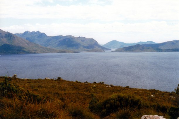
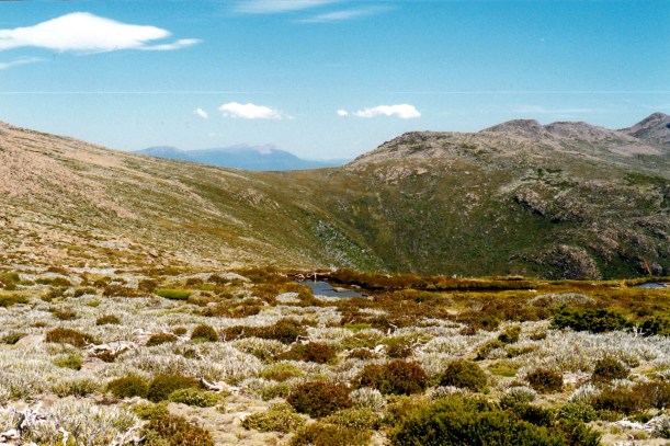
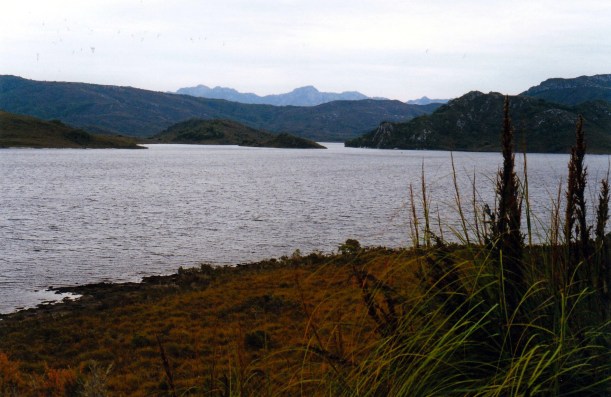
Lake Gordon from the Clear Hill Track

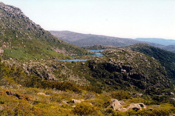
The unsealed track took us generally north, through the forests and in parts, close to Lake Gordon. The lake looked well down in level, because of the drought.

02-19-2000 03 Lake Gordon drought level.jpg

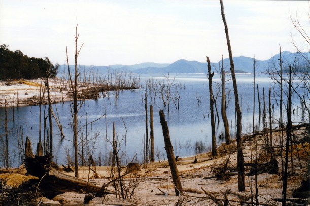
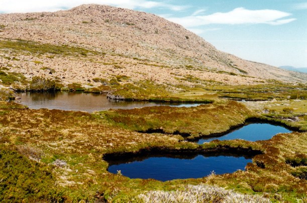
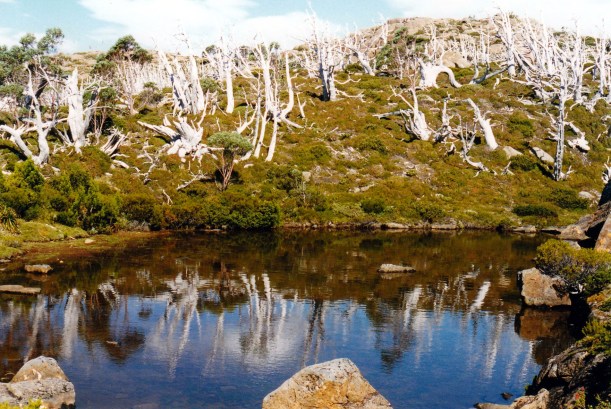
Drought level – Lake Gordon

Unlike Lake Pedder that we saw yesterday, where what was drowned was  scrub country, there is much dead timber evident in Lake Gordon. From the 1960’s, into the 70’s, there was intensive logging of the area that was due to be flooded by the damming – but, obviously, a lot of trees were left behind.

02-19-2000 02 sign adamsfield tk

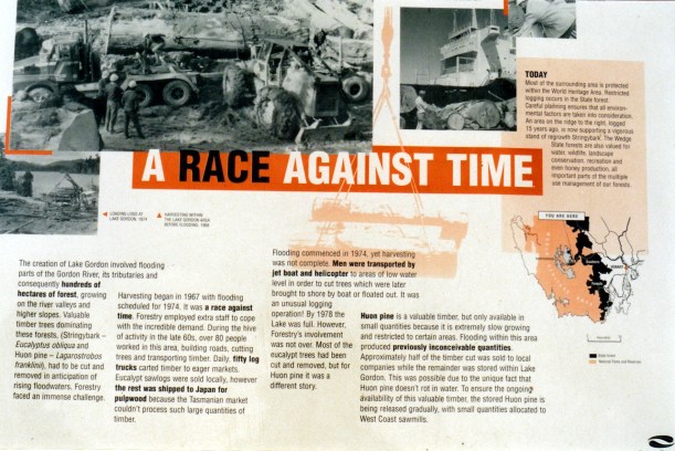
Information board about tree removal before the dam flooding

After maybe about 15kms, we came to the other end of the Adamsfield track, which had a locked gate across it, so we had no choice but to turn back the way we’d come. It was only about a 4km walk from this corner, to the old mining area, but this was not the right day to go exploring on foot in the forest!

On the track back, for the sake of exploring, John took a side track towards the lake. It ended at the lake edge, or where the edge would have been if it were not so low. At one point, the track was badly undermined by previous high water levels, so much that I considered it risky to drive over, but John made it over and then back. I stayed out of Truck on the excuse of photography!

02-19-2000 04 undercut track edge Lk Gordon

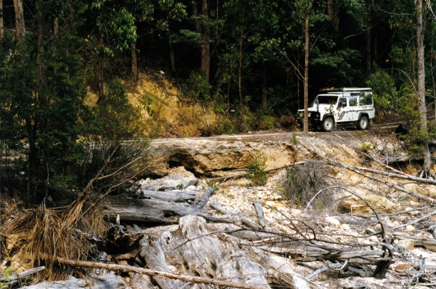
Under cut track. When Lake Gordon is full, the water level is up to the track.

Whilst wandering about by the edge area, and taking photos, we disturbed a very large tiger snake, which – luckily – decided to go the other way from us.

02-19-2000 05 tiger snake.jpg

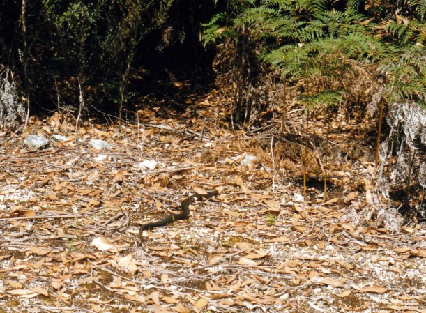
A large and well fed tiger snake!

I became increasingly concerned, as we dallied in this area, and the day got hotter, that we might get locked in, but the gate was still open when we got back to it. Whew! This concern, for me, rather detracted from the enjoyment of exploring.

We saw lots of apiary sites along Clear Hill Track. The bees were very busy around some sets of hives. On some hives, there were great clusters of bees on the outside of the boxes – we were not sure why. The heat? Or were they full of honey? We could certainly smell the honey as we went past. I think this area may be a prime one for leatherwood honey gathering.

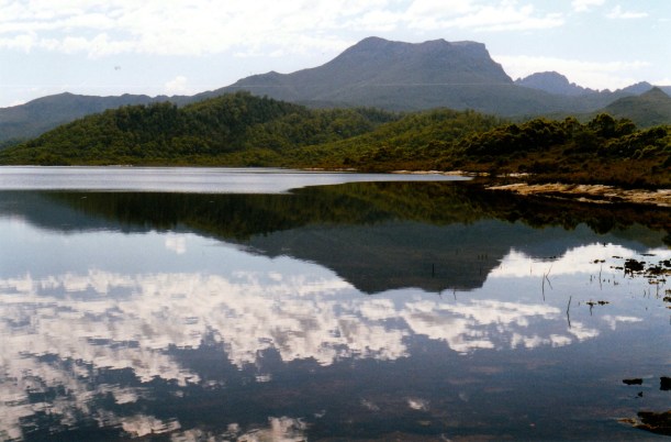
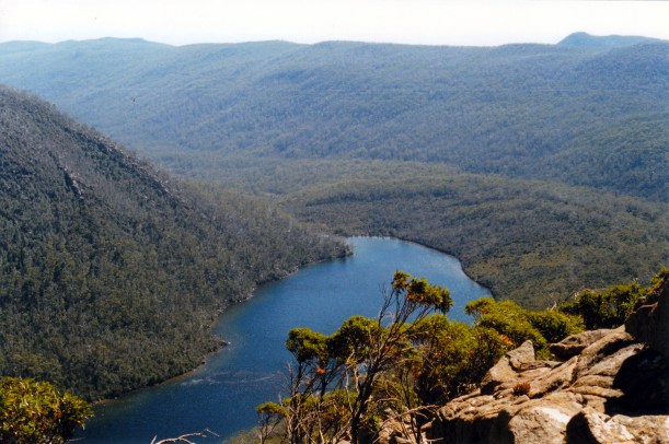
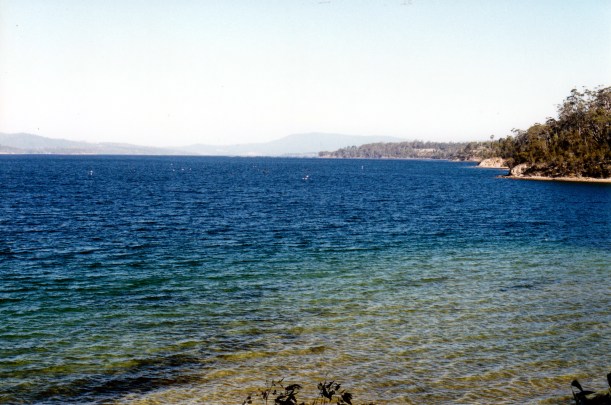
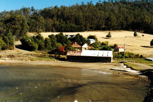
Back on the main Strathgordon road, we continued on in that direction, to find a picnic spot. Just over the bridge across the McPartlans Canal a side track took us to a parking area overlooking Lake Pedder and we ate lunch there.

02-19-2000 06 lk pedder near mcpartlan pass

Lake Pedder near McPartlans Canal

Then we back tracked and went up a side track to a boat ramp on Lake Gordon. John tried to fish there, but lost his lure – then found one. It was quite an eerie area – all dead trees and desolation.

02-19-2000 07 lake gordon.jpg

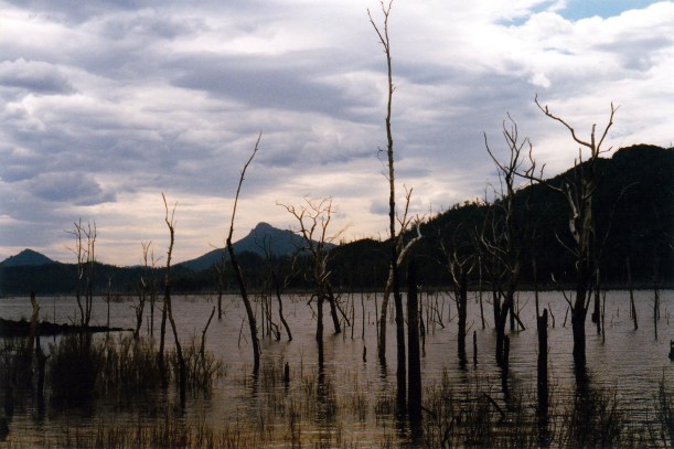
Lake Gordon – a desolate place

But after a short time of that, we decided to head back to the van. At the entry station, dropped off a pair of motor cycle trousers that we’d earlier found lying by the side of the road. We did wonder what the story was, there!

On the way back through Maydena, I was able to buy a Saturday Mercury newspaper. The letter that John had written, about enabling better access to the southern most point of the island, was in the paper. We wondered if it would stir up any response.

We topped up the fuel at Maydena, with $20 worth of fuel. It was 91cpl there!

We drove 189kms today.

Tea was left over chow mein and rice for John, stir fried veggies for me.

We had some spots of rain around dusk, then proper rain during the night. That should help to ease the quite serious bushfire problems in some parts of the state, we thought. It was very pleasant, hearing the rain on the roof during the night.

02-20-2000 around maydena.JPG

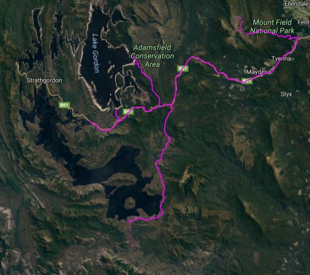
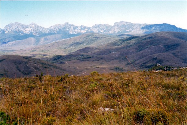
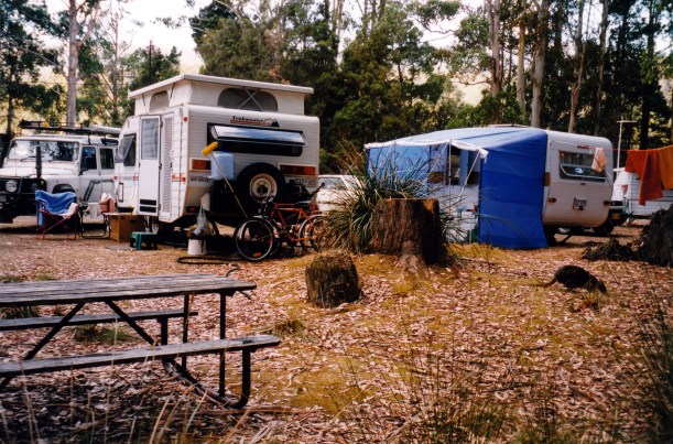
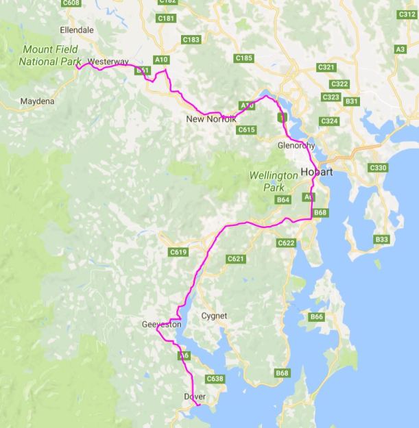
Our explorations whilst based at National Park


Leave a comment

2000 Travels February 18

FRIDAY 18 FEBRUARY     NATIONAL PARK

This was to be a driving day, not one for walking – theoretically, at least! We set out to drive to Scotts Peak Dam, at the southern end of Lake Pedder.

The original Lake Pedder – a small one by comparison with the present lake – was the subject of a significant environmental protest movement, before its damming in 1972. At that time, The Hydro Electric Commission of Tasmania had enormous influence in the State, to the point where it was seen as controlling governments – both Labor and Liberal. Many Tasmanians believed that the ongoing welfare of the state was dependent on HEC activity. The HEC in the late 60’s wanted to expand electricity generation by creating more and larger dams.

Lake Pedder was a glacially formed lake, with a beautiful quartzite sand beach. It was inaccessible, except by foot, and was a half way point on the challenging extended walk from Port Davey to Maydena – which took, on average, three weeks to complete. The lake was the focal point of a National Park.

The HEC proposed building three dams that would create a huge impoundment of water, drowning Lake Pedder in the process. Despite protests and the rapid growth of a movement to Save Lake Pedder, and the attempted intervention of the new ALP Whitlam Government in Canberra, the Tasmanian Premier revoked Lake Pedder’s National Park status and the dams were built, creating Lake Gordon and a huge “new” Lake Pedder, linked by the McPartlan Canal.

02-18-2000 12  original Lake Pedder around the corner.jpg

Lake Pedder as it is after the dams were built. The original lake was around the corner of the narrow channel

Although Lake Pedder was lost,  awareness of the values of the Tasmanian wilderness was well and truly raised. The Lake Pedder protest groups evolved into the Tasmanian Wilderness Society and eventually Green political parties. By the time, a decade later,  that the HEC proposed damming the Lower Gordon and Franklin Rivers, the environmental movement was able to prevent this happening.

The dams construction and the building of the hydro electricity generating plant meant that a road was built from Maydena – previously the end of the road – to the generating plant at Strathgordon, and another – unsealed  though – south to Scotts Peak Dam, creating access by vehicle to parts of the south west wilderness where none had been.

The scenery on the way to Scotts Peak Dam was magnificent, particularly the views of the Frankland Range and the Arthurs. The road ran beside Lake Pedder at times; reflections of surrounding peaks, in the water, were great.

02-18-2000 04  mt anne from scotts pk rd.jpg

Mt Anne from the Scotts Peak Dam road

02-18-2000 05 Lake Pedder & Frankland Ra.jpg

Lake Pedder and the Frankland Range

We stopped briefly at Edgar Dam, where there was a pleasant bush campground which we later decided was nicer than the Huon campground at the end of the road south.

02-18-2000 06  lake pedder at edgar dam.jpg

Reflections in Lake Pedder at Edgar Dam

We also stopped at Scotts Peak Dam lookout.

02-18-2000 07 lake pedder at scotts pk lo

Lake Pedder at Scotts Peak Dam Lookout


The road ended at the Red Knoll Lookout. We ate lunch there, soaking in the view across Lake Pedder to the valley that led to where the original lake was.

02-18-2000 11 truck and Lake Pedder

Hard to beat this for a scenic lunch spot

After lunch, the temptation of the distant vista of the Arthurs was too great to resist, and we decided to go for a walk towards them, along the track to Port Davey.

02-18-2000 10 western arthurs and pt davey tkrhs.jpg

The Western Arthurs and the Port Davey Track

We walked south for about 80 minutes, probably getting some 5kms along the track. I think we almost reached Junction Creek, before we turned around and backtracked. It was easy walking, in plain and marsh country, with a lot of board walked track. It was quite hot. Ahead of us there was an absolutely superb panorama across to the Arthurs. looming not that far away. We met a couple of groups of walkers coming in from walks in the Arthurs.

02-18-2000 14  pt davey tk.jpg

Boardwalks prevent track deterioration – and wet feet!

02-18-2000 17  Pt Davey Tk as far as we go.jpg

As far as we went – last creek before Junction Creek

02-18-2000 18 fungi.jpg

Interesting fungi by the walking track

The walking activity got rid of most of the stiffness from yesterday, without being too strenuous.

We got back to the van at a reasonable time, having driven 179 kms today, and sat outside having a couple of beers and watching the campground activity. There were four Dutch people camped next door and they were very intrusive, sitting right under our open van window and talking loudly. Despite the people, this was a pleasant place to be.

02-18-2000 01  Mt Field camp wildlife.jpg

Camp and wild life

The resident pademelons were not shy, quite happily browsing round our camp, despite the noisy neighbours. We discovered that some species of wildlife left its calling card on the camp seat we were using. Not sure that pademelons jump up on such things – it may have been a possum.

02-18-2000 02 nocturnal leavings Mt Field camp.jpg

Something was marking out its territory!

Tea was fried potato slices with fish; John had fish from the freezer that he caught at Nubeena. I had a piece of frozen oven-bake fish, cooked in the frypan too.

John had found that he got better TV here by bringing the aerial in through the roof vent – along with any bug that wants to come in that way! However, there was only SBS and Southern Cross available here. So we played cd’s instead of watching TV – lovely! It is a too rare treat for me to be able to have music in the van.

It was a hot night.


Leave a comment

2000 Travels February 17

THURSDAY 17 FEBRUARY     NATIONAL PARK

Today was big walk day!

We managed to get a reasonably early start, for once, drove the 15kms or so up to the Lake Dobson car park, and started walking at 10.25am.

02-17-2000 01 tarn shelf circuit walk.jpg

Setting out to walk the K Col-Tarn Shelf circuit

Our route started out along the Pandani walk, that we’d done before, but soon branched onto the Urquharts Track – a link track that cuts between large bends in the (closed) road up to the ski huts, and so saves some distance. This track was an easy, gradual gradient. By contrast, the road section that we had to walk next, was quite steep.

From the ski hut complex and the road’s end, we set out on the Snowgums Track and on to the tops, proper. The track was rocky in places, in other sections it was marshy enough to need board walk sections.

02-17-2000 02 snow gums tk

On the Snowgums Track

Took a short side track to Seal Lookout, which gave a great view over Lake Seal, now well below us, and some of the area we’d walked on one of the day trips up here from Hobart. This added about half a km to the walk.

02-17-2000 04 Lake Seal Mt Field NP.jpg

Lake Seal from Lookout

We were passing, and being passed by, a young Swiss couple who were doing an overnight walk to Mt Field West. They were more heavily loaded than us, but were faster walkers!

At a track intersection, further along, was the junction of the track to Tarn Shelf with that along the Rodway Range – the way we were going. Later on, all going well, we would arrive back at this junction, via Tarn Shelf, to complete a circuit.

02-17-2000 05 the Tarn Shelf Mt Field NP.jpg

Tarn Shelf – perched high above the neighbouring valley

From here, we ascended into a massive boulder field, through the Lions Den – a narrow route through, over and around, huge boulders. John managed these very well.

02-17-2000 07 rodway rnge tk thru boulderfield.jpg

The track through the Rodway Range boulder field

At the top of the ridge, we could see ahead to K Col below us, with the track descending through the boulder moraine field, to the col, with Mt Field West, Lake Gordon, and some of the high peaks of the south west, in the distance. The panoramas were worth the effort to get here, but we would be going higher still.

02-17-2000 08  K Col below.jpg

K Col from Rodway Range. Lake Gordon in far distance

Our lunch stop was not long after the Lions Den, atop the boulders of the Rodway Range. We sat, admiring the incredible outlook and looking down on the hut at K Col, which looked really tiny in the distance. Spectacular country!

02-17-2000 12 lunch.jpg

Lunch place – overlooking K Col

02-17-2000 10 Rodway Range vista LHS Mt Field West.jpg

Mount Field West from out lunch place on the Rodway Range

We clambered down through the boulder field to K Col. A col is a saddle between ridges and peaks – a feature formed by glaciers; this area, like much of central Tasmania, has been shaped during past glaciation. The valleys leading down from the col would have had glaciers in them – like rivers of ice. The boulder fields we had been walking through are moraines, where the rocks being ground along by ice were dropped when the ice melted.

02-17-2000 13 at K Col looking back way we came down

Looking back up the boulder field to where we had lunch, on the ridge

02-17-2000 14  sign at K Col.jpg

Signpost at K Col

We clambered down through the boulder field to K Col. A col is a saddle between ridges and peaks – a feature formed by glaciers; this area, like much of central Tasmania, has been shaped during past glaciation. The valleys leading down from the col would have had glaciers in them – like rivers of ice. The boulder fields we had been walking through are moraines, where the rocks being ground along by ice were dropped when the ice melted.

02-17-2000 15  K Col view Mt Field NP.jpg

View from K col down the Lawrence River valley

02-17-2000 16 heading for Newdegate Pass.jpg

Heading up to Newdegate Pass, in centre, with The Watcher to its left

After a short swampy section, we came to our turn off to Newdegate Pass. The main track continued on to Mt Field West. Our track skirted just below the boulder and scree fields of the Rodway Range, and was wet and muddy in parts.

Then, we commenced a steady climb up to Newdegate Pass. This area was wonderful – lots of little tarns at different levels, with The Watcher peak at the back. There were great colour contrasts – lots of vivid green cushion plants and browny tarns.

02-17-2000 18  wildflowers near Newdegate Lake.jpg

Wildflowers in Newdegate Pass

02-17-2000 23 K col.jpg

Looking back to K Col

We could not linger at the Newdegate Pass area. It was after 2pm by then, and John was getting concerned about how far we still had to go. The boulder work had been really hard on him and we did not know how challenging the rest of the way would be.

02-17-2000 24 the watcher newdegate pass

Newdegate Pass and The Watcher

02-17-2000 25  mt field west from newdegate pass.jpg

Mount Field West from Newdegate Pass

The track down from the Pass to Lake Newdegate and Tarn Shelf was steep and rocky and very hard on the legs – and knees, in particular.

02-17-2000 26 boggy track to Tarn Shelf

Boggy track to Tarn Shelf

We had a brief stop at the Lake – it was one of the larger ones in this section, and very pretty, in rather a basin amongst the hills. One could see how it had been scooped out by ice action.

02-17-2000 27 Lake Newdegate.jpg

Lake Newdegate

Then we had to plod along the Tarn Shelf, both getting very weary. My knees were hurting – unusual for me. There were, as the name suggests, lots of little lakes and tarns, but we really did not have time to dwell and admire many of these. Tarn Shelf is another of the places whose name has long intrigued me – finally I was there!

02-17-2000 22 snowgum shape.jpg

Dead snow gum shape amongst the cushion plants on Tarn Shelf

I’d expected Tarn Shelf to be rather flat – like a shelf! But there were quite a few short and sharp ups and downs, which added to our tiredness.

02-17-2000 29  tarn shelf scene.jpg

Tarn Shelf scene

02-17-2000 30 tarn shelf pandanus

Beside Johnston Tarn

I ran out of the second film I’d taken, and had no more, which was a great pity. There was a lovely orange-y coloured lake that John wanted a photo of – I think it was Tarn Lake – but I had no film! Using a 24 exposure film is a pain, but often that is all one can get.

02-17-2000 28  king billy pine.jpg

King Billy Pine on Tarn Shelf

There was a steep climb up to the Rodway Day Hut – a real sting in the tail of this walk – then up again, to the track junction we’d passed this morning. Then the walking was easier – across the top, then down to the huts and the road. The walk down the steep road was unpleasant and treacherous, with feet sliding out on the small gravel. We were glad to reach the Urquharts Track and an easier final leg to Truck, which we reached at 6.45pm.

So the walk had taken us about eight and a quarter hours! The distance was almost 12kms. It felt like about 25kms! We’d taken our normal water bottles, plus the two smaller ones – and drank the lot along the way. Although there was plenty of water in the lakes and tarns, we did not want to resort to drinking that, without boiling it.

It was a tough walk, but one with absolutely magic scenery and it gave us a real sense of something special achieved.

02-17-2000 walk circuit map.JPG

We shared a can of coke between us, in the car park, and chatted with a couple from the camp ground; they’d walked up Mt Field West and returned back the same way they’d gone, getting back to the car park the same time as us. They’d opted to return via the Rodway Range track, because they knew how rough the K Col – Newdegate track was!

It had been a hot day down below, and was pretty warm walking, too, but up top was a bit cooler, even with a bit of a breeze.

On the drive back to camp, we rehashed the walk. I think we were both a bit euphoric from the experience.

It was to be chow mein for our late tea. We alternated the cooking of it between us both – one cooking and the other going off for a very welcome hot shower.

The Hi-tec boots, that I’d acquired from John, in exchange for the ones that had been dad’s, died an honourable death on today’s walk! A big hole appeared in the side; the tread was already very thin in parts of the sole. Definitely no longer usable. I photographed them, for posterity, and consigned them to a rubbish bin in the camp ground. Between the two of us, we had walked them a few hundred kms. I would now need to use my heavier Hi-tec walk boots until we get back to Melbourne where I may be able to get another lighter weight pair. My cheap Dunlop sneakers are also showing much wear – they will not last much longer, either.

02-17-2000 34 walked hundreds of kms vale.jpg

One dead pair of hiking boots!

After tea, checking the walk notes and books, we were a bit miffed to read that the Tarn Shelf circuit was rated “moderate”.

John had a blister under his big toe. My legs were stiff and aching. Bed was most welcome!


Leave a comment

2000 Travels February 16

WEDNESDAY 16 FEBRUARY   DOVER TO MOUNT FIELD NATIONAL PARK   167kms

Today was quite hot and got more so as we moved away from the coast.

We were rather slow getting away this morning, after discovering that our “new” neighbours – in an older style van – live just around the corner from us, at home. There was much swapping of stories, especially as they metal detect and he does woodwork.

We also had to go an wish M well – he has been good to us during our stay here. He is trying to get a petition going to open vehicle access to South Cape – to attract more tourists to these parts. Personally, I think there is ample to do, especially for people who walk.

It was 11 am when we left Dover.

John was very pleased that the van brakes seem to be working well, and that a couple of checks showed that the wheel was no longer getting unduly hot.

John had been somewhat concerned about some of the big hills we’d face on the drive back to Hobart, but managed them quite well, with a combination of gears and brakes. Having the van brakes working well makes a big difference!

We had a hassle-free run through Hobart, then did a shop stop at Claremont.

When we’d gotten into phone range, there were a couple of messages from J’s brother C, so we phoned him. No dramas – he was just keeping tabs on us! Seems he has kind of appointed himself as the watcher over our welfare! John promised to try to phone him once a fortnight.

We then had a straightforward run to Mount Field, along the Derwent valley on the Lyell Highway, through New Norfolk. Decided to stay on the highway as far as Rosegarland, then take the Gordon River Road to Bushy Park and on to National Park. It was faster and easier than the road through Plenty.

We found an acceptable powered site – it was a matter of pay and then go hunt for oneself. The powered site cost $14 a night, so not cheap, despite it being National Park. They were not large sites, either!

02-16-2000 camp mt field.jpg

Our site at National Park

We didn’t intend to stay more than a few days, so did not put up the awning roof, but did put out the chairs, tables and fridge.

There were a number of other campers about the place, but it did not feel too crowded. There were also lots of little pademelons – little critters that are like a miniature wallaby, or a cross between a wallaby and a possum.

Went for a walk around the campground and car park area, then along the Tyenna River that borders the campground, for a way. Saw smoke begin to rise from the next ridge, that was obviously bush burning. We were told that it was the Westerway brigade, burning off, which we thought was rather chancy on such a hot, dry day, and when the bush around here seems so dry.

We have mobile phone coverage here! That was not expected. Phoned K and left message where we are.

Tea was soup, and crumpets – with eggs for John and golden syrup for me.

02-16-2000 from dover


Leave a comment

2000 Travels February 15

TUESDAY 15 FEBRUARY     DOVER

We left for Kingston at 9.30am and got there at 10.45, half an hour before John’s dentist appointment.

I read the paper whilst waiting for him and spotted a small item about a share I’d bought a little while ago. I felt, from this, that it was a good time to sell, so phoned the broker to sell now, thus cementing a 97% profit, made in just a month. I felt very pleased with myself! Later in the day, John decided to use the profit to buy shares he’d selected – about which I am rather dubious, but we shall see.

John’s dentistry was a straightforward filling, that cost $90. More than our caravan park fees for a week!

Did some shopping a a Kingston supermarket. Got diesel – 84cpl.

Back at camp, packed up the awning and some of the other camp things.

I took a photo of a bumble bee on a bush. We have seen a few of these around this area. They are not native, and have only recently been seen in Tasmania. They are much bigger than the standard bee and I’m not sure I’d like to be stung by one!

02-10-2000 big bumble bee.jpg

Bumble bee

Tea was frankfurts and bread. John’s choice!

Today’s round trip was 163kms.

02-15-2000 around dover.JPG

Our travels whilst based at Dover


Leave a comment

2000 Travels February 14

MONDAY 14 FEBRUARY     DOVER

Valentine’s Day again, and a warm one.

We had a leisurely morning. I read for a while.

The Sydney lady came over for a talk before leaving. We exchanged names and contact details. She said her husband was interested in finding out more about the share market, so I gave her details of a book that I’d found useful.

After lunch we went driving. Drove north again, along the coast road, then on to Huonville. Then followed the Huon River valley to Glen Huon and on towards the Snowy Range, on unsealed tracks, kind of following the river. Then we found ourselves amongst forestry operations, and where they are any resemblance of tracks to what is on the maps, ceases! So we decided that was enough track exploring in that direction, and took the 4WD Link Track to Lonnavale and then came back along the northern side of the Huon River, to Huonville – a pleasant circuit. We could see where the recent fire had burnt.

We drove 164kms today.

This part of the coast seems to be becoming a focus for fish farming – in this case, salmon. As we have driven along the coast road through Surveyors Bay and Police Point, have seen the distinctive round cages out in the channel that is the Huon estuary. Interesting. Logic would suggest that intensive fish farming has to be more sustainable than increased wild fishing, though I don’t know how many species lend themselves to this.

02-10-2000 DEntrecasteaux Channel Bruny Island fish farms.jpg

Buoys marking fish farming activity

Back at Dover, collected the mail. Had letters from our Hawker friends and from the WA sisters we’d met at Atherton, in ’98; they sent us a book on free camps in WA, which was really lovely of them.

Tea was soup and a chicken stir fry.


Leave a comment

2000 Travels February 13

SUNDAY 13 FEBRUARY     DOVER

The weather was much better today.

John worked on the van brake, which took much of the day, but seemed to go ok. He thinks a part may have been put back in the wrong way up, at the last service.

The traveller next door was an interested watcher/”helper” without being obtrusive at all. The best sort!

A lady who was staying in one of the cabins came over and introduced herself – from Sydney. They have a 19 foot Trakmaster Simpson. She said it weighs 3 tonnes! I am very glad we are not towing something of that weight about the country. We swapped “Trakkie” stories, briefly, before she went off sightseeing with her travel friend.

02-10-2000 caravan park Dover.jpg

The barbeque area and more of the caravan park

I made potato and bacon soup. We had some of that for tea, followed by cold roast lamb and vegies.


Leave a comment

2000 Travels February 12

SATURDAY 12 FEBRUARY     DOVER

Today was wet and windy and generally unpleasant.

John intended to tackle the van brake repair, but it was too horrible to be outside.

Fetched the papers and spent some time reading those, then just read books. John played on the computer. I did some more messing about with share market research.

Tea was roast lamb and vegies.


Leave a comment

2000 Travels February 11

FRIDAY 11 FEBRUARY     DOVER

After last night’s rain it was a really humid day.

After discussing it all, last night, today we drove back to Nicholls Rivulet, to Pav’s mill, in order to put in a firm order for the silver wattle timber for the kitchen. We will need a fair quantity, so the lead in time will allow him to find us really good wood.

I suspect that, when Pav saw us coming, he was worried that we’d come to cancel yesterday’s sassafras purchase and demand our money back! After all, how many retirees wander in and buy a ruddy great log, on impulse?

We gave him the silver wattle order and paid a $100 deposit. Again, this will not be needed for at least a couple of years yet.

Back at Dover, found the brake part parcel had finally arrived at the Post Office. John was pleased that it had finally come, as he really wanted to fix the brake before we moved again.

02-12-2000 10 View from van at Dover.jpg

The pleasant outlook from our van at Dover Caravan Park

Tea was fish and fries.


Leave a comment

2000 Travels February 10

THURSDAY 10 FEBRUARY     DOVER

This began as another warm day, but became increasingly humid as the day progressed. By late afternoon, there was a big build-up of cloud; by evening it was raining.

We set out to go to Nicholls Rivulet to visit The Deepings – woodturner – mentioned in the tourist information material we have. This was a place that ran residential classes, as well as having wood products for sale.

To get there, had to drive north to Huonville, then turn and follow the coast back to Cygnet, then head inland a little way, into hilly and timbered country. We followed the Esperance Coast Road around, rather than going the more direct highway route. It is such a scenic way to go that we do not get sick of it and consider the extra distance worth it.

02-09-2000 low tide near Dover, Brooks Bay.jpg

Unusually situated shed at Brooks Bay – maybe there was once a jetty here?

The Deepings had the same sort of products for sale that we had seen elsewhere. I actually thought that the Forest Centre in Geeveston had a far better range. We bought a small myrtle turning blank, that had an appealing grain pattern, for $10.

From there, we went on a bit further, to Craftwood Timber Supplies, a small timber milling operation, that we had been told about. This was a real find – a magic place. The owner – Pavel – was great, and really helpful and keen to show us his stocks, and talk timbers with John.  We spent about three hours there, and ended up buying a sizeable length of blackheart sassafras log. Slabbed, it would make beautiful coffee tables  – about 6 of same. Also bought sassafras for legs and celery top pine that would be under slats, if John decided to put magazine racks under. We paid a $500 deposit, in cash, on an $1100 purchase! They were beautiful looking slabs that would take two years to finish seasoning and kiln drying. so there were no worries about us not wanting it sent for another two or three years.

Pav had some beautiful blackwood there, too, with superb graining. We priced that, and his silver wattle, for future reference. He said that he could supply us with silver wattle, for our kitchen renovation, and would ensure we got top quality. This seemed very promising, as we do like the timber.

Pav also has turning blanks and burl materials. He told us of some tracks worth exploring, on the west coast, for when we go there.

Back at Huonville, we got diesel – 83cpl – and did a quick shop at the supermarket. Noted some phone messages, while we were in range. I phoned our sharebroker and put in a sell order on a batch of shares whose price had climbed to a level I was happy with.

John was anxious to get back to Dover to go to bowls practice. However, by the time we did get back, there were already some showers of rain, and the looming storm clouds had seen bowls called off.

Back at the van, John did a quick price comparison on silver wattle from the two places we’d seen that supplied it. Craftwood Timber was a little dearer than Island Specialty Timbers, but would probably be worth it, given the attention to quality Pav will guarantee. John will no doubt negotiate, anyway.

Tea was kumara soup, fettucine with a tomato sauce.

After tea, John phoned daughter R, who’d left several messages for us. Seems the government job she started a few months ago, will end soon, but she has some interviews lined up.

Overall, it was a most interesting day. We drove about 160kms.

It was quite pleasant to hear the rain on the van roof. They certainly need the rain in these parts.