This Adventurous Age

Adventures travelling and working around Australia.


Leave a comment

2000 Travels March 7

TUESDAY 7 MARCH     QUEENSTOWN TO ZEEHAN   38kms

We slept in – the mornings are so dim, here.

Whilst packing up, I could hear the conversation between our Golf caravan neighbour, who was quite nice, and the man behind him, who arrived a couple of days ago and backed a huge van right up against the Golf. There was not room to walk between the two! Even then, the van was too long for the site and his drawbar sticks out onto the road. Touring in something that big is so limiting. I bet he had some tense times on some of the local, narrow roads!

Anyway, he sounded an absolute bore, so I was pleased he had not come near us. He thought Queenstown and the west coast was “boring” – he’d done absolutely all there was to do, in a couple of days! “Once you’ve seen one mountain, you’ve seen them all”. He felt offended because he thought Queenstown houses were shabby and more effort should have been made to pretty up the place for tourists. (We thought many residents had done a surprisingly good job with their homes, in adverse conditions).

He was one of the “I know it all – I’ve got the best” types that one sometimes encounters. After the Golfers escaped, having listened to him politely, for far too long, he tackled John, who decided to prove he hadn’t seen it all…..he’d never even heard of the Mt McCall drive, or Pillinger, etc. However, he certainly had the heavier van – 2.5tonnes unloaded. Crazy! We wondered what he had in all that space – and how much more it weighed. He also had a big roof rack on his vehicle, fully laden, plus cycles on the back of the vehicle. One wonders why some people bother leaving home.

We had some difficulty hitching up the van, this time. John wanted it swung a bit sideways, beforehand, to make his approach easier, but doing that put a wheel partly off the wood levelling block, so John chocked the jockey wheel. Then it was almost impossible for me to move the van sideways at all, for lining up, so John had to back Truck exactly in line – no margin for error. It took him three attempts to get Truck straight in line with the hitch block. Not one of our better exits!

We did a careful drive to Zeehan on the hilly, winding Zeehan Highway. At least we knew what most of it was like, having travelled it the other day on the way back from Rosebery. At least, it wasn’t far.

The town of Zeehan was on a flat, buttongrass plains approach, not in a valley, as I’d envisaged. But there are some very big hills around it. On first impressions, it seemed more pleasant than Rosebery had, the other day.

Booked into the Treasure Island Caravan Park – $14 a night. The park was pleasantly “bushy”, after the gravel of Queenstown. The amenities were basic, but ok.

We set up, and had lunch.

Zeehan began as a mining centre, in the last part of the 1800’s. Lead and zinc were extracted, then later tin mining became significant. At the height of the silver boom, around 1900, Zeehan’s size was on a par with Hobart and Launceston, but the mining began declining from the early 1900’s, and the town declined too. Now it is just a small isolated town, with some once-lavish old buildings to hint at its past.

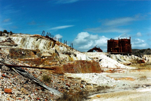
Drove to the old smelter site and explored around a very impressive set of ruins. It must have been huge in its silver mining heyday.
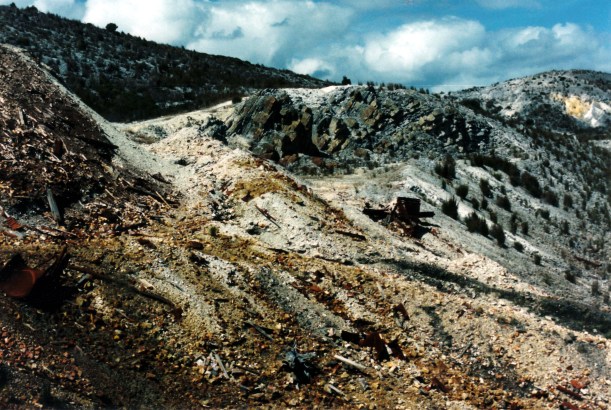
03-07-2000 at old smelter ruins Zeehan.jpg

Two photos at the old smelter ruins

03-08-2000 smelter ruins zeehan.jpg

Then we found our way up King Hill – the views were mostly obscured by scrub, but there were massive ranges in the distance. We wandered about the mine remains there – a big poppet head, relay poles for a  haulage way up the hill, part of a turntable.
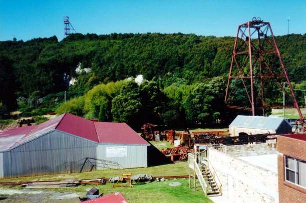
03-09-2000 mining relics Zeehan.jpg

Mining relics Zeehan

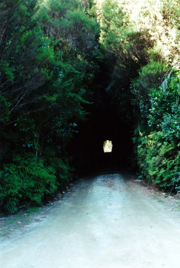
Next was a “little adventure” that John wanted to do. We drove the Spray Track, to the Spray tunnel. This 100 metre long burrow through a hill was originally built in 1901, to bring ore by light rail from the Spray Silver Mine, at its far end, to Zeehan. The tunnel is an unusual keyhole shape – this allowed for the shape of boilers being taken to the mine.

The tunnel is 3 metres high and 2.2 metres wide!

John was determined to do the one-way drive through the tunnel. Once started, drivers are committed to keep going! He tucked the side mirrors in against the Truck body!
03-09-2000 spray tunnel.jpg

Looking into the Spray Tunnel

At the entrance, we could see the other end, so it was not as claustrophobic as I’d feared – but there was not much clearance either side. John did it well. Would have been interesting if we’d broken down and needed to get out of the vehicle!

03-09-2000 spray tunnel truck

Not much clearance room

Looked at the mine remains at the other end, then completed the loop drive back through the bush and to town. It was a very pleasant little excursion.

The caravan park had filled up a bit by the time we got back – there were about six other vans.

I went off for an early shower, thinking to get in before the rush, but still had to wait. Others had the same idea!

Tea was pork and honey sausages I’d bought in Queenstown – very ordinary – and leftover macaroni cheese. I also made borscht soup to use up the beetroot I’ve been carrying around for weeks.

S phoned in the evening, while we were watching TV. While John was talking to her, there were a couple of rifle shots, not too far away. Then, a little while later, there were three shots from much closer – far TOO close! We were both afraid to go out of the van. John phoned the police, as apparently did some others. They came about 20 minutes later and sussed it out. Apparently a local was shooting wallabies. Rather thoughtless of him to come so close. Maybe he doesn’t like tourists?

It was a really cold night.

Leave a comment

2000 Travels March 6

MONDAY 6 MARCH     QUEENSTOWN

Early on, the day looked like there would be high cloud, maybe even some sun.

It was a public holiday in Tasmania – the 8 Hour day; perhaps a bit like our Labour Day.

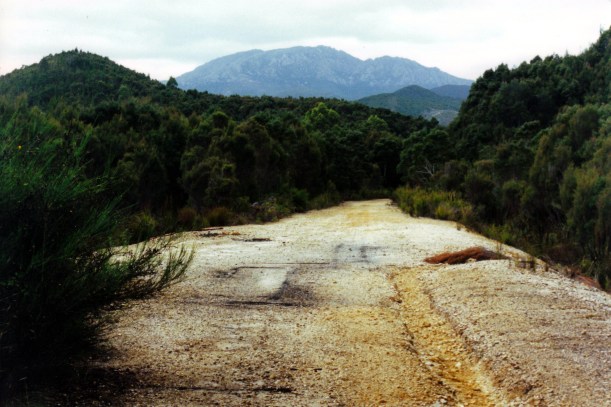
After breakfast, and completing some odds and ends, we drove out along the unsealed track that follows the old ABT rail alignment. There is a 4WD track that follows this for some of the old route. At Halls Creek, behind the Bradshaw sawmills, there was a sign saying the bridges were unsafe for driving on, any further. To this point, the track had been rather rough, with a number of big, wide, puddles and a ford or weir to cross that was not too deep, but running. Guessed there would have been a bridge there in the rail times.

03-05-2000 old rail alignment near Queenstown.jpg

Road along the old railway alignment out of Queenstown

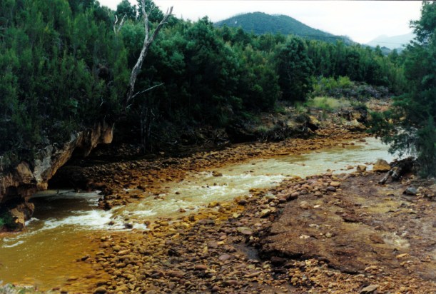
We ate our packed lunch by the Queen River, at that point, then left Truck parked and started walking.

03-05-2000 Queen River near Queenstown.jpg

Queen River

A few hundred metres from the start, we passed a parked ute, and then a broken bridge. We were able to cross this on a couple of laid planks, but vehicles had made a little side track that forded the creek, below.

03-05-2000 J on old ABT bridge

Narrow track and planks across a rickety bridge

Then we encountered a man picking blackberries. He said his dog had wandered off. Further along, we were passed by a man and a couple of kids on a 4 wheeler buggy.

The track narrowed to normal railway width. We could hear the sound of the rushing waters of Halls Creek to our right, but the valley by then was too deep and forested to see it.

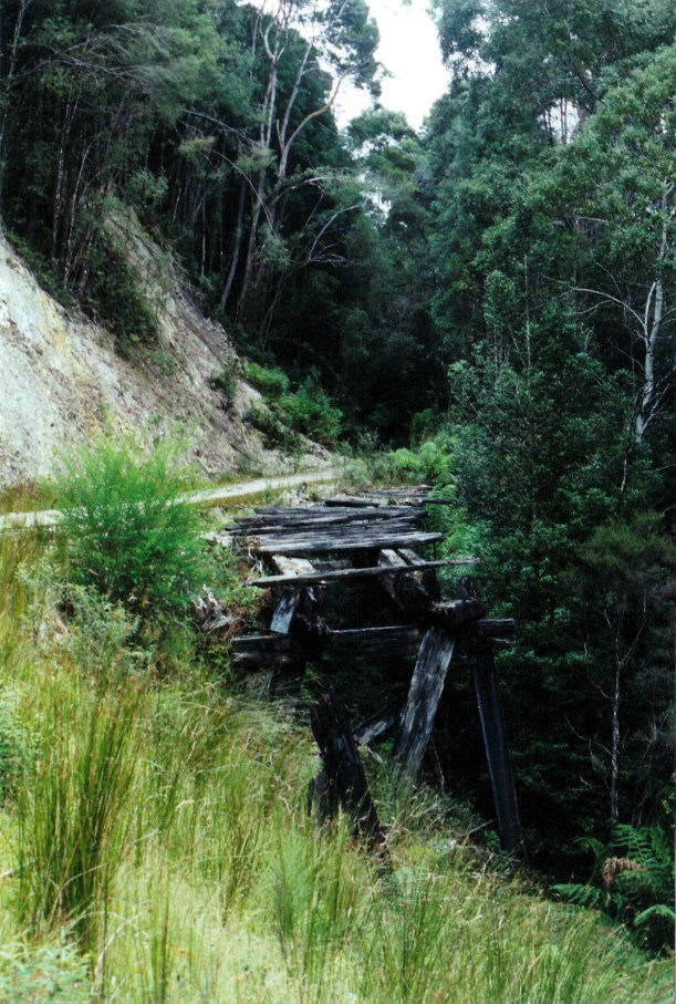
We crossed several bridges that had planks laid over them – obviously for the use by 4WD vehicles. We would never have attempted to take Truck over some of them, though! In one place, a landslip had been used to fill in a gully where a bridge had been, but it looked to be slipping away again.

03-05-2000 old abt bridge

Broken bridge

We plodded steadily up the rising track. This was the 1:16 gradient that had used the ABT cog system – though the rails had long gone, of course.

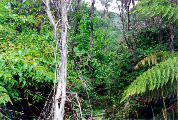
Eventually we reached the Rinadeena site, that was the highest point on the old railway. There were a few traces of buildings here, if one looked closely, but the area was largely overgrown. It is less than forty years since all was abandoned, but the vegetation grows quickly it seemed.

03-05-2000 was rinadeena yards.jpg

This was open space and rail yards, some 38 years ago – Rinadeena station site

A work site for the railway restoration had been cleared – with a bulldozer there – and an access track coming in from the Strahan road. That was never there before!

There was  a little brown mouse-like creature coming out from the bushes to feed on the ground, and then going back in again. There had been quite a lot of bird life along the track – thrushes and the like.

We walked back to Truck. The blackberry man was gone, but his dog was there. Was nothing we could do about it, except to hope it knew its way home! Or that he would come back, looking.

I thought that, overall, we’d walked about 7 kms.

Drove the Anthony Road again, now that the cloud had lifted. This time, could see big vistas across lakes, to huge mountains. It was obviously a previously glaciated area and was quite awe inspiring, though not as spectacular as John had expected. At the junction with the Murchison Highway, turned around and went back to Queenstown on the same road.

Back in Queenstown, John parked outside a shop, while I went in to get milk. A lady driving a red people mover pulled in, to the No Standing area right in front of him, and in doing so drove too close and grazed the corner of our bull bar – which is solid steel. He was astounded. She actually denied hitting Truck and raced off to the shops. Unbelievable. No damage to us, but John reckoned that, in better light, she’d see the evidence down the side of her van. Her problem!

Drove 130kms today.

We packed up the awning and outside furniture. The lone traveller came over for a chat.

Tea was macaroni cheese.

The stay in Queenstown has been very pleasurable, because we have been able to access so much wonderful, wild, country.

03-05-2000 around qtown.JPG

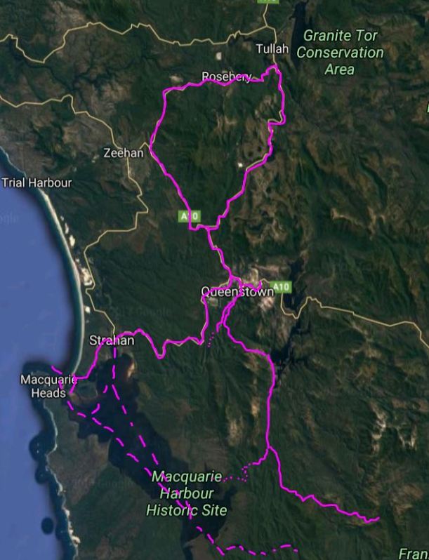
Assorted explorations from our Queenstown base


Leave a comment

2000 Travels March 5

 SUNDAY 5 MARCH     QUEENSTOWN

It was a misty morning, with some drizzle and not a great deal of visibility. But the forecast was for showers, clearing, so we decided on a drive.

We took the Mt Anthony road – a fairly new one that, presumably was built because of hydro developments. It goes from Queenstown to the Murchison Highway, north of Rosebery. It is much straighter, and shorter, than the highway route and locals use it to avoid the hilly, winding route through Rosebery.

I had the impression that it was really scenic, but we couldn’t see much at all, because of the misty rain. I knew from the map that there were some really high mountains in the area. There was a 10% gradient drop at the northern end, for a couple of kms!

At the highway, we turned left and went to Rosebery. It was still misty. We walked around the streets of the town, looking at the older buildings, and some mining relics. The Pasminco mine there is still operating. Since the shop was open as we passed, I bought a lotto ticket for next week’s jackpot – $3million.

Headed back south on the Murchison Highway and stopped by the Henty River bridge, to eat our lunch – sitting in Truck in steadily pouring rain. It would have been a pretty spot to explore a bit, in dry weather.

Got back to camp about 1.30pm, having driven 133kms.

John was really tired and had a four hour “nap”. I read the weekend papers.

It continued to rain for most of the afternoon. I guessed we were seeing the west coast as it mostly is. Although, even this country has seemed drier than normal – we could see that the hydro dams are well down, and the walking tracks were certainly drier than indicated in track notes.

Talked for a while with a Victorian neighbour – a man travelling alone in a Roadstar van. He seemed lonely and wanting to talk about travels.

The caravan park manager sent another guest over, who had been asking about the Mt McCall track and the Pillinger walk, so we talked with him for a while. I think we convinced him that both were quite do-able with his vehicle. I do think that people who run caravan parks should be more pro-active in producing proper information about what is to be done around their area. It would certainly encourage longer stays.

Tea was steak, mushrooms and green beans.

We decided to stay an extra day to finish off some undone things.

The rain eased off through the night.


Leave a comment

2000 Travels March 4

SATURDAY 4 MARCH     QUEENSTOWN

After breakfast, we drove up Spion Kopf Hill, behind the town. From here, there were good views over the railway station building works, and up the “Gormy” hill. Could see a newly painted and refurbished train turntable at the terminus works – very flash.

03-04-2000 Queenstown view from Spion Kopje.jpg

From Spion Kopf. New railway building in centre.

Then we drove to Strahan, yet again. I put a couple of rolls of film in for processing at the good shop there. At the bakery, bought scrolls for lunch, and for dessert tonight.

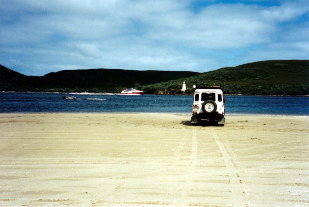
We drove out to Macquarie Heads and ate lunch, sitting in Truck, parked on the beach there. Watched the cruise boats go out through Hells Gates.

03-04-2000 Ocean Beach by Hells Gates

On the beach at Macquarie Heads, with tour boat passing Bonnet Island

Then drove around to Ocean Beach which, as the name suggests, fronts on to the Southern Ocean. John said he was sure he had been here before, but I did not remember it. We concluded that he might have visited it alone, while I was in hospital in 1993.
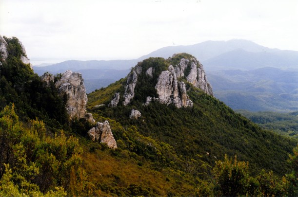
We went for a very pleasant walk along Ocean Beach, for a couple of hours. Then drove back to Strahan where I collected my photos. Refuelled Truck – 96cpl.

Went to Tuttles Whittling Display, which was quite whimsical and something different.

I drove us back to Queenstown, so John could have a good look at the scenery on the way, for a change. The road certainly required one to concentrate!

Tea was leftover chow mein for John; I had some salad and a tin of fish.


Leave a comment

2000 Travels March 3

FRIDAY 3 MARCH     QUEENSTOWN

Today was another nice weather day. We are really being quite lucky.

I worked on share market stuff through the morning. John pottered about.

After lunch, went back to Bradshaws mill. I’d designed a Huon pine storage box I want John to make for the foot of our bed – to store knitwear and the like away from moths. He intended to buy a nice birdseye speckled board for the inset top and take it with us – he thought it would fit in Truck.

03-03-2000 huon pine stacks.jpg

Huon pine in various forms, at Bradshaws Mill

The best laid plans……We saw some lovely speckled and “waved” freshly cut pine and chose several pieces of it, including one eight foot long, narrow piece that would make an excellent feature display table. Therefore, shipping to home for us became the only option. The timber we chose cost us $475, including transport costs. They will round out the somewhat uneven sized parcel with offcuts, they said.

03-03-2000 our huon pine.jpg

Out little stack of Huon pine, at the front.

The timber will be shipped to coincide with our pass through Melbourne in April. We will have to go pick it up at Yarraville, near the docks,  and store it carefully in John’s shed, to dry.

After about three hours at the mill, we went and did a grocery shop and then headed back to the van. We were both excited by the wood purchases.

Fish and chips for tea.

Phoned K about the missing photos. They had arrived at home the day after he sent the mail bag. The slowness was apparently explained by the Hobart shop wrongly addressing them. It seemed like a good idea at the time, but I won’t be doing that again. Still, it was a relief to know they are there


Leave a comment

2000 Travels March 2

THURSDAY 2 MARCH     QUEENSTOWN

There was a good warm drying wind this morning, so I washed, including the bedding.

Went to the Post Office, posted some letters and collected our bag of mail.

Took the flat tyre to be fixed. Turned out we must have had a faulty tube in there, because it had split. A new tube and the labour only cost us $15 – very reasonable.

Dealt with the mail. Was pleased to receive letters from V and my brother, and information on the family book launch and associated gathering. Brother had included a photo of my nephew, in his new Year 7 Trinity uniform. Nice of him. There were some bills, too, which we went back to the Post Office to pay.

I was concerned that the four packets of photos I’s been expecting, from the Glenorchy photo shop, were not in the mail bag. I’d mailed them the films  and negatives while we were still at Dover, and they were to send the completed photos home. I hoped that they’d not gotten too wet in our letterbox to send, or gotten lost.

After lunch, went to the Gallery Museum and browsed there. They had a huge collection of old photographs, painstakingly presented and explained. Included were photos and information about Pillinger and Crotty. It really was an excellent display – much better than we’d anticipated – and we spent a couple of hours there.

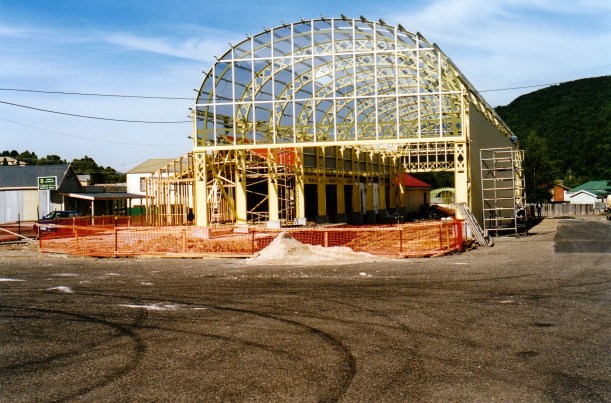
03-02-2000 new abt station.jpg

The building that would be the Queenstown terminus for the restored ABT Railway

We went and fetched a couple of containers of water from the standpipe, to put in the van tanks.

John left me at the van and went off to access some Internet for an hour, from 4-5pm. I read the papers we’d collected.

Tea was chow mein, which made John happy.

After tea I started writing a letter to V.


Leave a comment

2000 Travels March 1

WEDNESDAY 1 MARCH     QUEENSTOWN

We woke to another fine morning – this is almost a record for these parts!

I packed lunch and we set out for more exploring and walking. Drove out the Mt Jukes road again, past the sawmill, the lookouts and Lake Burbury. We also passed a road-killed quoll – maybe the same one we’d seen alive two days ago? The level of road kill we are seeing in Tasmania is such that it must be deliberate, on the part of many drivers. It is quite distressing to us.

Our destination today was the road’s end at the Bird River Bridge, and then the walk track to Pillinger ruins and Kelly Basin, a small bay on Macquarie Harbour. John was really keen to do this walk, which was good.

We followed the same route as on Monday, to the junction of the Kelly Basin road track and the Mt Mc Call track. We took the 5km driving track to the Bird River Bridge. This was really lovely to drive on, narrow and often through deep cuttings, as it followed the old railway alignment.

03-01-2000 01  bird r tk.jpg

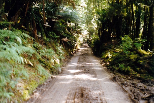
The road followed the old railway alignment

We had to park about 500 metres short of the road’s end, on a flat area sometimes used by apiarists. This was because there were National Parks workers at the road end, making a new car park and doing some roadworks. So that was going to add about a km to our 11km return walk.

In the late 1800’s, one James Crotty established the North Mt Lyell Company, in competition with the Mt Lyell Company, in Queenstown. He built a mine at Linda (now on the Lyell Highway a few kms east of Queenstown), smelters at the township of Crotty (now under Lake Burbury), a smelter and port township at Pillinger, on Macquarie Harbour – and a railway to connect them all, via the township of Darwin. This railway had much easier gradients than that of the other company’s one to Strahan.

East Pillinger township had the smelter, sawmill, brick works, three wharves, ore crushing plant and company housing. Across the Basin, and linked by ferry boat, was West Pillinger, containing government services like school, police station, and stores, hotels, housing.

The area was thriving in the very early 1900’s and it was assumed that the port of Pillinger would be the main one on Macquarie Harbour. But James Crotty died, the Crotty smelters were inefficient and in 1903, the two rival companies merged. The Mt Lyell Company chose to continue with Strahan as its port, rather than Pillinger.

The Mt Lyell Company gradually dismantled much of the settlements. But trains continued to use the railway, to transport timber for the mining operations. But in 1926 the rail track between Darwin and Pillinger was lifted. The last family left what remained of the town, in 1943.

We walked across the Bird River Bridge, with the little river brown below, and set out along the walking track, that follows the old rail alignment. It was supposed to be a 3-4 hour walk – about 5.5kms each way, but by the time we dawdled, looking at the river, fallen trees, fungi, taking photos, it took us three hours one way!

03-01-2000 03  Bird River view.jpg

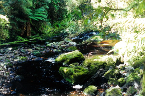
The Bird River, beside the walking track

The track was affected by landslips in places, where cutting walls had collapsed, and by fallen trees, so there was some scrambling over obstacles involved. Mostly, though, it was easy walking, but we needed to watch our footing amongst tree roots.

03-01-2000 06  bird r rail alignment.jpg

Walking track along the old rail alignment

The first section of track followed the lovely Bird River, a shallow and small stream. The rushing water noise was most enjoyable, on this part. Then the river hived off to the left and we went through an area of swamps and ti-tree. It was rather hot and humid there, although, overall, it was a beautiful day.

03-01-2000 07  old bridge.jpg

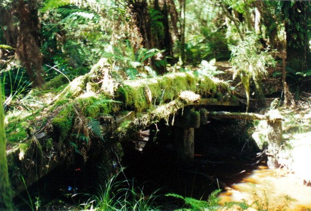
Remains of old wooden rail bridge

03-01-2000 05 more Bird R reflections

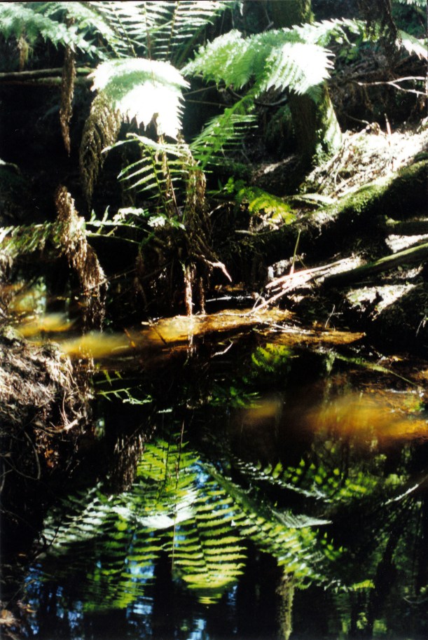
Reflections in the Bird River

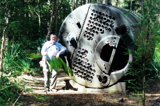
We came to a boardwalk that led off to some brick ruins of kiln structures, and two big old boilers.

03-01-2000 09 pillinger brickworks ruins.jpg

One of the old steam boilers left at Pillinger

It appeared that some restoration work may be under way and attempts to reclaim what is left, from the encroaching  bush. A big tree that had been growing in part of the old brickworks had been cut down. Much of the settlement remains were well and truly in the bush so there was limited ability to explore what had been there, and no way to get over to what had been West Pillinger.

03-01-2000 11  pillinger brickworks walls.jpg

Walls of the former brickworks at Pillinger

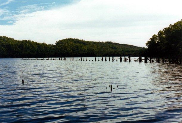
We looked out from the shore, at the pilings that are the remnants of the wharves, then sat on the modern, cement National Parks jetty and ate our focaccia roll lunch.

03-01-2000 12 pillinger jetty ruins

What was left of the Pillinger wharves

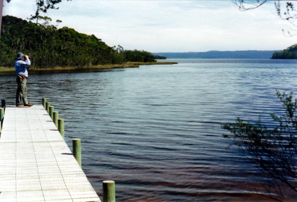
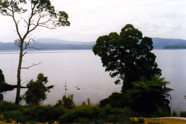
It was a really scenic and tranquil picnic spot, with its views over Kelly Basin and into Macquarie Harbour. This alone would have been worth the walk.

03-01-2000 13  kelly basin jetty.jpg

Kelly Basin – part of Macquarie Harbour – at Pillinger site

The return walk only took us about 90 minutes and it too was, mostly, really enjoyable.

John was in the lead, as usual, because of my tendency to stop for photos. He walked right past a tiger snake that was on the track – it was about a metre long, and his boot was about 15cms from its head! He didn’t see it, and the snake didn’t move. I pointed it out to him, after I’d very carefully passed it. We thought it looked rather dead, so I touched its tail with a – long – stick, and it moved slowly away. Maybe it was a bit cold? It almost certainly would not have had much contact with people, so maybe we just didn’t bother it? John was annoyed that he hadn’t seen it, and a bit shaken. Anyway, that was the daily sighting we seem to get on every Tasmanian walk we tackle.

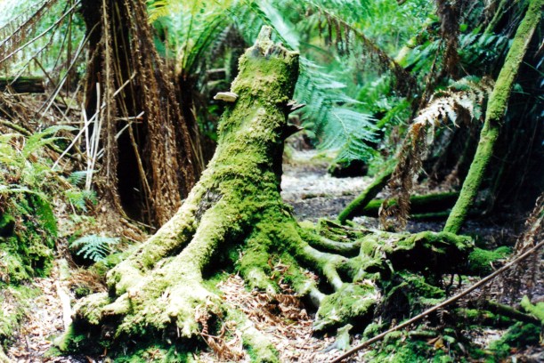
03-01-2000 15 bird r rainforest.jpg

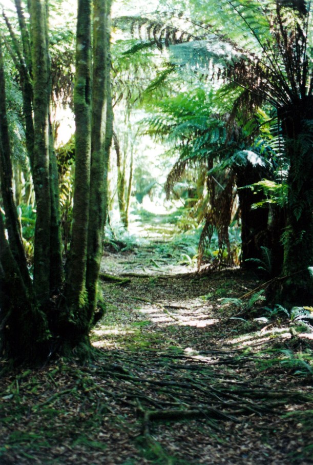
Rainforest elements – buttress tree roots, fungi, ferns, lichens

When we reached Truck, it had a flat driver’s side front tyre. Not what we needed! John even wondered if someone had let it down deliberately, as there appeared to be no tyre damage. It took us about half an hour to change the wheel – the Landrover jack, which is a high lift type – is very slow to use.

It was very dim and semi-dark in the forest, by this time. On the drive back, we felt rather vulnerable, being in an unpopulated area with no spare wheel. We probably should have gone to the effort of carrying the other spare wheel from the van, on these forays.

The drive out there and back was 91kms.

Tea was salads and salmon, again.

After tea, we both felt really weary, suddenly, which was surprising because it had not been a particularly strenuous walk.


Leave a comment

2000 Travels February 29

TUESDAY 29 FEBRUARY     QUEENSTOWN

Yes, a Leap Year!

We woke early, to the alarm. Left camp at 7.45am to drive to Strahan, getting there at 8.30.

Stopped at the bakery, so I could buy us focaccia rolls for lunch, as we had decided not to pay the extra fee for the lunch provided on the cruise, thinking it would probably be fairly ordinary.

We were able to get a window seat on the cruise boat, opposite a couple from NSW. The seats were each side of tables, so some people faced forwards, some back. The Wanderer III was a big boat which took over a hundred people at a time. We found it quite comfortable. There were some tour groups on the boat, mostly older people.

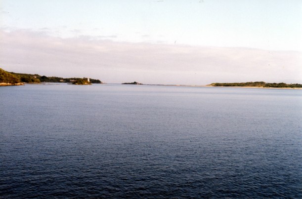
Departure was as scheduled, at 9am. We cruised down Macquarie Harbour, then around to Macquarie Heads and the narrow Harbour entrance – Hells Gates. This name came from the convicts when Macquarie Harbour had a penal settlement, 1822-33. To them, it was the entrance to Hell.

02-29-2000 01 Hells Gates from inside Macquarie Harbour.jpg

Approaching Hells Gates: Bonnet Island and Entrance Island

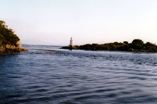
The boat proceeded past the small light houses on Bonnet and Entrance Islands the guide through the channel – narrow and treacherous – and on out into the open sea. We could see the convict-constructed rock wall along the channel near the entrance. The commentary explained the scouring effect of the channelling, to keep the entrance clear, and pointed out the Cape Sorell Lighthouse.

02-29-2000 02 hells gates.jpg

The narrow, treacherous channel at Hells Gates

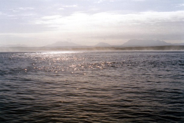
We could just see lots of wild, western mountains in the misty distance – a lovely outlook.

02-29-2000 04 west coast mts

The mountains of the west coast, from outside Macquarie Harbour

We were followed through Hells Gates by another, similar, cruise boat.

After our little look about out there, we motored back into the Harbour. The Hells Gates entrance was, thankfully, very docile today. I guess there are plenty of times when the cruise can’t go outside, as we did.

02-29-2000 05 outside hells gates

Outside Hells Gates, Entrance Island, other boat

Our next destination was Sarah Island, down the Harbour, about 25kms from the entrance, passing some Atlantic salmon fish farms in their circular cages, on the way. This was the site of the penal settlement. There, we went ashore for a guided tour. This was done by actors based at the Visitors Centre, in Strahan, and was excellent, interesting and informative. Despite the large group, it was all audible. At one stage, an actor went into the water (in a wet suit) to explain and show the existence of the old slipway timbers and jetties.

02-29-2000 06 Sarah Island ruins

Sarah Island building ruin

Much research seems to have been done about Sarah Island. Conventional wisdom has long had it that Macquarie Harbour was a dreadful place of punishment and that the penal settlement here was eventually abandoned in favour of Port Arthur because of the difficulty of supplying the place from Hobart (by ship). However, on the tour it was suggested that it was actually a very successful, calm and hard working establishment, where there was little trouble and the convict population took pride in the ship building and support works. Not all of the convicts were those being punished for further crimes committed while under sentence elsewhere; some were those who had opted to go there in return for a remittance  of their sentence. Thus, the tour suggested, it was abandoned because it was not punishment enough!

02-29-2000 08 new penitentiary sarah is.jpg

The New Penitentiary on Sarah Island

The hour of the presentation flew by. I would have liked some time to browse on the island independently, which we did not get. I think that only having supervised groups may be part of the preservation tactics.

02-29-2000 07 sarah is view

Macquarie Harbour from Sarah Island

Back  aboard, the boat headed further down the Harbour, to the entrance to the Gordon River.

Lunch was served on the boat at this time. I think we were the only ones who had brought our own! The boat meal looked excellent – cold meats, stacks of smoked salmon, salads. I think we made a major misjudgement there! Still, our focaccia was nice.

We progressed slowly up the Gordon River – there is a low speed limit, to protect the river banks from wash from the tour boats.

02-29-2000 10 on the Gordon R.jpg

Going up the Gordon River

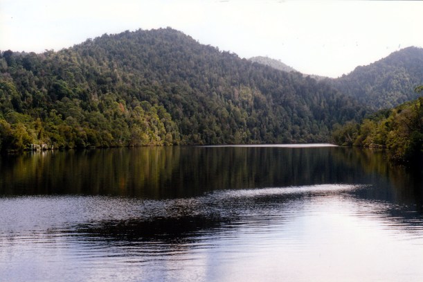
Thick forest came right to the water’s edge. There were brilliant reflections in the dark river water. The river was wide and tranquil.

We passed a yacht tied up at Fishermans Landing.

02-29-2000 09 Gordon R Fishermans Landing

The Gordon River at Fishermans Landing

The commentary on the boat told of the protest blockades of the early 80’s, over the proposal to dam this river, downstream of the junction with the Franklin River, that would have impacted hugely on both rivers. It described all the arrests that were made – including of Bob Brown, a leader of the Save the Franklin movement, who went on to become an Australian Senator and Greens Party founder and leader.

The rivers were saved, after the intervention of the newly elected Hawke ALP government, and High Court decisions about federal powers and World Heritage Area rights. All history now!

02-29-2000 12  gordon r.jpg

Reflections in the tannin brown Gordon River

We went ashore at Heritage Landing for a 15 minute rainforest walk, with commentary. The forest here, ironically, was nowhere near as good as that we’ve seen in other part of Tasmania. There was one huge Huon pine tree – falling down – and we took photos of that.

Back on the boat and back down the river and across the Harbour, to Strahan. One does not really realize how big Macquarie Harbour is, until you do something like this.

We spent some of the time on deck and some inside, watching a scenery video they showed – brilliant. Many of the older, tour bus people slept.

It was a pleasant trip back down the river and up the Harbour, but blowy when the boat went fast.

02-29-2000 13 macquarie harbour

Speeding back to Strahan across Macquarie Harbour

We docked at 3.45pm. The trip, at $44 each, was excellent value.

We then went to the pine mill here – Morrisons – and John talked to the owner, who seemed to remember him. This is where John bought the Huon pine he used to make our bedroom furniture, in early 1993. He did the timber buying whilst I was laid up in Queenstown Hospital with a ruptured disc in my lower back; he enjoyed that time much more than I did! The pine was shipped across for us.

There were lots of round pine turning blanks, some sassafras ones too. The prices seemed good and John got a price list. He was given the advice to keep such pieces in plastic, to season it and prevent cracking.

At the bakery I bought two more focaccia rolls, for tomorrow’s lunch.

The drive back to our Queenstown base, in the late afternoon sunshine, was enjoyable. We were in time to collect the papers for the last two days.

Tea was potato salad and coleslaw and a tin of pink, smoke flavoured salmon. Seemed fitting and was nice.

This was the last day of summer – and an excellent way to spend it. I was so pleased that the weather forecast had remained accurate, and that we had a clear, sunny day for this trip.

We decided to extend the stay here until after the weekend, as there are still things we want to do.


Leave a comment

2000 Travels February 28

MONDAY 28 FEBRUARY     QUEENSTOWN

This morning seemed to herald a more promising weather day.

After breakfast, and making some lunch, we went to the National Parks headquarters again, and got the key for the Mt McCall Track. Washed the underneath of Truck at a servo.

We took the Mt Jukes Road, south, out of town. This paralleled the brown coloured Queen River for a while, to where it ended at its junction with the King. Then the road trended south east, roughly, until we eventually came to the southern part of Lake Burbury, which we followed south.

We saw a spotted quoll walking across the road near Mt Jukes – have never seen one of these in the wild, before. A quoll is a carnivorous marsupial. This one looked a bit like a large, spotted cat, but with a different shaped face.

It was still quite misty, out to Lake Burbury; we had assumed this would lift as the day went on – and it did.

The track  continued, generally south, until, about 37kms from Queenstown, we came to the junction with the Kelly Basin/Bird River Road. Our Mt Mc Call track trended to the south east again.

We soon came to the locked gate and locked it again behind us.

02-28-2000 09 mc call tk gate.jpg

Key is needed to go any further

The road had been really good until the Kelly Basin Road, then it quickly became rougher and steeper. In places, the track was quite rocky and there were some steep hill climbs and descents, but it was all quite manageable.

02-28-2000 02  Mt McCall Tk getting rugged.jpg

Somewhat steep and rough!

I used my Franklin topo map and the GPS to try to keep track of where we were on the track. I was mindful of the warning in the rough track notes we had, that, at the end, the track stops abruptly and without warning, at a 300 metre log haulage way drop down to the Franklin River below!

02-28-2000 06  mc call tk vista.jpg

Sections of the track felt like the top of the world!

The drive was extremely scenic and different, especially as the mist lifted. We saw some most incredible vistas from the track.

02-28-2000 01 mccall tk

White quartz outcropped along parts of the track

Near the end of the track, some 22kms from the gate, it went very steeply uphill, then very abruptly down. I chose to walk this last section, as really steep downhills give me the heebies. At the end was a fair sized clearing in which to turn around – despite what we had been told, there was certainly room for more than one vehicle.

We parked in the turnaround, ate lunch, watched birds. We inspected the haulway remnants, where logs harvested from the surrounding forests were “dropped” down into the Franklin River and would eventually be floated down this to the Gordon and thence to Macquarie Harbour.

02-28-2000 04 haulway.jpg

Old logging haulway – logs dropped 300m down this to the Franklin River below

At one stage, we thought we could hear voices from below, faintly – maybe rafters on the Franklin?

It certainly was wild and lovely country and we felt privileged to have been able to do this drive – and so happy that we’d made the effort.

02-28-2000 08 view to Mt Owen from Mt McCall Tk.jpg

View to Mt Owen from the Mt McCall Track

The drive back out was even more breath taking as we could see vistas that had been invisible in the morning mist. Much of the way was through quartz capped hills and ranges, like Frenchmans Cap, which was as the crow flies, not that far away. There were vistas into deep, thickly forested valleys.

02-28-2000 07 from Mt McCall Tk

Really rugged country

In places, we could see the track winding away over the top of the ridges.

02-28-2000 05 mc call tk view

The Mt McCall Track winding away over the ridges

We stopped at the Lake Burbury lookouts to see the views over this and to the back end of Frenchmans Cap in the distance.

02-28-2000 10 lk burberry frenchmans cap

Looking over Lake Burbury towards Frenchmans Cap

On the way out of town, this morning, we had passed a big Huon pine sawmill. There were great heaps of the timber stacked about. John was amazed at the quantity. We called in on the way back – it was Bradshaws Mill. Although it was 4.30pm, the owner and his son allowed us in to browse around. John was really taken with the pallets of offcuts they sell – he thought they were great value. They had some great slabs and carving pieces too. They have recently amalgamated with the mill at Strahan, we were told.

Huon pine is a really unique timber because its natural oils make it repellent to insects, and it does not rot away. It is also very slow growing and can grow to many hundreds of years old. Thus, the rings in the timber are really close together. The early colonists realized that Huon pine was a perfect timber for boat building, and the logging of it became an industry, supposedly the reason that the Macquarie Harbour penal settlement was established. It is no longer legal to cut down Huon pine trees, but when areas were going to be drowned by hydro dams, the Huon pines there were cut and preserved for the future. Now, three companies have the right to retrieve and mill this Huon pine, Bradshaws being one of them.

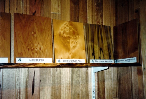
When Huon pine is first milled, it is quite pale in colour, but ages to a golden caramel colour. I love the smell of it – quite distinctive. There can be beautiful speckly patterns in the timber – called birds eye – and this is the most valued form for woodworkers.

03-13-2000 brittens smithton.jpg

Birds Eye Huon Pine

We did not stay too long, given the time, but John indicated to them that we would be back.

We returned the gate key to National Parks, and filled our large water container from the standpipe near the Parks Office, there for this purpose. The locals drink it so I guessed we could too. Presumably it is piped from somewhere up in the mountains that is distant from the pollution of the area closer to town.

We were too late to pick up the paper.

Tea was pasta with bacon and mushroom creamy sauce.

This had been yet another truly  memorable day in Tasmania. We drove 138kms.


Leave a comment

2000 Travels February 27

SUNDAY 27 FEBRUARY     QUEENSTOWN

It was a bit misty this morning, and we were late getting up.

After breakfast, set out for Strahan.

We drove past the caravan park and had a look. It does appear to be in better condition than in ’93, but not by much. There are now some permanent amenity blocks at least. We are definitely better off in Queenstown.

02-27-2000 Strahan shacks.jpg

Strahan houses – colourful!

We spent some time in central Strahan. Booked ourselves onto a Gordon River cruise for Tuesday, as the weather forecast for that day looked ok. Bought a topo map – the Franklin sheet – that covers the Mt McCall area.

I put four rolls of film in for processing at the Kodak shop, after they assured me that their work would be good. I hoped I was not being gullible.

We drove out the King River Forest Drive – out along the Lowanna road beside Macquarie Harbour, then the dirt road alongside the King River. This took us to the old Iron Bridge, part of the former ABT railway, near the Teepookana locality. The road track followed the old rail alignment and was very narrow in parts, and with the King River right below.

02-27-2000 king river nr teepookana.jpg

The King River from the Drive

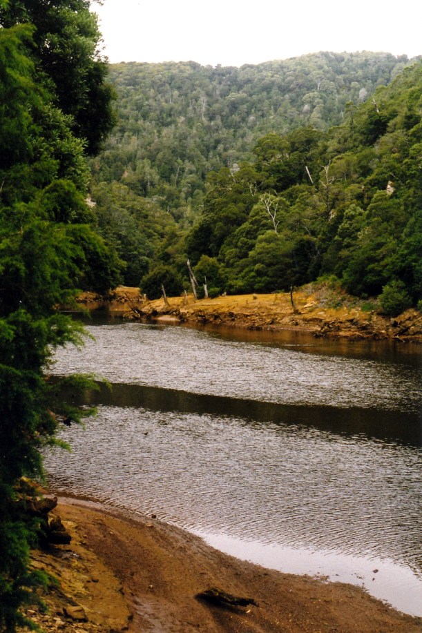
The King River still had the polluted sludge banks evident in piles alongside its channel – from the days when the Mt Lyell Mine and smelter in Queenstown used the Queen River water in their processes, and then discharged the untreated waste straight into the river. The Queen is a tributary of the King. Even though the mining practices have changed in recent times, these rivers are probably the most polluted ones in Australia. The sulphuric acid residues remain a major problem.

02-27-2000 King R Teepookana and mine sludge

The King River near Teepookana – and polluted mine sludge residue

Gold and copper mining began in the Queenstown area in the late nineteenth century, with smelting of copper commencing in 1895. Back then, there were no roads into the region and so, in 1897, a railway opened between Queenstown and Teepookana, near the mouth of the King River. This was to bring the mine products to a port there, for export.

The building of the 3’6″ gauge railway had to overcome major problems. The terrain was mountainous and heavily forested. There were many streams. Cuttings were dug by hand, some up to twenty metres deep. The original 35km long railway had 48 bridges, the longest of which was the “quarter mile” bridge – approximately 250 metres long. They had difficulty finding a firm foundation for this, having to dig down a great distance into the river silt. Even so, trains could only go at walking pace across this bridge, as any greater speed would cause it to sway too much and collapse! It was high up above the river.

The problem of the steep gradient from Queenstown up to Rinadeena siding – 1 in 16 – was solved by using the Swiss ABT rack and pinion system, for some 7kms. The train engine could engage with this central “rail” and pull itself up.

In 1899 the railway was extended from Teepookana to Regatta Point, near Strahan, where the bay was deeper. This necessitated the building of the Iron Bridge over the King River at Teepookana. Later, the railway extended right into Strahan. What had been a busy little port town quickly declined.

02-27-2000 iron bridge teepookana.jpg

The Iron Bridge, near Teepookana

The first road to connect Queenstown to the outside region was the Lyell Highway, in 1932. In the 1950’s, a road was built between Queenstown and Strahan, and this spelled the end for the railway, as the many wooden trestle bridges were too costly to upkeep, and there were increasing concerns about the Quarter Mile Bridge.

The last train ran in 1962. I was fortunate enough to do the return trip on the railway in May, 1962, and remember the Quarter Mile Bridge swaying quite noticeably as the train crawled over it. The bridge was virtually only the width of the rails, so one looked straight down from the open train windows – and the river was a long way below!

In 1964, with three friends, I walked the disused railway track, camping a night at Dubbil Barrel siding and even riding hand operated trolleys some of the way. These had just been left at sidings when the railway closed! Crossing the Quarter Mile Bridge on foot, high above the river, with no side rails, was very scary!

This bridge was, by 1972, partly washed away by floods and by the 1990’s most of the old track, bridges, sidings and station buildings had fallen down, been burnt in bushfires and overgrown by the lush vegetation of these parts.

Now, the decision had been made to rebuild the ABT Railway as a tourist railway and work was obviously  happening at both ends.

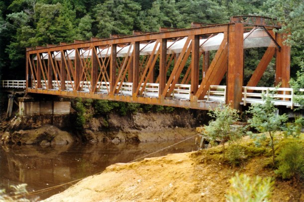
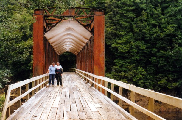
Because of this, the Drive was blocked at the Iron Bridge. It used to allow one to drive as far as the former Teepookana town site. We walked around the fence and across the bridge, with another Victorian couple who had fetched up there at the same time as us. They took a photo for us, on the bridge. When the former rail alignment here was set up as a tourist drive, wooden planking and side rails were added to the bridge, and mesh was slung between the top girders to stop flakes of rusty metal falling on cars and walkers.

02-27-2000 iron bridge mesh

The Iron Bridge altered for road traffic

It was a pity that we could not access the walk to the old Quarter Mile Bridge. Apparently, a tour operator can take customers up to the Teepookana Plateau, for $30 a head. John is not inclined to do that, at this stage.

John found a healthy looking Huon pine tree growing by the King River, and wanted a photograph with it.

02-27-2000 huon pine king r.jpg

John with Huon Pine at the King River

On the drive back to Strahan, we looked at the ABT Railway terminus at Regatta Point, which is being restored. This is where the new tourist railway will terminate.

02-27-2000 regatta pt abt terminus

Regatta Point Railway Station being restored

In Strahan, we went to the huon pine sawmill, and looked at the mill and associated gallery of timber pieces. They had some great products, bowls especially, and some very evocative wax painting by a local artist.

We collected my photos. They were beautifully done. It was not cheap, but he gives a replacement film “free”. For $1 a roll extra, I could upgrade from a 24 exposure to a 36, so I got 4 rolls of 400 speed for, effectively, $4. That shop also had huon pine wood products for sale. I liked the wooden cribbage boards – an idea for John to make sometime for Xmas presents: wooden board, Tasmanian illustrated playing cards, printed game rules, in a box. I also liked the shaped garlic bread dishes, with a natural edged top, about 1cm thick, and naturally curved, hand carved, I think.

At the Strahan bakery, I bought a loaf of damper bread and some rich, indulgent fudge.

After a full day, we drove back to Queenstown. The highway between the towns is 41kms, so it is not that far, but overall we managed 156kms for the day.

Tea was cold roast chook, the damper bread which was very nice, and the fudge which was yummy!