This Adventurous Age

Adventures travelling and working around Australia.


Leave a comment

2002 Travels June 3

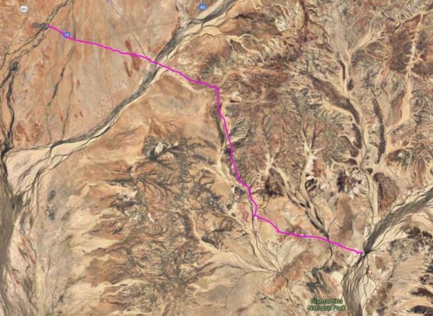
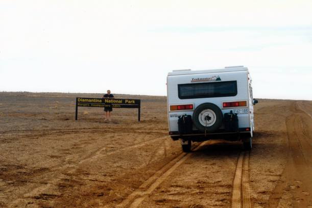
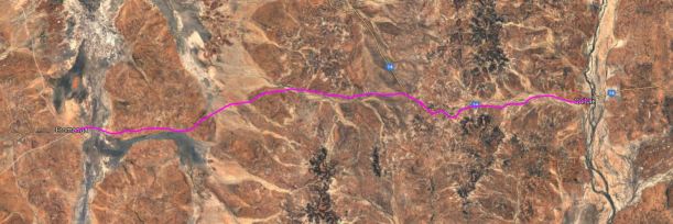
MONDAY 3 JUNE   HUNTERS GORGE TO BOULIA   180kms

The morning was still chilly, and windy.

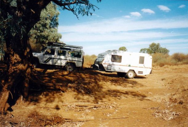
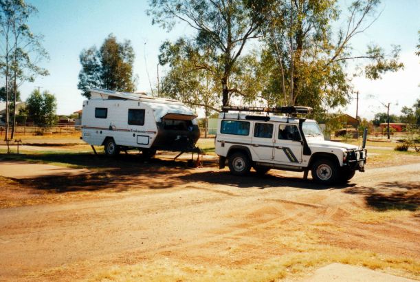
We managed to get breakfasted, packed up, and away, quite early.

Resize of 06-03-2002 01 leaving Hunters Gorge

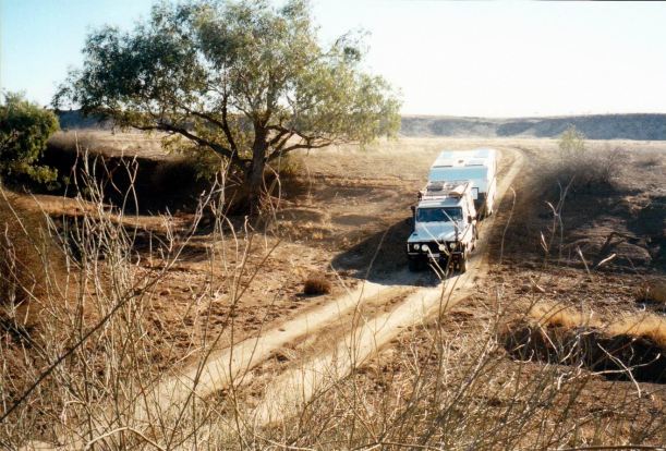
Leaving Hunters Gorge

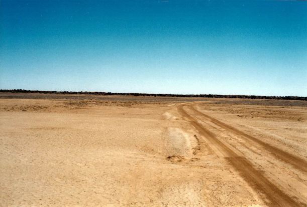
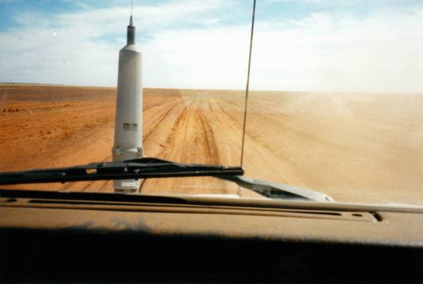
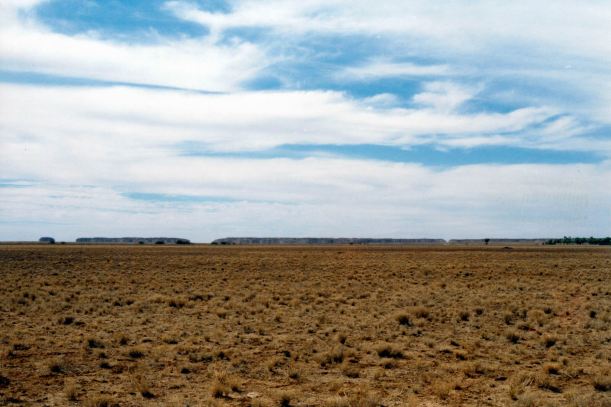
The unsealed road out to the Boulia-Winton road was much better than the road we had come in from the south on. There were the occasional lumps and bumps and dust areas, but not the huge bulldust sections of the other day. Most of it seemed to be station tracks. The track went virtually to the front door of Springvale Homestead – another Stanbroke Pastoral Company property – they are all around this area.

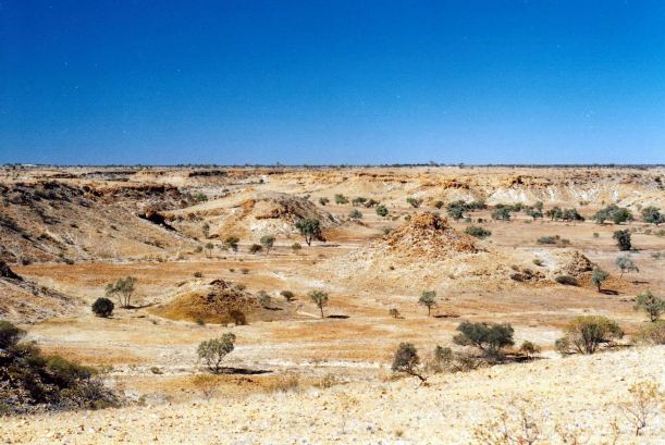
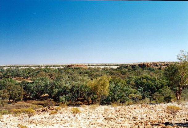
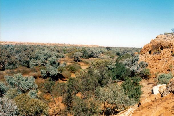
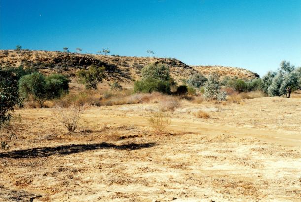
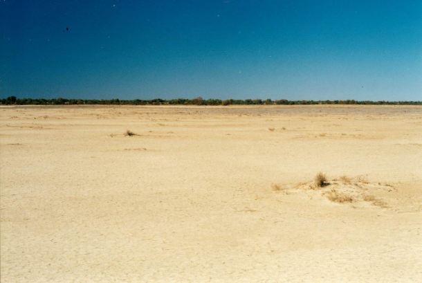
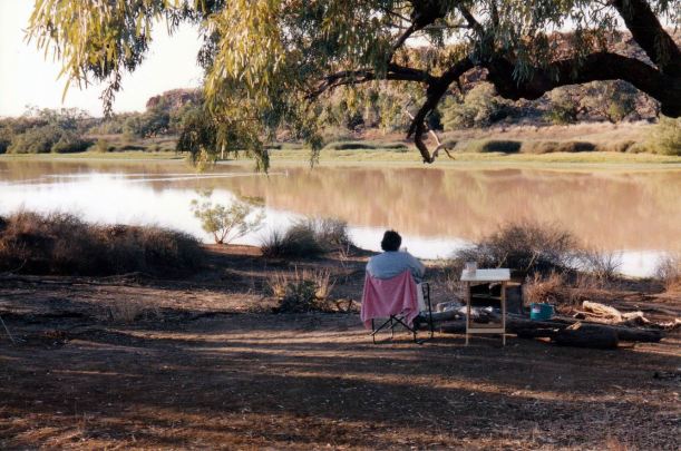
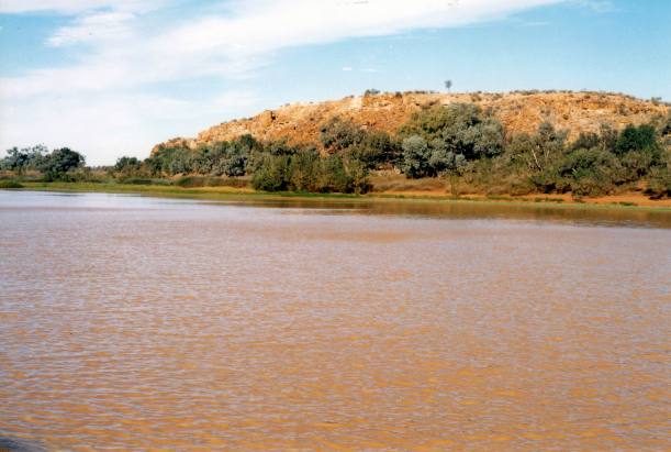
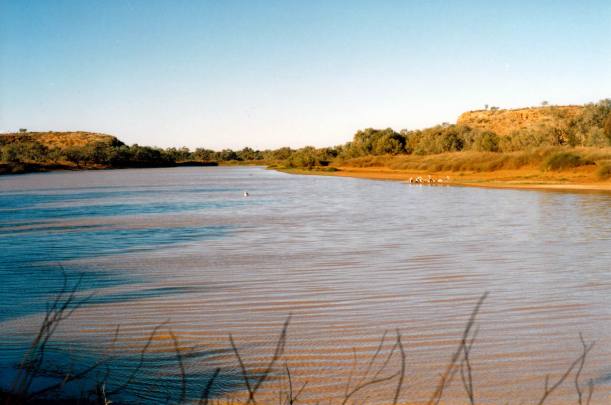
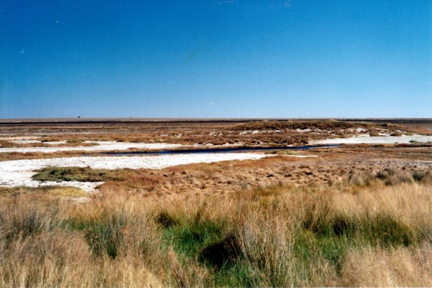
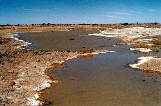
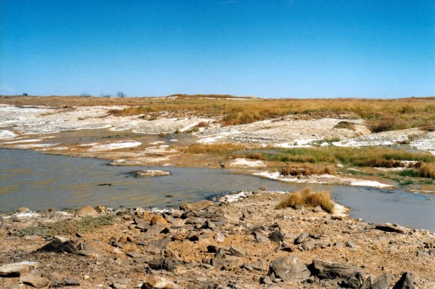
We sidetracked a short distance to look at Elizabeth Springs – natural artesian mound springs, the same type of occurrence as we’d seen along the Oodnadatta Track in SA. But the mounds here were only low, grass covered rises, not the big mounds of SA. But there was still an evident flow, with open pools and a small wetland.

06-03-2002 03  Elizabeth Springs.jpg

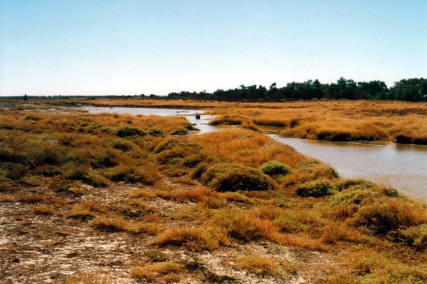
Quite a useful flow in very dry country – Elizabeth Springs

06-03-2002 06 Elizabeth Springs mound springs.jpg

Low mound formed by deposition around a spring

There were salty residues at the edges of the water, in some sections, suggesting that the outflow levels have dropped. There could have been quite an impressive wetland area here, before the Great Artesian Basin became depleted.

06-03-2002 04 Elizabeth Springs outflow

Salty residue on the water’s edges

We spent about an hour wandering about the Springs area, and taking photos.

06-03-2002 05 Elizabeth Springs

Elizabeth Springs

Further on, on Canary Station by now, we came across a couple of different mobs of cattle, being droved by riders on horseback. This appealed, as a real “outback” scene.

Resize of 06-03-2002 02 cattle muster on Canary Station

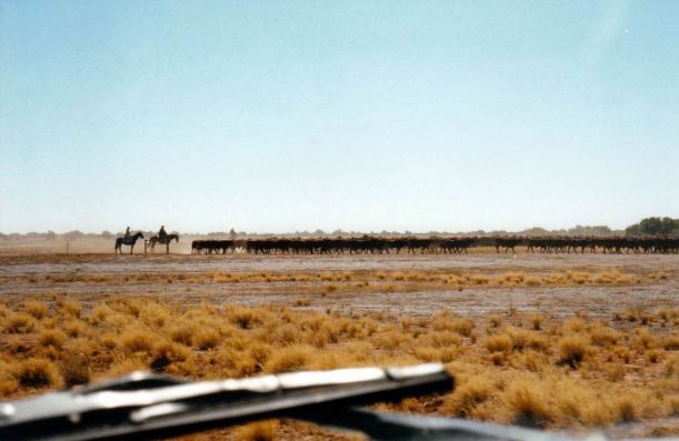
Cattle droving on Canary Station

The final 25kms of the journey was on a sealed road – albeit a narrow strip – of the Winton road.

We reached Boulia in the early afternoon, and went straight to the caravan park. We had been here in 1999, after our Simpson Desert crossing.

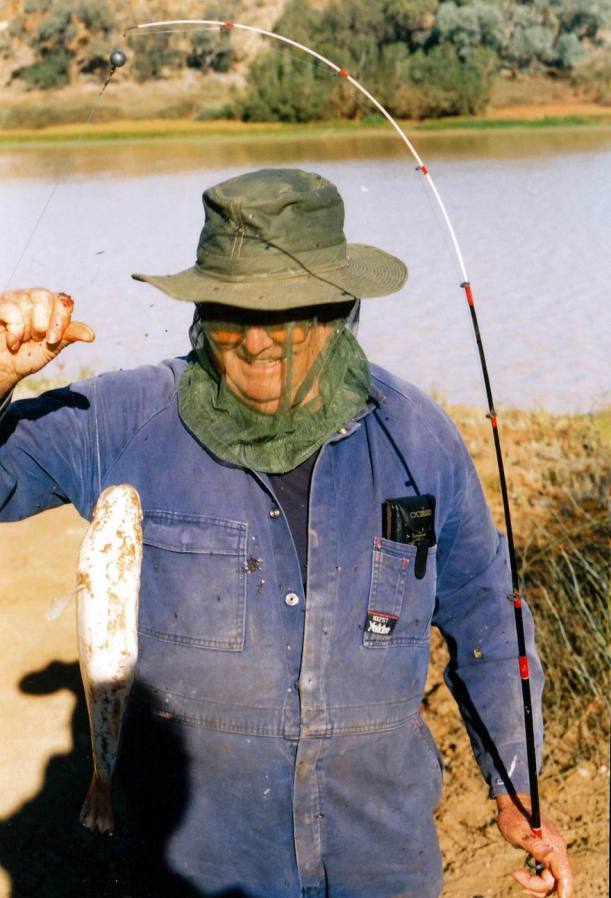
After a minimal set up for an overnight stop, we walked across the river bridge, to the main street shops. John bought a fly net for his hat.

At the new Information Centre/Min Min Light display, i bought some postcards. The charge for going into the display section was $11 a head – too much for us. There was a bus load of elderly travellers in there, though. The Centre seemed to be doing ok – that sort of interpretative centre of local features has become very popular with visitors now.

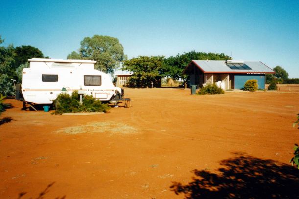
The little caravan park was much busier than when we were here nearly three years ago. However, they hadn’t improved the donga amenities any! At $12.10 a night, it really was rather over priced.

We were not on a proper site, but pulled up alongside the kerb of a grassed area. This was fine for our overnight stop – grass was quite a luxury!

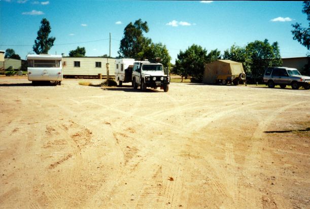
The park became more crowded later in the afternoon. There was a variety of motor homes in evidence, and I wondered if they had come from a get-together somewhere.

The lady in the General Store in town had told us that the road south from here to Birdsville was still not sealed. She said that when the government changed in Qld and the ALP came into power, they withdrew the funding that had been allocated for that work. I guessed there were not too many ALP voters out Birdsville way?

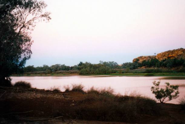
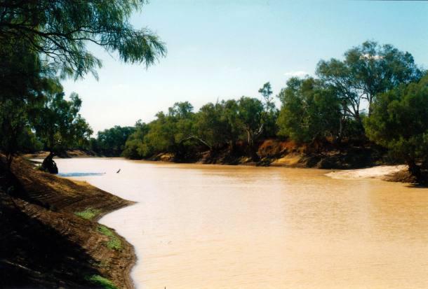
The Burke River that borders the park was much lower than when we were last here.

Despite the rather basic amenities, it was wonderful to have a shower, and to wash my hair. The last shower was back at Windorah! There was a definite brown scum on the residue that rinsed out of my hair! Diamantina dust!

The mobile phone worked, here. There were messages from cousin M and H, who were aware of our vague route, and had been waiting in Mt Isa, as they knew we were going to be there around about now. The final message said they had decided to leave today, and head up via Lawn Hill National Park, to Adels Grove. Oh, well.

Tea was ham steaks – the nice ones from Charleville that I’d had frozen, pineapple (from a tin), and Greek salad. I’d managed to buy some salad makings at the General Store.

TV signal here was great – but unfortunately the available programs were not.

John spent some time playing computer games – no need to conserve power now!

Resize of 06-03-2002 to bouliA.JPG


Leave a comment

2002 Travels June 2

SUNDAY 2 JUNE     HUNTERS GORGE

The day was still sunny, but with a chill wind that made it feel quite cold. This was to the extent that we sat inside the van to eat breakfast – most unusual for us, because we like to sit looking out at whatever view we have.

Drove to the Ranger’s base, to pay for our extra day.

We were greeted by a most unexpected sight – a moving sail in the distance, on the flat, arid, stony country! Closer up, it was a little sail powered go-cart type of thing, being ridden by his wife, with dog racing alongside. It seemed to speed along on the firm, stony, surface, but would not be much good in sand. Out here, I guess, the residents have to find ways to amuse themselves. From the Rangers base, there was not even much in the way of interesting walking – given the nature of the occasional floods of the river, the base was away from any timbered channels.

Resize of 06-02-2002 03 the Rangers wind ski Diamantina NP.jpg

Speed machine. The apparent water in distance was a mirage

The Ranger was very friendly, and showed John over his great solar panel set up, with its huge array of panels. $200,000 worth, he told us. The solar set up ran all the house electricals. There was a very large bank of batteries, too. This set up would – eventually – save money on diesel to fuel generators, and get round the hassle of transporting large quantities of same, out here. He said it was all remotely monitored and controlled from Perth!

Resize of 06-02-2002 04 solar panel array at HQ Diamantina NP

Really large solar panel array. Storage batteries under the roof

This park was so off the tourist trail! There were twelve entries, to date, in the Visitors Book, for 2002.

I asked about the ruins we saw on the circuit drive – Ingledoon? He told us that these were originally thought to have been police barracks, but now they were believed to be from the original settler in the area, as they had found some ladies’ artifacts. It seemed someone needed to do more research on the place.

They definitely need a feral car eradication or, at least, reduction, program!

From Ranger headquarters, we drove a short way along the road to Winton, then turned west to go to Janet’s Leap Lookout. This took us onto an escarpment on the other side of the Diamantina Gates from where we had walked yesterday.

Resize of 06-02-2002 09 Track to Juliets Leap

The track to Janet’s Leap

I wondered about the origin of the Janet’s Leap Lookout name and later found that it was a relatively modern one. When Janet Holmes a’Court sold the Diamantina Lakes property some local remarked that she might as well leap off the cliff there as sell it to the National Parks, for all the good it would do. I for one, am very pleased she did sell it this way, and people like us can get to visit the place.

Apart from showing us the river from that angle, it also showed a totally unexpected expanse of dissected hills and valleys to the east – sort of tableland country. It would be spectacular for photography.

Resize of 06-02-2002 07  view south from the Leap.jpg

Dissected breakaway country, seen from the Lookout track

To us, that area to the east looked like the opal mining country we’d seen around Quilpie and Winton – guess it is really not that far from Winton. Had we seen that before talking with the Ranger, I’d have asked if there had been historic opal mining over in that part of the Park.

From the Lookout, we could clearly see the Diamantina Gates, and extra waterholes along the river channels.

Resize of 06-02-2002 05  Diamantina Gates from The Leap.jpg

Diamantina Gates from Janet’s Leap Lookout

Resize of 06-02-2002 08 view over channels from Leap

Channel and waterhole from Lookout

We’d seen photos at the Ranger Base, taken in the floods of January 1999. The waters were all around the low rise that the Ranger’s house is on, and way out across the flat plains. He said that some of the channels had been filled to more than 6 metres deep. Their airstrip would have been well under water. I’d tried to imagine what it must feel like, isolated out here, with even that means of access to the outside world cut off.

Resize of 06-02-2002 06 view from Leap

From the Leap Lookout, could see the river channels spreading out over the flat plains


Back to camp, where we packed up as much as we could.

The other couple were back. They’d checked out Gumhole, as a more sheltered alternative camp, but decided they preferred Hunters Gorge.

Resize of 06-02-2002 waterhole end

From our camp, in the late afternoon, the other end of the waterhole

We had a last, final, sit round our campfire, watching the sunset and then the stars.

There was an owl in the tree over my head. I hadn’t seen it, but earlier the honeyeaters had been making a fuss around the tree, and I’d wondered why. I only saw it after dark, when it suddenly flew off – and frightened me!

Tea was mushroom soup from a tin, corn cobs and left over fish cakes.

After we went in the van, John plugged the laptop into the inverter and had a little computer time.


Leave a comment

2002 Travels June 1

SATURDAY 1 JUNE     HUNTERS GORGE

Today was the first day of winter! The temperature monitor registered 4 degrees overnight, inside the van. Today was fine, with a lovely clear blue sky.

Both other sets of campers left, so we were on our own again. I guess most of the few travellers who venture this way, did not stay as long as us. But we really wanted to explore as much as we could, but without rushing around.

I made bread, using the bread maker and bread mix from a packet. Pottered about camp while that was doing its thing.

After lunch, we went walking, up the waterhole to the gorge and past where it narrowed. The waterhole petered out into lignum and high grass, with some dry or swampy channels.

Resize of 06-01-2002 01 top of the waterhole area from scarp walk

The top of the water hole ended in a swampy channel

We climbed up a bluff, then, onto the hill tops. There were great views to be had from up there – to the Ranger base in the south, across to other hills in the east, and over the Diamantina channels. The two gorges of the Diamantina Gates were very obvious from above, as was the flatness of the plains to the west and southwest.

Resize of 06-01-2002 02 Hunters Gorge from scarp

The “gate” effect is clear, here


Resize of 06-01-2002 09 view towards ranger station from scarp.jpg

Looking south from the scarp, along a main Diamantina River channel

There was an excellent view over our camp.

Resize of 06-01-2002 03 view over our camp from scarp

Could just see the van, parked beside the waterhole

We walked around on the hill crests, to a narrow valley around from the campground, then picked our way down this.

Resize of 06-01-2002 07 scarp where we walked from near camp

It was a pleasant walk, apart from the hordes of flies hitching a ride.

Resize of 06-01-2002 05 bush flies

John’s passengers!

Back at camp, we fired up the HF radio, and did a sched in with the VKS737 base.

A couple arrived late in the afternoon, and camped further along from us.

A wind came up and it grew increasingly cold again.

Tea was fish cakes, with brussells sprouts – the latter much to John’s disgust!

It was too chilly to sit outside this night, due to the wind, so we read inside until bedtime.

We could hear dingoes howling in the distance – always a wonderful sound.

We decided to stay another day.


Leave a comment

2002 Travels May 31

FRIDAY 31 MAY     HUNTERS GORGE

It was cold overnight, down to 5 degrees, according to the monitor in the van. The morning was cool, but fine. At least, while it was cool, the flies were not about.

After breakfast, we set out to drive the 90kms Warracoota circuit drive. Carrying the extra fuel, as we had, enabled us to do such exploring.

We used the National Park’s mud map, but there were no interpretative notes, which was a pity. I didn’t know whether that was due to there being such small visitor numbers here, or because the Park has only been established for ten years, and there was so much to do.

The drive did take in representative environments of the Park – we managed to establish that much.

We began at some modern cattle yards. These still looked used, and moo-poo we saw on the tracks suggested that there were still cattle in the Park, yet to be mustered off. Later, we saw a group of eight or so. They were in very good condition, considering the drought. I wondered if the Ranger occasionally included free-range beef on his menu?

The track ran along a valley between red, low, sand dunes – Gum Creek valley. It deviated to a small waterhole. Then we came onto gibber stone washes and plains. There, we saw another gibberbird.

Resize of 05-31-2002 01 red sand country on circuit drive.jpg

Red sand country on the Warracoota Circuit Drive

Resize of 05-31-2002 gibber bird.JPG

Gibberbird

In a low-rise section of better soil and low trees, we saw a Weebill – tiny and brilliant yellow.

The track then went across cracking clay pans with Mitchell Grass – the cracking clays made for a corrugated track. We disturbed a dingo, that ran along the track in front of us, for a distance, before becoming smart enough to turn off to the side.

Resize of 05-31-2002 dingo dust.jpg

Dingo in distance


Resize of 05-31-2002 02 Diamantina nature drive and dingo

Trying very hard to out run us!

We saw Lake Constance – dry as a bone. It would be lovely with water in it. There were horse hoof prints there.

Resize of 05-31-2002 dry lake constance

The dry Lake Constance

The bush flies were horrendous – possibly because the day was warm, with no wind.

Had our lunch at Warracoota Waterhole. Despite the drought, this was still huge in length – we couldn’t see its end. I presumed that it was replenished whenever the Diamanatina flooded. It must have been really deep, to not have dried up.

Resize of 05-31-2002 03  Warracoota Waterhole Diamantina NP.jpg

Warracoota Waterhole

Near Warracoota Waterhole, we came across the ruins of several stone huts – this may have been an ill fated settlement of the late 1800’s, called Ingledoon, but we couldn’t find any other information about them. The ruins were right by the National Park boundary.

From this point, we had some doubt about the right way to go. The mud map we had showed that we were to back track for a little way, then take a track to the north. But as we’d driven in, we hadn’t seen that track turn off. But a graded track seemed to continue on from the Waterhole, westwards. A dilemma. But we decided to try to do what the mud map suggested, drove back the way we’d come, and found the northwards track – there was an arrow on a post, but it had been hidden from view on the way in.

The track deviated around the extensive and tree-edged Warracoota Waterhole.

There were no more of the cracking clay stretches, fortunately, as they had been by far the roughest part of the drive.

It seemed fairly soon that we came to a big “tank” – where a creek had been dammed. There was even a cement and boulder spillway. There was still a sizeable pool of water there. It would be very extensive – a lake – after good rains or floods. We explored around that for a while.

After that, we were soon back at the main west-east track that would take us back towards camp. But on the way, we deviated to have a look at the Gum Hole camp area. It was on a small water hole, and the camping area was fairly small. It was nowhere near as scenic as Hunters Gorge, but it was certainly more sheltered. There was no one there.

Overall, the circuit drive had been really worth doing, with just enough variety and points of interest to keep from being at all boring. It certainly showcased a variety of the local mini environments. I was so pleased that we’d carried enough extra fuel to be able to do this.

When we got back to camp, there was another lot of gear about a hundred metres from us, but no vehicle. It was about 4pm by then. We were pottering about camp when a Toyota and a Cub camper came along the track, and parked just across the nearby little gully from us. It was a couple. When I walked by, on my way to the toilet, they apologized for disturbing our peace! We chatted, briefly. They had been here last year and were now on their way to the Kimberley. I thought that, if they liked a place like this enough to return, they were our sort of people!

Resize of 05-31-2002 04 our Hunters Gorge camp

Our Hunters Gorge camp

The car from the other camp came back near dark. There were three people. They were rather noisy – and lit a bonfire, rather than a campfire. They were not our sort of people!

I watched two feral cats prowling on the other side of the waterhole – through the binoculars. One rushed at a group of pelicans on the bank – who flew safely away.

I marinated the remaining perch in garlic, ginger, chilli and lime juice. It was nice, cooked, with leftover coleslaw, followed by cheese and biscuits.

We sat out by our campfire. It was not as cold as last night, so we were out there until about 9.30pm. The moonrise was later tonight.

A cat jumped onto the table where we had eaten our tea. They were certainly bold. I thought that a trapping program at the camp area was well overdue.

We listened to the evening news on the radio. There was no mention of our green streak of last night, but there were reports of a meteorite, to the east of here, seen last Tuesday about 6pm. So maybe there was a little shower of meteorites happening?


Leave a comment

2002 Travels May 30

THURSDAY 30 MAY     HUNTERS GORGE

It seemed very cold overnight, and we needed to really snuggle in under the doona, but it became a fine, sunny day. I guess that is the nature of the interior country at this time of the year.

The bush flies, in large numbers, became very sticky and annoying, through the day. Fly nets called for.

Watching the waterhole “unfold” in the early morning was lovely – so peaceful and serene. The morning light shone on the bluff opposite – it seems to be at just the right angle to get light on it most of the day, so it was nearly always spectacular.

Resize of 06-02-2002 01 dawn Hunters Gorge.jpg

Dawn over the water hole

When there was no wind, the bluff was reflected in the water. When the wind was blowing, the waterhole had a variety of colours, from pinky-orange, through yellow to brown, even a blue.

The pelicans cruised slowly past, going first one way, then the other, occasionally fishing for something.

Resize of 06-02-2002 pelicans.jpg

This place was so worth the trip in.

Resize of 06-02-2002 02 early morning Hunters Gorge

We stayed around the camp all day, just enjoying it.

Resize of 06-01-2002 wendy by waterhole.jpg

There were often feral cats on the tree branch above our camp fire area

The two men from NSW that we’d encountered on the way in, came from their camp at Gumhole to fish here, further up from us. They caught fish. John went and fished, too, and talked with them. They caught four perch, and then gave John their leftover prawn bait. He then asked them to the van for coffee and we talked for a while. One of them has a wife who will not travel with him, even though he’d bought a caravan of her choice. It is so hard for me to fathom some women! So he travels with his mate, and they were off to the Kimberley, via the Tanami Track.

After they had gone back to Gumhole, and after we’d had lunch, John caught a couple of small perch, and a bigger one. They were very fatty to clean, but would do for two meals.

Resize of 05-30-2002 yellowbelly for tea

I read, and watched the birds. A group of spoonbills had flown in and more pelicans. There was a pink-eared duck on the water, and more Pacific herons had come. I saw a snakebird (Darter) catch and eat a fish – it manoeuvred the fish round and round, as the heron had done, yesterday, then down it went. I could see the bulge go down its neck. Then it went and perched on a log – guess it was digestion time! There were some cormorants perched on branches and logs, for a while, with their wings spread out, drying.

Late in the afternoon, we went for a short walk, up as far as the camp area extends. There were some wired-off revegetation areas. We saw no other campers. The NSW men had told us there were some others camped at Gumhole, but they’d not found them very friendly.

Resize of 05-29-2002 11 Diamantina Gates from HG camp.jpg

Up near the end of the waterhole by the Diamantina Gates

Tea was fish and fries. The perch was very nice to eat.

After tea we sat huddled close to the fire – the night was cold.

The feral cats were prowling around again. I saw two tabbies and a ginger one.

The moon rose about 9pm. About 9.20pm, John saw, above the ridge behind the van, a streak of bright green light, with bits shooting off the streak, like fireworks rockets. It went down at an angle behind the ridge and disappeared. We thought it might have been a little meteorite?

Resize of 05-29-2002 diamantina np


Leave a comment

2002 Travels May 29

WEDNESDAY 29 MAY   WINDORAH TO HUNTERS GORGE   346kms

We had the alarm set this morning, for 6am, as it could be a big day. We were setting out into somewhat remote country.

We were out of Windorah at 7.30am – after paying our camp fees for the previous night.

There was some light cloud about in an otherwise blue sky – it was quite a pleasant day for travel.

Took the Diamantina Development Road west from Windorah. This was single width and sealed, and John had to concentrate hard driving on the narrow strip of tar. Still, we made reasonable time to the end of the tar, some 130kms from Windorah, by Morney Station.

On the way, we passed the old JC Hotel ruins, some 80kms west of Windorah, and about 20kms further on, the turnoff to Birdsville. There were occasional stark jump ups to vary the otherwise flatness of the country.

Resize of 05-29-2002 01 windorah bedourie rd.jpg

Mesa formations seen from the Windorah-Bedourie road

Once we left the bitumen strip behind, John had to concentrate even harder. Today would not be an easy one for the driver. At least, there was very little other traffic.

Further on from Morney, we came to the multiple channels of Farrars Creek. Around this area, there were some occasional low red dunes appeared. The creek channels were mostly just distinguishable by lines of low trees intersecting the road, but occasionally there was a Floodway sign. The country had steadily become more arid and stony too.

We had no trouble finding the Palparara turn off – it was signposted to Diamantina National Park, too.

This was definitely a station track. It ran roughly parallel to the braided channels of Farrars Creek, as far as the Palparara homestead – about 56kms from where we turned off. There were frequent patches of bulldust – the fine, powdery dust in holes of varying depth in the road. We decided there must be a lot of truck traffic, moving stock off the property, due to the drought.

Resize of 05-29-2002 02 palparero tk bulldust

The track through Palparara

We stopped at 10am, for morning coffee, near an abandoned bore.

Resize of 05-29-2002 old bore mill Palparara station.jpg

Derelict old windmill on Palparara Station

Near the Palparara homestead, our way veered off to the NW, to Davenport Downs homestead, about 100kms distant, and near the Diamantina River. This section of the track was better – probably there was less stock truck traffic? But there were still some hefty bulldust sections. Despite being very cautious, sometimes it was hard to see these, or gauge their depth, so occasionally we ploughed through one instead of crawling carefully around it, and raised a great cloud of fine dust all around and over us. I was concerned about how much of this might be finding its way into the van – I had opened the pressure hatch on the roof this morning, but reckoned this stuff must be penetrating everywhere, regardless.

Resize of 05-29-2002 03 in dust on Palparero road.jpg

What happens when one drives through bulldust – note the dust on the dashboard

Mixed in with the dusty country, there were extensive gibber plains. On one of these gibber sections, I spotted a small group of birds on the ground and we stopped to check them out. Light brown, with some yellow, they were identified as the Gibberbird – a type of chat. We hadn’t seen these before, so were quite pleased with ourselves. It gets harder all the time to find birds we have never spotted before.

Resize of 05-29-2002 04 near Davenport Downs

Dry country on Davenport Downs

We stopped for lunch by a dry creek channel, a bit south of Davenport Downs homestead. Around this time, had begun to notice quite strange, low hills on the horizon – a low range with quite wide gaps in it. We speculated whether any of these gaps were the so-called Diamantina Gates, where that river’s many channels constrict to flow through two gaps, before spreading out again.

Resize of 05-29-2002 05 Davenport Downs strange hills.jpg

Unusual hills in the distance

The track turned north just before Davenport Downs was reached. The entrance gate to the National Park was only a few kms north. We reached that about 2pm – the going had not been fast.

Resize of 05-29-2002 06 entering diamantina np

As I was opening the gate, a 4WD came up behind us. This was the only vehicle we’d encountered since turning off the Development Road. The 4WD driver was amazed to see us there with a caravan, and wanted to know how we’d managed to tow it, on that track. He reckoned he’d nearly gotten bogged in the bulldust, as few times. Maybe we’d taken a lot more care than he had, but it really hadn’t seemed all that bad, to us. We certainly were going slower than him.

Continued north, running parallel to the Diamantina, until we came to the National Park headquarters. This was quite a substantial set of buildings, which we thought must have been the station homestead and associated outbuildings, when this was Diamantina Lakes Station, once briefly owned by Kidman. It would have been a bleak and lonely place, surrounded by the flat barrenness of the flood plains.

There was a huge solar panel array on one building.

The two men from the 4WD were there too, booking in. It cost us $7.70 a night, and we paid for four. They said they were going to the Gumhole Camp, as it was more sheltered. We opted for the Hunters Gorge Camp area, because it was right by the Diamantina River. I might add that when we got to Hunters Gorge, and felt the wind, we realized why shelter was significant!

The track to Hunters Gorge – and beyond that, to the Boulia road – crossed the Diamantina channels in cemented dips – interesting! They would be covered very deeply in floods! Just beyond the channels we turned right on the track to Hunters Gorge. Then we crossed a small but deep, dry creek channel.

Resize of 05-29-2002 back clearance.jpg

On the track in to Hunters Gorge

When we got to the camp area, which was just basically anywhere one could access along the river bank, we were the only people there. It was a bit dusty and had been well “stick-picked”. We found a fairly flat spot for the van, with a premium view over the big Mundaweira Waterhole – the deepest one in the park – to a reddish coloured bluff beyond.

The waterhole was great – clay coloured water, pelicans drifting about on it. From the outset, we thought it a magic place and well worth the effort to get here.

Resize of 05-29-2002 09 view from Hunters Gorge camp

Mundaweira Waterhole at our Hunters Gorge camp

There was a long drop toilet not too far away – but not too close! It was somewhat smelly, but better than none.

There was not as much dust in the van as I’d feared, given what we had been ploughing through. A quick wipe of all the surfaces, a floor sweep, and all was well.

A screw holding one end of the griller burner had vibrated loose and the burner was resting on a bread baking tin that I’d stored in the compartment. Good thing it was there because the burner had not been able to drop far, so it was all easily fixed by screwing it up again.

We pottered about, setting up camp and just looking at the waterhole and the birds.

Resize of 06-02-2002 10 Diamantina River Hunters Gorge.jpg

Looking along the waterhole towards one of the Diamantina Gates

John’s left arm and shoulder were sore from the driving – it had been a hard day for him. requiring total concentration and lots of gear and clutch work.

Tea was tinned mussell soup, then garlic and parsley pasta with a tomato sauce – I had some squishy tomatoes to use up.

After tea, we sat out by the fixed fireplace/BBQ that was by our site. We watched stars in a brilliant night sky. The moon rose about 8.30pm. John had set up his camera on the tripod and took photos – including a moon “staircase” on the waterhole (these did not come out!).

There were lots of fish splashing. We’d earlier seen a Pacific heron, on the opposite bank, catch and eat a big fish. It took him ages to mouth-maul it to the exact position he wanted, before swallowing it, head first.

The cruising pelicans made great phosphorescent streaks where they sailed across the moonlight path on the water.

It was a chilly night, though. So quiet – no people type noises at all.

Unfortunately, there were several feral cats about. They approached our camp soon after we set up and were around for the rest of the night. One even climbed into a gum tree, in the dark, about two metres from where I was sitting.

We were both very tired and did not stay up late.

Resize of 05-29-2002 to h gorge


Leave a comment

2002 Travels May 28

TUESDAY 28 MAY     WINDORAH

It was a fine day and not really hot.

After a leisurely start to the day – a rather early one, due to the fee collecting caretaker – we set off to do the Nature Drive.

The 12 km of the Nature Drive was on a dirt track, but was well signed. But given that most of it was over the Cooper floodplains and channel areas, definitely a drive for when it is dry!

There were a couple of historic aspects highlighted, like the old telephone line and site of the original road over Cooper Creek, but mostly it featured the varied plant communities and their key species. The latter were signed and named.

Resize of 05-28-2002 sandalwood.jpg

We found it really interesting. It was a great example of a little town making a feature out of what it had around – in this case, basically bush!

Resize of 05-28-2002 dead finish

Dead Finish – so named because it is the last thing starving stock will eat

The drive ended up at Cooper Creek, downstream from the road bridge.

Resize of 05-28-2002 cooper ck

Good camp sites are up along the Creek banks

The Thompson River, which passes near Longreach, joins with the Barcoo River which comes from the NE, just to the north of Windorah. Both of these rivers have formed multiple channels before they reach each other, so after the junction there is a real tangle of intertwining creeks. This system is one of those that is responsible for the floods that sometimes inundate the Channel Country. The shallow channels fill up, the waters spread out and flood widely. If the flow is big enough, the waters will flow into Lake Eyre, eventually.

Resize of 05-28-2002 Cooper Creek Windorah near bridge free camps

Cooper Creek was quite low level, in the prevailing drought

The periodic inundation can be a major inconvenience to settlers and travellers, but the great benefit is wonderful pasture growth after floods – the Channel Country has long been known as great cattle fattening country in the right seasons.

One of the postcards I bought featured Windorah surrounded by floodwaters.

There were quite a number of campsites evident along both sides of the creek, and both up and downstream of the bridge. There were quite a number of campers in same. If we come this way again, I think we’d find it very pleasant to camp out here.

The Creek was quite low, but there were pelicans on it and other bird life around. We saw a big Brahminy kite there.

It would be interesting to come out here not long after a big flood, when the creek was almost full – though I guess a lot of the camp sites would then be under water!

Back to town for a late lunch.

Then went for a walk. I took the book – duly read – back to the library and retrieved my $20. Posted the cards. Called in at the store.

Back at camp. John drove off to fill with diesel. We’d heard that there was a rally coming through, in the late afternoon, and wanted to be sure to get fuel ahead of them. In the event it did not seem to be a large group. Only a few of them arrived in the caravan park, though it was possible there were lots of others staying out at the Creek.

John reported back that the man at the servo was blind – but managed perfectly well! The fuel was $1.00 a litre. He filled the remaining two empty jerry cans – the ones that live on the back of the van. That effectively gave us 60 litres extra fuel – almost an extra tankful.

Dinner was a chicken stir fry with hokkien noodles.

It was a clear and cool night – very pleasant.


Leave a comment

2002 Travels May 27

MONDAY 27 MAY   EROMANGA TO WINDORAH   230kms

It was another fine day.

No one was moving off early, including us. We chatted for a bit with the off road van guy; they eventually headed off in the direction of Innamincka, to the west.

The two old biddies from the camper trailer hung about like a bad small. It appeared they were watching us closely in case we saw something, or found out something they might miss. We were waiting for the lady owner to appear, in the hope that she might show us the opal. John also wanted to approach her about work in the area. next year – there is more than one way to get on to opal bearing properties, he thinks!

I went into the roadhouse cafe to buy an Eromanga sticker to display on the Truck side window. I rarely buy stickers, but this had been a memorable “different” place. The two biddies were there in the cafe, drinking coffee and writing postcards. Given what we’d seen and heard from them, to date, it must have hurt them to fork out for the coffee!

A bit later, we were all at our respective camps, and John went to walk into the cafe. They raced out and followed him. He changed his mind at the door and came back – and so did they! In the end, John was steaming. I thought it was quite funny.

Then, while they were tucked away in the toilets, we met the lady owner coming across the yard, and talked to her. She took us in the back door to see the water burning demonstration. The two biddies came rushing in the front door! When she turned on the cold water tap, a mix of gas and water came out. It just barely caught and flickered when she held a lighter near it. She said that, some days, it is all gas, and can be fully lit. I wondered what use that water would be in the event of being needed for fire fighting? There was no mention of the opal, though.

We left our contact details with this lady, in case of future work being available, and departed. We stopped at the hotel – had been waiting for opening time – and put our $10 in the Flying Doctor tin, as we’d said we would.

We’d asked about the condition of an unsealed road that was marked on my Road Atlas as cutting through from Eromanga to the Windorah road, and had been told we should be fine to take it.

So we drove the Kyabra road. The 95kms of dirt was fine, and saved us a 150kms backtrack route.

After about 45kms we came to Kyabra Creek. Its permanent water holes were very attractive, so we stopped there for lunch and a wander around. There was a large flock of galahs occupying a red gum tree that leaned over the water hole.

Resize of 05-27-2002 galah tree Kyabra Ck.jpg

Galah tree

The two ladies we had not liked at the Eromanga camp had been intending to come camp out here. I very uncharitably hoped they would be surrounded by things that went bump in the night!

Resize of 05-27-2002 kyabra ck

Kyabra Creek water hole

The track crossed Kyabra Creek at a dry point between waterholes. Crossed a few more creek channels between Kyabra Creek and the Windorah road. But none of these had water in or presented any challenge – hardly had to slow down.

Reached the “main” road right by Thylungra Station. This is also by a waterhole of Kyabra Creek, which runs SE for a distance, and then turns to the NW – we had crossed it on that leg – before flowing into the Cooper Creek near Windorah. It is clearly a creek that has some beautiful waterholes along its length. Thylungra was another of the historic Durack places.

The single strip of bitumen road that links Quilpie and Windorah demanded concentration. It was narrow and in places the shoulders were rough. There were occasional cattle grids to be cautious about, and the regular slight dips of floodways. The country was the usual Channel country grass and scattered trees, with areas of bare earth between grass patches – sometimes paler, sometimes more red. In a couple of places there were low red sandy rises – echoes of the desert country further along.

Because of this being the Channel Country, there were always lines of trees in the distance, marking channels.

Not far before Windorah, the road crossed the Cooper Creek. There were several streams and channels close together, but the actual Cooper Creek main channel was unmistakable, with a big bridge over it. There were obviously camping spots along the banks, that were well used. I was a bit tempted for us to camp there – with its poetic, outback connotations – but I really wanted to be able to shower and wash my hair before we continued on into the wilds, so caravan park it was.

Resize of 05-28-2002 cooper ck bridge.jpg

Bridge over Cooper Creek, near Windorah

Our first stop was the Information Centre in the township. It was in a pleasant new building and was well set up. It was also the Craft Centre and Library. The very helpful lady there let me borrow a novel, on a $20 surety. She told us that the track through Palparara Station would be the best route from this direction, into Diamantina National Park.

We found the little caravan park – obviously fairly newly set up, to attract tourists to stay in the town. There was a very nice, new, small amenities block, and freshly planted shrubbery. We thought it very pleasant and it was only $6 a night. A caretaker came round about 7.30 each morning, to collect the fees. It turned out to be a noisy place though, with truck traffic passing and the town generator in the background, all night.

Resize of 05-27-2002 windorah camp

Our caravan site at Windorah and menity block

While John was pottering about the camp, I walked back to the store and bought some postcards.

At the Information Centre, we’d been given material on a Nature Drive, that looked interesting, so we decided to stay here tomorrow, as well, and do some exploring.

Tea was sausages and coleslaw.

I did some intensive reading of the borrowed novel.

Resize of 05-27-2002 to windorah.JPG


Leave a comment

2002 Travels May 26

SUNDAY 26 MAY   QUILPIE TO EROMANGA   100kms

It was a fine day after a chilly night.

We left town, after checking for the Saturday papers at the shop. They had not yet arrived. Oh well, can’t win them all.

It was only about 100kms to Eromanga, the first 35kms on the same road as we’d already driven to go out to Pinkilla the other day. The road was easy enough driving – a reasonably wide single strip of tar and pretty flat country.

On our first pass through the hamlet, I could not see the Eromanga Caravan Park that the literature had indicated was in town. I asked at the hotel which was at the far end of the town and was told that it was behind the cafe/roadhouse. That, we had passed, so we returned there.

Booked in – $10 a night for a powered spot. I would not really call it a site. The fee indicated the overall level of facilities. It was, basically, just parking by a power outlet pole, in the middle of a gravelled area. On the other side of the pole from us was what appeared to be a permanently parked van.

Resize of 05-26-2002 eromanga camp.jpg

We were told there would be a BBQ tea provided tonight.

There was another occupant of the small caravan facility – a camper trailer, set up off power. Later, a couple of older ladies returned to it. They had been taken on a tour of the area – free – I gathered.

Very hospitable people here, though Eromanga is not exactly on the beaten tourist track.

Later, another offroad van – not our brand – arrived, and set up on power too.

We had an early lunch, then went for a walk and saw pretty much all of the town – a few houses, the hotel, a school, our roadhouse/cafe/motel, a police station. There was no general store.

There was a small oil cracking refinery across from the cafe and camp area, and it also sold fuel, but it was not cheap – a BP outlet. One would think that the fuel would be cheaper, in these circumstances, with no need to transport it distances.

The refinery product was taken to the pipeline at the Jackson oil field, near Noccundra to the south, by a specially licensed B-double-double truck – i.e. four trailers. I felt glad we were not taking the same route – imagine the sway on the hind-most trailer! The truck left every morning about 8am and returned about 8pm every night. The road had been especially sealed to take this traffic.

We walked out to the cattle grid at the entrance to town, to photograph the sign that says Eromanga is the “furthest town from the sea” in Australia. I found that somewhat hard to credit.

Resize of 05-26-2002 eromanga sign.jpg

Really?

On our walk, spent some time at a display of old machinery that was set up on a vacant block by the road. John became totally engrossed in this, and even I found it interesting. There was an early oil drilling rig, set up to be pulled and positioned by horse, it appeared, and a collection of different sized flywheels and the like.

Resize of 05-26-2002 drill rig

Early drilling rig

There was a machine whose appearance from a distance had us mystified until we could read the sign that said it was a machine for turning flat sheets of tin into corrugated iron.

Resize of 05-26-2002 makes corrugated iron.jpg

Corrigated iron shaper

John was most taken by a machine that tumbled and sorted opal. Eromanga is still definitely within the Queensland opal region. I could see John inspecting it and considering whether he could build something similar. Might be a bit hard to carry on the roof rack, though!

Resize of 05-26-2002 opal sorter

The lady who had booked us in warned us that the local bore water supply was very smelly and oily, and that it had so much gas in it that it could sometimes be lit! So we decided to pass on showers.

We did decide to go to the BBQ tea as a way of meeting some of the locals and maybe finding out more about the area. There were quite a few people there – mostly family, it seemed, and some who worked for the earth-moving branch of the family’s businesses. They had all had a big night, last night, at the post-races party. What a pity that we hadn’t been a day early – we could have gone to a true country horse race meeting.

There was lots of food provided. Salads, sausages, meat patties, chops, steak, hot potatoes.  The roadhouse owners also own Kyabra Station, an historic former Durack property, to the north, but have to live in town because of their other businesses, especially the earth moving. They were developing the motel and cabin side of the place here. The motel looked quite nice.

The lady owner told me that she found it hard to get – and keep – staff, out here. She also told me that she had an opal they found out on their property, worth nearly $100,000. She might remember to show it to us tomorrow. I’d certainly love to see it!

They were really nice, friendly, generous people. She would not take any payment for the meal! We told her we would put a donation in the Flying Doctor donation tin at the hotel.

We spent some time talking with the people from the other off road van. He was some sort of professional sportsman – but his knees were shot, now. He had just had solar power put onto his van and was having problems, too. He did not seem to fully understand it all, either. His 240v charger did not seem to be working. He was not at all happy with the attitude of the company that made his van, towards their customers. We found them pleasant people to talk to.

We’d had a great day in a little township where we had not expected much.

Resize of 05-26-2002 Eromanga full moon rising

To top it off, there was a full moon rising and the dusk sky had that blue and pink layered effect that seems quite common in the arid outback.

05-26-2002 to eromanga.JPG


Leave a comment

2002 Travels May 25

SATURDAY 25 MAY     QUILPIE

After breakfast, I did our washing.

John topped up the Truck fuel and also refilled the jerry can that we’d used at Duck Creek – 89cpl.

In the afternoon, John went off to bowls. There were only a few men playing, so he had an average sort of afternoon.

I cleaned the van interior and generally tidied up ready for moving.

Resize of 05-23-2002 quilpie.jpg

Quilpie site – not exactly crowded!

Could not have my usual newspaper fix, because the Saturday papers do not arrive in town until late today or sometime tomorrow.

We really had been here in Quilpie for a couple of days longer than it warranted – but that was mostly due to John’s conviction that we’d be doing lots of fossicking – including on Seven Wonders.

I cooked mutton chops for tea, with potato and broccoli. No lamb chops available here!