This Adventurous Age

Adventures travelling and working around Australia.


Leave a comment

2005 Travels September 21

WEDNESDAY 21 SEPTEMBER   COOPER CREEK TO RAWNSLEY PARK STATION   400kms

Managed a fairly early start, while the morning was still cool.

Resize of 09-20-2005 23 at Coopers Ck Birdsville Tk

Early morning, Cooper Creek

I would have liked to detour off to the east, to see where the ferry operated from, in years when the creek was in flood. But the driver was not interested.

We passed Clayton Station. They had recently set up a campground by a wetland area – another place I would have liked to explore and stay!

Saw a mob of emus, not too far from the road, when we had stopped for a morning tea break. John decided to try out something he had seen on a TV program, and stood, waving his hat in the air.The theory was that emus are very curious creatures, and would approach closer to investigate. But these emus didn’t know that theory – or maybe they were short sighted – and ignored his efforts.

Resize of 09-21-2005 01 John trying to attract emus

Once we reached Marree, we were back on a route travelled before. We did not stop in that settlement, but turned and headed south.

Eventually reached the sealed road again. Stopped at Leigh Creek to refuel, having done 333kms by then. $1.45cpl.

Continued on, eventually running alongside the western flank of the Flinders Ranges – always a beautiful drive. Turned east on to the unsealed Moralana Scenic Drive, which was a short cut between the main road we had been on and that north from Hawker into the Flinders Ranges. We had driven this before. As before, it was really pretty in the late afternoon light – but there was little stopping for photos.

Resize of 09-21-2005 02 Flinders Ranges

Flinders Ranges from the Moralana Scenic Drive

Decided to book into the camp ground at Rawnsley Park Station, rather than going a bit further on to Wilpena, which had originally been John’s intention. The stay would only be for one night, it seemed, as John wanted to press on to Broken Hill and then take a break from driving days, there.

The unpowered site cost $16.20 after discount. The place was surprisingly busy and there were no powered sites to be had. We set up away from the more formal area, though it meant a bit of a hike to the ablutions block.

Resize of 09-21-2005 03 Rawnsley Park camp

Camp at Rawnsley Park Station

We were in a pleasant grove of cypress pines.

Although it was quite late in the afternoon, managed a short walk out along a station track, before settling in for the night.

Resize of 09-21-2005 to rp


Leave a comment

2005 Travels September 20

TUESDAY 20 SEPTEMBER   BIRDSVILLE TO COOPER CREEK   385kms

The morning saw a quick pack up, then we headed out of town, across the Diamantina River channel.

Finally, we were on the Birdsville Track – a long held goal of mine. This was the last of the three desert tracks in this region, and the only one we had not previously driven.

Resize of 09-20-2005 02 on the Birdsville Track

I was hoping that we could take our time going south to Marree, camp at least a couple of nights along the way, sidetrack out to Kalamurina on the Warburton channel – but John was not so inclined. Once he became fixated on an end goal, he was not to be moved, and in this case the goal was getting south fast!

Left to my own devices, I would have camped at least a night at each of Kalamurina (probably two or three nights!), Mungerannie, Cooper Creek, Clayton Station – and taken a week to do the track.,

It did not take long before we were seeing sand dunes running parallel to the track.

Much of the way was flat and dry, as one would expect, but not without its own beauty.

Every so often we would cross a dry, shallow water course, marked by a line of low trees – variety in the landscape.

Resize of 09-20-2005 07 Tree by Birdsville Track

It was getting late in the tourist season for people to be travelling the Birdsville Track. We only encountered one lot of traffic for the day.

Resize of 09-20-2005 03 other travellers Birdsville Track

The dust of other travellers on the Birdsville Track

The track was in much better condition than I had anticipated – but with some areas of corrugation, and – surprisingly – a short, wet section. The water was not very deep, and the base of the track was still firm though.

Resize of 09-20-2005 08 Water over Birdsville Tk

We had a couple of short stops, to look at the country, stretch our legs a bit.

Resize of 09-20-2005 04 Corella tree Birdsville track

Corella tree

One of the stops was to look at some budgerigars that appeared to be nesting in a tree hollow. There were not that many trees along the northern part of the track, so that was a novelty.

Resize of 09-20-2005 06 Budgie Tree Birdsville Track

Had a slightly more extended break at Mungerannie Roadhouse. The little camp area there was quite pleasant, beside a wetland created by the bore outflow.

Resize of 09-20-2005 11 Mugerannie RH wetlands

Mungerannie

We walked around and took photos.

Resize of 09-20-2005 13 Mugerannie RH wetlands

Bought cold drinks at the roadhouse and refuelled – we had done 326kms. Fuel was $1.70 cpl.

Resize of 09-20-2005 12 Mugerannie RH wetlands

There were some relics here of the time of the Birdsville Mailman, who plied this track, keeping the really isolated station people in touch with the outside world. They were the days before mail planes!

Resize of 09-20-2005 10 Birdsville Mailman relics Mugerannie

It was getting to late afternoon, by the time we came to the Cooper Creek crossing.

This was quite prominent, in that a belt of low trees and scrub extended for some distance  – the result of the occasional big floods of the creek. There were a number of shallow channels. But now it was totally dry.

Resize of 09-20-2005 19 Camp in Coopers Creek crossing

Cooper Creek

It was time to stop for the night, so we pulled slightly off the track, in amongst some trees.

Resize of 09-20-2005 20 Camp in Coopers Creek crossing

Good place for a camp

After the minimal set up for overnight, I had a walk around the area. The profusion of little bush flies were really annoying.

Resize of 09-20-2005 22 Wendy Coopers Creek

Wendy – with passengers!

The colours of the sky and the bush, as the day faded, were beautiful.

Resize of 09-20-2005 24 Dusk at Coopers Creek

The night was quiet and still – like being back at Pungalina.

Resize of 09-20-2005 to c ck


Leave a comment

2002 Travels May 28

TUESDAY 28 MAY     WINDORAH

It was a fine day and not really hot.

After a leisurely start to the day – a rather early one, due to the fee collecting caretaker – we set off to do the Nature Drive.

The 12 km of the Nature Drive was on a dirt track, but was well signed. But given that most of it was over the Cooper floodplains and channel areas, definitely a drive for when it is dry!

There were a couple of historic aspects highlighted, like the old telephone line and site of the original road over Cooper Creek, but mostly it featured the varied plant communities and their key species. The latter were signed and named.

Resize of 05-28-2002 sandalwood.jpg

We found it really interesting. It was a great example of a little town making a feature out of what it had around – in this case, basically bush!

Resize of 05-28-2002 dead finish

Dead Finish – so named because it is the last thing starving stock will eat

The drive ended up at Cooper Creek, downstream from the road bridge.

Resize of 05-28-2002 cooper ck

Good camp sites are up along the Creek banks

The Thompson River, which passes near Longreach, joins with the Barcoo River which comes from the NE, just to the north of Windorah. Both of these rivers have formed multiple channels before they reach each other, so after the junction there is a real tangle of intertwining creeks. This system is one of those that is responsible for the floods that sometimes inundate the Channel Country. The shallow channels fill up, the waters spread out and flood widely. If the flow is big enough, the waters will flow into Lake Eyre, eventually.

Resize of 05-28-2002 Cooper Creek Windorah near bridge free camps

Cooper Creek was quite low level, in the prevailing drought

The periodic inundation can be a major inconvenience to settlers and travellers, but the great benefit is wonderful pasture growth after floods – the Channel Country has long been known as great cattle fattening country in the right seasons.

One of the postcards I bought featured Windorah surrounded by floodwaters.

There were quite a number of campsites evident along both sides of the creek, and both up and downstream of the bridge. There were quite a number of campers in same. If we come this way again, I think we’d find it very pleasant to camp out here.

The Creek was quite low, but there were pelicans on it and other bird life around. We saw a big Brahminy kite there.

It would be interesting to come out here not long after a big flood, when the creek was almost full – though I guess a lot of the camp sites would then be under water!

Back to town for a late lunch.

Then went for a walk. I took the book – duly read – back to the library and retrieved my $20. Posted the cards. Called in at the store.

Back at camp. John drove off to fill with diesel. We’d heard that there was a rally coming through, in the late afternoon, and wanted to be sure to get fuel ahead of them. In the event it did not seem to be a large group. Only a few of them arrived in the caravan park, though it was possible there were lots of others staying out at the Creek.

John reported back that the man at the servo was blind – but managed perfectly well! The fuel was $1.00 a litre. He filled the remaining two empty jerry cans – the ones that live on the back of the van. That effectively gave us 60 litres extra fuel – almost an extra tankful.

Dinner was a chicken stir fry with hokkien noodles.

It was a clear and cool night – very pleasant.


Leave a comment

2002 Travels May 27

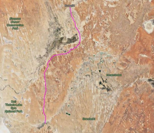
MONDAY 27 MAY   EROMANGA TO WINDORAH   230kms

It was another fine day.

No one was moving off early, including us. We chatted for a bit with the off road van guy; they eventually headed off in the direction of Innamincka, to the west.

The two old biddies from the camper trailer hung about like a bad small. It appeared they were watching us closely in case we saw something, or found out something they might miss. We were waiting for the lady owner to appear, in the hope that she might show us the opal. John also wanted to approach her about work in the area. next year – there is more than one way to get on to opal bearing properties, he thinks!

I went into the roadhouse cafe to buy an Eromanga sticker to display on the Truck side window. I rarely buy stickers, but this had been a memorable “different” place. The two biddies were there in the cafe, drinking coffee and writing postcards. Given what we’d seen and heard from them, to date, it must have hurt them to fork out for the coffee!

A bit later, we were all at our respective camps, and John went to walk into the cafe. They raced out and followed him. He changed his mind at the door and came back – and so did they! In the end, John was steaming. I thought it was quite funny.

Then, while they were tucked away in the toilets, we met the lady owner coming across the yard, and talked to her. She took us in the back door to see the water burning demonstration. The two biddies came rushing in the front door! When she turned on the cold water tap, a mix of gas and water came out. It just barely caught and flickered when she held a lighter near it. She said that, some days, it is all gas, and can be fully lit. I wondered what use that water would be in the event of being needed for fire fighting? There was no mention of the opal, though.

We left our contact details with this lady, in case of future work being available, and departed. We stopped at the hotel – had been waiting for opening time – and put our $10 in the Flying Doctor tin, as we’d said we would.

We’d asked about the condition of an unsealed road that was marked on my Road Atlas as cutting through from Eromanga to the Windorah road, and had been told we should be fine to take it.

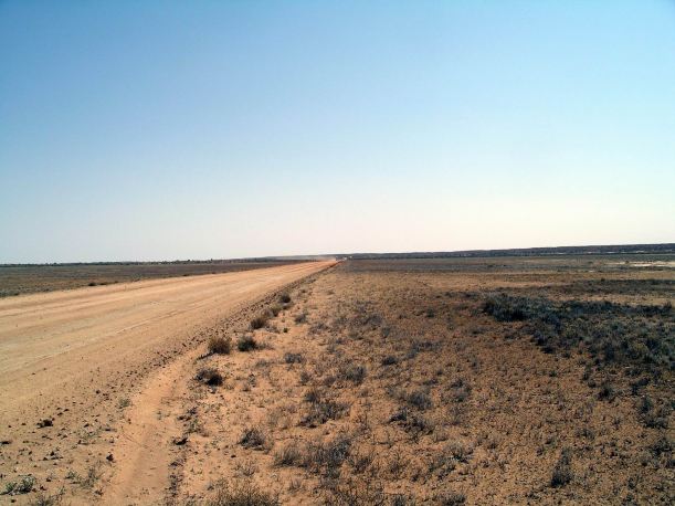
So we drove the Kyabra road. The 95kms of dirt was fine, and saved us a 150kms backtrack route.

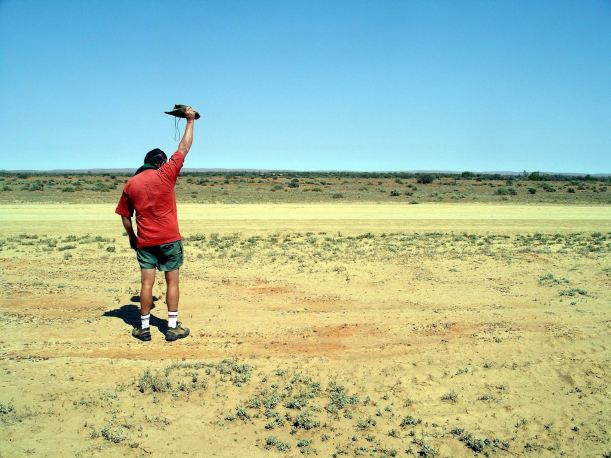
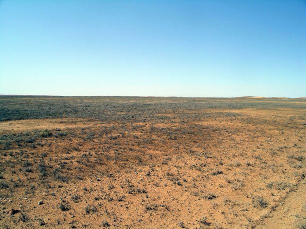
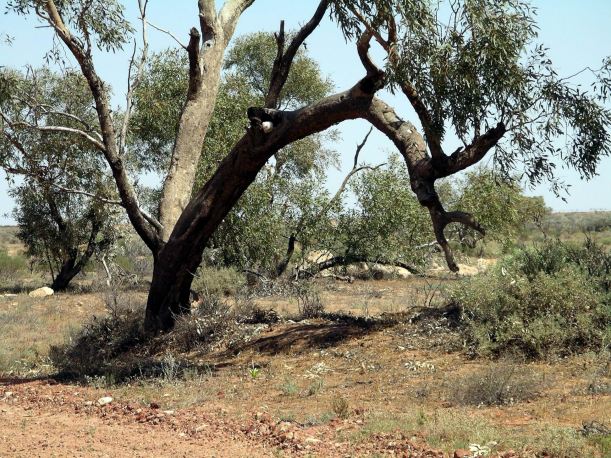
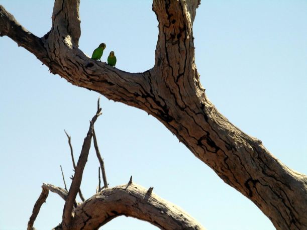
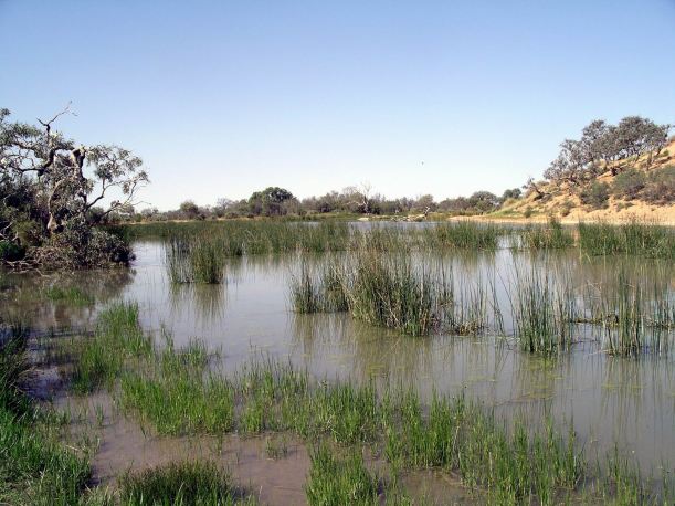
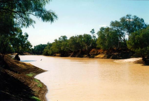
After about 45kms we came to Kyabra Creek. Its permanent water holes were very attractive, so we stopped there for lunch and a wander around. There was a large flock of galahs occupying a red gum tree that leaned over the water hole.

Resize of 05-27-2002 galah tree Kyabra Ck.jpg

Galah tree

The two ladies we had not liked at the Eromanga camp had been intending to come camp out here. I very uncharitably hoped they would be surrounded by things that went bump in the night!

Resize of 05-27-2002 kyabra ck

Kyabra Creek water hole

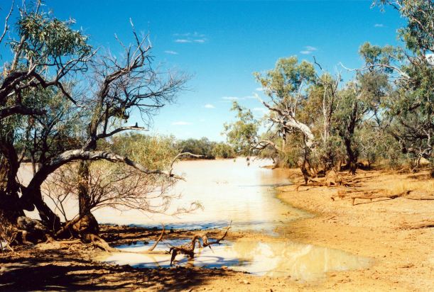
The track crossed Kyabra Creek at a dry point between waterholes. Crossed a few more creek channels between Kyabra Creek and the Windorah road. But none of these had water in or presented any challenge – hardly had to slow down.

Reached the “main” road right by Thylungra Station. This is also by a waterhole of Kyabra Creek, which runs SE for a distance, and then turns to the NW – we had crossed it on that leg – before flowing into the Cooper Creek near Windorah. It is clearly a creek that has some beautiful waterholes along its length. Thylungra was another of the historic Durack places.

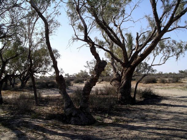
The single strip of bitumen road that links Quilpie and Windorah demanded concentration. It was narrow and in places the shoulders were rough. There were occasional cattle grids to be cautious about, and the regular slight dips of floodways. The country was the usual Channel country grass and scattered trees, with areas of bare earth between grass patches – sometimes paler, sometimes more red. In a couple of places there were low red sandy rises – echoes of the desert country further along.

Because of this being the Channel Country, there were always lines of trees in the distance, marking channels.

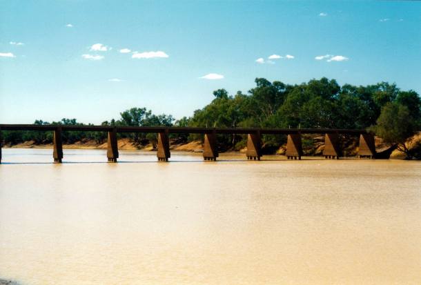
Not far before Windorah, the road crossed the Cooper Creek. There were several streams and channels close together, but the actual Cooper Creek main channel was unmistakable, with a big bridge over it. There were obviously camping spots along the banks, that were well used. I was a bit tempted for us to camp there – with its poetic, outback connotations – but I really wanted to be able to shower and wash my hair before we continued on into the wilds, so caravan park it was.

Resize of 05-28-2002 cooper ck bridge.jpg

Bridge over Cooper Creek, near Windorah

Our first stop was the Information Centre in the township. It was in a pleasant new building and was well set up. It was also the Craft Centre and Library. The very helpful lady there let me borrow a novel, on a $20 surety. She told us that the track through Palparara Station would be the best route from this direction, into Diamantina National Park.

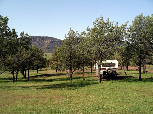
We found the little caravan park – obviously fairly newly set up, to attract tourists to stay in the town. There was a very nice, new, small amenities block, and freshly planted shrubbery. We thought it very pleasant and it was only $6 a night. A caretaker came round about 7.30 each morning, to collect the fees. It turned out to be a noisy place though, with truck traffic passing and the town generator in the background, all night.

Resize of 05-27-2002 windorah camp

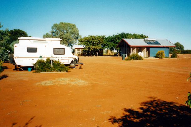
Our caravan site at Windorah and menity block

While John was pottering about the camp, I walked back to the store and bought some postcards.

At the Information Centre, we’d been given material on a Nature Drive, that looked interesting, so we decided to stay here tomorrow, as well, and do some exploring.

Tea was sausages and coleslaw.

I did some intensive reading of the borrowed novel.

Resize of 05-27-2002 to windorah.JPG