This Adventurous Age

Adventures travelling and working around Australia.


Leave a comment

1999 Travels August 16

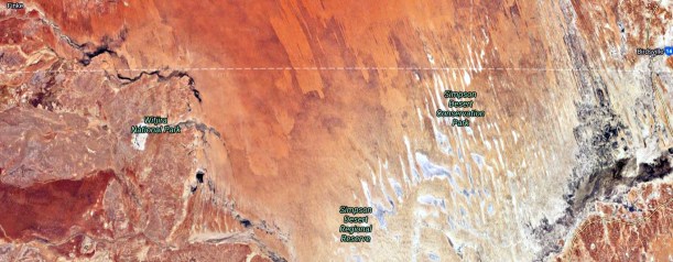
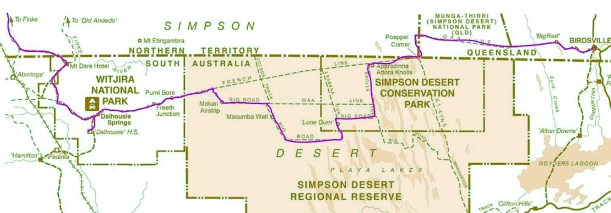
MONDAY 16 AUGUST    PURNI BORE TO RIG ROAD SOMEWHERE   136kms

I crawled out of the tent about 7am and joined the queue for the shower. This was my last chance to be clean for a few days, and especially to wash my hair. We are conserving our water, so after this it will be Baby Wipes for getting clean! It was a very pleasant and appreciated shower.

We did not leave Purni until after 10. John had to program the GPS after we were packed up. It seems to be a very fiddly process. He also emptied one of the fuel jerry cans from the roof into the tank – less weight on the roof now.

We let the Truck tyres down to a softer pressure, as we will hit the dune country properly today.

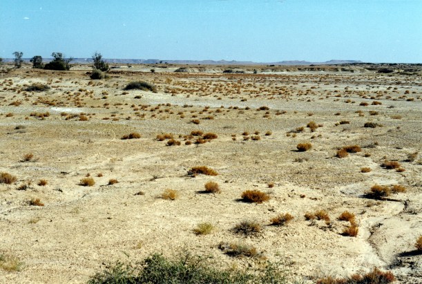
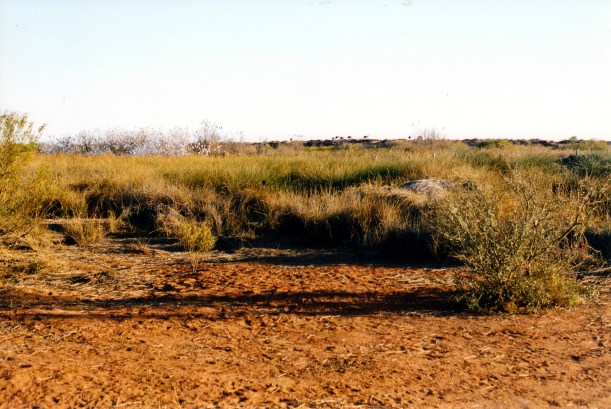
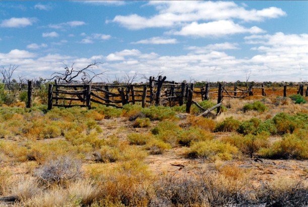
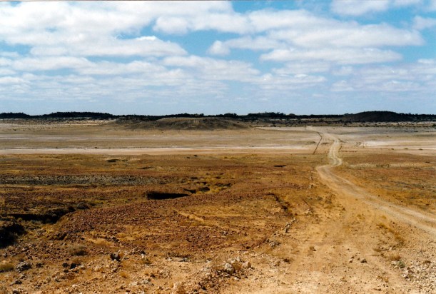
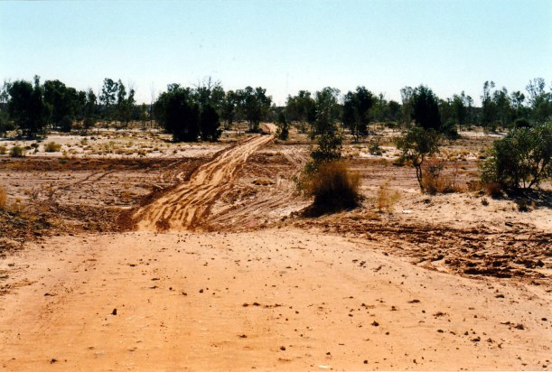
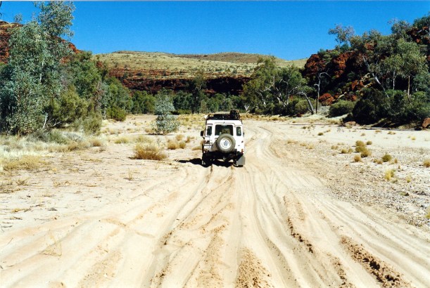
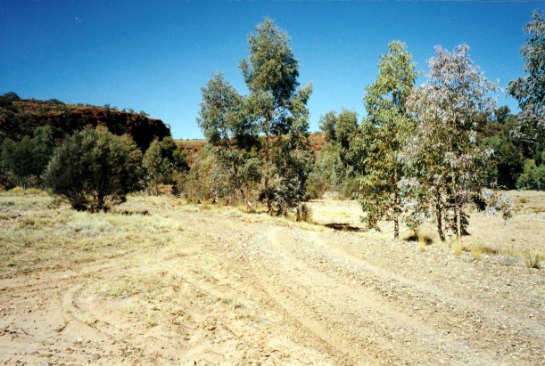
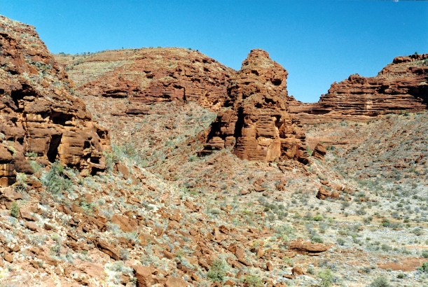
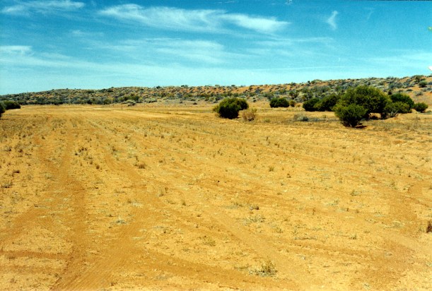
We drove out along the French Line and were soon into small dunes. The track was not too bad, but needed care in driving. The sections between dunes were far more vegetated than I had expected.

08-16-1999 between dunes french line.jpg

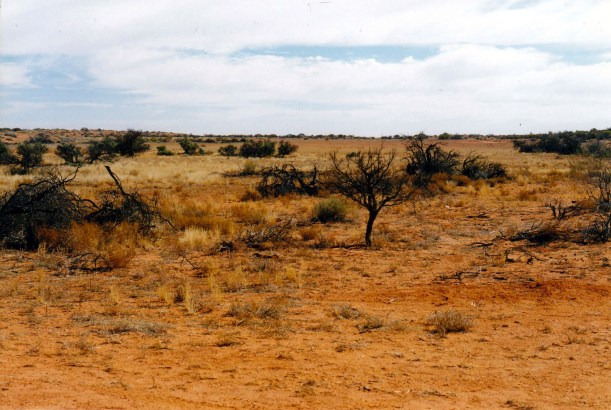
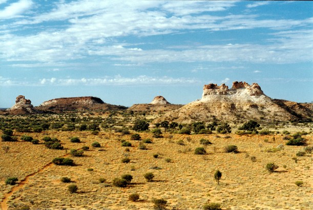
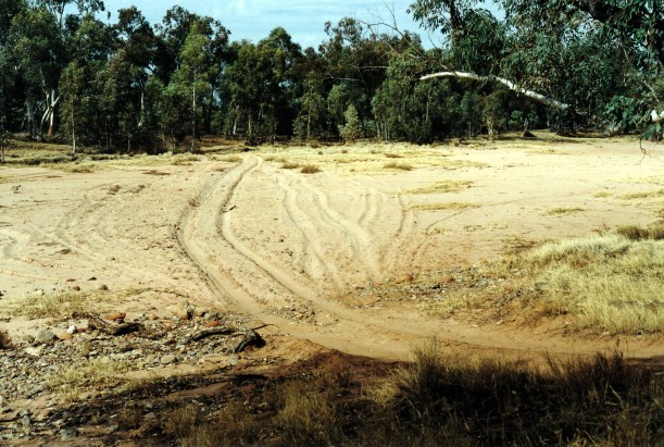
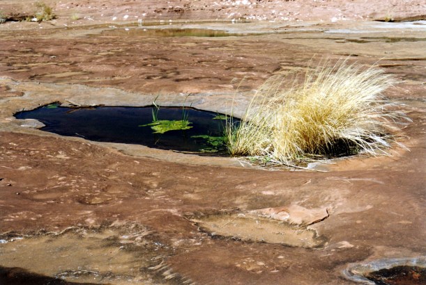
Between the dunes – the western end of the French Line track. Not all that desert like.

08-16-1999 01  french line near purni.jpg

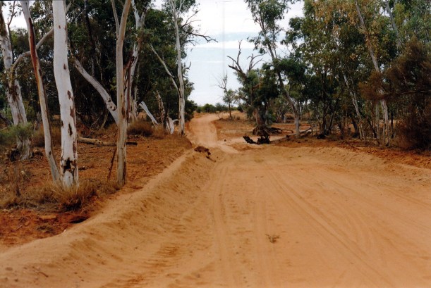
The French Line track not far from Purni Bore

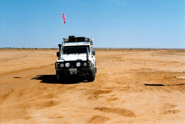
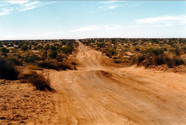
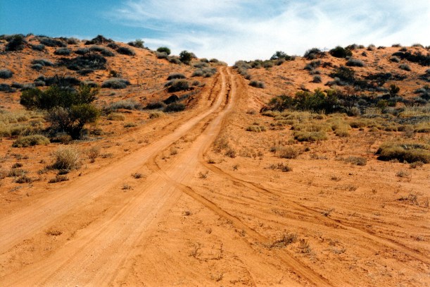
It did not take us too long to cover the 30kms to the French Line/Rig Road corner. At that corner, which was signposted by one of the Oodnadatta Pink Roadhouse signs, we turned to the south, onto what appeared a much better track – initially at least.

08-16-1999 03  cnr French and Rig roads.jpg

French Line straight ahead. Rig Road to right

08-16-1999 04  cnr french and rig.jpg

Our first N-S run between the dunes was quite a good track, but it was obvious that the dunes were getting higher around us.

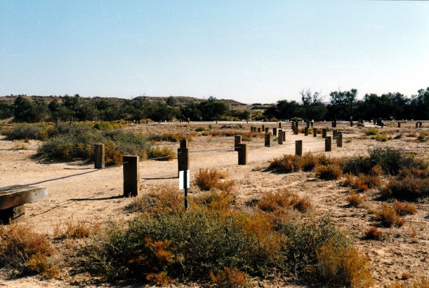
We stopped briefly at Mokari Airstrip, once used to service the oil rigs, but now for emergency use only.

08-16-1999 05  Mokari oil well former  airstrip.jpg

Mokari Airstrip

08-16-1999 06  Rig Rd at Mokari.jpg

The Rig Road at Mokari Airstrip

After the airstrip, we were onto a W-E section, and dune crossings, for some 36kms, to the junction with the WAA Line track. We had lunch here.

08-16-1999 07  rig road.jpg

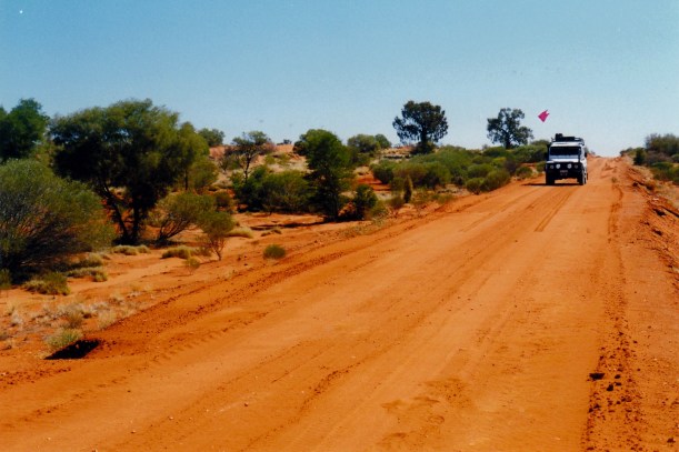
The straight line of the Rig Road on a west to east section

08-16-1999 08 cnr Rig rd and WAA Line & bad rig tk

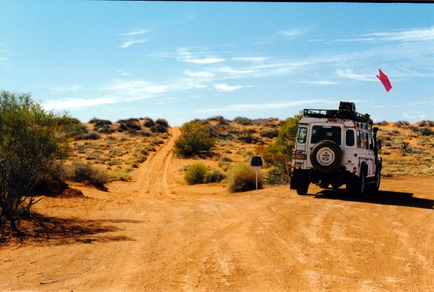
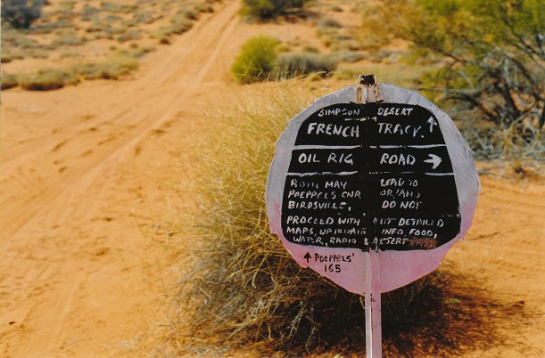
Corner of Rig Road and WAA Line. We go right.

The next 35kms was SE again, mostly between dunes, though we crossed the occasional one.

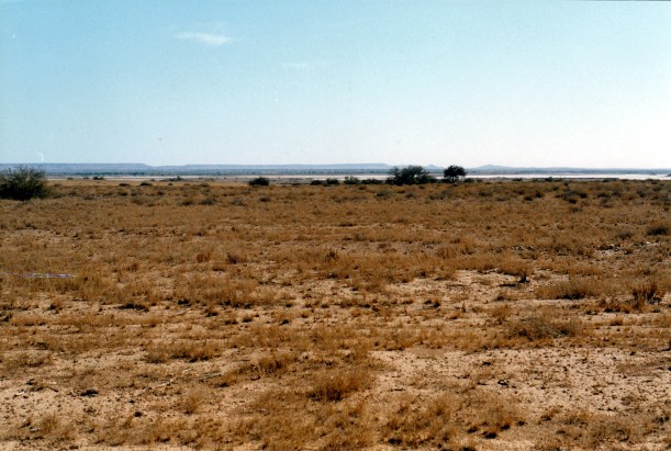
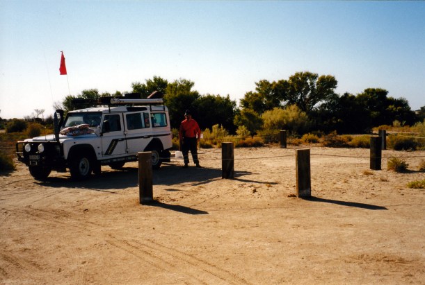
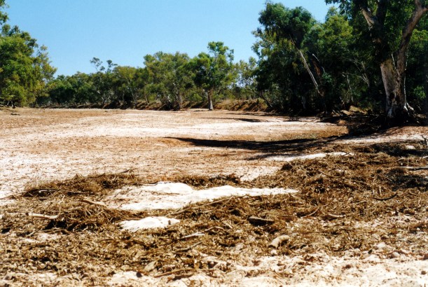
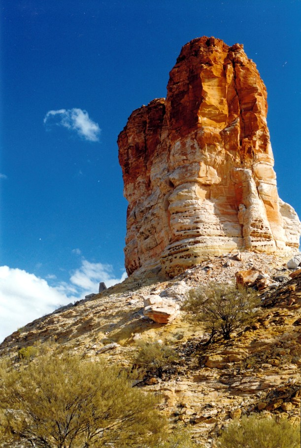
Stopped to look at the Macumba No 1 Well, now closed down.

08-16-1999 10  Macumba No 1 oil bore.jpg

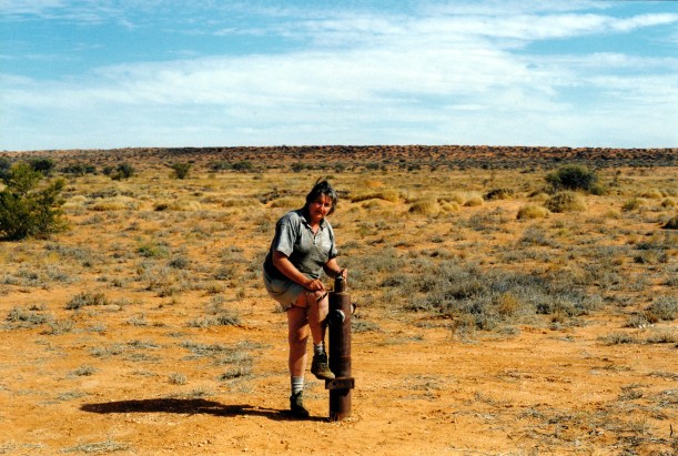
The shut down Macumba No 1 oil well

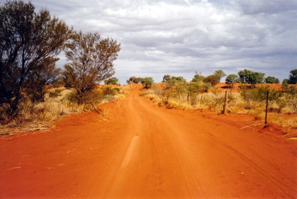
Our final leg for the day was back to heading east, and crossing dunes regularly.

08-16-1999 rig rd e to w

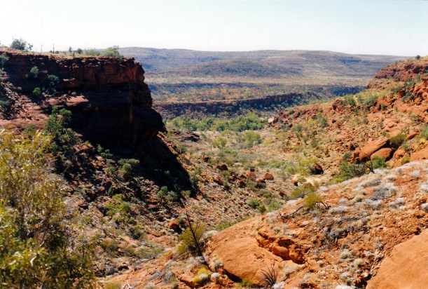
Looking back to the west along the Rig Road, and down the easier slope up the western face of the dune

I drove some sections today – the first run south, to Mokari, and later some of the W-E track, including some quite badly broken-up east faces of dunes, with big gullies. I did not find it any hassle – quite enjoyed myself – and John was being an excellent passenger.

08-16-1999 09 rough tk wendy driving

I drove this section of the track. The eastern face of the dunes were often cut up and eroded

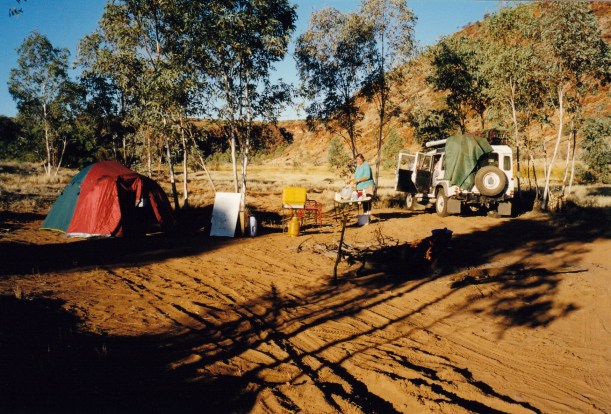
We stopped for the day about 4pm, some 25kms before Walkandi Junction, in a valley between dunes.

We had not seen any other vehicle since leaving Purni – which made us feel pleasantly isolated.

John was able to get through for the afternoon radio sched.

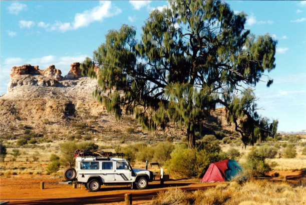
Set up the tent, trying to angle it into some low bushes, for a little protection – maybe – should camels come through!

08-16-1999 12  rig rd camp.jpg

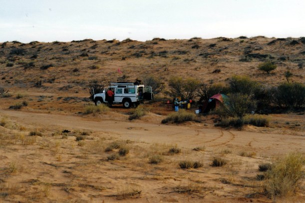
Our camp beside the Rig Road

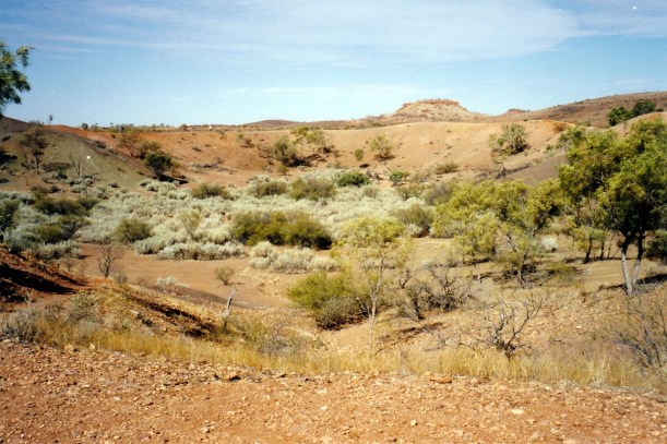
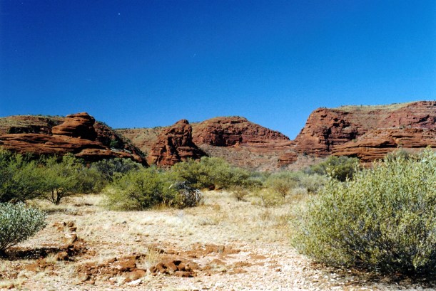
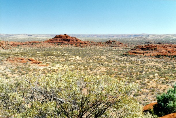
The dunes we crossed today were really varied. There is nothing boring about this desert!

08-16-1999 11 dune patterns Rig Rd.jpg

Sand dune patterns

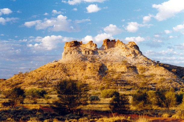
There had been some light bits of cloud in the sky during the day, and this made for some pretty pastel sunset effects. It got cold quickly, once the sun went down.

08-16-1999 14 rig rd sunset.jpg

Sunset coming. Evening light on the dunes at our Rig Road camp

Tea was a tin of soup and a packet of macaroni cheese. I cooked some dried apricots in a little water for dessert.

We bundled all the fridge stuff that was now going off into a double layer of garbags and left it in the fridge.

We had wood on the roofrack, that we had gathered a couple of days ago, so were able to have a campfire to sit round after tea.

08-16-1999 15 Rig road camp by fire

We read, and watched the stars, which were so bright. It was a most enjoyable evening. At one stage, I walked up on to the high dune behind us and looked all round – there was just pure darkness in every direction. No sign of any other people. Just occasional rustlings from little critters.

We slept well.


Leave a comment

1999 Travels August 15

SUNDAY 15 AUGUST   DALHOUSIE SPRINGS TO PURNI BORE   75kms

We were up at 7.30. It was a day with blue sky but was not hot.

Left Dalhousie at 9.30am.

The country we passed through today varied a little. We had claypan bog areas to begin with – the claypan Spring Creek delta, with the evocatively named Gluepot Bog. There was some sandy plain country, stony in parts. There were the occasional jump ups, just to be different. It was not really hard to drive.

08-15-1999 03  Spring Ck delta and Dalhousie mound springs 2.jpg

Spring Creek Delta and extinct Dalhousie mound springs

08-15-1999 05  Glue Pot bog Spring Ck Delta Tk.jpg

The Gluepot Bog

Not far from Dalhousie, there was a dingo beside the track. He was quite a big one. We were able to get quite close to him, for photos.

08-15-1999 04 dingo near dlahousie

One of the locals – good looking dingo near Dalhousie Springs

We trended north east across the flood-out country for much of the way.

At Freeth Junction, where the closed Macumba track comes in from the south, there was a display board with emergency contact details, and instructions for radio use. Here, we really began to feel isolated.

08-15-1999 07  freeth junction.jpg

Sign at Freeth Junction

It is around Freeth Junction that the Finke River disappears into a salt pan in the Simpson Desert.

08-15-1999 06 Freeth Junction where Finke ends in desert salt pan

The ancient Finke River ends in a salt pan near Freeth Junction

We used the HF rdio to phone K, from here. It was a clear call, for once. He confirmed that he had received our instructions and understands the seriousness of reporting to authorities, if we have not contacted him by the date specified. He is our safety net, along with the trip plans we’d left with Alice Springs Base.

08-15-1999 08  Freeth Junction looking back.jpg

At Freeth Junction. The track we came in on trends to the upper right of the photo

Beyond Freeth Junction, sand dune country gradually began. By the time we reached Purni Bore, were definitely in dune country.

The long parallel dunes of the Simpson extend in a general NW-SE line. There are over 1100 dunes from Birdsville, stretching up towards Alice Springs. Some are 200kms along. It is the largest sand dune desert in the world. Before finding out more about the place, I had envisaged something like the Sahara, but the Simpson dunes are vegetated enough to be, largely, fixed in position.

08-15-1999 simpson desert pic.JPG

What the Simpson Desert looks like from space

We do not have to cross all 1100 dunes, as some only begin to the north of here. But we will tackle several hundred of the things. I will not be counting! Going the way we are, we start with the lowest dunes – maybe 3 metres or so – and gradually build up to the bigger ones in the east, around30 metres high. By then, we will have had plenty of practice at climbing dunes. Also, going this way, we will be going up the less steep side of each dune. They have been shaped by westerly winds, so the east side is the more steep drop-off side.

The tracks that we will be following now, were put in by companies exploring for oil and gas in the 1960’s and 70’s, and sinking wells.  Reg Sprigg – of Arkaroola fame – surveyed the first seismic line across; this became known as the French line, because the French Petroleum Company did the first geological survey along this. Essentially, it runs in a broadly straight line from Purni to the Qld-SA-NT border at Poeppel Corner. It is the route most commonly taken by Simpson travellers, partly because it is the shortest, partly because of its reputation for challenging dunes.

We planned to be different and take a more roundabout route. This would enable us to see more of the Desert, hopefully for some of the time be away from the more popular parts, and also be somewhat easier, as for some of the way we would follow the Rig Road. This route was developed to service oil and gas operations; it was graded and clay capped, to be able to carry trucks. Much of this has broken down in the years since it was used, and it is 4WD only, now.

As well, our route would take in some N-S tracks, in between the parallel dunes, rather than always going across them as the French Line does. We still will have to cross the things, but the inter-dune tracks will provide variety.

08-15-1999 simpson desert

Our planned route across the Simpson Desert

I was expecting that there would be more travellers on this first part of the way, where we are on the French Line route, and the more popular E to W way. But it was a surprise that in the 75kms from Dalhousie to Purni, we passed only three vehicles coming towards us.

We were the first to set up camp at Purni Bore – another surprise. So we were able to pick a spot where there were some low bushes around us. The camp area here was not dusty like Dalhousie was.

08-15-1999 15  Purni Bore camp.jpg

Our camp at Purni Bore

While we were setting up the tent, several vehicles from a Melbourne 4WD club came and set up nearby – guess we must have picked the most attractive part of this fairly extensive area! Later, another four vehicles arrived. One lot, with children, camped right behind us, despite there being lots of other space around! There are times that I hate other travellers….. At least, the group with the feral kids, from Dalhousie, did not appear – we had dreaded them tagging us this far.

Purni was beautiful, in a surreal way. The water from the bore is so hot that it steams for a while after it runs into the pool area. Dante’s Inferno came to mind.

08-15-1999 11  purni bore.jpg

The steaming outflow water at Purni Bore

08-15-1999 10 Purni the bore

The bore at Purni

There are no pools to swim in, here. The water is too hot and too polluted by feral camels and donkeys. But there is a hot shower and a laundry tub with hot water, along with the long drop toilet. It is all kind of anachronistic amongst the dunes.

There were lots of birds – water birds, bush birds and hundreds of corellas clustered in one area of trees. We spotted crimson chats – hadn’t see those before.

08-15-1999 09 Purni Bore & emus

Purni wetlands and emus

After camp was set up and lunch was had, we walked around the perimeter of the wetland area. Like at Coward Springs, this is here because of the bore outflow. Purni Bore has been capped, in recent times, to limit the outflow, so the wetland is not as extensive as it once would have been.

On our walk, saw a mob of about eight camels. Later, near sunset time, these appeared on the dune skyline.

08-15-1999 16   camels Purni Bore.jpg

The extra vegetation, and the water, attracts camels

We wanted a photo of the corellas rising from the trees, so John walked around that way to see if some would take flight. He made a noise and there was a mass takeoff. It was a pity I couldn’t capture the very loud and raucous noise they made, as well as the image! It gave John quite a fright.

08-15-1999 13  purni corellas.jpg

Corellas taking fright

08-15-1999 14 view over Purni Bore to camp area

Looking over the Purni wetlands to the camp area, ar right

By the time I’d gotten things organized for tea, there was a queue at the shower, so I gave up on that, because we did not want a late tea. Then John got fiddling with the GPS and didn’t want to stop, so tea was late after all!

We ate tinned soup, a stew made from chick peas, kumara, spinach and tomatoes. So tea used quite a few tins and we lightened the load in Truck.

After tea, went and sat round the campfire (bonfire!) of the 4WD club. Talked with them. They had, between them, had a lot of varied experiences. They had just come from the Canning Stock Route – a trip that took them two years to plan. They seem very well organized. It was a pleasant, convivial evening, if somewhat cold.

The fridge did not work again, this afternoon, so we have finally given up on it.


Leave a comment

1999 Travels August 14

SATURDAY 14 AUGUST   MT DARE HOMESTEAD TO DALHOUSIE SPRINGS   86kms

We got up about 7.30. Before breakfast, we walked around the campground area, looking at birds. There were a number of red-tailed black cockatoos in the trees and we watched their antics for a while.

It still took us nearly two hours to breakfast and pack up, but it gets easier each time as we work into the routine of where everything goes.

08-14-1999 02  cleaning tent mt dare.jpg

Cleaning out the tent – morning at Mt Dare

Topped up the diesel here, and also one jerry can, which we’d carried empty until now, in preparation for the long stretch across the desert. Fuel was $1.15 cpl! We filled the empty 10 litre water container with local water, too.

Advice was that the longer track to Dalhousie, via Blood Creek Bore, was in better condition, so we chose to go that way. There is not far to go today, so the extra distance and time is not an issue.

08-14-1999 04  on the way to Dalhousie.jpg

Track intersection at Blood Creek Bore. John checking the roof rack tie downs

It was another blue sky day, but with that cool wind again.

We stopped a few times along the way, mostly for photos, though the old yards at Federal ruins were interesting to wander about and look at. This station became part of the Dalhousie pastoral run.

08-14-1999 03 yard ruins federal now witjira np

Old yards at former Federal Station – now part of Witjira National Park

Another stop was to photograph the Red Mulga, miniritchie, with its unusual curly bark.

08-14-1999 06  red mulga.jpg

Red mulga – miniritchie

Today was a pleasantly short one, after the long one of yesterday.

Dalhousie Springs is in the Witjira National Park, so most of today’s driving was in the Park, which is quite a new one. It segues into the Simpson Desert Regional Reserve to the east. To travel and camp here was why we bought our Desert Parks Pass, when we were at Wilpena.

Dalhousie Springs are more of the mound springs noted further south. In this area, there are a number of extinct mound springs, due to the level of the water table dropping.

We reached Dalhousie Springs before lunch time. The campground was rather dusty and barren. It is being redeveloped after much indiscriminate usage and degradation. Now there are defined camp areas, revegetation happening in fenced off sections, and access to the springs is only on foot.

08-14-1999 12  Dalhousie Springs campground renovations.jpg

The approach and camping area at Dalhousie Springs

08-15-1999 01 Dalhousie camp spot

Our chosen camp site at Dalhousie

The springs are a big waterhole, fringed with scrub and reeds. Obviously they are a major oasis in this very arid area. There were some water birds here, including a spoonbill perched in a tree.

We had lunch and set up camp, then went for a drive to look at the Dalhousie Homestead ruins, some 12kms to the south. Dalhousie was a pastoral cattle lease, from the later part of the 1800’s, and the buildings dated from that time – at a spot where there were local springs.

08-14-1999 10  dalhousie ruins.jpg

Dalhousie Homestead ruins

We wandered about there for a while. The limestone ruins, with their associated date palms, were quite striking. It seems a very desolate area, but there was obviously a substantial cluster of buildings here, at one time.

08-14-1999 08  Dalhousie ruin.jpg

Dalhousie ruin. Date palms may have been planted deliberately, or may have been carried in accidentally by Afghan cameleers

We saw a flock of Bourke’s Parrots – first time we have seen these birds. They are nor much bigger than a budgie, and are a rather pale grey-brown, with some pink and blue areas. Very pretty.

We drove back to camp, to find a group of travellers – families – setting up in the bays near us. There were several adults and a heap of totally feral young children. Not our idea of ideal neighbours! Whilst the adults sat round their camp, drinking beers at a great rate, the kids ran riot, including through the fenced off revegetation areas, with their Keep Out signs.

We planned to go for a swim in the springs pool after getting back from the ruins. The water is the temperature of a rather warm bath. At one stage, the mob of feral children seemed to be campaigning with the drinking parents to be allowed to go run riot in the pool. I made a comment to John, designed to be heard by some of the brats, about watching out for crocodiles in the pool. Half an hour later, when we went for our swim, there was not a kid to be seen! And I did not feel at all mean or guilty.

08-14-1999 11 dalhousie springs

Dalhousie Springs pool

We swam for nearly an hour. It was very refreshing, but it also felt really chilly when we got out.

Did our radio sched with Alice Springs base.

The fridge did not start working when we turned it on. John eventually turned it off, after some hours with no cold building up on the elements. We will just have to manage without it. It is really only margarine, cheese, eggs and a few vegies that are in it now.

Tea was packet vegie soup, fried rice from a packet, with the addition of capsicum, onion, fried eggs. The packet fried rice does not take as much water to cook as “fresh” rice.

After tea, we read for a while, lacking the energy to do much else, like go walking. Maybe our energy was sapped by the long, hot “bath”?

There were lots of mosquitoes here. We got a number of bites before wising up and applying repellent.

A Ranger – aboriginal – came around after dark to check that we had camp permits or Desert Park Passes. Very pleasing to see such things being checked. He told us that there has not been rain that affected the tracks in these parts for two and a half years. But, back then, there were campers stranded at Purni Bore needing air drops of supplies. It is hard to visualize now, with it so dry. Although, having crossed Tenacity Bog, on the approach to Dalhousie, we could see it being a problem when wet!

08-14-1999 07 approach to dalhousie tenacity bog

Tenacity Bog, on the approach to Dalhousie Springs

We heard dingoes howling in the night, not too far away. I love that sound.


Leave a comment

1999 Travels August 13

FRIDAY 13 AUGUST   CHAMBERS PILLAR TO MT DARE HOMESTEAD   311kms

We woke up at 7am. The night had been a bit too chilly and the lilo not comfortable enough to sleep well.

Again, it took us nearly two hours to breakfast and pack up.

It was a lovely clear day, but cool – I kept my windcheater on all day.

The route back to Maryvale seemed easier than it had yesterday. The fact of having driven it once turns it from the unknown to the more familiar. At Maryvale we bought Mars Bars, bottles of cold water and fuel – 98cpl.

Then we went back the way we’d come, yesterday, as far as the Rodinga Siding ruins, on the Old Ghan rail route. We stopped there, to put up a makeshift sand flag on Truck. John had pre-planned the construction of this, using the broken CB radio aerial and a bright pink piece of rag, from his stock of same; it had once been a T shirt. He tied the lot firmly to the roof rack. Quite effective and cheaper than buying a proper one. Sand flags are mandatory in the coming sand dune country, to give approaching vehicles some advance notice of one’s  presence.

08-13-1999 01  Rodinga ruins and flying the flag.jpg

At Rodinga ruins, flying our new sand flag

Then it was onto the Old Ghan Track, heading south for Finke. At the start of this section, driving on the old rail alignment was a novelty, and we mixed road tracks and old rail alignment. But by the time we reached Finke, we had in fact, travelled most of the way on the rail alignment. It was much smoother than the road tracks, the latter having been used not long ago, for the Finke Desert Race, and really churned up. However, some track sections did appear to have been recently bladed.

08-13-1999 04  road contrast.jpg

The churned up road track

08-13-1999 02  the Old Ghan Track.jpg

On the Old Ghan Track, with the alternate road beside it

The problem with the rail route was that there were lots of big metal spikes, once used to anchor the sleepers, still lying about, and these are risky for tyres. But we preferred to chance that, rather than get bogged, or break something, on the road tracks.

The countryside we travelled through today was mixed – some red sand dune country, some flat-topped mesa country, some river plains and flats, gibber stone plains in the south – some country similar to that around Oodnadatta. So it was a day of considerable variety.

08-13-1999 03 old ghan tk

Red sand dune country

The first section, from Rodinga to Finke, had lots of arrow signs and X markers, relating to the Desert Race.

Just as on the southern section of the Old Ghan Track, that we’d tackled earlier in the year, there were the ruins of former sidings, at regular intervals.

We stopped to have our lunch at the historic Alice Well, by the crossing of the dry Hugh River bed. There are some stone building remains there – what is left of the former Government Depot and Police Station.

08-13-1999 06  ruin govt depot alice well.jpg

What was left of the old Government Deopt at Alice Well

I had the lunch makings of Ryvita biscuits, cheese, vegemite, in the picnic basket and the fridge – which John had made sure was accessible easily. The fridge does not run while we are travelling, but the theory is that the contents stay cold through the day, anyway. The chill breeze, flies and dust dictated that I prepared the food in the passenger side footwell of Truck. It is actually quite convenient.

08-13-1999 08  lunch by tk.jpg

Making lunch by the side of the track

08-13-1999 07  Hugh R bed at Alice Well.jpg

The bed of the Hugh River at Alice Well

Next we stopped to have a look around the remains of the old Bundooma Siding. There is not much left there now. There were some foundations and the old water tank on its stand.

08-13-1999 05  Bundooma Siding ruins.jpg

The reamins at Bundooma Siding

At Engoordina Siding there were remains of the fettlers’ accommodation – really close to the rail alignment.

08-13-1999 09 Engordina Siding ruins

Engoordina Siding ruins – very close to the rail alignment

I took a photo of Colsons Pinnacle at a point where there was a good view of it in the distance. This is somewhat similar to Chambers Pillar – another erosion feature and a landmark for earlier explorers and travellers, because of its distinctive shape. It was also known as the Maiden’s Breast! It, and the surrounding mesas, are two toned, with alternating layers of light and dark rock. The horizontal line of separation of these is so straight it could have been drawn with a ruler.

08-13-1999 10  colsons pinnacle.jpg

Colsons Pinnacle

I drove for some of the way, each side of Finke.

The river bed at Finke was wide, sandy and churned up, but we ploughed through fairly easily.

08-13-1999 finke river.jpg

Our old friend, the Finke River

08-13-1999 11 finke river crossing

The track through the river bed at Finke

After Finke, we left the old rail route, and headed more to the west and south west, on dirt roads and station tracks. It was  stony country now, and more monotonous as the mesa country was left behind. There was almost no other traffic. There were gates to open and close, of course. Landmarks that reassured us that we were going the right way – very few signposts! – were New Crown Homestead, Charlotte Well, then crossing from the NT into SA.

08-13-1999 12 bulldust Finke Mt Dare rd

Going around a section of bad bulldust on the Finke to Mt Dare track

The waypoints that John put into the GPS yesterday, were mostly right and were an extra reassurance. However, we did go the wrong way for a short distance, south of Charlotte Well, where there were several tracks. It was a good thing that I was navigating, as well, and had my Westprint map, and realised we were on the Abminga track, not the one we wanted to Mt Dare.

We reached Mt Dare – homestead, hotel, campground – about 4pm. There was no one else in the campground. The man obligingly opened the bar, so we could each have a beer! To camp cost us $5 each, the beer was $3.50 each. John bought a cask of riesling that he saw there – $25! He’d asked for it before he knew the price.

The camp area was alright. Some bushes for shelter, bare dirt – as one would expect out here. They lit the hot water “service” for our showers – made out of an old, tall, LPG cylinder – ingenious. We enjoyed that shower, too.

08-14-1999 01  Mt Dare camp in morning.jpg

Our Mt Dare camp – with visitng willy wagtail

By sunset, there were lots of galahs in distant trees and they squawked on and off, well into the night.

The fridge was set up on gas, again. It is working, but does not seem to be cooling as quickly or as much as usual.

Tea: mushroom soup from a packet, with dried milk powder used to make milk for it. Then fettucine, with a bottled tomato sauce.

After the radio sched, John did work on tomorrow’s waypoints to take us to Dalhousie Springs. I wrote up the diary and some cards.

It was quite a chilly night, so we did not sit up too long.

08-13-1999 mt dare

From Chambers Pillar to Mt Dare


Leave a comment

1999 Travels August 12

THURSDAY 12 AUGUST   STUARTS WELL TO CHAMBERS PILLAR   167kms

We were up at 7.30am, after a good night’s sleep, despite the occasional waft of odour from the camel farm next door.

Again, it took us two hours to breakfast and pack up – this is starting to look like the norm.

John topped up the diesel at the Roadhouse – $1.00 cpl.

Took the Stuart Highway south, for 10kms, then turned east onto the unsealed High Stock Route. This road appeared to have been recently graded and was in quite good condition, apart from a couple of bulldust patches that pulled Truck to one side when we ploughed into them.

And this road had gates! Lots of gates. I must have opened and closed at least eight of the things, in about 60kms.

08-12-1999 01  hugh stock route.jpg

Just one of many gates on the Hugh Stock Route

As the name suggests, this route roughly parallels the Hugh River, for some of the way, but at too great a distance to really see it. After nearly 40kms, we crossed the Adelaide to Alice Springs rail line – carefully stopping and checking that there were no trains looming in the distance. We drove beside the railway for a short distance, before crossing the Hugh River bed; the nearby rail crossing was on a nice high bridge.

After another 25kms, came to the junction with the Old South Road – also unsealed – and turned south. The road was alright.

It was some 33kms to Maryvale Homestead. For a little way, the road ran close to the alignment of the Old Ghan rail route, before it swung away to the SE. We did not sidetrack to visit the Rodinga siding ruins at this point, being focussed on getting to today’s destination of Chambers Pillar.

We stopped at the store at Maryvale and bought biscuits and a tin of smoked oysters – these would be lunch. Bought a map, and some coke. All this cost $25. At least, we were able to use Visa for it.

Now we deviated from the Old South Road onto the track to Chambers Pillar, to the south west of Maryvale. After a few kms, stopped at the crossing of the Hugh River to eat our impromptu lunch. Buying the makings at the store saved having to unpack anything in Truck, apart from the board, plates, knife, tin opener that I carry in the picnic basket on the back seat, with the thermos and drink makings.

08-12-1999 hugh river near Maryvale.jpg

The dry Hugh River bed, near Maryvale, where we stopped for lunch

After that, the track varied from good to challenging. There were bulldust patches at times.

We stopped to add to the firewood supply that we already had tied up on the roof rack.

08-12-1999 02 firewood

Gathering more firewood from beside the track

The crossing of the Charlotte Range, that other people had told us was hard, seemed easy enough to us. From here, we caught our first look at Chambers Pillar – distant, but quite clearly an impressive, slender column. There were surrounding flat topped hills, just like we’d seen further south, on the Oodnadatta Track.

08-12-1999 03  first views of Chambers Pillar.jpg

First look at Chambers Pillar, on the centre horizon. Track is indicated by the red line in the sand

The sand dunes that came after the Range were more challenging. This was the only section of the track in where we might have had problems, had we tried to bring the van in here. John had to have two attempts at one dune, after taking the wrong route the first time.

08-12-1999 04 range behind on cp tk

Tackling a dune. The Range crossing is behind us on the horizon

08-12-1999 tk to chambers pillar.jpg

In places, the track was quite good

Chambers Pillar is a sandstone column that stands about 50 metres above the surrounding country – therefore it has been quite a landmark for earlier travellers and explorers. The first to see it, and name it, was John McDoull Stuart, in 1860.

08-12-1999 05  chambers pillar.jpg

Chambers Pillar

The colours of the Pillar, and the nearby eroded landforms, remind me of Rainbow Valley, so I am guessing that the same factors caused there to be more resistant red sandstone at the top.

08-12-1999 10  Castle Rock and Window Rock.jpg

Window Rock (left) and Castle Rock (right) are close by to Chambers Pillar

We reached the camp area, 45kms from Maryvale. This is near the base of the Pillar. The camp area is small, but very pleasant, with desert oaks that give some shade. It is a very scenic place to camp, between the Pillar and Castle Rock, which is even more impressive, I think. It has greater complexity and therefore more moods as the light changes.

08-12-1999 06  Castle Rock and campground .jpg

Castle Rock and part of the campground

We paid $5 in camp fees – honesty box system. There were several other lots of campers there, so we had no real choice about where we fitted, but we did like the bay we got into. We had a fire pit/BBQ plate, a low table platform, and there were pit toilets for the campground. Very nice.

08-12-1999 13  camp ch p.jpg

Our camp at Chambers Pillar, with Castle Rock behind

Set up as quickly as we could, then walked to the Pillar, which was only about 500 metres away. We walked around the base and scrambled up the scree slope to the base of the rock pillar, proper. This was a steep little climb.

08-12-1999 pillar from below

We had to scramble up this loose scree face to reach the base of the Pillar

Some workmen were there, building a walkway around the western face at the base of the rock part of the Pillar. The workmen were camping here too, accounting for why the campground seemed fuller than we’d expected.

08-12-1999 07 Chambers Pillar east face

The eastern face of Chambers Pillar

Apparently the platform  is needed due to erosion by tourist, like us. Hopefully, it will stop these same tourists from carving their initials into the Pillar – we saw too much evidence of that. What is it about some people that they must do moronic stuff like that?

The platform will impinge on photos of the sunsets, though. It is a very photogenic place. We were lucky to have blue sky, with just a few bits of cloud, for interest, without spoiling the light.

08-12-1999 12 Chambers Pillar west face

The western face of Chambers Pillar, and the partially built walking platform at its base

There were great views from the base of the Pillar, out over the surrounding country. We looked for a while in the general direction we plan to head after this. It looks big country! In a place like this, I feel very small and insignificant.

08-12-1999 08  country sth of Pillar where we going.jpg

The view from the base of the Pillar, towards the south, where we are going next

We wandered about for a while, taking photos. There was no shortage of material as different angles and vistas opened up. Did some more of this, later, as the sun was going down – wonderful colours.

08-12-1999 15  sunset Window Rock.jpg

Late afternoon sun on Window Rock

08-12-1999 14 sunset on castle rock and camp

Castle Rock – late afternoon light over the camp ground

John did the radio sched with Alice Springs base.

Tea was a packet minestrone soup, and a Hawaiian tofu stir fry. Quite enough to satisfy.

We noticed lots of predatory crows in the campground – have to be careful not to leave anything unguarded that they might want to investigate.

The Chescold fridge appears not to be working! We disconnected it from the gas, emptied it, turned it upside down and shook it for a while, then talked nicely to it. Put it all back together again and now can but hope. Past experience has taught us that sometimes gases or chemicals or something, settle and compact on rough roads, and a good shake up is all that is needed. It will be a real nuisance if it has decided to really break down.

After tea, John worked on more map and GPS entry. I just sat about, taking in the solitude and the night noises.

Later, it seemed the fridge was working.

The night was cool, but not cold.

08-12-1999 chambers pillar.JPG

The route to Chambers Pillar


Leave a comment

1999 Travels August 11

WEDNESDAY 11 AUGUST   BOGGY HOLE TO STUARTS WELL   174kms

We had a good night’s sleep. Woke to a day that was warm, but with high cloud coming in rapidly.

Got up at 7.30. It took us a couple of hours to breakfast and pack up – no hurry.

Then we continued on along the Finke. Crawled past the other campers, who all appeared to be staying longer. The track at this point (the waterhole) was – obviously – up on the bank at the side of the river. But soon it was back to alternating river bed driving with criss crossing and bank driving.

08-10-1999 12 track at Boggy Hole.jpg

The track goes up the river bank – and some have had difficulty here

The river sections were a mix of sandy wheel ruts, then river stone sections.

08-11-1999 03 in finke flood debris.jpg

A stony section of the Finke River bed

08-11-1999 04 looking back at Finke Gorge from sth of Boggy Hole

Looking back up the Finke Gorge, from the track south of Boggy Hole

Occasionally the track deviated away from the river, through higher mulga country, cutting across where there was a big bend and meeting the river again.

It certainly is a majestic river. It would be impossible to see it in full flow, except from the air, in the Finke Gorge section, but it would be quite something.

08-11-1999 06 Finke R crossing looking upstream.jpg

The Finke River, south of Boggy Hole, looking upstream

Truck handled the difficult conditions really well.

08-11-1999 05 crossing Finke south of Boggy Hole

The track criss-crossed the river

We came to a sign that marked the exit point from the National Park – a rare man-made landmark on this route.

08-11-1999 07 leaving finke gorge np.jpg

Leaving the National Park

It took us a couple of hours to get from Boggy Hole to the Running Waters Yards – relics from older pastoral times. It is here that the Finke swings east and the track goes west, for some 12kms.

08-11-1999 09 pastoral relics Running Water Yards.jpg

Running Waters Yards

Just before we got to the Yards, met a vehicle heading north – the only vehicle we’d encountered in two days, at that time. It was noon, and he was aiming to make Palm Valley! He had no idea of how rough and slow the track was about to become.

At the next track junction, we debated whether to keep going on the side track to Ilamurta Springs and old police station ruins, to the west. I’d have liked to go there and camp the night, but John preferred to keep going on our main objectives. So we turned to the south.

From here, the route was across low red sand dunes, in fairly flat country. The river red gums were replaced by desert oaks. On this stretch we met a group of five vehicles, towing camper trailers. They would soon be encountering difficulties on some of the sandy, rough, steep river bank sections to come. We’d thought a few of these entry and exit points a bit reminiscent of the OTL Track on Cape York! But without the water. The young couple that we spoke to yesterday, at Boggy Hole, had needed to snatch a Disco towing a camper that was stuck on that section.

John wished the group luck!

08-11-1999 10 track south of Running Water Yards.jpg

The run south to the Ernest Gikes Road

After a rather faster, but much less interesting run to the south, we came to the junction with the Ernest Giles road, and turned east. This is the unsealed route that cuts from the Kings Canyon road, across to the Stuart Highway.

We stopped to eat our lunch at the dry Palmer River crossing. The country now was markedly different to that around the Western MacDonnells to the north.

08-11-1999 11  Rogers Pass scene Ernest Giles rd.jpg

At Rogers Pass, on the Ernest Giles Road

08-11-1999 12  lunch palmer river.jpg

Lunch stop at the dry Palmer River crossing on the Ernest Giles Road

The Finke Gorge was an excellent little trek and I am very glad that we did it.

Not long before we reached the main highway, we turned off to the north, to drive for 5kms along a track to the Henbury Meteorite Craters. A few thousand years ago, a meteorite heading for Earth broke up in the atmosphere and the pieces impacted here, making craters of varying sizes.

We walked the few hundred metres to look at the main crater. It was definitely worth the short detour. Without knowing its origins, one could think it was a very large, partially filled-in quarry. Or an old volcanic vent – had there been volcanoes anywhere around here!

08-11-1999 13 henbury meteorite crater.jpg

Henbury Meteorite Crater

We were hot and thirsty by now. It was sunny, though there was some cloud still. Conditions were such as to make us look forward to the end of the day’s driving.

Reached the bitumen Stuart Highway and turned north. We soon crossed the Finke, yet again, but this time via bridge. The river here was wide, with the sandy bed we were used to, and multiple dry channels. I thought that floods here would cut the highway, for sure, given the low level bridging.

After  40kms, we came to Stuarts Well, with its roadhouse and camp area. This was 10kms north of where we wanted to turn off again, but we decided to do the extra, to refuel, and also for a convenient camp spot. This is fairly small, intended really for overnighters, like ourselves.

08-11-1999 15  pioneer truck and wallara ranch sign.jpg

Stuarts Well Roadhouse, with its Wallara Ranch sign. Our camp area was beneath the trees in the background.

We paid $12, for a pleasant grassy place to pitch the tent – grass! There was no power but there were lots of galahs in the surrounding trees, depositing their droppings on our camp gear and Truck.

We bought ourselves a cold beer – $3 each – and sat in the shaded beer garden area for a couple of hours, while John programmed his GPS and I read.

I bought some postcards of Chambers Pillar – tomorrow’s destination.

Stuarts Well is an interesting place. The father of the man  who owns it originally built Wallara Ranch, just east of Kings Canyon. It was they who, in 1961, formed the first track to Kings Canyon, and set the Ranch up as a tourism base, before the days of the current resort, on land leased from the station owner. Then in 1990 the station owner refused to negotiate reasonable terms for the lease renewal. It was believed that this was due to pressure from those who wanted to develop Kings Canyon further, and hoped to thus acquire the ranch lease cheaply. In protest, the leasee bulldozed everything they had built at Wallara, before leaving and setting up Stuarts Well.

The old Wallara Ranch sign now hangs at the front of the roadhouse, and an old truck is parked on display – with the attached frame that was used to make the first track to Kings Canyon. There is a display, inside, of the history outlined above. It made interesting reading. A story too often repeated – the “small man”/battler losing out to the power of big business.

08-11-1999 14 Stuarts Well rig that made first Kings Canyon track

This rig pushed the first track through to Kings Canyon

I had a lovely warm shower, albeit in a cramped Atco facility.

I think I may have been a bit dehydrated from today’s heat, as I didn’t feel at all hungry. I had some lettuce, tomato and cheese, while John had a great fish and chip and salad meal at the roadhouse for $9.50.

We sat and read until bedtime at 10.30. The night was quite warm and it was pleasant sitting out. The galahs in the trees kept squabbling – or maybe protesting about the bright light from our lantern?

08-11-1999 to stuarts well.JPG

From Boggy Hole camp to Stuarts Well Roadhouse


Leave a comment

1999 Travels August 10

TUESDAY 10 AUGUST   PALM VALLEY TO BOGGY HOLE   56kms

Today was our eighth wedding anniversary. What a contrast to last year – from the lush tropical Far North Qld to the arid Red Centre!

It took us two hours to breakfast, pack up, and leave – from 8am to 10am. But we didn’t really hurry.

The day was hot – brilliant blue sky.

Had to drive back to Hermannsburg, the way we had come in here. Once, adventurers accessed the route south right down the Finke River, but that “short cut” from the Palm Valley track is now forbidden. The access road goes from Hermannsburg.

We topped up with diesel – 92cpl – and bought a few things at the store there. Then we headed SE out of town on a road that intersected with Ellery Creek, where we took to the creek bed and banks.

08-10-1999 01 ellery creek nr finke junction.jpg

The track followed the bed of Ellery Creek towards the Finke River

The first part of our way was through aboriginal land along Ellery Creek. It was just a bit sandy.

Once we got into Ellery Creek Gorge, the route began to criss-cross the stream bed. Sometimes we were in sand, sometimes in water worn stones. The gorge walls were a real orange-red. It was most spectacular.

The valley widened out again, somewhat, as we approached the junction with the Finke River, which came in from the west – our right. The Finke River was first found and explored by our old friend Ernest Giles. For him, subsequent explorers, missionaries and settlers, it was a way through the ranges. As Boggy Hole usually has water, that was an additional benefit. Of course, the aboriginals would have been using this route and this waterhole, prior to white arrivals.

08-10-1999 02 junction of Ellery Ck & Finke R

The junction of the Finke River and Ellery Creek

After the junction of the two streams, there was much more sand. We found no real problem areas, though it was slow going. For most of the way, the track was in the dry Finke River bed itself, though at times it moved up onto the bank beside the main channel.

08-10-1999 04  Finke Gorge ahead.jpg

Finke Gorge ahead


08-10-1999 track in the Finke gorge.jpg

The track winding its way through Finke Gorge

The Gorge walls stayed red and rugged. River red gums grew in the river bed. Debris from previous floods was piled against the upstream side of some of these trees – higher than our Truck. It might not happen often, but they obviously have some very enormous flows in these parts. The Gorge would channel these flows, obviously.

08-10-1999 05 track in Finke bed with flood debris

Truck in the Finke River bed with flood debris piled against a river red gum

Occasionally, there were very small waterholes, or areas of tall grasses and rushes that indicated where water had been standing.

08-10-1999 06 waterhole in Finke bed

A little waterhole in the Finke

08-10-1999 07 river bed getting wider and track sandier.jpg

The river bed got wider and the track got sandier

08-10-1999 08 near Boggy Hole.jpg

Finke Gorge, not far from Boggy Hole

We reached the Boggy Hole area about 1pm, and ate our packed lunch. Then we explored a bit and found a place to camp – by a reedy section of the long waterhole. This offered an open camp area, as opposed to those a bit further up by the main part of the waterhole. It was a bit dusty, though. We had water birds near us, and a vivid red rock wall behind the waterhole. Overall, we thought it was a pretty spot.

08-10-1999 14 Boggy Hole camp vista.jpg

Our camp at Boggy Hole, with the waterhole and gorge wall behind

John went off in Truck to scrounge some firewood, while I did some camp setting up. He managed to get a little bogged in an innocuous looking patch of bulldust, near the camp! It was hard to believe. The spade, and the use of our shadecloth mats, extricated him, easily.

08-10-1999 09 bogged in camp bulldust

Unbelievable! Bogged in bulldust near our camp

After setting up camp – which does not take long – we walked along to the main part of the waterhole. There were other camps set up there – a lone couple, and a group of four vehicles with a lot of people. There was a large burned area, where it seemed a campfire may have gotten away, and a big mass of melted fibreglass that maybe once was a canoe! Whoever the mess belonged to should have taken it out with them, not just left it there to mar the place!

08-10-1999 13 boggy hole

Boggy Hole waterhole in the Finke River Gorge

We had not seen anyone else on the track since leaving Hermannsburg, so had originally been surprised to find other campers at Boggy Hole – assumed they had left earlier and were ahead of us, but found out in talking with them that they’d come from the south. Well, that tells us the track that way is passable!

Walked back to our camp, which was about 500 metres from the others – nice and peaceful. Lit a campfire.

08-10-1999 10 Boggy Hole in front of our camp.jpg

The Finke River in front of our camp at Boggy Hole waterhole

At 5pm, we radioed in to VKS737, listened to the sched for a while, then reported, in our turn, our location, that all was well and our plans for the next couple of days.

Went down to the waterhole to collect water to use for dishes and washing.

08-10-1999 15 camp boggy hole wa 10

Late afternoon at camp

Tea was salmon cakes and salad.

After tea, once it was dark, John had a bush shower, from the black bag, which he’d put out to warm as soon as we’d arrived here. I used baby wipes for a quick wash – none of this exposure to the elements for me!

We sat around the campfire and drank our celebratory bottle of Omni.

I wrote up the diary. We read by the light from the kero lantern, but did not stay up all that late.

The night was clear, and cold.

John sneezed a few times and it made a strange, echoing roar, because of the gorge walls. I wonder what the other campers thought it was?

Coots and ducks kept up the occasional call from the waterhole, well into the night. Their noise was amplified too.

08-10-1999 finke route


Leave a comment

1999 Travels August 9

MONDAY 9 AUGUST     PALM VALLEY

The coach camp groups were up at dawn and made heaps of noise around the amenity block, so woke much of the campground. But it was too chilly to get up then, unless one had to. John eventually got up at 8, I had a rare sleep in, until 9.

We had decided to tackle the 5km Mpaara/Ampitheatre walk today.

After breakfast, took the walk track the half km or so, to the start of the walk, bird spotting as we went. Saw teenage and female Splendid Wrens, but no sign of a male one. Of course, it is the males who have the brilliant blue and purple plumage, the others are dull by comparison, with just a blue tail.

The track took us across to the Finke River, then along this to the Glen of Palms.

08-09-1999 02 the Finke R and start of Glen of Palms.jpg

Walking beside the Finke River towards the Glen of Palms

08-09-1999 01 glen of palms view to ampitheatre

At the Glen of Palms, looking forward to where we are going

There, we left the Finke for a tributary valley and climbed steadily and steeply up this to a sort of saddle on a ridge. The view from here, over the Ampitheatre towards Palm Creek – ringed by rock walls – was stunning.

08-09-1999 04 view down to glen of palms ampi walk.jpg

Climbing up – looking back down to the Glen of Palms and the Finke River

08-09-1999 05 Palm Valley Ampitheatre walk top view 1 LHS.jpg

From the saddle, this was the scene looking to our left…….

08-09-1999 06 Palm Valley Ampitheatre walk top view 2 Nxt from L.jpg

…….then panning towards the right…..

08-09-1999 07 Palm Valley Ampitheatre walk top view 3 in from R.jpg

…….and more to the right, seeing why it is called the Ampitheatre……

08-09-1999 08 Palm Valley Ampitheatre walk top view 4 RHS.jpg

………finally, right around to Palm Creek in the distance. We go down there

The track then descended the ridge face and crossed flats to Kalarranga Lookout.

08-09-1999 09 Palm Valley Ampitheatre walk looking back.jpg

Looking back

It was a rough walk in places, but John’s legs were ok.

We had a slightly late lunch after an exhilarating walk.

In the afternoon, we read for a while. John fiddled with the GPS, entering locations for tomorrow’s trip along the Finke. We took down the tarp, late in the afternoon, and packed it and the poles away.

Tea was packet soup, bacon, egg, potato and salad.

It was a very cold night. We had to get out the polar fleece jackets!

There was a crescent moon and brilliant star display.

We had a good night’s sleep after the exercise of the day.

08-08-1999 palm valley terrain.JPG

Palm Valley terrain. The dotted lines show our walks


Leave a comment

1999 Travels August 8

SUNDAY 8 AUGUST     PALM VALLEY

I got up at 6.30. Sometime during the night, John had rolled himself up in the bedclothes, so I woke up freezing. I went for a walk, in the early-morning light, to get warm – around the road and up the track to the Lookout. Sat up there for a while, watching birds and enjoying the solitude. Got back to camp about 8am, just as John was stirring.

The morning was rather cloudy.

After breakfast, drove the 4km track up to Palm Valley. This followed the line of Palm Creek for most of the way, some of it in the creek bed. It was quite rough, with rock ledges and sandy parts. Definitely 4WD needed.

By the time we set out walking, it was getting sunnier and becoming quite hot.

08-08-1999 02 red cabbage palms.jpg

As we walked along the bed of Palm Creek, we started to see some red cabbage palms

From the car park at the end of the track, walked the 5km Mpulu Walk. This took us, firstly, along the creek valley where the Livistona – red cabbage – palms occur, that are unique to this place. As this is what people come to Palm Valley to see, this first part of the walk had too many other people around for it to be totally enjoyable. However, most people only do the short walk to, and through, the palm part, and then go back the way they came, once the palms start to thin out.

08-08-1999 03 Palm Valley walk relics of wetter time

Walking in Palm Creek Valley

In places, water seeping from the sandstone valley walls was evident; it is this “fossil water” that sustains the palms.

08-08-1999 05 the last of the palms on PV walk.jpg

Seepage marks across the rock valley floor to a small waterhole

The combinations of rocky slabs on the valley floor, red rock walls, assorted plants, and occasional pools of water made for beautiful natural landscaping – the sort that people in the cities pay a fortune to have replicated.

08-08-1999 06 palm valley walk.jpg

Landscaping by Nature

Our track returned to the car park via the ridge top, which was drier, and which offered some great outlooks. After we’d done the palm part, and followed the creek around in a big U curve, we climbed up the valley wall to the top of the plateau and ridge area. There were good views back over Palm Creek and south to the Areyoonya Valley as we walked back to the car park.

08-08-1999 09 palm valley from rim.jpg

Looking back down into Palm Valley from the track up to the top

I got some close-up photos of a pair of Spinifex Pigeons putting on a very nonchalant display and ignoring us.

08-08-1999 08 hen pecked

Hen pecked?

Back to camp the way we’d come, very carefully.

When we got back to camp, there was a big group of what we assumed were day trippers, having a BBQ picnic in the camp area, despite the existence of a picnic area down the track. They had parked in our camping bay, by the tent, so we asked them to move. Later, we had to ask them to please be quieter – they were so intrusive and noisy. It is an affront in such a peaceful place. We were very glad when they left – they didn’t clean the BBQ after themselves, of course.

Then we could relax and read peacefully for what was left of the afternoon.

There is an AAT group, and a safari tours outfit in the coach camp area, so there are still hordes of people about.

Tea was packet soup, sausages BBQ’d, potato and salad. I am back to cooking on the gas stove, of course – two burners.

The night sky was clear, with lots of stars, so it was very cold. I wore woolly socks to bed, and put the old sleeping bag we carry for guests, over the doona, too. That made the bed much warmer, and better.


Leave a comment

1999 Travels August 7

SATURDAY 7 AUGUST     PALM VALLEY

We got up at 8am. It was quite warm by then, but cloudy.

Spent some time chatting with a couple with two primary age children, from North Ringwood, not far from home.

Walked the Kalarranga Lookout walk – only about 1.5kms and quite easy. There were very good views down the Palm Creek valley, and over the Ampitheatre in the central valley.

08-07-1999 01 view over Palm Ck valley from Kalaranga LO.jpg

The Palm Creek valley from Kalarranga Lookout

08-07-1999 03 Palm Valley on Kalarranga lo.jpg

On Kalarranga Lookout

There was a crew filming something on top of the Lookout. It was a pleasant little circuit to walk.

08-07-1999 02 view over Ampitheatre from Kalaranga LO

Looking over The Ampitheatre from Kalarranga Lookout – with some palms

Had lunch back at the tent.

Then we had a relaxed afternoon, just enjoying being in the bush surrounds. There were a lot of other campers came in through the afternoon, and by dusk there were few sites left. Somehow, we lucked getting in here ahead of a crowd. It is so good to be away from the town again.

During the afternoon, darker clouds started coming in and a wind blew up that became quite strong.

John started reading a new book – Cry of the Curlew – that we’d bought in Alice as our wedding anniversary present (early). Part of our camp set up was a sort of “verandah” for the tent – a tarp on four poles. so it provides shade a shelter – an outdoor living area!

We had our showers mid-afternoon, while there was still hot water left.

Tea was steak, mushrooms, potato, zucchini.

By 8pm, the camp area was very crowded, as visitors continued to come in, and campers had filled up the coach area too. Two showers and toilets per gender are not really sufficient now! I guess this may partly be because it is a weekend, and the place is not too far from Alice. Possibly not the best planning on my part – might have been better to wait till after the weekend.

There was no check made, that I could see, by staff, over who had paid, via the honesty box system. I wondered how many had not bothered, thinking they could get away with it.

Early night, for us. The night was cold, so there was not a great incentive to sit outside for too long.

08-07-1999 palm valley.JPG