This Adventurous Age

Adventures travelling and working around Australia.


Leave a comment

1999 Travels August 13

FRIDAY 13 AUGUST   CHAMBERS PILLAR TO MT DARE HOMESTEAD   311kms

We woke up at 7am. The night had been a bit too chilly and the lilo not comfortable enough to sleep well.

Again, it took us nearly two hours to breakfast and pack up.

It was a lovely clear day, but cool – I kept my windcheater on all day.

The route back to Maryvale seemed easier than it had yesterday. The fact of having driven it once turns it from the unknown to the more familiar. At Maryvale we bought Mars Bars, bottles of cold water and fuel – 98cpl.

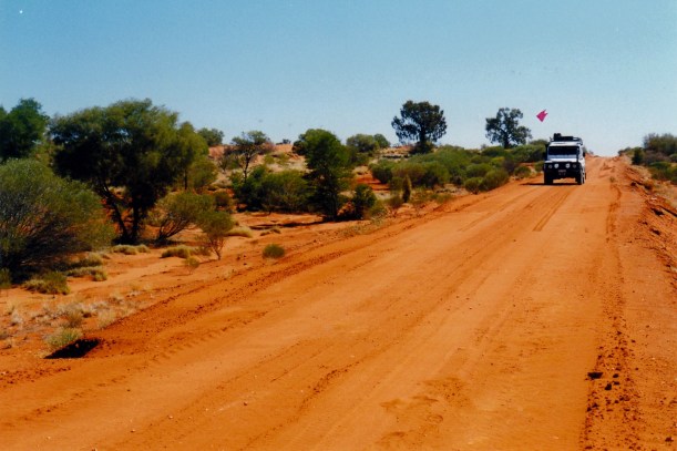
Then we went back the way we’d come, yesterday, as far as the Rodinga Siding ruins, on the Old Ghan rail route. We stopped there, to put up a makeshift sand flag on Truck. John had pre-planned the construction of this, using the broken CB radio aerial and a bright pink piece of rag, from his stock of same; it had once been a T shirt. He tied the lot firmly to the roof rack. Quite effective and cheaper than buying a proper one. Sand flags are mandatory in the coming sand dune country, to give approaching vehicles some advance notice of one’s  presence.

08-13-1999 01  Rodinga ruins and flying the flag.jpg

At Rodinga ruins, flying our new sand flag

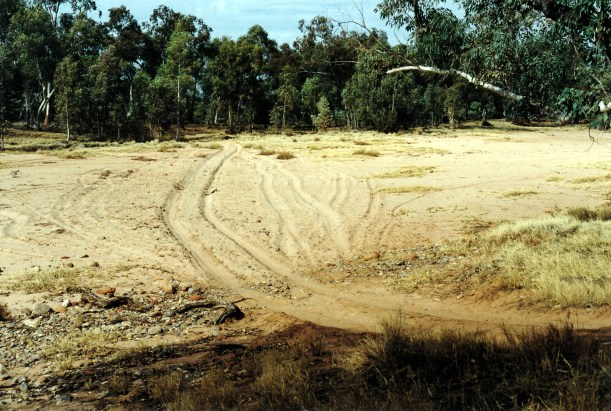
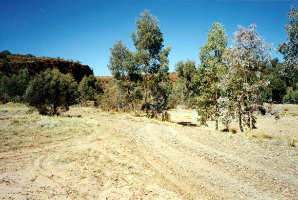
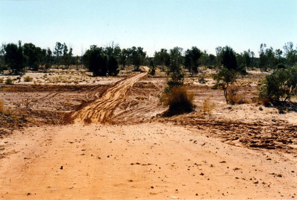
Then it was onto the Old Ghan Track, heading south for Finke. At the start of this section, driving on the old rail alignment was a novelty, and we mixed road tracks and old rail alignment. But by the time we reached Finke, we had in fact, travelled most of the way on the rail alignment. It was much smoother than the road tracks, the latter having been used not long ago, for the Finke Desert Race, and really churned up. However, some track sections did appear to have been recently bladed.

08-13-1999 04  road contrast.jpg

The churned up road track

08-13-1999 02  the Old Ghan Track.jpg

On the Old Ghan Track, with the alternate road beside it

The problem with the rail route was that there were lots of big metal spikes, once used to anchor the sleepers, still lying about, and these are risky for tyres. But we preferred to chance that, rather than get bogged, or break something, on the road tracks.

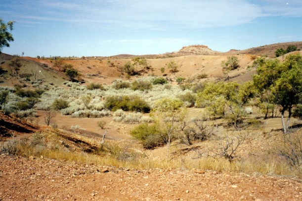
The countryside we travelled through today was mixed – some red sand dune country, some flat-topped mesa country, some river plains and flats, gibber stone plains in the south – some country similar to that around Oodnadatta. So it was a day of considerable variety.

08-13-1999 03 old ghan tk

Red sand dune country

The first section, from Rodinga to Finke, had lots of arrow signs and X markers, relating to the Desert Race.

Just as on the southern section of the Old Ghan Track, that we’d tackled earlier in the year, there were the ruins of former sidings, at regular intervals.

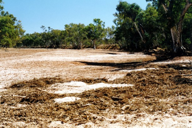
We stopped to have our lunch at the historic Alice Well, by the crossing of the dry Hugh River bed. There are some stone building remains there – what is left of the former Government Depot and Police Station.

08-13-1999 06  ruin govt depot alice well.jpg

What was left of the old Government Deopt at Alice Well

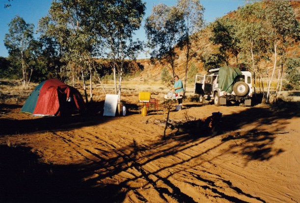
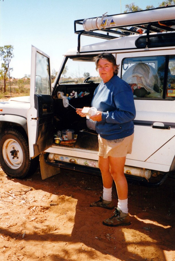
I had the lunch makings of Ryvita biscuits, cheese, vegemite, in the picnic basket and the fridge – which John had made sure was accessible easily. The fridge does not run while we are travelling, but the theory is that the contents stay cold through the day, anyway. The chill breeze, flies and dust dictated that I prepared the food in the passenger side footwell of Truck. It is actually quite convenient.

08-13-1999 08  lunch by tk.jpg

Making lunch by the side of the track

08-13-1999 07  Hugh R bed at Alice Well.jpg

The bed of the Hugh River at Alice Well

Next we stopped to have a look around the remains of the old Bundooma Siding. There is not much left there now. There were some foundations and the old water tank on its stand.

08-13-1999 05  Bundooma Siding ruins.jpg

The reamins at Bundooma Siding

At Engoordina Siding there were remains of the fettlers’ accommodation – really close to the rail alignment.

08-13-1999 09 Engordina Siding ruins

Engoordina Siding ruins – very close to the rail alignment

I took a photo of Colsons Pinnacle at a point where there was a good view of it in the distance. This is somewhat similar to Chambers Pillar – another erosion feature and a landmark for earlier explorers and travellers, because of its distinctive shape. It was also known as the Maiden’s Breast! It, and the surrounding mesas, are two toned, with alternating layers of light and dark rock. The horizontal line of separation of these is so straight it could have been drawn with a ruler.

08-13-1999 10  colsons pinnacle.jpg

Colsons Pinnacle

I drove for some of the way, each side of Finke.

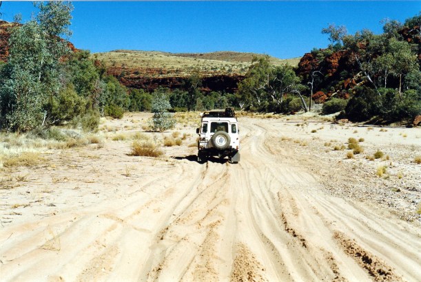
The river bed at Finke was wide, sandy and churned up, but we ploughed through fairly easily.

08-13-1999 finke river.jpg

Our old friend, the Finke River

08-13-1999 11 finke river crossing

The track through the river bed at Finke

After Finke, we left the old rail route, and headed more to the west and south west, on dirt roads and station tracks. It was  stony country now, and more monotonous as the mesa country was left behind. There was almost no other traffic. There were gates to open and close, of course. Landmarks that reassured us that we were going the right way – very few signposts! – were New Crown Homestead, Charlotte Well, then crossing from the NT into SA.

08-13-1999 12 bulldust Finke Mt Dare rd

Going around a section of bad bulldust on the Finke to Mt Dare track

The waypoints that John put into the GPS yesterday, were mostly right and were an extra reassurance. However, we did go the wrong way for a short distance, south of Charlotte Well, where there were several tracks. It was a good thing that I was navigating, as well, and had my Westprint map, and realised we were on the Abminga track, not the one we wanted to Mt Dare.

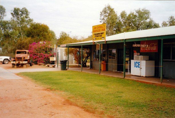
We reached Mt Dare – homestead, hotel, campground – about 4pm. There was no one else in the campground. The man obligingly opened the bar, so we could each have a beer! To camp cost us $5 each, the beer was $3.50 each. John bought a cask of riesling that he saw there – $25! He’d asked for it before he knew the price.

The camp area was alright. Some bushes for shelter, bare dirt – as one would expect out here. They lit the hot water “service” for our showers – made out of an old, tall, LPG cylinder – ingenious. We enjoyed that shower, too.

08-14-1999 01  Mt Dare camp in morning.jpg

Our Mt Dare camp – with visitng willy wagtail

By sunset, there were lots of galahs in distant trees and they squawked on and off, well into the night.

The fridge was set up on gas, again. It is working, but does not seem to be cooling as quickly or as much as usual.

Tea: mushroom soup from a packet, with dried milk powder used to make milk for it. Then fettucine, with a bottled tomato sauce.

After the radio sched, John did work on tomorrow’s waypoints to take us to Dalhousie Springs. I wrote up the diary and some cards.

It was quite a chilly night, so we did not sit up too long.

08-13-1999 mt dare

From Chambers Pillar to Mt Dare


Leave a comment

1999 Travels August 11

WEDNESDAY 11 AUGUST   BOGGY HOLE TO STUARTS WELL   174kms

We had a good night’s sleep. Woke to a day that was warm, but with high cloud coming in rapidly.

Got up at 7.30. It took us a couple of hours to breakfast and pack up – no hurry.

Then we continued on along the Finke. Crawled past the other campers, who all appeared to be staying longer. The track at this point (the waterhole) was – obviously – up on the bank at the side of the river. But soon it was back to alternating river bed driving with criss crossing and bank driving.

08-10-1999 12 track at Boggy Hole.jpg

The track goes up the river bank – and some have had difficulty here

The river sections were a mix of sandy wheel ruts, then river stone sections.

08-11-1999 03 in finke flood debris.jpg

A stony section of the Finke River bed

08-11-1999 04 looking back at Finke Gorge from sth of Boggy Hole

Looking back up the Finke Gorge, from the track south of Boggy Hole

Occasionally the track deviated away from the river, through higher mulga country, cutting across where there was a big bend and meeting the river again.

It certainly is a majestic river. It would be impossible to see it in full flow, except from the air, in the Finke Gorge section, but it would be quite something.

08-11-1999 06 Finke R crossing looking upstream.jpg

The Finke River, south of Boggy Hole, looking upstream

Truck handled the difficult conditions really well.

08-11-1999 05 crossing Finke south of Boggy Hole

The track criss-crossed the river

We came to a sign that marked the exit point from the National Park – a rare man-made landmark on this route.

08-11-1999 07 leaving finke gorge np.jpg

Leaving the National Park

It took us a couple of hours to get from Boggy Hole to the Running Waters Yards – relics from older pastoral times. It is here that the Finke swings east and the track goes west, for some 12kms.

08-11-1999 09 pastoral relics Running Water Yards.jpg

Running Waters Yards

Just before we got to the Yards, met a vehicle heading north – the only vehicle we’d encountered in two days, at that time. It was noon, and he was aiming to make Palm Valley! He had no idea of how rough and slow the track was about to become.

At the next track junction, we debated whether to keep going on the side track to Ilamurta Springs and old police station ruins, to the west. I’d have liked to go there and camp the night, but John preferred to keep going on our main objectives. So we turned to the south.

From here, the route was across low red sand dunes, in fairly flat country. The river red gums were replaced by desert oaks. On this stretch we met a group of five vehicles, towing camper trailers. They would soon be encountering difficulties on some of the sandy, rough, steep river bank sections to come. We’d thought a few of these entry and exit points a bit reminiscent of the OTL Track on Cape York! But without the water. The young couple that we spoke to yesterday, at Boggy Hole, had needed to snatch a Disco towing a camper that was stuck on that section.

John wished the group luck!

08-11-1999 10 track south of Running Water Yards.jpg

The run south to the Ernest Gikes Road

After a rather faster, but much less interesting run to the south, we came to the junction with the Ernest Giles road, and turned east. This is the unsealed route that cuts from the Kings Canyon road, across to the Stuart Highway.

We stopped to eat our lunch at the dry Palmer River crossing. The country now was markedly different to that around the Western MacDonnells to the north.

08-11-1999 11  Rogers Pass scene Ernest Giles rd.jpg

At Rogers Pass, on the Ernest Giles Road

08-11-1999 12  lunch palmer river.jpg

Lunch stop at the dry Palmer River crossing on the Ernest Giles Road

The Finke Gorge was an excellent little trek and I am very glad that we did it.

Not long before we reached the main highway, we turned off to the north, to drive for 5kms along a track to the Henbury Meteorite Craters. A few thousand years ago, a meteorite heading for Earth broke up in the atmosphere and the pieces impacted here, making craters of varying sizes.

We walked the few hundred metres to look at the main crater. It was definitely worth the short detour. Without knowing its origins, one could think it was a very large, partially filled-in quarry. Or an old volcanic vent – had there been volcanoes anywhere around here!

08-11-1999 13 henbury meteorite crater.jpg

Henbury Meteorite Crater

We were hot and thirsty by now. It was sunny, though there was some cloud still. Conditions were such as to make us look forward to the end of the day’s driving.

Reached the bitumen Stuart Highway and turned north. We soon crossed the Finke, yet again, but this time via bridge. The river here was wide, with the sandy bed we were used to, and multiple dry channels. I thought that floods here would cut the highway, for sure, given the low level bridging.

After  40kms, we came to Stuarts Well, with its roadhouse and camp area. This was 10kms north of where we wanted to turn off again, but we decided to do the extra, to refuel, and also for a convenient camp spot. This is fairly small, intended really for overnighters, like ourselves.

08-11-1999 15  pioneer truck and wallara ranch sign.jpg

Stuarts Well Roadhouse, with its Wallara Ranch sign. Our camp area was beneath the trees in the background.

We paid $12, for a pleasant grassy place to pitch the tent – grass! There was no power but there were lots of galahs in the surrounding trees, depositing their droppings on our camp gear and Truck.

We bought ourselves a cold beer – $3 each – and sat in the shaded beer garden area for a couple of hours, while John programmed his GPS and I read.

I bought some postcards of Chambers Pillar – tomorrow’s destination.

Stuarts Well is an interesting place. The father of the man  who owns it originally built Wallara Ranch, just east of Kings Canyon. It was they who, in 1961, formed the first track to Kings Canyon, and set the Ranch up as a tourism base, before the days of the current resort, on land leased from the station owner. Then in 1990 the station owner refused to negotiate reasonable terms for the lease renewal. It was believed that this was due to pressure from those who wanted to develop Kings Canyon further, and hoped to thus acquire the ranch lease cheaply. In protest, the leasee bulldozed everything they had built at Wallara, before leaving and setting up Stuarts Well.

The old Wallara Ranch sign now hangs at the front of the roadhouse, and an old truck is parked on display – with the attached frame that was used to make the first track to Kings Canyon. There is a display, inside, of the history outlined above. It made interesting reading. A story too often repeated – the “small man”/battler losing out to the power of big business.

08-11-1999 14 Stuarts Well rig that made first Kings Canyon track

This rig pushed the first track through to Kings Canyon

I had a lovely warm shower, albeit in a cramped Atco facility.

I think I may have been a bit dehydrated from today’s heat, as I didn’t feel at all hungry. I had some lettuce, tomato and cheese, while John had a great fish and chip and salad meal at the roadhouse for $9.50.

We sat and read until bedtime at 10.30. The night was quite warm and it was pleasant sitting out. The galahs in the trees kept squabbling – or maybe protesting about the bright light from our lantern?

08-11-1999 to stuarts well.JPG

From Boggy Hole camp to Stuarts Well Roadhouse


Leave a comment

1999 Travels August 10

TUESDAY 10 AUGUST   PALM VALLEY TO BOGGY HOLE   56kms

Today was our eighth wedding anniversary. What a contrast to last year – from the lush tropical Far North Qld to the arid Red Centre!

It took us two hours to breakfast, pack up, and leave – from 8am to 10am. But we didn’t really hurry.

The day was hot – brilliant blue sky.

Had to drive back to Hermannsburg, the way we had come in here. Once, adventurers accessed the route south right down the Finke River, but that “short cut” from the Palm Valley track is now forbidden. The access road goes from Hermannsburg.

We topped up with diesel – 92cpl – and bought a few things at the store there. Then we headed SE out of town on a road that intersected with Ellery Creek, where we took to the creek bed and banks.

08-10-1999 01 ellery creek nr finke junction.jpg

The track followed the bed of Ellery Creek towards the Finke River

The first part of our way was through aboriginal land along Ellery Creek. It was just a bit sandy.

Once we got into Ellery Creek Gorge, the route began to criss-cross the stream bed. Sometimes we were in sand, sometimes in water worn stones. The gorge walls were a real orange-red. It was most spectacular.

The valley widened out again, somewhat, as we approached the junction with the Finke River, which came in from the west – our right. The Finke River was first found and explored by our old friend Ernest Giles. For him, subsequent explorers, missionaries and settlers, it was a way through the ranges. As Boggy Hole usually has water, that was an additional benefit. Of course, the aboriginals would have been using this route and this waterhole, prior to white arrivals.

08-10-1999 02 junction of Ellery Ck & Finke R

The junction of the Finke River and Ellery Creek

After the junction of the two streams, there was much more sand. We found no real problem areas, though it was slow going. For most of the way, the track was in the dry Finke River bed itself, though at times it moved up onto the bank beside the main channel.

08-10-1999 04  Finke Gorge ahead.jpg

Finke Gorge ahead


08-10-1999 track in the Finke gorge.jpg

The track winding its way through Finke Gorge

The Gorge walls stayed red and rugged. River red gums grew in the river bed. Debris from previous floods was piled against the upstream side of some of these trees – higher than our Truck. It might not happen often, but they obviously have some very enormous flows in these parts. The Gorge would channel these flows, obviously.

08-10-1999 05 track in Finke bed with flood debris

Truck in the Finke River bed with flood debris piled against a river red gum

Occasionally, there were very small waterholes, or areas of tall grasses and rushes that indicated where water had been standing.

08-10-1999 06 waterhole in Finke bed

A little waterhole in the Finke

08-10-1999 07 river bed getting wider and track sandier.jpg

The river bed got wider and the track got sandier

08-10-1999 08 near Boggy Hole.jpg

Finke Gorge, not far from Boggy Hole

We reached the Boggy Hole area about 1pm, and ate our packed lunch. Then we explored a bit and found a place to camp – by a reedy section of the long waterhole. This offered an open camp area, as opposed to those a bit further up by the main part of the waterhole. It was a bit dusty, though. We had water birds near us, and a vivid red rock wall behind the waterhole. Overall, we thought it was a pretty spot.

08-10-1999 14 Boggy Hole camp vista.jpg

Our camp at Boggy Hole, with the waterhole and gorge wall behind

John went off in Truck to scrounge some firewood, while I did some camp setting up. He managed to get a little bogged in an innocuous looking patch of bulldust, near the camp! It was hard to believe. The spade, and the use of our shadecloth mats, extricated him, easily.

08-10-1999 09 bogged in camp bulldust

Unbelievable! Bogged in bulldust near our camp

After setting up camp – which does not take long – we walked along to the main part of the waterhole. There were other camps set up there – a lone couple, and a group of four vehicles with a lot of people. There was a large burned area, where it seemed a campfire may have gotten away, and a big mass of melted fibreglass that maybe once was a canoe! Whoever the mess belonged to should have taken it out with them, not just left it there to mar the place!

08-10-1999 13 boggy hole

Boggy Hole waterhole in the Finke River Gorge

We had not seen anyone else on the track since leaving Hermannsburg, so had originally been surprised to find other campers at Boggy Hole – assumed they had left earlier and were ahead of us, but found out in talking with them that they’d come from the south. Well, that tells us the track that way is passable!

Walked back to our camp, which was about 500 metres from the others – nice and peaceful. Lit a campfire.

08-10-1999 10 Boggy Hole in front of our camp.jpg

The Finke River in front of our camp at Boggy Hole waterhole

At 5pm, we radioed in to VKS737, listened to the sched for a while, then reported, in our turn, our location, that all was well and our plans for the next couple of days.

Went down to the waterhole to collect water to use for dishes and washing.

08-10-1999 15 camp boggy hole wa 10

Late afternoon at camp

Tea was salmon cakes and salad.

After tea, once it was dark, John had a bush shower, from the black bag, which he’d put out to warm as soon as we’d arrived here. I used baby wipes for a quick wash – none of this exposure to the elements for me!

We sat around the campfire and drank our celebratory bottle of Omni.

I wrote up the diary. We read by the light from the kero lantern, but did not stay up all that late.

The night was clear, and cold.

John sneezed a few times and it made a strange, echoing roar, because of the gorge walls. I wonder what the other campers thought it was?

Coots and ducks kept up the occasional call from the waterhole, well into the night. Their noise was amplified too.

08-10-1999 finke route