This Adventurous Age

Adventures travelling and working around Australia.


Leave a comment

2004 Travels August 2

MONDAY 2 AUGUST   EXMOUTH TO MESA CAMP   44kms

We were fed, organized, packed up, and at the National Park Entrance at 8.30am.

There were only a couple of other vehicles ahead of us.

The bad news was that there were no sites becoming available at either Lakeside or Ned’s. So much for our research! But we were offered one at Mesa and took that – better than the alternative of going back to Exmouth! We told ourselves that it was only at the other end of the beach from Ned’s. It was going to cost us $10 a night.

Drove on down the road and into the Mesa camp.

There were twelve camp sites at Mesa. Seven looked out across the sands to the sea; they had some trees around them too. The other five sites looked out on to the visitors’ car park and some dunes. They had no trees around them.

Of course, we got one of the no-view sites! The campers who had been occupying it were moving across to one of the better sites that was being vacated. We were not best pleased, but had to be philosophical about it.

We discussed with the lovely couple who were the campground hosts, the possibility that we, too, might move sites to one with a view – if one became vacant during our time here. They agreed to keep that in mind for us.

And so we set up, on the very open, bare site, hoping it would be a short stay!

Resize of 08-03-2004 Mesa Camp 1st Site - 4.JPG

First camp site at Mesa

It was very windy.

After setting up, walked to the beach, through low dunes, and walked along it for a bit. The sand was very soft.

Checked out the long drop amenities on the way to the beach – very clean.

John went down to the beach to try some fishing, after  lunch. No joy there.

Resize of 08-05-2004 mesa hills

Beach at Mesa – waves breaking on Ningaloo Reef, in distance

There was another Trakmaster van here – a Sturt model. The people were from Tasmania. They had one of the “good” sites.

The campground hosts held a happy hour get together in the late afternoon, and we wandered across to that and sat chatting with the small group of campers. Very pleasant.

Resize of 08-02-2004 to mesa.JPG


Leave a comment

2004 Travels August 1

SATURDAY 1 AUGUST     EXMOUTH

I was able to get newspapers and spent some of the day reading those.

Went to the supermarkets and topped up our food supplies.

Went for a short drive and looked more closely at the new-ish marina development that we’d passed on the way into town. It seemed that some people were optimistic about being able to sell real estate, and establish sea-related businesses, in such a place. Early days yet!

Exmouth had only really existed since the mid 1960’s, being built to house workers and service the needs of the US North West Cape communications base, built at that time. It was a bit like a Pilbara mining town, but on the coast!

John watched football on TV.

This period was meant to be a quiet and restful recovery time, after our Pilbara whirl! A camp over in the National Park should be just the thing.


Leave a comment

2004 Travels July 31

SATURDAY 31 JULY   NANUTARRA ROADHOUSE TO EXMOUTH   270kms

Today’s was a routine drive through some fairly uninteresting country, that we’d driven a few times already.

Took the short cut through Giralia Station to the Exmouth road. It was now a good. sealed road – last time we drove this, it was gravel.

I’d intended to stop at the Kailis seafood factory, not far past the big Learmonth Airforce Base, but the Kailis place was closed for a couple of hours over lunchtime. We’d bought great prawns there on previous trips.

Reached Exmouth about 1pm. Went into the Ningaloo Caravan Park, in the town. It was a Top Tourist park – we were back in the realm of discounts! $23.40 a night, after that. The park was full. It was of the expected high standard. The amenities were clean. There appeared to be some pressure on the washing machines and clothes lines, though.

After setting up, John watched football on TV, whilst I went for a walk to the shops – not too far.

I went to the Tourist Information Centre and found out about camping out in the Cape Range National Park. They did not take bookings for sites in the several campgrounds scattered along the coast. One must go and queue up at the Park entrance – early! The camp ground hosts at the various camps radio to the entrance, when they know of an incipient vacancy, and these are handed out to those in the queue. Very much a pot luck scenario – one takes what one is given! The info lady seemed to think that if we were good and early, we’d get a spot somewhere.

Later in the afternoon, went for a drive around to the National Park, and looked at the various camps that had generator areas – not all did, and we would need one, in case the solar input wasn’t enough.

We decided that we’d find the Lakeside or Ned’s camp grounds ideal.

Refuelled – $1.20cpl.

Had a text message from M. She’d collected her mother from the plane in Darwin, and all was well, so far.

Resize of 07-31-2004 to e


Leave a comment

2004 Travels July 30

FRIDAY 30 JULY   SOUTH HEDLAND TO NANUTARRA ROADHOUSE   490kms

Today’s was a long day of driving south.

The country was not particularly interesting, and we’d driven it before.

Refuelled at the roadhouse at the turn off to Karratha – $1.08cpl. Topped up the fuel again at the Fortescue River Roadhouse – $1.20 cpl.

For several weeks now, we had spent time in the very large catchment area of the Fortescue River. Now, we were not far from its mouth, about a hundred kms SW of Dampier. There was water in part of the wide bed. We had to detour through a section of the river bed, around the bridge repairs that were happening after the cyclone damage of earlier in the year. Clearly, this river could be ferocious at times.

Resize of 07-30-2004  01 bridge over Fortescue R.jpg

Fortescue River bridge – note flood debris

Resize of 07-30-2004 02 Fortescue R bridge flood damage

Flood damage Fortescue River bridge

Overnighted again back at Nanutarra Roadhouse. The ground was dry, this time, but the place was still noisy. $20 a night.

Resize of 07-30-2004 03 Nanutarra Road House Dry (2).JPG

Dry Nanutarra, this time

Whilst we were here, John took the jerry can to be refilled – $1.36cpl.

He then retreated to the van for a rest. I went for a walk along to the Ashburton River and had a look at the works going on there on a new road bridge. It would be a big improvement on the old, one lane only bridge.

Resize of 07-30-2004 to nr.JPG


Leave a comment

2004 Travels July 29

THURSDAY 29 JULY     SOUTH HEDLAND

It was an early start, as we had to have M at the airport by 8am.

Resize of 07-29-2004 camp south hedland.JPG

Early morning, South Hedland

Watched M onto her plane – to Perth. From there, she would fly to Darwin, to meet her mother, who had flown from Melbourne. They would catch the new Ghan train service from there to Adelaide.

Shopped at the supermarket in South Hedland for food.

Refuelled truck – $1.06cpl.

I phoned Exmouth and booked us into a caravan park.

Then we sat round, relaxing, for the rest of the day. It had been a much more hectic three weeks than we were used to. Our travelling and sight seeing was usually done at a much slower pace!

Had a phone call from M, after she reached Perth. She said they flew over Karijini and that it looked really spectacular from the air.


Leave a comment

2004 Travels July 28

WEDNESDAY 28 JULY   MARBLE BAR TO SOUTH HEDLAND   202kms

An unpleasant surprise greeted John when he went to pack up this morning. The driver’s side front tyre on Truck was flat! So, a wheel change was needed before any other packing up got under way.

Resize of 07-28-2004 02 Marble Bar flat tyre.JPG

How many flat tyres was that, for this trip?

While that was happening, the gold miner from the General Store arrived, with some small nuggets that he thought might be what I was looking for, to make earrings. I bought two.

After that, we had a routine drive to Port Hedland, all on good sealed roads.  Once past the hilly country around Marble Bar, the country got to be flat and a bit boring.

Went into the South Hedland Caravan Park, at $18 a night. It was rather shabby and contained mostly longer term dwellers. Later, as we were driving about, noticed a new park – Black Rock – that had recently opened. I wished I’d known about that one earlier! Knew there was another park, in Port Hedland itself, but had encountered sandflies there, back in ’93, and was not keen to repeat the experience.

After setting up for a short stay, drove into the main – older – part of Port Hedland, and had a look about. Port Hedland is really these two separate settlements, separated by several kms of desolate flat ground given over to salt pans and some industry. The drive in there took us past the very extensive salt works with their heaped up white salt hill.

The older, original Port Hedland was on a narrow peninsula of ground and limited by the swampy flat lands behind it. When there was the need to expand the original little fishing port town, with the advent of iron ore shipping, the necessary shops, services and houses were built back away from the swampy inlets, to the south. The layout of this part mirrored that of the other Pilbara towns set up for mining related purposes.

We saw long ore trains heading for the port area in the old town.

I remembered buying prawns from a trawler at the port, in ’93. We found out that it was no longer possible to buy fish or prawns from the boats, any more. Pity.

At one stage, saw an entourage in the distance –  turned out to be that of the Prime Minister. Never did find out why he was in town, though.

Came across a shop selling gemstones and rocks, and bought a few pretty stones for grand daughter.

Collected our mail from the PO. This included the new battery charger we’d had sent from Melbourne. But we decided not to try to get this installed now – not sure about the local work. We’d been managing with the portable charger, so thought we’d try to get back home with that system, and get the new charger properly installed at Trakmaster.

John found a tyre place and put the flat tyre in for repair.

M bought us all chicken and chips as a farewell dinner. I made an exception to my rule of not eating chicken not cooked by me – and hoped! I’d been outvoted. Fortunately, there were no adverse effects later.

Resize of 07-28-2004 to sh.JPG


Leave a comment

2004 Travels July 27

TUESDAY 27 JULY     MARBLE BAR

In the morning, John wanted to do some computer stuff, so M and I went for a walk to explore the town, after I’d packed our lunches ready for later.

Resize of 07-28-2004 01 camp Marble Bar.JPG

Morning at Marble Bar Caravan Park

It was an interesting place, with some very dignified old stone buildings, dating from the time when mining seemed to offer a bright future for the place. Who knows, with the advances in the technology of minerals exploration and extraction, those times might come again?

Marble Bar is known as the hottest place in Australia. In recent times, that has been its only claim to fame. That was why John wanted to visit here in ’93 – so he could say he’d been there! We certainly were not expecting somewhere so intrinsically beautiful, and with so much that interested us.

The hottest reputation is not because of a maximum temperature reached on one day, but because it holds the record for the longest run of days over 100 degrees F (37.8 C) – 160 days over summer of 1923-24. They didn’t have air-con then, either!

We looked over the Pilbara Pioneers Memorial Wall. The plaques here give details of pioneers who often died alone and who were buried in remote and lonely places in the district. Some typical inscriptions: Avis Hosotana 1898: aged 3 days; buried at Tomborrah Creek; son of Otako and George; died of heat exhaustion. Robert Chandler 1899: Aged 42 years;  Buried at Tabba Tabba Creek near Port Hedland; a saddler who became lost in the bush and died of thirst.

Resize of 07-27-2004 01 memorial wall Marble Bar Lang Hancock.jpg

The Wall also honours Lang Hancock, who is credited with founding the iron ore industry of the Pilbara. He recognized the richness and extent of iron ore deposits in the region, and publicized and promoted the potential, although he never owned an iron ore mine himself. He did however, start asbestos mining at Wittenoom! These days, a dubious claim to fame. His daughter Gina, and her Hancock Mining Company provided funding for the Memorial.

M and I only progressed as far as the General Store! A miner’s wife ran that establishment. From her I bought a gold nugget already mounted ready for chain and four smaller nuggets, also mounted, for the daughters for Xmas. I put in an order with the miner for a pair of “flat” nuggets for earrings, when he had two that matched. M bought a nugget too.

We had certainly done our bit for the local economy, whilst here!

Then John arrived, driving Truck, to put in some fuel. He only added 50 litres – at $1.28cpl. That should see us through to somewhere cheaper!

We drove out to Coppin Gap, to the NE of the town about 60kms. This involved us taking the sealed Port Hedland road, then the gravel Bamboo track to the east. The Coppin Gap track led off this.

Resize of 07-27-2004 02 track to Coppins Gap and smoke.jpg

Bamboo Road – and smoke

We passed mustering vehicles and a helicopter. The mustering team had lit fires in the spinifex, out beyond the Gap, as they had mustered out there. The dark spinifex smoke hung in the air – not all that far away, it appeared.

The country out that way was just beautiful.

Resize of 07-27-2004 04 country near coppons gap.jpg

We parked at the end of the access track, then walked to the Gap, and walked/scrambled through it.

Resize of 07-27-2004 10 approach to coppins gap.jpg

Approach to Coppin Gap

The Gap was quite dramatic – a water carved gap in the Coongan Hills.

Resize of 07-27-2004 07 John on Coppins Gap walk track.jpg

Walking through Coppin Gap

Resize of 07-27-2004 06  coppins reflect.jpg

Reflections

We had lunch, sitting by the waterhole at the base of the steep cliffs of the Gap.

Resize of 07-27-2004 05 creek in Coppins Gap.jpg

Resize of 07-27-2004 09 oppins gap waterhole.jpg

As we retraced our way back to Truck, the fires looked closer, but still a way off. But they were enough for us to curtail any further exploration out in that direction.

Yet again, apart from the mustering team, we’d encountered no other people. Being able to enjoy places like this in solitude was wonderful, after the crowds of Karijini.

On the way back to camp, detoured to take in Doolena Pool, off the Hedland road, as it wasn’t far from where we rejoined this.

Resize of 07-27-2004 11 at Doolena Gap.jpg

Doolena Pool

Doolena Pool was on the Coongan River. Whilst it was very pretty, it was not in the same league as Coppin Gap.

Resize of 07-27-2004 12 Doolena Gap.jpg

I thought John had done so well with the pretty constant driving he’d had to do over the past three weeks. We would have to find somewhere that he could have a good long refreshing break from it, once M left.


Leave a comment

2004 Travels July 26

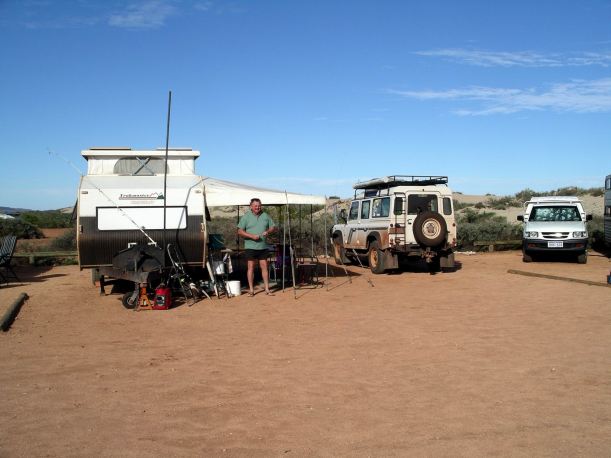
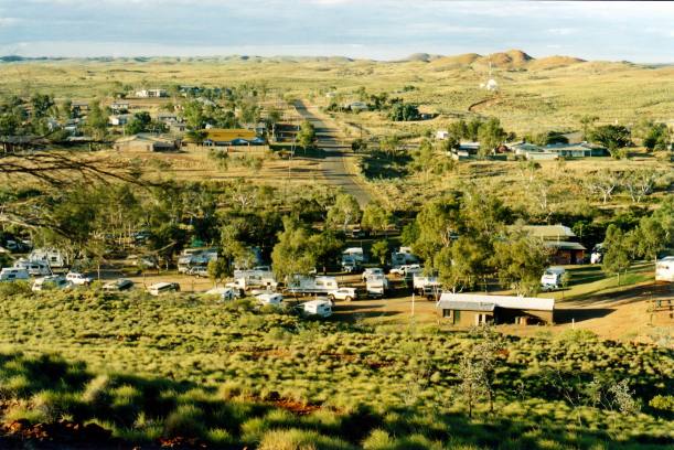
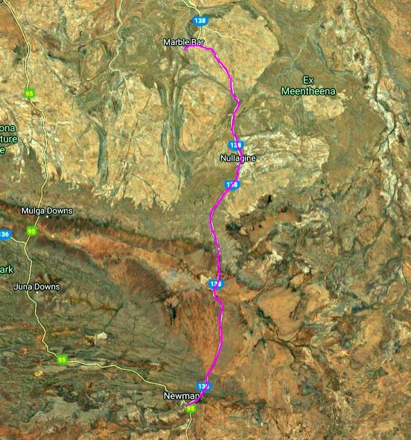
MONDAY 26 JULY     MARBLE BAR

We managed quite an early start to the day’s sight seeing ventures.

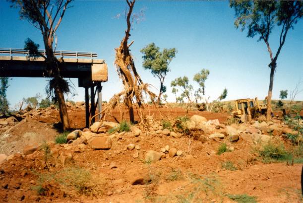
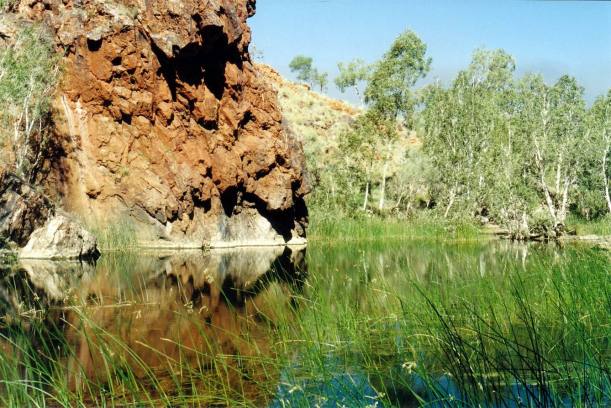
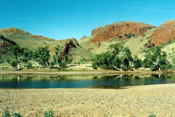
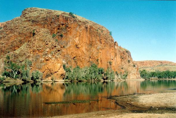
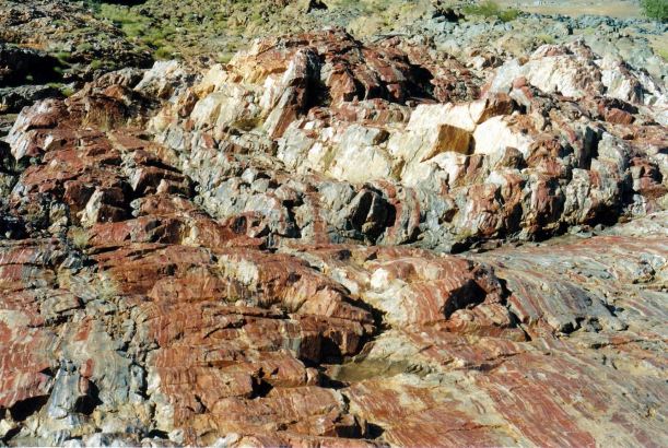
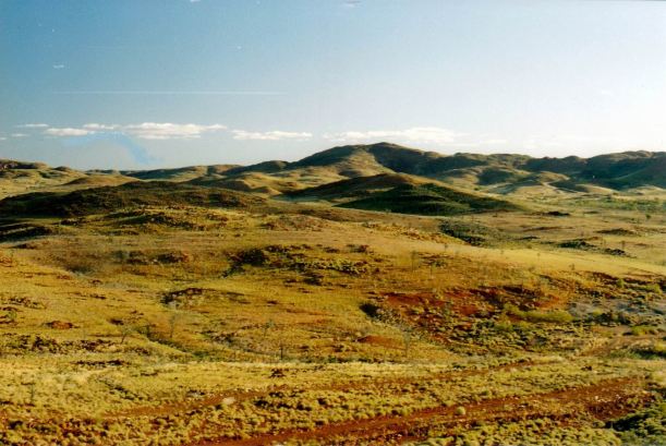
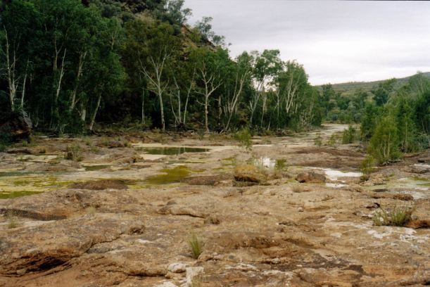
Drove the couple of kms to the actual “marble bar” at the nearby Coongan River, that gave the town its name. The reef of rock is actually jasper, not marble, but – especially when damp –  it looked enough like the real thing to trick the first settlers.

Resize of 07-26-2004 02 bar.jpg

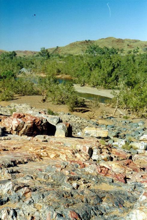
The “marble” bar and Coongan River

We put some water on it to show M how it does look like marble.

Resize of 07-26-2004 05 jasper bar.jpg

Jasper outcrop

People trying to souvenir a chunk of jasper at the main part of the bar, had become a problem, so a little quarry area had been created, slightly out of the way, where those so inclined could pick up a piece of jasper, with vandalizing the main reef.

Resize of 07-26-2004 01 hill at the Marble Bar

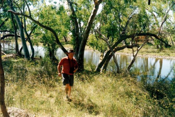
It was a pleasant spot out there, by a big pool in the river, and we had a bit of a wander around.

Resize of 07-26-2004 07 Coongan River Marble Bar

Resize of 07-26-2004 08  Mem in Coongan River.jpg

Resize of 07-26-2004 10 on tree.jpg

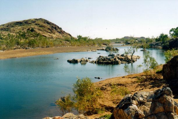
It would appear that there were fish in the river…

Then drove on a little way further south, to the old Comet gold mine. This started with a gold find in 1936 and was worked until the 1950’s. Its claim to fame was that it had, for some years,  the tallest chimney in the southern hemisphere, at 75 metres. It was still producing little bits of gold to sell to people like me!

The township of Marble Bar grew up as the result of a gold rush in the 1890’s. In that period of optimism, some substantial buildings were put up. However, the main rush was fairly short lived, as news of the great finds around places like Kalgoorlie, filtered north. But some mining activity continued, in fits and starts, around Marble Bar. The Comet Mine had been one such occurrence.

I bought a chunk of gold nugget. I planned, when back home, to have a setting put on the top, so I could wear it on a chain, as a pendant. Also bought a tiger eye iron necklace. My excuse was that these would be this year’s birthday and Xmas presents!

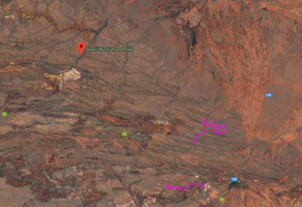
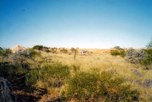
We went back to the van for lunch. Then it was out the Salgash Road, for about 36kms, to the old Corunna Downs WW2 airstrip and base.

Back in ’93, when we were rained in at Marble Bar, the park owner had given us directions out here and we had been captivated by the place and its little-known history – which he had told us, as there was then no tourist information available.

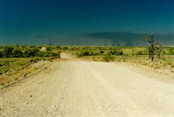
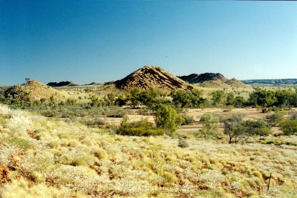
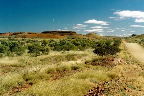
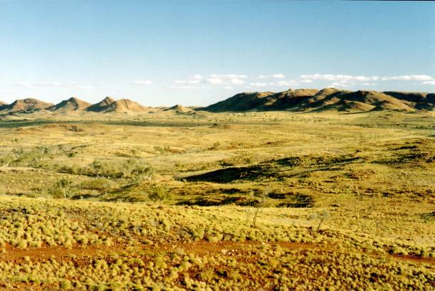
The drive out to Corunna Downs was lovely – dramatic scenery.

Resize of 07-26-2004 12 Corunna Downs rd rock outcrop.jpg

Unusual rock outcrop near Corunna Downs

The air base here was built in 1942, in great secrecy – for long range B24 Liberator bombers – American – that would attack Japanese bases in the Dutch East Indies, and shipping in that region. At the time, the air bases further north – around Darwin and at Truscott in the Kimberley – were being attacked by Japanese planes. The surrounding area here was so hilly, remote and inhospitable, that it was thought the Japanese would not suspect a base was here. It was also beyond the range of most of their aircraft.

Resize of 07-26-2004 15  Corunna Downs.jpg

Rugged Corunna Downs country

The base operated until 1945 and was decommissioned in 1946. It was never attacked. Although the Japanese hunted for the base of the big bombers, they never found it.

The remnants had survived remarkably well, though the few actual buildings that existed, were removed. The Australian and American servicemen were housed in tents, camouflaged, which must have been distinctly uncomfortable in the hot Pilbara summer.

Resize of 07-26-2004 14 Corunna Downs area

Flying fox was used when water course flooded

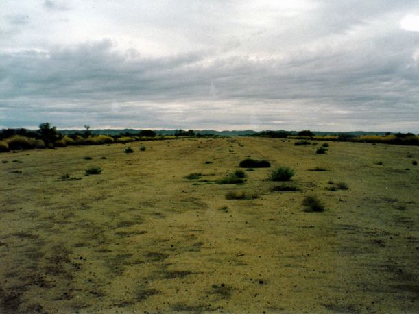
The longest of the two runways was about 2100 metres long and 50 metres wide; a slightly shorter runway intersected it, and there were kms of taxi ways.

Resize of 07-26-2004 19 Rotation of Rotation of corunnadowns03.jpg

We could still see the remains of the old runways and some of the twenty earth bunkers that sheltered – and helped camouflage – the big bombers. There were lots of bits of metal, old drums and the like, lying around.

Resize of 07-26-2004 17 truck in revetment

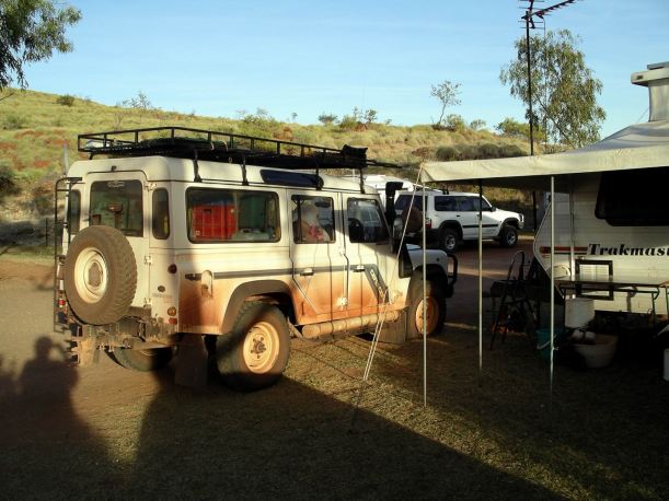
Truck in revetment that once sheltered a big bomber

Of course, we had to drive some of the long runway, at speed! We did quite a bit of walking around and exploring on foot.

Resize of 07-26-2004-1993 18 old Corunna Downs WW2 airstrip.jpg

On the runway

It was a very good afternoon. Something different for our tourist friend and something well off the beaten tourist track. We saw no other travellers at all, through the afternoon.

Resize of 07-26-2004 16 mulla mulla

Some of the travellers  we talked to, back at the caravan park, said that Carrawine Gorge, east of here, which we had considered visiting, was not worth the trip, because it was really badly degraded after this year’s cyclone. Scratch that idea, then!


Leave a comment

2004 Travels July 25

SUNDAY 25 JULY   NEWMAN TO MARBLE BAR   300kms

We headed north out of Newman, soon onto the unsealed road to Nullagine. The road was in pretty good condition.

We stopped at Nullagine to eat the lunch I’d packed.

Back in ’93, we were intending to stay here because John wanted to do some prospecting, so we’d driven down from Port Hedland. However, we thought it was a place with a very bad “feel”, not helped by seeing some sort of lock up structure, with bars, and occupants visible behind them as we passed. We’d about turned and driven all the way back to Marble Bar.

It still did not appeal at all to me as a place to stay! Whereas, we had great memories of Marble Bar – despite, or maybe because of – being stranded there for a few days by rain-closed roads. Back then, the Port Hedland road was still unsealed. Whilst the roads out to the south and north had been closed, the little local ones were not, and the caravan park owner had directed us to some great exploring.

We continued on to Marble Bar, through some really interesting country – ranges and hills, flattening out a bit before we reached Marble Bar.

Resize of 07-25-2004 01 near Marble Bar.jpg

Went into the Marble Bar Caravan Park – $20 a night. The park had grown in size, since ’93. It was still quite a pleasant one. This was the park that was offered to us, to buy, back then! New owners took over, 16 months ago. There is really only a few months of tourist season here, though, obviously, it is far more a visitors’ destination now than it was eleven years ago.

Because we had phoned ahead and booked, they had kept us a nice site. M had a great grassy patch to one side of us for her tent. They were full and having to use a gravel overflow area too, so we congratulated ourselves on our foresight!

The town looked like it had been spruced up since ’93, and there was more information for tourists. But there were still some grotty areas.

After setting up, M and I walked up Water Tank Hill, behind the park, late in the afternoon. The sweeping views from the top were superb.

Resize of 07-25-2004 02 view from Water Tank Hill Marble Bar

Resize of 07-25-2004 03 Marble Bar CP from water tank hill.jpg

Marble Bar town and caravan park from top of Water Tank Hill

Resize of 07-25-2004 range view from marble bar.jpg

At 5pm, the park owner held a briefing session for all that day’s newcomers – about things to do in the area. Great idea, that probably resulted in at least some visitors staying on longer than they intended.

It was very pleasant to be back in a park that was peaceful and quiet, after Newman.

Resize of 07-25-2004 to mb.JPG


Leave a comment

2004 Travels July 24

SATURDAY 24 JULY     NEWMAN

Today’s destination – also sourced from out little booklet – was Weeli Wolli Springs, about 100kms from Newman.

This involved driving back on the main highway, the way we’d come on Thursday, for about 70kms, then turning north-ish.

Resize of 07-23-2004 Kalgan.JPG

Locations of Kalgan Pool and Weeli Wolli (Google Earth)

The track was reasonable for most of the way. It deteriorated, though, towards the end. We may have tried to drive a bit too far?  We got stuck trying to cross a little creek that John didn’t check first – just drove into. It had a deep gravel base that we sunk into. Luckily, he was able to reverse out.

Resize of 07-24-2004 03 where truck stuck WW track.jpg

Oops!

Then we saw where other vehicles had crossed this creek and were able to drive on a bit further. These places just do not have sign posts to tell you when you have reached where you intended to go!

Resize of 07-24-2004 02  Mem in Weeli Wolli bog area.jpg

Checking out the creek depth

We had lunch out there – by a pool and rock wall.

Resize of 07-24-2004 09 Weeli Wolli scene.jpg

Weeli Wolli

There was a build up of dark cloud, so we did not go exploring to follow the creek any distance from there.

However, we did stop a bit further back on the track, closer to the springs, and wandered about exploring there, for a while.

Resize of 07-24-2004 07 Weeli Wolli valley.jpg

Creek at Weeli Wolli. near springs

Would have liked to stay out there longer, and maybe walk far enough to see if we could find the source of the springs, but the skies were looking really threatening.

Weeli Wolli Springs and creek were supposed to be a Rainbow Serpent home. It certainly seemed an unusual formation for these parts. The belief was that the Serpent came up here, in the water that flowed at the springs, from the desert to the east. He went north under  the creek and came up again in the Fortescue Marshes, then went on to Millstream. It was supposed to be a dangerous place where no one was to venture into the water and should not camp there at night. Women were not to walk alone along the creek, according to the lore.

On the return trip, took an alternative, longer track to the highway – this brought us out a bit closer to Newman. We only did it for variety, and because it was marked on the map.

As we’d driven about, the past two days, saw much evidence of mining and exploration, and one could not help but hear talk of new mines. I did hope that exploration and development spare places like Kalgan Pool and Weeli Wolli.

Over the past two days, we’d visited two little known destinations that were just superb, neither of which we’d been to before. Once off the main roads, both times, we’d encountered no other travellers – had both destinations to ourselves. Wonderful.

Back in Newman, refuelled again – $1.16cpl. We’d done 353kms since yesterday’s fill!

The people who were now parked next to us had come in from the Canning and the “bomb” tracks – so called because they were made (by Len Beadell) initially to monitor the atomic bomb testing in the desert country. One of their party had been towing an Ultimate camper trailer. His auto transmission got too hot and caught fire. There may have been a build up of dry spinifex underneath, too, I thinks to myself.  That damaged the electricals, so they were now in Newman for repairs, for a while. Another thing that I thinks to myself was that they were pretty silly to be towing anything on those tracks, anyway.

There were a lot of “sitting about” indigines in Newman. One cannot buy 4 litre wine casks in town, unless leaving town that day – and driving licence must be produced. They let us stock up today, as tomorrow was Sunday and we were leaving then – we had to make solemn promises that this was true. We wanted to stock up a bit because we’d heard that such casks were not available in Port Hedland at all.