This Adventurous Age

Adventures travelling and working around Australia.


Leave a comment

2000 Travels June 28

WEDNESDAY 28 JUNE     LAKE ARGYLE

The day was lovely, warm and sunny, again.

We lazed about the van in the morning. John played computer games – he had power again for his laptop! I wrote letters and read tourist information.

We watched the antics of the Great bower bird that had built his bower on the site behind us. He hovered protectively around it, all the time. Occasionally, he “danced” and displayed his pink neck feathers. He made a harsh calling noise. There seemed to be quite a few lady bower birds around.

We discussed the possibility of storing the caravan here, while we went off on our planned jaunt through remote parts of the Kimberley. This place seemed relatively secure and away from some of the issues we’d heard about in Kununurra, when we were there in ’93, and a caravan park storage area had been broken into and vans ransacked.

John went off to talk to the park manager about this and came back having organized for us to bring the van back out here when we were ready.

We were at the cruise office at 2.30pm. A bus then took us to the boat mooring. The boat was a wide based one with open sides and a roof for shade. We seemed to sit quite low in the water.

06-28-2000 01 boat wake argyle.jpg

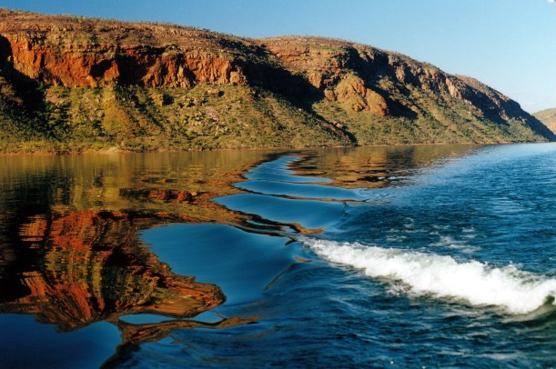
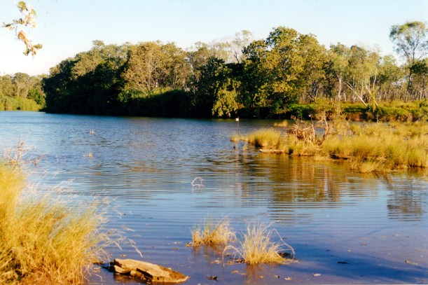
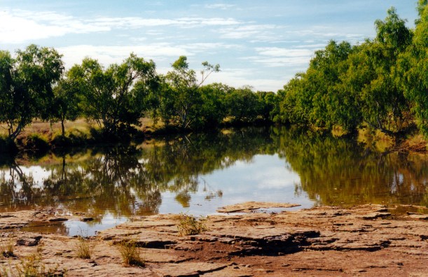
The boat’s wake distorting reflections in the water

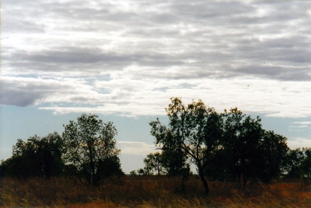
The cruise was well worth doing – the perspective from the water was so different. We really only motored about on a comparatively small part of the northern section of the Lake – but that seemed pretty big.

06-28-2000 04 late pm reflections on Lake Argyle.jpg

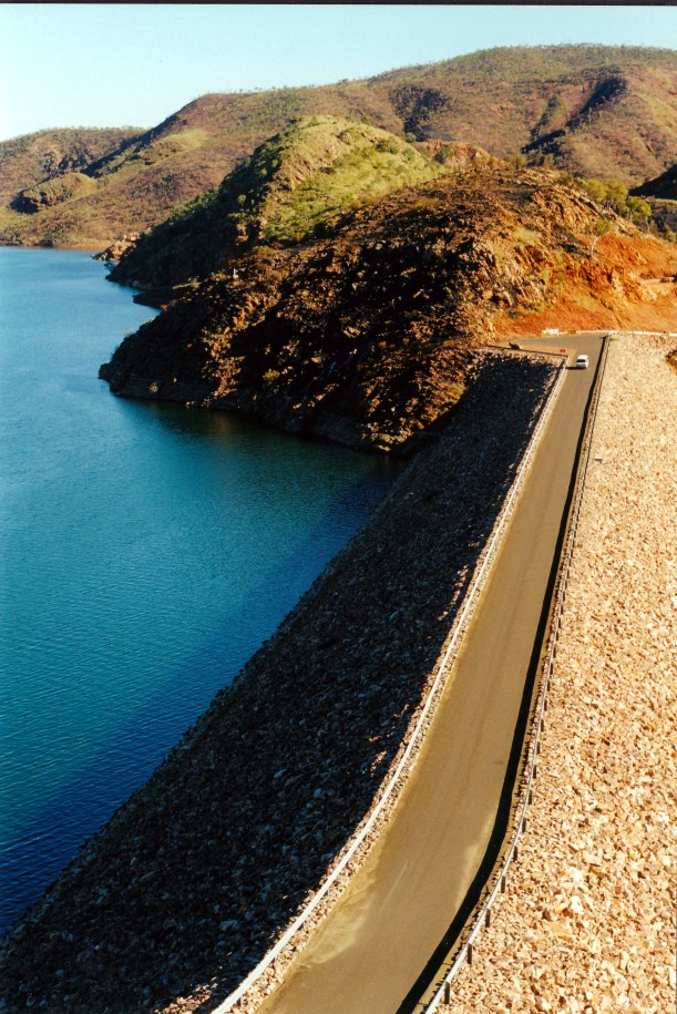
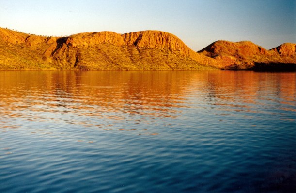
On Lake Argyle – dam wall in distance

It was pointed out that, submerged under the Lake, was the original homestead area of the pioneering Durack family. We learned that this was being dismantled, carefully, as the dam wall was being constructed, to be re-erected away from the lake level, as a memorial. However, the rains came and the Lake filled far more quickly than anticipated, so not all was saved. Even more portable tools and machinery were lost. So what is now the museum and homestead on display is not fully the original.

06-28-2000 03 lake argyle reflections

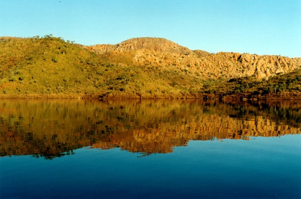
Reflections on Lake Argyle

We saw rock wallabies and Euros – there are islands in the Lake and these critters have survived on them. We cruised around some of these islands.

06-28-2000 06 on Lake Argyle 03.jpg

We also saw freshie crocs – there are thousands of them in the lake, catfish and archer fish. These shot water at pieces of bread held out by tourists on the boat. One freshie had learned that fish come to the boat for a feed, therefore so does he!

We watched a great sunset over the Lake, whilst partaking of generous quantities of champagne, biscuits and dips. It was all very pleasant.

06-28-2000 07 lake argyle sunset.jpg

Sunset over Lake Argyle

The cruise got back at 6pm, which felt much later to us. The bus transferred us back to the resort.

We had a fish and chip dinner at the hotel that is part of the resort complex. The fish was silver cobbler – local catfish caught in the Lake, that has had a name and image change and now sells at a much more handsome price. Who says a name is but a name? It was actually very nice to eat.

After dinner, walked back to camp and had an early night by local time, but it felt right to us.


Leave a comment

2000 Travels June 27

TUESDAY 27 JUNE   KEEP RIVER TO LAKE ARGYLE   69kms

Our pack up and departure was very leisurely, with only a short distance to move, today. It was another hot day.

Keep River National Park was a great place to stay. We felt that we’d covered the Park’s attractions pretty thoroughly. Could have lazed around a bit longer there, just enjoying the place, but we really needed to get onto mains power. So annoying!

The stop and check at the border quarantine point was a routine one – they only checked the fridges. The person on duty told us that vehicle numbers going through, so far this year, were down by about 100 a day, on the average for this time of year. I thought this might be due to the late severe weather, and people’s perceptions of floods and damage up this way.

At the border we “gained” time again – another 90 minutes.

Not far into WA, we turned south off the highway, for Lake Argyle. The country we were passing through was quite rugged.

Lake Argyle is a man-made reservoir on the Ord River, created to provide year-round irrigation water for farming downstream of the dam. A seemingly small dam wall holds back an enormous amount of water in the valleys amid the range country here. Lake Argyle is the largest single water storage in Australia – it would fill at least 18 Sydney Harbours in normal times, and about 70 of them in flood times! The dam was built from 1969-1971, officially opened in 1972, and by 1974 was full – silencing the sceptics who doubted it would ever fill! The wet season rainfall up here can be huge, and the Ord River catchment is a large one.

A creek that flows out of one arm of the Lake acts as a natural spillway and is crossed by a bridge on the road in. Spillway Creek was a raging torrent!

06-27-2000 06 Lake Argyle spillway creek raging.jpg

Spillway Creek

We booked into the Lake Argyle Tourist Village caravan park, for $16 a night. It was adequate – sites were a reasonable size, grassed and there were shady trees.

While John was doing the set up, I did two loads of washing – it had built up, and was a great day for drying. We had lunch and then went driving.

Firstly, we visited the lookouts and sightseeing points around the dam wall and Ord River. The river water leaves the dam via a small hydro electric plant; when the Spillway Creek is flowing, that enters the Ord between the dam wall and Kununurra, some 55kms downstream. The hydro plant helps power Kununurra and the Argyle diamond operation, to the SW.

06-27-2000 05 argyle dam

Argyle Dam wall, holding back the massive volume of water of Lake Argyle, blocking the Ord River – and a cruise boat

06-27-2000 03 Lake Argyle outflow from hydro plant.jpg

The hydro station outflow. Dam wall base at left, with road. The Ord River.

06-27-2000 04 Lake Argyle hydro plant.jpg

Below the dam wall. Hyrdro station outflow sending water down the Ord River

The Lake is truly vast and impressive, even though one only ever sees a small fraction of it from around here. The only way to really take in its full size would be from the air.

06-27-2000 01 Lake Argyle expanse.jpg

A very small portion of Lake Argyle

Due to 1999/2000 being the biggest Wet since records have been kept, the Lake was at its highest level ever, although 3 metres below its peak of earlier in the year. That would explain why the Spillway Creek was such an incredible torrent.

06-27-2000 02 argyle dam wall.jpg

Looking down on the top of the dam wall. The lake water level is high.

We drove back to the Spillway Creek bridge for a look, then took a side track alongside it, to try to get close to where it comes out of the Lake. We did not succeed in driving that far – tracks became rather muddy. But we then walked along the creek and looked. I was trying to cross a little side creek, to get a better view when I saw a crocodile only a couple of metres away! It gave me a huge fright! It was a freshwater one, but still…..Then, a short distance further upstream in my walk, I nearly trod on another! After that, I felt outnumbered and gave up on the exploring.

06-27-2000 09 spillway waves.jpg

Waves on the Spillway Creek would challenge a surfer!

They were quite big freshies. Apparently, the water was running far too fast for their comfort, so they had taken refuge wherever they could find quieter backwaters.

06-27-2000 08 freshie

Fresh water crocodile taking refuge from the raging creek. Look in front of the water!

After that little adventure, it was back to camp.

Tea was sausages, with the veggie mix I cooked up yesterday.

Phoned P and wished her a happy birthday.

Our body clocks were “out” – we needed to adjust to the change in time zone.

At the same time as we booked in today, we booked and paid to go on the afternoon cruise, tomorrow, on Lake Argyle – $35 per person.

06-27-2000 to argyle


Leave a comment

2000 Travels June 26

MONDAY 26 JUNE     KEEP RIVER NATIONAL PARK

Today was another one like yesterday.

We got up about 8am. There was much activity in the camp area – it seems like just about everyone is going today. We will then be the longest staying ones here! It is a pity that so many people do not take the time to fully explore and enjoy this park. Quite a few seem to be here simply as an overnight stop.

In the morning, we heard a pheasant coucal in the distance, and a dingo howling. There was much noise from butcher birds, pardalotes and friar birds.

After breakfast, drove back towards the highway, to the Ranger Station and Cockatoo Lagoon, and watched the birds at the Lagoon for a while.

06-26-2000 02 turkey bush.jpg

Turkey Bush

Then we went back a little way, to the kite hunting hide on Gingers Hill. This was interesting: a low stone walled shelter, with the top camouflaged under spinifex grass. The aboriginal hunters used to light a smoky fire and the black kites – also called fire birds because they hang about fires hunting small creatures escaping from it – came down and were grabbed by the hunter in the hide. Clever!

06-26-2000 01 gingers hill

Kite hunting hide on Gingers Hill

We went back to the van for lunch – rolls John baked from a bread mix packet. They were good.

We’d driven 36kms this morning.

Later in the afternoon, we did the circuit walk that went from the camp ground. This was the best of the lot. The track wound around through excellent rock formations and across ledges that gave views from quite high up. I was glad we saved this closest one till last.

06-26-2000 03 more walk from Keep River campground.jpg

On the walking track from the campground

06-26-2000 04 keep camp circuit.jpg

Unusual rock stack shapes on the walk from the camp ground

06-26-2000 05 walk from Keep River campground.jpg

06-26-2000 06 walk tk from camp.jpg

There were more campers in the campground using a loud generator. Since they were making a noise, John had no qualms about running Truck engine for a short while, as the van battery was low again. It really was most unsatisfactory and we were really annoyed that the so-called solar power expert in Melbourne had equipped us with what was now an obviously insufficient set up for even our modest needs.

Then John worked out how he could switch the second, spare, Truck battery for van use, and all was well for the night. The fridge ran as needed. That was a useful lesson to have learned.

I did a bit of a cook up of apples, also of an onion, capsicum and tomato mix. I had intended to make minestrone soup, to use up the remaining vegies, but John was cross about the fridge and battery not working as we wanted, and did not like the idea of me heating up the van any more. So I threw out the soup ingredients.

Tea was the last of the carrot soup, and salads.

Like last night, the insects came in, in their hordes, and we had to retreat indoors quickly. It affected the whole campground and sounded like it was raining on the van!


Leave a comment

2000 Travels June 25

SUNDAY 25 JUNE     KEEP RIVER NATIONAL PARK

It was another beautiful blue sky day, about 30 degrees. The nights had been just cool enough to need the doona, which was pleasant because it did allow one to cool down after the day.

We were woken at 7.30am – which was just after daybreak here – by the nearby van group starting their bloody generator – again! Absolute morons! I thought very nasty wishes for them until they left, and glared hard whenever I saw them, just in case they didn’t realise what other campers thought of them. Fortunately, they packed up and left.

After a slow start, we eventually got moving and drove to the Keep River Gorge. This was again to the north of where we were camped, but not as far as yesterday, and the side track went off to the east. The Keep River makes a big curve around from where we went yesterday.

06-25-2000 01 John & boab Keep R Gorge.jpg

John with boab near the parking area for the Keep River Gorge walk

Left Truck in the parking area wand walked the marked track down its length through part of a little gorge, to a rock overhang area that was an aboriginal shelter. This was some way above the river level.

There was much flood debris showing that a huge depth of water had been through the gorge.

We saw lots of interesting boabs. They have such individuality that I never get sick of gazing at them.

At the shelter, there were some well defined and interesting paintings.

06-25-2000 02 keep r art.jpg

Rock art in overhang, Keep River Gorge. Figures with no mouths – Wandjina like?

The gorge itself was quite rugged. There was lots of bird life.

06-25-2000 03 boab and rock Keep R Gorge.jpg

In the Keep River Gorge

When we got back to Truck, decided that this 3 or 4 km walk had been quite enough exercise in the heat, so we went back to the van for lunch and a lazy afternoon. The drive there and back was 25kms.

I sewed. John replaced the heat generator on the lamp with a spare we’d bought in Cairns in ’98. He got bitten on the toe – not too hard – by a little centipede. His attempts to rest on the banana lounge were plagued by ants! He listened to footballs on the little radio – turned right down so as not to disturb me or anyone else. There were bitey midges about again.

06-25-2000 05 keep r camp again.jpg

Our camp set up at Keep River National Park

Tea was carrot soup, a udon noodle stir fry I made up using veal and a commercial stir fry sauce. It was ok, bit nothing special. John had some watermelon given to him by one of the two lots of Qld caravanners neighbours. They had a Golf and a Bushtracker – a big, heavy van with many mod cons. It weighs 2.3 tonnes, empty. I was glad we were not towing it! It was very nice watermelon. They had come out here from Kununurra are were going back there, so could not take any fruit or veg back across the border. I was trying hard to use up all our stocks, too.

The lamp worked!

I started reading “Going Inland” again – really enjoyed it the first time, but it was the sort of book that would give even more the second time.

Suddenly, a huge horde of mosquitoes descended on the lamp and we were driven inside. We could hear them banging on the van sides and vinyl of the poptop. It was almost scary! A couple of campers with a small tent, set up nearby, were cooking their tea outside when this happened and they too were driven to take refuge in their tent. Without tea! We have never encountered anything quite like this before.

Read in the van, by the lamp light, until 10.30pm – a late night for us!

John went out to take a leak in the nearby bush, under a low tree, heard a noise above him, looked up and right into the face of a huge bat feeding in the leaves! John got the biggest fright!


Leave a comment

2000 Travels June 24

SATURDAY 24 JUNE     KEEP RIVER NATIONAL PARK

We were up about 7.30am. The tour group left soon after. It didn’t seem like they had seen much of the park!

It was a lovely morning, with lots of birds about – much bird noise.

After breakfast, I packed lunch, and we drove back to the main park track, then further north for about 16kms, to the other camp ground, Jarnem. That was larger than the one we were in, with more specifically marked out caravan and trailer bays. But it is not quite as impressive in its immediately obvious surrounding scenery, as ours. The track there was fine, but we could see a number of places where the track had flooded.

06-24-2000 03 near Jawarrm campground Keep R.jpg

Near Jarnem campground

Our goal was to walk to Policemans Waterhole. On the information  boards in the National Parks office in Timber Creek, I’d noted that the western track was closed, due to water, so we took the northern route.

There was a large area of water over the track in one stretch, so we did get wet feet. We passed through high grass, in places. It did not seem that this track had been much used, recently.

06-24-2000 01 walk tk to policemans whole.jpg

The almost overgrown walking track to policemans Waterhole can be seen leading away from me

Policemans Waterhole was on the Keep River, but when we reached there, most of it was obscured by vines, pandanus and high grass, so it was a bit of an anti-climax. However, the sandstone outcrops on the way had been scenic, so the walk itself was worth doing. We had travelled about 2kms from the Truck.

06-24-2000 04 old policemans wh tk

Near Policemans Waterhole

It was getting hot by the time we left the water hole. We retraced our route for some of the way, then branched off to the west to do the Nigli Gap walk. According to the information at Timber Creek, this track was closed, due to water, but it appeared to us that they had it the wrong way round, because this track was fine.

06-24-2000 02 walk tk to pmans whole

Lone palm tree on the ridge

The Nigli Gap track went round some excellent sandstone formations – rather like those of the Bungles – most spectacular and very photogenic.

06-24-2000 06 nigli gap walk

Bungles-like dome formations on Nigli Gap walk

06-24-2000 07 nigli tk

Spinifex, dome like shapes, and palm trees on the Nigli Gap walk

06-24-2000 08 nigli domes.jpg

It was a hot walk back to the Truck. We had lunch in the camp ground there and watched birds.

Then drove back to our camp. The round trip today was 41kms.

We  lazed about for the rest of the afternoon. I marinated chicken drumsticks for tea. I tried to treat a heap of sandfly bites I must have collected yesterday, on my right elbow area – it is very hot and swollen today. We could see little sandfly/midge things around, so I put on repellent.

It was pleasant, later in the afternoon, as the day cooled down. The camp area became quite crowded by evening.

John had another go at fixing the kero lamp.

Tea was carrot soup, drumsticks, coleslaw.

There was one group of campers running a generator, which was quite noisy. They didn’t turn it off until after 10pm, by which time most other campers were trying to get to sleep. Inconsiderate pigs.

Our lamp gave up totally and wouldn’t go at all. We lit a small fire in the nearby fireplace and sat round that for a while, before turning in, and trying to sleep against the background noise of that infernal genset. Karma would get them, somewhere, sometime, I found myself thinking!


Leave a comment

2000 Travels June 23

FRIDAY 23 JUNE   TIMBER CREEK TO KEEP RIVER NATIONAL PARK   211kms

We got up about 7.30am, but did not get away from the caravan park until after 10, because of talking to people.

We refuelled Truck and also filled the smaller jerry can, which we’d emptied back at Opalton. Fuel here cost $1.07cpl.

At the store, I bought four small yoghurts and a half litre of milk – cost $8.65! The cost of remote living. I also phoned home from the phone box at the Park and left a message about our planned movements.

The drive westwards was really interesting. We saw the very large Victoria River, off to the right, initially. It sure had grown in size from where we crossed it a few days ago! There was some fairly flat river flood plain country; we crossed the East Baines River, that we’d seen at Bullita yesterday. Further on were the several channels of the larger West Baines River, and after that we were into increasingly dramatic range country.

The turn off to Bulloo Station was just west of the West Baines River – Sara Henderson’s place and the setting for her books. The homestead was some 70kms from the highway – a long driveway!

We stopped at a parking area just past that turn off, for a coffee break. There were several other vans there.

Close to the WA border, and the Keep River turnoff, which is only a few kms this side of it, we went through a range of hills.

Turned to the north to go into the Keep River National Park, on a good unsealed road, with a couple of small creek crossings. About 3kms in, was the turnoff to the Ranger Station and Cockatoo Lagoon. A few kms after that there was a water collecting tap beside the road. Then about 15kms from the highway, we turned left to go into Gurrandalng camp ground, another 3kms in.

06-23-2000 road into Keep River NP.jpg

The road into Keep River National Park

We loved the camp ground as soon as we saw it. It was a small, lovely area, a road circle constructed around some sandstone outcrops, with bays and pull in areas for campers’ rigs. It looked to have the capacity for maybe a dozen or fifteen rigs.

We parked by two other vans, making and end-to-end line of three, side on to the low log fence that enclosed the central area. The other two lots made us welcome – I think they saw us as “compatible” and preventing worse occupation of the vacant spot by them – such as the Whizz-bang type of camper favoured by overseas back packers, so called because of the noise made by the sliding door of the camper, especially in the middle of the night! The others had only arrived today, too.

06-23-2000 camp keep river

Our camp site at Keep River – superb backdrop!

The camp ground had a very spectacular sandstone ridge backdrop, complete with walking track.

There was a long drop toilet and some low tables and fireplaces, in the central area.

06-24-2000 camp area.jpg

The central part of camp area – railed off from vehicle access

At the entrance we completed a payment envelope and put in the $5 a night fee, paying for four nights.

There was a lot of bird life around the camp area.

After setting up, I chatted to our neighbours for a while, then made soup – curried carrot – enough for three days or more.

John tried to fix the kero lamp, which had begun to play up  at Opalton – with only moderate success.

Tea was soup, fried chops, potato, salads, yoghurt. I was not very hungry – maybe due to the heat?

There was a pleasant breeze, after dark.

06-23-2000 sunset keep river.jpg

Sun setting on the hills by the camp ground

Just on dark, an Oka 4WD bus of West Coast Adventures pulled in nearby and disgorged about ten campers. After a most unpleasant time with an AAT Kings neighbouring group, in the Bungles in ’93, we thought dire things, but they were actually very quiet and unobtrusive. I wish all tour groups were like that!

There were a few mozzies about.

The stars were brilliant.

We did not stay up late – back to conserving our power!

06-23-2000 to keep river.JPG


Leave a comment

2000 Travels June 22

THURSDAY 22 JUNE     TIMBER CREEK

We got up about 8am. This is the type of campground where most travellers move on after one night, so there was much activity around us, to wake us up.

After breakfast, I went to the general store – part of the roadhouse complex – for bread. While I was gone, John got talking to the man on the next site, and helped him back his vehicle onto his van. His wife, whom we’d thought on seeing her yesterday was ill, he says is losing her sight and balance; this trip is for her. Of course, there is much that she can’t do, so he doesn’t either.

We went to the National Parks Office, here, and collected information about Gregory and Keep River National Parks.

Drove back along the highway for a few kms, then took the unsealed Bullita road, towards Bullita Homestead, which is 47kms from the highway.

The road was not too bad; there were lots of dips, quite a few with flowing water in. The deepest crossing was probably about 35cm. John stopped briefly in the middle of several crossings to “give the tyres a cool down” – not recommended practice at all, but it gave us views up and down the little creeks.

We spotted two new birds by the track, after getting out of Truck and looking carefully at the movements we saw – both finches: the long tailed and the black faced. There was much other bird life, most of which were familiar varieties. We are getting better at our bird remembering.

About 40kms down the Bullita road, the turnoff to Limestone Gorge was on the right, and we took that. The Information Board at the start of this said that it was closed beyond the Calcite Walk park area, due to washouts.  When we got to that point, some 6kms along, there was a closed gate across the track.

We left Truck parked there and did the 600m Calcite Walk. This took us to a valley where the limestone formations looked like a white waterfall.

06-22-2000 02 calcite near Limestone Gorge.jpg

The Calcite Flow

There were occurrences of stromatolites in places. The layered limestone outcroppings on the valley walls were most unusual. I loved the boabs scattered across the slopes. In all, a most interesting and enjoyable little walk.

06-22-2000 01 limestone gorge

Rock layers created an interesting terraced effect on the hillside

We encountered another traveller who told us that a grader driver had told him you could fish in the potholes in the closed section of the Limestone Gorge track.

We set out to walk to Limestone Gorge – the camp ground there was about 2kms from where we were parked. The closed road really was very badly cut up in a section of a few hundred metres – and there were little fish in some of the larger water filled holes in the road. It was a real mess, and we couldn’t see it being easily or cheaply repaired.

06-22-2000 05 limestone tk closed.jpg

Closed road into Limestone Gorge camp area

There were some superb old boabs en route.

06-22-2000 06 limestone gorge boab.jpg

Boab tree with massive base

Stopped to eat lunch just short of the campground, beside the Limestone Creek, near little rapids. We were amused by a water monitor sitting on a rock and watching us carefully. He was about half a metre long. Eventually he took to the water, but then crept around in a big circle behind us – cunning fellow!

06-22-2000 04 water monitor Gregory NP.jpg

Water monitor  watching us

We walked on to the campground. This would be a really pleasant place to stay, were it accessible with a vehicle.

From the campground, we decided to do the Limestone Ridge walk, since we were here. This was a 1.8km loop that was signed as taking one and a half hours, but we found it hot and exposed, and did not dawdle, so it took us 45 minutes. It gave great views over Limestone Gorge – quite impressive.

06-22-2000 03 Limestone Gorge Gregory NP

Limestone Gorge, seen from the Limestone Ridge walk track

We had ample water with us, which was good, given the heat of the middle of the day.

In all we walked for two and a half hours, over nearly 6kms and were stuffed by the time we got back to Truck. Our systems have become unused to exertion in real heat.

We then drove back to the Bullita Track and down to the Bullita Homestead area. We looked at the camp ground there, which would also be a pleasant, quiet place to stay – just a basic, National Park camp area. There was no one else there.

The Bullita Stock Route circuit drive starts there, with a crossing of the nearby East Baines River. We looked at this – with the river level quite high and the exact route through the river rather vaguely marked, it did not look a pleasant prospect. There was no way I would be wading that river to check the way – this is real croc country!

06-22-2000 08 bullita tk at east baynes r..jpg

Bullita Crossing of the East Baines River. Route goes to left of the marker.

It was getting quite late, so we did not stop to explore the old homestead area itself.

Returned to Timber Creek the way we’d come, getting back near dark.

A shower was very welcome after all the hot and sweaty walking.

The night seemed a little less hot and oppressive. Maybe we were beginning to acclimatize? The occasional small breeze that wafted over was lovely.

I couldn’t face cooking the planned sweet and sour pork, so I just cooked up the pork strips with some onion, and John had that with the leftover fried rice. I wasn’t hungry.

We drove 136kms today.


Leave a comment

2000 Travels June 21

WEDNESDAY 21 JUNE   TOP SPRINGS TO TIMBER CREEK   251kms

We were up at 7.30am and away by 9.

John topped up the tank with 20 litres of diesel. The fuel here was 1.13 cpl.  He pumped up the van tyre that had been put on yesterday – it had lost some air overnight – only a few pounds.

Today’s driving was really scenic. After leaving Top Springs, we soon drove into jump-up country, which was much more interesting that yesterday’s fairly flat grass and scrub lands had been. There were more creek crossings, too, the closer we got to Victoria River Downs, and some with significant water in, too, though the crossings were shallow fords.

06-21-2000 04 Dashworth Crossing VRD.jpg

Cement ford over creek on the Buchanan Highway


We stopped at the Dashworth Crossing of the Victoria River, and walked alongside the adjacent waterhole, for some way. It was really lovely.

06-21-2000 02 vrd road

Crossing the Victoria River

06-21-2000 03 Victoria River waterhole

Waterhole on the Victoria River at Dashworth Crossing

There was more traffic today – we met about ten vehicles on the dirt “highway”, over several hours. Most were VRD vehicles.

Victoria River Downs is a very large cattle station that dates from the early days of pastoral settlement of the NT, in the 1880’s.

A few kms after the river crossing, we passed kind of through the settlement that is the station centre. It was like a small town. There were many houses, other buildings, yards, an airstrip. We saw two helicopters there and two light planes.

We decided that, in the rainy season, there would only be air access to the place. at times, given the size of the streams we crossed in the area.

After VRD, the road headed more in a northerly direction. We stopped at the campground at the entrance to Jasper Gorge, and had lunch. This was just into the Gregory National Park. It was a very attractive spot, beside Jasper Creek, a tributary of the Victoria River, which flows through the Gorge.

06-21-2000 06 jasper gorge camp area

Camp area near the entrance to Jasper Gorge

There were pandanus growing there. Hadn’t seen any of those for quite some time!

06-21-2000 jasper gorge.jpg

Jasper Creek at the campground

There were two camper trailers set up at the campground, but we thought the people were off canoeing.

Then we drove on through the Jasper Gorge itself, which was very dramatic, with great towering red walls.

06-21-2000 07 jasper gorge

Jasper Gorge

Closer to the main Victoria Highway, there was burning off close to the road.

It had become increasingly hot and humid through the day – possibly partly a product of us moving further northwards.

The road today was rougher than the one we were on yesterday, and much more stony and rocky. With that, and lots of creek floodways that made dips in the road, it was fairly slow going. We had ceertainly made the right decision to stay at Top Springs last night, and not press on.

06-21-2000 01 Buchanan Hway west of Top Springs

A road that required some caution

Once we reached the sealed main highway, and turned left, it was only about 30kms to Timber Creek – a small settlement beside the large Victoria River.

Timber Creek began as a dock for boats that serviced pastoral stations upstream, around 1900, but really only grew after the Ord River Scheme over the border in WA, began, the highway between that and Katherine to the east was sealed, and a bridge built over the Victoria River for the highway – in the 1970’s. One tends to overlook how relatively recently these parts have become readily accessible to travellers like ourselves.

We booked into the Timber Creek Caravan Park, for $15 a night, for two nights, because we wanted to do a little exploring around here.

John went to the servo and workshop at the roadhouse, to see about a new tyre. The man told him that our Dunlops were wrong for the roads up here! We will see, because this was an issue we had discussed specifically and at length with the Rockhampton dealer before we bought them. John then said we would wait until we got to Kununurra before looking for a replacement. We do, of course, still have one usable spare, for either Truck, or van.

John hosed the van down – it was extremely dusty – before we set up. Setting up was hot and sweaty work!

06-21-2000 washing van.jpg

Looking much more respectable.

I phoned K and reported our movements to the answering machine.

Tea was soup, lamb chops, veggies, yoghurt.

No doona was needed tonight. It is not that long since we were huddled up in our winter gear, around the campfire at Opalton!

We went to bed at 9.30pm – were both really tired.

06-21-2000 to timber ck


Leave a comment

2000 Travels June 20

TUESDAY 20 JUNE   DUNMARRA TO TOP SPRINGS   198kms

Despite the highway noise, and that of other travellers getting going, we managed to sleep in until 8 and 8.30am, respectively. It was not intentional.

The bush thick knee was wandering about near our site, again.

We were the last ones out of the caravan park!

We bought fuel at the Roadhouse – $1.12cpl!

Then, John decided he wanted to phone his mates at Cockatoo. This took half an hour, so it was 11am when we finally left Dunmarra.

There was a few kms on the highway, then we turned left onto the unsealed Top Springs road – the Buchanan “Highway”. We stopped at the turn off to take off the weight distribution bars.

The road seemed reasonable. It was firm gravel type surface and was not rough, compared to some we’d been on.

We saw a big, 2 metre long reptile just starting to cross the road, and stopped to take a photo of it – at a prudent distance! I did not know what kind it was – maybe a King Brown snake? Or a python of some sort? I did not know how to tell the difference between a snake and a python. But it looked somehow more “snaky” to me.

06-20-2000 king brown.jpg

Long reptile – looks like we might have squashed its tail!

There were plenty of birds about, and plenty of plants in flower, which made the drive an attractive one.

We got a flat tyre on the van – the first one ever! It took us about half an hour to change the wheel. The tyre was ruined – it looked like a sharp stone had gone through the side wall. The van tyres are still the ones we started out with, in 1997, so are different from the ones we now have on Truck.

06-20-2000 first van flat .jpg

First ever flat tyre on the caravan

Not long after we got going again, we encountered a Down Under Tours bus, towing a trailer, heading east. On the CB, he said the road ahead wasn’t too bad, there was a bit of a washout at Coolibah Creek, beyond Top Springs, but it was better than last year.

That was the only vehicle we saw on the road, all day.

We had a late lunch parked by the crossing of the Armstrong River – really a creek with a bit of water each side of the ford. Watched birds while we ate – mostly finches.

We reached Top Springs about 3pm. We knew it was too late to go on and reach Timber Creek today, so had to decide whether to stay here or go on and try to find a camp in the bush further along. We’d been told this place could get pretty rowdy – hooligans, according to one traveller – but decided to take the risk. It was not a weekend, when workers from the surrounding stations might be in to celebrate, and it wasn’t pension payment day, either.

Top Springs is a hotel/motel and roadhouse, with a sort-of caravan area. It is at a crossroads – the east-west road we are taking, and a north-south one that goes from west of Katherine, down to Halls Creek, in WA. This is a region of really large cattle stations.

We were charged $14 for a powered spot. Had to go under overhanging trees and plug into an extension lead rather than a pole. It was alright for a night. The showers and toilets were adequate.

06-20-2000 Top Springs caravan facility.jpg

Top Springs site

There were butcher birds about – singing their carolling song, and  we saw a rufous throated honeyeater – a new bird.

After the minimal set up, we wandered over to the hotel and had a beer each at the bar – $3.50 each. There was a road making crew came in and stayed at some of the room accommodation. Some aborigines set up camp out the front, too.

When we arrived on our site, there was a man working on his car, near us. Then a helicopter flew in, landed at the side of the enclosed yard area, and this man went through a form of job interview – for about five minutes. He was hired, there and then, as a stockman on Camfield Station, about 90kms SW of here.

06-20-2000 job hire top springs

Arriving to conduct a job interview

The chopper took off again, and the stockman left to drive to his new job. Just like that!

Tea was soup, fried rice, yoghurt.

I phoned K from the public phone box over at the hotel, and left a message where we were.

06-20-2000 late pm top springs

Late afternoon at Top Springs

After dark there was a surprising amount of road train traffic. They all seemed to stop, for a meal or a drink, before moving off, with accompanying noise.

There was a nice moon. The night was so warm that we didn’t need the doona at all, for most of it.

06-20-2000 to top springs


Leave a comment

2000 Travels June 19

MONDAY 19 JUNE   TENNANT CREEK TO DUNMARRA   373kms

Under the impact of seeing L and P pack up and head off for Karumba, John decided we would go today, after all. We left the park about 10am.

John put some grease on the van wheels before we left.

We went straight to the Post Office. The mail had arrived! We’d have been rather inconvenienced if it hadn’t.

We then went to the Education Centre and saw John’s bowls friend. It seemed to me to be pretty disorganized in there. The aboriginal students were older teens or adults. They were at least using computers, which was something. From what I could see, there was a huge need for materials development, to support such learning. The centre also offered VET programs, such as health work, but we didn’t get any indication as to successful completion of same.

Neither of us was tempted to change our plans for this!

We left there after midday. It was quite hot. We ate lunch as we travelled.

It was fairly monotonous country, mostly flat and featureless grass and scrub country.

North of Elliott, we passed a big Trakmaster van, made contact on the CB, and pulled over for a talk. They were Victorians, from Wedderburn, who had been travelling for a week longer than us. Theur van was 19 foot long and was the first full caravan that Trakmaster built. It was more spacious inside than our minimalist rig. They had also had electrical/wiring problems, running three solar panels and two batteries – installation of that system done by the same man as did ours. Hmmm…….

We got to Dunmarra about 5pm. This is essentially a roadhouse and motel, with a basic caravan park area, for overnighting, adjoining it. We paid $10 for a powered site at the Wayside Stop and did not need to unhitch. It was a pleasant enough place to overnight.

06-19-2000 camp dunmurra.jpg

Late afternoon at Dunmarra Roadhouse camp

We had passed one wayside rest area, not far south of Dunmarra, where there were about ten units all setting up for the night. They were all crowded together – much more crowded than here.

On dusk, we had a short walk around the camping area and saw a bush thick knee, hiding by a bush.

06-19-2000 bush thick knee dunmurra

Bush Thick-knee (Curlew)

Tea was soup, pasta with tuna, caper, olive etc sauce, and pears.

I phoned K. The dog is going fairly well and seemed to be happy enough.

Being by the main north south highway, there was a lot of passing truck traffic through the night.

06-19-2000 to dunmurra.JPG