This Adventurous Age

Adventures travelling and working around Australia.


Leave a comment

2000 Travels July 22

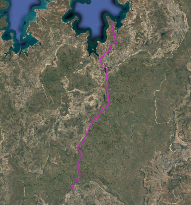
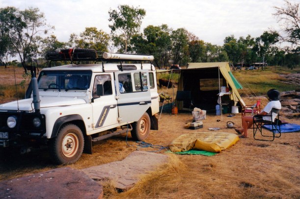
SATURDAY 22 JULY   THEDA STATION TO HONEYMOON BEACH   105kms

It was a cold night again.

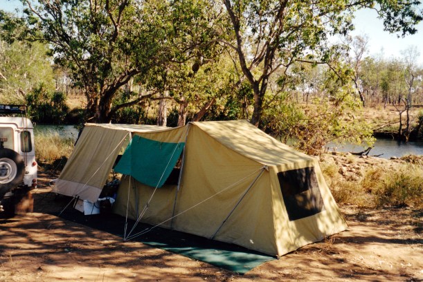
We were up at 6.30am, and packed and away by 9.30. No speed records there!

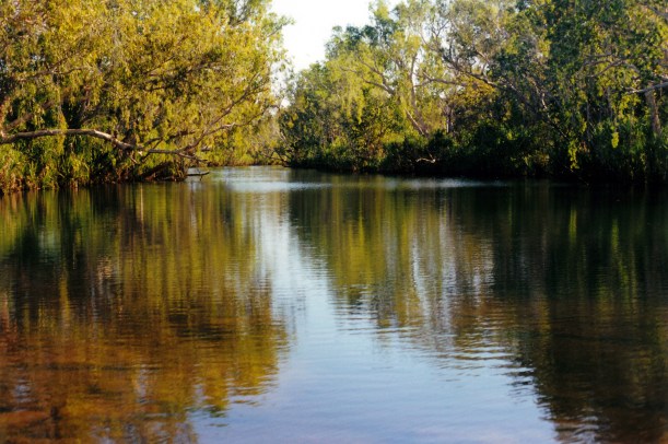
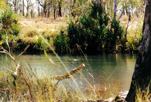
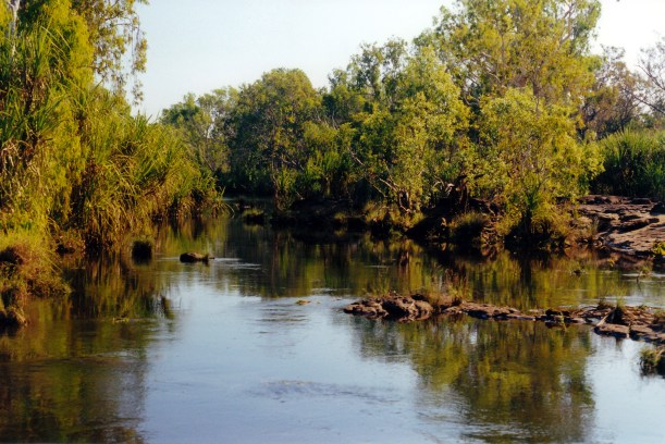
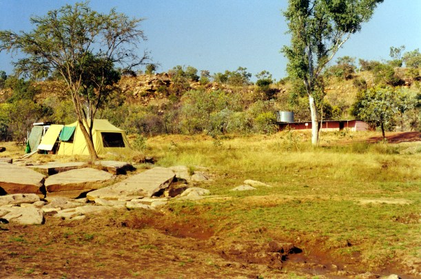
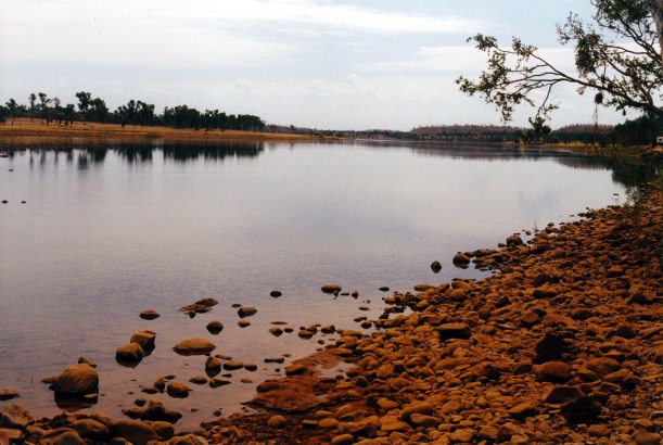
Our little freshie friend watched proceedings with great curiosity from the far side of the pool, for a couple of hours. He didn’t disappear until the tent was down.

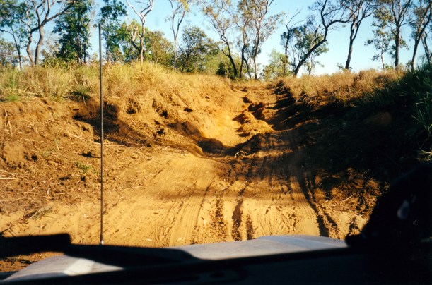
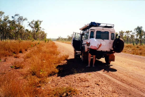
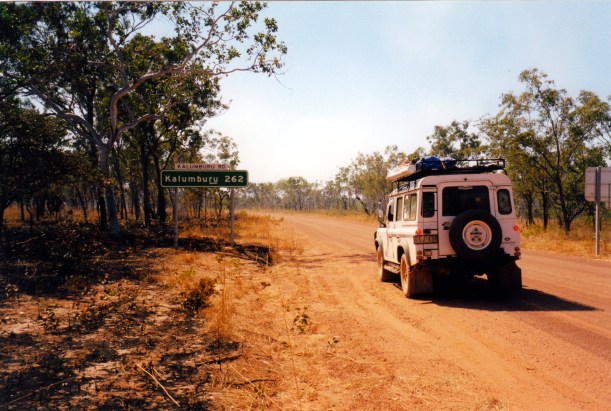
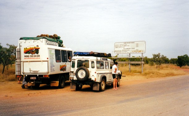
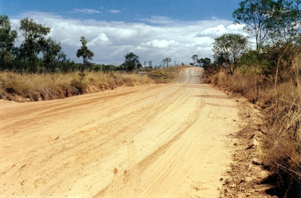
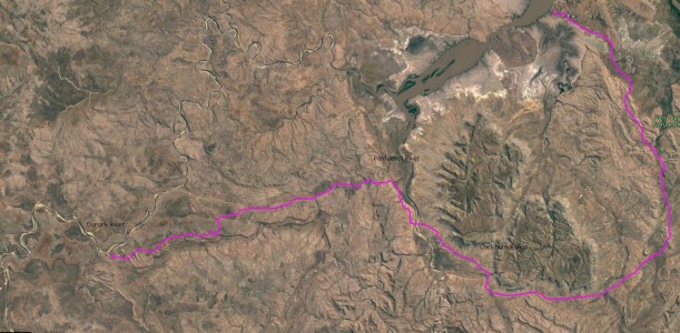
Turned north again, on the Kalumburu road. North of Theda, the road was very variable. It was quite reasonable in parts, in others just wheel tracks on stony rubble.

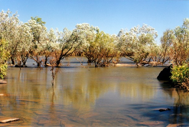
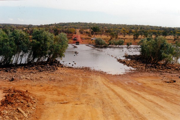
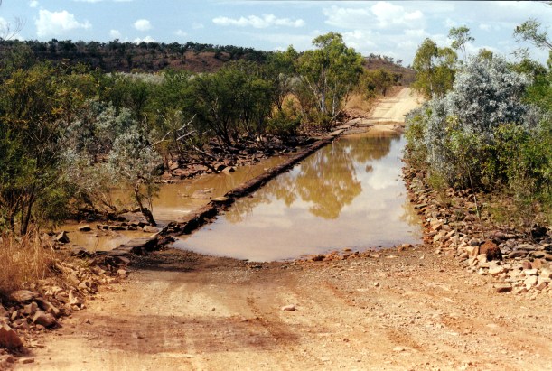
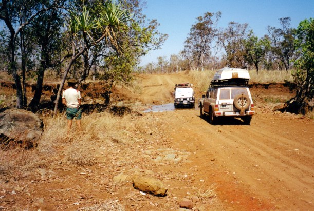
There were regular water crossings, most shallow and not very wide at all. Some just a muddy patch on the road.

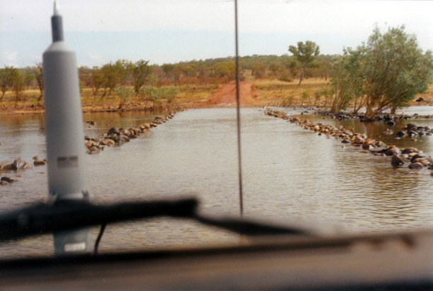
We drove into one such water crossing, following the tracks of a much larger vehicle that had entered the water on our side of the road. There was a car load of aboriginals approaching the crossing from the other side, so John kept to the one side. The water was very muddy.

We ground to a halt in the middle of what was basically a very large puddle! Even engaging the diff lock didn’t budge us. Eventually John worked out that we were hung up on a large rock. The tracks we’d followed must have gone each side of it, but he’d had a higher clearance!

07-22-2000 01 bogged .jpg

Not going anywhere…..

The aboriginal vehicle rocked and scraped, crossing beside us, but got through.

07-22-2000 02 bp truck left rock isolated.jpg

They stopped to watch but not to help……

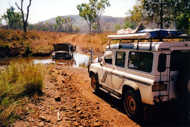
We had to winch out, but – as usual – there is never a good big tree around when you need one! However, there was a very large rock that we used.

It was not easy to set up for winching, with truck mired in knee deep water and mud. John hurt the soles of his feet, wading around getting out the needed gear and setting it up. Another tourist vehicle approached from the Kalumburu side, and he helped John with the winch. His wife complained to me about how expensive it had been at the beach camps there. They had gone and camped in the bush instead, and then been told off for being where they shouldn’t be.

The winching out produced a loud scraping noise from under Truck. We hoped it wasn’t a vital area! Our tourist helpers scraped their rear and exhaust, crossing where it was “good”. We wondered what this crossing would be like by the time we came back this way.

07-22-2000 03 winching out.jpg

Winching out, using large boulder as anchor

Obviously a big vehicle had churned up the crossing, recently, despite the supposed road closure to vehicles over 7 tonnes.That might have been the truck noise we thought we’d heard a couple of days ago. We were pretty annoyed.

07-22-2000 04 looks so innocuous.jpg

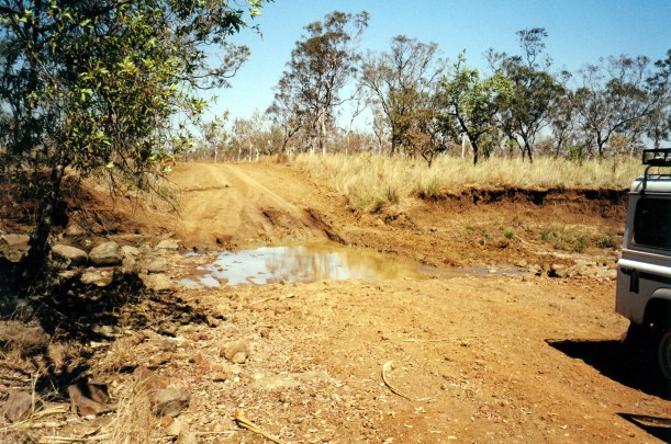
It looks so innocuous…..

Further on, we encountered some locals in a conventional car, stuck in another crossing. He was a white man, with an aboriginal lady and young child on board. We winched them out. We thought they would have more trouble where we were stuck, and warned them about it.

The lady said there had been a BP fuel road train into Kalumburu, because the town had run out of diesel. He’d been and gone, so our theory seemed confirmed. Pity they couldn’t have barged some fuel in, like they do in the Wet!

07-22-2000 05 helping out locals.jpg

Helping out some locals….

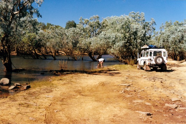
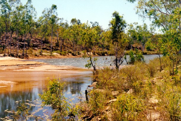
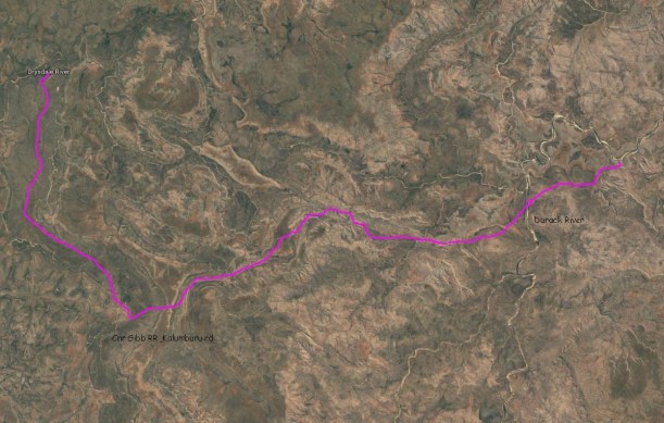
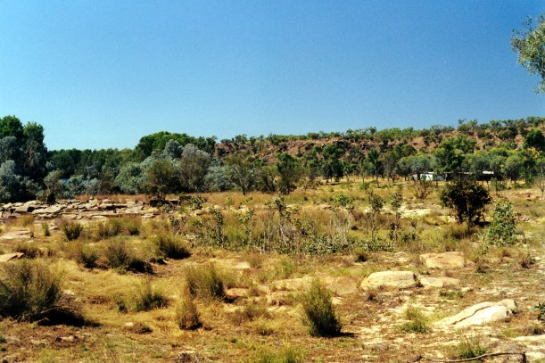
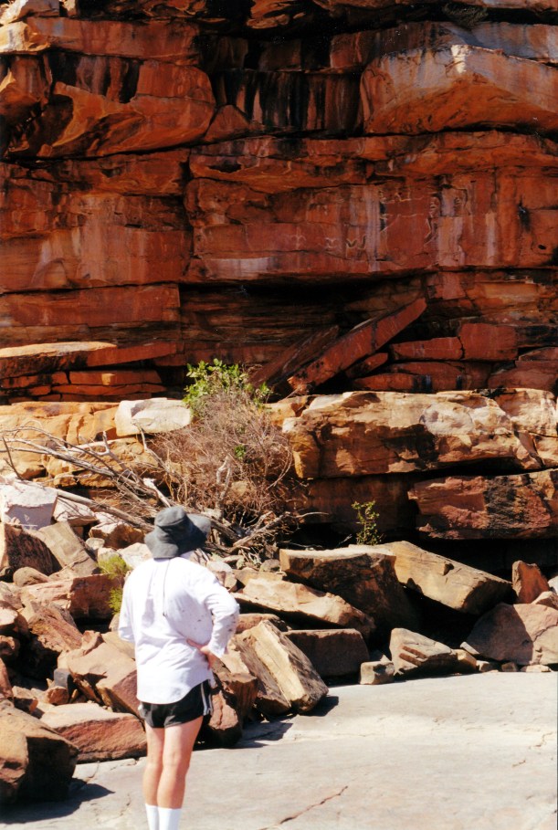
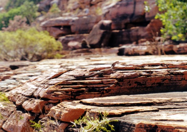
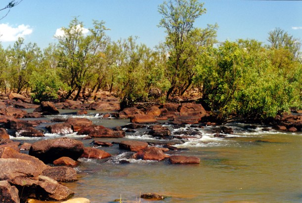
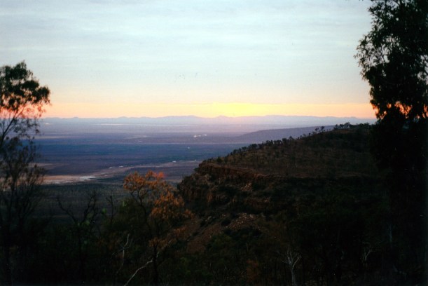
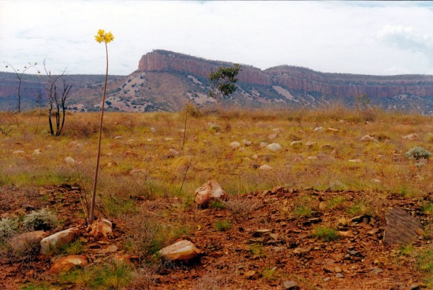
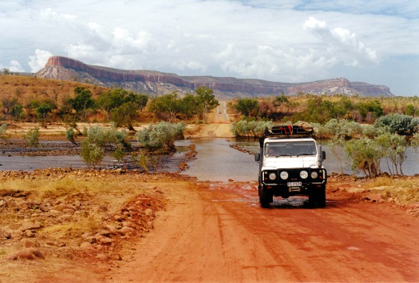
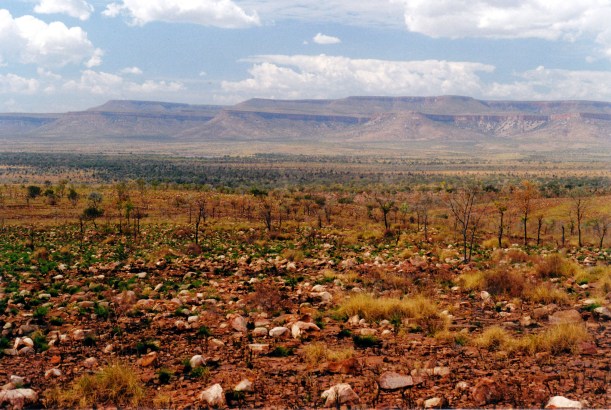
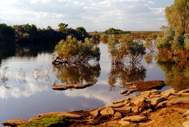
We travelled on, through some picturesque country, with hills, stony rises, creek gorges, and the black rock faces of the Carson Escarpment. The crossing of the larger Carson River was no problem.

The Kalumburu township did not look too bad, but it was all closed up, of course. It looked fairly well kept. There was some litter, but we had seen worse.

Kalumburu began about 1905, when Benedictine monks from New Norcia, near Perth, set up a mission for the aboriginals of the remote Drysdale River area – at the Pago Creek, some 30kms north of the present location. In 1930, the monks were joined by Benedictine nuns.

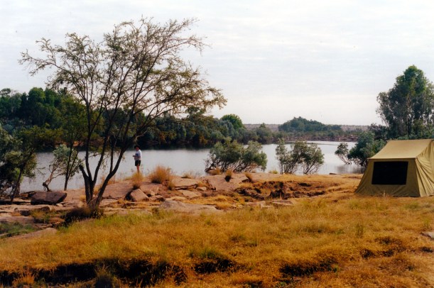
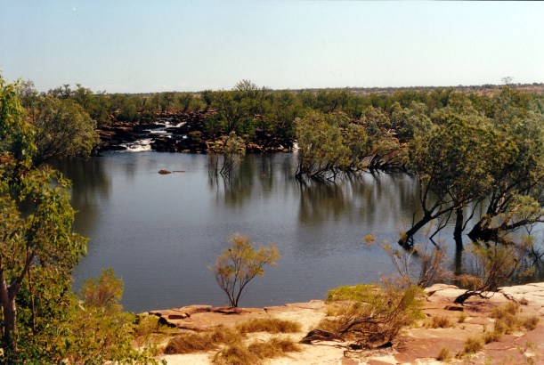
In 1932, the mission was moved to a site by a pool in the King Edward River, not far from its mouth, where there was permanent water. The mission was reliant on sea transport for goods it could not produce itself, although as air transport began, an airfield was built.

In WW2 the Drysdale air base became a significant part of the war against the Japanese, and Kalumburu was attacked and bombed. Many of the mission people were evacuated to Wyndham for the war. In 1944, the Truscott airfield was built on a peninsula on the other side of the bay, and the Drysdale base became less important.

Until 1951, the settlement was called Drysdale River Mission, then the name changed to Kalumburu. Cattle grazing and some cropping were successful activities, with the place being largely self sufficient. There was an emphasis on education – albeit for limited roles – and improving health.

The 1970’s saw the construction of a road south to meet the Gibb River Road, so land transport to the mission was established, in the Dry season.

In 1981, despite much resistance from the Mission, who did not regard them as capable of running their own affairs, the aboriginals obtained independence from the Mission and after that, Kalumburu was administered as an independent settlement, which now has about 500 people. It has the usual, store, Town Office, school, medical centre. The Mission remained, though, in its own premises, staffed by a few priests and nuns. It runs a church, store, museum, camping ground, and has the only fuel outlet in town.

Those religious staff who remained at the Mission must have been so disappointed to see the decline of the place under self-determination, and the descent of the people into welfare dependency, with increasing alcohol and drug issues, decreasing school attendance and literacy rates.

We had thought to stay in the Mission’s camp ground, but there was not anyone in it, so we decided to go and see what else was on offer. Our Kimberley guide wrote of two camp areas on the coast, run by local indigenous families. We aimed for Honeymoon Beach, the further of the two, but written up as the better one. It was about 26kms north of Kalumburu.

The road went out past the airstrip. Having the Moon’s guidebook was a godsend here, as signposts were non existent. The gravel road soon became more of a track. It was sandy in places and in others rather hard to follow. It was a matter of going the way that looked the most used, and hoping. There was a rudimentary sign at a fork in the track – left went to McGowans Island, straight ahead to Honeymoon – we hoped.

08-01-2000 sandy track.jpg

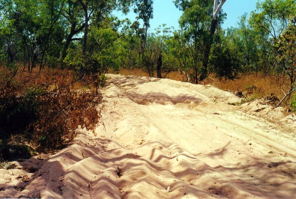
We hoped we were following the right track….

That last section of the track was quite tricky. New tracks had been formed, there were detours. There were a couple of signs at crucial points, thankfully.

We came to the end of the track, at Honeymoon Beach, and thought it looked quite good.

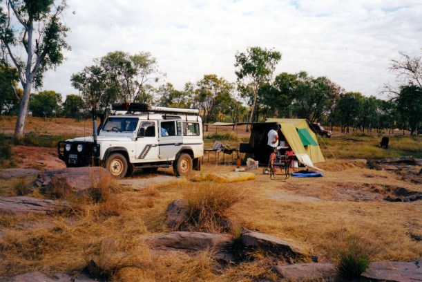
The Les French family lived is a large tin/steel shed structure, with a large open air veranda section. There were a lot of young children around. An old lady sitting under the veranda structure took our camp fees – $10 per head, per night. We paid cash – the only option – for two nights, and were sent off to find our own place to set up camp, down a slight slope from the shed.

We set up camp in some shade. There were 6 or 8 other lots of campers around, in quite a big area. We were able to connect into a power box – electricity was an unexpected luxury, out here. There were water taps, at intervals, around the camp area. There were two toilets – flushing – and two showers – all unisex – in a partly constructed block. The rest of the block featured a toilet sitting on a cement slab – not walled in yet, and presumably not plumbed or in use! There was a wood heater for the showers.

07-23-2000 honeymoon ablutions.jpg

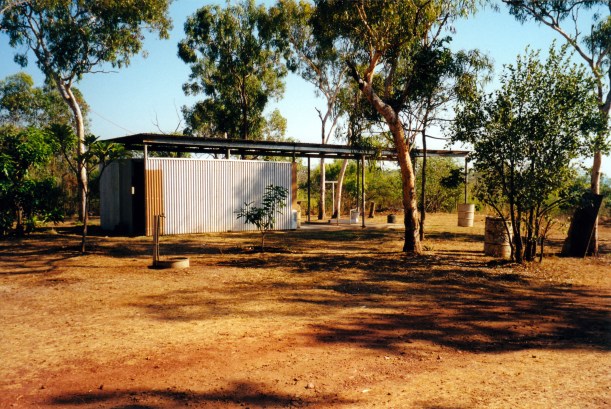
The partly built ablutions block

Our set up seemed to take ages. We were tired and hot. John had to change the plug on our electrical lead for it to fit the power point here, which is 10amp not 15.

We could just see the turquoise sea, down the hill. The sound of it was very strong.

I had a very welcome shower and washed my hair which felt full of Kimberley dust!

Just on dusk, we went for a walk along the beach – really pretty. There was a track down from our campground level to the beach, and down there was a large tin building, with campers staying in it.

There were people gathering oysters from rocks, further around from the beach – big ones!

We talked briefly with some of the other campers staying here. There were mixed comments from them about beach fishing here. John may go out on one of the fishing trips that Les French offers, at $40 a trip, which seems a reasonable rate – but John does not really like small boats.

We decided that, overall, this is quite a nice spot, and we would probably stay longer than the two nights we’d paid for, at this stage.

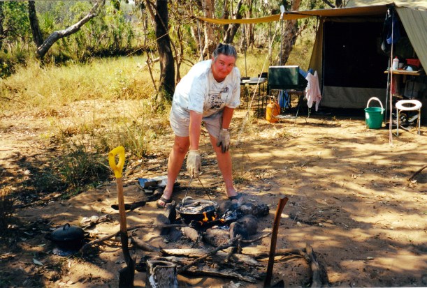
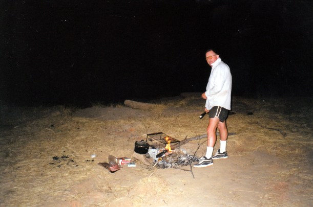
Tea was cold leftover patties from last night. John had baked beans with his.

After dark, the water went off. This did not auger well for the condition of the toilets, by morning!

It was very pleasant to drift off to sleep, lulled by the sound of the sea.

07-22-2000 to hmoon.JPG


Leave a comment

2000 Travels July 21

FRIDAY 21 JULY     THEDA STATION

There was heavy dew on the Truck and tent this morning.

I was up at 7.30. Washed the clothes I’d soaked overnight – they came out reasonably clean. This camping lifestyle does make clothes very grubby, very quickly.

The little freshie croc watched us for a while, doing its dead pandanus act. It is a pretty good act, too, but the floating upstream against the current is a bit of a give away!

No sign of our dark visitor, which I was tending to think was of the saltwater persuasion.

John fished again. Caught one of the turtles for which the pool is named – which he released, after apologising to it for the intrusion!

07-20-2000 tis turtle pool.jpg

John with turtle

After lunch, drove the 7kms up to the homestead.

07-20-2000 track to turtle pool.jpg

Part of the Turtle Pool track

We chatted with them about our croccy residents – they really want to believe the big one is a freshie, for obvious reasons. They are the locals, and should know best, but a little part of me is not totally convinced.

I bought grapefruit they had for sale from their own garden trees, and a polo shirt for me.

They confirmed we do have to move on tomorrow, because the camp is booked by others.

We’d decided against doing the Theda Bradshaw  art tour because of the cost.

07-19-2000 bradshaw art on pc.jpg

Bradshaw art

From their phone box, tried to phone Kalumburu to get a permit to travel there, on Saturday, but got no answer from the town office. When we’d enquired about this in Kununurra, had been told that the road was not open then and so there was no point in a permit. It had, of course, since opened.

07-20-2000 ford on track to camp.jpg

Ford on track to camp

Back at camp, did a little packing up.

07-20-2000 rapids near turtle pool

Morgan River near our camp

Tea was burghul and rice patties.

The moon was waning now. It rose later and was odd shaped. So the nights were not as bright.

We built up the fire again before going to bed.


Leave a comment

2000 Travels July 20

THURSDAY 20 JULY     THEDA STATION

Another hot day.

John made some radphone calls in relation to his oldest brother, C, who at 80 is not well. There is concern in the family about him.

John then went fishing some more. I walked down the side of the river for some way, and back.

07-19-2000 04 turtle pool, morgan r.jpg

Turtle Pool on the Morgan River at Theda Station

I noticed a grey “rock” in the pool by camp, where there hadn’t been one before, and spotted a croc – just eyes and nose – watching the camp. This was different behaviour to that of the little pale brown freshie we saw a couple of times yesterday, floating around over the other side, pretending to be a piece of dead pandanus, while it checked us out. It had also done its check, in the same way, this morning. It rather gives itself away, by floating upstream!

The grey watcher sank when he heard John coming back up the river bank, then resurfaced, and John saw him. I fetched my camera, but he went under again and came back up, across the other side, floating around for a while before swimming slowly away, upstream. He was about 3 metres long. I was unsure whether he was a very large freshie or a small saltie. He seemed quite bold, for a freshie, but we had been told there was a big one in the pool.

07-20-2000 turtle pool new croc.jpg

Larger, grey coloured crocodile

The question was whether he would come back at night for a closer look!

We had a quiet afternoon, in the heat. We played chess and yahtzee to while away the time.

In the late afternoon, John fished some more.

Tea was pasta with a tub of capsicum and olive sauce – quite nice.

07-20-2000 camp cook.jpg

Camp oven cookery

We made sure we kept a fair sized fire going through the night, getting up a couple of times to put more wood on it. When I was camping on a beach on Melville Island, with some Tiwi people, a decade ago, they kept a large fire burning between their camp and the water, as a croc deterrent.

Occasionally, we heard splashing noises from the pool. The night was cold again.


Leave a comment

2000 Travels July 19

WEDNESDAY 19 JULY     THEDA STATION

Woke to another hot day.

There was some burn off haze not far away. The area around the camp spot has been recently burned, so we have no worries about a fire near us.

We heard a vehicle which sounded like it was coming near us, but it faded. We think the main road might be not too far from here, across the river, so it was probably a truck.

John walked down to nearby rapids and later we both went exploring down that way – it was really pretty. The reflections in the water, in the morning light, are wonderful.

07-19-2000 05 rapids Turtle Pool.jpg

Rapids at Turtle Pool, on the Morgan River

We saw a little, pale brown coloured, freshie croc in the pool, over the other side from us, just floating on the water surface, looking for all the world like a dried pandanus leaf. Sighted him a couple of times, just hanging about there.

07-19-2000 02 freshie playing being floating pandanus leaf.jpg

Freshie croc playing at being a floating pandanus leaf, over by the far bank

There were some cattle around, but they stayed away from the immediate camp area.

John investigated under Truck again, and removed the remainder of the broken part, altogether. He thinks it will be alright to go on without it.

07-18-2000 02 didnt need it anyway.jpg

That part is no good any more!

I made bread, from a packet mix, forming four rolls and cooking them in the camp oven. The tops got a bit dark but otherwise they turned out well, and will be lunch for two days.

07-19-2000 burnt bread.jpg

Well done bread rolls!

John went off up the access track, on foot, hunting firewood, and discovered why some of the local timber is called ironwood! Hard to cut into and hard to get axe out of! And heavy.

07-19-2000 03 its ironwood

Axe stuck in ironwood

He then tried some fishing and caught a black bream.

After lunch, we went for a walk back up the track we’d driven in on, looking at birds. There were lots of them. The bee eaters put on a great show by camp, as does a kingfisher. On the way back from our walk, we startled a large dark coloured snake – we actually startled each other! It disappeared very quickly into a crack in the ground. It looked like a taipan – and that hiding in ground cracks is taipan behaviour. That rather spoiled the enthusiasm for walking!

We lazed about camp during the hottest part of the afternoon.

07-19-2000 01 camp at turtle pool theda

Our camp at Turtle Pool

John had his bream for tea, with potato and some bits of vegies. I had potato and vegies.

At dusk we heard the vehicle noise again – going the other way.

John phoned his sister on the radio. He then went fishing for a while.

I sat by the campfire, in the moonlight. It became quite cold.

Tonight’s sleep was rather disturbed by the noises of cattle nearby and croc growls from the river.


Leave a comment

2000 Travels July 18

TUESDAY 18 JULY   DRYSDALE RIVER STATION TO THEDA STATION   160kms

It was another hot day.

We were up at 6.30 again, and away two hours later, after topping up our water containers.

We drove into Miners Pool to have a look – 3.5kms from the main road. It was a much bigger camp area than I remembered, strung alongside the waterhole, and with pit toilets. It would have been a fairly pleasant place to stay, after all.

The Kalumburu road was still closed to vehicles over 7 tonnes, beyond Drysdale River HS, and was listed as 4WD only. It is usually later to open than the main Gibb River Road, and also later to be graded.

We encountered several muddy sections of road. After going through one of these, there was much grinding from under Truck. We stopped, looked, drove it back and forth a few times. John decided the noise was coming from the left rear wheel. He jacked Truck up and took off the wheel. The shaped metal plate that protects the brake was buckled and rubbing on the wheel. The bolt area was still attached, so part of it had just torn off! John took it off to stop it rubbing any more and ensured what was left was clear of the wheel.  He buckled a bit of the Truck frame using the jack – did not have it in at the right angle.

07-18-2000 01 nasty noise in wheel.jpg

Having some difficulties – checking out the noise from the wheel (and losing shorts!)

We passed the turn off to the Mitchell Plateau and continued on to Theda Station, through some Livistona palm stands. Mostly we passed through typical Kimberley savanna scrub and woodlands.

The road was great in sections, corrugated and dusty in others. It was not fast driving. There was very little traffic.

We reached Theda at lunchtime. There were two other travellers’ vehicles there, having tyres repaired.

The Theda person said we could bush camp at their Turtle Pool site, for $14 a night, but it was only available for four nights. Their other dispersed camp sites were not available as the tracks were still too cut up. The tracks to Worriga Gorge and King Edward Falls, that we’d read about and thought of driving, were still inaccessible – but we could do their Bradshaw art tour for $55 each! Hmmm – we would need to think about that.

He also said that a large freshie croc lived in Turtle Pool!

I bought magnets and postcards.

We drove out to Turtle Pool, about 7kms away, crossing the Morgan River, which was shallow at the ford and not very wide. The track was rather basic.

07-18-2000 morgan river at track ford.jpg

Morgan River,  taken as we forded it

07-18-2000 03 track to Turtle Pool camp.jpg

The track to Turtle Pool

We set up the big tent, in a shaded part of a clearing, not far from the river, then had lunch.

John had a sleep for a while, then he fished. Caught a couple of little somethings – bait?

I went for a walk, exploring along the river for a little distance. Turtle Pool was a lovely, long, wide stretch of the Morgan River – it was a serene spot.

Tea was the last of the corned beef, potato, some salad.

It cooled down really quickly once the sun set. We discovered that there were mozzies here!

John took the lamp and went off to fish, which left me with nothing to do except sit and stare into the darkness! Even with light, I have found the evenings a bit boring – miss having books to read.

Eventually the moon rose.

John returned with no fish. We turned in. There were lots of night noises – splashes from the pool, night insects – but we slept well.

07-18-2000 to theda


Leave a comment

2000 Travels July 17

MONDAY 17 JULY   JACKS WATERHOLE TO DRYSDALE RIVER STATION   188kms

We were up at 6.30am, and away at 9. That included a stop at the store to buy a tea-towel, a Tshirt for John and one for K for Xmas – because it has a big barra on the front.

It took John longer than usual to pack the Truck because he had to work out how to position the big water container so we could fill it at the Durack River crossing, upstream from here. We wanted to fill it where the water had the best chance of being unpolluted at all.

After Jacks Waterhole, the GRR was corrugated, with bulldust patches, for a way. then we got onto grey slaty material and that was much better going. That proved to be a pattern – the red soil road sections were cut up, the grey harder ones better.

These days, with its rapid growth as a tourist route, there is constant work (in the Dry) to improve the road and keep it in reasonable condition – or try to!

We could see that it has changed since ’93 – it was easier travelling now.

We could also see that some of the places one could bush camp back then, are now prohibited for camping – according to our booklet information. It also seemed, from what we saw, that plenty of campers ignore such prohibitions.

There were several water crossings, none higher than about half way up the wheels.

07-17-2000 01 durack r ford on grr.jpg

Approaching the Durack River crossing

We stopped at the Durack River and filled the water container. This was obviously a place where people camped.

07-17-2000 02 getting water Durack River.jpg

Filling water container at the Durack River ford – from upstream!

We stopped at Russ Creek for morning tea. In ’93 we had an overnight camp here. The creek is much higher than it was then, and the area where we camped is obviously very frequently used, now – and not left very clean!

07-17-2000 03 russ ck;1993 camp. more water now.jpg

About 110kms west of Jacks Waterhole, we turned north onto the Kalumburu road.

07-17-2000 04 cnr grr and kalumburu rd.jpg

Corner Kalumburu and Gibb River Roads – and lots of red Kimberley dust

Just a short way north of the corner, was the ford of the Gibb River. This was obviously another popular camp area.

This road was much rougher, with long sections of corrugations and bulldust. It was rather reminiscent of the Cape York road.

We reached Drysdale River Station at lunchtime.

The brakes were grating with mud/water/dust as we arrived!

We refuelled – $1.30cpl. Paid $16 to camp the night there.

John would have preferred to go on and camp at Miners Pool, just a little further, on the Drysdale River, but I remembered that it had not impressed us all that much, last time we came this way. Of course, with more water around now, it might have been nicer. It would have cost us $8 to bush camp there, whereas here we had tapped water, showers, toilet.

There was a big workshop at Drysdale River, doing a steady trade in vehicle repairs, including on an OKA with clutch problems. The workshop kept going until well into the evening.

We were on our own in the camp area – a fairly ordinary but grassed area – until about 4pm, and then lots of campers rolled in, so it became quite crowded.

07-17-2000 05 drysdale r camp.jpg

Our dome tent tucked in under the trees at Drysdale River Station

We only put up the dome tent – quick and easy for one night.

From the phone box at the shop complex, phoned K and left message where we are.

Tea was cold corned beef, potato, salad.

It had been another hot day, but cooled enough after sunset for us to need long trousers and windcheater to sit outside.

The moon was full again. We missed the night time curlew calls we’d had at Jacks.

07-17-2000 route.JPG


Leave a comment

2000 Travels July 16

SUNDAY 16 JULY     JACKS WATERHOLE

We were woken by a really red sunrise, glowing into the tent. However, I was too sleepy to get up and go take a photo of it! I think the smoke from all the burning off is responsible for the red.

After breakfast, we went walking again. Upstream, this time.

07-16-2000 03 Durack River light.jpg

Durack River. Brown line across trees show line where water was up to for a time

There were not the cliffs of the other direction, that we had yesterday, but were still some rock shelves and jumbles of stone, and a steep slope on the far side of the river.

We saw some birds that proved hard to identify: olive green with a smoky red upper tail and back, and some red in the wings, a finch-like face, a dark beak. They were after insects or seeds. Seemed to have elements of both the Crimson Finch and the Firetail. It remained a mystery.

We walked as far as some rapids in the river – yet another great outlook. We sat on the rocks for a while, just looking and listening.

07-16-2000 01 other end Jacks Waterhole.jpg

Upstream rapids where river widens to become Jacks Waterhole

On the walk back, detoured via the store/office. Looked at the detailed maps of the area that were displayed there, and talked with the lady manager. They leave in November, while the road is still passable, go to Qld for the summer, and return at the end of the Wet. She said that his year it had been such a big job to remove the mud from the buildings – the uneven stone floors mean that shovels can’t be used. It must all be hosed and broomed out. Her husband has staked out a claim on some of the area – he wants to build a stone house up on the bluff above the camp area (someone who thinks like John!). But she says it is not for her, and the aborigines will object to the claim, anyway.

07-16-2000 05 durack river camp.jpg

The floods earlier this year reached inside the amenities block shown

We spent another quiet afternoon at camp.

A plane that had flown over, low, in the morning, had in it a German lad who is working here. We were talking to him later in the afternoon. The plane had flown out of Home Valley because the Durack River airstrip had not been repaired after the Wet. He said they’d flown for nearly two hours – but it affected his stomach!

There was fire somewhere nearby. We could smell it. Either a burn off or a camper’s fire that had got away. It is hard to tell, sometimes, in this country.

07-16-2000 04 durack river hs flooded to 1m in 2000

All this area was under water earlier this year – it was up to a metre deep in the building  shown

A large tour bus came in, during the afternoon. About 30-40 people in an ordinary bus. It was a real mix of people and thus interesting to watch them. There did seem to be some really obnoxious types amongst them, though – loud and opinionated.

I cooked a piece of corned beef for tea. It was ok, and will do us for three meals. John cooked potatoes in the coals of the fire, and I cooked zucchini and carrots as well. The honeydew melons had gone off – were mushy inside. So, they don’t keep!

There was a full moon at night and then a funny eclipse-like effect – a sort of browny shade over part of the moon.

07-15-2000 10 full moon and shower block jacks waterhole.jpg

Full moon over camp

It cooled at night and we needed windcheaters to sit outside.

It was tempting to consider staying on longer here as it is such a beautiful place, but we do have a lot more of the Kimberley to visit.


Leave a comment

2000 Travels July 15

SATURDAY 15 JULY     JACKS WATERHOLE

We woke up early – it gets very light inside the tent!

I washed out a few items of clothing that I’d soaked in our wash dish, overnight – it makes washing by hand so much easier.

We ate breakfast looking out over the waterhole, admiring “our” superb view. We really were lucky to get this spot.

07-15-2000 01 camp by jacks waterhole.jpg

Our position by Jacks Waterhole

The family that came in at 9pm yesterday had a very mangled tyre on the back of their Jayco Hawk – and the camper looked very much the worse for wear, overall. They did not appear to have any extra spare tyres, either. We thought they were really not well set up for these roads.

We went walking, downstream. Followed cairns that guided us to an area of aboriginal art, up in the cliff wall. It did not seem of much note.

07-15-2000 03 rock art.jpg

Some rock art on the low cliffs beside the Durack River

The way was over blocks of sandstone and big rock shelf areas, so it was quite interesting. We saw a rock wallaby and a white quilled rock pigeon – finally – I have been trying to spot one of these for ages! There was a large water monitor on a rock ledge, and we saw a freshie croc in the river.

07-15-2000 02 water monitor

Rock shelves and water monitor

We eventually reached a place where, on the other side of the waterhole, a tributary stream came in over a set of rapids – really pretty. There was quite a flow of water coming in. We thought this was where some people had been catching barra.

07-15-2000 04 tributary of Durack

Tributary stream entering Jacks Waterhole

We continued on to where Jacks Waterhole ended in its own set of rapids, after which the river became quite wide and flowed on. There was too much water flow for us to be able to cross to the other side.

07-15-2000 05 rapids Durack River.jpg

Rapids on the Durack River at the end of Jacks Waterhole

We talked for a while with a young couple, with kids, who’d walked that far. He’d tried fishing, with no luck. We walked back towards camp with them.

07-15-2000 07 reflections in Jacks Waterhole.jpg

Durack River at Jacks Waterhole

The sandstone cliff walls were varied colours and interesting to look at, as we walked.

After lunch, we had a lazy afternoon at camp, in the heat. It was beautiful to just sit and gaze over the waterhole.

07-15-2000 08 more reflections Jacks Waterhole.jpg

Late afternoon reflections in Jacks Waterhole

John listened on the radio to the football.

The chops that I had planned to cook for dinner had gone decidedly “off”. A bone must have put a minute hole in the cryovac bag. They were very green and slimy and smelled ghastly. I resolved not to ever again get things with bones cryovacced!

We had steak instead. It took ages to cook on the wire BBQ frame, over the fire. John had his quite rare. I left mine cook longer and ate my potato and salad first. The steak tasted of strange smoke and I didn’t eat it. The wire frame sits a bit high up for some cooking, and the fire wasn’t the greatest, either. After we’d finished cooking dinner, the green chops were thoroughly incinerated!

07-15-2000 11 cooking dinner.jpg

Cooking dinner

We were tired from the walk and went to bed before 10pm.

The night was cool enough for the doona again, despite how hot the day had been.

The curlews were calling again.


Leave a comment

2000 Travels July 14

FRIDAY 14 JULY   WYNDHAM TO JACKS WATERHOLE   193kms

We got up before dawn to drive back up The Bastion and look at the sun rise over the Gulf. It was alright, but not stunning.

07-13-2000 sunrise bastion lo.jpg

Sunrise from The Bastion

We seemed to take ages to pack up and did not get away until 9.30. It was a very hot and sweaty job too.

Refuelled at Wyndham – diesel here was 2.8cpl cheaper than in Kununurra, at 98cpl.

I felt fine about leaving the van at the caravan park.

Drove back down the highway again, for 52kms, to the junction with the Gibb River Road, and turned west onto this.

07-14-2000 01 cnr gibb river rd.jpg

Corner of the Gibb River Road and the highway

The Gibb River Road evolved over some time. It has become one of the classic dirt road drives of Australia. It closes in the Wet season and for much of the Dry can have wet stream crossings. Depending on when it was graded, it can be quite rough. A number of the cattle properties along its length have set up camp areas for travellers.

The route of the road follows the explorer Frank Hann’s 1898 route from the west, as far as where Mt Elizabeth now is. In 1901, the Brockman expedition came from the Wyndham end as far as Mt Elizabeth, then went north. They named the Pentecost and Durack Rivers.

From 1914, on, the pastoral settlement occurred and leases were taken up. Until the Beef Roads scheme of the 1960’s, the road was a rough track between Derby and Mt House, then it was improved for cattle trucks, and named the Gibb River Road, because it reached as far as the Gibb River. In the 1970’s, it was pushed through to the Wyndham end and also a road was formed north to the Kalumburu Mission.

It felt great to be on the Gibb again – finally! We drove this in ’93, from the other direction, and without a great deal of time to linger at its attractions.

It was a pity that it was so hazy from all the dry season burning in the region – it would affect the quality of my photos.

07-14-2000 02 Cockburn Range from GRR

The Cockburn Range from the Gibb River Road

There was quite a bit of traffic on the road, until we passed the turnoffs to Emma Gorge and El Questro – obviously, people go that far and no further, even day tripping from Kununurra.

We kept encountering a tour group in a 4WD – a nice group. We saw them at Wyndham yesterday, and at the Gibb River Road turnoff this morning. John had flagged him down, just out of Wyndham, to tell him that one of his back wheels was very wobbly – he said he’d had it checked and it was ok. The group members are paying $1600 each, for an 8 day trip from Darwin to Broome!

Almost 60kms along from the highway, we came to the main obstacle to travellers on the Gibb – the crossing of the Pentecost River. As one would expect, after a generous Wet season, it was quite wide. Our last time here, in ’93, it had been dry and there was a mustering camp in the river bed!

07-14-2000 04 approach to pentecost r.jpg

Approaching the Pentecost River crossing

This is one river crossing one does not walk to check depths first. There are very large saltie crocs live in the Pentecost – lots of them. It is also a place where I would never camp on the banks downstream from the crossing – though some do. El Questro is some distance upstream from here, by the river; we were camped there in ’93, in late June, when a good sized saltie was caught in the river pool below the main guest house.

We sat and watched some other vehicles do it – the route is clearly marked by rocks at the sides. It looked straightforward, although obviously a bit rocky, as vehicles crossing jiggled around a bit. It only looked to be about 45cms deep. We ploughed on through – yes, it was a bit rocky, but nothing major.

07-14-2000 07 crossing the Pentecost.jpg

Crossing the Pentecost River

07-14-2000 08 upstream view Pentecost ford.jpg

Looking upstream as we crossed the Pentecost

07-14-2000 06 downstream Pentecost R at crossing

The Pentecost River downstream of the crossing. Home Valley Station land on the far bank

We stopped on the far side, to photo the crossing and the view back the way we’d come. The outlook back to the Cockburn Range was superb.

There was water draining out of the underside of Truck as John sat waiting for me!

07-14-2000 09 through pentecost r.jpg

Looking back across the Pentecost to the Cockburn Range

After the crossing, the road climbed up a ridge and we stopped at the Cockburn lookout at the top, to look at the way we’d come. There was a vast panorama across the wide Pentecost valley, to the Cockburn Range behind. This section of the Gibb is undoubtedly really scenic.

07-14-2000 10 pentecost valley LHS.jpg

Pentecost River valley and Cockburn Range from Cockburn Lookout

A little further along the road, on a gentle corner, an oncoming rental 4WD that was going too fast, startled an eagle by the road side. it did not fly clear in time and was hit. It was horrible – feathers and pieces of eagle went everywhere. The bird was killed. It must have given the people a real fright, as it plastered across their windscreen. We certainly hoped so – it might have made them slow down after that. This incident highlighted what is actually the greatest hazard of the Gibb – other travellers going too fast. Overseas hirers of 4WD vehicles are the worst offenders.

After the Pentecost, the few stream crossings that we encountered were really just puddles, although the Bindoola Creek crossing was maybe 30cms deep, and edged with rock – presumably to keep travellers on a safe track through it, as there was a bit of a downstream drop off. The name of Bluey O’Malley’s crossing commemorates one of the pioneering drovers of the area.

07-14-2000 12 gibb nr bindoola ck.jpg

Gibb River Road just before Bindoola Creek

07-14-2000 13 Bindoola Ck ford.jpg

Bindoola Creek ford

We stopped by the road side just after Bindoola Creek, for lunch.

Then we continued on, to Jacks Waterhole, or Durack River Station.

The Sinnamon family held the Karunjie and Home Valley pastoral leases, until last year, when they sold to the Indigenous Land Corporation. In the 1970’s, when the Gibb River Road was realigned to pass close to the Durack River in one section, Sinnamon set up a tourist operation at a large waterhole on the river, calling it Durack River Station.

Although the buildings at Jacks Waterhole look like they were once a station homestead complex, there was never one here.

At the office/store structure, we booked in. It had a cement floor and corrugated iron walls – these had marks on which recorded the levels reached in the ’97 and 2000 Wet season floods – about a metre up the walls! Apparently, the ’97 flood was a bit higher, but came up and went down fast, whereas this year’s lasted longer. The German lady – half of the couple managing the camp area – said that it had not been fun to come back after the floods to clean out all the mud. I bet! The location might be a great one from a tourist viewpoint, but it is very prone to flooding.

The waterhole was a lovely place – a long, tree fringed pool of the Durack River.

07-14-2000 14 afternoon Durack River.jpg

Jacks Waterhole on the Durack River

We paid $14 a night to camp here – no power or formal sites, of course, but a newish corrugated iron amenity block with flush toilets and hot showers – if one wanted hot, in this weather!

We cruised around the tracks in the camping area – all quite informal – and found ourselves a lovely spot to camp. There was no shade, but rocky outcrops and wet season erosion channels ensured no one else would be able to set up near to anti-social us! We had a brilliant view down over the waterhole, and it was not too far to walk up to the amenity block, on a bit of a terrace above us.

It was early afternoon when we’d reached Jacks Waterhole, so we were able to take our time, setting up camp with the big tent. Hoped that the occasional cow grazing nearby would not come too close to the tent!

07-14-2000 15 camp jacks wh.jpg

Setting up camp at Jacks Waterhole – and watching the cow!


Then we sat and relaxed, looking out over the view. It was really peaceful and pleasant.

07-14-2000 16 camp and home jacks

Lilo almost inflated. The “homestead” buildings in the background

The 4WD tour group we’d been encountering, were camped here too, and its members were swimming in the waterhole. I was not sure that I’d trust it to be saltie free! The camp manager had said there were barramundi in there – I’ve always believed that where there are barra, there can also be salties!

There were few other campers when we arrived, but there was a steady stream of arrivals through the afternoon. We were later surprised that three lots came in after dark, including one 4WD, towing a popup Jayco camper – at 9pm! Travelling the GRR in the dark seems rather silly to me – missing all of the wonderful scenery. That late lot had much difficulty finding somewhere to set up, in the dark, and in the end gave up and parked on a track. They then seemed to have much difficulty getting the top of the camper to wind up – not really built for these roads!

Later in the afternoon, John radphoned sister H. When he’d finished, I checked in with the VKS Base at Alice Springs, to let them know our location and intentions.

Tea was curried leftover sausages, rice, followed by melon.

The evening was pleasantly cool. We needed the doona.

During the night, there were lots of curlew calls in the distance – nice.

07-14-2000 to jacks.JPG


Leave a comment

2000 Travels July 13

THURSDAY 13 JULY     WYNDHAM

Over breakfast, I told John how worried I was about the van left at Argyle and how I wasn’t sure I would enjoy going on with the trip as planned. It turned out that he was uneasy too. He came up with the idea of going and getting it, and storing it here at Wyndham. The caravan park manager, P, said he would store it right by his van and living area, and keep a close eye on it – for $20 a week. That sounded much better!

So we set off in the heat and drove back to Lake Argyle. It only took us about half an hour to secure the stuff in it for moving, put the bikes up on to the rack, etc and go. We gave the manager there two rock melons as a thank you gift, and paid him $4 for the two nights. It was not his fault that the Village admin had decreed that our van should go into the Works area.

We had a stop on the way back through Kununurra. Got money from the bank. Bought John a new pair of bathers, shorts style, as his old ones were so thin as to be indecent! John had another pie and pastie lunch!

We took the van on to Wyndham and set it up on the slab behind the manager’s hot food van.It had not been as hard a day as we thought it would be. We drove 363kms!

07-13-2000 van at wyndham

The van securely set up at Wyndham Caravan Park

We walked to the Post Office/store and bought a newspaper. It was a reasonable walk, and a change from being in the Truck for hours.

Tea was savoury mince and a bread roll.

After tea, I cleaned out the Chescold camp fridge – it smelled of the spicy sausages!

It did seem to be a bit cooler here, at nights, by the coast.