This Adventurous Age

Adventures travelling and working around Australia.


Leave a comment

2000 Travels August 11

FRIDAY 11 AUGUST   BARNETT RIVER GORGE TO KUNUNURRA   555kms

John had a bit of a rash on his torso, yesterday afternoon, and he woke this morning much worse, with hundreds of little spots and itchy lumps. It was almost a measles-like rash, but he was not really feeling ill enough to have something like that. In fact, he did not really know if he was feeling ill or not! It did not seem to be a heat rash. We wondered if there had been something in the water at one of the swimming places – but I was not affected at all. Quite strange and rather concerning.

08-11-2000 01 john feeling miserable.jpg

John feeling miserable
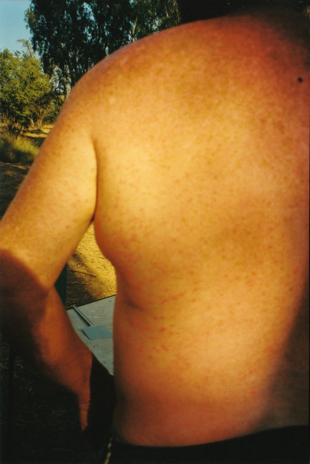
08-11-2000 03 kimberley rash.jpg

Very spotty!

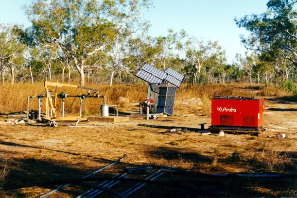
We packed up and continued west on the Gibb River Road, to Mt Barnett store, for fuel. This was $1.22 a litre.

We debated whether to continue on to Old Mornington, as had been our plan. This was about 100kms south of the Gibb River Road, by the Fitzroy River, and thus rather remote if John did get really ill. Our plan after that had been to drive the Tableland Track back to the east, if it was open  – and that would be particularly remote.

We decided to play safe and head back east along the Gibb, abandoning the plan to drive the Tableland Track.

Fortunately, we had gotten away early this morning.

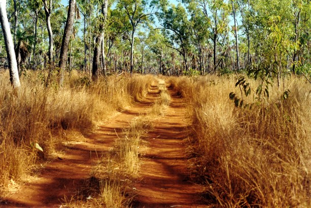
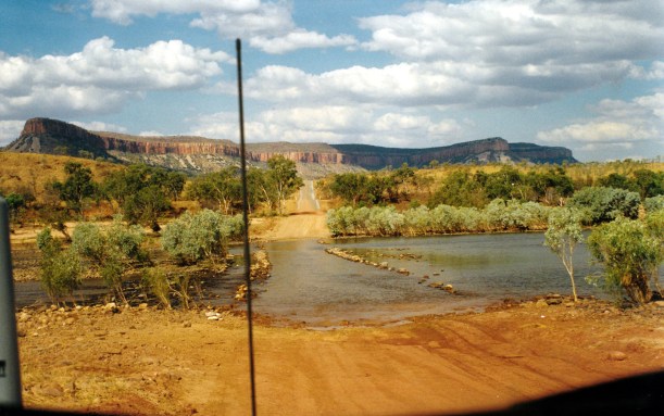
So we traversed the road already driven on this trip.

08-11-2000 gibb burnt and unburnt.jpg

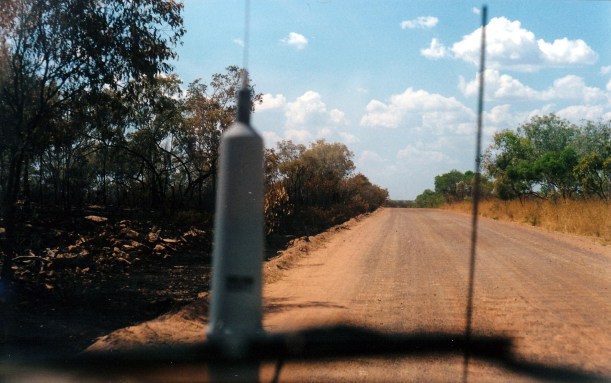
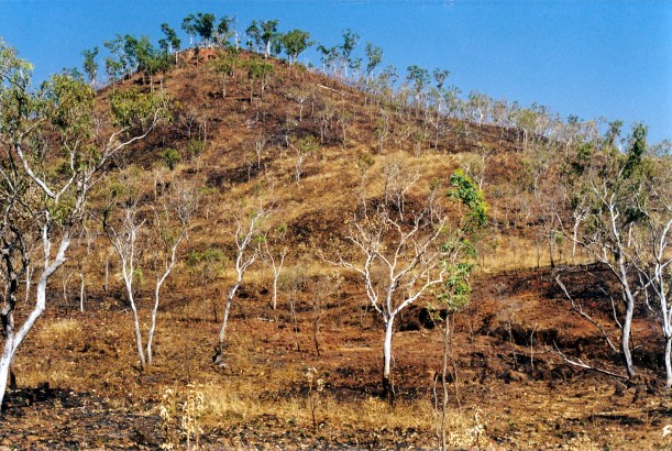
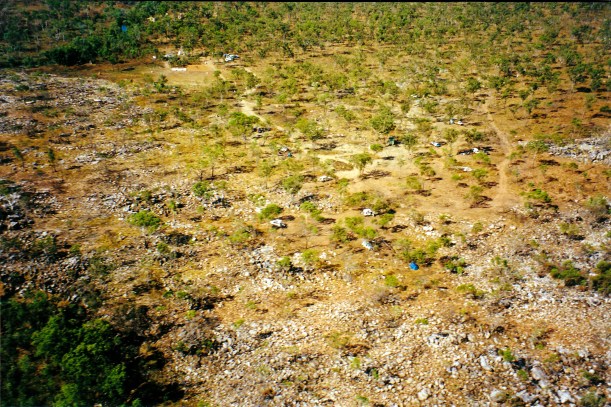
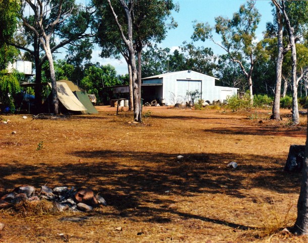
Gibb River Road – burnt and unburnt sides. The road is an effective firebreak for early dry season burns

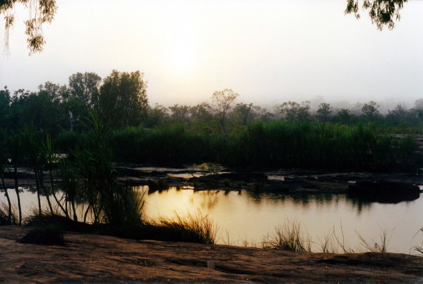
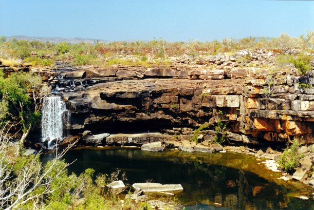
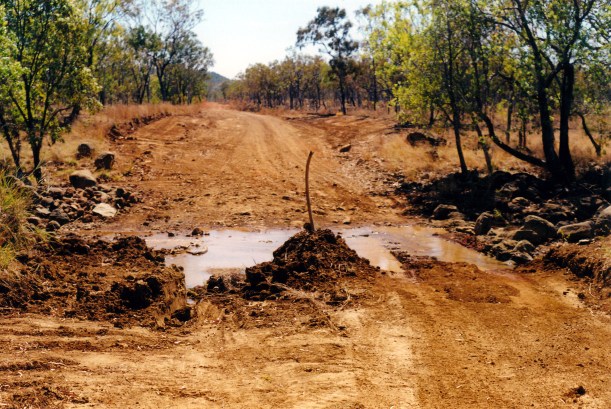
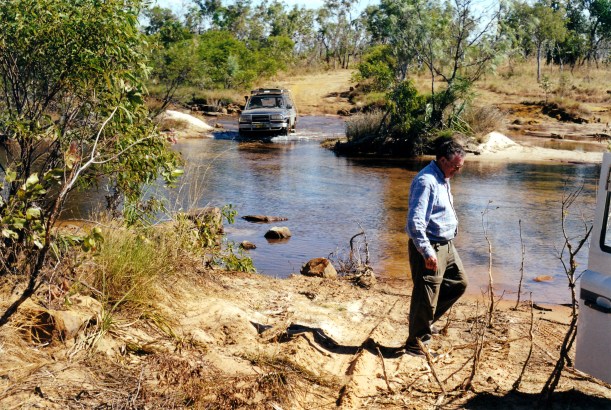
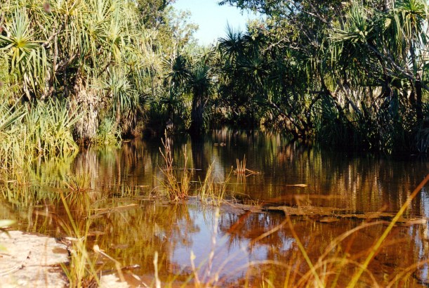
Stopped to have lunch at Bindoola Creek crossing, so we made good time to there. The ford was much drier than when we’d come this way a month ago.

08-11-2000 04 bindoola ck less water

Bindoola Creek with much less water

There was not much traffic. We wondered if the early heat was deterring some travellers?

08-11-2000 kapok and range.jpg

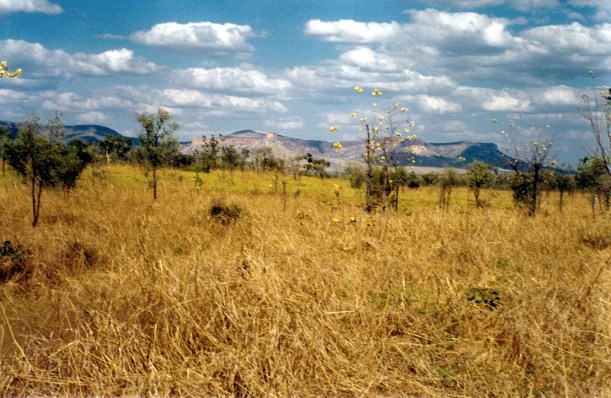
Kapok trees, the Cockburn Range and long dry season grass

08-11-2000 05 pentecost.jpg

The Pentecost River again

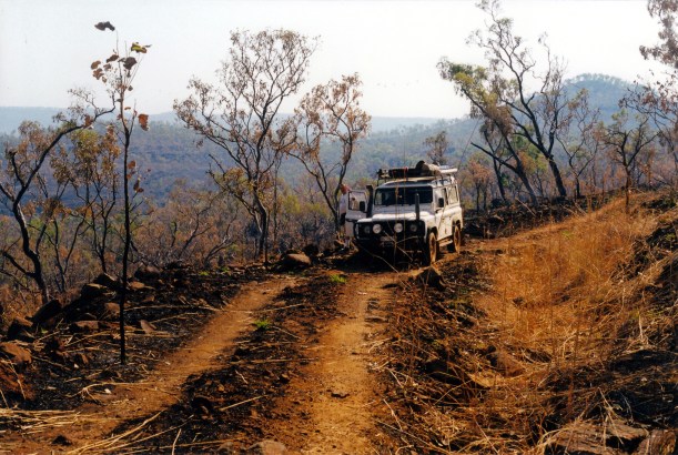
The road was more corrugated. There were now quite a lot of burnt areas. It was a relief to reach the highway and the bitumen again – it had been a while!

We reached Wyndham about 4pm. John went into the store to buy a newspaper and a cask of wine – we had been deprived of same for some time. I stayed in Truck , trying to phone Kununurra to see if we could get a place in a caravan park. John really wanted to press on there, if we could, rather than overnight at Wyndham. I think he just wanted one last burst of effort to get set up for a few days, before giving in to feeling miserable! It made sense to get settled in the larger town, in case he got worse.

An elderly aboriginal kept leaning in the open window of truck, asking me for the “loan” of a dollar. He was being quite pestering. This sort of thing is not the greatest experience for tourists. I remember R at Honeymoon saying that there was too much booze and fighting in Wyndham.

At the caravan park, it was great to see the van again, and see that all was well, even though it was also disappointing to have cut short the time along the Gibb. I actually felt quite dislocated – this morning was camped by the creek at the Gorge, and expecting to be camped by the Fitzroy River tonight, instead of being back in town!

It took us a while to hitch up the van, and secure things for travel, with some distraction from a horse that wanted to find food in the van, and actually stuck its head in the door.

08-11-2000 07 horse wyndham.jpg

Packing up at Wyndham

When we began to open up the van, I got quite a fright. This is rather a quirky caravan park and someone had put a life sized plaster statue of a jabiru by the van. I went to pick it up and move it out of the way – and it squawked and moved of its own volition! Totally tame bird.
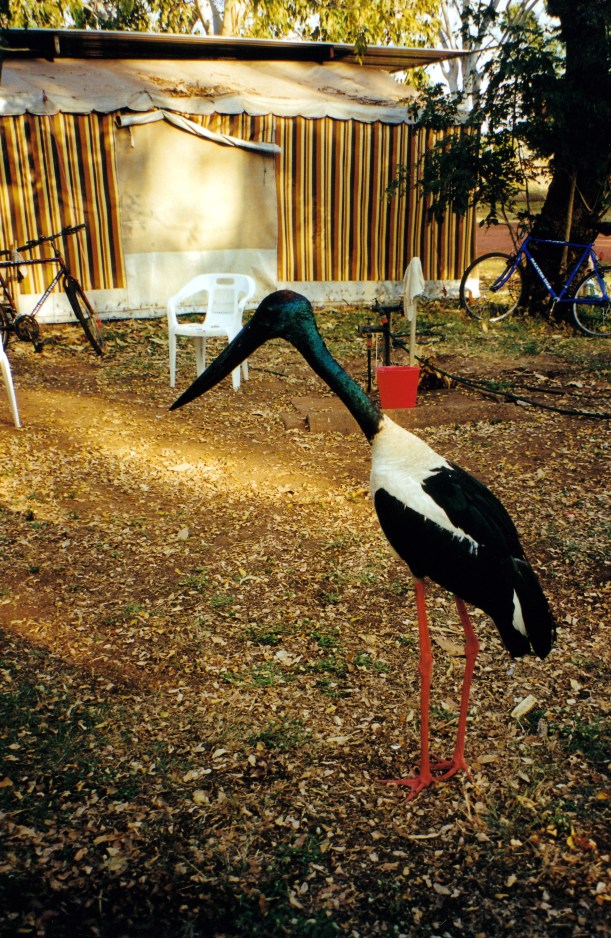
08-11-2000 06 jabiru wyndham.jpg

Jabiru – for real!

We paid our $80 storage fee.

It was just on 6pm when we reached Kununurra.

As it gets dark early in these parts, we drove the last part in the dark.

Set up at Ivanhoe Village Caravan Park, also in the dark. Our site cost $19.80, after discount. Having the last six nights free camped had been good for the budget.

John insisted on doing the full set up, even though he was tired and ill tempered by now. He made some annoying mistakes, which didn’t help, like putting the wrong side of the van up on a levelling block!

Late tea was bacon and eggs for John, which he requested – not really invalid food! I had some lovely vine-ripened tomatoes that I bought at the Reception desk when we were checking in.

The lady at Reception said there was a mysterious rash doing the rounds, and most of the Kimberley had it!  It was hard to work out how John came by it, though.

Well, at least we do not have to move tomorrow, and we are close to medical facilities, if needed. Greater peace of mind.

I have to admit that a proper shower was much appreciated!

Because of the requirement to get to Karratha for the Olympics, the original rough plan that I’d made for this jaunt, had us away for only about a month, anyway, and back in Kununurra about this time. However, it had not included such a long stay at Honeymoon. It had included Old Mornington, the Tableland Track, the Bungles, and the Duncan Road back to here! Clearly, was a rough guide only, and we have unfinished business in these parts. Next year?

08-11-2000 gibb.jpg

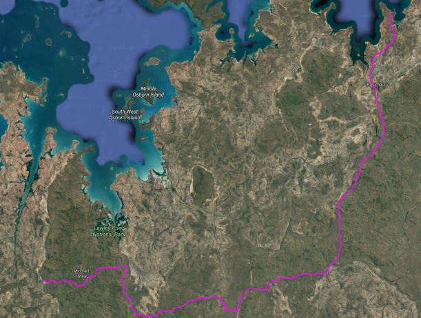
Where we drove and camped


Leave a comment

2000 Travels August 10

THURSDAY 10 AUGUST  KING EDWARD RIVER TO BARNETT RIVER GORGE  267kms

I woke to spatter sounds on the roof of the tent – heavy dew? Light rain?

There was misty cloud about and morning mist over the river, which was a different scene  again. The sun behind the mist created some interesting light effects. All yet another type of mood for this beautiful area.

08-10-2000 01 King Edward River morning mist.jpg

Morning mist over the King Edward River

We were up at 6am and packed and away at 7.45am.

Churned our way back through the river ford and were soon back on the main Kalumburu road, heading south, then the Gibb River road, heading west. The road was variable, from good to very corrugated, with some bull dust patches and places where rocks outcropped from the road. There were several water crossings but nothing that was any issue.

08-08-2000 15 king edward river.jpg

King Edward River ford – can be a bit tricky

We did not see much private traffic on the road, but did see several safari tour buses.

08-10-2000 03 gibb view east.jpg

Back on the Gibb River Road

After straightforward travel ,we reached the turnoff to Barnett River Gorge at lunchtime. We followed the track, which seemed to divide a few times. It was not really clear where the camp area was – I thought it was a pretty informal camp place. We found a secluded spot beside a little creek, edged with pandanus and cadjeput. There were lots of mozzies, though. It was a pretty spot and John liked it.

08-10-2000 09 barnett gorge camp.jpg

Camp spot at the Barnett River Gorge area

We did the basic set up, then drove further along what appeared to be the main track, for about 3kms. The track ended in what did look like a place for camping – but not as nice as where we were.

We parked there, then walked upstream, across stony country between loops of the river, following a track marked by varied and creative rock cairns. That took us to the gorge rim. We followed along that for a way, then the track took us down into the gorge.

08-10-2000 04 cairns barnett gorge tk

Cairns marked the route to the Gorge

08-10-2000 05 barnett gorge.jpg

The Barnett River down in its gorge

It was a lovely gorge, with red rock walls. It was quite wide, so there was enough light for a variety of vegetation to grow. There were pools and rapids.

08-10-2000 06 barnett river gorge

Down in the Barnett River Gorge

After exploring we had a swim/wash in a pool – extremely pleasant!

08-10-2000 07 John in Barnett R Gorge.jpg

Great place for a swim

This is a little off the main tourist itinerary so there were fewer people about.

It was about 4pm when we headed back. Even the walk back was enjoyable, though we did have to climb up onto the gorge rim again. We then drove back to our camp.

08-10-2000 08 kimberley rose.jpg

Kimberley Rose by the walk track

Tea was mushroom and garlic pasta, followed by tinned fruit.

There had been some build up of cloud through the day and thus there was a really deep red sunset. There was a ring around the moon tonight – I was not sure of the significance of this, in these parts though.

There were lots of birds around our camp area. We heard a pheasant coucal call.

Today had been out wedding anniversary – great to be spending it in the Kimberley!


Leave a comment

2000 Travels August 9

WEDNESDAY 9 AUGUST     KING EDWARD RIVER

Another hot and sunny morning, but some cloud came in, during the afternoon. There was still considerable smoke haze around.

John used the radio to call some family members. He found out that Melbourne is still cold and wet! His artist sister asked him to try to get some photos that have the sun’s rays coming through clouds – that might be a bit hard, up here, at the moment!

After breakfast, we went for a walk following the river downstream, and were away for about three hours.

08-09-2000 01 King Edward River view.jpg

King Edward River

We found some lovely rapids and little sets of falls.

08-09-2000 03 King edward River scene.jpg

The river upstream from the camping area

Mostly, we were walking on slabs of rock.

08-09-2000 07 King Edward River vista.jpg

Rock slabs bordered much of the river

The river was extremely picturesque with varying views and “moods”.

08-09-2000 05 King Edward River small rapids.jpg

At one point, we spotted what was either a brown goshawk or a collared sparrowhawk, flying low over a big puddle;  it then settled on a rock in the water.

08-09-2000 06 goshawk.jpg

We couldn’t quite tell if this was a brown goshawk

We also encountered a local resident – a dark red young shorthorn type bull or steer. He did not seem unfriendly, but we did not go too close. He seemed to be all by himself.

08-09-2000 met by track.jpg

Had lunch back at camp.

I made bread in the camp oven. Then we went swimming again.

We emptied the 25 litre jerry can of fuel into Truck.

Talked briefly with the tourist camp cook. She loves the area and the work and also does some guiding, too. Their guests come in for a night, go up to the Falls for a night or two, then come back here, and  on out. So she has quite a lot of time alone, and only groups of 7 or 8 to do for, anyway.

There are more people in the camp area, tonight.

Tea was bread, soup, fire-baked potatoes  and cheese – all very filling.

Phoned K. He has sent mail to Kununurra. He is about to become Australian Sales Manager for a big hotel chain. I am pleased he is doing well.

There was not so much red fire glow tonight. There was a pleasant, cooling breeze in the evening.

It had been a most enjoyable couple of days here. Have loved being able to swim so easily – and thus feel so clean. We are accumulating some very grotty dirty clothes though!


Leave a comment

2000 Travels August 8

TUESDAY 8 AUGUST     KING EDWARD RIVER

Today was hot and sunny, with more smoke haze.

D and R left for Barnett Gorge.

We’d finally had enough of the lilo-interrupted sleep! John went in the river with it and found a hole – in the flat top surface, not around the valve or a seam, as we would have expected. Left it to dry while we were away.

08-08-2000 02 finding leak.jpg

Finding where the lilo leaks

We drove to the art site here that we’d heard about – back  near the river crossing. This was most impressive. To me, it was on a par with the Nourlangie rock art site in Kakadu.

08-08-2000 04 rock art site.jpg

Rock art site near the King Edward River crossing

It was in an area where blocks of rock outcropped from the otherwise flat ground. There were a couple of galleries of Wandjina heads – these were quite eerie: the eyes seem to “follow” you. I felt they were benign, protective images, though.

The Wandjina were creation spirits. When they found the place they would die, they painted their image on rock walls, then entered the nearby waterhole. It was thought they ensured the coming of the monsoon rains, and for that reason they were repainted every year.

08-08-2000 05 wandjina heads.jpg

Wandjina heads

There was a deal of other art work too, of a different style of red outlines and infill lines.

08-08-2000 06 other art.jpg

08-08-2000 09  animal rock art King Edward River.jpg

08-08-2000 10 skinny figure rock art King Edward River


We explored fairly thoroughly amongst the clusters of outcrops. Here again, the fires had been our friend, because some of the area had been burnt a while ago and thus it was easy for us to see where we were going and to walk around.

08-08-2000 13 King Edward River rocks at art site.jpg

Recent burning at the rock art site

08-08-2000 14 art site and anthill.jpg

A different shaped termite mound

In our explorations, we found two skulls up on what must have been a burial ledge, with some other bones. I am not sure we should have seen those!

08-08-2000 12 burial ledge view.jpg

Burual ledge – skulls and bones in there

Looking around this area was all a rather special experience.

We picked up some firewood on the way back to camp.

The lilo had dried while we were away and John tried to repair it by putting silicone on it. He was not sure if this would work, but it seemed the best option with the materials available. He later put repair tape over the silicone.

We went for a swim in the river near our camp. The water was cool and lovely. Lazed around for a while, then went for another swim – it was good to feel cool and clean.

This campground was not as busy as I’d expected. It has a composting toilet.

There was much bird life, especially butcher birds. Four brolgas flew in and did some feeding nearby.

There was a family camped down along the river who had been here since before D and R arrived – at least a week. Their vehicle was broken down and they were waiting on a part. The guy had hitched a ride to Drysdale River Station to arrange it. I imagined that getting the part, plus the services of the mechanic from Drysdale River, were going to cost a significant amount.

There was also a camp set up by a tourist company, further along – with permanent (for the season) tents. The camp cook was there all the time.

We got chatting to another couple of campers. The man runs an equipment hire firm in Mt Isa. He invited us to look him up next time we are in Mt Isa – which will probably be next year – and he will show us around the place.

Tea was udon noodles with stir fry vegies, then tinned fruit.

The fire across the river was very bright tonight.

John was not optimistic that the lilo repair would hold, but it actually stayed up all night. It felt so good to wake in the night and not be resting on the hard ground.

At night, there was a bush curlew chorus nearby – quite close. It sounded like there were several of them, calling to each other. It is a lovely noise.


Leave a comment

2000 Travels August 7

MONDAY 7 AUGUST    MITCHELL PLATEAU TO KING EDWARD RIVER   140kms

It was a very early start, as we were woken at 5.45am by a helicopter taking off. A bit early we thought. They do not seem to operate to many rules, up here.

We breakfasted, then packed up and were away at 8am.

08-07-2000 01 mitchell plateau tk.jpg

The Mitchell Plateau track – unburned section

We drove the 15kms back to the Port Warrender track, then turned left. After another 20kms, we turned left again, onto the 6km track to the Surveyors Pool car park area. It was all quite rough. There were some minor washaways on the track in.

We passed through much burnt out country – some of the tree stumps were still smoking. It was quite hazy.

08-07-2000 02 surveyors pool tk burnt.jpg

On the track to Surveyors Pool

We set off on the 4km walk to Surveyors Pool at 10am. We had no trouble finding where the walking track started – there were arrows and the foot pad was obvious. When we’d talked with D and R about this walk, they told us how they’d walked through grass taller than themselves, and hadn’t always been sure of the way to go. That was before they’d gone on to Honeymoon to camp.

08-07-2000 04 start of walk tk to Surveyors Pool.jpg

As far as the road goes – starting point for the walk to Surveyors Pool

Since they were here, a few weeks ago, the fire had come through and made a big difference. Most of where we walked today was burnt.

It took us 80 minutes to reach Surveyors Pool.

08-07-2000 09 surveyors pool from distance.jpg

Surveyors Pool falls from a distance

 It was much bigger than I’d expected – a very large pool on a large creek that flows into the inlet of the Mitchell River.

08-07-2000 06 surveyors pool.jpg

Surveyors Pool

There was a good waterfall coming into the Pool, which was in a low gorge cut into white sandstone, with sets of little rapids, too.

The approach from the walk track was very attractive, with the creek rapids first, then the view of the falls and the big pool, which was quite a long way down from the ledge where the track finished up.

08-07-2000 07 surveyors and john.jpg

It was certainly worth the effort of walking, in the heat, to get there.

We explored around the pool area for a while, then sat enjoying the wilderness and watching the falls. Not knowing what barriers the terrain offered between the pool and the sea inlet not too far away, we were not prepared to risk swimming in the pool.

At midday, we left to walk out again. John tried to use the GPS to locate the start of the track out but couldn’t find it. We argued over which was the right way to strike out to intersect with it. I think I’d gotten disoriented, following the creek around on the way in – if we’d gone out the way I thought we should go, we would probably still be walking!

John decided that we would not keep looking for the track at its start, but would go cross country to a further waypoint on his GPS. We did find the track there, but it was not pleasant walking through the burnt stuff, in the heat.

08-07-2000 03 burnt country near Surveyors Pool

Burnt country by the track to Surveyors Pool

The final part of the track was quite steeply uphill, for a distance – very hard work in the heat.

I eventually dragged myself to Truck, parked in its clearing, feeling ill and giddy. John had been a way ahead and had the air con going for me by the time I got there. I soon cooled off and felt better.

It had taken us nearly two hours to walk the 4kms back!

It had been very enjoyable, being the only people on the walk and at the pool.

We retraced our route to the Port Warrender track, and thence back to the King Edward River. We stopped briefly for a late lunch where the track skirted close to the edge of the plateau, and gave us an outlook whilst eating.

08-07-2000 10 the main Mitchell Plateau road

Back on the Mitchell Plateau track. Most traffic does not go beyond the turn off to Mitchell Falls.

08-07-2000 12 camp ck bog.jpg

A boggy section of the road at Camp Creek

We reached the camp area at 5pm.

D and R were still there, so we set up camp at a little distance from them. It was a very quick and efficient set up of the small tent.

08-08-2000 01 camp king edward river.jpg

Camp at the King Edward River

This was such a pretty place, though shade was a bit scarce.

For tea, John had bacon, eggs and baked beans. I had a quick packet pasta meal. We followed with tinned fruit.

We talked with D and R for a while, but were both tired, so went off early to do the nightly battle with trying to sleep on the deflating lilo.

After dark, there was a very obvious red glow from a burning fire, somewhere over the river, not too far away.

I was pleased we’d made the effort to come on here. It might have been easier to leave the camp set up at the Mitchell Plateau and do Surveyors Pool as a day trip from there, but this is just such a nicer place to be. And there will be no early morning helicopters!


Leave a comment

2000 Travels August 6

SUNDAY 6 AUGUST     MITCHELL PLATEAU

For some time now, our lilo has been steadily going down through the night. John has to pump it up again in the middle of the night – he gets that job – and then it is down again by morning. Does not make for a really great night’s sleep.

We were up about 6.30am, to a hot, sunny day.

We began our walk to the Falls at about 8am, before it got too hot. John was in a hurry to leave, and worried that we seemed to be the last walkers to leave. He’d gone to the pilots’ base about 7am to book our flight.

It all became a great rush to get lunch ready and get going, and in the flurry I could not find my bathers – knew they were in the bottom of my clothes bag, somewhere.

The track was pleasant walking – single file for the most part, and needing care because of rocks and tree roots. In a few places we needed to scramble over rocks.

08-06-2000 07 mitchell falls tk.jpg

Walking track to the Mitchell Falls

It did not take us long on the track to reach the Little Mertens Falls, where there were very attractive rapids, and small falls, upstream, and a long fall downstream of a plunge pool.

08-06-2000 02 rapids little martens falls.jpg

Rapids on Mertens Creek

08-06-2000 06 from behind Little Mertens Falls

Plunge pool at Little Mertens Falls

We admired the pool and falls for a little while, and then John found the way down the side of the small falls to their base. There was some aboriginal art work on the overhanging ledge beside and under the falls. It was interesting – using mostly colours of brown and black, like we’d seen at Kalumburu. There must be so many art sites throughout the Kimberley. I ondered to what extent they had been documented and analysed by white scholars?

08-06-2000 03 rock art under Little Mertens Falls.jpg

08-06-2000 04 art little mertens falls.jpg

Rock art in cave behind the Little Mertens Falls

It was very cool and pretty behind the falls, with ferns growing in the moisture.

08-06-2000 05 behind little mertens falls.jpg

A fernery in the micro climate behind the Falls

We continued on the walking track, past some more art work beside Mertens Creek, to the Big Mertens Falls. These were a huge, single drop down into a narrow, very deep gorge. The sides of this were vertical and there was a long view down the ravine.

08-06-2000 12 Big Mertens Falls & walk track.jpg

Big Mertens Falls

08-06-2000 11 big mertens falls at walk tk

Looking down the gorge of the Big Mertens Falls

We explored around the top of the falls area for a short time, then had to cross the top of the falls to continue on the walking track. The way across felt uncomfortably close to the edge of the ravine.

08-06-2000 10 tk at Big mertens falls.jpg

The track crossed the top of the Big Mertens Falls

From there we skirted round a low hill, then it was a bit of a scramble over a slabbed rocky area and down to the Mitchell River, above the Falls.

08-06-2000 13 approach to mitchell falls.jpg

The Mitchell River, seen from the approach track to the Falls area

It was all absolutely spectacular.

08-06-2000 20 a view down Mitchell R Gorge.jpg

Looking down the Mitchell River Gorge

We had a look around the top of the falls, before taking off our boots to cross over, through some small rapids.

08-06-2000 18 crossing at mitchell falls.jpg

Crossing above the Mitchell Falls

We had a swim in the pool back a little from the top of the falls. John had his bathers; I swum in my clothes – it was too tempting to pass up. It was beautiful and cool and it was lovely to feel clean again. It took me a while to drip dry though!

We ate lunch sitting on the rocks by the pool.

A guide brought two women near us, and we talked. He had tentatively arranged for them to go back on the same helicopter flight as us, but they now said they’d walk back. Him doing that meant that there was no other chance for the remaining two seats on our flight to be sold, so we ended up having to pay the full $100 each. I felt this was a bit unfair to us.

After lunch we went walking and scrambling around the top of the falls and downstream a little, to see what perspective of the falls we could get from there. Did some rock hopping. Managed to get down a little gully that gave us good falls views.

08-06-2000 23 mitchell falls 3 tiers.jpg

Mitchell Falls – the top three tiers seen from the side of the gorge

We got some excellent views back upstream, of three, then four, drops of the five drop falls.

These have to be the BEST falls we have seen in Australia.

There was a lot of water coming over, too – they would be immense in a big wet season. Of course, the only way to see them then would be from the air.

We filled in time around there, taking photos and just admiring the whole place, until it was time to make our way back to the little plateau by the top of the falls, that the helicopters used, for our 2pm flight.

The pilot actually came about 2.20pm. He was a very taciturn young man, with an attitude that we were just a chore to be managed, rather than welcome customers. John went into the back seat behind the pilot, and I was put in the front seat. There was no front door on the helicopter – to enable a better view.

The pilot did not give any assistance with getting set up for the flight. I was left to work out how to do up my harness myself. He did not help, or check it, just shoved some headphones across at me. He was focussed on some girls who were sunbaking topless further across on the rocks. Because I was trying to put those on, and do up the harness, I finished up with the mouthpiece digging uncomfortably into my neck. I still was not sure about the harness when we suddenly took off and dropped straight out into space above the falls. I was petrified that I’d fall out, so hung onto the door frame – very tightly!

08-06-2000 27 mitchell valley chopper flies down.jpg

The valley of the Mitchell River

I did not feel secure or at ease during the entire flight, much of which was on a sideways slant, to give us views, but which put me on the “downhill” side.

I managed a few – one-handed – photos – but it was a pity I could not do it properly.

We flew over the falls for a bit, then went up high enough to get a good perspective right back over the river, the falls, the plateau, and where the gorge of Big Mertens Creek meets the Mitchell River, downstream from the falls.

08-06-2000 26 falls from helicopter

Mitchell Falls seen from the helicopter

Then we flew downstream, over the lowest falls, to where the tidal influence meets the fresh water.

The plateau nature of the area was more evident from the air, as was mile after mile of dissected sandstone block country. It looked so vast, with just the slash of the river course through it.

08-06-2000 29 falls and river.jpg

Mitchell Falls, Plateau and River. A helicopter is on flat area in photo centre

There would be so many scenic places that we do not get to see, because they are only accessible from the air,  if at all.

08-06-2000 31 falls.jpg

A vast area of wilderness

The pilot gave almost no commentary. He did much fiddling with his radio and there was a lot of static noise from that. He talked at length on the radio with someone about bring back a forgotten towel. So we did not feel that we got any value in the way of informed commentary. We had been expecting something like a mini aerial tour, but what we got was just an aerial taxi service!

Coming in over the campground to land was interesting. The camp area was much larger than was evident on the ground. We could see Truck and our tent.

08-06-2000 32 camp area and us.jpg

The campground at the Mitchell Plateau. Our red and green tent is in photo centre

Even though we had to pay the full amount, seeing the area from the air was worth it. That was a great anniversary present.

I felt quite exhilarated after the flight. Maybe it was just relief at surviving! My first helicopter flight. Pity about the attitude of the pilot, though.

We relaxed at camp for the remainder of the afternoon, reliving the experiences of the day.

Tea was potato rosti, egg and bacon.

The moon was beginning to be evident again at night, after some dark ones.


Leave a comment

2000 Travels August 5

SATURDAY 5 AUGUST   HONEYMOON BEACH TO MITCHELL PLATEAU   229kms

We were woken early by campground noises and so were up at 6.15am.

There was water, so I was able to have a shower and wash my hair, which made me feel much better.

We worked steadily on the pack up and left about 8.40, after stopping off at the shed/office to say goodbye. Les and R had already gone out on the boat with a fishing party, so we only saw his wife and daughter.

Today’s was another mass exodus. By the time we left, there was only one remaining group.

After yesterday, it felt good to be going. Apparently, there was to be a corroboree and a celebration for the Sisters – some sort of anniversary – in town tonight, and we could have gone to that. It might have been interesting.  But we hadn’t found out about it until we were packed up, and by then we were very focussed on going.

The driving was alright – it seemed ages since we had done that!

Not far from town, drove past burning bush, not far from the road. We assumed it was the normal dry season burning, done by the locals, to deter fierce fires later in the season, by reducing fuel availability, in an ad hoc sort of pattern.

The road condition was rather varied. THE problem creek crossing had been worked on and partly filled in. A pile of earth covered where the rock had been, and a big stick marked the way. Road repairs Kalumburu style!

08-05-2000 01 rock fixed.jpg

Road repairs! The problem rock dealt with, and much less water.

We called in at Theda Station, briefly. I bought grapefruit, some used books that were for sale, and a postcard.

Next stop was at the King Edward River, for lunch. We had to ford the river to reach the camp ground and stopping place beside the river. The ford was 40-50cms deep and quite rough, though not all that wide.

The area was most picturesque and we would both really like to spend some time camped there, so we decided to do that after we’d been to the Mitchell Plateau.

08-05-2000 02 King Edward River.jpg

King Edward River near the camping area

After lunch, found where D and R were camped, and exchanged home addresses, which we’d forgotten to do at Honeymoon.

It took us two hours to drive from the King Edward River to the Mitchell Falls camp area – 85kms. The track was corrugated, stony, rough, winding, and needed much concentration. Hazards such as sharp corners were not signposted. The road camber was wrong in parts too.

For some of the way, the track followed a ridge line, and there were some distant views out across the scrubland. After some 60kms, we came to the small, but boggy crossing of Camp Creek. On our ’93 trip, we’d camped a little distance from the Mitchell Plateau track, beside Camp Creek. The area looked different from what we remembered, and I thought the track route may have slightly changed. Back then ,there was a rather confusing maze of tracks around here. From there, we’d gone to Crystal Creek, the most northerly spot on the Plateau able to be reached by vehicle. We had not turned off the Port Warrender track to go to Mitchell Falls, which were hardly flowing that year. This time, only a couple of kms beyond Camp Creek, we turned left for the Falls. So, the 15kms of the track to the Falls camp are was new for us.

There had recently been a big fire through some of that country – it was quite desolate in parts.

08-05-2000 03 Mitchell plateau burnt Livistonia palms.jpg

Burnt Livistona Palms by the track to the Mitchell Plateau

It was just after 3pm when we reached the campground. It was a hot day, but the travel had created a bit of a breeze through the windows.

The camp area was bigger than I expected and not as crowded as I’d feared. However, it was rather barren, rocky and hot, but would do for our purpose of a place to camp whilst visiting the Falls. There were a few composting toilets. At least, it was free to stay here.

We had passed a number of vehicles going out as we were coming in – obviously some people do it as a day trip from King Edward River. It would be a hard day, driving that road twice, not to mention the walk to the Falls – 3kms each way.

We set up the small tent, easily enough.

08-05-2000 04 mitchell plateau camp.jpg

Camp at the Mitchell Falls campground

After setting up, we walked to the creek to get water and then up to the pilots’ base to enquire about helicopter flight options and costs. Found out that there are currently three helicopters based here. We decided to buy a 12 minute flight from the Falls back to camp, as an anniversary present to ourselves. It would cost $100 each, or $60 if they get another two passengers.

Three years ago, to this day, John went into hospital for his hip operation. That was one anniversary. The other is our wedding one, coming up in five days.

Tea was tinned ham, potato, some salad.

At night, there was a feeling of some coolness in the air.

08-05-2000 to m plat.JPG


Leave a comment

2000 Travels August 4

FRIDAY 4 AUGUST     HONEYMOON BEACH

There was quite an exodus this morning, especially of what had become our little group – D and R and the three Argyle Mine workers.

It was hot again, and too windy in the morning for fishing trips.

Les went to town, leaving John and aboriginal R to mind the place!

07-26-2000 workshop and house.jpg

The combined house, office and workshop

John had wanted to have a quiet day, pottering about and doing some packing up, because we had decided last night, that it was time for us to leave also. Seductive though some aspects of the lifestyle here are, we do have other places to see.

I washed some clothes.

John went to make some more signs that he’d promised Les. He was not really in the mood for doing them, so it was an effort.

07-27-2000 camp view.jpg

Some of the camp area, looking towards the Bay

At midday, R came to find John – there was no water! They went off to the bore, checked the pipes – couldn’t find a leak. They tried to keep the system pumping, but probably should have turned the water off to camp and let the tank build up a bit. There was a trickle of water some of the time, but not enough for showers.

I made roti bread for lunch, with enough over for another day or two. Did some preliminary packing up.

After lunch, we went for a drive out along the bore track, to try to tape record the noises of the red tailed black cockatoos. We’d already taped the raucous calls of the blue winged kookaburras, which had been particularly active for the past few days.

Late in the afternoon, we went for a farewell walk along the beach. R had earlier said that a person out fishing had reported a very large crocodile cruising around the point and into the bay.

07-24-2000 03 honeymoon bay.jpg

The beach at Honeymoon Beach

This evening, there were only four other lots in here camping, so the place felt pretty quiet.

Les got back after dark and turned all the water off. He’d apparently found a leak, back up towards the tank, then got up during the night to pump water. He had told us, at some stage earlier in our stay, that frogs get into the works up at the bore and prevent the solar panel tracking the sun, which then means that there is no power for pumping. Hence his need for a large genset.

So, it was a mixed last day here for us.

07-25-2000 dusk over Napier Broome Bay.jpg

Dusk light over Napier Broome Bay

Tea was pasta and bottled tomato sauce.

John radphoned his sister H – it was coming up towards her birthday.

It was not good to go to bed feeling grotty, with no shower. I’d wanted to wash my hair too.

I was definitely feeling this night, that it was time to leave here. I’d had enough of aboriginal ad-hoc-ery, and red neck white men.

Les had previously, quite seriously, said that “teacher John” as he calls him, should stay and work here. Presumably just for the pleasure of being here! It would be alright if I went off travelling, but John should stay! I think part of John was flattered, but he has had enough, too. It has been a real insight into some of the issues in such places. We really admired Les, for trying to get this enterprise going, and for his hard work. It was sad that so few of his family, apart from his wife, helped at all. We could only hope – as Les does – that some in the coming generations will show more interest, and willingness to put in consistent effort.


Leave a comment

2000 Travels August 3

THURSDAY 3 AUGUST     HONEYMOON BEACH

It was a hot day that was windy in the morning, but by night there was a bit of a breeze.

Les came down and told us he would take us to see art. We were to meet him in Kalumburu, as he had some phoning to do – to try to get the phone put on to Honeymoon, for starters.

We drove in, and went to the Mission to get our gas bottles filled. That took half an hour. The young Irish guy that looks after the fuel centre was so slow, and rather strange. Gas for our two bottles cost $31.50.

08-03-2000 01 kalumburu.jpg

Sports court at Kalumburu, with the Mission behind

I bought some oddments at the store, and then we sat in Truck for an hour, waiting for Les. It was interesting, watching the passing parade of people, here. Eventually, John went in to ask Les how much longer he’d be, and he appeared.

Then we drove around the settlement, looking for R.

08-03-2000 02 at Kalumburu.jpg

In Kalumburu

Our first stop was out at Marra Garra – the barge landing. We were surprised to see a great deal of mining equipment here – a company called Striker is setting up to explore for diamonds. A track has been pushed through Carson River Station to the back of Ellenbrae Station, to get the gear up there. There was one white man relaxing and fishing there – it was his job to mind the equipment.

08-03-2000 03 Longini Landing and diamond mining gear.jpg

Mining equipment at Marra Garra barge landing

08-03-2000 04 barge landing and king edward river mouth.jpg

The coast at Marra Garra, looking across to the King Edward River mouth

We then followed Les up a defined track, but he stopped at a creek and decided we were going the wrong way. Further back along the Marra Garra road, he took to the bush and blazed his own track with the Nissan, for over a km. We followed, through the high, dry grass, hoping we wouldn’t rearrange something vital on a hidden rock or ant hill. It was rough.

08-03-2000 05 following les to art site.jpg

Going bush!

08-03-2000 07 where is art.jpg

Rock outcrops where art work found

We came into sandstone pillar type/Lost City formations and then walked a few hundred metres. Under a couple of overhangs in cave-like formations in the sandstone, there was much art work. It seemed to my very inexpert eye to have elements of both Bradshaw and Wandjina styles.

08-03-2000 08 kalumburu area obscure art.jpg

08-03-2000 09 art site marra garru.jpg

Les was uncertain of the origins of it, and asked if we could figure out the meanings of it all! It is sad that loss of culture resulted from the Mission years – they did much that was beneficial, and much that is now seen as regrettable.

08-03-2000 11 cave at art work site.jpg

Rock shelter and more art

We had to scramble up into the rocks to get to a second lot of art.

Les said it was alright to take photos.

Then we backtracked through the bush to the road. Les went off to town to make some more phone calls, and we went back to camp.

We’d gotten some bites from green ants, out in the bush, and they were stinging a bit.

Les said that he was going to take us out to the King George Falls, to the east of here, some 75kms away. He said there were tracks through their lands to the river. It was a really tempting offer – Europeans can usually only see the Falls from the sea, as part of a Kimberley cruise, or by private boat. But we were certain that the going would be slow and rough, and thus more than a day trip – and Les does really have a business to run! Even if he is rather casual about it, at times. We told him that we were grateful, but we did not think it was good to take him away from the campground for too long.

After lunch, we went for a walk out to the bore, for exercise.

08-04-2000 solar powered pump and genset.jpg

The bore and genset

We had a final drink with D and R, who leave tomorrow to go camp at the King Edward River.

Young M, the crane driver from the Argyle Mine, brought John back some oysters, so John had those as an entree to tea, which was fries and bluebone, followed by tinned apricots. M said he was coming back here for his next three week off spell. That would be great for Les, because M would do quite a bit of helping about the place.

Les confirmed that the big snake, last night, would have been a king brown. He said they are attracted to music! The shed inhabitants certainly play that loudly!


Leave a comment

2000 Travels August 2

WEDNESDAY 2 AUGUST     HONEYMOON BEACH

The day was hot and very windy for most of it. However, the wind had died down by late afternoon and it became rather humid.

The water pipe to the lower hut broke again in the night. The slobs down there had made such a fuss that Les left the pipe joined up. Luckily, Les got up at 1am, found the tank empty, found the leak, turned off the water to down there, and pumped water. So, there was water for the rest of us  in the morning.

John, the two R’s, Les and a couple of others worked on it all morning. There were the usual difficulties – no spares, different diameter pipes.

The slobs from the shed were, of course, off in their boat, fishing. I was pleased to hear that they did not catch anything, despite going way out, and they got wet and got sore backs from bouncing around on the choppy seas.

I did some washing, which I’d soaked last night, and eventually got it rinsed, in between water turn offs, and hung out. There was no campers’ laundry facilities of any sort, so all clothes washing was done by hand, in my own plastic wash bowl.

The Europeans who had been here for two nights left this morning. They only paid Les $20 for the fishing trip, because they only caught sharks! What ratbags. R had gathered – and opened – so many oysters for them, last night. And they’d drunk all the Jim Beam that the Argyle boys had. D was really furious at their attitude. I just decided that karma would catch up with them!

After lunch, we drove to Pago, in tandem with a couple who were camping, who were also members of the VKS radio network.

There was a private OKA at the Pago ruins – looked like they’d set up to camp there, which I did not think was permitted.

It was a very pretty drive out there, with a couple of shallow water crossings.

08-02-2000 pago track.jpg

A ford on the track to the old Pago Mission site

We looked around the ruins of the original Mission, at Pago, for a while.

08-02-2000 pago well.jpg

The old well at the Pago ruins

08-02-2000 remnant Pago ruins.jpg

Remains of oven at Pago

John showed me a bore pipe that had been dug and put in for the current native title owner. Apparently, he has a nice new house, provided by the government, just down the track, but prefers to spend most of his time in Kalumburu, so the house is empty. Les had told John all that.

08-02-2000 pago creek waterhole.jpg

Near Pago

08-02-2000 pago creek

We went onto the Mission Beach, and John showed the other man how to get oysters. John ate some off the rocks. I did not want any – think I am all oystered out!

08-02-2000 Pago Mission Beach and mangroves.jpg

Mission Beach and mangroves

08-02-2000 pago mangroves.jpg

Root system of mangroves exposed at the low tide

On the way back from Pago, we saw some feral donkeys, mixed with some horses. These animals are remnants from the cattle rearing days of the Mission. Whilst, obviously the cattle are killed for meat, as Les did, they basically run wild and we did not see any evidence of attempts to manage them as a resource.

R worked on Les’ Nissan all afternoon, and fixed all sorts of oddments, including the tailgate fastener, the passenger door, and made a dipstick to measure the fuel.

Les, his wife and aboriginal R went off town for the evening, so we hoped that nothing broke down any further.

Tea was shark, cooked to a recipe I had for doing crocodile, Asian style. I had to improvise a bit, using chilli sauce instead of oyster sauce, and red onions instead of shallots. But it was very nice.

Just after dark, the campers next to us were startled when a big snake sashayed through their camp, right close past the chair one man was sitting in. They thought it was a king brown snake. They are nasty ones.

The lower hut slobs were being drunken and extremely raucous. I willed the snake to go down their way!