
SUNDAY MAY 16 PORT LINCOLN
I woke feeling somewhat better, but still not one hundred percent. However, the forecast was for a weather change for the worse after today, so it was decided we had to do the Whalers Way drive today.
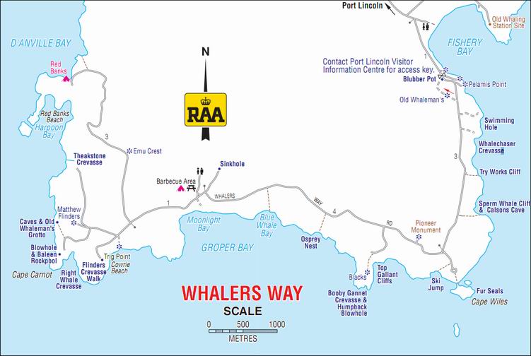
Whalers Way is a route around some absolutely brilliant coastal scenery to the south of Port Lincoln. The gravel track is on private property and access is strictly monitored. As the name suggests, there are some associations with the whale hunting of the early colonial times.
Off we went to the Information Centre in town, where we paid $30 for our permit to do the drive, and were given an access key, and map.
Initially, our route was the same as a couple of days ago – to Tulka. But then we kept straight ahead, passing the Sleaford Mere Conservation Park. Sleaford Mere is a large lake, at the area where the Jussieu Peninsula – where the Lincoln National Park is – joins the main land area. If Sleaford Mere was a bit larger, the Peninsula would be an island.
There was whaling activity in these parts, briefly, in the period around 1840. The names of various features around the drive, developed by the local farmer on his land, are largely whaling related. The actual whaling “settlement” was at Fishery Bay, by which the drive starts. This was as far as open public access went.

At the entrance station was an old blubber pot, in which pieces of whale would have been boiled down for oil.
At the Information Centre, we had been shown which of the side tracks off the main drive, to various features, were able to be driven, with 4WD, and which were best walked the relatively short distances involved.
First stop was by a track to be walked, to the Swimming Hole. Or, to be more accurate, to the cliffs above same.
There were superb coastal views, the cliffs, and a very small, smooth pool.
Despite its name, attempting to try for a swim there would have been a foolhardy exercise, given the cliffs and the unpredictable nature of rogue waves in these parts. But it looked lovely.
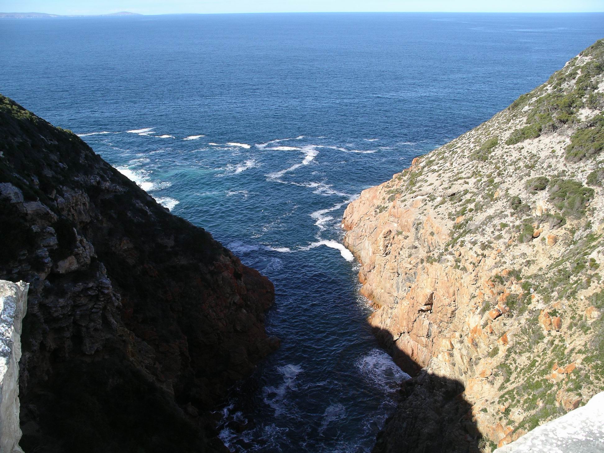
Next, we walked the track to Whalechasers Crevasse. As named, a narrow inlet.
It was clear that more than this one day would be needed for us to visit every named feature along the drive. Our aim was to get a fair sampling of the variety on offer, so we did not detour to every possible place. Ate our packed lunches at the designated picnic area.
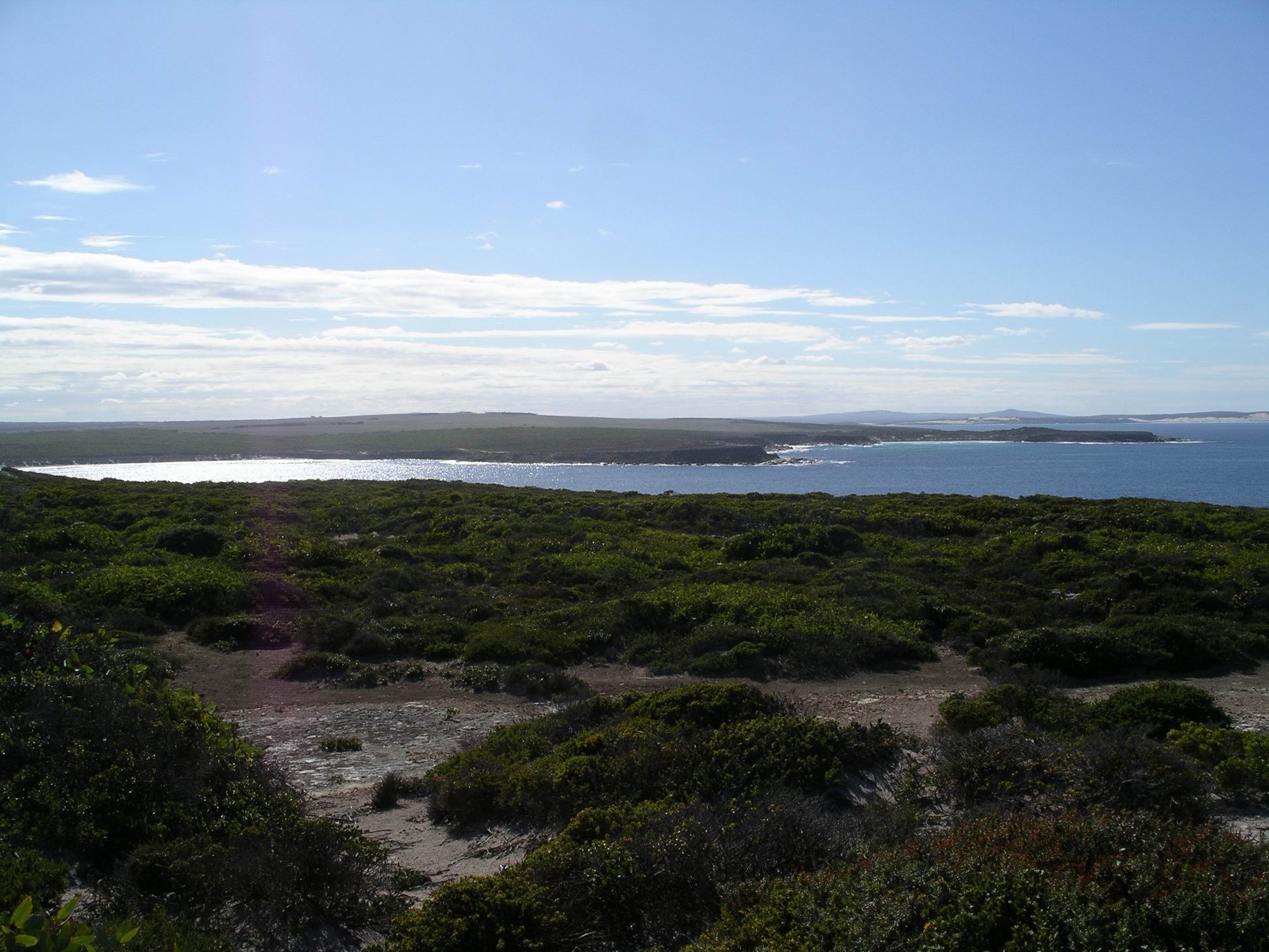
Cape Wiles was where the coastline “turns the corner”. The coastal rock formations here were unusual – small triangular shaped islets of rock.
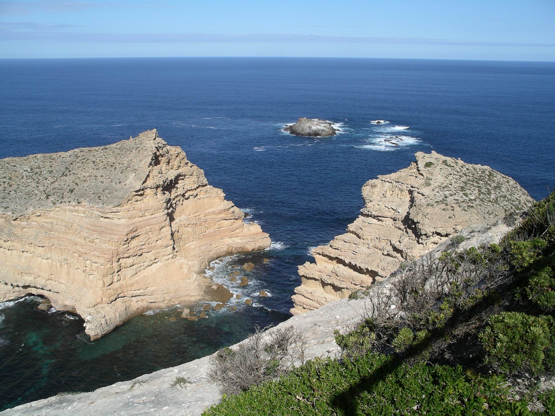
Between Cape Wiles and Cape Carnot, to the west, the cliffs faced south.
At Cape Carnot we investigated the Blowhole and Baleen Rock Pool.
From this Cape, the coast swung away to the north west.
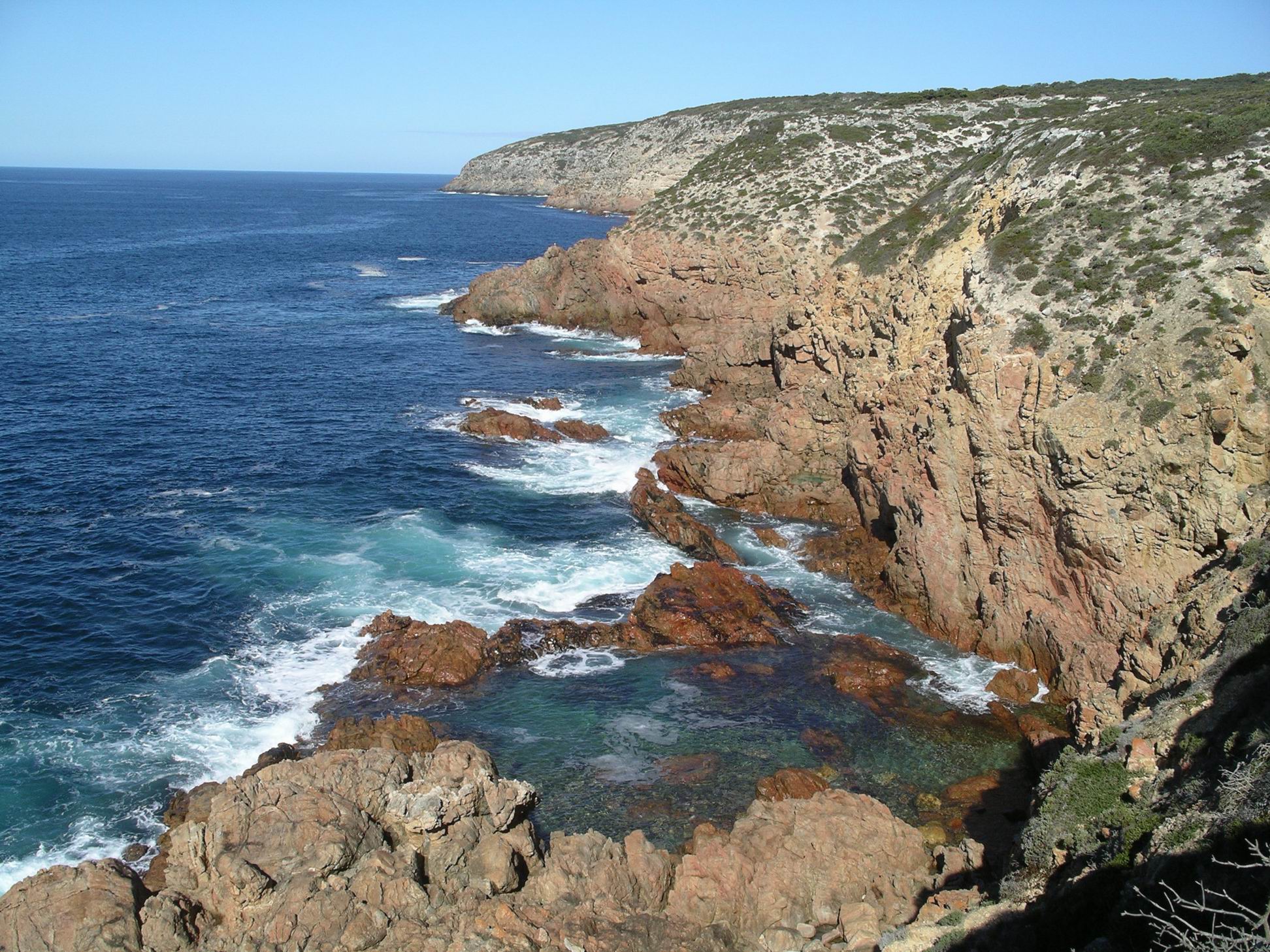
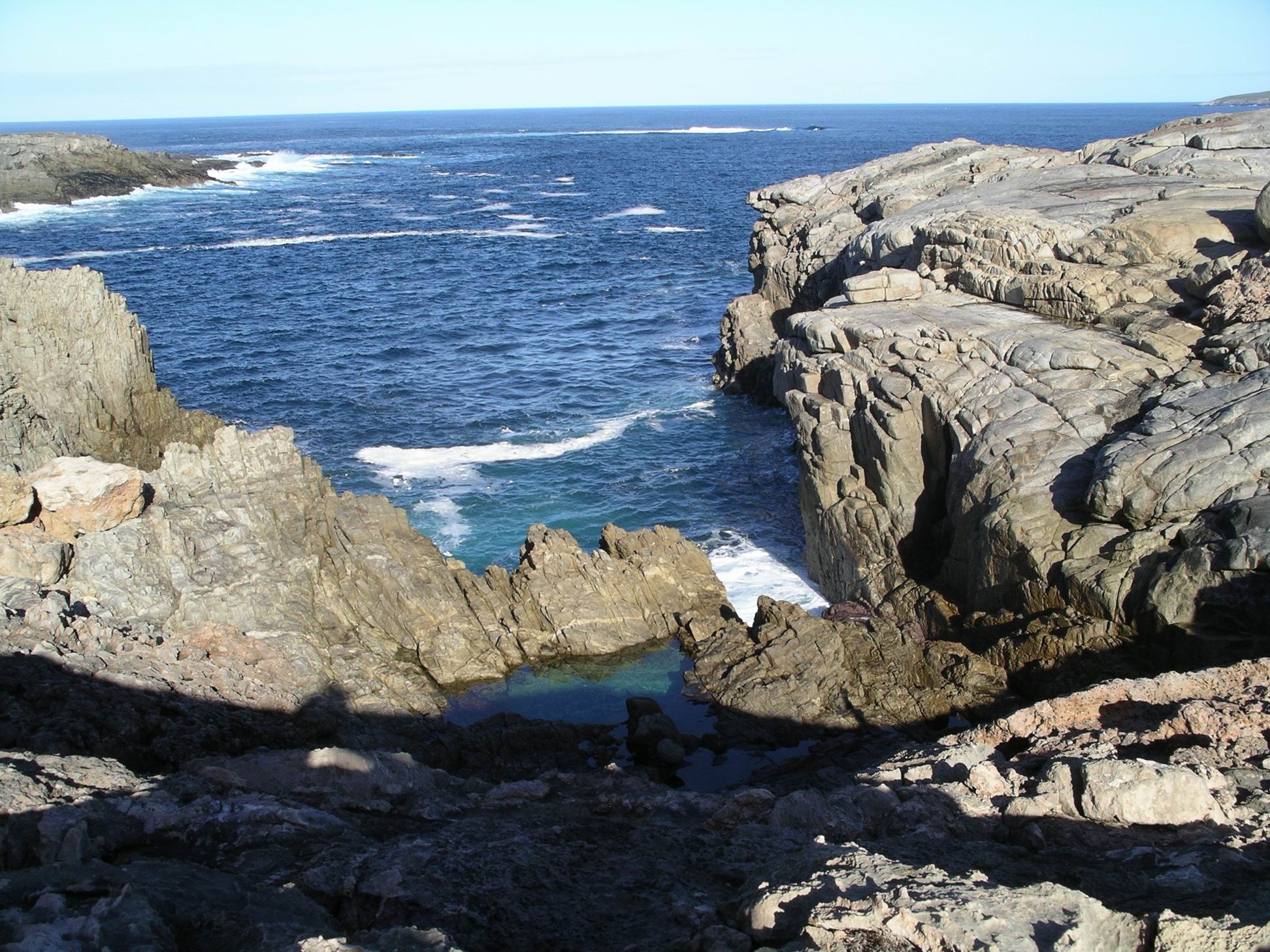
The geology of the rocks here is such that the pounding of the huge seas of the Southern Ocean has been able to open up long narrow crevasses along lines of weakness, or joints in the rock. Theakstone Crevasse was a great example of this – so narrow you almost felt you could jump across it, so deep that common sense prevailed!

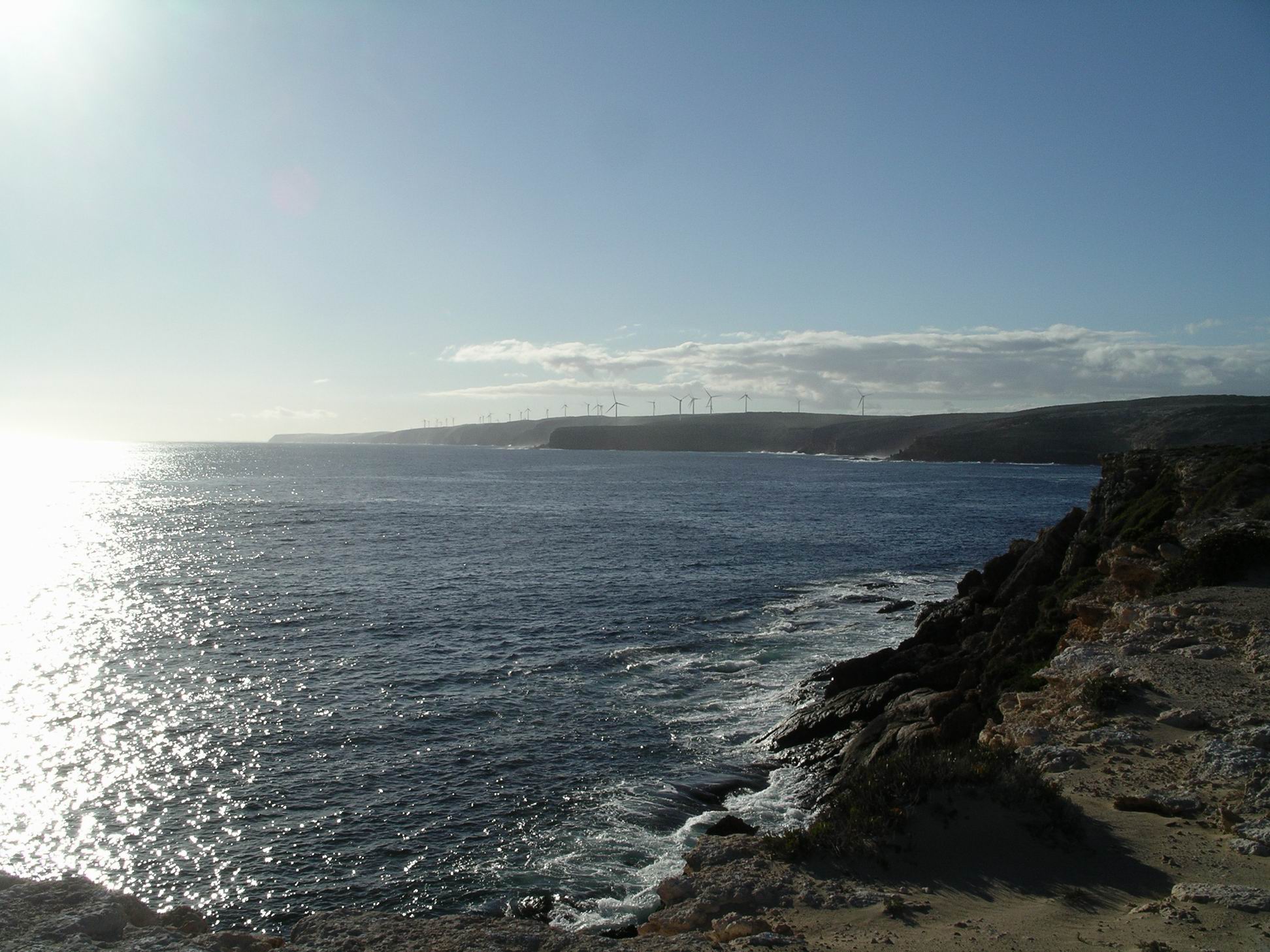
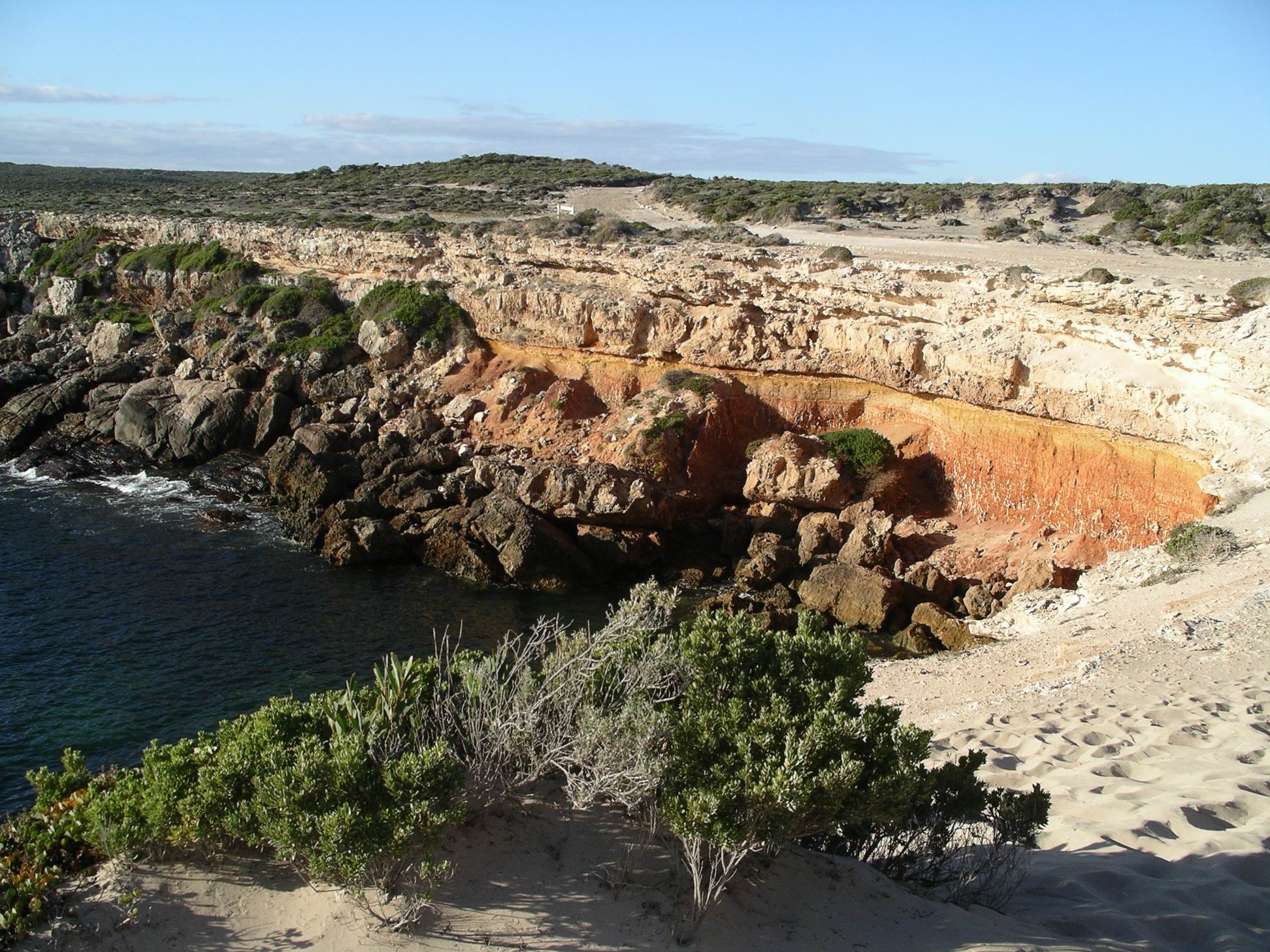
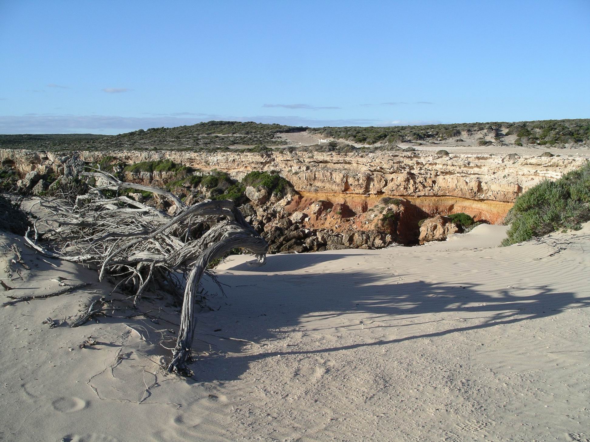
We continued on to the end of the track, at Red Banks. On the distant hills, there was a large wind farm.
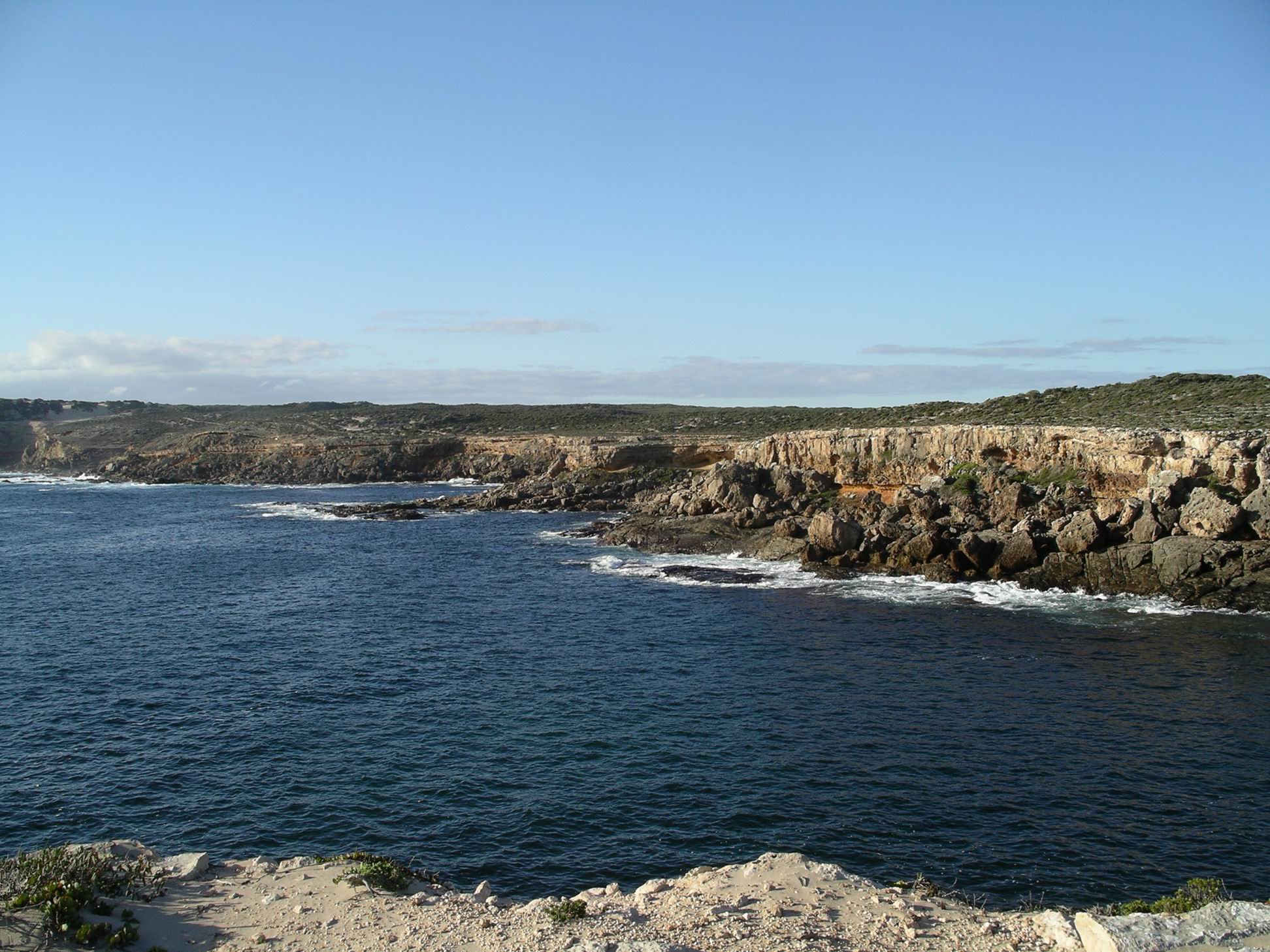
Red Banks had obviously been named for a distinct red layer of rock occurring in the otherwise white/grey cliffs of the area. There was a rough camp area here, open, exposed, on sandy gravel.
We wandered about there, for a while. I’d gotten tired, after lunch, and left M and John to do some of the walking to features without me, whilst I waited in the parking areas.
Whalers Way was a dead-end track so we had to return the way we’d come. The main track was a good firm gravel surface, with no tricky driving at all involved. I suspected that the lack of a sealed road, plus the cost, deterred many visitors to these parts from tackling it. That was probably good in conservation terms, preventing “over love”, but it was certainly an experience we would recommend to any of our friends visiting here.
It was a great day and worth every cent of the $30 fee.
We got back to camp about 5pm. Tea was whiting and fries.
