This Adventurous Age

Adventures travelling and working around Australia.


Leave a comment

2007 Travels June 10

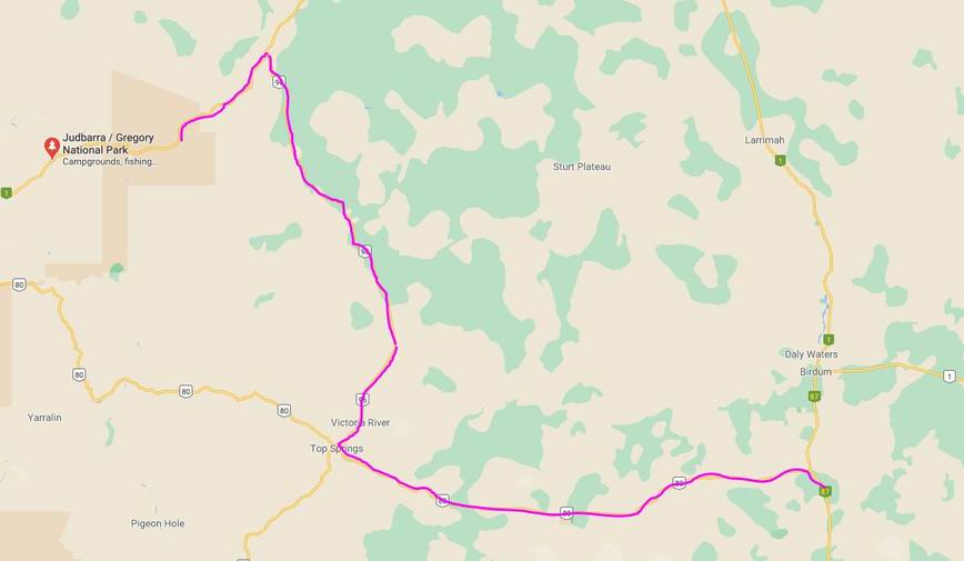
SUNDAY 10 JUNE   SULLIVAN CREEK CAMP TO VICTORIA RIVER R/H   16kms

It had become obvious by the late afternoon, yesterday, that Sullivan Creek was not a suitable place for staying any longer. Too many people too close together. This is the trouble with half way decent low cost or free camp areas. So we packed up and moved on.

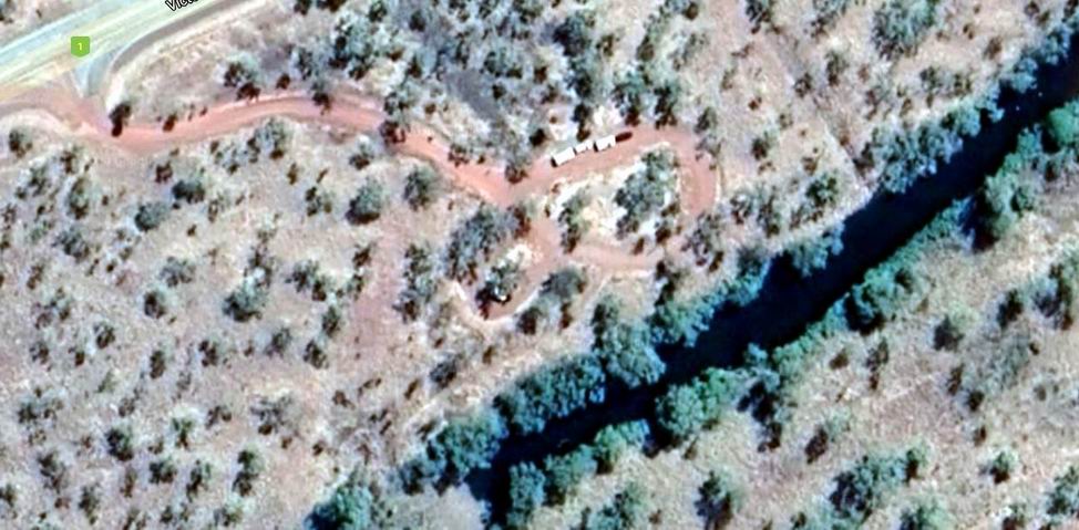
After only 16kms, reached the Victoria River Roadhouse. While John refuelled – $1.62cpl – M and I had a quick look around.

The campground looked very attractive and this would be central for walks M and I wanted to do. John was not happy that we’d “messed about” with last night’s camp, only to come 16kms today, before wanting to stop again.  However, we didn’t then know how good this was, or how unsuitable Sullivan Creek would turn out to be.

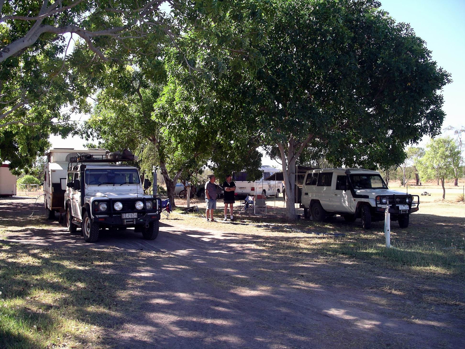
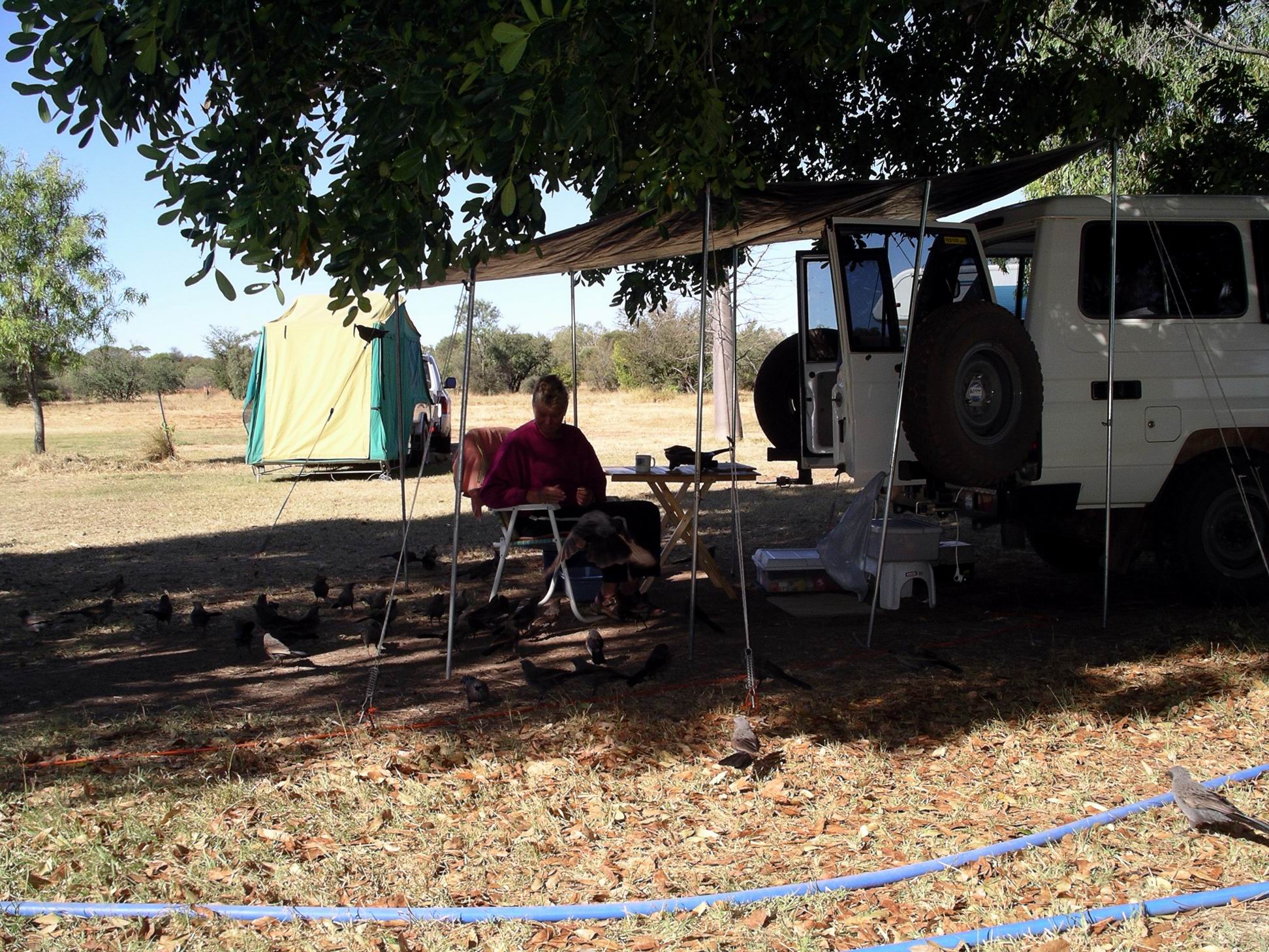
Our powered site cost $20 a night. The campground was huge and grassy, with plenty of shade trees. It was very pleasant – and not all crowded! There was some TV – but only one channel, relayed from the roadhouse.  

Victoria River Roadhouse camp

 Set up camp, then set off to do the Escarpment Walk, before lunch. Had to drive along the highway for a couple of kms, to get to the carpark, from which the walk started.

Walk goes up to the top of that….

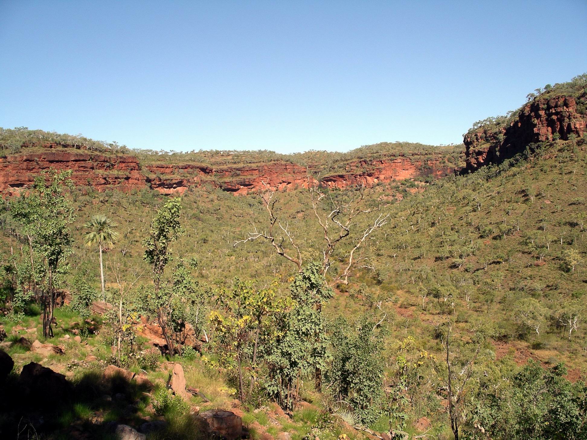
This 3km walk involved climbing up to the top of the scarp. There’s that dreaded word “climb” again! It was quite steep in places. Taking photos provided an excuse to stop and rest my cramping calf muscles – always an issue on uphills.

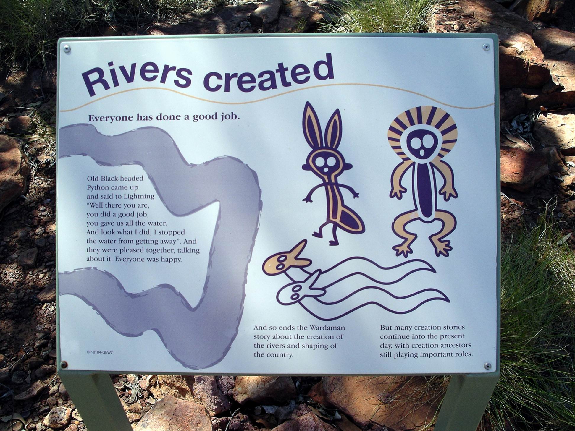
Along the way were boards featuring some of the stories of the local aboriginals, that explained how rivers (and hence gorges) were made and how rain was made to fill these.

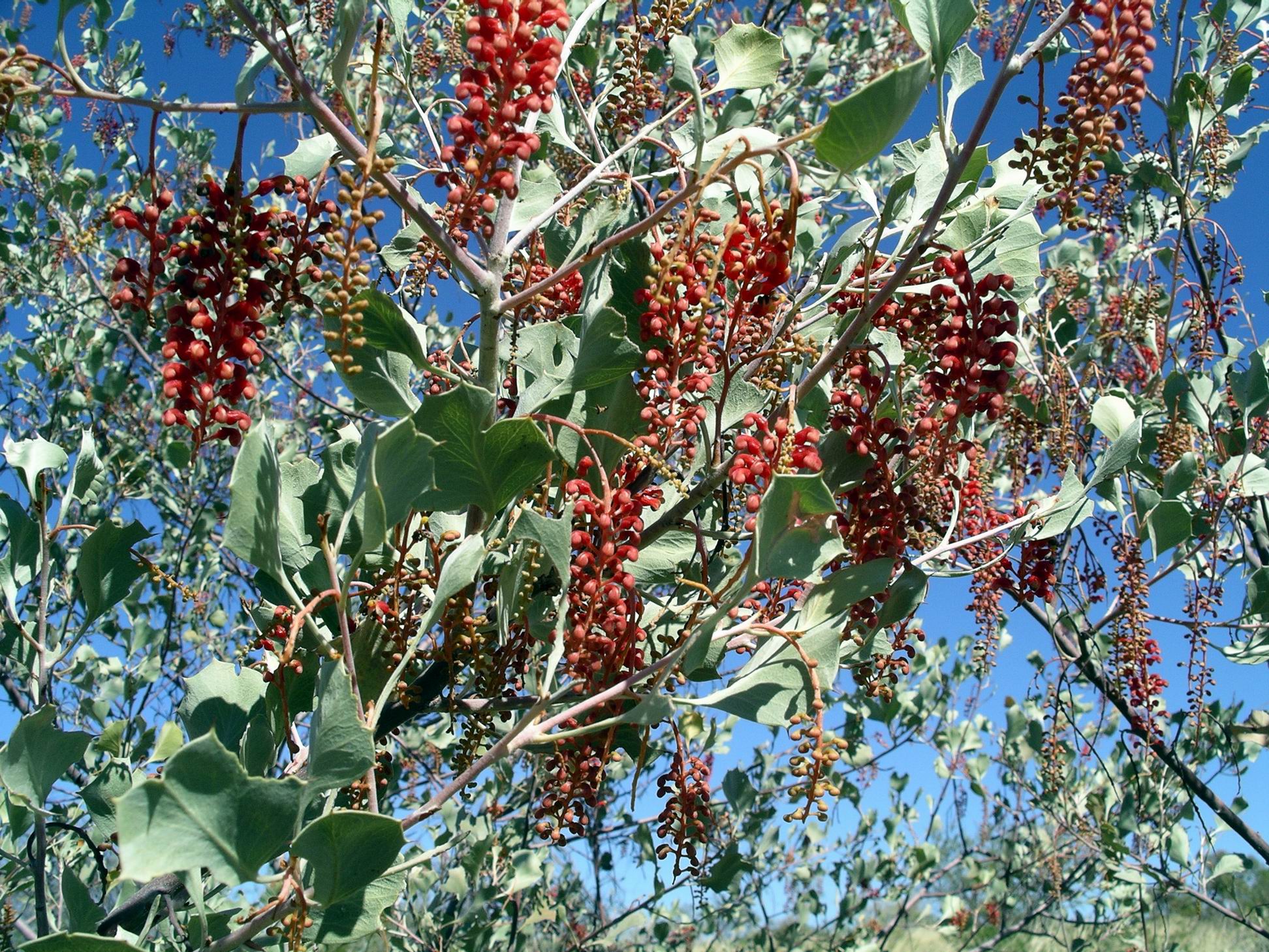
A local tree was flowering profusely at this time of year, and its brilliant yellow blooms were a distraction from the broader scenery.

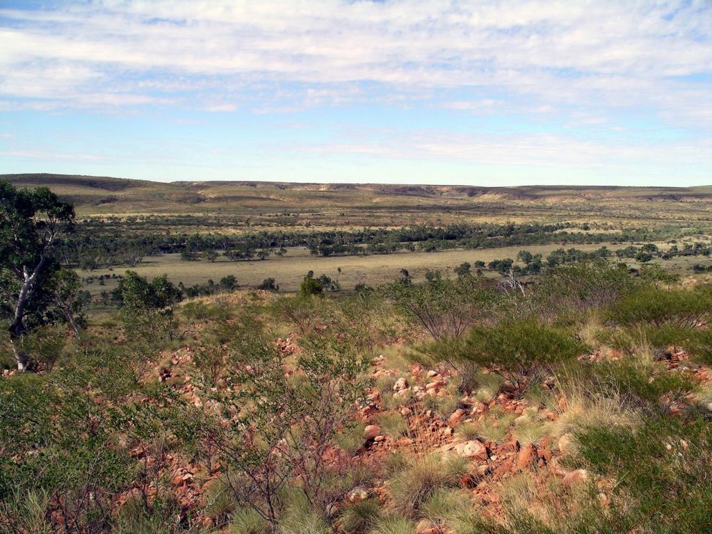
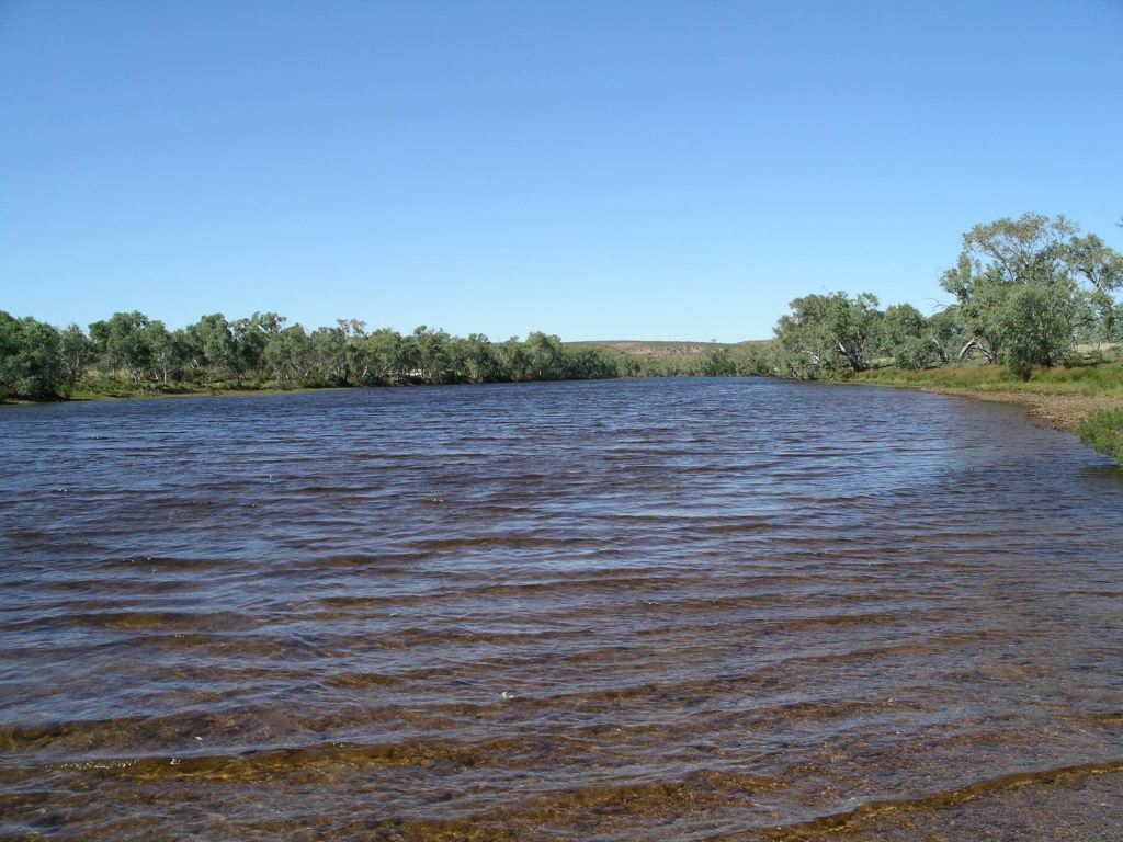
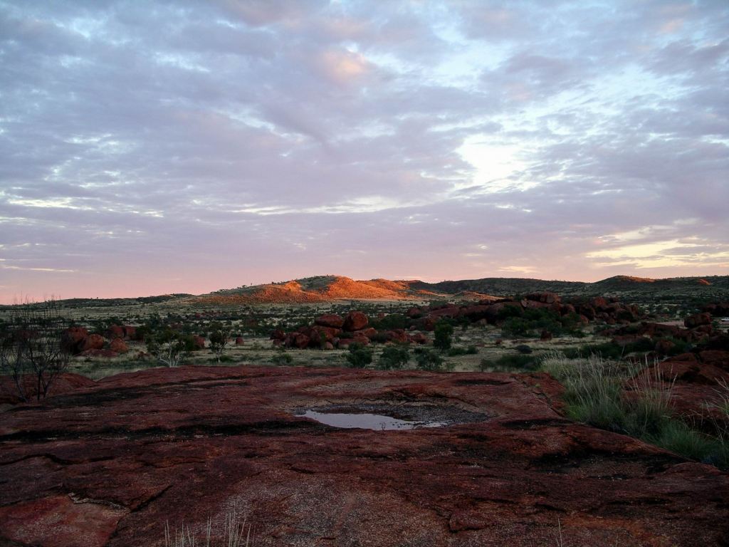
There were excellent views from the top of the Escarpment, over the ranges, the Victoria River and associated gorges, and over our campground.

Victoria River and Highway 1
Highway, Roadhouse & camp complex, tree line of Victoria River below the escarpment

And what goes up must come down again…….

Just a little rest here…..

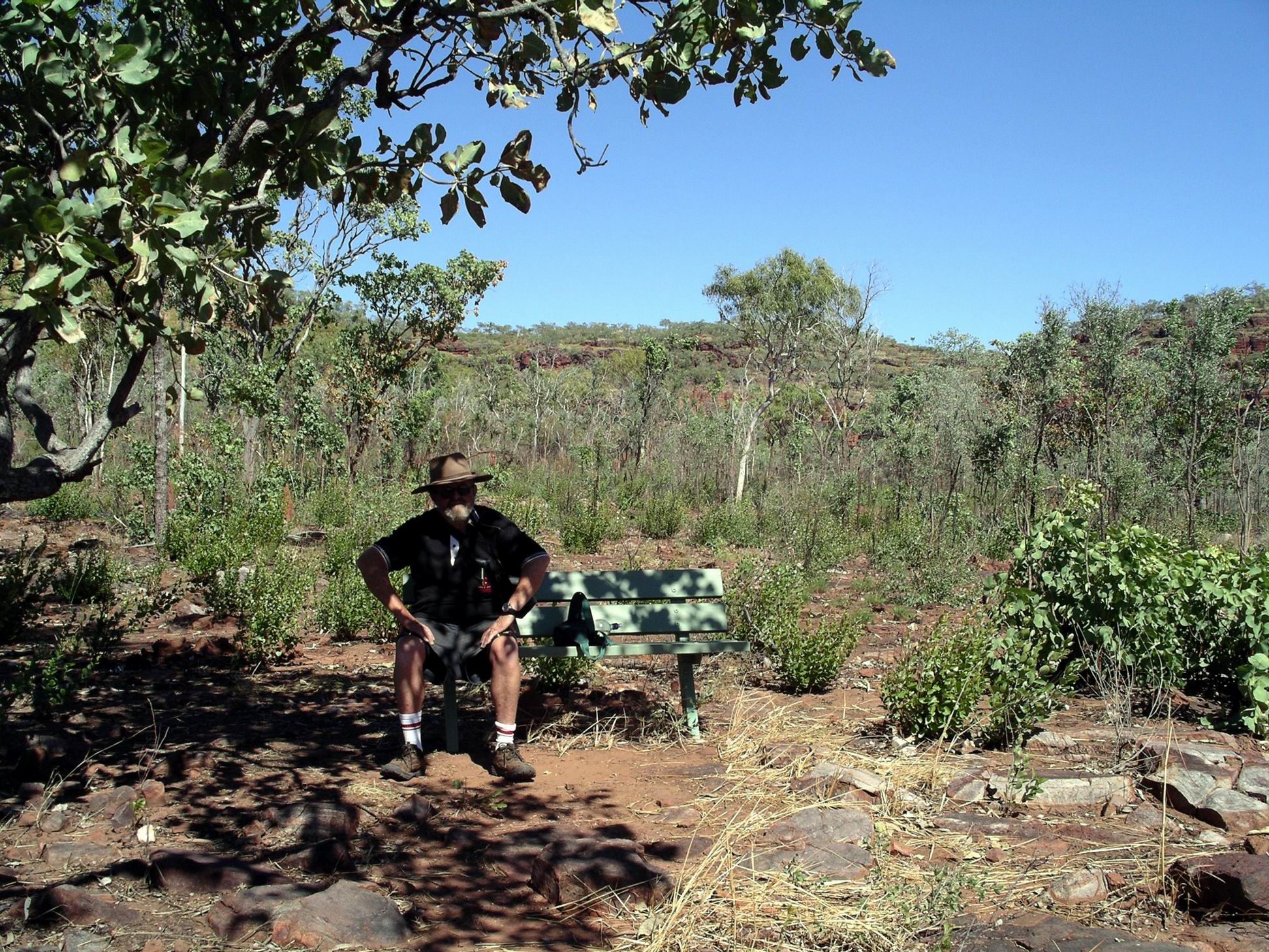
After lunch back at camp, we stirred ourselves again, and drove 10kms to the turnoff to the Joe’s Creek picnic area – 2kms along a gravel track. Here was the second walk we wanted to do in this area. This one was only a 1.7km circuit – however, distance is not always the  indicator of difficulty!  It just tells you for how long, roughly,  you are going to be in pain!

Escaprment of Victoria River valley from Joe’s Creek track

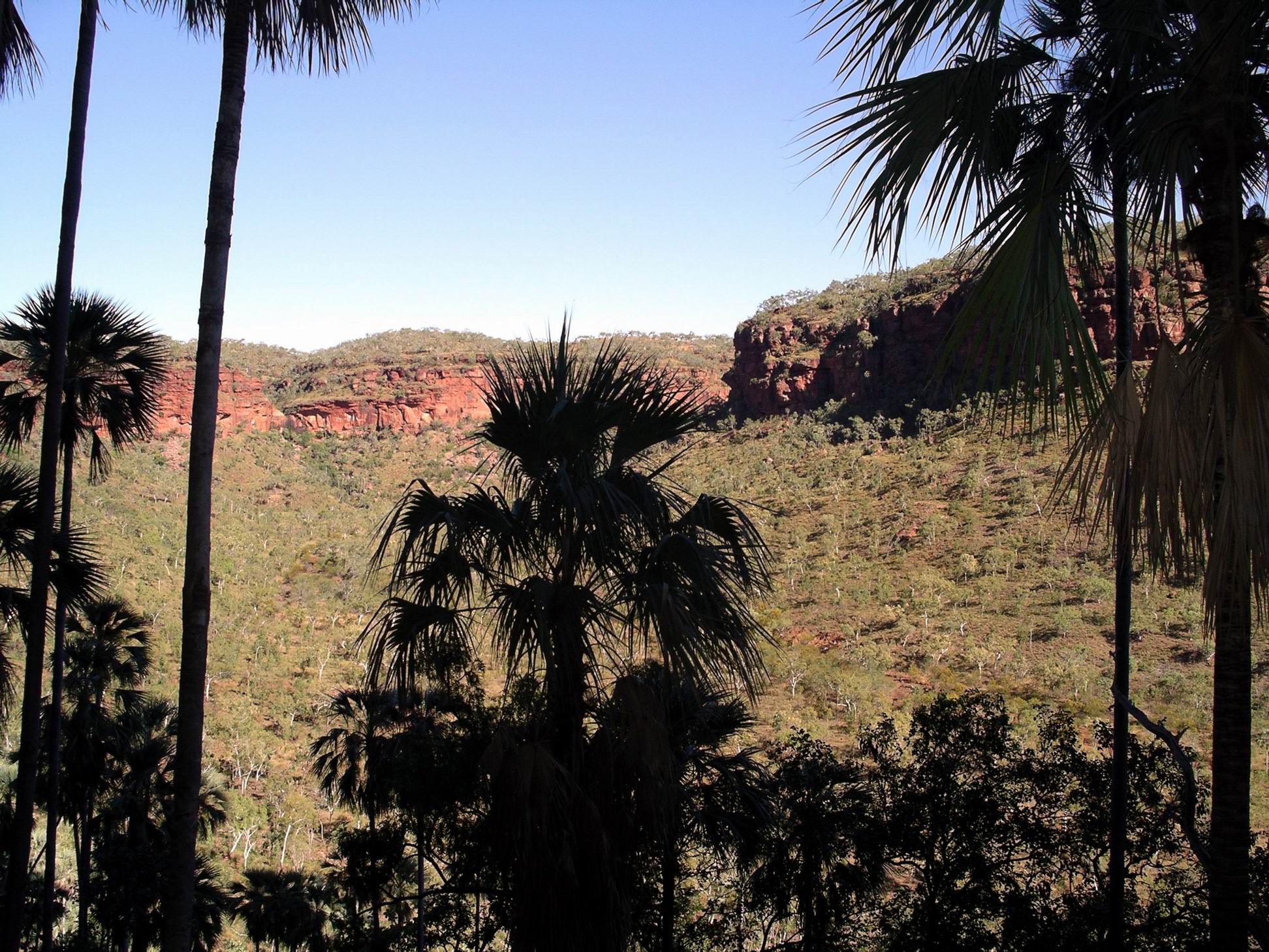
From the carpark, in the picnic area, the range rose in a tall semi-circular escarpment. It was worth driving in here just for that outlook.

Joe’s Creek valley – from part way up the walk track

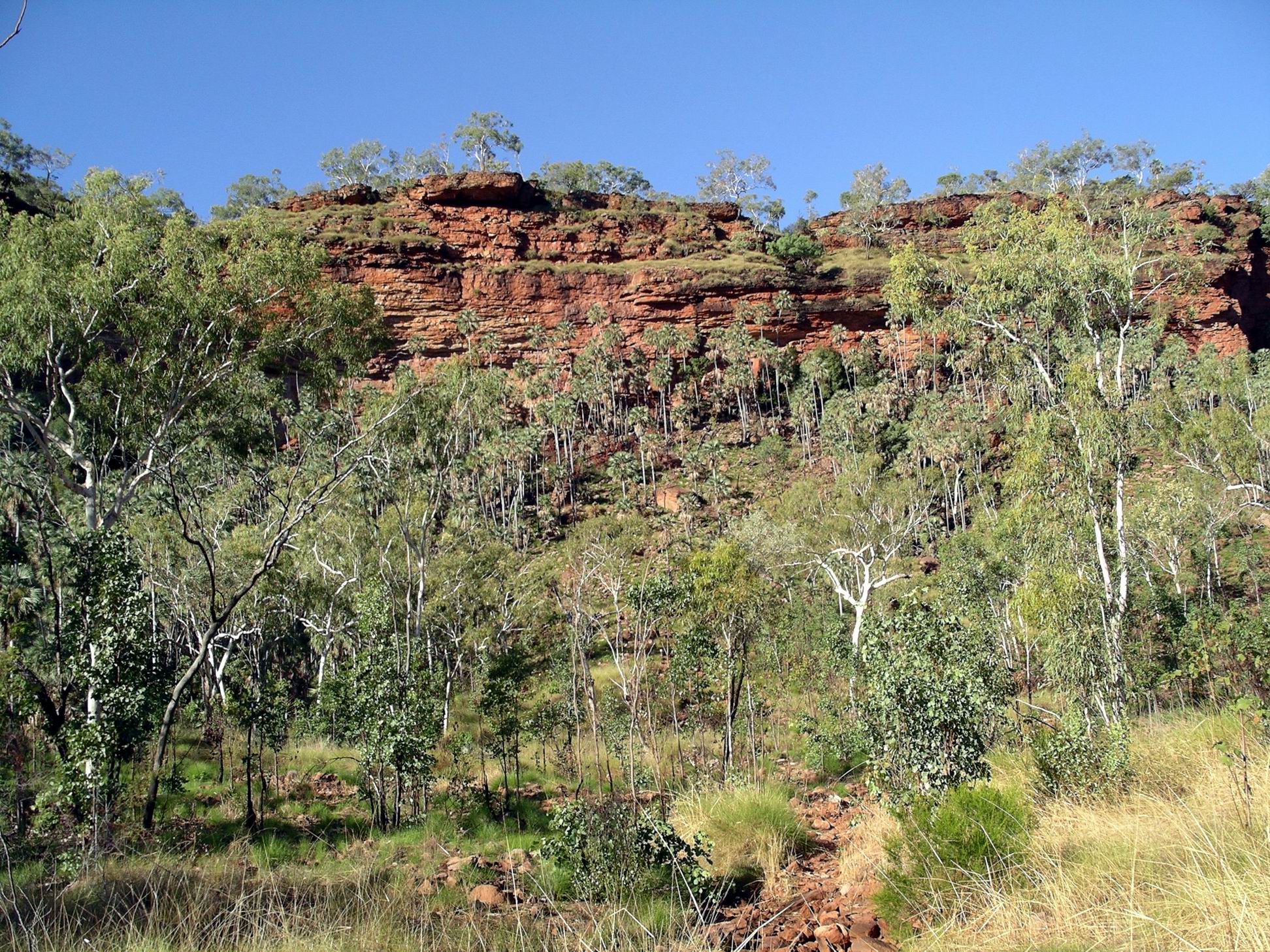
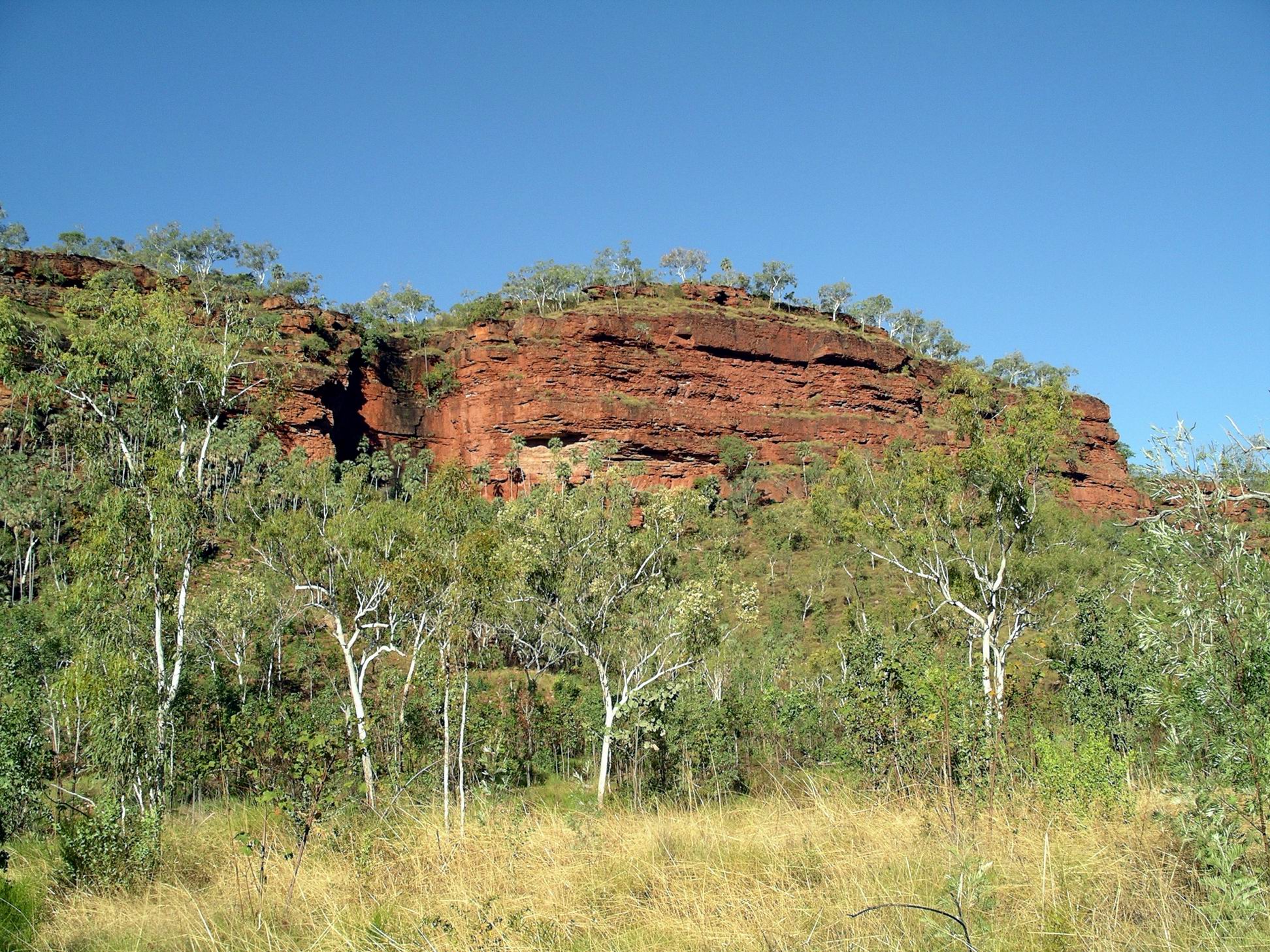
Our path wound through the spinifex and scrub, and then  up a loose rock scree slope, through clusters of Livistona palm trees, to the base of the almost vertical scarp face.

The track along the base of the scarp wall took us past aboriginal art works on overhanging rock sections. One of the figures reminded me of the Lightning Man depictions at Nourlangie Rock in Kakadu. Another, an elongated being with a striped body, was similar to something we’d seen up near Kalumburu in the northern Kimberley. I found it interesting that there were these apparent similarities from across such a widespread area.

Then we descended back through some more scree slope and palms, and wound back to the car park, all the time with those imposing scarp walls encircling us.

Walk track, scree slope, palms
The black scar of a wet season waterfall

This walk had been very scrambly, in sections. John did well, considering. All of us were leg weary by the time we got back to the vehicles.

Since we were close by, decided to take the short 4WD track to the Old Crossing of the Victoria River. It was only in 1970 that the road bridge near the Roadhouse was built across the river. Until then, traffic had to use the Old Crossing – basically a rock shelf in the river. It would have been impassable for significant periods.

Old Victoria River Crossing

It is easy to forget how recently it really was that these regions were opened up to the sort of modern access and travel that we enjoy today.

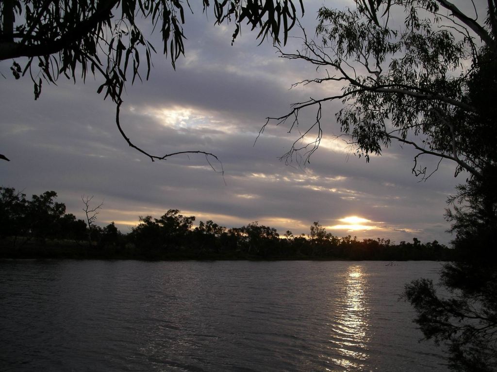
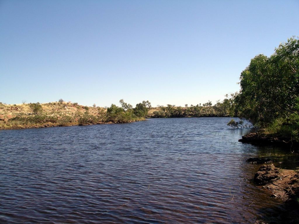
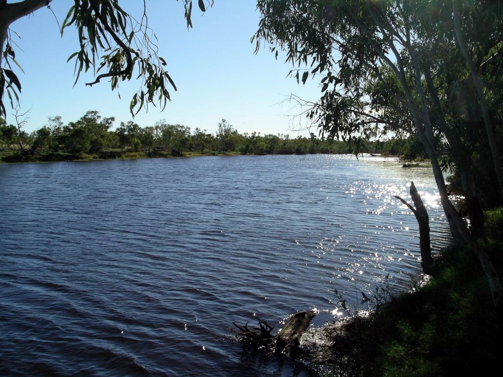
Our final little sidetrack for the day was to drive down a road near the Roadhouse, that led to a place on the river where boats could be launched, into what was a long reach of the river. We had to walk the last part of this, not being sure if there would be room to turn our rigs around at the end. It was a narrow little road through very tall grass.

Decided to have another, lazy, day here, tomorrow, in this very pleasant spot. John was content to do so, being happy that there was some TV.

Both walks today were excellent, but neither had been easy. The clearly hotter days made exertion that bit more difficult. The nights were still cool, though, and we needed to change into long pants.


2 Comments

2007 Travels June 9

SATURDAY 9 JUNE   DUNMARRA R/H TO SULLIVAN CREEK CAMP   426kms

We left the bitumen at Dunmarra and drove west to Top Springs – some 180kms on a reasonable gravel road. In 2000, we’d camped here but it seemed the Roadhouse at Top Springs now no longer offered camping. The area we’d stayed in was fenced off.

Refuelled – $1.75cpl. Treated ourselves to cold drinks and ice creams. The days were starting to seem hotter.

From Top Springs, the Buntine Highway was narrow and sealed. It was interesting enough, with some low range areas breaking up the grassland sections. Along the way we passed the turnoff to the Birrimba  station, once owned by a lady I knew back in my teaching days, who was an advocate for the needs of isolated students. I wondered idly if her family was still there.

At the intersection with the Victoria Highway, we turned west and thus onto a road travelled before – most recently last year. This time, we had the luxury of leisure time to explore.

Gregory National Park is slightly strange, in being divided into two different sections, with considerable distance between them. It is about 85kms by road between the parts, though south of the highway they are closer. I presumed, from the irregular boundaries, that both sections had been pastoral leases. The section between them was now marked on my road atlas as Aboriginal land. The eastern section contains some of the upper Victoria River and is spectacular range and gorge country, whereas the western part is flatter and has tributary streams of the Victoria River. The Park is regarded as marking the division between the tropical north and the semi arid grassland areas to the south. Thus, like Davenport Ranges, it is biologically diverse.

Pulled into the Sullivan Creek Camp Ground, just inside the National Park, which – according to one of my guide books – was a good place from which to explore that section of the Park. It looked very pleasant – fairly small, with toilet. There was a fireplace and low table in a circular central area, protected from encroachment by vehicles by bollards. The small creek looked lovely.

Sullivan Creek Campground

There were two vans already set up, parked in the most secluded corner of the camp area. We decided to stay and paid our $6.60 into the honesty box provided. Found a place to set up, parallel to the bollards of the central area, with M behind us.

John did not want to pull into any of the nicer, bushy corners, because he wanted full sun on the solar panels. He declared that he would decide where we parked, and that he did not want my input, at all! The result was that he did not get my input – and parked the rig pointing the wrong way, so the van door opened out into the road part, not towards the bollards. Eventually, he realized this, and had to drive away and come back from the other direction. Face was lost!

We wandered about, looking at the creek. It formed a small waterhole here which would be very tempting in hot weather. But it also might not be croc free…..

Sullivan Creek

As the afternoon wore on, a surprising number of rigs arrived, the last couple well after dark. They ended up squashed in everywhere, with later comers just parked on the access road itself. I find it quite incredible, how late some people travel. There had also been a few who drove in, looked, and departed again.

Zoom image of Sullivan Creek Campground

After tea, we chatted for a while with a couple who had set up by a fireplace not far from us. They were travelling with just a vehicle, being workers moving from one place to another,  and set up a foam mattress by the fire, to sleep on. She – an indigenous lady – was an interesting person to talk to. She told us they were moving elsewhere to work because she was sick of her relatives “bludging off us”.


Leave a comment

2007 Travels June 8

FRIDAY 8 JUNE   TENNANT CREEK TO DUNMARRA ROADHOUSE   360kms

Before doing anything else this morning, I sent an email to A and T, to send mail to Kununurra. Also sent emails off to son and daughter in law.

Today’s was a very routine pack up and move, straight north up the Stuart Highway – “The Track” in local parlance.

There were heaps of caravans heading north. The grey nomads well and truly on the move. Not many of them had stayed in the same caravan park as us though. It really had not been very busy at all. We seemed to spend all morning passing vans that were slower than our little rig.

I was a bit distracted by the passing scenery, but not enough to keep from feeling anxious about son.

We reached Dunmarra , which was just the Roadhouse, camping ground and associated buildings, about 3pm.  Refuelled – $1.58cpl.

Took a powered site in the rather pleasant little campground – $17.50 for the night. There was ample shade, and the amenities were adequate.

Pleasant overnight stop at Dunmarra Roadhouse

Only needed the basic, quick overnight unpack, being able to keep van hitched up.

Then sat around in the shade which made for very pleasant relaxing, watching the groups of apostle  birds that gathered around us. The antics of these very sociable birds were always entertaining – we had encountered them before.

The birds……..
Apostle birds

Went for a stroll around the establishment, which did not take long, but gave the illusion of a little exercise.

A couple of really creepy looking characters came into an area of the roadhouse surrounds, that we could see from where we were sitting in camp. They were in an old sedan, with no plates or registration sticker. We noticed that they parked the vehicle off to one side, out of sight of the highway, before going into the roadhouse. They came out after a while, and drove away. I was pleased they were not staying.

We spent some time discussing tomorrow’s move. Essentially, everywhere west of the Stuart Highway, through as far as Broome, would be new ground for M, whereas we had visited those parts three times to date. It was not a part of the country we tired of, and there were still plenty of places we still had not gotten to.

We would take the unsealed Buchanan Highway to the NW. The issue was whether to continue through on that, to the main Victoria Highway, a route that John and I had taken before. It passed through the large Victoria River Downs station and then the Jasper Gorge. I wanted to take the Buntine Highway north from Top Springs, in order to visit the eastern section of Gregory National Park, which would be new for me and which had some walks to do.  For once, I won!


Leave a comment

2007 Travels June 7

THURSDAY 7 JUNE     TENNANT CREEK

The wind was still quite strong. It made the day seem chilly. Perhaps we were experiencing the three weeks or so that pass for winter in Central Australia?

I did our washing. There wasn’t a great deal, but best to keep on top of it when I didn’t know when there would next be access to machines. The ones here were not working properly, but I managed to get something approximating clean, although still dripping wet. Our travel wardrobe leans towards dark clothes for a reason!

We drove to the town centre and did a small shop. We browsed amongst the magazines and books on display at the newsagent/chemist. M bought John a book on building wood fired pizza ovens. This was something he had been talking about constructing at home, for a while now. I was not enthusiastic about the idea and really wished M had not encouraged this particular flight of fancy!

John was away! Planning where it would go, how he would build it – as soon as we got home…..Bad luck about the garden I had growing in the chosen spot.

After lunch, M and John went to the town’s club and practised bowls. I begged off on the grounds of conserving my dodgy heel. It was a lady at this bowls club, in 2000, who had tried to persuade John to stay in town and teach at the TAFE. I was very glad that did not appeal to him at the time – don’t think I would have liked living here. Damn sure I wouldn’t have liked living here!

Tough little local bush

I defrosted a frozen chook we bought this morning, and then roasted it for our tea, along with a heap of roasted potatoes, pumpkin and parsnips. At night, I had another lengthy phone talk with son, and with daughter in law.  It was not very reassuring. He seemed completely devastated by wife’s actions. They were still sharing a house, though, which he wanted, for the kids, but which made it even harder for him. I considered abandoning the trip and returning home, but decided this would clearly change nothing. Families!


Leave a comment

2007 Travels June 6

WEDNESDAY 6 JUNE   OLD POLICE WATERHOLE TO TENNANT CREEK   240kms

Pack up times seemed to come round too quickly!

We returned to the Stuart Highway over the same route we had come in on.

Near Kurundi, passed the turn off to the Whistle Duck Creek camp area, 24 kms to the south. I’d have liked to go camp there for a couple of days, but the majority – 2 to 1 – was for pressing on north. So, it was on up the Highway, to Tennant Creek.

Holly grevillea

We booked into the Outback Caravan Park, for $26 a night.

This park seemed to have gotten quite “tired” since we were last here. A pity, because it had been a very pleasant place to stay as a base for exploring around Tennant Creek. There were notices up, offering free sites in return for work about the park. I was not sure they would get many takers, because we found that the town as a whole had also gone downhill greatly, so it might not be a great drawcard.

After set up, drove into the centre of town to have a look round. The place seemed dirty, hopeless, sad. Inebriated people were much in evidence, even in the early afternoon. There was now just the one supermarket, a combined pharmacy and newsagent – and four hotels! As well, there were several rather grotty looking take away food places. There were a number of closed shops and businesses.

It had been from the newsagent here that I used to get my weekly newspaper when we were at Pungalina, in 2005, along with supplies from the supermarket, flown in on the weekly mail plane.

As we drove around the town, saw that there was a lot of quite damaged  housing – some of it clearly recently built, too – and destroyed to the point of not being habitable. What a waste of resources! This was the sort of place that armchair based, bleeding hearts, who have never ventured far from the big cities, should visit and stay a time in, before making glib pronouncements about white oppression! Now to climb down from the soap box………

Fuelled up Truck – $1.39 cpl.

It was a luxury to have a shower again – and to wash my hair!

Park definitely getting tatty – no mops in the amenities, no hand washing soap at all, washing machines not working well.

Tennant Creek camp

Son had left a message on my phone to call him, which we received when we came back into phone range. So I called him at night. His news was a real bomb shell. He and wife had split up. He was rather vague about why this had happened, but implied it was her wish. They had just sold their house, too.

I certainly didn’t see that one coming! My immediate concern was for the children, aged 1 and 6. Nothing I could do about it, but that didn’t make it any easier to deal with. I was definitely back to real life with a thud, now.

After that news, I really needed a stiff drink, but there was nowhere to get same in town – everything closed at 8pm.


Leave a comment

2007 Travels June 5

TUESDAY 5 JUNE     OLD POLICE WATERHOLE

The morning was windy. Clouds were scudding over from the west, but there was more sunshine than yesterday.

The remaining two sets of campers who had been here last night, left, so we were alone again. But later in the day, two more couples came in.

John’s hip was sore, so he had a camp day. I suspected he might have overdone the lifting and toting yesterday, when playing mechanic.

M and I went walking. Headed down to our end of the waterhole, where it petered out enough for us to cross.

Google Earth view of Old Police Waterhole and the ridge we climbed – to the left
The shallowing end of the waterhole

From there, we bush bashed across to the far ridge, and climbed up onto it, then walked along the top.

Part-way up the ridge. The line of trees marks the Waterhole

There was no particular reason for doing this, except it was there, it was exercise, and we were curious to see what could be seen from there.

Still some way to go….

There were good outlooks from the top, back across to the Waterhole.

Saw a mob of wild horses in the distance. At least we presumed they were wild, but they could have been a mob of station horses, turned out. I think we were quite close to the irregularly shaped Park boundary here.

It was rather hard to find our way down from the ridge again, without back tracking, but we eventually slid and clambered down.

Picking our way down again

Then we angled across to the Old Police Station ruins and back around that end of the Waterhole.

It was a lovely walk, and a great way to finish up our stay here. The only down side was a lot of spinifex scratches and punctures on our arms and legs. Note to self: try not to go walking through spinifex in shorts!

Might look fluffy on top, but it is anything but! Flowering spinifex

Spent a final evening round our fire, after dinner was cooked and dishes done.

The sunsets over the Waterhole had been brilliant.


Leave a comment

2007 Travels June 4

MONDAY 4 JUNE     OLD POLICE WATERHOLE

I was up at 7.30am.

The morning was cloudy, but it was high cloud. There was a strong breeze – from the S-SE. The day remained quite cool, due to the wind, and remained cloudy. At one stage, I wondered if it might rain? The track back out could be a bit tricky in spots if it got really wet. But, I thought to myself, if the worst happened, this was not a bad place to be marooned for a while.

The track down from the loo….

Most of the morning time was devoted to man-work on a broken down Lexus. Yesterday, it had come up the rough Hatches Creek track from the south. The first we knew of any problem was when a couple of men came to our camp to see if John had a drill. He did. He also had the genset to run it with, so there was a considerable unpack of the back of Truck.

The Lexus was three camps back from us, but people from three  other camps ended up involved – us, and two lots who were packed up ready to go, as was the Lexus.

It seemed the tumblers in the ignition slot had collapsed, which meant the steering was locked and the airbag suspension was uneven.

One couple had a sat phone and they managed to get onto the guy’s Toyota dealer, and eventually got almost step by step instructions how to demolish the innards of the steering column. It was really convoluted – there was so much stuff packed in there! Wiring central…..

It took about three hours, and several sat phone calls, but the men finally got it pulled apart, to the point where a screwdriver stuck into something, would allow it to function.

How many men does it take to fix……….

M and I, having a functioning camp, made hot drinks for the others, and eventually I cooked some lunch for all  – savoury pikelets.

The woman from the Lexus was not at all well – it was not really made clear what was wrong with her.  They were intending, from here, to go north to Barkly Homestead on the Barkly Highway – some 150kms of very rough track. They did not leave here until 2pm. We hoped, for her sake, that they make it through with no more breakdowns. I thought they would have been much safer going out the way  we’d come, but the man seemed determined to stick to his original plan. I thought he was ill-advised to do so, particularly given that, of all the guys working on the vehicle fix, he’d seemed to know the least!

After that little demo, they could keep their fancy expensive vehicle – we would stick with the much less sophisticated, but more rugged, Defender!

With not a great deal of the day left, M and John fished in the waterhole. John had caught some crabs and water beetles, overnight, in a net. The fish proved totally not interested, so the crabs were let go, having failed as bait.

While they were thus occupied, I went for a walk – for two hours – down the road to the south of the campground, some of the very rough Frew River Loop Track.

The ranges were low and rocky….

The scenery was interesting and the walk was good exercise. M and John walked out and met me as I was returning. John did not have his Skins on, and his hip was playing up.

The Frew River marked by line of trees

Spent some time at camp admiring the sunset over the waterhole.

The progression of the sunset…….

We had the usual quiet evening by the campfire, and an early night.

A watched dinner never…… ?

It was very windy through the night.


Leave a comment

2007 Travels June 3

SUNDAY 3 JUNE     OLD POLICE WATERHOLE

The day was sunny and warm.

I was up early and sat in the sun, writing  postcards and my diary, until John surfaced.

After breakfast, we set out to walk around the waterhole, which was quite extensive. Although it is on the Frew River, the channel at either end had dried up, so we were able to walk right round, even though there were no real tracks.

Old Police Waterhole – taken from the “entrance” end of the camp area

The Frew River is probably better described as a series of water holes rather than a river in the traditional sense.

Across the other side of the waterhole from the camp area, we found the ruins – just some rocks and stone heaps – of the original Frew River Homestead, one of a couple of cattle stations in the area, which were abandoned in the late 1800’s, due to poor seasons and troubles with the local aboriginals. For these, the waterholes of the river were important places ,where they spent significant amounts of time, camping and hunting. Obviously, the arrival of a new source of meat was going to end in grief.

There were the remains of the Police Station, built in 1919 at the same spot, but abandoned later, when the tungsten (wolfram) mines at nearby Hatches Creek, begun in 1915, ceased working. Now, there were just some remnants of stone walls.

 Continued walking around the waterhole. It took us two hours to complete the circuit – a lovely walk. The low ranges in the near distance were intriguing.

Spinifex in bloom – grevillea too
The other end of the waterhole. Our camp visible as a small patch of white

During the day, three more lots of campers arrived, but the site nearest us remained empty – it was quite small. Not that we are anti-social, but we hoped it stayed that way! The lot that came in yesterday were leaving tomorrow, so there would be a nice site further back, to tempt any more arrivals. Maybe the place being empty when we arrived was an aberration?

I sat by the waterhole for the afternoon, watching the birds, and sewing. M did crosswords. John retreated into the van to play computer games.

Late afternoon at Old Police Waterhole

We had another pleasant evening by the campfire, and an early night.


Leave a comment

2007 Travels June 2

SATURDAY 2 JUNE   DEVILS MARBLES TO OLD POLICE WATERHOLE   175kms

I was up just after dawn. It was a chilly early morning.

The previous night’s full moon was just going down over the Marbles.

I wandered around, again, taking early morning photos of the sunrise over the rocks. M appeared not long after I went out. John slept in.

Early morning Devils Marbles

We got away from there at 9.15, by which time most of the other overnight campers had departed. We were not famed for early starts – something M just had to put up with!

The turnoff we sought was not far north of the Marbles. It was the dirt road east to Kurundi and Epenarra stations. From near Epenarra, we took the Binns Tracks south for 34kms, and then the track into Old Police Waterhole campground, in the Davenport Ranges National Park.

The road quality over the 160kms (about), was variable. At the start, it was “channelled” into multiple deep ruts by wet weather drivers – tricky driving with the van in tow – but after that, improved. The section south from Epenarra was sandy in parts, and it was rocky for the last 9 kms.

Location of Davenport Ranges National Park, showing our access route via Kurundi

It was a very pretty drive, especially from the highway to the Kurundi area. After that, it was open and flat, for a while.

It was into the afternoon when we arrived at the campground. The low ranges around the Waterhole were not visible until the last few kms.

First impression was that it was worth the effort we’d made to get here.

There was a long waterhole, with lots of grass and shade trees in the camping area, which spread out along one side of the pool. There were about eight fire pits/BBQ ‘s scattered through the camp area, and a couple of the Central Australian style ventilated pit toilets too.

With no other campers present we had the choice of camping sites and  set up at a distance from where the track in entered the camp area. There were not really any attractive sites beyond where we were. There was a toilet not too far away, with a track going up a small hill to it. There was a fixed low table and a fireplace.

Camp at Old Police Waterhole

Another couple arrived a while after us, and set up a good distance away, but that was it for the day. Magic solitude!

There was a whistling kite’s nest across the waterhole, with a baby in it. We could hear the kites “talking” to each other in a way that was reminiscent of when we camped by the Cooper Creek at Innamincka.

There were corellas and white-plumed honeyeaters galore – and huge spiders in hanging webs!

M came in here last year, on her way south from Darwin, and camped a couple of nights. She said it was bare and dry then, with much less water in the waterhole.

Old Police Waterhole, by our camp

Now, the holly grevilleas were blossoming, also some wattle species, and the spinifex was blooming. On the way in, we’d seen some bloodwood trees in flower.

This area  is, biologically, the divide between Central and Northern Australia, so there is much diversity.

John and I had not been here before, though it had been on the “one day” list for ages.

Now, seeing it, we decided to stay an extra three nights – four in all. Park fees cost us $6.60 a night – $3.30 each.

After setting up camp for an extended time, we just sat around, admiring the outlook over the waterhole, and enjoying the general peacefulness of the place.

We cooked dinner on the BBQ plate provided on the fireplace.

Not his best angle!

It was great to be able to sit round a campfire again. The night was pretty cool though! It was so quiet, with just the bush noises from the occasional night bird, insects and frogs. It is getting increasingly hard to find these really peaceful, solitary,  places.