This Adventurous Age

Adventures travelling and working around Australia.


Leave a comment

1999 Travels June 13

MONDAY 13 JUNE     KINGS CANYON

Today is my brother’s 50th birthday. I wonder what he feels about attaining this landmark?

The day dawned sunny, so we took a packed lunch and drove to the Kathleen Springs area – back eastwards some 23kms from the campground.

Kathleen Springs is, as the name suggests, an area where permanent water derived from springs, is found. Such a place, in this arid environment, was of great importance for wild life, aborigines and later, pastoralists.

06-13-1999 01 in spinifex ring.jpg

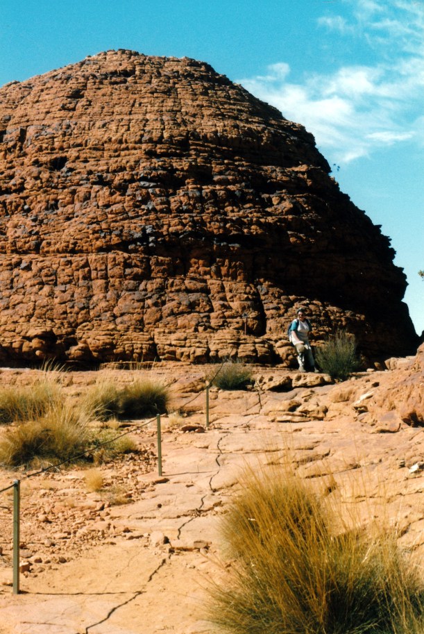
Perfect spinifex ring at Kathleen Springs

We walked the 1.3kms track to the Springs, looking at birds, and at the remnants of the pastoral industry: trapping yards, windmill site, and tank. The trapping yards were built in the early 60’s. As a natural valley, where cattle came to get water, it was an obvious point for catching cattle to send off to market.

06-13-1999 02 yards kathleen springs

Old cattle loading ramp at the trapping yards – note fence up gully side

06-13-1999 03 old fence Kathleen Springs

Cattle trapping fence at Kathleen Springs

It was a very pleasant walk, where we saw few other people. Quite a contrast to the main part of the Kings Canyon.

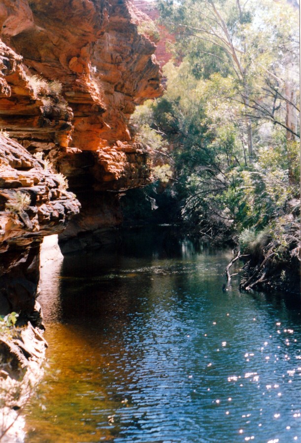
The springs themselves, and associated pool seemed rather dark and sombre. A creeping fern grows there that is found nowhere else in the world.

06-13-1999 04 creeping fern unique to Kathleen Springs.jpg

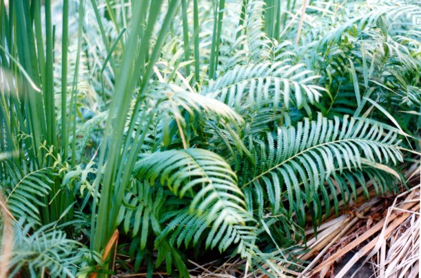
Kathleen Springs Creeping Fern

We walked back to the picnic area near the car park and ate lunch. Saw some spinifex pigeons on the way back to the picnic area, and watched them for a while. They are superbly camouflaged.

06-13-1999 06  Kathleen Ck valley where yards are.jpg

The Kathleen Springs valley – easy to see why it was a great place to catch cattle

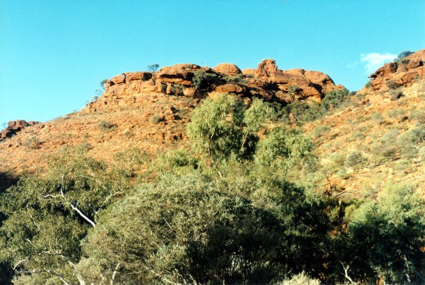
After lunch, walked up the Giles Track. This is a 22km long track between Kathleen Springs car park and Kings Canyon. It roughly follows the edge of the plateau that is the George Gill Range. Track notes recommend an overnight camp somewhere along its length, but I suppose it could be done as a long day walk, if one did not spend too much time looking around. However, we do not have the requisite transport at each end, so plan to walk some of each end of it.

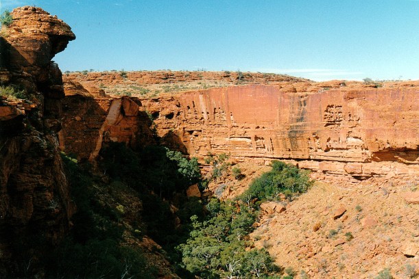
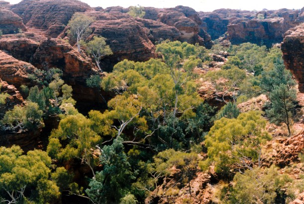
After the track climbed over some ridge tops, we got a good view back over Kathleen Springs canyon and the area of the trapping yards.

This was a very pleasant walk – not very hard – through varied country. We saw no other walkers.

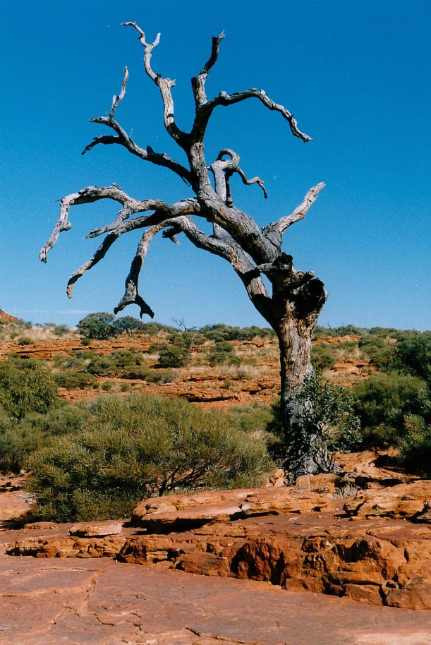
I saw a strange plant – rather like a cross between cacti and broome – not sure if it is a native to the area, or a weed.

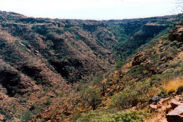
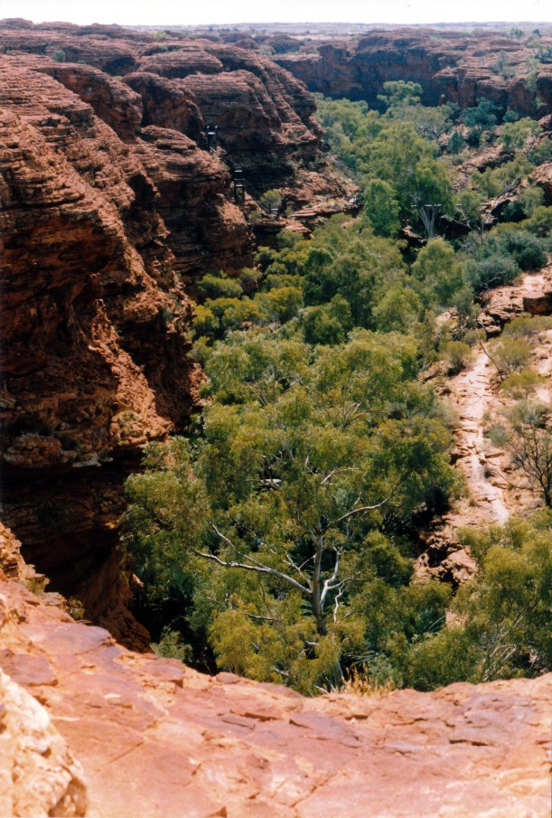
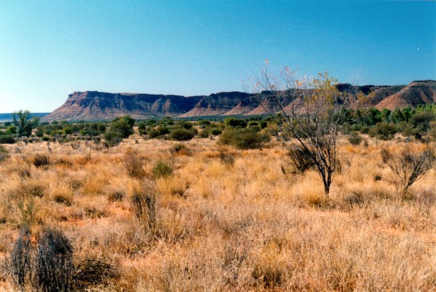
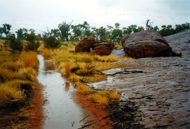
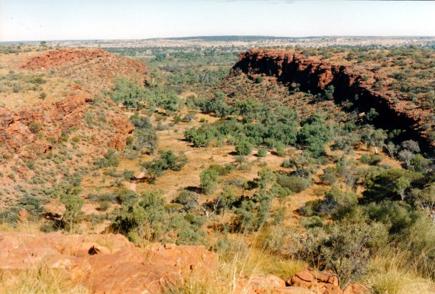
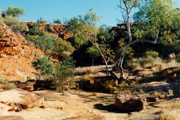
After about 4kms, we reached the Wanga Creek valley – mostly dry – and explored down the creek to where it drops precipitously off the escarpment. It was quite a deep and rugged little valley at this point. There were a few small waterholes. It was a lovely, peaceful place.

06-13-1999 07 Wanga Ck view downstream

The Wanga Creek valley

06-13-1999 08 exploring Wanga Ck.jpg

Scrambling down the Wanga Creek valley – dry waterfall

06-13-1999 10 wanga creek.jpg

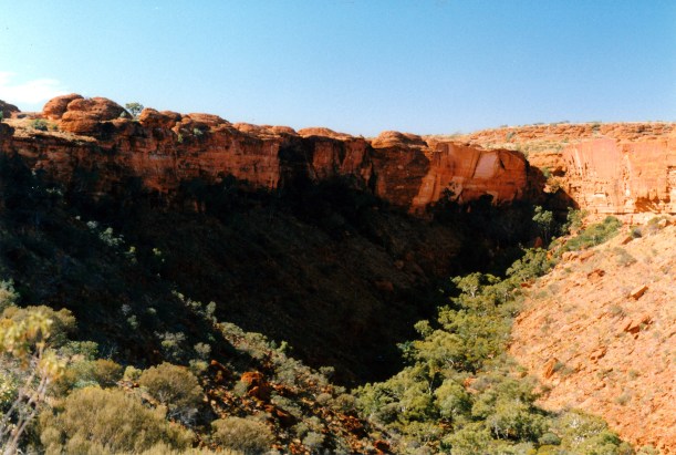
The point at which the Wanga Creek drops over the edge of the plateau

It occurred to us that, when there is rain in these parts, there would be a number of waterfalls coming over the edge of the plateau – and over the walls of Kings Canyon, too. It could be a really interesting time to visit.


In our exploring, rather lost track of time, and finished up having to do a fast walk of the 4kms back to Truck. Reached there about 5.30pm.

06-13-1999 wanga ck upstream.jpg

Late afternoon at Wanga Creek

Back at camp, showered, then made tea of potato soup, crab and corn cakes – using tinned crab meat.


Leave a comment

1999 Travels June 11

FRIDAY 11 JUNE     KINGS CANYON

We were up at 9am again.

There was a lot of cloud about, at first, and we thought it would not be a good day to do much. However, by about 10, it had broken up, the sun was shining, and we decided to tackle the full Canyon Rim walk.

We took a packed lunch, and water, and the little first aid kit, in the day pack. I forgot to take extra film, though, and ran out part way round the walk. Drat!

06-11-1999 01 start canyon walk.jpg

Starting out. Behind John is the spur that the track goes up to reach the top of the plateau

Drove to the carpark. Walked the sealed first section of the track – this section is shared with the walk we did along the creek valley. Then it branched, and the first part of the Rim Walk was a steep climb up to the top level. Much of the ascent was stepped and staged, so it was by no means the worst climb I’d ever done.

06-11-1999 02 carpark and plains from part way up canyon spur

The car park and the surrounding flat plains from part way up the spur climb

As we gained height, there were dramatic views up the adjacent big valley, along the main Canyon, and back over the carpark and the plains below. The plateau at the top of the Canyon  is 100-150 metres above the valley floor.

06-11-1999 03 next valley from spur track

The next valley from the track up the spur. The flatter, top level is evident

06-11-1999 04 view up Kings Canyon.jpg

Looking along Kings Canyon as we climbed the spur track. We will be walking right around the top

Once on the top plateau, the track wound along through lots of small dome, valley and chasm formations, that were quite unexpected and rather reminiscent of the much larger domes of the Bungles, in WA. The domes, according to local aboriginal lore, are native cat men.

06-11-1999 09 on the top scene.jpg

Valleys on the plateau, between the red domes

The sunlight on the red sandstone was brilliant.

There was so much more variety up on top than I had expected. Little valleys had quite thick clumps of grasses growing, with shrubs, low trees and the occasional white trunked ghost gum contrasting strongly with the red rock.

06-11-1999 06 domes and gums on top of canyon rim.jpg

Red rock domes, ghost gums, thick grasses in the valleys between the domes

06-11-1999  10 collapsed rock rim walk.jpg

A place where a rock formation has collapsed

In places we were walking on bare rock sheets.

06-11-1999 07 track guide by domes.jpg

Track guide to stop walkers straying too close to the dome – or taking the wrong route

There were occasional lookouts with huge drops into the Canyon below. Sometimes we could see people across the other side, looking really tiny.

06-11-1999 11 canyon and rim.jpg

Lookout over the Canyon. There are people on the rim on the other side. The smooth rock faces are where slabs have fallen into the valley below. Note the pointy rock at top left.

06-11-1999 13 canyon edge

The unprotected plateau edge, beyond John – who is not going too close!

We came across a first aid box and stretcher arrangement, for case of emergency up there. Like the same sort of thing we’d seen on the Valley of the Winds Olgas walk.

06-11-1999 14 reality bites.jpg

Multi purpose emergency first aid box!

06-11-1999 15 Kings Canyon rim walk looking back.jpg

Looking back the way we have come on the track that weaves through the domes. The pointy rock form by the Canyon Lookout can be seen at left of photo

One side track that we took went to a lookout over the Garden of Eden. This is a deep, steep sided valley in the sandstone, formed by Kings Creek. Because of its depth and narrowness it stays rather permanently damp in there, from seepage out of the sandstone,  and so it is a little oasis, with palms, ferns and 400 year old cycads. Even when Kings Creek is dry, water remains in some deep pools down there.

06-11-1999 16 Valley of Eden Kings Canyon path and steps

Looking over the Garden of Eden. The stairs down are at left

The lookout track crossed a deep ravine over a bridge and had some pretty vertiginous drops – but we gained an excellent view up the Garden of Eden.

After that, we went along and down into the Garden of Eden – on steps built down the rock face. Walked along to the permanent pools. There were a couple of ducks there, and a crow in a tree. Its call was magnified greatly by the rock walls – it seemed quite put out by the loud, echoing call, and kept repeating it, and acting puzzled. We thought it quite amusing.

06-11-1999 17 Valley of Eden

The pool in the Garden of Eden

We ate lunch sitting by the water. The ducks came begging for some. They were quiet enough to take pieces of crust from my fingers. It really was a lovely and serene place.

There were more stair cases to climb to get back up to the top level again.

06-11-1999 18 view over Valley of Eden.jpg

A final look back at the Garden of Eden

The path continued around, through more domes and clefts and with more outlooks across the Canyon. This side of the Canyon was not as rugged as the first had been. The track around the Canyon Rim goes in a big U shape, so a little after the Garden of Eden, we could see where we had walked this morning.

06-11-1999 19 above canyon.jpg

There was more flat rock surface on this side of the Canyon walk

There were places where the red sandstone walls were broken by white patches – places where pieces of rock had broken away and the underlying light coloured sandstone had not yet been oxidised to red.

One intrusive note was the helicopters regularly flying sightseers  over the Canyon to look at it. They were quite low. One even landed up on top and we wondered if it dropped some walkers off to save them the climb up? They were just an incongruous presence in such a grand and awesome place.

Some people venture awfully close to the edge, but not this little black duck!

Eventually, we began a gradual downhill section and arrived back at the carpark.

The walk had been 6kms in total. We had left the carpark at 11am and returned to it at 4pm, without hurrying at any stage. In fact, we dawdled a lot!

I think it is one of the best day walks we have ever done – just a magic day. It was not too hot, and there was a little cooling breeze.  I imagine that being up on the Rim on a really hot day would make it really hard. There were quite a few other walkers, as one would expect in a place like this, but they were not intrusive, and much of the time we were walking alone.

We certainly felt a great sense of achievement from completing this walk.

We did not feel too tired after all the exertion and scrambling, though, back at the van, John had a nap.

I made potato soup and we had some of that for tea, followed by curried tuna and rice – and yoghurt, of course.

A fairly early night was called for.


Leave a comment

1999 Travels June 10

THURSDAY 10 JUNE     KINGS CANYON

We got up about 9am. We certainly seem to be sleeping in later these days, possibly because it seems to get light later. It is a big contrast to this time last year, in Qld, when I was waking so early.

After breakfast, I did three loads of washing, including the sheets. At $2 a load, it was 40cents each time cheaper than at Yulara. It was a sunny day with a strong breeze – good for drying.

It turned into a puddling about type of day.

John did some work on the TV aerial and checked the Truck batteries. I washed the van floor. We just relaxed in the sunshine and relative quiet of the camp ground.

Later in the afternoon we drove out to the west, on the unsealed Mereenie Loop Road, for about 25kms, to a little way beyond the National Park boundary. The country was interesting, with the dissected ranges in the distance. We spotted a brown falcon – a new bird for our records.

06-10-1999 george grill range.jpg

The George Gill Range, seen from Mereenie Loop Road

We were passed by a couple of carloads of aborigines, heading east towards the Resort – wondered if this was due to it being pension pay day? They seem to drive very fast.

We went back to the Resort and the shop. Newspapers here only come in on Wednesday and Sunday. Supplies at the shop are expensive. I bought a roll of film, which at $7.50 for 24 exposures, is much more than I am used to paying. Also bought postcards and magnets – one for me and one for P, who is collecting them.

Tea was tinned mushroom soup – which I managed to boil over onto the stove! Then chicken breasts done Greek style, potato and zucchini, followed by the ever reliable yoghurt.

06-09-1999 desert dusk light Kings Canyon.jpg

Dusk light on the Range from the campground – the gradation from pink through purple to blue is typical of Central Australian dusk

After tea, I wrote a letter to a friend. John tried to phone S, from the camp ground phone box, but couldn’t get through.

There was a large Britz hire camper parked behind us today, with Japanese occupants. Apparently, they were filming a feature or advertisement on Japanese camping in Australia. They had pre-cooked food, but filmed to make it appear they were cooking it! They set up the camp ground provided table for dining out – after moving it from near us – but soon abandoned that venture as the late afternoon chill set in. They were very noisy. They departed with their camper about 11pm. John said they came back later, after I was asleep and they were quite noisy then, too.

It was a cold night. I went to bed about 11pm. John played his computer game till 4 am.


Leave a comment

1999 Travels June 9

WEDNESDAY 9 JUNE   YULARA TO KINGS CANYON   330kms

Our departure was efficient, getting away  about 9.30.

The drive to Watarrka National Park and Kings Canyon was pleasant, interesting and varied.

We had to back track, of course, back east past Curtin Springs, before turning north on to the Luritja Road. There were low ranges evident to both sides of this road, and it also crossed some red sand dune country. There was considerable variation in vegetation growth levels, as well as in the scenery. We pulled over after about 50kms, and ate lunch parked just off the road. After 67kms, the Luritja Road intersects  with the unsealed Ernest Giles Road that goes east to the Stuart Highway. We turned west, staying on the sealed road.

Ernest Giles was an explorer who, in the second half of the 19th century, explored much of Central Australia and the western deserts. He gets commemorated a lot in these parts.

As we proceeded west along the Giles Road, the George Gill Ranges came into view, and the area became quite rugged, with lots of ravines and gorges evident in the ranges to our right. Passed the Kings Creek Station, which has a camping ground. We had debated about staying there, rather than what we expected would be the less atmospheric Kings Canyon Resort, but decided the 34kms from the Canyon was too much of a drawback.

Booked into the Kings Canyon Resort campground. They charged us $26 for the first powered site night, $21.50 for the second night, and $13.50 a night after that. This was rather better than we expected, at a total of $115 for a week. I presume the sliding scale is to encourage lengthier stays – or reward same, which ever way you want to look at it. We booked for a week.

It is quite a pleasant campground, not as big as that at Yulara – but then it does not get the visitor numbers either. I suspect that many bitumen only travellers are put off by the need to back track the 170kms from here, back to the Lasseter Highway. They miss out on something special, because this is a great area.

We were able to choose a site at the edge of the park, with a great view across to the range, which glows red at sunset. The amenities are modern, spacious and clean.

There are lots of birds about the place, especially miners, pigeons, mudlarks and some varieties of honey eaters – there’s quite a number of trees in blossom for them.

After setting up, we drove to Kings Canyon, a few kms back. The access road to the car park area is sealed, and there is a fairly large car park. We had decided to tackle the Creek Bed Walk, to get some exercise after the driving. It was only a 2.6kms return walk, fairly level.

It was fairly late in the afternoon, by this time. The walking was pleasant, and easy. There were lots of holly leafed grevilleas in flower, and heaps of birds about – it would have been their afternoon feeding time by now.

We had good views of the late afternoon sun on the Canyon walls as we walked. Passed the point where the Rim Track branches off to the left. The canyon seemed quite broad as we followed beside the dry creek bed. There was spinifex interspersed with bare ground, shrubs and low scrubby trees.

06-09-1999 03 in the Canyon late pm.jpg

The walls of Kings Canyon in the late afternoon

Unfortunately by the time we reached the viewing platform at the end of the track, some clouds had come over the sun, so the photos I took there were found later to be rather poor. There was a small pool at the track end. We could see people up on the Canyon Rim track.

06-09-1999 02 Canyon head from creek walk LO.jpg

The head of Kings Canyon  – late afternoon sun on the walls

After looking about at the end of the track, retraced our steps to the carpark.

06-09-1999 01 late pm in Kings Canyon

A ghost gum standing out amidst the scrub in Kings Canyon

Then we drove to the sunset viewing area and looked at the George Gill Range from there, for a while.

06-09-1999 sunset George Gill Range.jpg

Sunset on the George Gill Range

Back at the Resort, bought a 24 stubby slab of beer, for $40! They do not sell wine, damn it.

I made fried rice for tea, followed by yoghurt.

John listened to/attempted to watch the World Cup cricket. TV reception is not great, here.

Bed about 11pm.

06-09-1999 to watarrka.JPG


Leave a comment

1999 Travels June 8

TUESDAY 8 JUNE     YULARA

I was up at about 8.45. John slept till 9.30. He was not in the best of moods.

After breakfast, he went back to his computer game.

I went for a walk, all round Yulara village. It was a beautiful, blue-sky, sunny day, and the walking was great.

After lunch, we went for a drive back out to the Rock and sat and watched people climbing it, for a while. We do not seem to get bored with speculating which of those who set out will turn back when the chain is reached and who will go on. The chain is fixed in place, at about waist height, to steady walkers and to help them haul themselves up the very steep section here. It is also the place where there is an almost vertical drop off, beside the chain.

The varied attitudes to the climb, that can be heard, are also interesting – from gung ho bravado, to tentative. We noted that the gung ho ones were over-represented in the turn backs.

06-07-1999 19 olgas late afternoon.jpg

The distant Olgas in the late afternoon

06-07-1999 20 Ayers Rock from Olgas rd.jpg

Ayers Rock as seen from near the Olgas

After that, went back to Yulara village and shopped for food. I mailed a 50th birthday card off to my brother.

During our time here, I have chatted a couple of times with ladies on the check outs at the supermarket. Most of them are travelling the country, like us, and are just working here for the short term. I do like Yulara. It would be interesting to work here for a while, at some future time. I have seen a few job ads displayed around the place – for example, entry station attendant at the Park. I would like that one!

Refuelled Truck – still 90 cpl.

Did the usual preliminary packing up.

Tea was kumara soup, pizza, banana and yoghurt.


Leave a comment

1999 Travels June 7

 MONDAY 7 JUNE     YULARA

The day began still cloudy, but the rain had stopped.

We set out to visit the Olgas, stopping on the way at the Kata Tjuta Viewing Area, for some photos of the Olgas domes from a distance.

06-07-1999 02 Olgas panorama RHS.jpg

The Olgas seen from the approach road

Left Truck in the Valley of the Winds car park and set out to walk, with lunch and the little first aid kit in my day pack, and our water bottles.

My first impression was that quite a lot of track works have been done here in the six years since we visited. And it is evident that a lot of feet have come this way since then.

Signs to the two domes lookouts basically ensure that those walking the Valley of the Winds circuit do so anti-clockwise. I seem to remember that in 1993, one could go either way, and we went the other way then. So today’s experience seemed quite different, more interesting, and much easier than in my memory.

06-07-1999 03 Valley Winds view from track in.jpg

The track towards the First Lookout has plenty that is of interest

The full circuit walk is about 8kms. We managed it well.

The first lookout, about a km in, gives a vista of some of the dome formations. They are a red sandstone, like Ayers Rock, but otherwise totally different in appearance.

06-07-1999 16coming round to LO 1 in pic centre.jpg

The First Lookout is in the cleft in the centre of the photo

The second lookout, about another 1500 metres further in, requires a climb up a narrow gap between domes. From there is a great view down into what appears to be a central valley between multiple domes.

06-07-1999 09 valley of winds.jpg

The Valley of the Winds from the Second Lookout – and the walking track down into the Valley


06-07-1999 10 view back to second Olgas lookout.jpg

Looking back up to the Second Lookout, from the track down

From the car park to the first lookout, we were in the company of a number of other walkers. Some of these dropped away after that point, but some continued, with us, to the second lookout. However, we were the only walkers in that cluster, to continue on. I guess people think that they have seen enough, from the lookout, but they really miss an excellent experience by not going on. Walking down in the valleys, surrounded by the complexity of the domes, and with changing vegetation, little creek gullies, and constantly changing perspectives, is really quite memorable.

06-07-1999 14 down in the Valley of Winds.jpg

Down in the Valley of the Winds


06-07-1999 15 domes in valley.jpg

Surrounded by domes in the Valley of the Winds

Down in the valley, we ate our lunch beside the track. Whilst there, we were passed by a couple of walkers. I just can’t believe how few walkers there are here. Guess it was the same on the Rock circuits – people drive around it on the road, but very few do the walk.

06-07-1999 13 Olgas Valley of Winds dome

We crossed a number of dry creek beds

With lots of photo stops, as well as the lunch stop, the full walk – almost 8kms – took us three hours.

06-07-1999 18 another view up Valley Winds entry track.jpg

The track in went via the valley between the domes – we are almost back to the start, here

Drove back to Yulara. There was no mail for us, and no papers in.

John wanted pizzas for tea, so we bought some ingredients to make our own.

Since the mail hasn’t come, stopped at the office and booked in for another day.

Made the pizzas and cooked them in the van oven. We ate one for tea and left the second one for tomorrow’s tea.

K phoned us to say that the mail room at his work had messed up, and our bag of mail has ended up back in his pigeon-hole there! At least we now know where it is. I told him to send it to Alice Springs, instead. He had been fishing and caught a huge trout that had to be bent to fit in the oven – such fishing seems a remote concept, from here. They had lost Fox dog – for two days. She got out when he was mowing. I think John was kind of pleased that he is now not the only one who has lost her. Little varmint. Our Butch, of course, stayed put.

Now we have an extra day here that we really do not need, because we have done all that we wanted. Oh well.

John stayed up until 6am, having a real session with his computer game.


Leave a comment

1999 Travels June 6

SUNDAY 6 JUNE     YULARA

When we woke, it was still raining, quite strongly. At intervals, through the night, had woken and heard the steady rain on the pop top roof. But inside the van was dry and snug.

I would expect lots of desert wild flowers to bloom in the next few weeks, after this soaking. There is much red mud in the caravan park. It has made the floors in the amenities areas really messy. It is quite cold, too, like a Melbourne winter day.

Visitors who have only scheduled a day or two here are not going to see Ayers Rock the way they expected it to look!

06-06-1999 cloud on Rock.jpg

Cloud sitting on the top of Ayers Rock

After breakfast, we drove out to the Rock, and drove around it, on the circuit road. We were looking to spot places where water was flowing down the Rock. Found some on the southern side – lots of little streams and small falls. We walked for a short while, and took photos – and got wet feet.

06-06-1999 streams on the rock.jpg

A chain of water holes down the face of Ayers Rock


06-06-1999 Rock feature in wet

Caves, and a little stream on the Ayers Rock surface

The Rock today is rather like it was when I first saw it – there was even some cloud drifting across the top. Ten years ago, I was in Alice Springs for meetings to do with work, and my boss organized a day trip tour for me, to Ayers Rock. It was raining there, and the top of the Rock was obscured in cloud. But a bus took us out for a close-up view. It was my first trip in a small plane. After we took off from Yulara to return, the pilot decided to try to give us a closer, low  aerial view of the Rock. I shall never forget him peering through the windscreen, saying “There’s another small plane up here, somewhere.” I was thinking never mind that, there’s also a bloody big rock in those clouds somewhere! Flying over the rugged ranges between Yulara and Alice Springs was awe inspiring.

I think we are most fortunate to have seen the Rock in all moods, in this way.

06-06-1999 mist on rock top.jpg

Streams flowing down the Rock face – and a sheltered section that looks like a big wound on its side!

We got back to the van mid-afternoon. Read the papers some more. John watched football on TV. He drank the last of the beer – and it is expensive to replenish, here.

I made a batch of kumara soup and we had some of that for tea, then pasta and a tomato sauce, and yoghurt.

We both had a reasonably early night.


Leave a comment

1999 Travels June 5

SATURDAY 5 JUNE     YULARA

We woke to steady rain. We had not been following the weather forecasts, so were not expecting that. I don’t even know if it was actually forecast.

After a slow start, and dawdling over breakfast, I packed lunch – yesterday’s rolls – and we drove to the Rock.

06-05-1999 wet rock.jpg

Ayers Rock in misty rain

Sat in Truck and ate lunch, just looking at the Rock – wet. The combination of clouded skies and water changes the colour and makes the Rock dark.

06-05-1999 Ayers Rock wet patterns.jpg

The contrast between wet and dry faces on the Rock

The climb was closed, obviously, due to the weather.

We walked a little way, towards a gully where there was already water pouring down. The path had turned into a creek.

06-05-1999 new waterhole fill.jpg

Waterhole at base of Ayers Rock, filling

06-05-1999 wet path.jpg

It’s normally a path!

Saw two of the most miserable looking Crested Pigeons you could imagine – cold, wet, and looking thoroughly unhappy. Definite bird body language there!

06-05-1999 wet crested pigeons.jpg

Are we happy?

Went to the Cultural Centre. There was no charge for entry to this. We spent almost three hours there, looking at all the displays and cultural-related activities. Many of the displays were really well done and there was a lot of information to absorb. However, I felt that the video material of the Anangu people dancing – shuffling about, really – would not impress tourists, especially overseas visitors, with its level of cultural or intellectual sophistication! That was a very uninteresting and meaningless aspect of the displays, compared to some we have seen in other places. Pity, because it detracted from the overall impressions of the Centre.

06-05-1999 The rock in the rain

Collected the weekend papers at the Yulara shops.

Back at the van, John made Chelsea Buns. I made a start on the papers.

Tea was tinned pea and ham soup, Chelsea Buns and crumpets. Comfort food in the rain.


Leave a comment

1999 Travels June 4

FRIDAY 4 JUNE     YULARA

Today we decided to spend just relaxing around camp. That, in itself, can be quite interesting, as I sit outside and watch those who are departing get ready to go – with greater or lesser degrees of efficiency. Later in the day, there are the new arrivals to watch manoeuvring onto sites and setting up.

John made bread: a loaf and some rolls. We ate the rolls for lunch, with cheeses.

I used the morning to catch up with putting photos into the album, and annotating same.

Walked to the shops. The Resort is laid out in a rough circle, with the central part left to the native vegetation – probably with some help from Resort gardeners. I enjoy the fact that there are paths through this central area, that make the walking interesting.

There was still no mail for us. Nor were there papers – the plane connection had been missed. I walked around much of the Resort, then went back to camp.

I read for the rest of the afternoon. John computed.

Tea was fries with frozen, oven-ready battered fish. So-so.


Leave a comment

1999 Travels June 3

THURSDAY 3 JUNE     YULARA

We were up at a reasonable time. There is so much movement in this campground that it would be hard to sleep late.

I discovered that we had a significant leak – from the mains water system that links the outside supply to the sink tap. It is mostly rubber piping and something had loosened and allowed a steady drip of water into the cupboards under the sink. One big cooking pot was full of water and this had overflowed. There was water on the floor under my seat and along the back wall of the van, due to the slight lean of the van. The two bags of bread making flour stored under my seat were wet on the bases. I was able to retrieve some of the flour and store it in a container, and threw out about a half of each bag. Fortunately, flour is not too expensive.

John made repairs to the leaking item and I dried things out as much as I could. Must get into the habit of checking that area regularly and especially after rough road travel.

John decided that we would walk around the Rock again – the other way!

Took a packed lunch and drove to the Rock. Sat near the start of the climb and ate lunch, watching the climbers. I got chatting to some people sitting near us, who were interested in talking about Cape York. But our conversation was cut short when John said we must walk. I hoped they didn’t think us too rude!

06-03-1999 John on Ayers Rock base track.jpg

John setting his stop watch before setting off at a fast pace

After a few hundred metres, I stopped to take a photo and John went in front. Thereafter, he walked as fast as he could – I think he must have decided to see how quickly we could do the circuit. We had one brief water stop, although it was quite hot. We did the 10.6 circuit in just under two hours, which seemed to please him. But walking so fast meant one had to really focus on watching the track, rather than on looking about and enjoying the scenery.

Sat and watched the climbers some more – there is a strange fascination in this, it seems.

06-03-1999 people climbing Rock.jpg

The little dots against the sky are people ascending Ayers Rock

Drove back to Yulara, where I collected my photos and bought a paper. The mail was not in. Bought some fresh produce and withdrew some cash from the supermarket.

One good thing that happened in the day was that, as we entered the National park on the way to the Rock, the lady ranger was pleased to see us. She’d checked with her supervisor and she could extend the passes we bought yesterday, to cover our whole stay. It was very nice of her to take the trouble.

It looked like the sunset might be going to be nice, but we opted to shower while most people were away watching it.

Tea was tinned tomato soup, curried chicken and pineapple rice.

After tea John asked to look at the photos I’ve had processed here. This is unusual – but there were some that he had taken, in there.

John phoned S who was just back in PM after a few days at Bougainville. They talked for a while.

It was a chilly night, with the moon and stars really bright, and no cloud.

I stayed up till midnight – unusual for me – reading and knitting. John played computer until 5am.