First thing in the morning, I went to the park office and booked a second night. There was some sort of rather weird discount system applicable, because I paid only $30.60 for this night, after a $7.40 discount.
Chatted for a while with the park owner. He told me about a new caravan park chain that was about to start up – a really dog-friendly one. That sounded both interesting and overdue. It annoyed me no end, that the other major park chain to which we once belonged, and used a lot, had a no dog policy. The reality was that there were increasing numbers of travellers with dogs and, to me, it made sound business sense to recognize this and cater for it.
He also mentioned that the Halls Gap to Dunkeld road had been closed for much of this year, due to landslips, and this had impacted badly on tourism to Hamilton, it being a convenient stop between Halls Gap and the coast.
Couey had a morning walk along the creek trail.
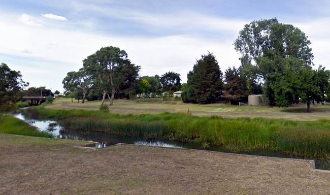
The Grange Burn by the caravan park
After John got going, we walked to the Woolworths complex. When I first moved to Hamilton, the commercial focus was in Gray Street, a block to the north, where the two old department stores and what passed for supermarket, were almost opposite each other. Then Coles set up not far from them. The Woolworths development happened after I left, but clearly, the main street was no longer central to commerce in the town.
John found a games shop there, too, so I waited with dog while he browsed in there.
After lunch back at the van, we went walking along the creek track, but the other way this time, under the highway overpass and towards Lake Hamilton.
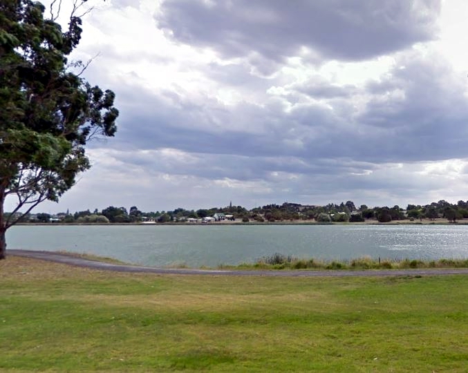
From the creek path, I could just see the spires of St Mary’s Catholic Church up on its hill, and a glimpse of the top of the towered house that had been my home for a while.
The spire of the church across from my old home; Lake Hamilton
I realized that, in a few months, it will be thirty years since I left Hamilton, after living there for thirteen years. No wonder the town had seemed altered!
More dog ball games on the grass near the park, then back to the van for the rest of the day.
The morning was cold, again, but the day cleared to sunny, though it still was not warm.
Had a little accident when packing up camp in the morning. John took the guy ropes off the poles that support the awning roof. The wind suddenly blew a huge gust, picked up the canvas roof and blew it right upwards. We were able to grab it and make a two person job of finishing packing it away, but a fastening bracket had been pulled loose from the van.
As we set off out of Beachport, we decided to just head for home, rather than meandering around any more. Had enough of the cold and damp. I thought, also, that John was worried about his breathing issues, though he wasn’t saying so. My shoulder continued to be quite painful. Caravan life didn’t seem to agree with it, again. As well, we were finding that a rather large, often damp dog and a rather small caravan were not the greatest match – well behaved though the dog was.
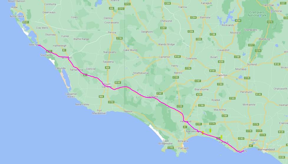
Travelled east through Penola, to Casterton and to Hamilton, through attractive country. There was lots of surface water lying about.
Typical country around Casterton
We stopped in Penola to eat the lunch I’d packed this morning, and give Couey a walk around. Had we been meandering, would have though strongly about a couple of nights here, to investigate both the interesting history aspects, and the terra rossi red wine country around Coonawarra.
East of Penola, the remnant coastal country was left behind and we were onto the volcanic plains of the Western District again. The big red gums that are a feature of these parts began to appear, as did more pine plantations.
After Casterton, the country was so familiar, from the years lived at Hamilton.
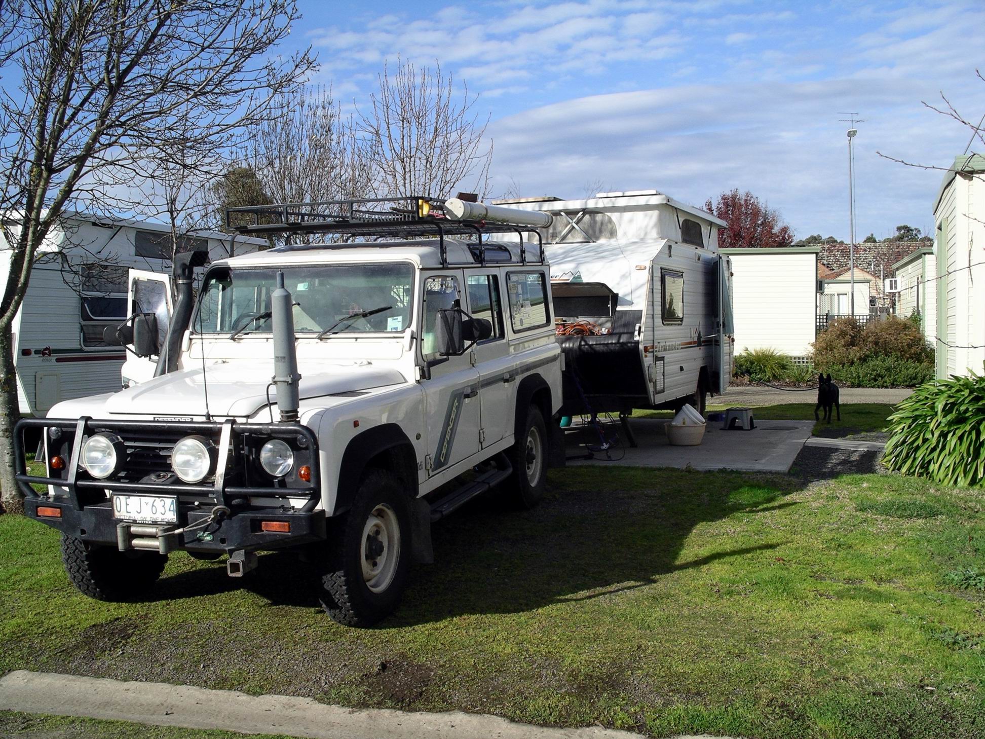
Booked into the Lake Hamilton Caravan Park, where we had stayed before, for one night. En-suite site cost $37.80, after a $4.20 discount. It was adequate.
There was not much setting up for a one night stay, as we were able to remain hitched up.
Hamilton site
I left John making a repair to the awning fastening with silicon and other bits from his travelling tool supplies, and took dog walking. There was a very pleasant walk/bike path alongside the Grange Burn creek that was next to the caravan park, so we followed that for some way to the south, then backtracked. I kept Couey firmly on her leash, with the creek nearby.
After a rest back at the caravan park, John decided the grassed area between the park and the walk path would be good for some off lead ball throwing for dog, so we both went and did that. She was too focussed on the ball to show any interest in the water. To date, it seemed that it was only large puddles that interested her, the muddier the better.
I made my old faithful tuna, olives, capers, tomato pasta meal with tinned apricots to follow.
Discussion after dinner centred around returning back through Melbourne on a Friday. Driver definitely not keen, so we decided to wait until Saturday for that. It seemed easiest to stay another night here, if we could, rather than hitch up and go elsewhere for just that time.
The day was fine but even colder. When I took Couey out for her first walk in the morning, there was ice on the boardwalk! The wind continued to be freezing.
Site with a view
After breakfast, John took dog walking through the canal and lake scrub tracks. She managed to find some animal’s manure to roll in. Did a thorough job – both sides. I hoped she’d enjoyed the freedom roll, because she certainly didn’t enjoy the cold hosing down she got, back at camp! Then, John played ball retrieving games with her for a while, to speed up the drying out process. I walked her around the streets, on the lead, to do my part for the dog drying.
John found the coolant level in Truck was down, so went off down the street to get some more. Whilst there, he felt the urge to visit the bakery and came back with a pastie for his lunch, and a Boston bun.
It was a bit of a concern that Truck coolant level was down. We hadn’t exactly been driving in hot weather! Having spent about $15,000 in the past couple of years, having the vehicle thoroughly repaired, things should be working perfectly.
After lunch we went for a drive, back out along the Scenic Drive.
I took some photos.
From the end of the Scenic Drive, John decided to venture along a 4WD track off into the dunes. It was loose and sandy and I was not happy. Just not in a mood to put up with getting bogged, like he had managed to do on some previous forays into sand. So, he soon turned round and we went back to camp.
Tea was Mongolian lamb and rice.
Our week here was up, tomorrow, and we decided to move on. Thought we’d head NE from here, up through Lucindale to Naracoorte. I’d be able to show John where I taught for a year. We would pass the little shearer’s cottage, out on the Conmurra road, where I’d lived – in somewhat primitive conditions: generator power and tank water. When the generator ran out of petrol at about 9.30 at night, it was bedtime. A weekly chore was to try to dig a hole to bury the contents of the toilet bucket – and the cottage was on a low limestone ridge with little soil! The conditions that teachers put up with in those days…….
Another mostly fine but bloody cold day – a really chilly wind blew all day.
We’d fallen into the habit of doing the same walk every morning now, with dog – path, canal, bush.
Beachport Lake
Given the weather, we were not motivated to do much today. John spent most of the time on his laptop, playing games, I read and did some crochet of an afghan rug I was making for grand daughter.
Stirred myself to make some flatbreads to have for lunch, with a nice warm soup – from tin!
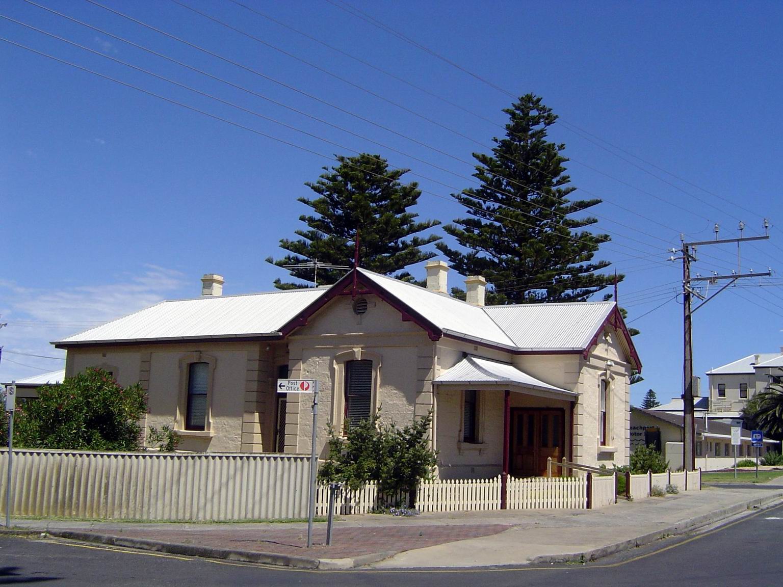
Typical of the older limestone buildings in town
Our most direct route to the amenity block involved going down the grassed slope from the upper terraced level our van was on. We were both noticing that John was having difficulty walking back up the slope again. Just the short uphill part – maybe ten steps – was leaving him breathless. Today, he actually had to stop for a breather half way up. Very concerning. He reckoned it was just due to the cold air affecting his breathing. Hmmm…..
I crumbed some fish for tea. From the freezebox, not caught by us – John had not been motivated to unpack the fishing gear, here.
Today was mostly fine, but with predominantly grey skies, and it was cold.
The dog’s morning walk was along the path, over the canal and around some of the bush tracks in the canal and lake area. Once she was off the lead it was impossible to stop her from cavorting in the large puddles formed in wheel ruts on the tracks.
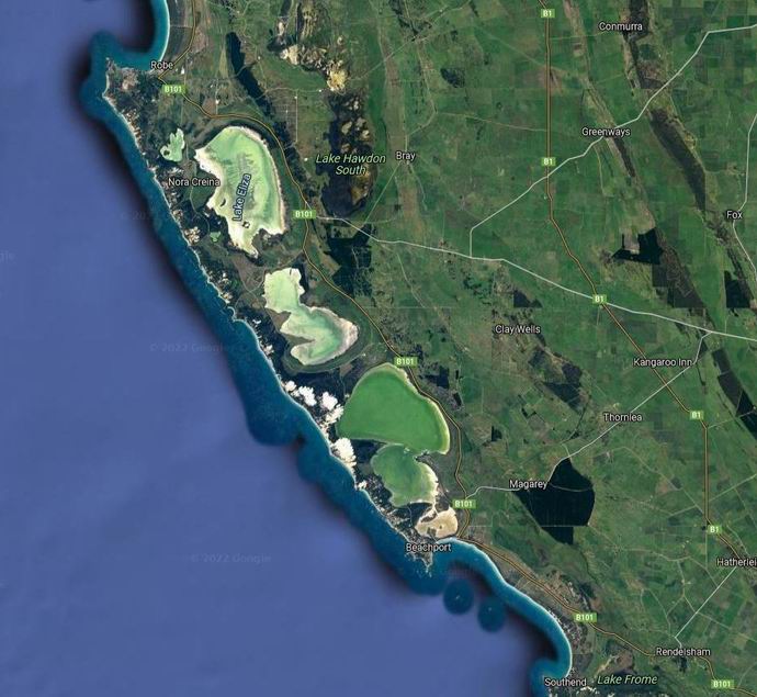
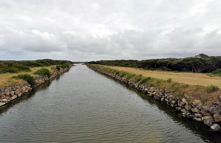
We drove to Robe, almost 50kms away. The road went inland, to skirt the eastern sides of several large lakes formed behind the coastal dunes. The retreating coastlines and resulting parallel dune systems have meant there is no normal drainage systems across such of the South East of SA. Instead, lots of man made drains were dug, over time, to drain the swamps and improve the country for grazing and farming. One of these was Drain L – no fancy names here – that we crossed a couple of times on the outskirts of Robe.
Drain L near Robe
Like Beachport, Robe is an historic settlement, dating from the 1840’s. Lots of old stone buildings to see, as we cruised around the streets. On a warmer day, it would have been pleasant to walk around, looking more closely at some of these.
We parked near the Obelisk and did venture out of Truck to wander around this area.
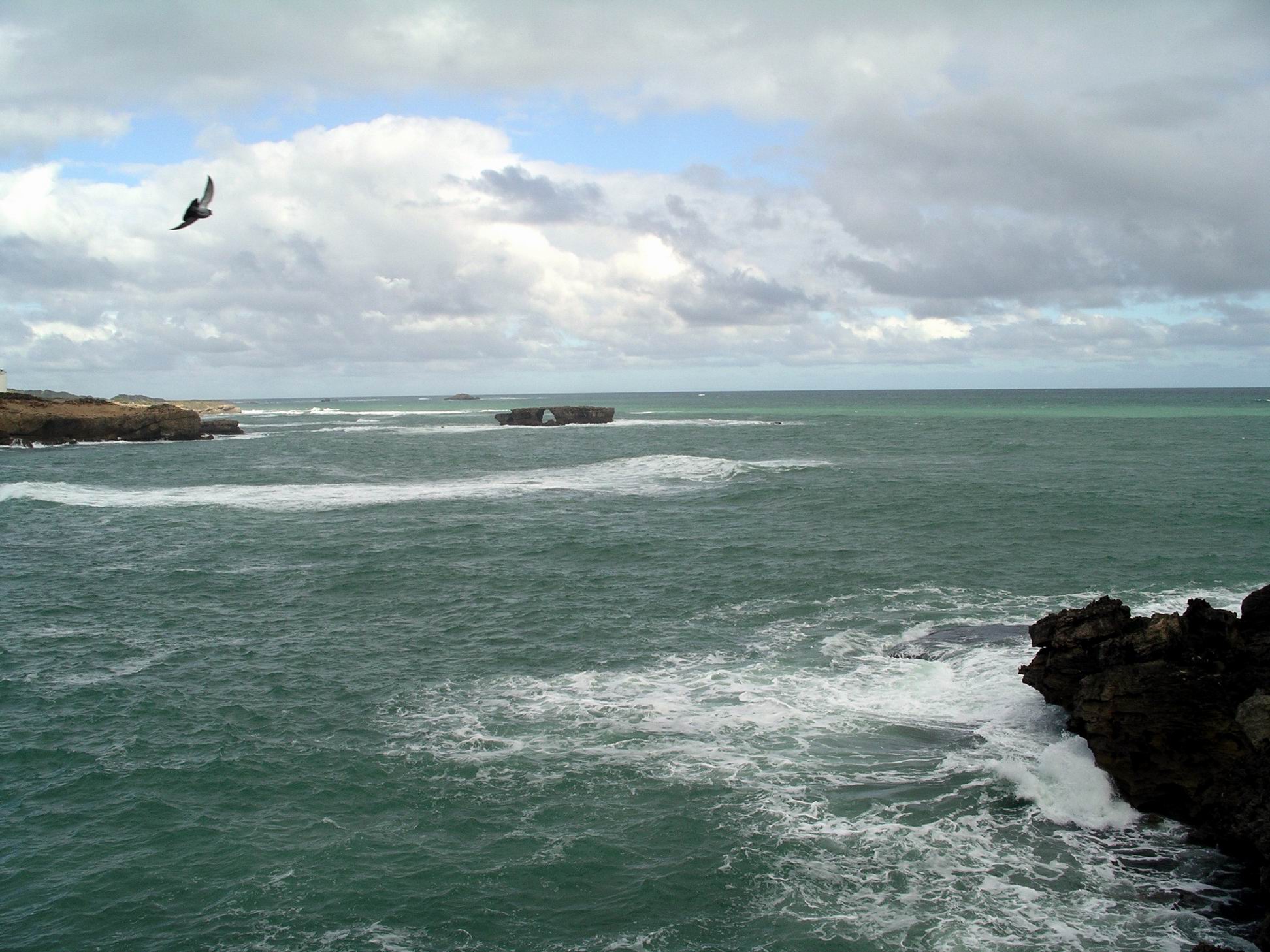
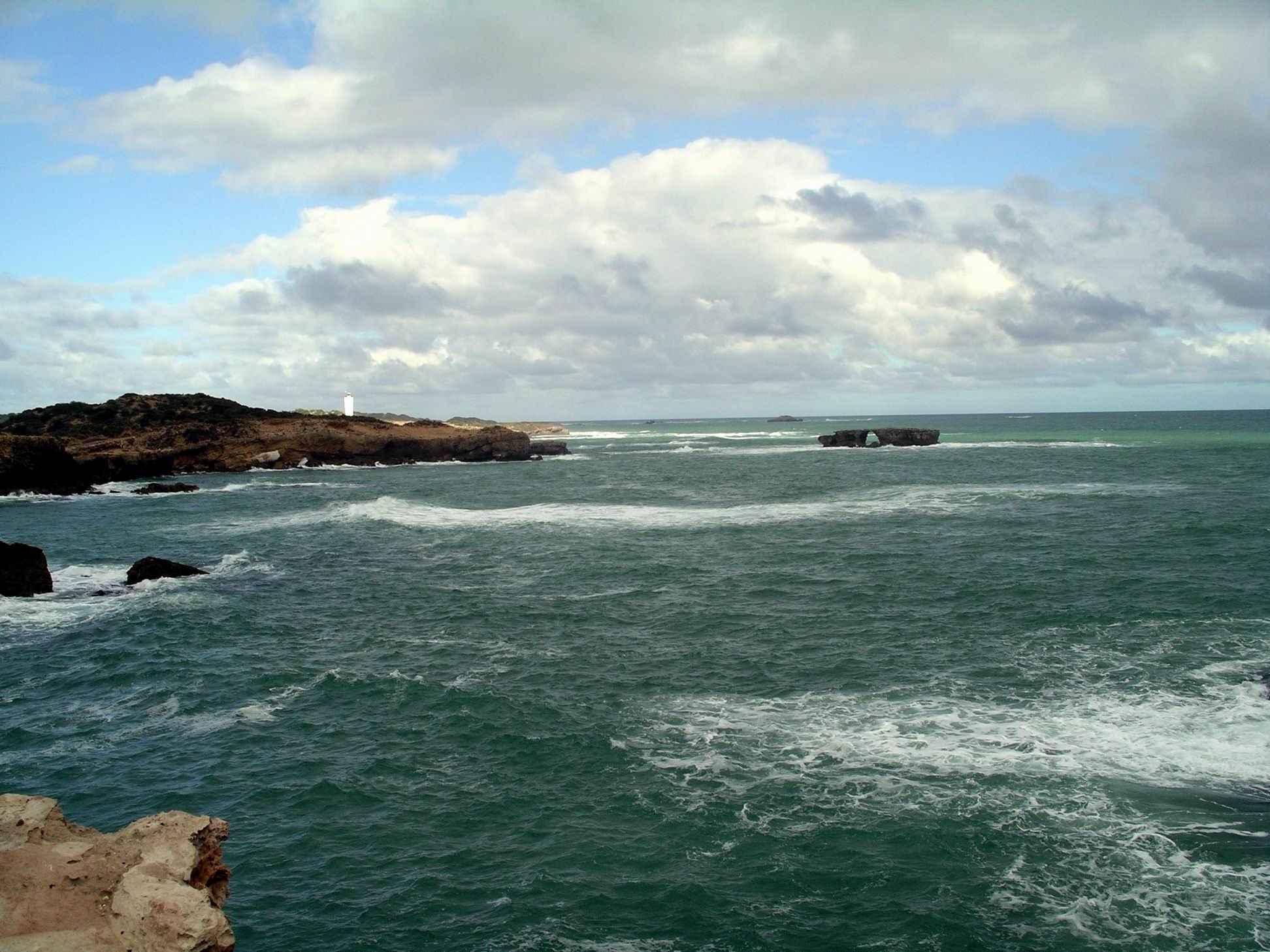
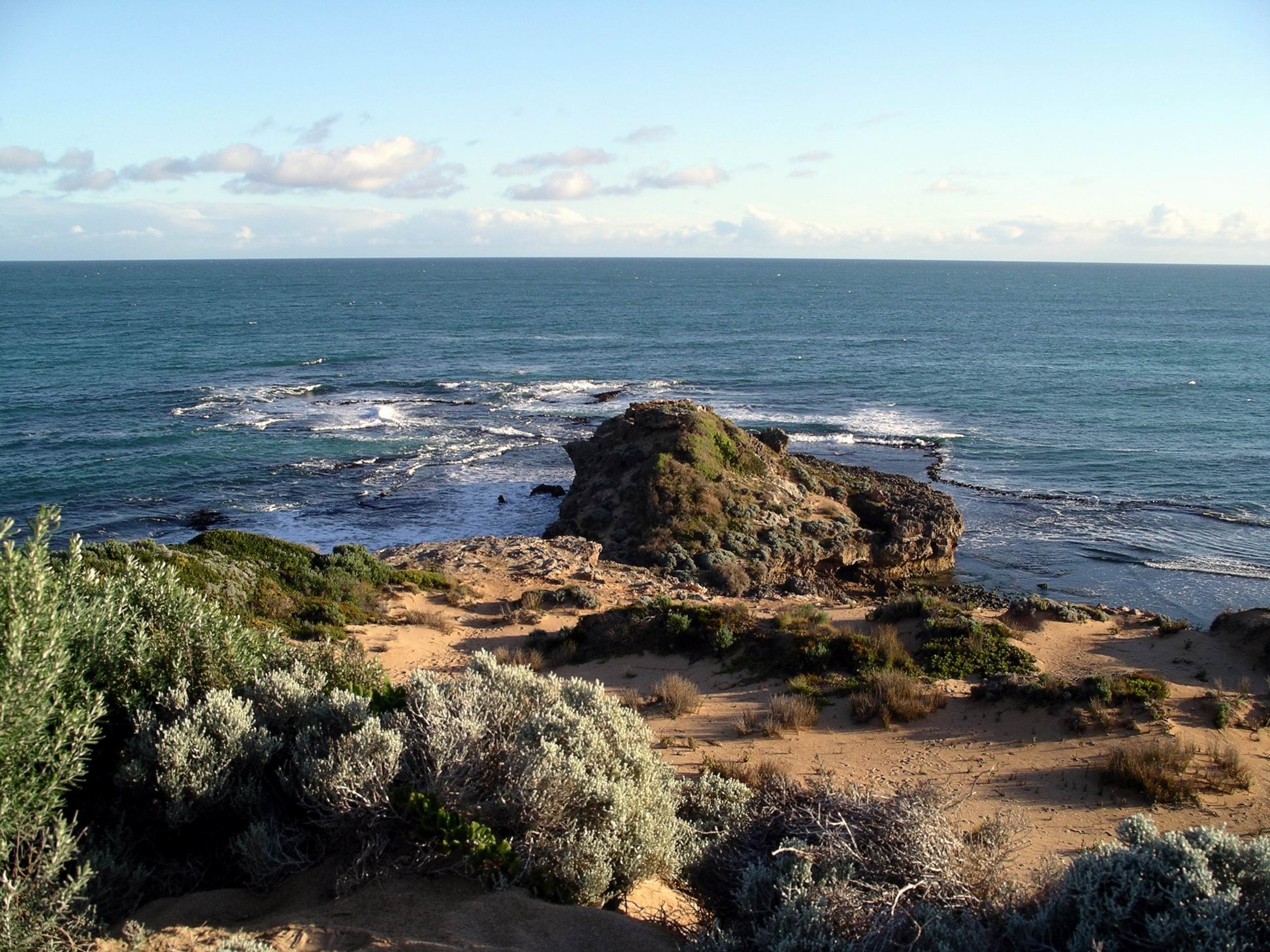
Robe coast
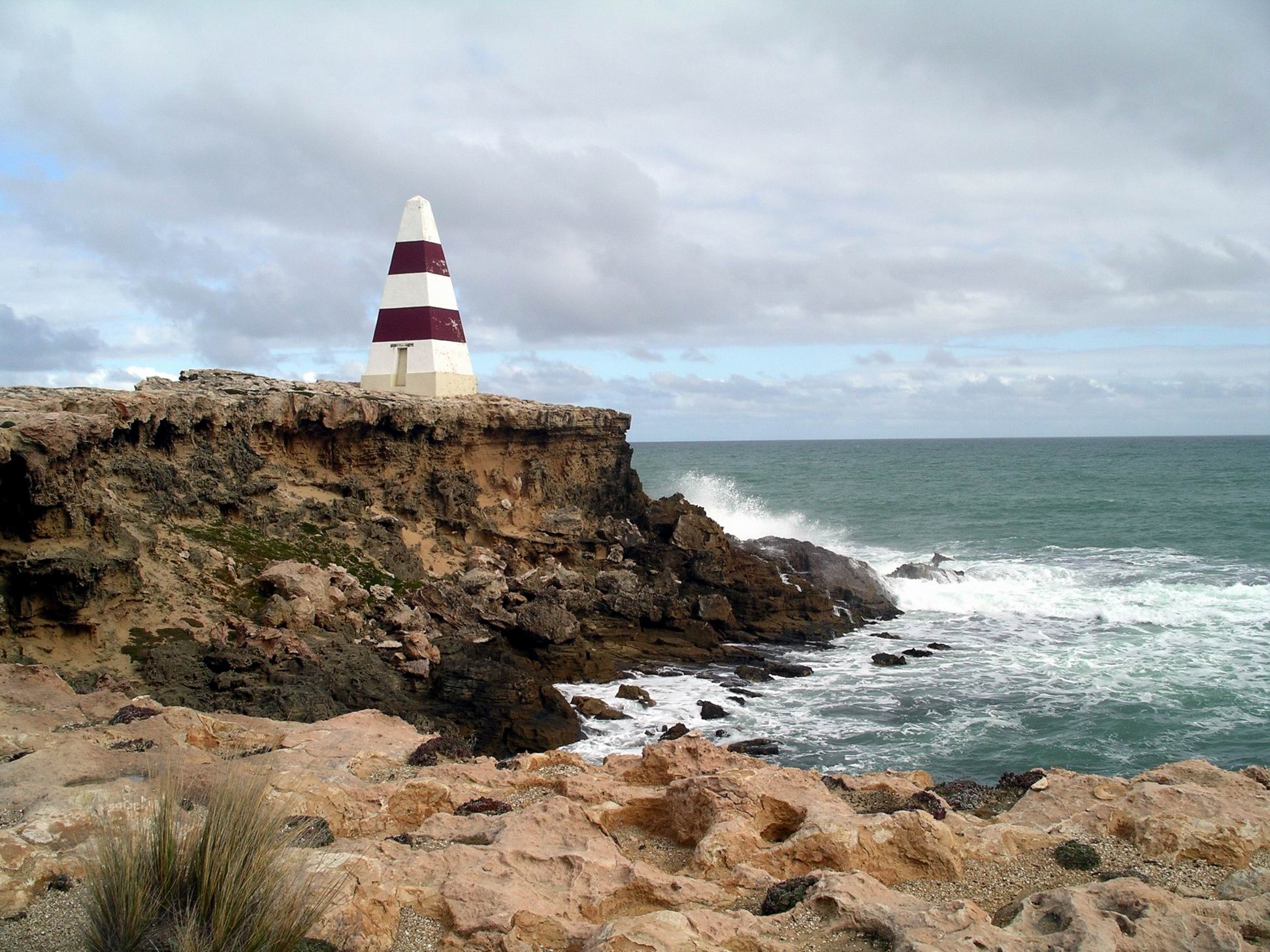
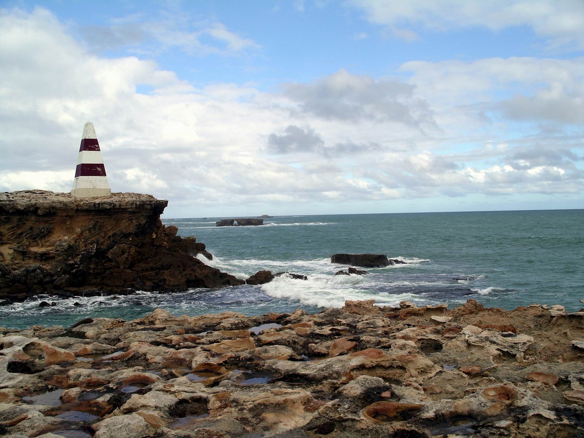
The Obelisk was a stone tower, built on Cape Dombey, to help ships navigate in Guichen Bay, where Robe is, in 1855. It was eventually painted with red stripes, to help it stand out from the land background.
Robe Obelisk being undercut by coastal erosion
Given the extent of coastal erosion we could see, it looked like the Obelisk would not last another hundred plus years, without being totally undermined.
A precarious situation..More modern aid to navigation in Guichen Bay
Back in the town, we parked and went walking, with dog, and found a bakery, where John was able to indulge in a pie, and me in a very nice salad roll. Dog got nothing except a drink of water; only two meals a day for her and very strictly no “people food”. Except for when she manages to scavenge something like a dropped scrap of pie crust!
We made a point of driving past the main caravan parks and checking them out. Still hadn’t decided on our next move. Decided that. although Robe was a larger centre than Beachport, we were happy there, and saw no reason to make Robe our next destination. Unless the weather improved radically, the day trip was sufficient.
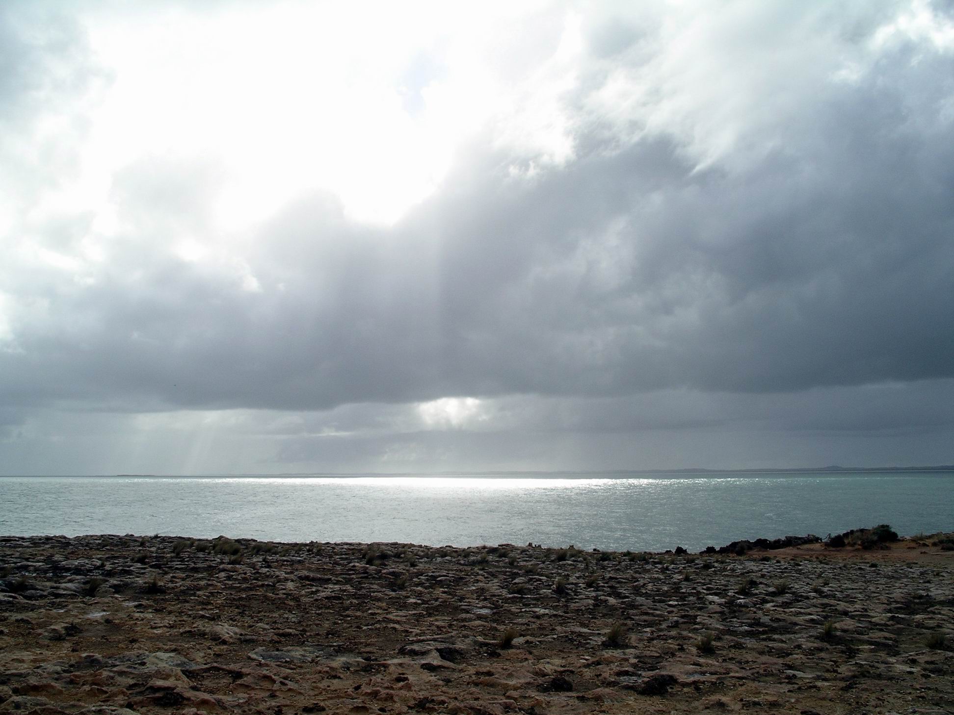
Rain clouds and sunshine over Guichen Bay
My map showed a dirt track from Robe along the coast to the hamlet of Nora Creina, which I had never been to, and a loop back to the sealed road. From the time, in 1968 when I lived in the South East, I had wondered who Nora was, but eventually discovered that the Nora Creina was a ship wrecked in the area. I found the name rather romantic and would have liked to see the place, but John was not feeling adventurous and just wanted to go back the known way.
We did, however, make a short detour to look at the Woakwine Cutting – essentially a very large ditch. Another drainage line, this cutting was carved, using a large tractor, for a km through a big sand dune range. Part of it is over 28 metres deep. A very big ditch!
I made a lemongrass pork stir fry for tea, with rice.
Another damp day, but there were some breaks between rainy periods. It was rather cold.
We managed to get in a reasonable dog walk along the bay path to the channel and back to the shops and around to the park – a big circuit. Even John was not prepared to take dog over into the scrub – and puddles – area.
After lunch, went driving again. This time, we skirted Rivoli Bay to the south, around to the hamlet of Southend, on the other side of the bay.
I’d not been there before. My tourist information mentioned a couple of caravan parks and I was curious to see if it was a possible next place to stay. In short, no.
Southend was very much a village of holiday houses and not many permanent dwellers. Beachport was like a metropolis by comparison – and infinitely more attractive. We stopped briefly at a couple of vantage points looking across the bay and township.
Rivoli Bay at Southend
There was a curved jetty, with a set of tracks on it for transporting gear and catches more easily from shore to boats. Again, a crayfishing place, in the season, with a small processing building near the jetty.
We concluded that Beachport was definitely the better end of Rivoli Bay at which to stay.
John had baked beans on toast for tea; I had some salad.
I did jinx us. It rained for most of the day and was a rather unpleasant one. The dog’s morning exercise was a fast walk to the shops and back. Spent the rest of the morning in the van, tucked away from the bad weather.
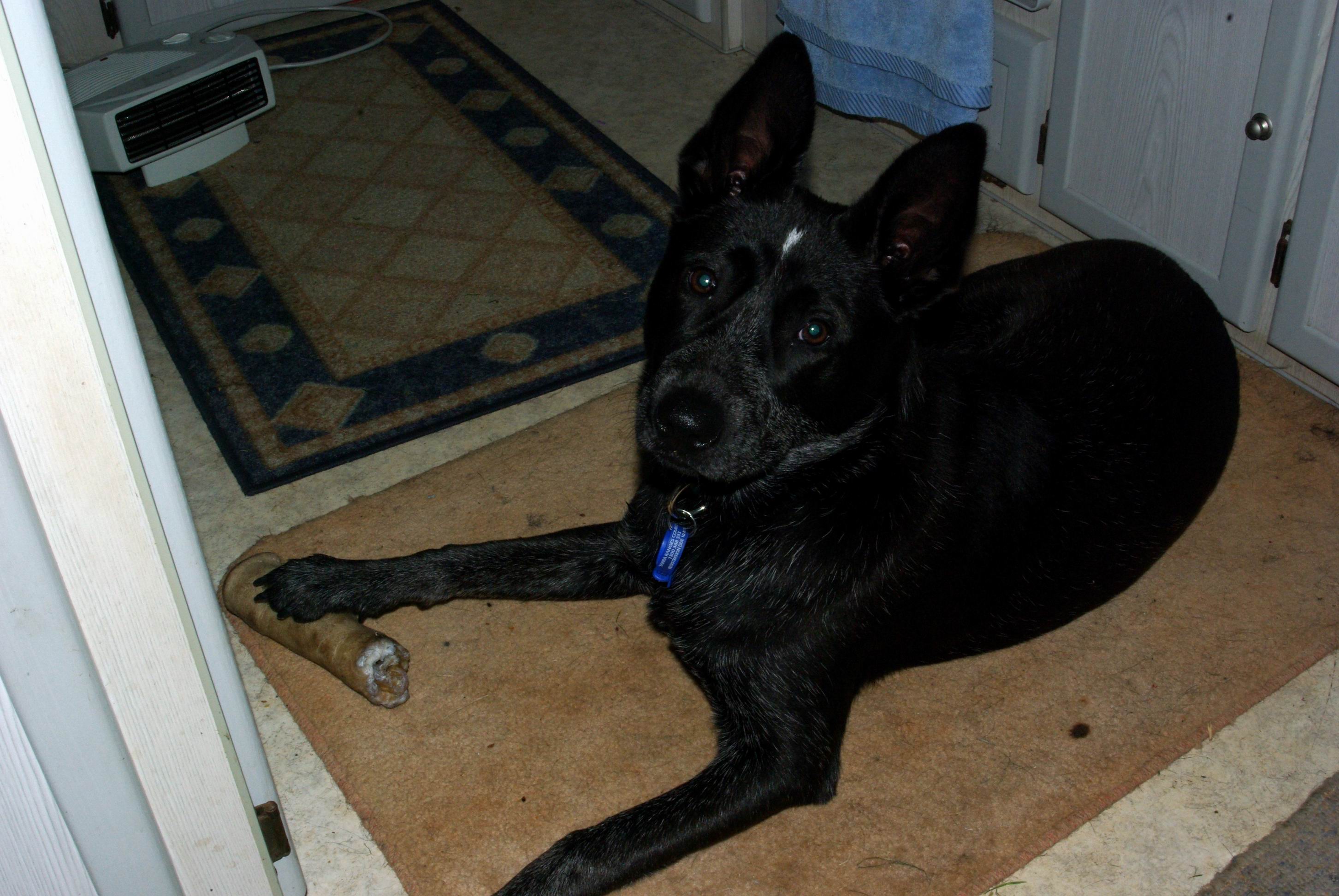
Prime place in front of the heater
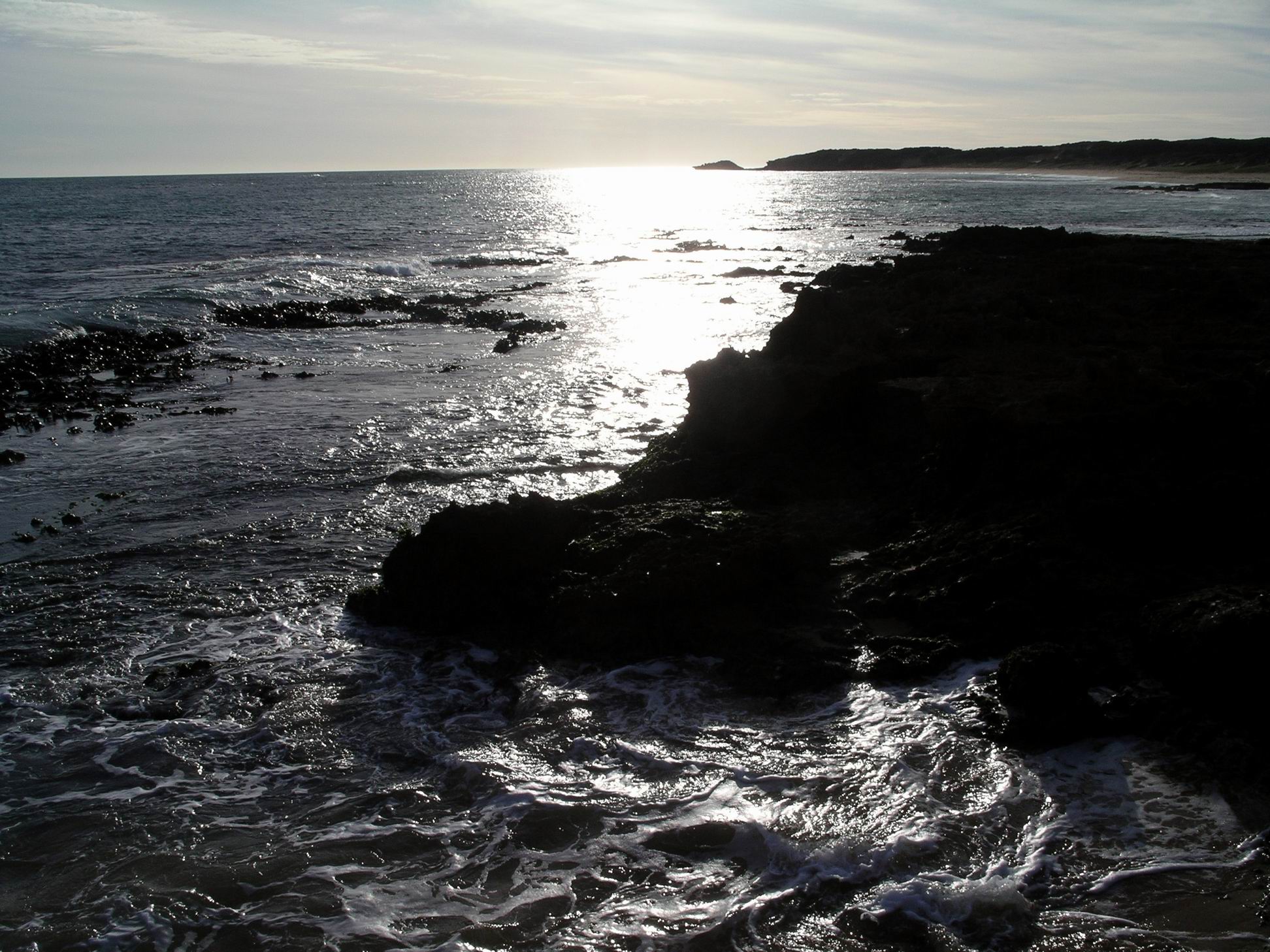
After lunch, the rain was not as heavy or constant, so we went for a slow drive along the Scenic Drive again, stopping in a couple of places to walk for a better view, and to take photos.
Limestone Coast – makes for interesting coastal erosion
But there was little temptation to spend long out of the warmth of Truck.
Today was another lovely sunny day. Seemed we did the right thing, coming further west. Hopefully that observation doesn’t jinx us.
John had a late start. Dog and I got up much earlier and went walking along the bay path, this time back towards town and around the block.
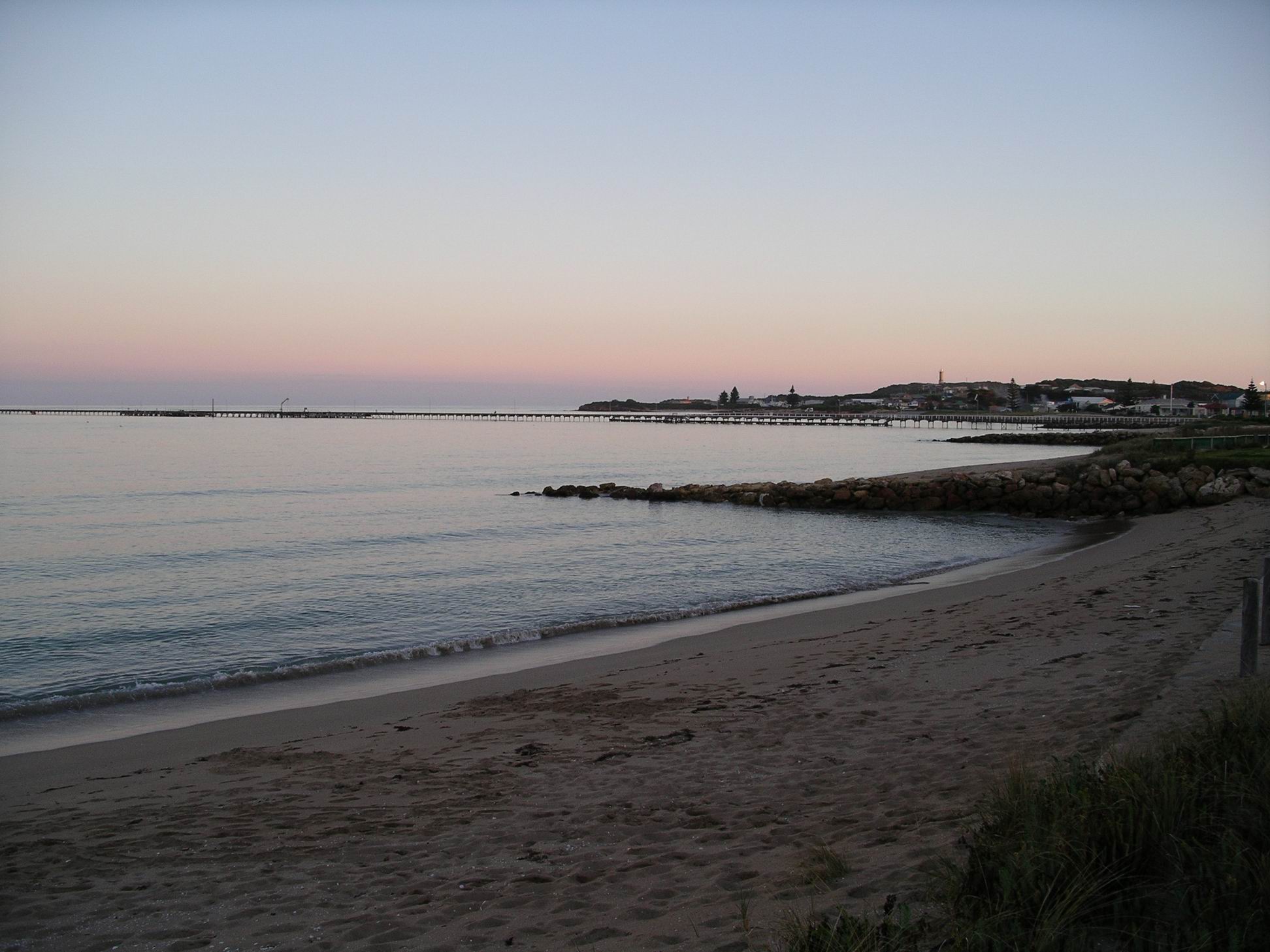
Beachport jetty
After John got going, we walked up to the town and looked at the shops, on foot. Tried to give dog some practice at being tied up outside a shop while we both went in, but it was not a total success -some barking as the separation anxiety kicked in. But at least she didn’t try to break the lead and follow us.
After lunch, went walking the other way, along the bay path to a nearby canal, which is the outlet from Lake George to the sea.
Rivoli Bay looking across to the Southend area
Through the south east of SA, in times long past, much of the land was formed as coastlines receded, which they did in colder periods when much of the earth’s water became locked in ice caps and glaciers. Conversely, in warmer times, sea levels were higher than today. The Naracoorte area, which seems a fair way inland now, was once a shoreline. Between there and the coast around Beachport and Robe, there are a series of parallel former coastal dune lines, that trend from NW to SE. In places, lakes and swamps have formed between parts of these ancient dunes. Lake George, and the Beachport Lake are examples.
Line of shallow lakes formed between remnant dune range and current coastal dunes
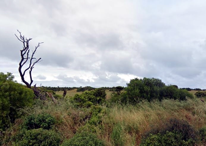
Between the road into town and Lake George, on the “away” side of the canal, was an area of scrubland and bush, with some tracks going through it, possibly made by trail bike riders and the like. John let dog off the lead here – he likes her to free range and do dog things. She rarely goes out of our sight though. Unfortunately, also along part of the track we were walking on were some large puddles, which dog delighted in galloping through and then wallowing in, before she could be stopped. Someone had to spend a long time tied up outside the van, drying out, before she was allowed indoors again!
Canal from Lake George with our dog walk area off to the right
Opposite the caravan park was the Beachport Golf Course. I told John about how my friend, who had a flying licence, somehow had gained permission to land his light plane on one of the fairways, when he wished. One time when husband 1 and I were staying with him, they went up on a joy flight to see the area from above. The golf clubhouse was at the end of the fairway used, up on a rise, and I watched on as the plane – with the extra weight of said husband on board – cleared the clubhouse roof by only a couple of metres. Reckon those drinking inside ducked! After that, there was no way I was taking up the offer of a flight, and even pilot friend seemed a bit subdued.
Spent the rest of the day lazing about camp, in the welcome sunshine, and drying out dog.
Fish and chips for tea, from shop. Very nice.
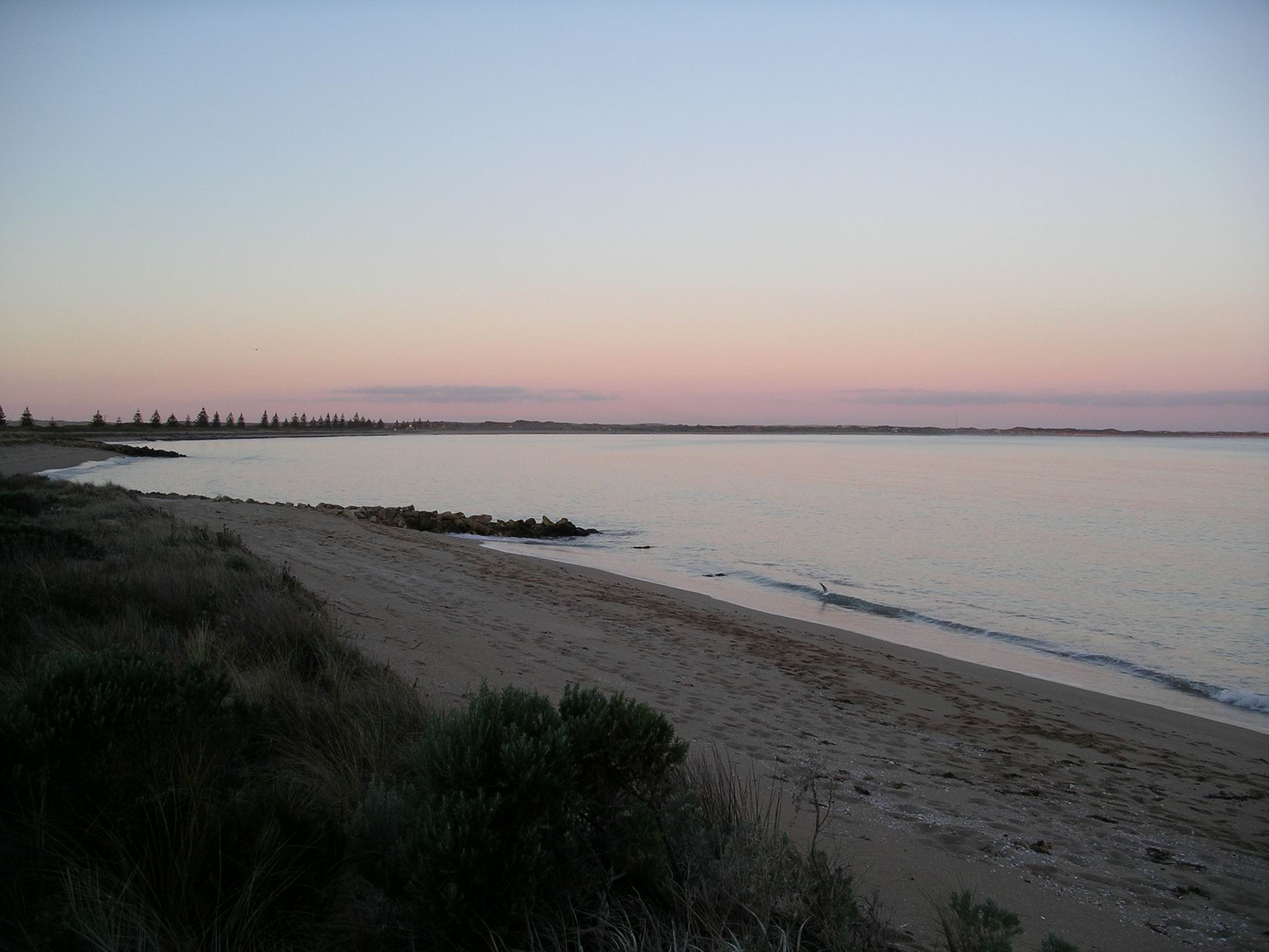
Dusk and sunset over Rivoli Bay are rather lovely.
I was up early and took dog for a long walk along the rail trail. When I got back, John was up and making breakfast. Didn’t hurry too much to pack up this morning.
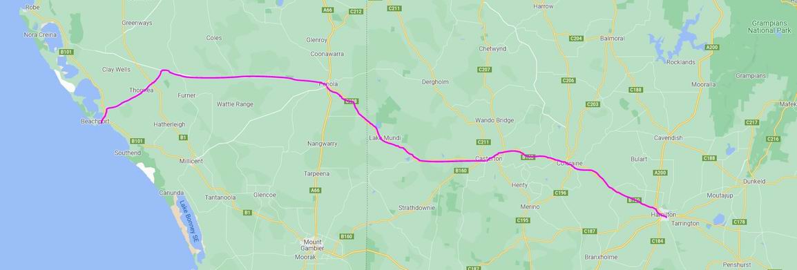
We had decided to travel on into the south-east of SA, to places we hadn’t stayed before together.
So travelled west towards Portland, then took the Mt Clay road to Heywood. Back in 1998, and again on a short family holiday a few years ago, we had stayed at both Portland and Narrawong, so didn’t feel the need to visit these again.
From Heywood, through Dartmoor to Mt Gambier, through a mix of grazing country and pine plantations.
Mt Gambier was fairly busy – more traffic than we really like, but the route through the town and out onto the Millicent Road – the Princes Highway still – was easy enough. We stopped at the Visitor Information Centre in the Mount, where there was parking for the rig. I collected some tourist information, we gave dog a short walk around on lead, and ate the rolls I’d prepared this morning, for lunch.
Again, Mount Gambier was a place we had visited before, so we had no wish to stay there. Instead, it was on up the highway, through Millicent, and onto the coast road that would take us to Beachport. This was an attractive stretch, through undulating farming land, with good looking scrub areas in patches, and alongside the quiet road.
Country approaching Beachport
I had visited Beachport and stayed there a number of times in the past, both when teaching at Lucindale – a small town about 90kms away – and at the more distant Hamilton. A friend had a family holiday house up on the hill at Beachport, with a wonderful outlook across the bay, and we used to have weekend gatherings there, in the days before children. So, for me, it was a favourite and nostalgic place to return to.
We booked into the Ocean View Caravan Park, for a week, intending to use it as a base from which to explore the area. The powered site cost $25 a night, with the seventh night free.
We were able to select a site for ourselves as there were few travellers here at this time of year. The park had a section of permanent cabins and vans and, separately, some terraced beautifully grassed levels for travellers. Set ourselves up on a high terrace that gave us an outlook across the road to the superb Rivoli Bay. We were not too far from the clean and adequate amenities block. The only drawback of our chosen site was that said amenities were at a lower level than our terrace, so there was a steep little clamber back up the slope, or a long walk around the flatter internal roads.
Caravan park at Beachport
The day had turned out sunny, so arriving in pleasant weather created a really favourable impression of the place, for John.
After setting up, we went for a quick drive around the streets to give John an idea of the layout. The small area of shops was not far from the caravan park – well within walking distance for me to get papers or other oddments. Being a small and seasonal tourist place, there were not many shops, but a sort of general store, a hotel, newsagency, fish and chip place ensured our needs would be well met.
Rather like Port Fairy, Beachport started out in the 1830’s as a whaling station, then transitioned eventually to a port servicing the surrounding area, and fishing. From the 1840’s and 50’s, pastoralists spread out through the south east area, coming both westwards from the settled areas around Portland, and overland from Adelaide. The Victorian gold rushes of the 1850’s saw ships landing Chinese miners along this coast, who would travel overland in an attempt to evade the tax levied on them entering through Melbourne.
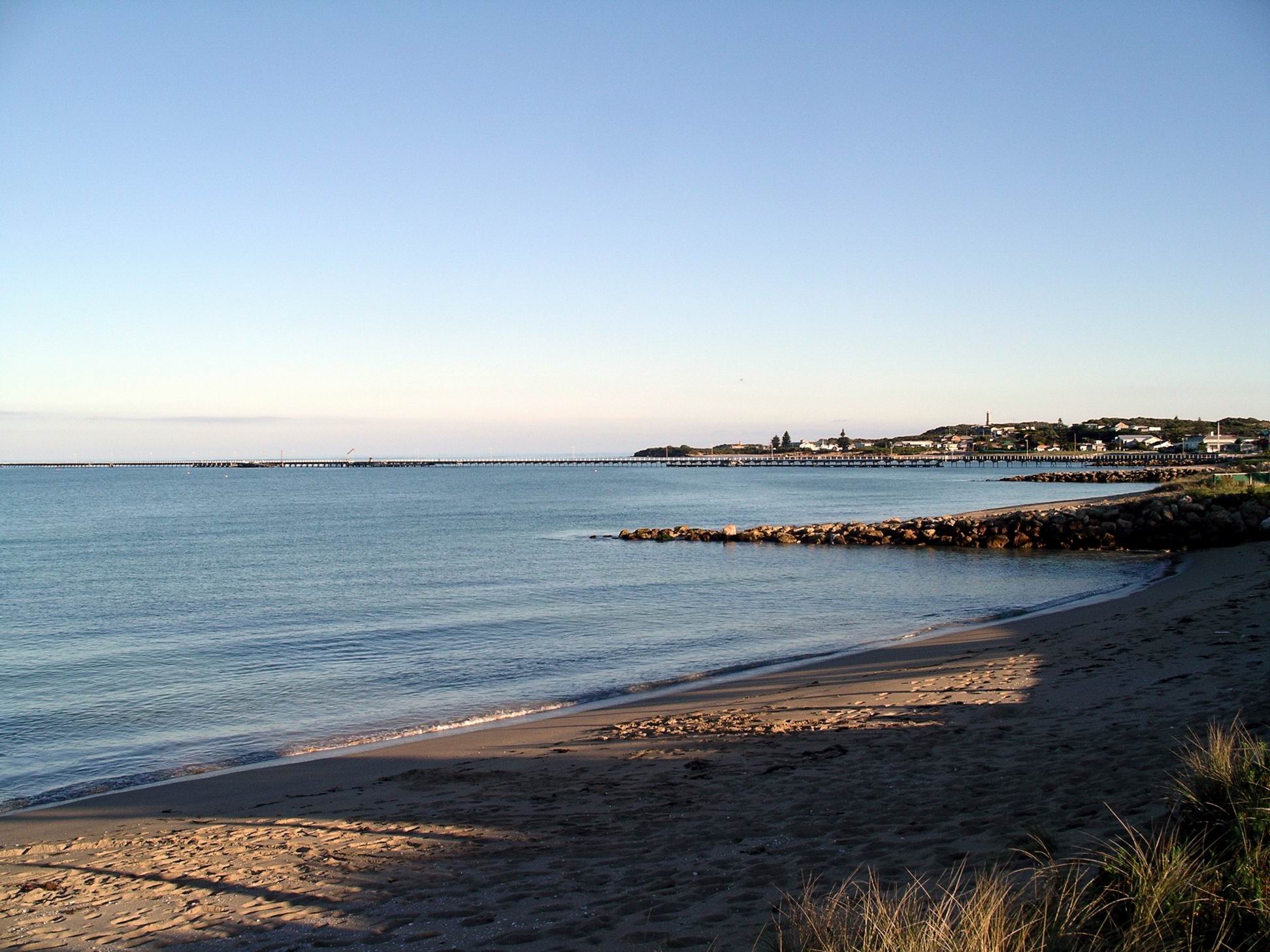
The magnificent jetty was completed in the early 1880’s, to enable wool exports from the hinterland. It was originally over a km long, but these days has been reduced to just under 800 metres.
With this history, Beachport has some beautiful old buildings, constructed from the local limestone, mostly, as well as little cottages that were the homes of fishermen, sailors and port workers.
Apart from tourists, these days the main industry in Beachport is cray fishing, but this only happens across the cray season over summer. My friend used to have a permit to put out a couple of cray pots, during the season, and we had some great cook ups of the catch, in the back yard, using a fireplace constructed to hold cray boilers. I thought it was a pity we were here out of season – would have been great to buy ourselves a feast.
I directed John up the hill and around the bends, past friend’s house – which as far as I knew they still visited, from their current home in a Murray River town.
Rivoli Bay from the hill
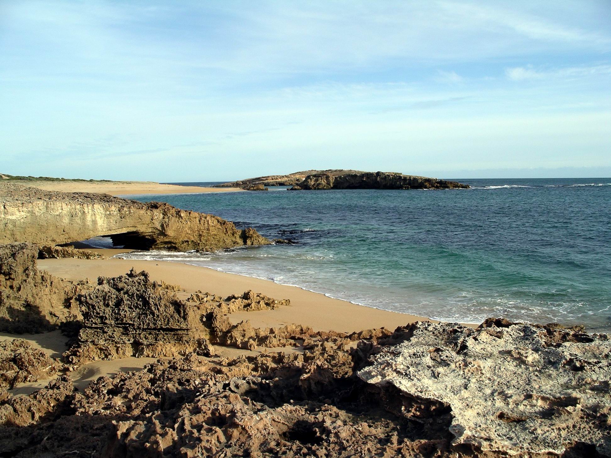
We continued on along the well named Scenic Drive for a few kms. It wound through the dune hills, past the super-salty Beachport Lake, became a good unsealed road and ended at a lookout over the ocean. We returned the same way.
Beachport coast along Scenic Drive
There would be time to explore the features along the route, later in the week. I guess we hadn’t explored much along that Scenic Drive area, back in the day, because it was far more spectacular than I remembered.
Back at camp, we took dog for a walk along a path that bordered the foreshore. There were several access points to this along the caravan park fence.
Then it was the usual afternoon and evening. Stir fry and rice for tea.
The weather over the two days was cold and occasionally showery, which limited our activities.
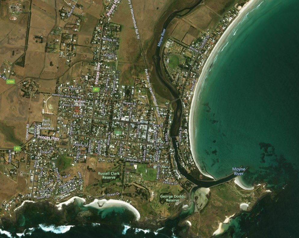
I did the early morning dog walking and discovered a rail trail that followed the old railway line alignment, from just back across the Moyne River bridge, towards the north-east. Ideal for dog walking.
We drove around exploring the township. Spent some time wandering along the river front boat mooring area – interesting.
Port Fairy (Zoom)
This part of the coast may have seen sailing vessels exploring rivers like the Moyne, seeking fresh water supplies, in the very early 1800’s. Port Fairy was named for one such vessel “The Fairy”, probably in the 1820’s.
Settlement in Port Fairy pre-dated that of Melbourne, starting as a base for seal and whale hunting. A whaling station was set up on Griffiths Island, just offshore. The Moyne provided a sheltered boat anchorage and general fishing became important. By the gold rush period of the 1850’s, Belfast as the town was known for a while, was a significant fishing and trading port.
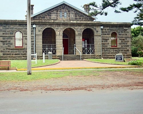
Given its age, and the availability of local stone, there are some wonderful historic buildings in Port Fairy. As well as substantial public buildings and former inns, there are a number of quaint cottages close to the river.
Typical bluestone building
I’d have liked to walk across onto Griffiths Island, once the site of the whaling station, but due to it also being a muttonbird breeding area, it was a no-go area for dog.
Much of today’s exploring was in Truck, just driving around the streets, because the weather was showery and cold.
Tuesday’s tea was chicken curry and rice, using a bottled curry sauce. Wednesday we bought fish and chips from a nearby shop. They were far too fatty, and also too expensive.