M did her Triple J tour today. She had a fine day for it, though there was still some cloud about.
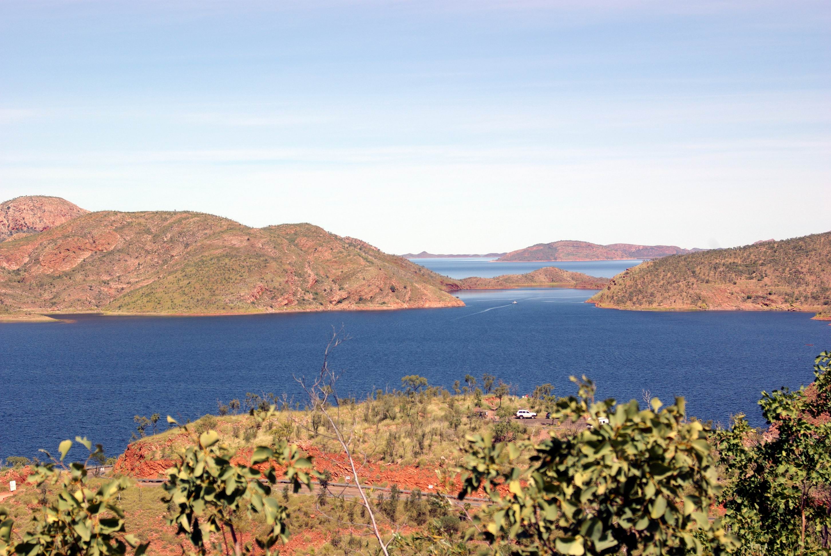
She was collected from the caravan park before 9am. They travelled by boat up the Ord River, from near this caravan park, to the Argyle Dam wall, where they disembarked at a small landing there. Lunch was provided at the tavern at Lake Argyle. A ground tour of the key features followed, like the dam wall and the reconstructed Durack Homestead.
Lake Argyle hydro scheme from dam wall. Boat landing on left
Patrick Durack, the founder of the Kimberley Durack dynasty, arrived in the Kimberley after an epic cattle drive. He built a substantial homestead on his Argyle Downs station, completing it in 1895. The site of this is now well under the waters of Lake Argyle, but before it flooded, the homestead was carefully taken apart, to be rebuilt above the water level. Even graves were relocated. It was to be a monument of sorts, to the pivotal role of the Durack family in opening up the Kimberley.
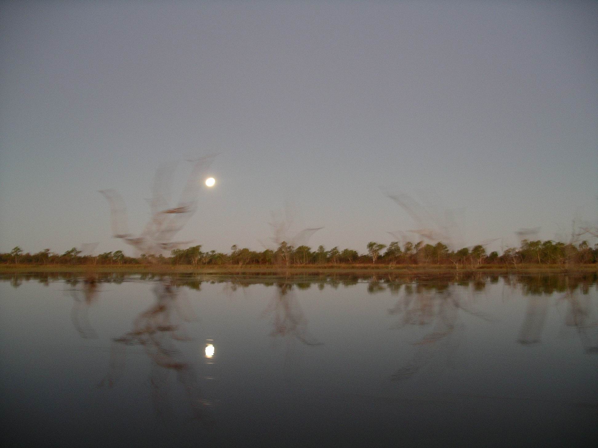
After the ground tour, the group took to another boat, on Lake Argyle itself, for the sunset boat tour, well lubricated with bubbly! Given that there was still some cloud about, they experienced a slightly different sunset to most groups, but it was very spectacular.
Lake Argyle – just a very little part of it
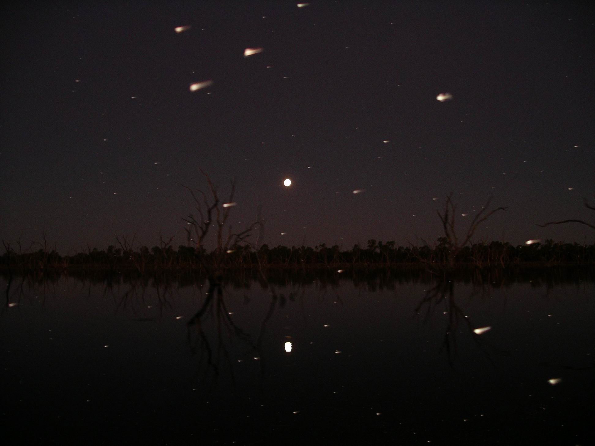
It was – obviously – well after dark when the bus deposited M back at the caravan park. It had been a full day. She enjoyed it, despite it still being windy and cold.
Ord River on Zoom. Red marks show pick up point and end of river trip
John spent much of the day messing about on his laptop.
Times like this, when we were largely confined to van by weather, and not going anywhere, were – fortunately – pretty rare on our travels. In what was essentially a 6 foot by 14 foot box, it didn’t take too long to start going stir-crazy.
I read and tried to do some planning for a possible trip to the Bungles and the Gibb River Road, and points beyond. One fact stood out – it was going to be expensive! Everyone in the more remote parts had to make their tourist profits in a very short window of time, and the charges reflected this. Even the basic campgrounds were relatively costly – and the tourist guide was emphatic that camping was allowed “in designated areas ONLY.” Gone were the days when one could pitch a camp in any lovely spot that caught the eye – too many such campers polluting the streams, leaving rubbish – and worse – and interfering with station activities.
A dilemma for us was what to do about the van. It was not allowed into the Bungles. Did we do a Bungles trip, with the van left here (or at Turkey Creek), then double back, collect it and take it through the Gibb? With the recent massive rains, how high would the Pentecost River be at the crossing on the Gibb – really didn’t want water above the van’s floor level! Hmmmm……..
We had been here for a week now. Booking in for a couple of weeks had not been so silly, after all. No word yet on when the tracks would reopen.
We had been rationing out things to do, around the area, to spread them over the time we had to be here.
It was definitely fining up. This was the second day without rain and the sky seemed much lighter. Blue skies by the end of the day!
A day trip to Wyndham today. Drove directly there on the highway – 105kms from Kununurra.
Wyndham is more essentially “Kimberley” than Kununurra, in my view. It is certainly older and thus reflects more of the history of the region. Located on the banks of Cambridge Gulf, it began in the mid 1880’s as the nearest port to the new gold fields around Halls Creek, quickly becoming somewhat of a boom town. However, the gold rush was quickly over and Wyndham remained as a small service centre for the surrounding pastoral ventures. Given the difficulties of land transport for so long into the 20th century, the port retained its importance in those times. Like a number of other northern ports, it was bombed during WW2.
The port area, with ship at jetty. Old town at base of hill.
On our previous visit here, my over-riding impression was of a little settlement battling to keep being. The improvements in land transport in the Kimberley did not favour Wyndham, for the most part, because it is not on either the main highway or the Gibb River Road. So, it requires a dedicated trip there, and the majority of tourists do not seem to bother – to their loss. However, the development of roads through the Kimberley did allow Wyndham to grow as a meat/cattle shipping port.
Ship departing. Blue roofed pens of the Crocodile Farm
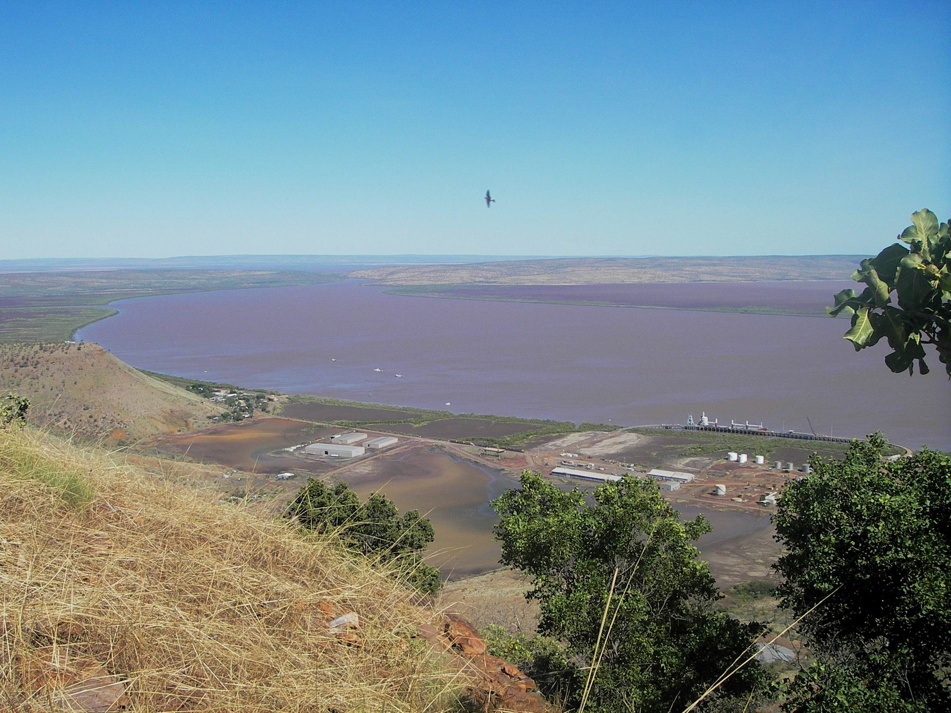
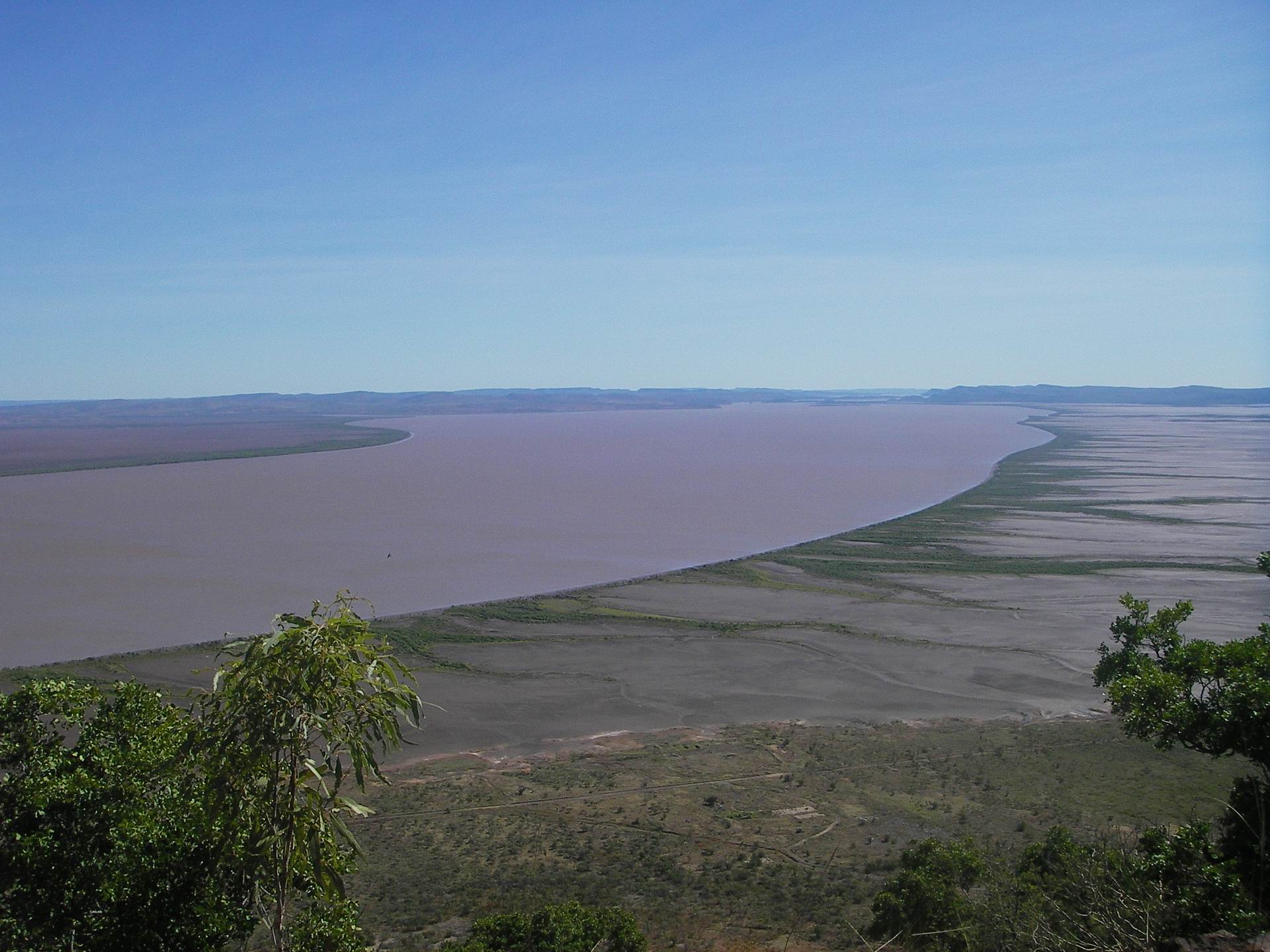
Our first stop at Wyndham was at the Five Rivers Lookout, reached by a sealed road that climbed steadily to the top of The Bastion – a peak right behind the town.
Cambridge Gulf from The Bastion – looking north towards the Ord River mouth
As suggested by the lookout name, five rivers flow into the Cambridge Gulf, at or near Wyndham. The Ord we had already encountered around Kununurra. The King was a short River, rising in the hills of El Questro Station. The Pentecost, whose tributaries drained much of the central Kimberley. The Forrest River passed mostly through the indigenous lands to the west of the Cambridge Gulf. Finally, the Durack, another system to the west of the Pentecost.
Upstream to the distant Cockburn Range. Past the narrow Gut in mid distance, the Pentecost enters Cambridge Gulf from the left, the Durack from the right
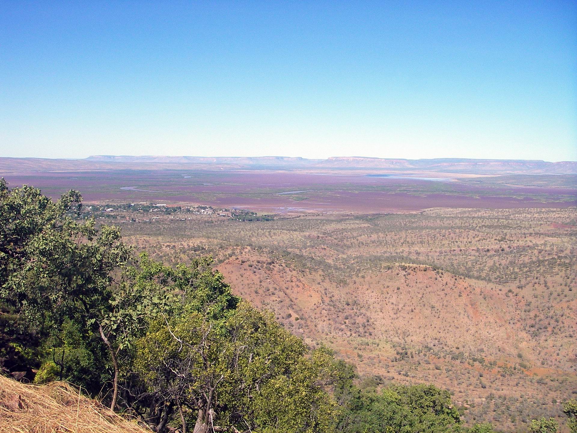
One gained a very good sense of the rather strange layout of the town, and the reasons for it, from up on The Bastion. The coastal, tidal mudflats and the narrowness of the flat coastal margin were obvious.
The swamps that are the lower King River, surrounding parts of Wyndham
The original town centred on the old port, with its circular jetty. It was here that a meatworks was built and operated for years, preparing beef to be exported. For years, the little creek mouth near the jetty was the haunt of large saltie crocs – because the meatworks sent their waste products down the creek. A modern crocodile farm is not far from there.
A newer section of the town developed some distance from the old port area and it is here that most shops and housing are found. Also the quite pleasant caravan park where we had previously stayed.
Wyndham – the new town
Made our way down the big hill, turning off just before the town outskirts, to go to the Three Mile Valley. From the road’s end, here, we walked some of the way along the – dry – creek. It would be really pleasant when flowing.
Then to the old town area. which did not take long to drive around. Impulsively, M decided she wanted to do the croc farm tour and John said he’d go too. I decided to save the money – I had done so many croc farm tours in the past, in Darwin.
They enjoyed the informative tour, which of course featured some croc feeding. The farm contained its crocs mostly in pens, rather than in large, more natural lagoons, like in Darwin.
I sat in the little shop/cafe and waited for them.
There was a large cement crocodile by the entrance to the new town area.
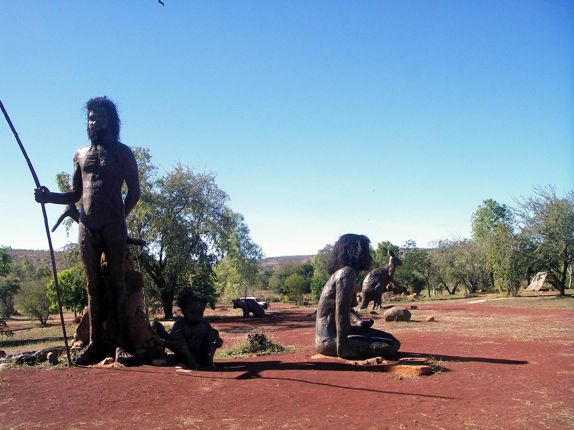
As usual I had packed our lunches. We went to Warraiu Park to find some shade where we could sit and eat. There was a Dreamtime feature here – statues of an aboriginal family and some Dreamtime animals.
There were a number of present day aboriginals in the Park, too – not all of them sober. One lady, who told us her name was Julie, was quite insistent that we buy a carved boab nut that she had made. I actually thought it was very well done, with a lot of detail, featuring goannas and bustards – the latter a favourite bird of mine. So I bought it, for $25. I had no idea whether I was ripped off or not, but the main thing was that I really liked it.
With a final stop to photograph the cement croc at the new town’s entrance – just because it was there – drove back the way we’d come, for a short distance, then took Parry Creek Road, briefly, before taking the track to the Telegraph Hill walk and Marlgu Billabong.
From Telegraph Hill
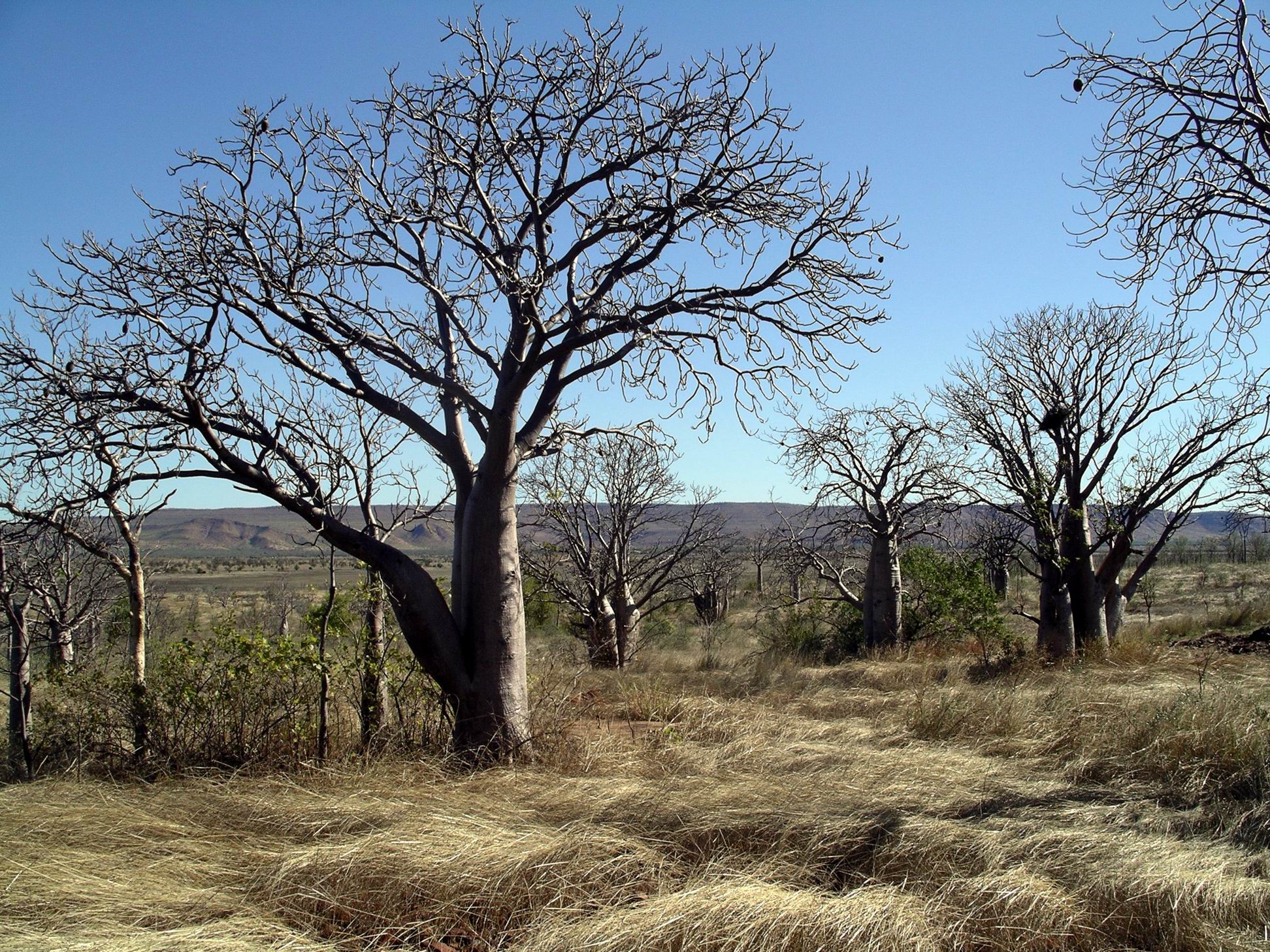
The shortish walking track at Telegraph Hill took us via the foundations of an old wireless station – not much to see, really, of that. But it was also a lookout point over the maze of floodplains characteristic of the area. Perhaps the main feature, though, was the boabs growing on the hill, some still with nuts on. It was a pity these were too high for us to reach – I wouldn’t have minded a nice fat, uncarved one.
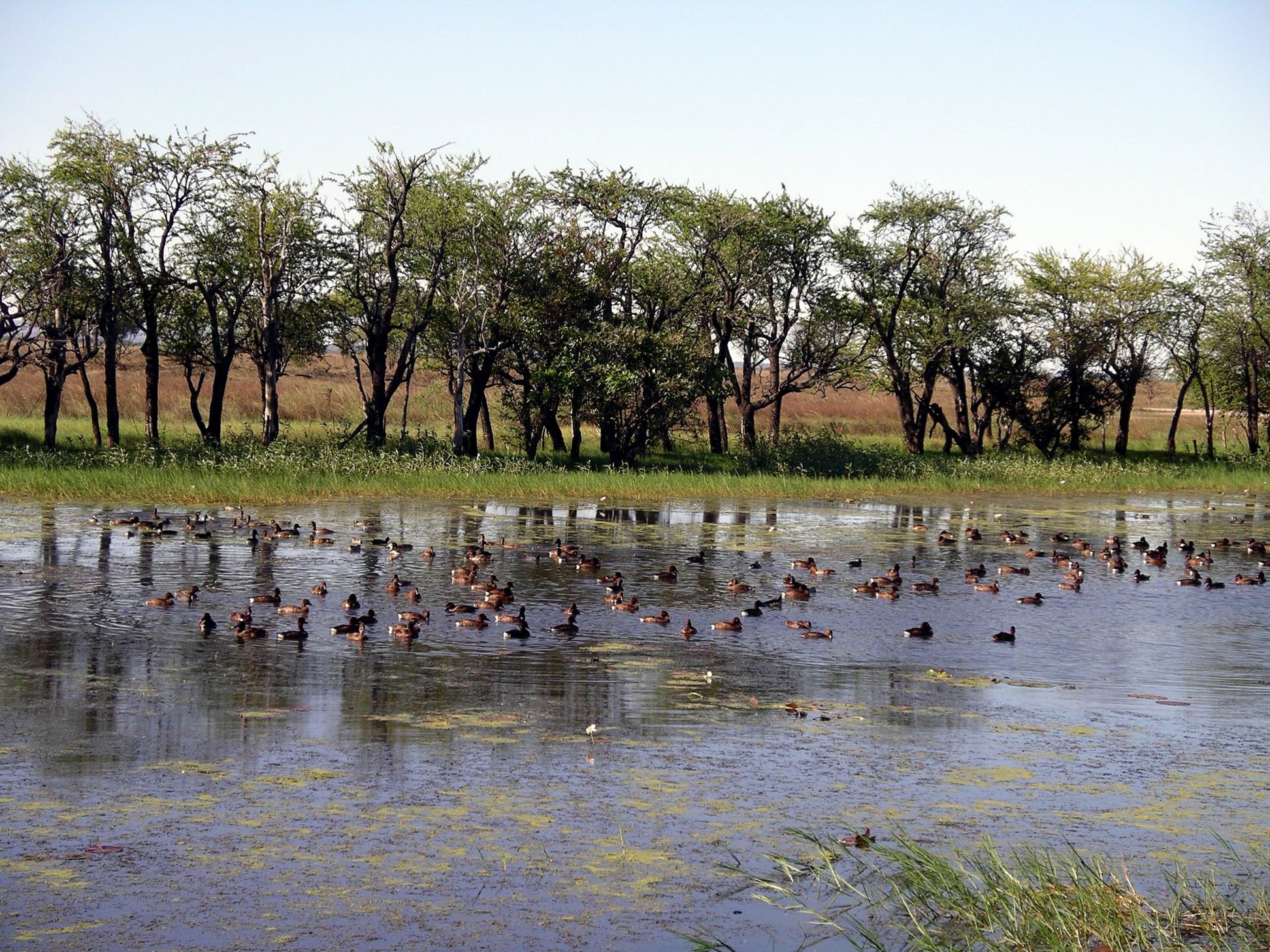
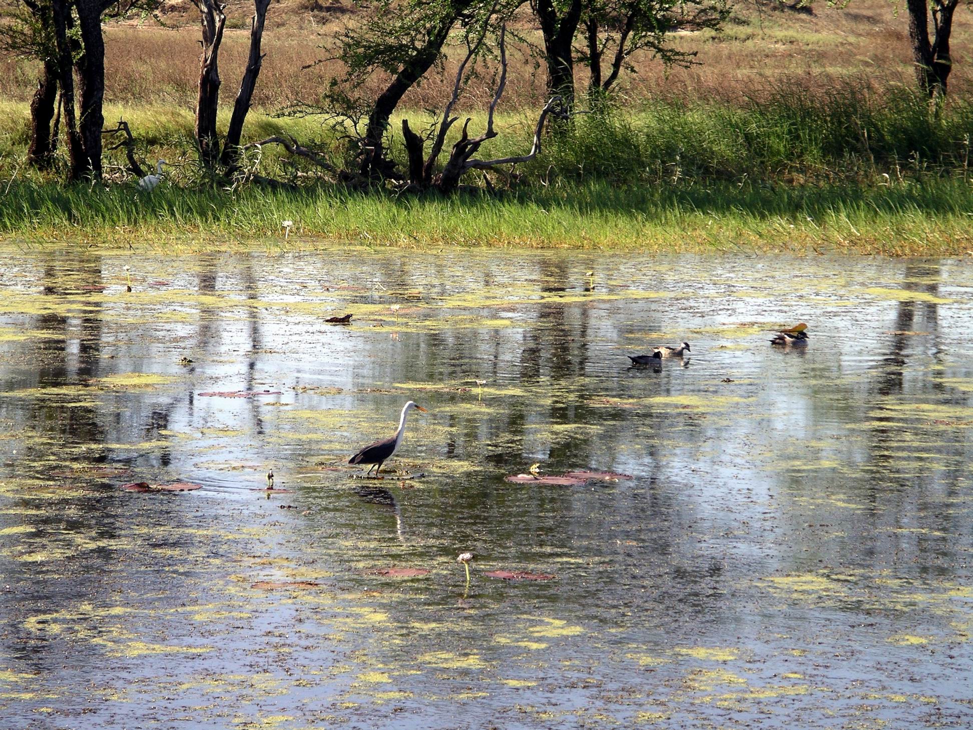
Continued on to the track’s end at Marlgu Billabong, where there was a bird hide overlooking the lagoon. Watched the bird activity for a while.
Marlgu Billabong
There were lots of hard-head ducks, a number of egrets, a few grebe, the occasional heron. Try as we might, couldn’t spot any type of bird we hadn’t seen before.
Hard head ducks
Back to the main road and our final touristy spot for the day – The Grotto. This was a deep valley in the surrounding rock, with a safe swimming hole at the bottom – a valued feature in these croccy parts. But to get to the water, one had to go down 140 steps hewn into the rocky cliff face – with no handrail. Not for me! Although it was the hottest day we’d had for over a week, it was getting later in the day, I was a bit weary – and I do not like heights. John’s hips were sore, so it was only M who ventured down to the water.
I wandered about up top, and tried to take some photos down into The Grotto, but they were not successful. It was quite hot among the rocks up top, so I was glad when M reappeared, reporting that it was nice enough down there, but she wasn’t sure it had been worth the effort.
Back to camp. We passed the junction of the Great Northern Highway and the Gibb River Road. On our way to Wyndham, this had featured a prominent Closed sign. But now, it was Open. So the glut of travellers aiming to traverse the northern Kimberley via this route, could now begin to empty out of Kununurra. I predicted a big exodus tomorrow.
John usually has little input into detailed decisions about where we will go, what we will see and do. Earlier in our travelling days, I used to pressure him over this. His response was usually to grab the map, have a cursory look and pick out the first name that caught his attention. Then he would be adamant that we visit there! This usually resulted in some “adventures” that I’d prefer to forget. Like on our first Kimberley trip, in 1993, when it took us two hours to drive 5kms, when John decided we must visit Crystal Creek – then about as remote as one could go in the region. Traversing large rock “steps” in the vehicle, literally through grass higher than it, just to get to a place that was open, hot, sandfly and croc infested………So, these days I don’t ask The Driver!
However, now that the weather was fining up, John decided he would really like for us to go to the Bungles, when our booked time here was through. It was a long time – 14 years – since we had been there, and M had never been. I liked the idea!
The sky was still grey, but there was no rain today. It was a bit windy, which was different and hopefully augured well.
Set out to do a little more exploring. Went driving, out across the narrow highway bridge that was also the wall of the Diversion Dam. Passed under the gantry structure that is the big crane, used in the raising and lowering of the gates below us that control the flow from the Dam. To our right were box structures that, presumably, were also to do with the regulation or monitoring of water flow. When this was built, they certainly were not interested in making a “pretty” structure – it was to be a dam, and the addition of an all weather road route across its top was just a secondary feature.
Beyond the Dam, turned left off the Highway and drove out the Packsaddle road, looking at the farms established out there, but also looking for a zebra stone rock gallery that was out this way. This proved well worth the visit, really making a feature of that rock. John talked with the owner and inspected several large-ish slabs of stone, with a view to maybe buying some to experiment with making “things” back home.
I cautioned him to remember the results, in 2005, of overloading the van with his treasures! Rock is bloody heavy. So, for the moment, rock purchase was left in abeyance.
There was a small cafe at the gallery here, and we enjoyed a coffee in the very pleasant surrounds, looking out onto the greenery that surrounded it. I noticed that they seemed to have some caravans stored there too.
Back at camp, I wandered around, taking some photos of Lake Kununurra, from the Park frontage to Lily Creek Lagoon. They were a bit different to the usual views taken in bright sunlight.
The rain eased off during the morning. The sky was still that dense grey colour, and there were occasional showers. There were big pools of water on the ground in the caravan park – it was very slow to dry. I guessed it was all so saturated. That sensation of dampness in everything was back.
From the veranda of the amenities block – that’s the back of our van on the right
There had been two inches of rain overnight!
However, the forecast was that his weather would clear away through this week. I hoped!
The amenities block floors got really mucky as grass and leaves and mud were tracked in. The staff did their best to keep it clean, with repeated visits through the day – but it just could not be helped in these conditions.
There was talk that food drops were being organized for campers stranded on the Mitchell Plateau. Probably by helicopter rather than plane. Campers were stranded in the Bungles too. There would probably have been other pockets of campers having to stay put in places along the Gibb River Road, but at least the campgrounds there had, for the most part, stores nearby.
Sleeping Buddha under cloudy skies
John went out with a purpose, and found a local firm that would sandblast and paint our roof rack, which was getting quite rusty where paint had peeled off. He reckoned the time here might as well be used productively, and he liked using businesses in such towns. At least he had help there to get the rack off the roof – it is a pig of a job when there is just the two of us!
I went to the Park office and through them booked an Ord River trip for Saturday, with Triple J. I was being optimistic that the weather would be fine by then. We would travel both ways from here to the Ord River Dam/Lake Argyle, by boat. Travellers most commonly did the boat trip one way, then a sunset cruise on Lake Argyle, travelling back in the dark by bus. But we had done the sunset cruise on a previous trip. I thought the river would look different coming back, anyway. M wanted to do the combined trip but could only get a place for Thursday next. She gambled that the weather would be on her side.
The weather might be going to clear?
Whilst I was out and about in the Park, and having a bit of a walk around, Telstra phoned John, and managed to convince him to order a Next G phone – with a more costly plan, of course! He also changed over the computer internet card. I wished he would have left any changes to our current technological set up, until we were at home. I had some memories of several previous efforts to upgrade things, or get things working, whilst on the road. It was never as seamless as the sales people promised.
The new phone and computer card would be mailed here, he told me. Well, we had a week until we were due to leave here – what could possibly go wrong?
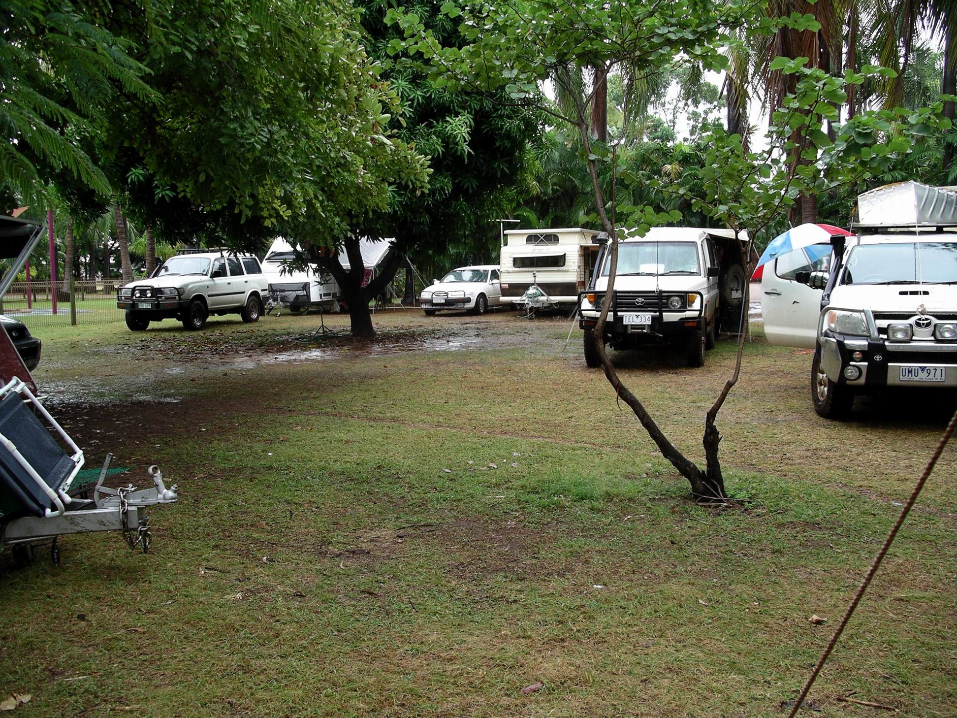
The accommodation problem in Kununurra was ongoing. We were so fortunate to arrive when we did. In this park – one of several in the town – they have packed vans in where they normally wouldn’t put them. The unpowered camping section, closer to the lake shore, was only partly full, because some of the ground was just too wet. Even so, there were a lot of campers there.
At one point, when the rain eased off somewhat, M and I went for a walk all around the park. The ground was very soggy. We saw a group of campers in the unpowered section, with camper trailers and 4WD’s smothered in red mud. They had just arrived – from the Tanami Track, which had been closed for five days now. No doubt – judging from the state of their rigs – their passing had churned it up considerably. Apparently, they told people they didn’t know the Track was closed. Hmmm…..I could be charitable here, but most travellers do not take five days to traverse the Tanami. Its thousand-odd kms were usually done in two or three days. Me-thought they had set off from the Alice Springs end, regardless of the closed road status. If so, that was exceedingly selfish, because of their impact on the road.
Word is about that the management up at Drysdale River roadhouse, on the Kalumburu road, was refusing to supply any travellers with fuel, whilst the road remained closed. Good for them – should be more of it!
Filled in part of the day by continuing research and planning for when the dirt roads would re-open.. John spent most of the day gaming on his laptop. Not much else could be done on such a dreary day.
No photos from this drab day, so here is a cheerier one from earlier days..
Today was grey, a little humid, and with showers through the day. It did not look like this nasty little low pressure system was going anywhere else, anytime soon. At least, the ongoing rain had saved face for me!
Whilst John was still sleeping in, M and I walked to the town shops, so I could buy a Weekend Australian paper. The town seemed even more crowded with disgruntled travellers.
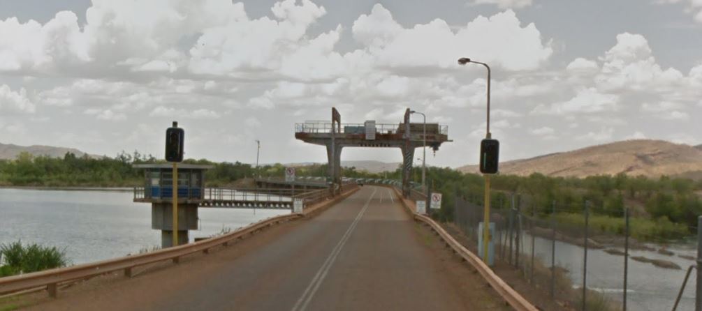
After John was up and breakfasted (late), I packed some sandwiches and we drove out to the Diversion Dam, just on the western edge of town.
Highway across the Diversion Dam (Google)
When the Ord River Irrigation Scheme was being established, the Diversion Dam was built across the Ord River, in 1963. This marked the start of the first stage of irrigated farming on the river’s rich flood plains. Before the dam, the absolutely huge Wet season flow of the Ord River – many millions of litres – flowed into the sea. Then, by the late Dry season, the river was almost dry. Successful farming would require regulation of the water flow, hence the dam, which created Lake Kununurra behind it – the stored water able to be released as needed for downstream irrigation.
One of the first crops tried in the new irrigated farmlands was rice – a logical enough product. The problem with this was that magpie geese love rice seedlings. Word quickly spread amongst the magpie goose population of the tropical north, about this new bonanza, and that spelled the end of rice cropping in the Ord. Cotton was another experiment. There seems to have been fairly consistent growing of some fruits and vegetables – melons, mangoes, beans, pumpkins and the like. But it is a long way from major Australian markets for that sort of produce. So the whole scheme sort of staggers on.
The Diversion Dam is an impressive structure, with its movable “gates” that can be lifted up and down to control the volume of water outflow. A bonus of the building of the Diversion Dam was putting a road across the top – the current highway. As we drove over the dam, could see the gate operating mechanisms, close up.
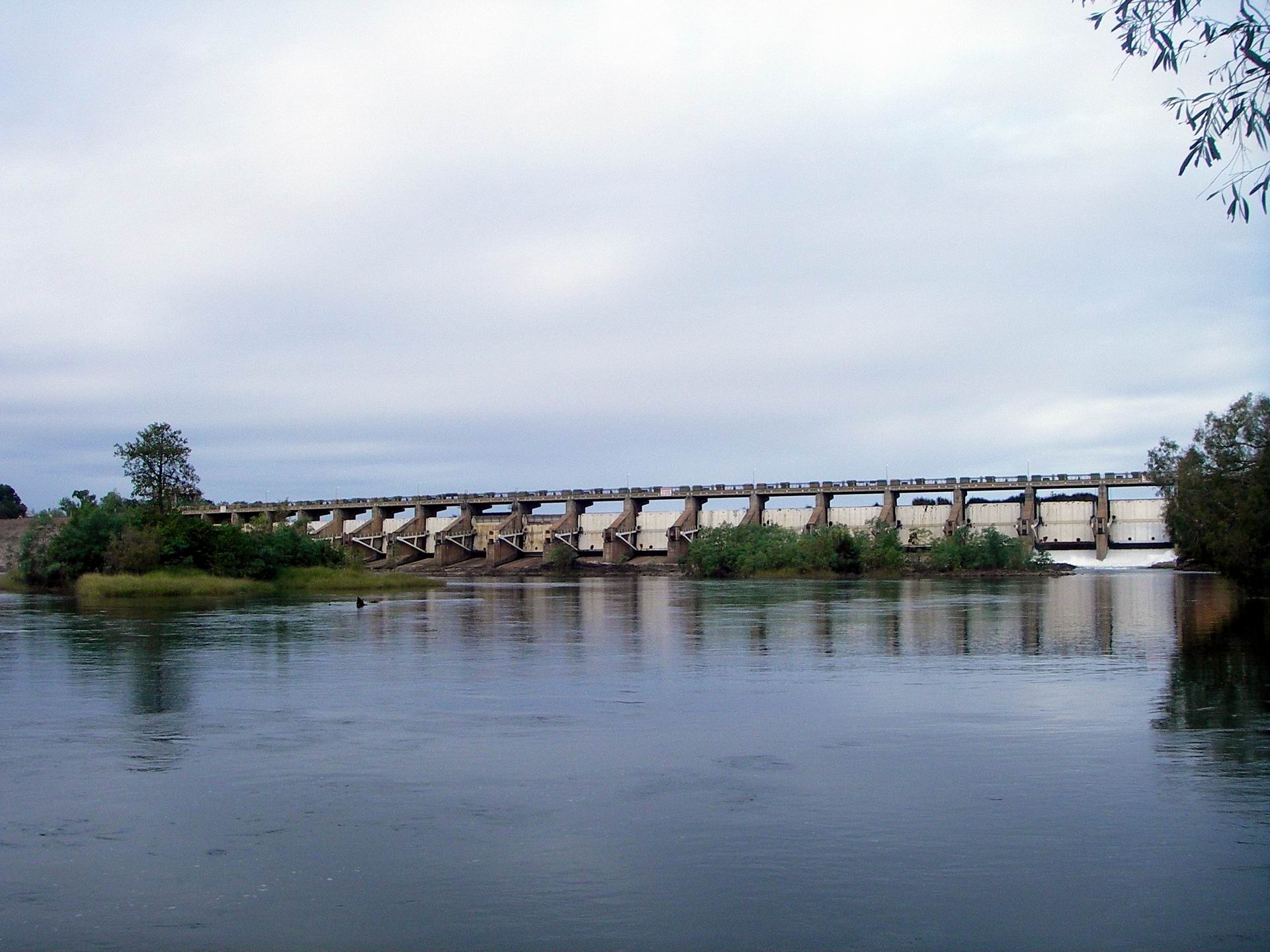
On the far side, a road goes down to a small picnic area, below the dam wall. From here, there were good views back to the wall and its gates, which were not letting out a great deal of water, it seemed. We kept a careful eye out for crocs. It was common to see people fishing below the dam wall, here, and where there are barra…….
Diversion Dam from picnic area; two gates letting out water
Ate our sandwiches here, admiring the river and the nearby boabs.
After that, drove back across the dam wall, and north, out the Ivanhoe Road, to the Ivanhoe Crossing. Today seemed to be developing an Ord River theme!
Before the Diversion Dam was built, up to 1963, this cement causeway was the way for travellers to cross the Ord. This was built in 1953, improving on an older causeway that had been made where a large rock outcrop broke the river into two smaller channels. It was probably originally used as a crossing point by the pioneering Durack family, who established the Ivanhoe and Carlton Downs Stations, on opposite sides of the river.
In the Wet season, the Crossing was often impassable for months on end. These days, since the upstream dams control the river differently to Nature, the water was over the causeway for much more of the Dry season, and generally at a higher level all year.
We had previously seen it at a driveable level – just – for the adventurous or foolhardy – but too high for us to tackle it. Mostly, we have seen it closed, as it was now. It was one of the local tourist attractions, and some people came here to fish in the waters below the causeway – definitely croc territory!
Ivanhoe Crossing – the force of that water coming over the causeway should not be underestimated!
Back to camp and a leisurely rest of the day, spent reading my newspaper.
The No Vacancy sign was a permanent fixture at the front of the caravan park!
At night, I phoned son, who was just back from his four day work trip to NZ, being Customer Service Manager for both Australia and NZ, for the motorhome rental company he worked for. He sounded alright – was minding the children while their mother was out socialising.
The skies continued to be grey. It still felt really damp. However, there was no real rain today, just a light drizzle that was almost just mist.
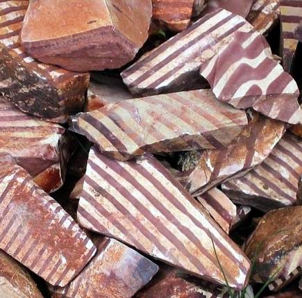
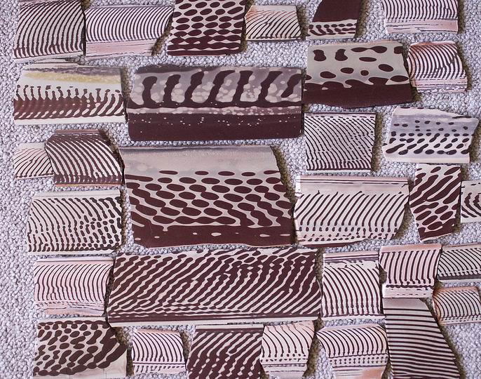
Went driving, north out the Ivanhoe Road, then River Farm Road, to the Top Rockz Gallery. This place featured the local colour banded stone – zebra stone and ribbon stone.
This rock is unique to these parts. Currently, there was only one deposit known of, that was still above the waters of Lake Argyle. It was being mined by the gallery owners.
Zebra Rock
The rock is composed of silts and sands, with an unusually high number and variety of elements, including rare earths – things like vanadium, strontium, chromium, iron ore. Scientists can’t really explain how it came to have the uniform patterning that is shown in the rock pieces. It may be the result of freak geological conditions.
The gallery also had normal gemstones – most fairly locally sourced. It was a great place to browse. I bought some small pieces of striped stone, with a view to one day shaping them and creating a pair of earrings. Or possibly carving them into beads for a bracelet.
Since we were out that side of town, wended our way across to the Weaber Plains Road and to the Hoochery. This establishment had been making rum from local sugar cane for the last decade or so. Since I had a fondness for rum back in my uni student days, as did M, the place beckoned.
The Hoochery was established in the mid-90’s by a local farmer. The development of sugar cane growing in the district gave him an idea………
I am very selective about group activities, like guided tours, but the one on offer here promised to be too interesting to miss. And so it was – well worth doing. We were shown all around the works, and the process of rum production was explained as we went, along with some of the local politics and issues. The distillery is on a small scale, so the tour did not last for too long.
Back at the rustic sampling bar and sales area – the place was put together by its founder using mostly materials he found around the farm – we enjoyed the sampling of the product! It was very tempting to buy a bottle of rum, but a bit too expensive for us. Actually, it was tempting to buy several bottles! Really yummy rum. It would probably have been sacrilegious to buy some and then drown it in coca cola, as I would have done.
Settled for buying a stubby holder and a polo shirt for John. I’d have liked a shirt too, but they did not have my size.
The future of the business – and indeed of sugar cane growing here – was in doubt, because the little local cane mill was to close down. It was overseas owned and apparently not profitable enough for the owners. As cane needs to be processed soon after harvest, this was a major problem. Growers had nowhere else close enough to send their cane to. So it looked like sugar cane growing around here might be on the way out, to become just another one of the several crops that had been tried up here and failed – for a variety of reasons.
The latest “growth” venture was Indian sandalwood trees, to be grown mainly for oil extraction for use in perfumes. We’d toured such a venture down near Albany, a few years ago, but that was more reliant on native sandalwood growing out in the bush. Around Kununurra, we saw a number of farms where little sandalwood plantations had been established.
Back in town, bought fuel – $1.54cpl. Did a small food shop, for the weekend. Tonight featured takeaway fish and chips from a local shop – not bad.
There was no rush to get up and go anywhere. Of course, those are the mornings when I wake up bright and early…..
The weather seemed to be clearing this morning. (I wondered what the other two would have to say to me, if we ended up stuck here for two weeks in sunny weather! )There was occasional light drizzle only. But it was quite cool, for these parts, and everything felt so damp.
When we all got going for the day, (i.e. John) walked to the town shops.
Kununurra is another of the relatively recently purpose- built townships that we’ve encountered. Unlike most, which are mining related, it was constructed to serve the needs of a new irrigation project, about 1960. So it has the usual cluster of shops and services together, with houses radiating around these, and a designated light industrial area, all in a pattern of curved roads.
The small shopping mall contained supermarket, newsagent, souvenir shop, a jewellers with wonderful pearl and diamond creations (reflecting local industry), some food shops.
Not far from the mall, was the Argyle Diamond shop, selling diamonds sourced from the nearby mine, including a comprehensive array of the famed pink diamonds. We went and had a browse there – an exercise in wishful thinking!
Now, of course, although irrigated farming continues in the surrounds of Kununurra, servicing the needs of tourists like ourselves has become a major industry.
Noticed, on our walk, that there were camping rigs of all descriptions, from large caravans to 4WD’s with tents, parked up everywhere. They were all around the parkland perimeter that was across from our caravan park, with some tents in the park. They were parked in ordinary streets. I also noticed No Vacancy signs outside all accommodation places.
Kununurra was more than bursting at the seams!
Not much dry room left…….M’s rig squashed in there
After the walk, just did the usual camp things for the remainder of the day. Back at home, I’d phoned the Derby Visitor Centre and ordered a copy of the 2007 Guide to the Gibb River Road, that they produce and revise annually. This was an essential source of up to date information and charges, in an area where things can change considerably, from season to season. So now, I dragged that out of its storage box, together with the Moon’s guidebook on the Kimberley, which was similarly essential for track information, and started, with M, looking at what we might do. That filled in time, at least.
I was amazed by the costs of everything through the Gibb area, these days. Clearly, whatever little jaunt we did undertake, was not going to be cheap!