SATURDAY 21 JULY CHARNLEY RIVER TO MANNING GORGE CAMP 100kms
We were packed up and away from the Charnley camp in good time.
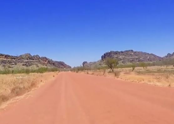
Traversed the 40-something kms back to the Gibb – cautiously. Then, east on the Gibb, it was 50kms to the Kupingarri Community, set back a little distance from the road.
The Gibb River Road was so good, these days, compared to what it was like in the early 90’s. The drivers doing stupid things, mentioned earlier, were far more of a hazard than anything the road presented!
Mt Barnett Roadhouse was the community store for Kupingarri, and also served the needs of travellers. I suspected just about every Gibb traveller called in here – for fuel, supplies, some to pay the camp fees for the Manning Gorge camp ground, accessed from here.
We refuelled Truck – $1.94cpl. Did some shopping at the store – csabai sausage, frozen chicken drumsticks, sausages, peanut butter, a couple of apples – at $1 each!
At the public phone, I called son. He seemed alright.
Booked into the campground – for $12.50 a person; unpowered of course. Then it was through the gate to drive the 7kms down the track to the large campground by the Manning River.
I think most people who drive the Gibb stay here, even if they don’t do the walk to the Gorge. It was a pleasant place in its own right, by a lovely large pool in the river – safe, albeit freezing, swimming.
A new amenities block had recently been built in the camp ground – with flushing toilets and cold (very cold) showers. We were told that the community had hired new, non-indigenous managers, so I hoped the standard of upkeep would be more consistent than we’d found on previous visits, and heard some horror stories about.
We found a good place to set up camp – away from the foot and vehicle traffic, and more crowded spots by the river.
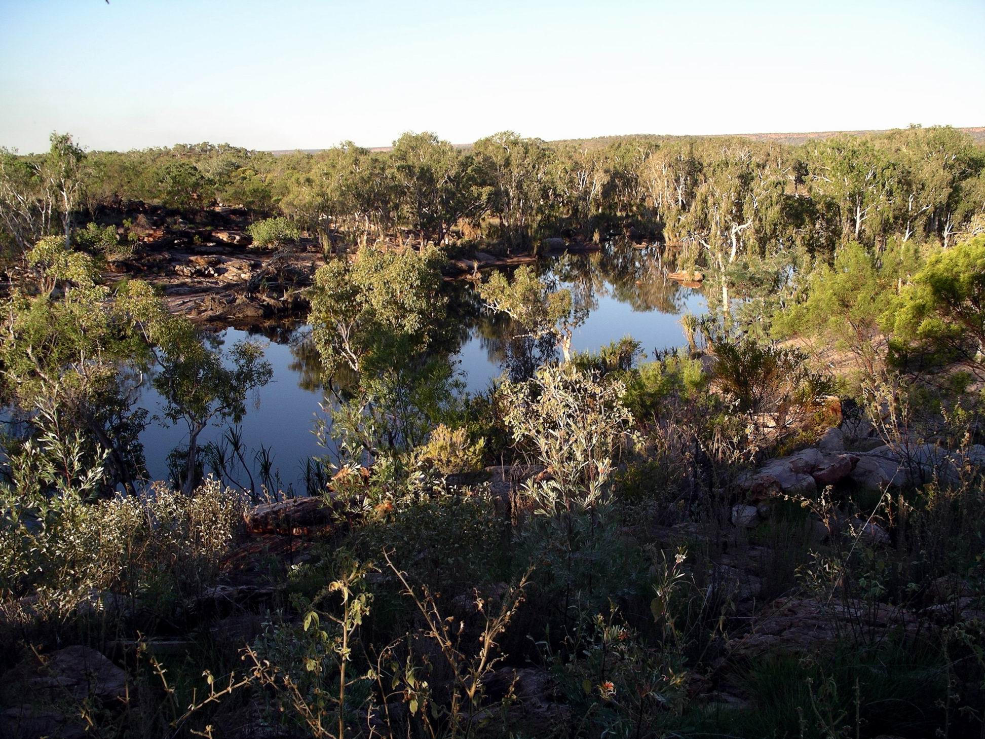
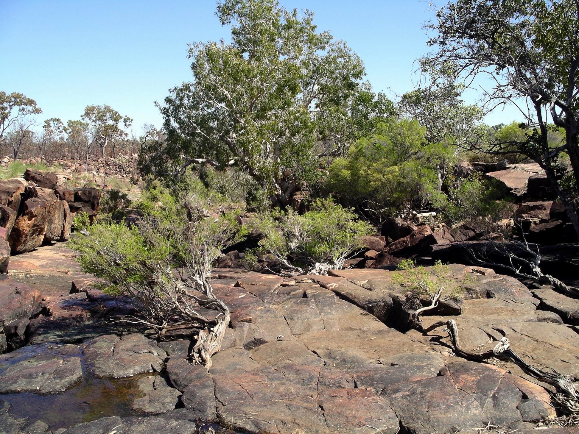
Camp at Manning Gorge Campground
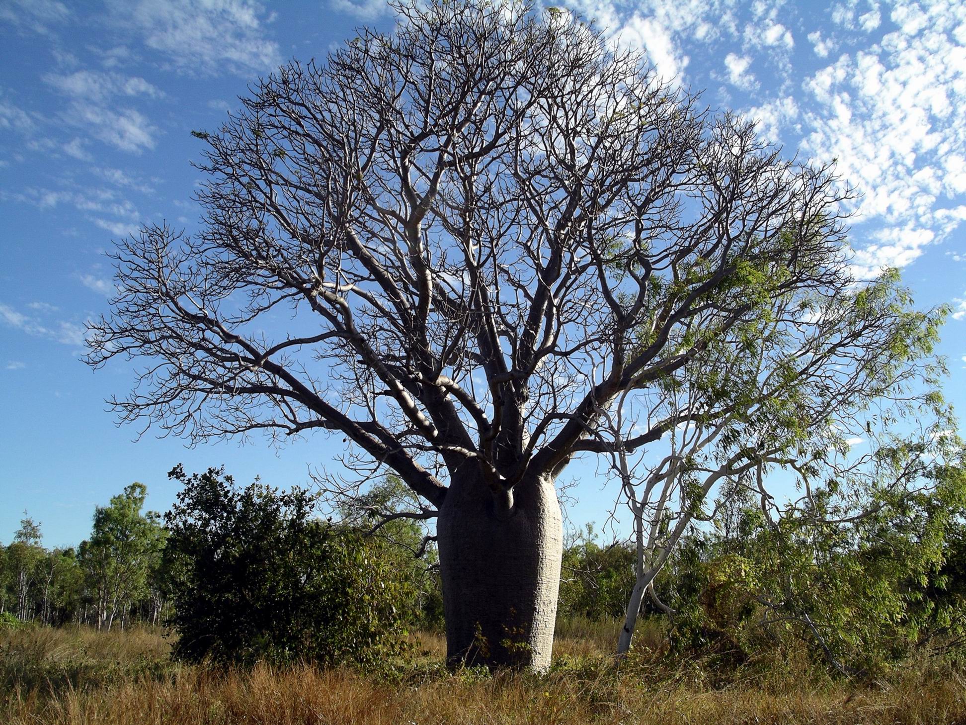
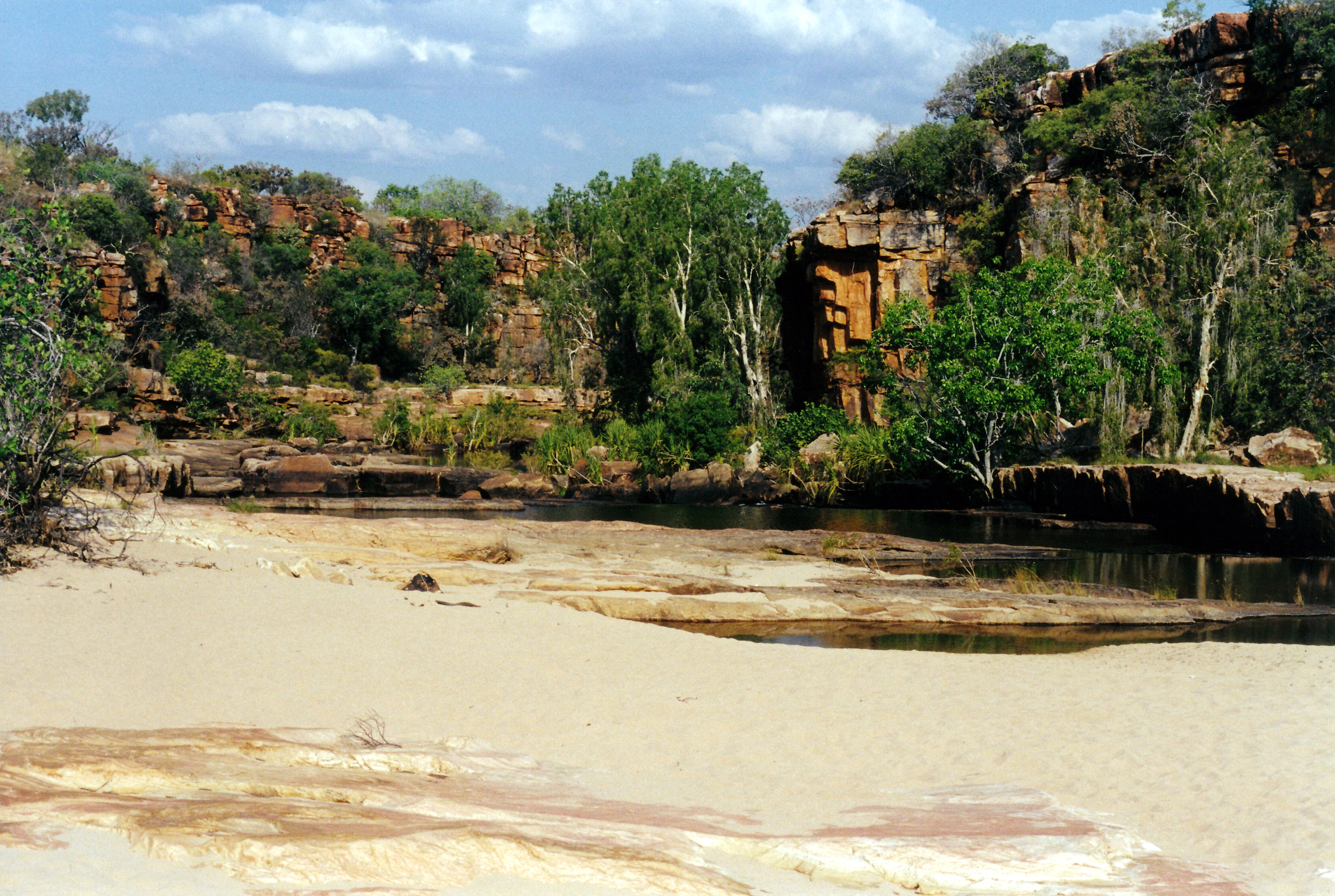
This was such a scenic place, with a number of really large boabs scattered about, and plenty of other shade trees. Wet season floods caused some changes from year to year. Now, there was lots of sand alongside the river, dumped by the big floods of earlier in the year. One day, they’d had about 170mm of rain in a few hours, and the rivers came up, big time.
The waterhole by camp, on the Manning River
After we’d set up the camp, John went back to the Roadhouse with the wheel he’d taken off at Charnley. He was able to get a new tube, and got the old one patched – in case it was needed further on. There was just a little rubbed patch on the tube, again. The fact that this had happened now on both left hand side wheels was suggestive – maybe confirming the idea that it was a big boulder run over in the Fletcher Creek that caused the problems.
The tyre work cost $70.
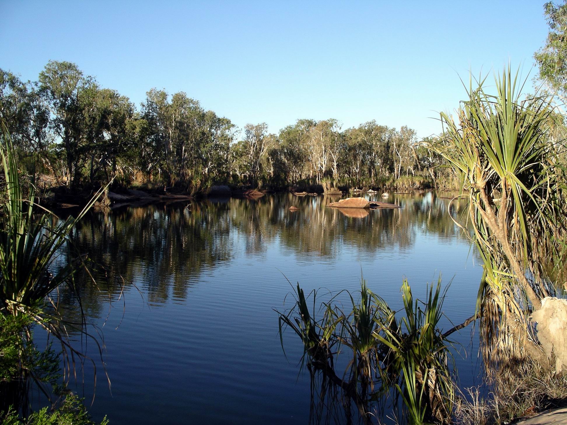
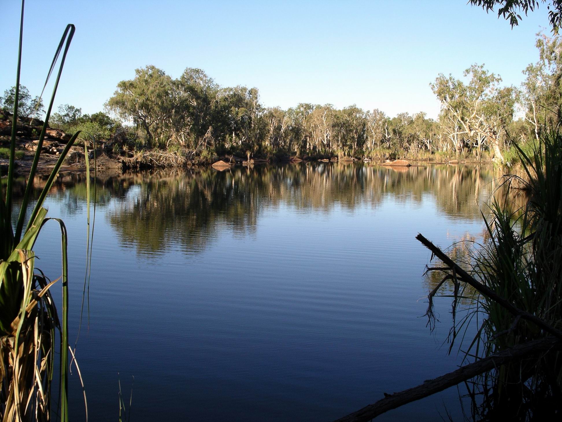
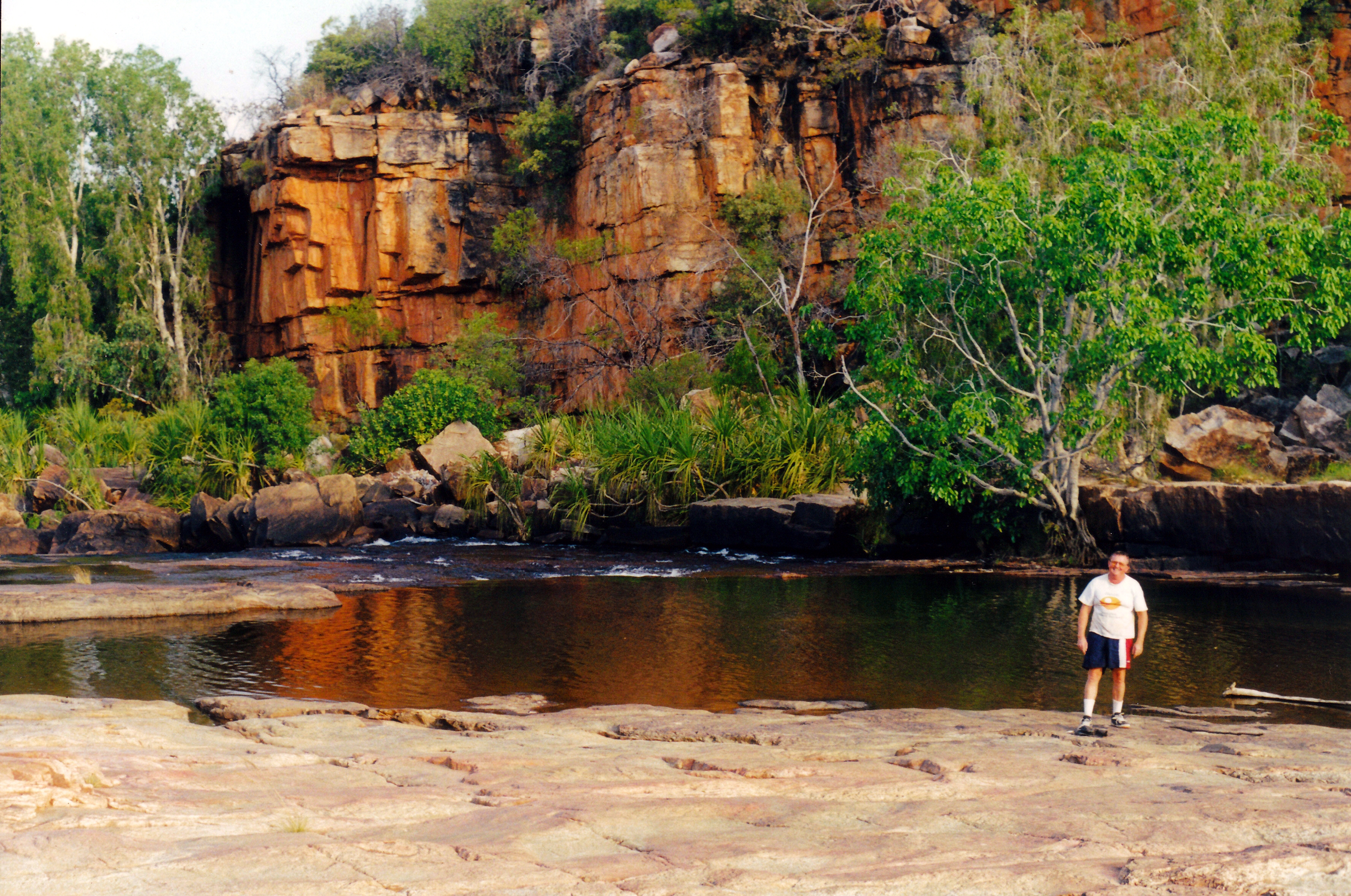
Waterhole by camp
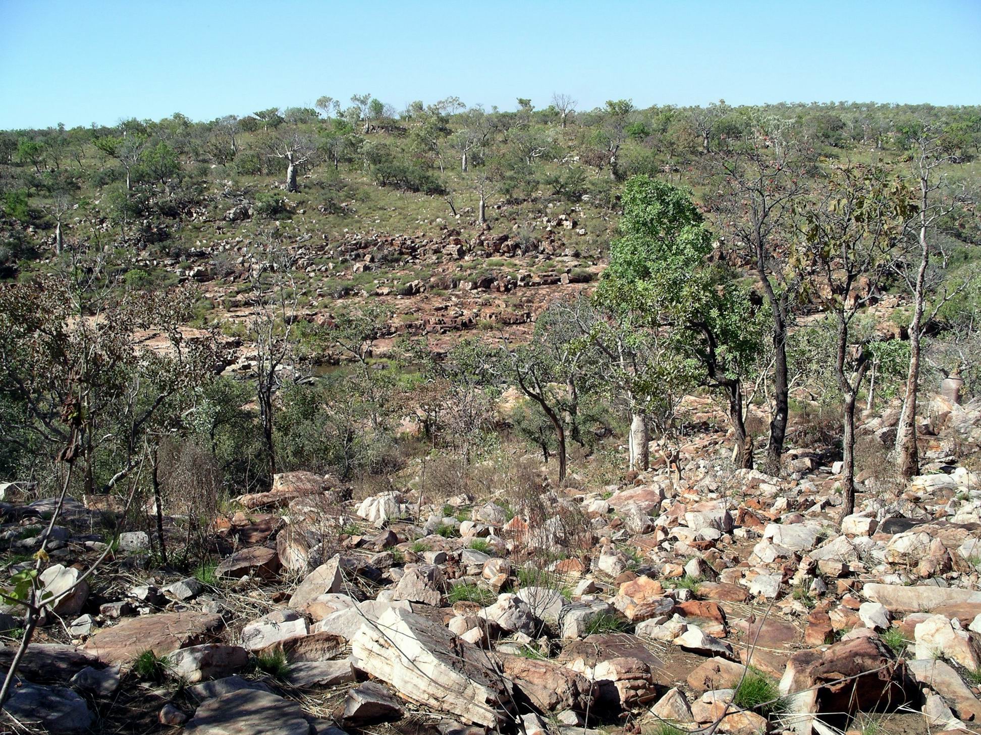
Went for a wander around the campground and environs, taking photos.
Our day’s route marked on map from Derby Visitor Centre
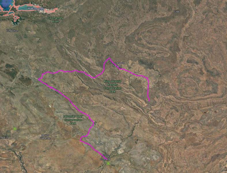
We got ourselves organized reasonably early, with prepared lunches, and set off for Grevillea Gorge and Lillie Pools. These were some 30kms to the north and then west of the homestead, on Plain Creek. This was a tributary of the Isdell River, which flowed NW to the sea at Walcott Inlet. In coming from Mornington, we had crossed the water shed between the river systems that flowed south and west, like the Fitzroy, and the northward flowing ones. The Gibb River Road tended to follow this water shed a lot of the time.
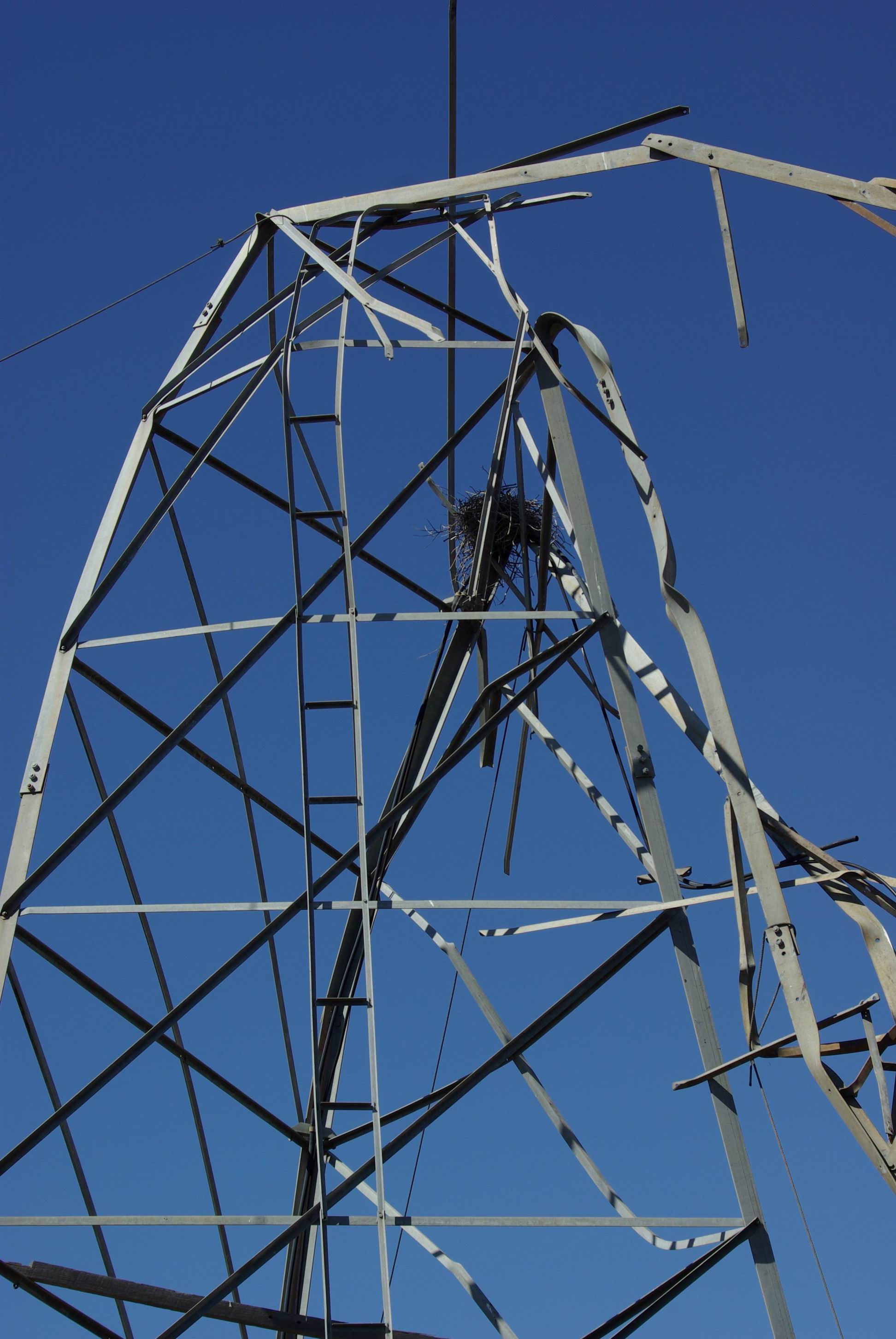
Along the way, we had a wander around an open grassed area where there was a derelict windmill structure that was all stark and twisted up. Presumably, it had succumbed at some previous time, to a cyclone – or two?
Cyclone damage?
An enterprising bird – a kite maybe? – had built a rough nest in the framework.
Better than a tree?Charnley country…
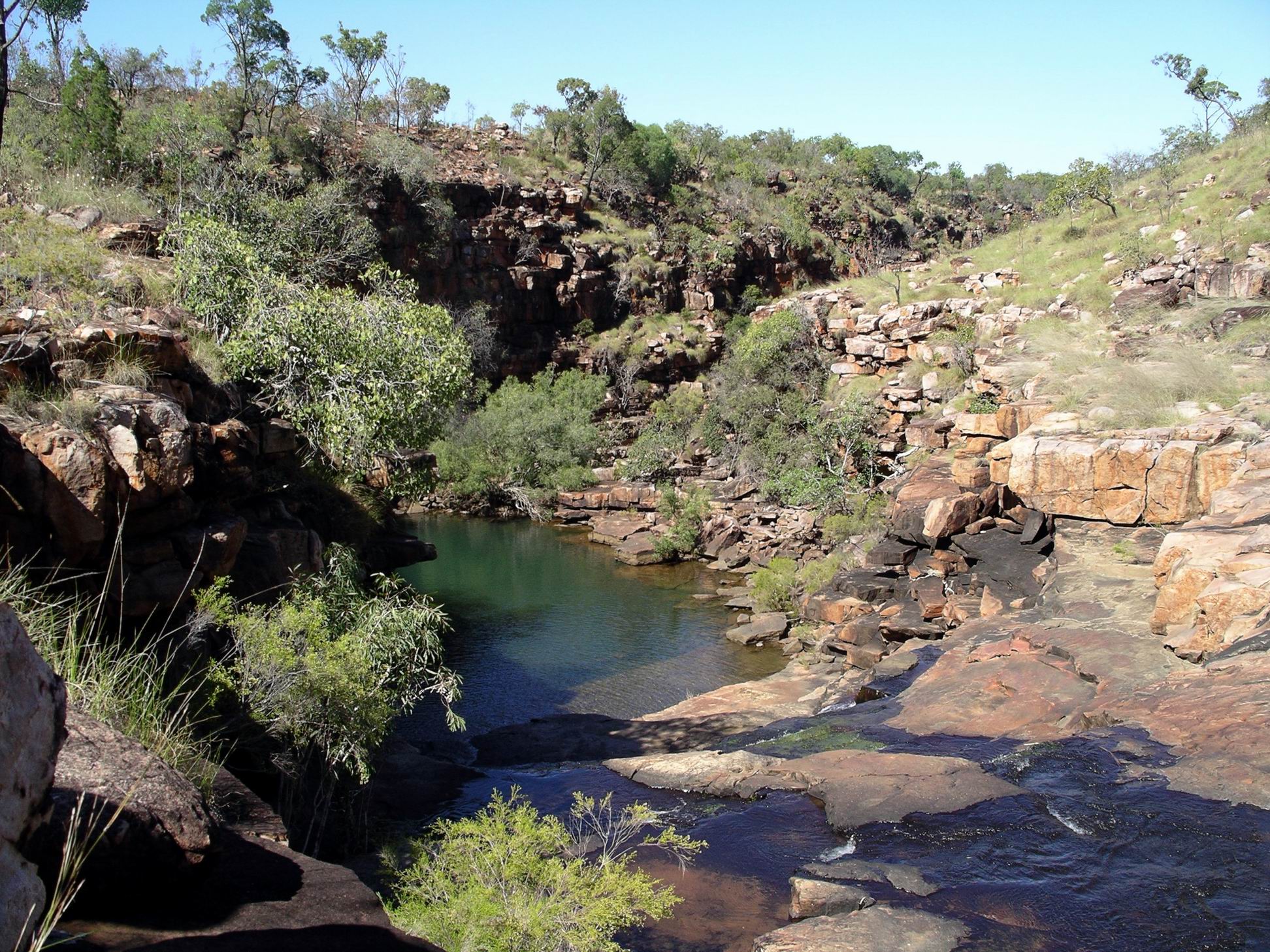
From the end of the access track we had to walk over a series of rock ledges – almost like a giant staircase – to reach a ladder that led down to the water level in Grevillea Gorge. The ladder was anchored – sort of – to a steel post cemented into the rock wall.
Nature’s stairway…Looking down on Grevillea Gorge and Plain CreekThe way down…
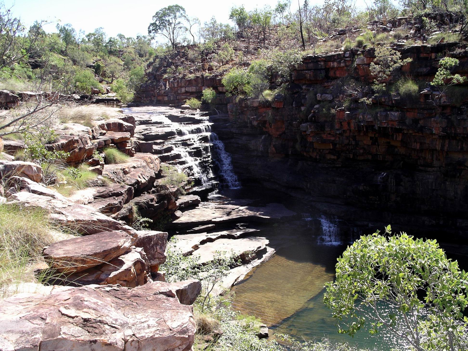
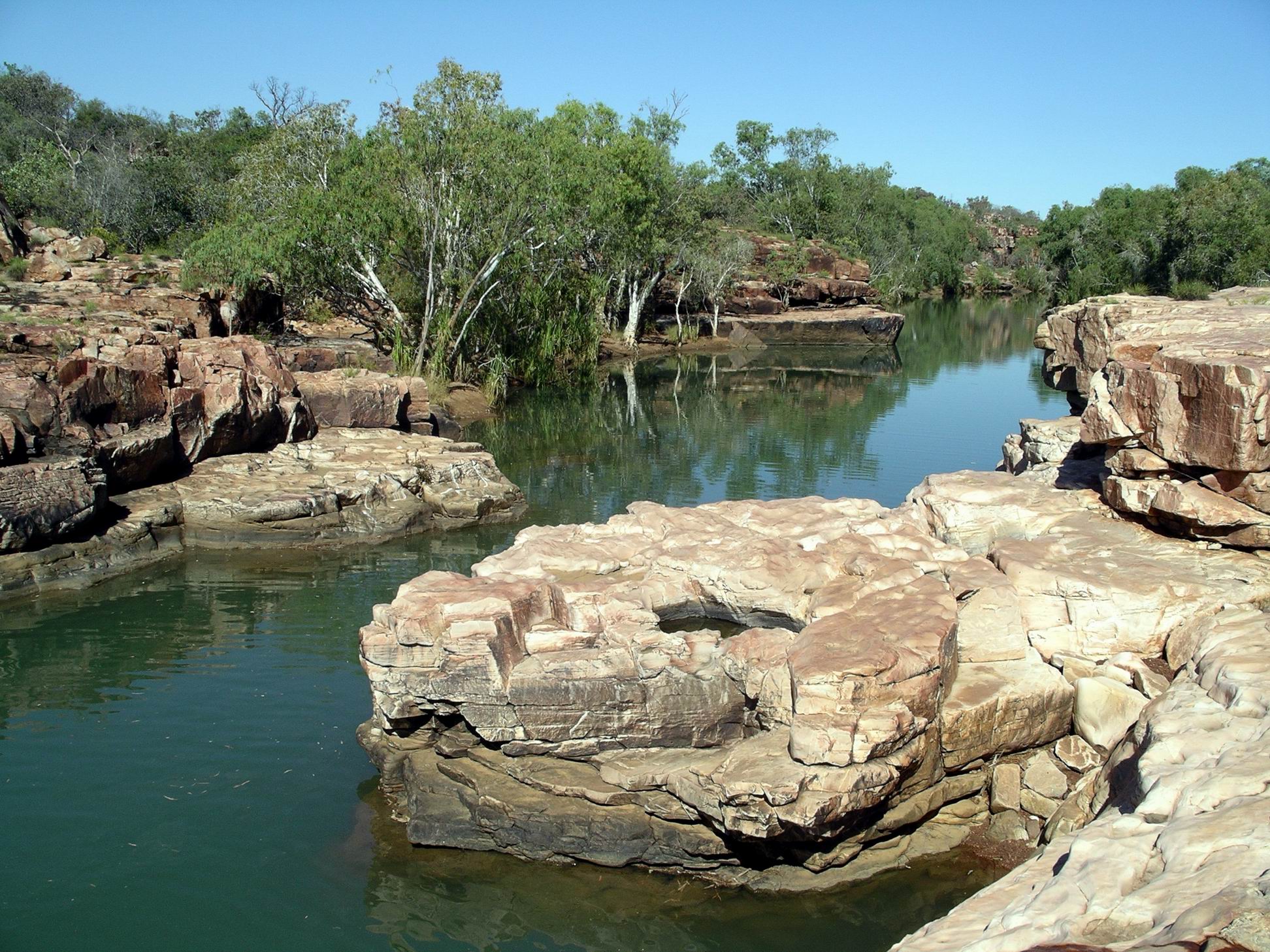
Found ourselves by a pool above a substantial two part waterfall.
The top of the waterfall….
Below that was another pool and more falls, but there was too much rock climbing involved for us to follow the stream down.
The lower part of Grevillea Gorge
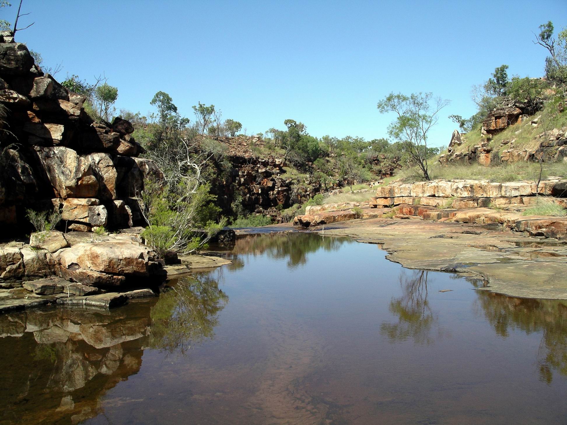
After spending some time around the ladder pool and falls, we followed rock shelves and ledges upstream for some distance along the creek. Although it was hot this was really enjoyable – the noise of the water in shallow areas, and the lush greenery along parts of the banks, made it feel cooler.
At nearby Lillie Pools, more scrambling over rock shelves was involved.
There were no waterlilies in the series of small pools here – they had been washed away in the last Wet season.
Near the Lillie Ponds
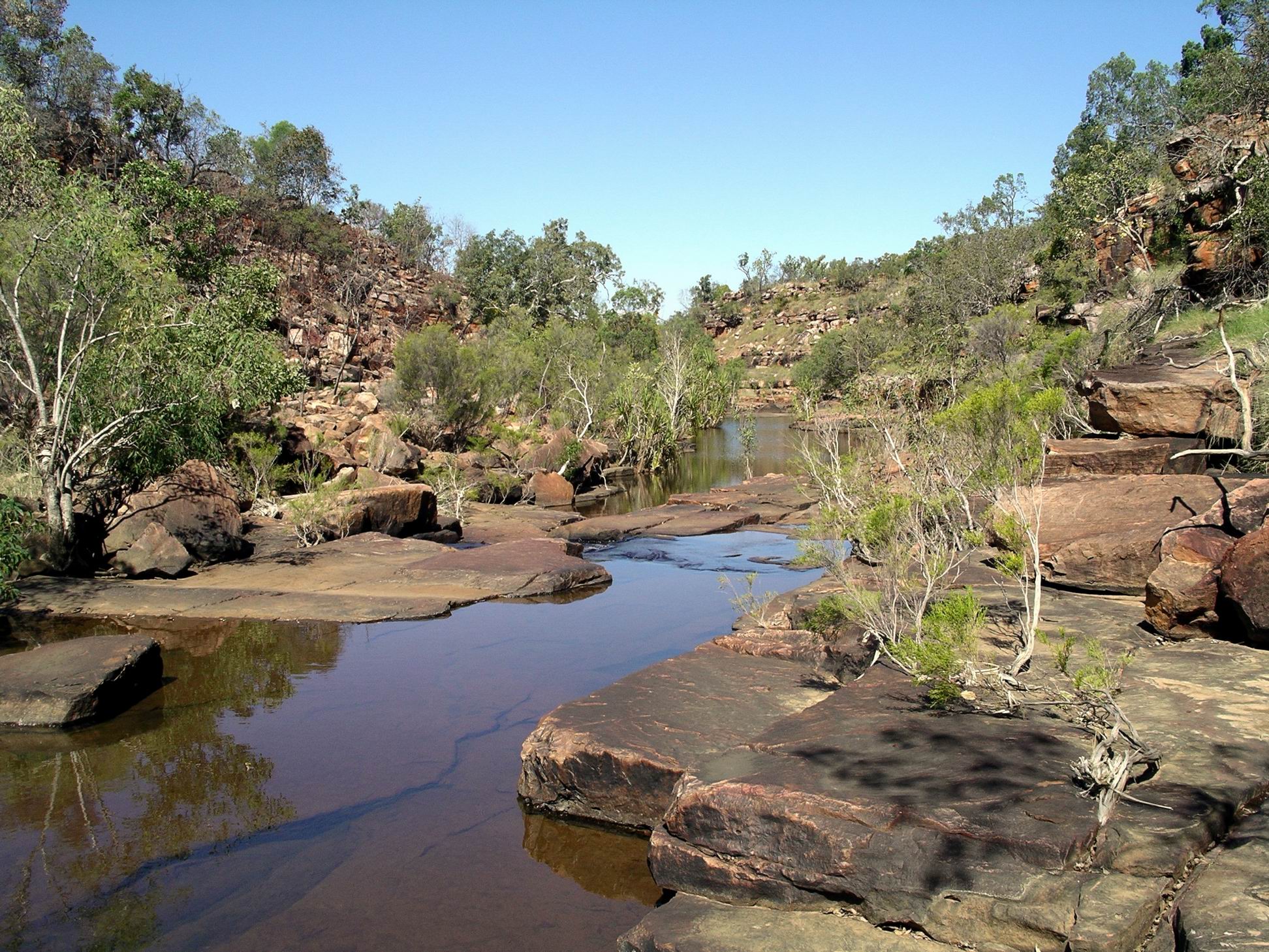
We were able to cut south, to Dillie Gorge, further downstream on Plain Creek. The grading and opening of the access track had only been completed yesterday. It was still rough in parts. In one place we stopped to pull some old barbed wire off the track.
Dillie Gorge down amongst the rock jumble, somewhere….
More scrambling down the rocky and rugged slope was required, to get to the water level. The boulder slope here was unusual – like a giant hand had just picked the rocks up and thrown them down in a random jumble.
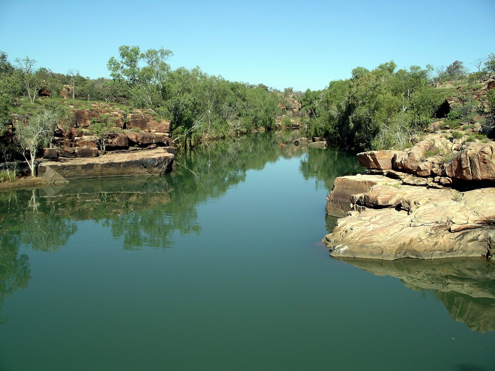
Dillie Gorge
The effort was worthwhile – Dillie Gorge was the best of the lot! It was quite a deep and extensive gorge.
Again, we spent some time exploring along the creek and gorge – and enjoying our total solitude.
Dillie Gorge was extensive enough to make us wish that we’d had a canoe to explore with.
We would have really liked to be able to explore the track further to the north – to Junction Waterhole and the old homestead, but it was not going to be open any time soon. Charnley was another less visited but so scenic part of the Kimberley.
As we’d been coming out of Mornington, the other day, we’d encountered six couples, from New Zealand, in rented motorhomes – the types that were allowed to be on unsealed roads. They were on a bird watching holiday, and we had talked birds, and destinations, briefly. They came into Charnley this afternoon. One of their vehicles had lost its brakes, so they were in a bit of a dither about what to do next. Our advice was to simply phone the rental company – there was a public use phone up at Reception – and let them sort it out.
The funniest event of the whole trip. to date, happened this afternoon – at least, it was funny for John and me. M walked across to Reception to make a phone call, to check on a friend’s welfare. As she wandered back, the aggressive gander started to follow her. M walked a bit faster. The gander started to waddle faster. M speeded up, gander too. Within a minute, M was running across the open space, hotly pursued by gander at full speed, neck stretched out, wings flapping. It was one of those events that would have looked hysterical on video – except we were laughing too much to even think of recording it. M arrived, hot and offended – at us laughing as much as at the bird. He retreated, no doubt considering he’d won the encounter.
John had now concluded that the reason the lamp was playing up was that he had not been putting enough fuel into it. So it may not have needed pulling apart at Mornington, after all.
WEDNESDAY 18 JULY MORNINGTON TO CHARNLEY RIVER CAMP 190kms
We were up at 6.45am., packed and away by 9. John really wanted to get ahead of other departing travellers with camper trailers, and not be held up by them and following a cloud of dust for long distances. He didn’t really know how many of such would be departing, just assumed there would be some!
A little way down the track, M’s CB radio suddenly decided it was going to work again, after having been U/S for some time. Seemed she might have hit the right bump? Anyway, now we could communicate when going along, again, if need be.
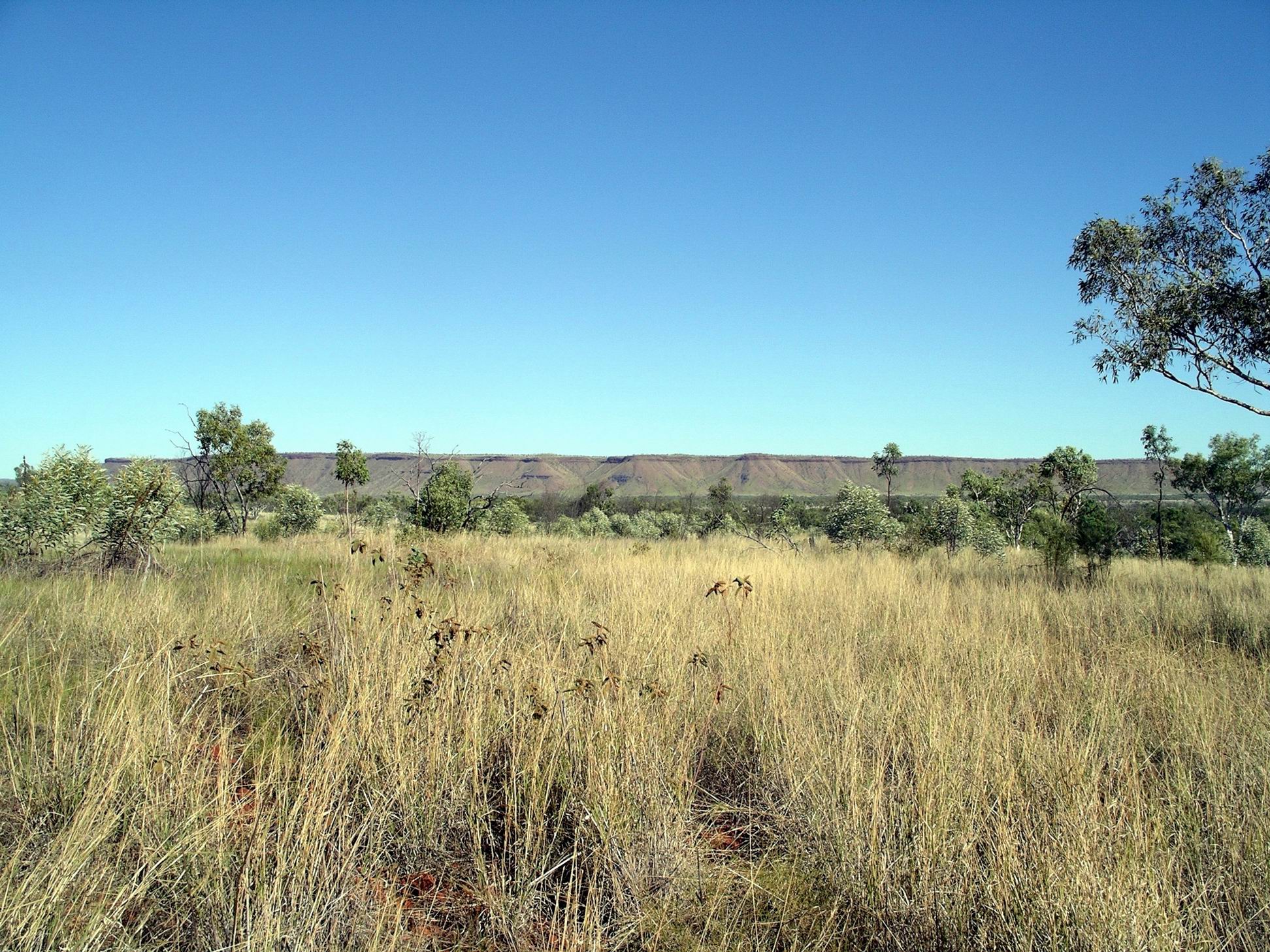
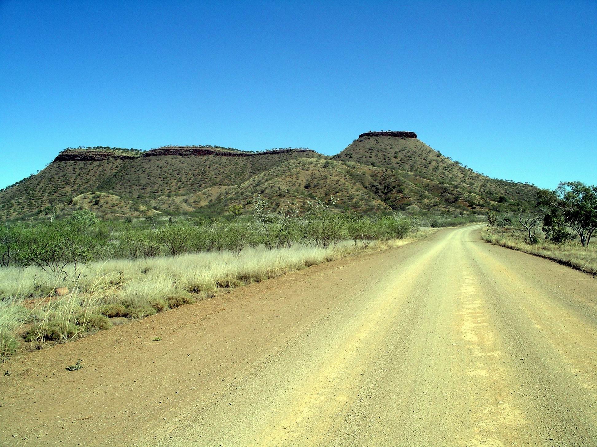
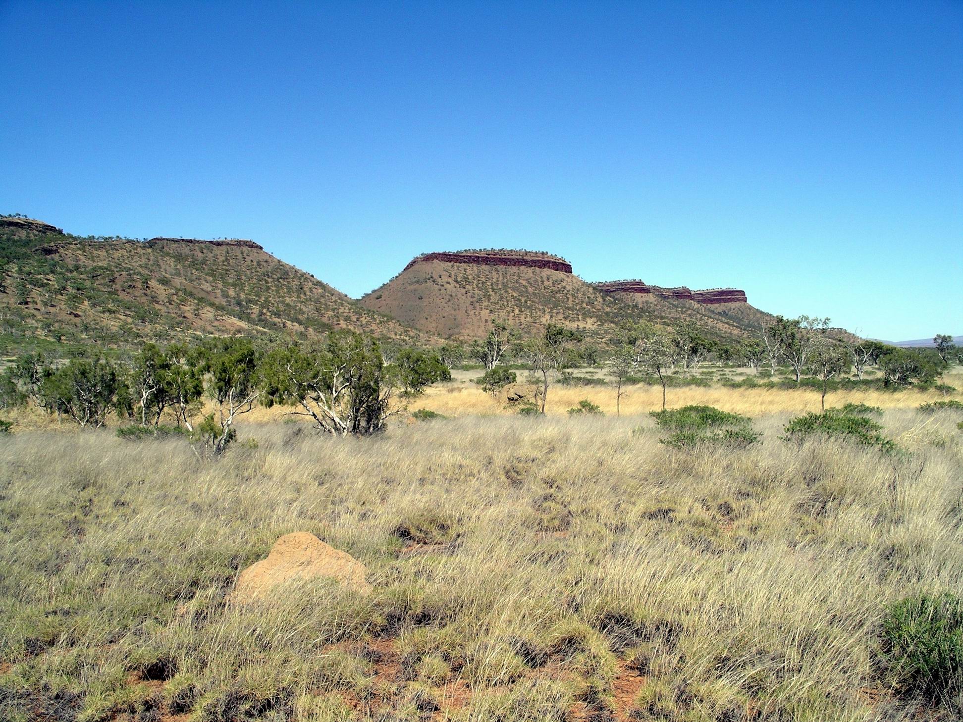
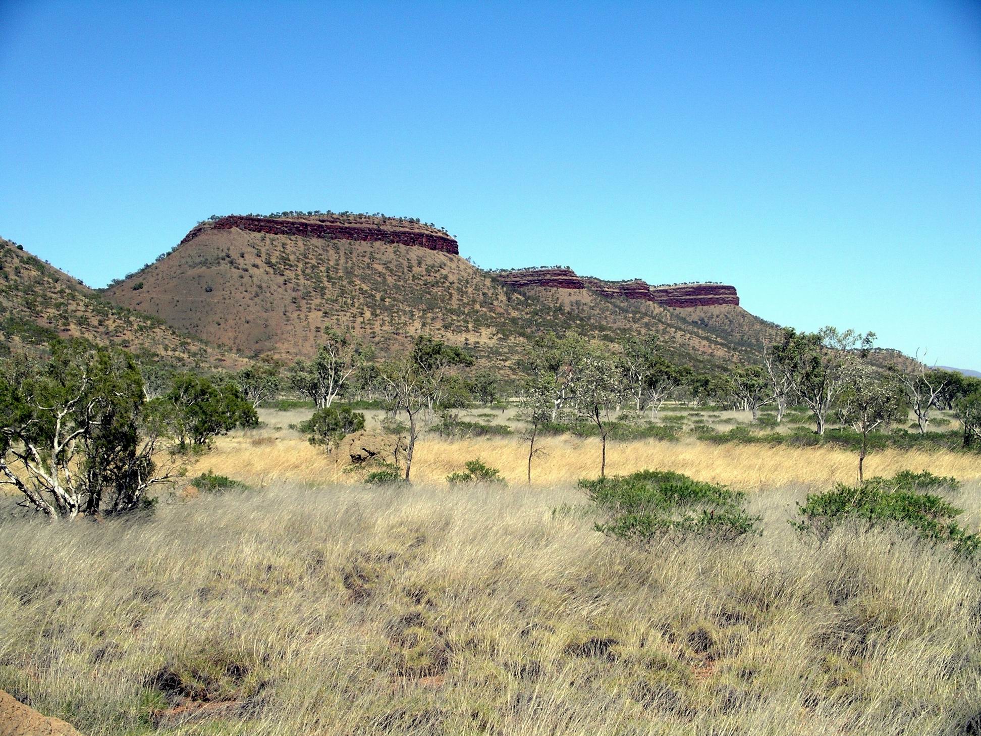
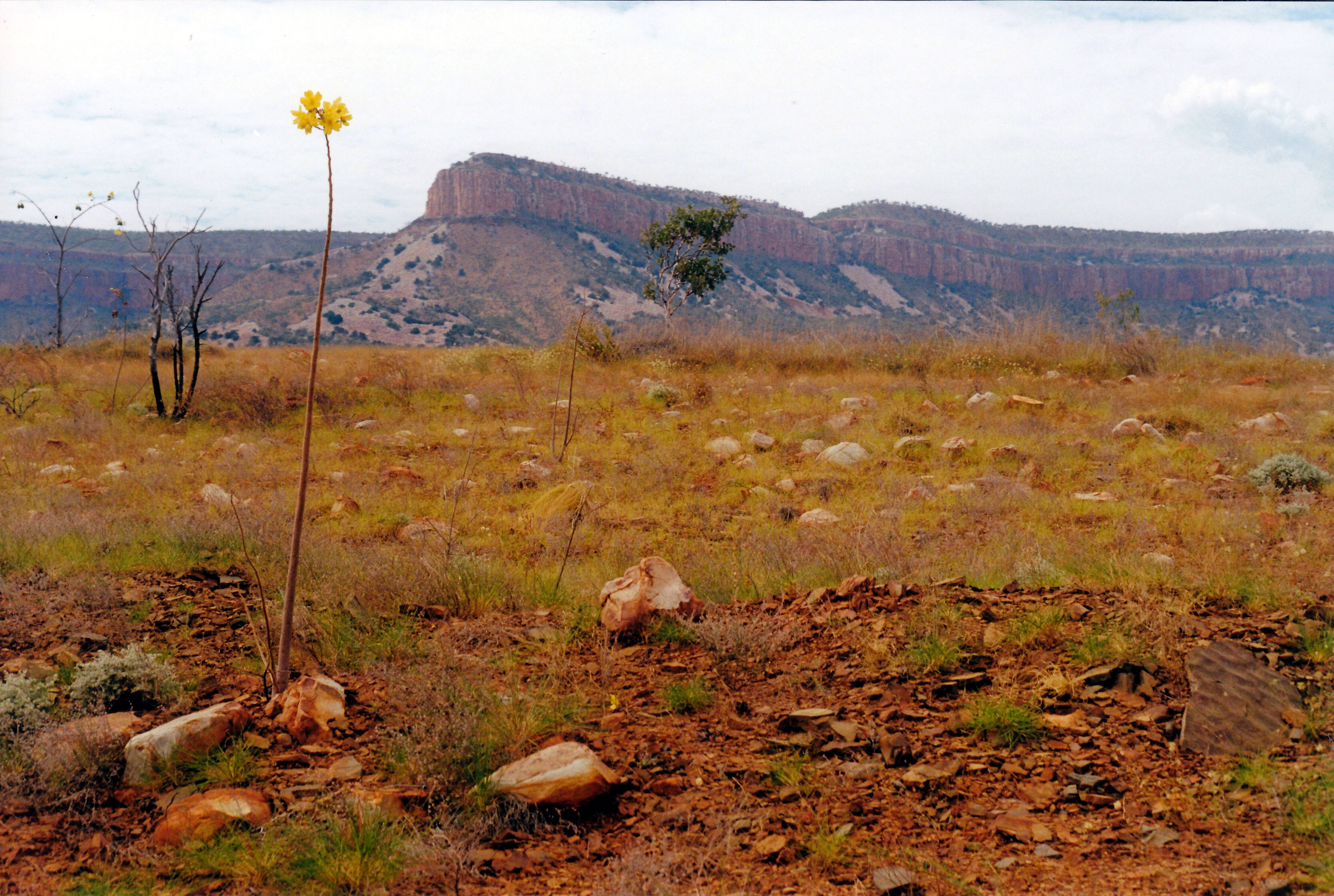
I loved the drive back to the Gibb River Road, with the King Leopold Ranges sometimes visible in the distance, and the majestic flat topped peaks near Mt House.
At the junction with the Gibb, turned to the west, to go back to Imintji Store, 25kms away, where we had noticed, the other day, they did tyre repairs. It meant backtracking, but doing all that was reasonable to ensure we had two functioning spares, seemed the sensible thing.
Tyre was repaired, after a fashion. The problem seemed to have just been wear on the tube – it might have been getting a bit old. Sometimes, we’d had new tubes put into older tyres, and part used tubes put into new tyres, and John had lost track of the age of the tube in this particular tyre. Fortunately, the wheel size was a common one, and the Store was able to supply a better tube.
The rough and rocky crossings of Fletcher Creek on the Bungles track had quite possibly created the problem.
M had elected to do the doubling back bit to Imintji with us, rather than go on ahead. We were able to do a little stock up at the Store – margarine, which we were just about out of and hadn’t been able to get at Halls Creek! Bought some frozen meat, packets of cup-a-soups, bread, fresh tomatoes (what a luxury), and a sandwich for John’s lunch.
Topped up the fuel again. We’d done 350kms since last here. It was still $1.85cpl.
Best of all, the wife part of the couple running the Store for the season, was a hairdresser by trade. Because the Store was not busy, I was able to get a hair cut. Bliss. I had definitely reached the uncomfortably shaggy stage.
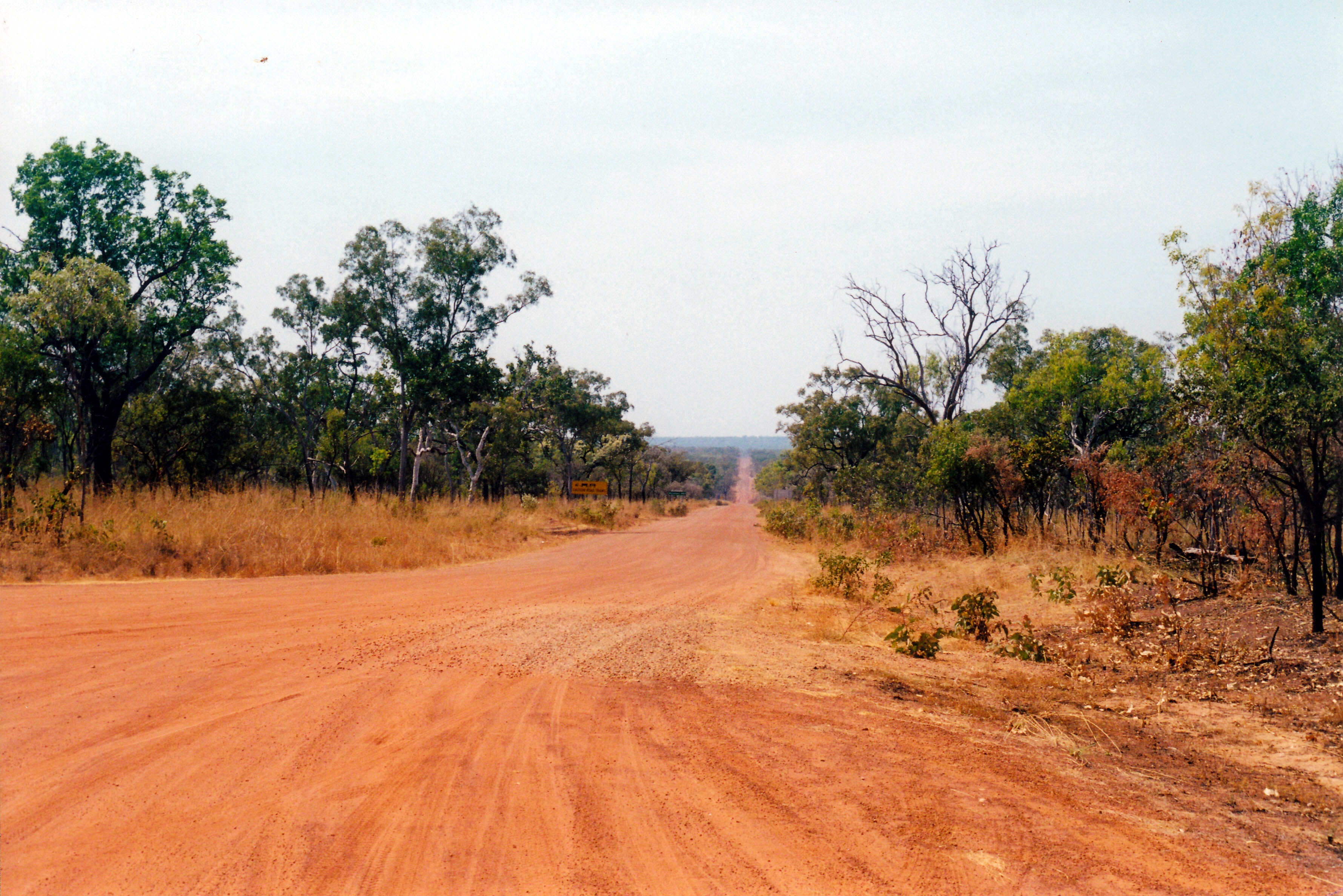
The access track to Charnley River Homestead (Beverley Springs Track) was only just to the east of the Mornington one we’d come up this morning. It was nearly 50kms from the Gibb to the Charnley River Homestead and camp area. The track was quite rough, and rutted in parts where it had obviously been driven on wet. So it was fairly slow going. There were a few little creek fords with mud and low water in.
Charnley River/Beverley Springs track
About 7kms in from the Gibb, we stopped to view a boab tree where the explorer Frank Hann (of Cape York notoriety) had carved his initials when he explored through this area in the 1890’s. I guess that what would be considered graffiti, if done today, served a purpose then, in that his route could be found by others.
Frank Hann tree
The campground fees here were $30 a night. Unpowered of course. The amenities were adequate, if a bit rough and bush style, compared to Mornington.
It was hard to find a good spot to pitch the camp. We were comparatively late getting here, due to the detour to Imintji. The really nicely shaded places, beside the little creek that edged one side of the camp area, were occupied. The area we ended up on had been watered, so was a little muddy in places, and with lots of ants going through it. Although we’d managed to find a place with some trees for shade, this would be in the mornings, so in the afternoon the tents would get hot. Couldn’t be helped. I resigned myself to a not so great camp spot.
Charnley River Homestead camp
After the rough track in, the left rear tyre was slowly going down when we arrived at the Charnley camp area. Another tube? Maybe it was a similar age to the one we’d just replaced? At least that justified the detour we’d done back to Iminitji!
From the information given to us when booking in, there was quite a bit to do here, although the access track to the north, to Old Beverley Springs Homestead ruins, was closed. Like Mornington, it was new ground for John and me.
Charnley was a working cattle station. There were some calves wandering about the place, plus a baby donkey, chooks, a little mob of geese, some peahens and peacocks.
At least our rather exposed camp spot was not very close to any other campers, which meant John could run the genset for a while so he could play computer games! No comment from me…
THURSDAY 12 JULY FITZROY CROSSING TO MORNINGTON WILDERNESS CAMP 428kms
The time at Fitzroy Crossing did not improve any.
Took my morning mug of coffee, intending to sit in my camp chair with it and watch the departing campers. As I sat down, the seam on the canvas seat split and I dropped right down into the metal framework of the chair. It hurt like hell and I was quite bruised. And I spilt my coffee!
The chair was 14 years old, and had been much used and exposed to the elements over its lifetime, so I probably should not have been too surprised. Better me than John – an accident like that could really cause him some hip damage.
Morning at Fitzroy Crossing camp
It was 10am before we departed camp. John had to go and refill the spare fuel jerry can, which meant a big repack of back of Truck.
From Fitzroy Crossing, drove 43kms west on the highway, then took the Fairfield-Leopold Downs Road – unsealed – for 124kms, to link us through to the Gibb River Road. This road was quite corrugated and rocky in parts and was fairly slow going.
We did not stop at either of the National Parks along this road – Tunnel Creek and Windjana Gorge. John and I had camped at Windjana Gorge in ’93 and explored both. M had visited them on her previous only trip to these parts – a short tour from Broome, undertaken on a tour package with her mother, a few years back.
Today’s was a very scenic drive. This western end of the Kimberley is all former Devonian Reef ranges – quite rugged.
Australian Bustard seen along the way
After we turned onto the Gibb River Road and headed east, these ranges were in front of us. It didn’t take long before we passed through the first of several gaps in the ranges – Yammera Gap, with its big rock formation on one side, very aptly named Queen Victoria’s Head.
Approaching Yammera Gap
A couple of the steeper sections through the ranges, like Inglis Gap, were sealed. There were some good outlooks from some of these, over the wild country ahead.
Through this section, there were several pleasant creeks and we noticed people setting up camps by some of these – even where they were clearly signed “No Camping”.
There was regular traffic along the Gibb. Too much of it was travelling too fast. 4WD’s towing camper trailers seemed to be the worst – even more so than the dreaded overseas drivers of hired 4WD campers. They pass oncoming traffic at great speed, with no thought about the stones and rocks they throw up at others.
At one point, we had slowed right down to go through a small creek ford in a little gully. A 4WD with trailer came up behind and sailed past us – didn’t slow down at all for the creek. I swear his camper trailer got airborne! These are the travellers who later complain about poor quality roads wrecking their vehicles and tyres – we have seen and heard it all before.
It seems to be an unfortunate fact that, these days, any area/road that is designated “remote” ” an adventure” ” challenging” brings out the most moronic of the idiot drivers – a scary number of them. I don’t give a damn if they spoil their own rigs, and holiday plans, but object mightily when their stupidity affects the sensible minority.
Some 95kms along the Gibb, we parted company with M for a couple of days. She took the side road to Silent Grove and Bell Gorge and planned to catch up with us later, at Mornington. John and I had previously camped at Bell Gorge and it was now one of several places along the Gibb that was very popular, and hence often crowded.
Only a few kms after the Bell Gorge turn off, was the Imintji Store. This had not been here the last time we were at this end of the Gibb, and was linked to the nearby little community of the same name.
We’ already done 300kms since filling last at Fitzroy Crossing, so refuelled here – $1.85cpl. Bought an icy pole for John and a cold drink for me. Chatted a bit with the very nice lady behind the counter – she and her husband had been contracted to run the place for this season, on behalf of the community.
Another 25kms brought us to the turnoff we wanted, to the south east. A hundred metres or so down this road (which also went to Mt House Station), was a roofed shelter, housing a two way radio. All prospective visitors had to use this to call the Wilderness Camp, some 90kms distant, to see if there was a vacancy in the campground . This was very sensible of them – it was a long way to go, only to find one was turned away! There was no other legal camping until back on the Gibb. As they strictly limited the number of campers at any one time, to 25 vehicles/50 campers, there was a very real chance of the campground being full.
We were fine, there was room, and we proceeded southwards, on a route that was new to us.
The track was quite reasonable. It took us an hour and a half to do the 90kms. The scenery was really wonderful, particularly when we were running alongside a group of flat topped, mesa like peaks.
There were a number of dry creek channels to be crossed, and occasional ones with a little water in. For the most part, these had been smoothed out by the road grader.
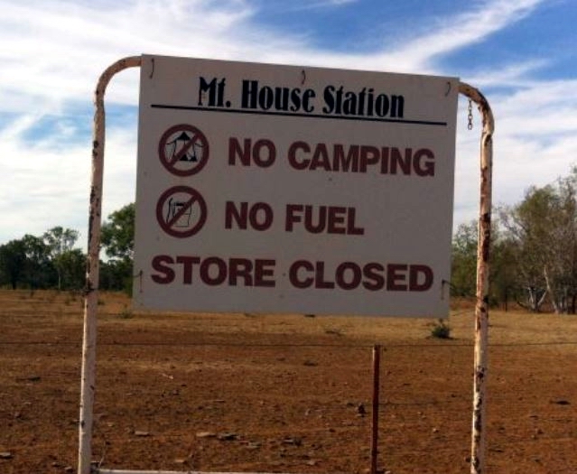
Passed the turnoff to Mt House Station – a cattle operation that did not welcome visitors.
Navigating from a map with a scale of 10km to the cm definitely involved a degree of guess work, given the myriad of station tracks, not marked on the map. I thought I’d identified the turn offs to Moll Gorge and then the Tablelands Track. The latter, in particular, gave me some angst because, if I was wrong, we could have veered right when we should have gone left!
So, I was quite relieved, shortly after, to recognize the site of the old Glenroy Meatworks. We were still on track. This had been the focal point of the Air Beef Scheme, set up after WW2. Cattle from quite a wide radius were brought into the abattoirs/meatworks at Glenroy Station, slaughtered, and the carcasses flown, soon after, to Wyndham, where they were frozen for shipping onwards. So there had been a large airstrip at Glenroy. The making of the Gibb River Road, in the mid-60’s, provided the alternative to cattlemen, of road transport of stock to markets, and so the Air Beef Scheme closed down.
For the final few kms, were winding back and forth across stream tributaries of the Adcock River, an upper tributary of the Fitzroy River. Annie Creek, beside which Mornington Wilderness Camp is located, is one such tributary.
Drove through the campground area and found the main building a bit further on. There, we booked in for five nights. Sites were $30 a night – no power, of course. Had to pay a $20 entry fee to the property, too.
There were really good, thick, woollen beanies for sale, with the Australian Wildlife Conservancy monogram on. I bought one – $20 – thinking it might help keep my head warm at night, when trying to sleep.
It hadn’t been hard to spend $190 here, in just a few minutes!
We then had to drive back to the camping area, which was strung out along the creek, and pick out our own site from amongst the empty ones. Sites were mostly just clearings in the bush, some of them off an access track that ran parallel to the road in. Probably about half the sites were occupied – the very best of the secluded, shadiest ones, at the northern end, were taken, but we found a good place to set up in the more southern section.
The Wilderness Camp was within the Mornington Sanctuary – a former pastoral lease owned since 2001 by the Australian Wildlife Conservancy. This private conservation group was doing great work on a variety of environmentally significant properties across Australia, underpinning their conservation efforts with really thorough scientific research.
I didn’t mind paying these sorts of fees when any profits went to support the work of such a group.
When we had been travelling in the Kimberley in 2000, I had planned for us to stay at Mornington, where the then station owner had set up a campground, like others that were springing up across the region, in response to growing traveller numbers. The remoteness of the place – being off the usual traveller route – had appealed to me. From there, we were going to try to drive the Tableland Track, back eastwards, to the Bungles area. But the fates intervened and that part of the planned Gibb River Road trek didn’t happen. When I read, the following year, that AWC had bought Mornington, I was sure the chance to explore that area was gone. But, the organization decided to keep a camp operation going – and here we were.
The campground amenities were very good, with flush toilets and warm showers.
There was also some safari tent accommodation in a different section further along the creek. There is only one commercial tour group allowed to access the property – Outback Spirit, and their tours use the safari tents. I believe that policy reflects a positive view about the environmental credentials of Outback Spirit. When we had worked at Adels Grove, that company had brought tour groups through; I always found them the best groups to deal with.
So, with limited numbers, the place never feels over run by people – unlike some places along the Gibb.
It was getting dark by the time we were fully set up. John found a small piece of board in Truck, that he normally used for packing between things. He was able to place that across the framework on my broken camp chair. With the addition of an old cushion – also used for packing – this would do me for the time being. The actual framework of the seat was quite sound, it was just the canvas seat that had weakened. We inspected John’s chair but the canvas showed no signs of tearing. However, he will be very careful when sitting down, to lower himself very gradually. I also had the option of using a little folding stool that occasionally saw use when John was fishing.
John also found that one of the front tyres was going flat – a slow leak.
We’d parked Truck in a way that would ensure there was still room for M’s rig, in case any other campers decided to set up in our little clearing.
A fine day. Good – I hoped all those dirt roads we would soon be traversing, were drying out fast!
For us, the main event of the day was that we collected our sandblasted and repainted roof rack. John was extremely pleased with the job that was done on it. However, collected was the operative word. We were shown it, paid for it, and then left to replace it into position ourselves! This took us a while – it was a bloody unwieldy object! Truck is high. We had to be careful not to scratch the sides of Truck.
The road into the Bungles was re-opened today. Guess there would be a number of campers very happy to be able to leave there now! But although the Gibb is open, the Kalumburu road that gives access to the Mitchell Plateau area is still closed, so there would still be stranded groups at the Mitchell Plateau, King Edward River, the Kalumburu area camps, and Drysdale River.
Still having a few more days to go here yet, should enable the initial rushes of travellers to the Gibb and the Bungles, to clear through the camps and get ahead of us.
Did some minor shopping for the weekend meals. Fish and chips again tonight. Didn’t reckon we would be having our Friday night feasts again, for quite some time.
M did her Triple J tour today. She had a fine day for it, though there was still some cloud about.
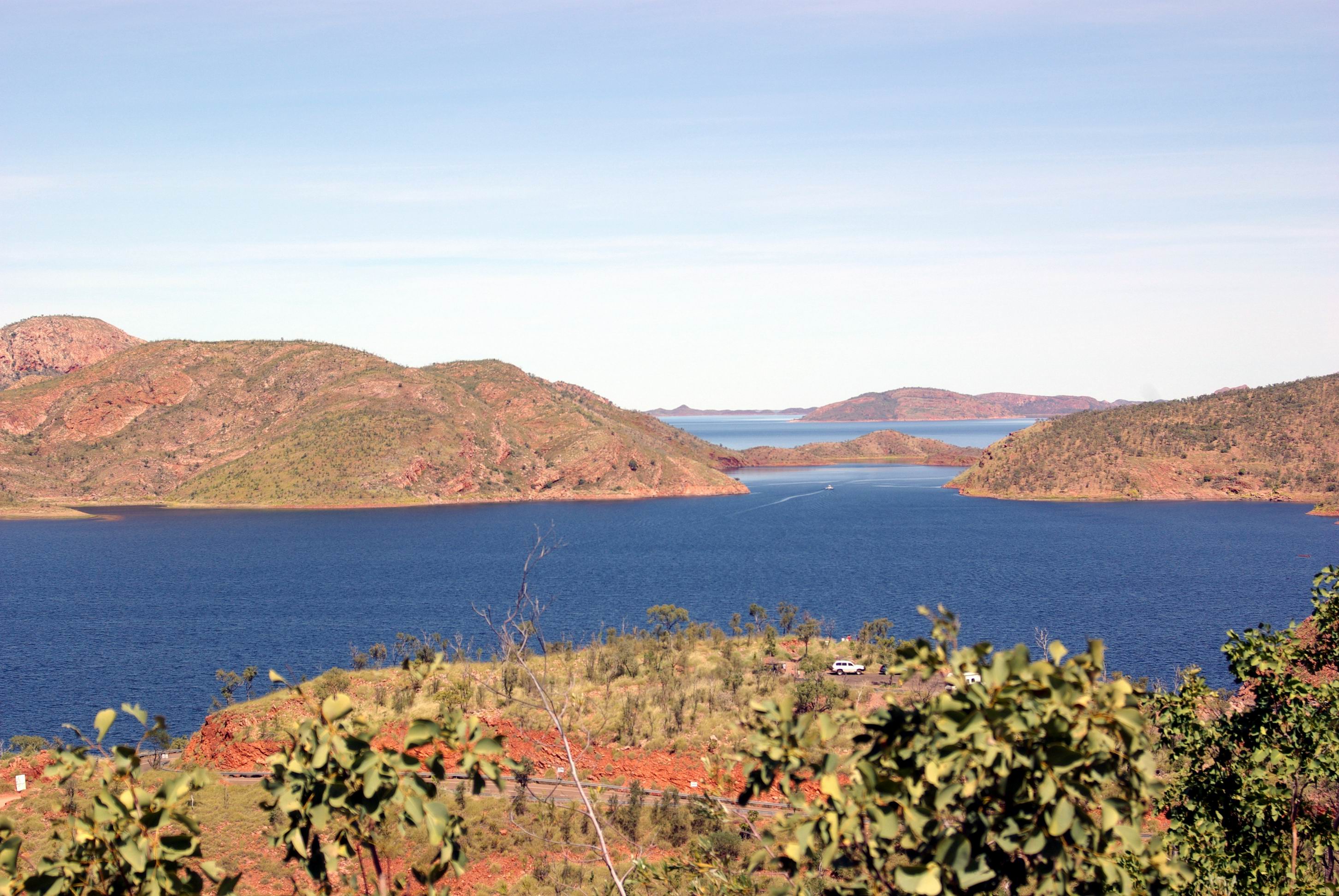
She was collected from the caravan park before 9am. They travelled by boat up the Ord River, from near this caravan park, to the Argyle Dam wall, where they disembarked at a small landing there. Lunch was provided at the tavern at Lake Argyle. A ground tour of the key features followed, like the dam wall and the reconstructed Durack Homestead.
Lake Argyle hydro scheme from dam wall. Boat landing on left
Patrick Durack, the founder of the Kimberley Durack dynasty, arrived in the Kimberley after an epic cattle drive. He built a substantial homestead on his Argyle Downs station, completing it in 1895. The site of this is now well under the waters of Lake Argyle, but before it flooded, the homestead was carefully taken apart, to be rebuilt above the water level. Even graves were relocated. It was to be a monument of sorts, to the pivotal role of the Durack family in opening up the Kimberley.
After the ground tour, the group took to another boat, on Lake Argyle itself, for the sunset boat tour, well lubricated with bubbly! Given that there was still some cloud about, they experienced a slightly different sunset to most groups, but it was very spectacular.
Lake Argyle – just a very little part of it
It was – obviously – well after dark when the bus deposited M back at the caravan park. It had been a full day. She enjoyed it, despite it still being windy and cold.
Ord River on Zoom. Red marks show pick up point and end of river trip
John spent much of the day messing about on his laptop.
Times like this, when we were largely confined to van by weather, and not going anywhere, were – fortunately – pretty rare on our travels. In what was essentially a 6 foot by 14 foot box, it didn’t take too long to start going stir-crazy.
I read and tried to do some planning for a possible trip to the Bungles and the Gibb River Road, and points beyond. One fact stood out – it was going to be expensive! Everyone in the more remote parts had to make their tourist profits in a very short window of time, and the charges reflected this. Even the basic campgrounds were relatively costly – and the tourist guide was emphatic that camping was allowed “in designated areas ONLY.” Gone were the days when one could pitch a camp in any lovely spot that caught the eye – too many such campers polluting the streams, leaving rubbish – and worse – and interfering with station activities.
A dilemma for us was what to do about the van. It was not allowed into the Bungles. Did we do a Bungles trip, with the van left here (or at Turkey Creek), then double back, collect it and take it through the Gibb? With the recent massive rains, how high would the Pentecost River be at the crossing on the Gibb – really didn’t want water above the van’s floor level! Hmmmm……..
There was no rush to get up and go anywhere. Of course, those are the mornings when I wake up bright and early…..
The weather seemed to be clearing this morning. (I wondered what the other two would have to say to me, if we ended up stuck here for two weeks in sunny weather! )There was occasional light drizzle only. But it was quite cool, for these parts, and everything felt so damp.
When we all got going for the day, (i.e. John) walked to the town shops.
Kununurra is another of the relatively recently purpose- built townships that we’ve encountered. Unlike most, which are mining related, it was constructed to serve the needs of a new irrigation project, about 1960. So it has the usual cluster of shops and services together, with houses radiating around these, and a designated light industrial area, all in a pattern of curved roads.
The small shopping mall contained supermarket, newsagent, souvenir shop, a jewellers with wonderful pearl and diamond creations (reflecting local industry), some food shops.
Not far from the mall, was the Argyle Diamond shop, selling diamonds sourced from the nearby mine, including a comprehensive array of the famed pink diamonds. We went and had a browse there – an exercise in wishful thinking!
Now, of course, although irrigated farming continues in the surrounds of Kununurra, servicing the needs of tourists like ourselves has become a major industry.
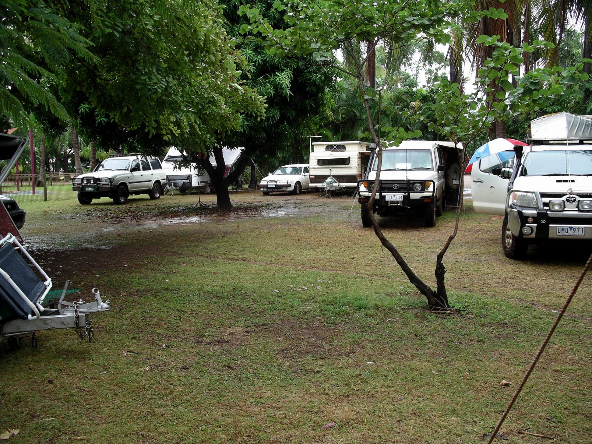
Noticed, on our walk, that there were camping rigs of all descriptions, from large caravans to 4WD’s with tents, parked up everywhere. They were all around the parkland perimeter that was across from our caravan park, with some tents in the park. They were parked in ordinary streets. I also noticed No Vacancy signs outside all accommodation places.
Kununurra was more than bursting at the seams!
Not much dry room left…….M’s rig squashed in there
After the walk, just did the usual camp things for the remainder of the day. Back at home, I’d phoned the Derby Visitor Centre and ordered a copy of the 2007 Guide to the Gibb River Road, that they produce and revise annually. This was an essential source of up to date information and charges, in an area where things can change considerably, from season to season. So now, I dragged that out of its storage box, together with the Moon’s guidebook on the Kimberley, which was similarly essential for track information, and started, with M, looking at what we might do. That filled in time, at least.
I was amazed by the costs of everything through the Gibb area, these days. Clearly, whatever little jaunt we did undertake, was not going to be cheap!
THURSDAY 10 AUGUST KING EDWARD RIVER TO BARNETT RIVER GORGE 267kms
I woke to spatter sounds on the roof of the tent – heavy dew? Light rain?
There was misty cloud about and morning mist over the river, which was a different scene again. The sun behind the mist created some interesting light effects. All yet another type of mood for this beautiful area.
Morning mist over the King Edward River
We were up at 6am and packed and away at 7.45am.
Churned our way back through the river ford and were soon back on the main Kalumburu road, heading south, then the Gibb River road, heading west. The road was variable, from good to very corrugated, with some bull dust patches and places where rocks outcropped from the road. There were several water crossings but nothing that was any issue.
King Edward River ford – can be a bit tricky
We did not see much private traffic on the road, but did see several safari tour buses.
Back on the Gibb River Road
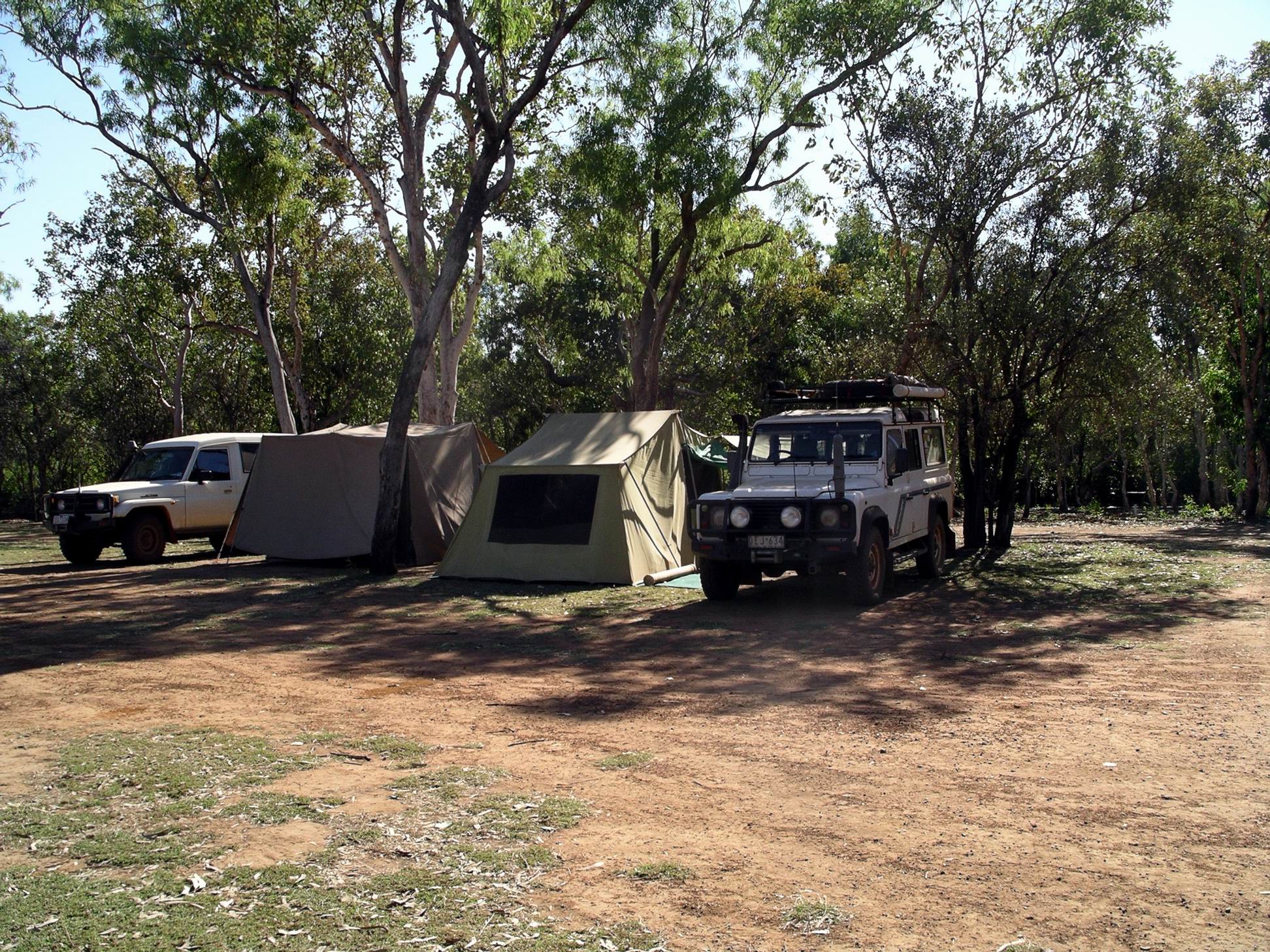
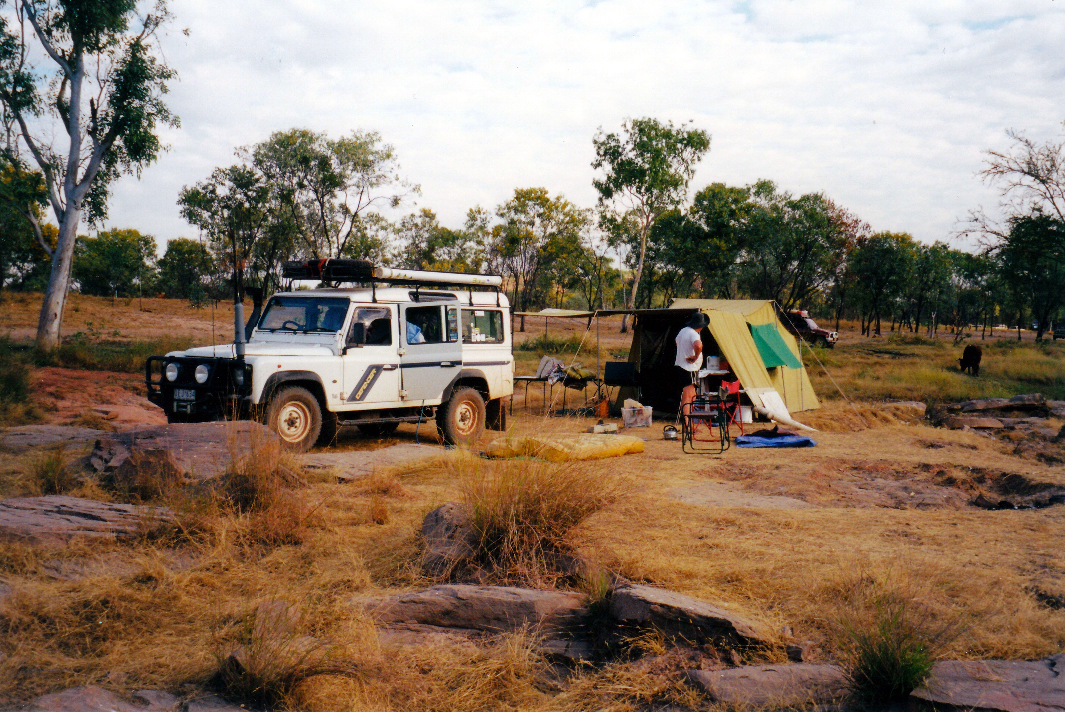
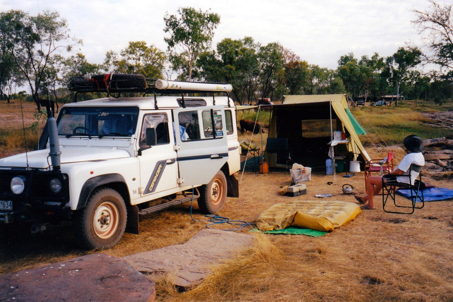
After straightforward travel ,we reached the turnoff to Barnett River Gorge at lunchtime. We followed the track, which seemed to divide a few times. It was not really clear where the camp area was – I thought it was a pretty informal camp place. We found a secluded spot beside a little creek, edged with pandanus and cadjeput. There were lots of mozzies, though. It was a pretty spot and John liked it.
Camp spot at the Barnett River Gorge area
We did the basic set up, then drove further along what appeared to be the main track, for about 3kms. The track ended in what did look like a place for camping – but not as nice as where we were.
We parked there, then walked upstream, across stony country between loops of the river, following a track marked by varied and creative rock cairns. That took us to the gorge rim. We followed along that for a way, then the track took us down into the gorge.
Cairns marked the route to the Gorge
The Barnett River down in its gorge
It was a lovely gorge, with red rock walls. It was quite wide, so there was enough light for a variety of vegetation to grow. There were pools and rapids.
Down in the Barnett River Gorge
After exploring we had a swim/wash in a pool – extremely pleasant!
Great place for a swim
This is a little off the main tourist itinerary so there were fewer people about.
It was about 4pm when we headed back. Even the walk back was enjoyable, though we did have to climb up onto the gorge rim again. We then drove back to our camp.
Kimberley Rose by the walk track
Tea was mushroom and garlic pasta, followed by tinned fruit.
There had been some build up of cloud through the day and thus there was a really deep red sunset. There was a ring around the moon tonight – I was not sure of the significance of this, in these parts though.
There were lots of birds around our camp area. We heard a pheasant coucal call.
Today had been out wedding anniversary – great to be spending it in the Kimberley!
We got up before dawn to drive back up The Bastion and look at the sun rise over the Gulf. It was alright, but not stunning.
Sunrise from The Bastion
We seemed to take ages to pack up and did not get away until 9.30. It was a very hot and sweaty job too.
Refuelled at Wyndham – diesel here was 2.8cpl cheaper than in Kununurra, at 98cpl.
I felt fine about leaving the van at the caravan park.
Drove back down the highway again, for 52kms, to the junction with the Gibb River Road, and turned west onto this.
Corner of the Gibb River Road and the highway
The Gibb River Road evolved over some time. It has become one of the classic dirt road drives of Australia. It closes in the Wet season and for much of the Dry can have wet stream crossings. Depending on when it was graded, it can be quite rough. A number of the cattle properties along its length have set up camp areas for travellers.
The route of the road follows the explorer Frank Hann’s 1898 route from the west, as far as where Mt Elizabeth now is. In 1901, the Brockman expedition came from the Wyndham end as far as Mt Elizabeth, then went north. They named the Pentecost and Durack Rivers.
From 1914, on, the pastoral settlement occurred and leases were taken up. Until the Beef Roads scheme of the 1960’s, the road was a rough track between Derby and Mt House, then it was improved for cattle trucks, and named the Gibb River Road, because it reached as far as the Gibb River. In the 1970’s, it was pushed through to the Wyndham end and also a road was formed north to the Kalumburu Mission.
It felt great to be on the Gibb again – finally! We drove this in ’93, from the other direction, and without a great deal of time to linger at its attractions.
It was a pity that it was so hazy from all the dry season burning in the region – it would affect the quality of my photos.
The Cockburn Range from the Gibb River Road
There was quite a bit of traffic on the road, until we passed the turnoffs to Emma Gorge and El Questro – obviously, people go that far and no further, even day tripping from Kununurra.
We kept encountering a tour group in a 4WD – a nice group. We saw them at Wyndham yesterday, and at the Gibb River Road turnoff this morning. John had flagged him down, just out of Wyndham, to tell him that one of his back wheels was very wobbly – he said he’d had it checked and it was ok. The group members are paying $1600 each, for an 8 day trip from Darwin to Broome!
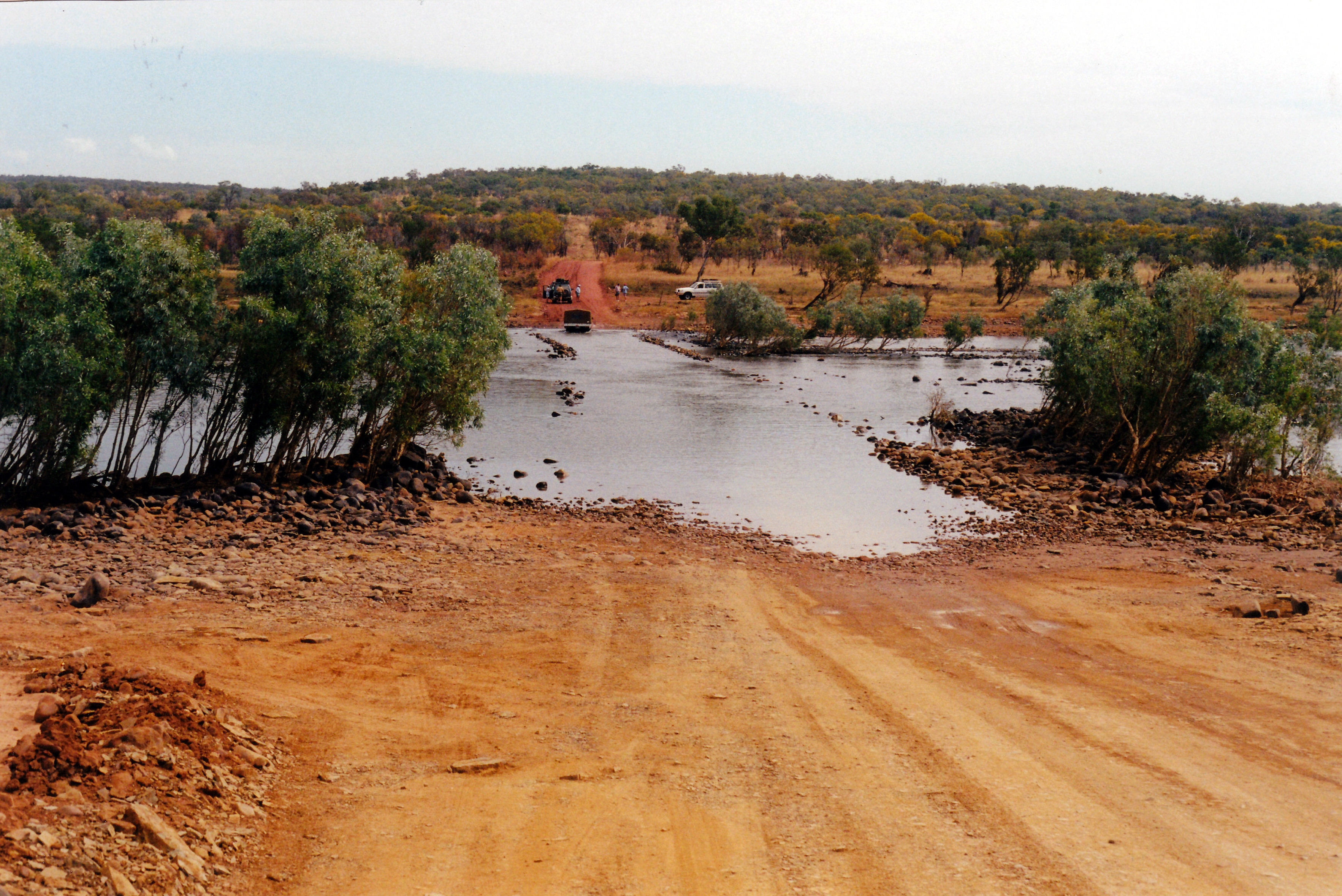
Almost 60kms along from the highway, we came to the main obstacle to travellers on the Gibb – the crossing of the Pentecost River. As one would expect, after a generous Wet season, it was quite wide. Our last time here, in ’93, it had been dry and there was a mustering camp in the river bed!
Approaching the Pentecost River crossing
This is one river crossing one does not walk to check depths first. There are very large saltie crocs live in the Pentecost – lots of them. It is also a place where I would never camp on the banks downstream from the crossing – though some do. El Questro is some distance upstream from here, by the river; we were camped there in ’93, in late June, when a good sized saltie was caught in the river pool below the main guest house.
We sat and watched some other vehicles do it – the route is clearly marked by rocks at the sides. It looked straightforward, although obviously a bit rocky, as vehicles crossing jiggled around a bit. It only looked to be about 45cms deep. We ploughed on through – yes, it was a bit rocky, but nothing major.
Crossing the Pentecost River
Looking upstream as we crossed the Pentecost
The Pentecost River downstream of the crossing. Home Valley Station land on the far bank
We stopped on the far side, to photo the crossing and the view back the way we’d come. The outlook back to the Cockburn Range was superb.
There was water draining out of the underside of Truck as John sat waiting for me!
Looking back across the Pentecost to the Cockburn Range
After the crossing, the road climbed up a ridge and we stopped at the Cockburn lookout at the top, to look at the way we’d come. There was a vast panorama across the wide Pentecost valley, to the Cockburn Range behind. This section of the Gibb is undoubtedly really scenic.
Pentecost River valley and Cockburn Range from Cockburn Lookout
A little further along the road, on a gentle corner, an oncoming rental 4WD that was going too fast, startled an eagle by the road side. it did not fly clear in time and was hit. It was horrible – feathers and pieces of eagle went everywhere. The bird was killed. It must have given the people a real fright, as it plastered across their windscreen. We certainly hoped so – it might have made them slow down after that. This incident highlighted what is actually the greatest hazard of the Gibb – other travellers going too fast. Overseas hirers of 4WD vehicles are the worst offenders.
After the Pentecost, the few stream crossings that we encountered were really just puddles, although the Bindoola Creek crossing was maybe 30cms deep, and edged with rock – presumably to keep travellers on a safe track through it, as there was a bit of a downstream drop off. The name of Bluey O’Malley’s crossing commemorates one of the pioneering drovers of the area.
Gibb River Road just before Bindoola Creek
Bindoola Creek ford
We stopped by the road side just after Bindoola Creek, for lunch.
Then we continued on, to Jacks Waterhole, or Durack River Station.
The Sinnamon family held the Karunjie and Home Valley pastoral leases, until last year, when they sold to the Indigenous Land Corporation. In the 1970’s, when the Gibb River Road was realigned to pass close to the Durack River in one section, Sinnamon set up a tourist operation at a large waterhole on the river, calling it Durack River Station.
Although the buildings at Jacks Waterhole look like they were once a station homestead complex, there was never one here.
At the office/store structure, we booked in. It had a cement floor and corrugated iron walls – these had marks on which recorded the levels reached in the ’97 and 2000 Wet season floods – about a metre up the walls! Apparently, the ’97 flood was a bit higher, but came up and went down fast, whereas this year’s lasted longer. The German lady – half of the couple managing the camp area – said that it had not been fun to come back after the floods to clean out all the mud. I bet! The location might be a great one from a tourist viewpoint, but it is very prone to flooding.
The waterhole was a lovely place – a long, tree fringed pool of the Durack River.
Jacks Waterhole on the Durack River
We paid $14 a night to camp here – no power or formal sites, of course, but a newish corrugated iron amenity block with flush toilets and hot showers – if one wanted hot, in this weather!
We cruised around the tracks in the camping area – all quite informal – and found ourselves a lovely spot to camp. There was no shade, but rocky outcrops and wet season erosion channels ensured no one else would be able to set up near to anti-social us! We had a brilliant view down over the waterhole, and it was not too far to walk up to the amenity block, on a bit of a terrace above us.
It was early afternoon when we’d reached Jacks Waterhole, so we were able to take our time, setting up camp with the big tent. Hoped that the occasional cow grazing nearby would not come too close to the tent!
Setting up camp at Jacks Waterhole – and watching the cow!
Then we sat and relaxed, looking out over the view. It was really peaceful and pleasant.
Lilo almost inflated. The “homestead” buildings in the background
The 4WD tour group we’d been encountering, were camped here too, and its members were swimming in the waterhole. I was not sure that I’d trust it to be saltie free! The camp manager had said there were barramundi in there – I’ve always believed that where there are barra, there can also be salties!
There were few other campers when we arrived, but there was a steady stream of arrivals through the afternoon. We were later surprised that three lots came in after dark, including one 4WD, towing a popup Jayco camper – at 9pm! Travelling the GRR in the dark seems rather silly to me – missing all of the wonderful scenery. That late lot had much difficulty finding somewhere to set up, in the dark, and in the end gave up and parked on a track. They then seemed to have much difficulty getting the top of the camper to wind up – not really built for these roads!
Later in the afternoon, John radphoned sister H. When he’d finished, I checked in with the VKS Base at Alice Springs, to let them know our location and intentions.
Tea was curried leftover sausages, rice, followed by melon.
The evening was pleasantly cool. We needed the doona.
During the night, there were lots of curlew calls in the distance – nice.
Woke to a day with some cloud about. We even wondered if it might rain, but it didn’t, and the cloud cleared a bit, later.
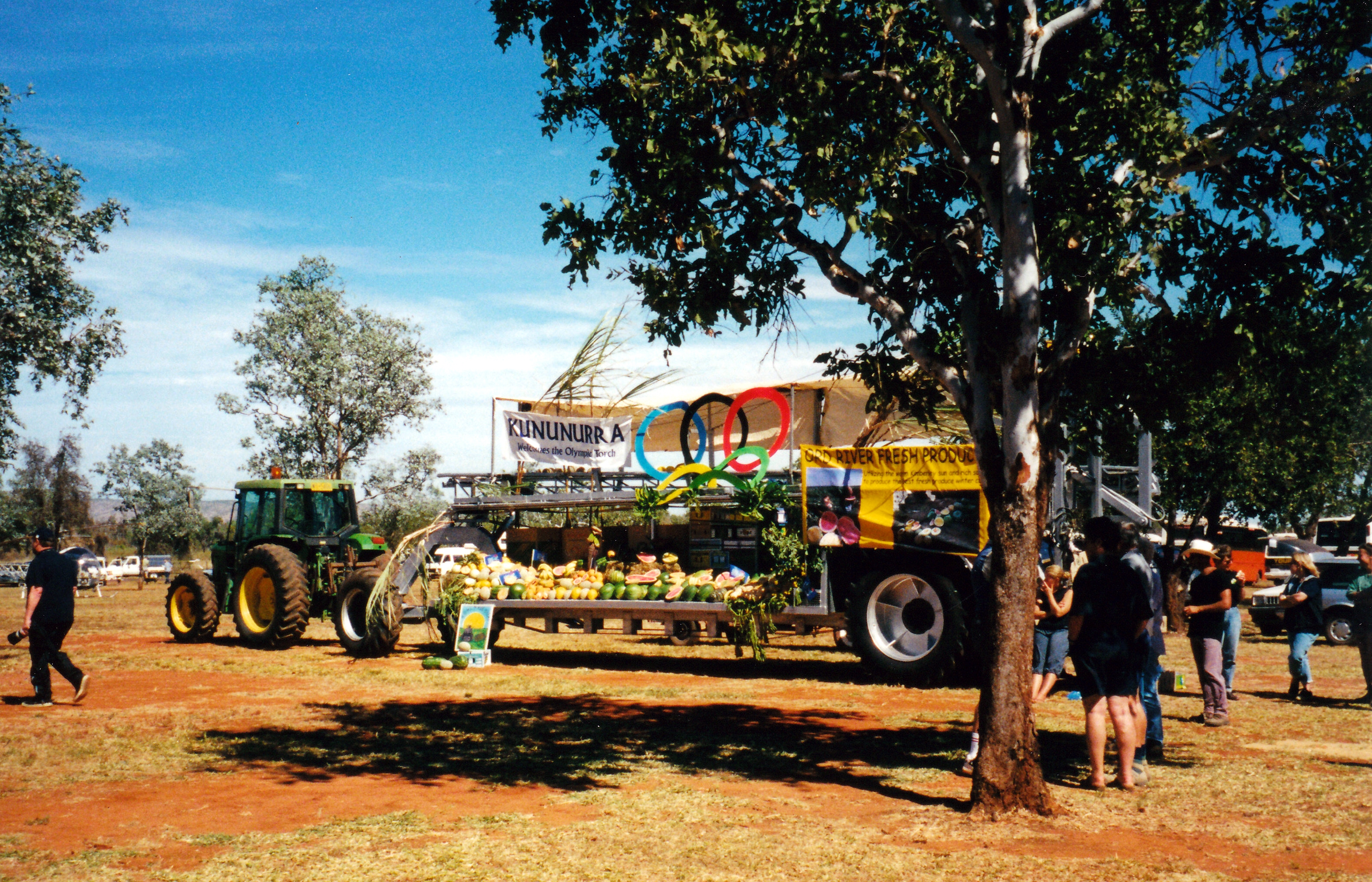
The Olympic Torch Relay was coming to town this morning, so we joined the throng going out to the airport, to see its brief stop there. The airport was the only place in town it would be.
There were many small planes and helicopters bringing people in from outlying areas. There were quite a few small buses – mostly Coasters – from local aboriginal communities in the car park, too.
It seemed to us like rather laid-back event organizing, but it did all come together.
The local fruit and produce growers put on a display stand, complete with some agricultural machinery. We scored some free melons, afterwards! They took around some cut up melon for people to eat, too, in the lead-up to the Torch arrival. A nice touch.
Display of produce and machinery by local producers
Premier Court of WA was there. There was a small media contingent, and AMP representatives – they were sponsors.
The Torch arrived by Air North commuter jet plane, from Darwin. There were several local Torch-bearers organized to carry it on a little procession, and they had escorts – guess that involved more people. One of the bearers was an old aboriginal lady, with very bad legs, in a wheelchair. A couple of the escorts were from Halls Creek.
Slingair flew in school children from all over the Kimberley – even from Kalumburu.
People arriving by helicopter for the Olympic Torch Relay visit
We saw the Torch go by, amidst the crowd. Later, John touched the Torch holder that one of the escort runners had.
The Olympic Torch
We watched the flame-carrying plane depart for its next whistle-stop, but few other people waited round, so the mass exodus happened before we left.
We went back to town, and put the wheel with the bad tyre in for changing – before the coming GST applies!
I put in two more films for processing. We had to do some banking. Refuelled Truck – 96cpl.
Went to the Tourist Information Centre, which is a modern, slick operation, here. Found out that the track to Mitchell Falls is open now. Bought the annual notes on the Gibb River Road and surrounds, produced by the Derby Tourist Bureau. A staff person phoned Mt House Station and found out for us that the Tablelands Track is too wet to use, at the moment. We remain hopeful that, by the time we are looking to go that way, it might be passable. That is the reason we plan to leave the van stored and take to the tent for our trip into those parts – would not be any hope of taking the van on the Tablelands Track.
I picked up my photos and was pleased with them.
I paid for another five nights at the caravan park. The price had risen – because it is July and the onset of GST – to $19.80 a night, after discount.
John went back to the tyre place and collected the wheel with the new tyre on it. The man there did not make any adverse comments about the suitability of our Dunlop tyres for these parts. Since he had what we needed in stock, there must be some demand for others for them, up here.
Tea was savoury mince and bread.
There was a lovely sunset. It was a bit cooler at night.
Today was the last day GST-free! The media was full of GST talk and speculation and dire predictions about its likely impacts.