
TUESDAY 7 SEPTEMBER MT IVE TO PORT AUGUSTA 477kms
Today’s plan was to drive south west, to Streaky Bay, on the coast of the Eyre Peninsula. We were definitely ready for some sea again! We still had, roughly, six weeks before needing to be in Melbourne to catch the ferry to Tasmania. Time enough to explore sections of the coast as we headed back that way.
Before leaving Mt Ive, spent some time adjusting the van brakes because the left wheel was locking when the brakes were applied. We seemed to fix it, by trial and error, and driving up and down a station track, testing the adjustments.
The drive south, through the Gawler Ranges, past Yardea and Paney Stations, was very pleasant and varied. The roads were unsealed, of course, to Minnipa. In places, the surface was gravel, but there were occasional slightly sandy sections too.
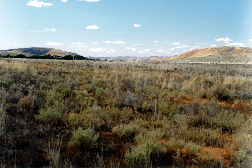
Gawler Ranges from Yardea road
John had done the usual entering of navigation points on the GPS, last night – useful, because the wasn’t a lot of signage.
We stopped to look at an unusual, large, round stone tank or well. The pastoral relics in these parts are most interesting, with a history of sheep grazing going well back into the 1800’s.

Old stone water tank on Yardea Station
We detoured slightly, to Pildappa Rock, not far from Minnipa. This is a “wave” rock formation, quite high, with good views from the top. Technically, it is a pink granite inselberg.

On top of Pildappa Rock
There were stone gutters built at the base of the rock, to collect and channel water – every little helps, in that dry country.
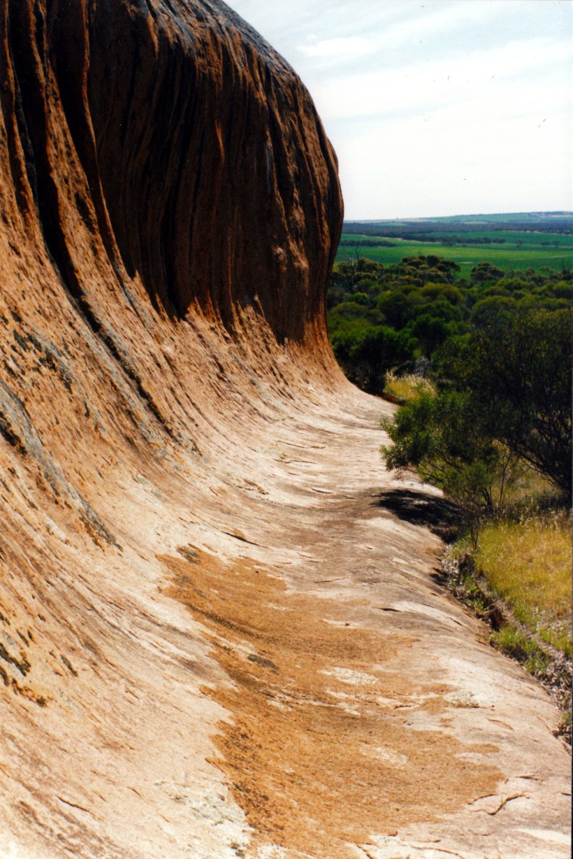
Water collecting gutter built at base of Pildappa Rock
We had our lunch at Pildappa Rock, then climbed to the top – which was quite easy as one side is almost stepped, with gradual rises up. The walk up, and exploring on the top, was interesting. There were natural rock waterholes, of varying sizes, in the rock surface, some with plants growing due to the moisture. The top was quite extensive and we wandered all over it.
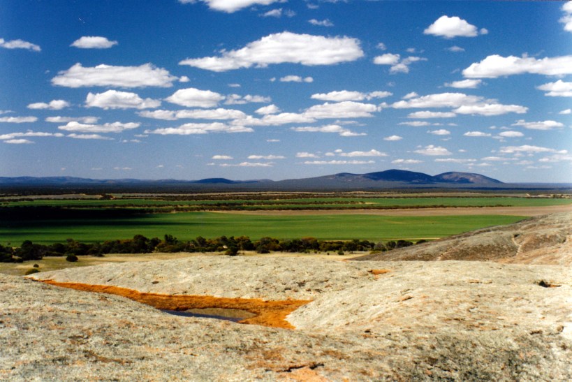
Gawler Ranges seen from top of Pildappa Rock, and a gnamma rock waterhole
We reached the Eyre Highway at Minnipa, about 3pm, and turned west. Turned on the mobile phone and found there was a signal and a message downloaded from John’s sister H, asking him to phone her. We stopped and John did this. One of the other sisters, N, was in hospital in Mornington, in her last days, and was hoping to see John.
We continued driving on, debating about what we should do. Our initial reaction was that we were too far away, and that it would take us days to reach Melbourne. But, near Poochera, we decided to turn around and try to make it back before she died. John needed to at least think that he had made the effort. If he was too late, he would at least be there with the family for the funeral.
From then, we alternated the driving, having about 320kms to go to reach Port Augusta, which seemed like a feasible place to stop for the night. The last hour was spent driving in the dark. The number of semi-trailers on the road seemed to suddenly increase as it got dark! That last hour was not enjoyable at all – and it was me driving!
We made no stops, except to change drivers, and to get fuel at Kimba – adding just a top up of 20 litres, at 84 cpl.
Noted that the bulk of Iron Knob, as we passed it, looked huge and impressive.
In Port Augusta, bought take away chicken and chips, and went to the Port Augusta Holiday Village. After the Big 4 discount, this cost $15.30. We were able to stay hitched up, and did a very minimal set up.
John phoned H for an update and to let her know what we were doing.
We went virtually straight to bed after that, gearing up for a very early start tomorrow.
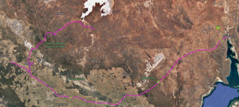
Our roundabout route to Port Augusta
