This Adventurous Age

Adventures travelling and working around Australia.


Leave a comment

1998 Travels December 7

MONDAY 7 DECEMBER     LAKE MARABOON

We drove to the gem fields for a day trip. Took the highway for 45 kms to the west of Emerald, then turned north on a sealed road.

Cruised around Anakie, Sapphire and then went on to Rubyvale. It was just the usual sort of lightly timbered grass and scrubland until we got to Sapphire. Here the houses were somewhat higgle-piggle  – it did not look as if the place had ever been surveyed or properly laid out. There were rough sign boards advertising gems for sale and some cottages that seemed to be on claims.

Just out of Sapphire, we crossed the Tropic of Capricorn. There is a bottle shop and drinking establishment built there.

Between Sapphire and Rubyvale, could see signs of large scale machine mining, in places.

Rubyvale appeared somewhat more of a “normal” township – at least along the main street. But once away from that, the straggle of camps on claims became more evident.

In the tourist information, we’d seen an ad for Old Mick’s gem cutters and shop. The name had appealed to John, who calls me “Mick”, so we had to go there. It is actually run by a lady, but named for an old timer on the fields.

We spent some time chatting to J, the shop owner. I ended up buying a ring from her – a lovely parti-colour sapphire (mostly yellow) on a nice broad band. It cost $340 and is to be my Xmas present.

12-07-1998 Old Micks Gem shop Rubyvale 2.jpg

At Old Mick’s Gem Shop with my Xmas present

J recommended that if we wanted to go fossicking in the area, to go to the Washpool Fossicking Area. There are several designated fossicking areas around the gemfields – where large scale machine mining is not allowed, and where claims are not pegged. The Washpool area is to the west, a few kms from Rubyvale. We tucked that information away for possible future reference.

Moved on to a place that was on a claim, along one of the winding, unsealed tracks that make up most of the township. It provided the gear, and taught visitors how to sieve the gravel wash and look for sapphires in it. This cost us $5 each for a bucket of gravel each. We found some bits of sapphire. John is better at the sieving than I am and gets the interesting bits more concentrated in the middle of the sieve load than I can. He found two “cutters” – stones that were big enough, and uncracked enough to be worth faceting.

12-07-1998 sapphire diggings at Washpool area.jpg

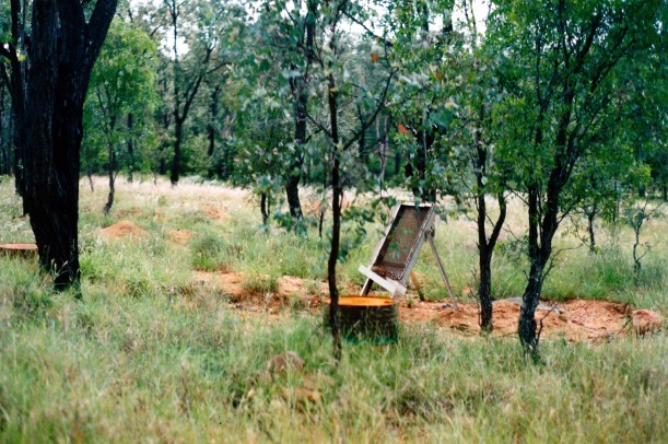
A typical scene on the fossicking areas – but with “green season” grass

I’d asked J if she knew of JJ and she told us that he was living out on Mt Leura station, on the Keilambete road, several kms out of town. So we drove out that way, found the property and drove in. A man came out to investigate, at the noise of the vehicle – and it was JJ. He was surprised to see us, obviously, but seemed pleased. We spent a couple of hours there, talking with him. He has a sort of caretaker’s role at the property, as the owner is away a bit. So he has a cottage to live in, there. He has a cute little Chihuahua called Zac. J offered to take us “specking” – looking for sapphires – on the property, if we came out to stay at Rubyvale, as we told him we were thinking of doing. We arranged to meet him next Saturday, in Rubyvale.

Back in Rubyvale, drove past the caravan park and thought it looked alright. Nothing lavish – one would not expect that, out here.

Drove back to camp, thinking it had been quite a fruitful day, and thinking that we would move out to Rubyvale next.

I made lentil cakes, with a lemon yoghurt sauce. Got the recipe from a newspaper. John did not like them and I wasn’t all that keen. Don’t win them all!

We drove 214kms today.


Leave a comment

1998 Travels December 6

SUNDAY 6 DECEMBER     LAKE MARABOON

I got up early. John slept until later.

It was nice sitting outside in the early morning – with a little cooling breeze and lots of birds.

After breakfast, we drove to Emerald and bought the weekend papers. Emerald is much more of a “proper” town than I had expected. I had associated it with the gemfields and assumed it was typical of such settlements. But it is not on the gemfields at all – they are some 80kms to the west. It is a service town, predominantly for the surrounding agriculturalists. It is growing very fast, due to the growth of irrigated cropping and new cotton farms nearby. From what we heard on the local news, aerial spraying of crops is a hot local issue, due to possible contamination of beef from the sprays. We did see some crop dusting as we drove – those pilots are crazy!!

On the way back to camp, bought some mangoes from a roadside stall.

We had a phone call from our Canberra friends. They are off to South Korea soon, for a month, and after that soon off again – to India for three months. Obviously, overseas travel, especially in Asia is what they enjoy most. Each to his own. I have no wish to travel overseas, these days, whilst there is still so much of this country to experience.

I phoned K to report our location. He says he is getting the pool ready for summer. That is good to hear.

Had a quiet day after that. Read the papers. Knitted some of a vest that I am making for P for Xmas.

We tried to phone JJ – the ex-husband of a close friend, who we knew had moved to the sapphire fields near Emerald. I found an address and phone number for him in the local phone book. But the number will not connect. Has he moved? Died? Not paid his bill? Gone south?

In the late afternoon, walked up to the lookout over the dam and read all about it on the information board there.

Tea was tinned fish, salad, leftover noodles.

12-07-1998 sunset lake maraboon.jpg

Sunset over Lake Maraboon


Leave a comment

1998 Travels December 5

SATURDAY 5 DECEMBER   CHARTERS TOWERS TO LAKE MARABOON   518kms

We were up at 6.15am and away at 8.10, after a good, uneventful pack up.

It was a hot day, of course.

We found it a rather monotonous drive south to Emerald. From Charters Towers, as far south as the Cape River – about 125kms – the road was mostly just a one width strip of bitumen; after that it was a normal two lane road and was pretty good. There were a couple of long stretches of road works on the single width sections.

We wonder whether weekends are THE days for moving extra-big loads? Had to pull over – right over – for five different lots, all with police escorts front and rear. Two lots had big dredges or machine buckets; one was a big shed or building; two were big machines, with huge double sets of wheels hanging over the edges of the tray of the carrying vehicle. They were monster loads.

12-05-1998 wide load south of belyando.jpg

It is a good thing that the road has wide shoulders – south of Belyando Crossing

The country was a mix of scrub and grazing lands, but was pleasantly green.

We stopped at Belyando Crossing for a drinks break. Truck finished up parked by a big stock road train that came in after us, which dwarfed our rig. We worked out that the road train had 62 wheels. Would cost a lot to get new tyres on that!

12-05-1998 belyando crossing.jpg

Our rig is dwarfed by a road train at Belyando Crossing

There was a big coal mine – Blair Athol – just north of Clermont.

We did not deviate to drive into Clermont township, which is slightly off the main road. We had originally thought of overnighting there, but John was feeling able to push on to Emerald.

We had lunch at a roadworks site, south of Clermont.

The Peak Range in the distance, to the east, made the last 100kms or so, more interesting to travel. Closer to Emerald, we came into farming country which was quite lush.

We bought fuel in Emerald – 75cpl. It is hard to account for the variations in fuel prices that we are encountering.

Then drove on out to Lake Maraboon Caravan Park, by the Fairburn Dam, some 20kms south of Emerald. We had decided that this sounded a more pleasant place to stay than in the town.

The Fairburn Dam was built across the Nogoa River for irrigation and forms the second largest dam in Qld, after Lake Dalrymple on the Burdekin. We drove over the dam wall and spillway to get to the caravan park. The road over the dam wall was not all that wide and it is definitely not the sort of feature I like driving over! We got good views, though.

The caravan park looked ok, so we booked in for a week. It cost $81 after Top Tourist discount and we get a free night. Pretty good deal, we thought. The place turned out to be rather busy and noisy today, though, with a large group out here for a Xmas party – with many children. There is some sort of cafe place attached to the park that obviously caters for such things. There were also motor boats and water skiers down the hill at the lake. But, we have a pleasant site. Hopefully, things will quieten down after the weekend.

There are lots of rainbow lorikeets and apostle birds around the park.

After we got set up, went for a walk along part of the lake side, where there was a path. We needed some exercise after the day of sitting.

Tea was vegie stir fry with hokkien noodles.

12-05-1998-to-lake-maraboon


Leave a comment

1998 Travels December 4

FRIDAY 4 DECEMBER     CHARTERS TOWERS

Another fairly quiet day, as it was even hotter.

We did some grocery shopping. Checked out the Post Office, in case there was any more mail – there was not. Fuelled up Truck – 63cpl.

Drove up to the Rotary Lookout, which gave us a very good view over the town. The gold mines of early Charters Towers were so spectacularly successful that, for a time, it was – rather egocentrically – known as “The World”. From the Rotary Lookout, one can see a large water tank on another hill, with a “The World” sign on it – a very prominent feature.

12-01-1998 08 from LO World sign on tank.jpg

Towers Hill, and its water tank with The World painted on it.

During WW2, Charters Towers was an important military base.

12-01-1998 09 Charters Towers town centre.jpg

Charters Towers town centre from Rotary Lookout

John played more of his computer game. I had a swim. We did some preliminary packing up.

Late in the afternoon, we went for a long walk around the neighbourhood streets.

Bought fish and chips for tea.


Leave a comment

1998 Travels December 3

THURSDAY 3 DECEMBER     CHARTERS TOWERS

Today was a relaxing day after the big one yesterday.

Hot and humid seems to be the norm, now. It really makes one want to laze around camp, rather than do much that is active.

I did the washing. Had a swim. Did embroidery.

John played the computer game for much of the day.

After tea – rissoles and salad – he went to bowls, from 7pm to 10.30pm. It does make more sense to play in the cool of the evening, with the weather as it is.

I worked on the Xmas letter.


Leave a comment

1998 Travels December 2

WEDNESDAY 2 DECEMBER     CHARTERS TOWERS

Today we drove to Ravenswood, another former gold mining town, but this one largely derelict. It is 90 kms east from Charters Towers and predated it, having been established when gold was found there in 1868. When four prospectors discovered signs of gold at what was to become Charters Towers, it was to Ravenswood that they rode to register their claim.

On the way, we stopped at Macrossan, where the highway and railway both cross the Burdekin River. Both bridges are high, in deference to the flood scale of which this river is capable. The railway bridge, built at the end of the 1800’s,  is a massive structure. Next to it, and only visible from certain angles, is the new bridge that replaced this in the 1960’s. On the western side of the river is a signpost that shows previous flood heights; some were not far below the railway bridge decking! The Burdekin has a very large catchment area, and one that can be affected greatly by cyclones, as they move inland.

12-02-1998 11 burdekin rail bridge.jpg

Burdekin River and the railway bridges, seen from road bridge at Macrossan

We drove to near the base of the rail bridge, on the eastern side, where there is a rough picnic area. John reckons the steel work of the old bridge would not have been strong enough for today’s trains.

12-02-1998 01 old and new Burdekin rail bridges.jpg

The old and new railway bridges over the Burdekin

Leichardt camped near here, too, in 1845. It was he who named the Burdekin River.

Ravenswood is brilliant! There are lots of old mine remains and mill stacks. Old machinery lies around. Some buildings are being restored. There is now (since 1995) a Mt Isa Mines/Carpentaria Gold mine working again, so the town has revitalized somewhat. It was really picturesque and we spent much of the day wandering about.

12-02-1998 08 Ravenswood vista.jpg

View over part of Ravenswood with the grand Imperial Hotel prominent

12-02-1998-05-ravenswood-smelter-remains

Stamping Battery relics

I was really taken with the set of steps, that is all that remains of the Browns Hotel. They stand in splendid isolation, going nowhere. Judging from the steps, the hotel must have been a fairly grand building.

12-02-1998 09 browns hotel steps ravenswood.jpg

The former front steps of Browns Hotel. Thorp Buildings behind.

Drove out to the feature called the White Blow, about 5kms from the town. This is a large white quartz outcrop, unusual because quartz is usually in veins and this looked more like a hill of the stuff – could have maybe been the junction of two big veins?

12-02-1998 07 white hill ravenswood.jpg

The White Blow quartz outcrop

Then John just had to take on the challenge of driving down the signposted “Very Steep Descent” on the Ayr road, which we did easily. Of course, we had to turn around and come back UP the very steep descent! This challenged Truck only slightly more.

Went to the Ravenswood Cemetery and had our usual explore of headstones and markers.

12-02-1998 02 Ravenswood miners hut.jpg

A miner’s hut at Ravenswood, with smelter stacks in background

12-02-1998 03 mabel mine ruins ravenswood.jpg

The remains of the Mabel Mill and stamping battery relics

In our wanders, managed to identify two new birds – a babbler and a pippit – as well as see excellent “old” ones, including lots of koels. These migrate in from South East Asia in spring, to breed here over summer, and they have a distinctive call. The babblers get around in sociable, quite noisy groups, a bit like apostle birds. The pipit was a solitary fellow; he twitches his tail up and down. Technically, he is a Richard’s Pipit.

12-02-1998 06 Ravenswood relics.jpg

Mining relics lying about all over the place at Ravenswood

On the drive back to Charters Towers, we went through a heavy shower of rain. In all, we drove 224kms today.

Made a zucchini sauce to go with pasta, for tea. I used spiral pasta, which was a good choice with the rather creamy sauce.

We were both really tired after the day’s excursion, in the heat, so it was early to bed.


Leave a comment

1998 Travels December 1

TUESDAY 1 DECEMBER     CHARTERS TOWERS

It is the first day of summer. Up here that is, officially, the start of the cyclone season.

We visited the Tourist Information Centre, where I added to the information I’d picked up previously, in other places, about this area and places further south we might go.

Then we walked and looked at some of the superb old buildings. John went and browsed in the Mining Museum; I wandered about, window shopping and put in a film for processing.  Picked it up after an hour and was satisfied with the photos.

12-01-1998 01 Charters Towers Stock Exchange building.jpg

The Stock Exchange Arcade and other grand buildings

We inspected the old Stock Exchange Arcade, which is superb. Yes – Charters Towers was so important because of its rich gold mining that it had its own stock exchange, from 1890 to 1916. This facilitated the trading of shares in the various mining companies, on the world stage. The arcade has an intricately tiled floor, and there is a barreled vault roof and stained glass use.  There are little shops tucked in behind columns, inside. Maybe these were once stock brokers’ offices?

12-01-1998 04 stock exchange building c towers.jpg

Inside the Stock Exchange Arcade

After lunch we did the tourist drive, as outlined in some of the gumpf I collected. This took us out to the weir on the nearby Burdekin River. There was a lot of water pounding over this – quite awesome to look at. It would be tremendous in a flood time.

12-01-1998 07 dam burdekin.jpg

The Town Weir on the Burdekin River

12-01-1998-06-burdekin-r-down-from-dam

Burdekin River downstream from the Town Weir

The rest of the drive was just so-so.

There was a lot of lightning happening, within the clouds to the SE, later in the afternoon.

After tea of steak, salad and mushrooms, we drove to the Rotary Lookout to try – unsuccessfully – to take photos of the lightning.

I really like that this town is preserving and maintaining so many of its grand old buildings.


Leave a comment

1998 Travels November 30

MONDAY 30 NOVEMBER     CHARTERS TOWERS

It was a hot and humid day.

After breakfast, John worked on printing “our” Xmas cards – on paper, rather than card.

I drove to the centre of town and collected our mail from the Post Office. The PO building is one of the grand old ones, opening in 1893, with a tall clock tower that is quite a landmark, although it was added to the original building in 1898.

12-01-1998 03 charters towers.jpg

The ornate Post Office building, dating from the 1890’s. Note the unusual metal “lacework” on the near building.

I also bought a few  groceries.

There were two big packs of mail, a parcel that contained the KKND computer game that John ordered to send to K for his Xmas present, and a letter from my brother.

Back at the van, I sorted the mail. It has been a while. Apart from my brother’s letter there was a nice haul of personal mail for me – one from each of P and K, and three from former work colleagues. But there were also bills – for water and shire rates, subscription renewal for the 4WD radio network, LandRover Assist premium for Truck. The Telstra bill is still too high! I wrote cheques as required and got them ready for mailing.

After all that work, I had a swim and relaxed in the cool inside the van for the rest of the day.

Tea was sausages and salad.

After tea, J phoned R for a chat.


Leave a comment

1998 Travels November 29

SUNDAY 29 NOVEMBER     CHARTERS TOWERS

It was a hot morning. I got up at 6.30am; John slept till 9am.

After breakfast, we set up the scanner on the bench in the van, and worked on scanning some photos we could use to make our own Xmas card, based on this year’s travels. We have so much material, it seems a shame not to use it in some way.

Left at 12.45 to go to bowls. We played on a grass green which I found very hard to adjust to, after the synthetic green of Atherton. My bowls were all over the place. John did better. It was very humid, and cloud built up during the day.

I made a Chinese recipe book meal for tea – beef, baby bok choy (instead of the water spinach specified by the recipe) and Szechuan pepper. With rice, it was an excellent meal.

I phoned home and spoke to P. K was out. Let her know we’d moved on.

It was spitting rain by 9pm, with much sheet lightning in the distance. But there was no heavy rain to clear the air and it stayed a bit too hot for comfort through the night.


Leave a comment

1998 Travels November 28

SATURDAY 28 NOVEMEBER   GREENVALE TO CHARTERS TOWERS   220kms

We were up early and away by 8am. Still being hitched up made departure much quicker. We refuelled in Greenvale – 76cpl.

The road was mostly the single width strip again.

There were a few drops of rain as we left Greenvale, but apart from that it was dry – and hot.

The country we drove through today was more interesting than that of yesterday – there were some more hills and low ranges appearing. The road ran almost parallel to the coastal range. There was really green grass, a couple of feet tall. Most of the creek channels had some water in them. It is good to see the country at this time of the year, when it is going green.

Reached Charters Towers – the size of which rather surprised me – just before 11am. Went straight to the Post Office in the centre of town, but it was closed. Could tell by just driving past, so did not have to worry about trying to park the rig. John then got me to navigate him to the Bowls Club, so he could check that out. There were no games happening there, as we drove past.

Went into the Charters Towers Caravan Park, on the southern outskirts of town. In order to get a spot with some shade, we had to take an en-suite site, but it was only an extra $2 a night, at $16 a night, with the seventh night free, so we booked in for a week. Our site is quite pleasant and it is a little luxury to have our own adjacent bathroom.

It was pretty hot, setting up in the middle of the day – mid 30’s, and there were stinging midgy type things about.

After set up, we drove back to the centre of town and bought the papers. John checked out the RSL Bowls Club and booked us in for a game tomorrow.

After lunch, I had a swim in the pool – pleasant.

We put the air-con on in the van – lovely and cool.

When it started to get cooler outside – about 5pm – we went for a walk for a couple of kms around the nearby streets. Being on the outskirts, the area is a bit of a mixture of older and newer houses, vacant land, some light industrial type uses.

Charters Towers looks to be a really interesting town. We have passed a huge cemetery. Perhaps that reflects, in part, the privations of its early days as a mining town. Gold was found here in the 1870’s and there is still some mining today. Charters Towers was, for a while, the second largest town in Queensland – only Brisbane was bigger. There is evidence of this in the scale and grandeur of some of the buildings in the city centre. We only glimpsed these, driving through, but they look very impressively upkept or restored.

Had our Friday fish and chip dinner a day late.

It stayed hot through the night and was not a very comfortable night for sleeping.

11-28-1998 greenvale to ct.JPG