This Adventurous Age

Adventures travelling and working around Australia.


Leave a comment

2009 Travels August 21

FRIDAY 21 AUGUST     FORREST BEACH TO CHARTERS TOWERS   270kms

We were up at 6am, courtesy of a very loud kookaburra, right by the van. It was a more pleasant way to wake up than via the alarm clock.

Did a steady pack up. John checked the tyres, all round. He took his photo album of all the furniture he’d made, to show N. We were invited by N and her family to go round and visit them if we were back this way, next year.

At this stage, our thinking was that next year’s trip would bring us back to North Queensland. We still wanted to go back to Cooktown and Cairns, and there were some lovely coastal places to stay between Townsville and the Daintree.

Had a brief stop in Ingham, for me to return library books, and left there just after 9am.

Proceeded mostly uneventfully southwards – the familiar route! For the last 30kms or so before the highway became multi-lane, north of Townsville, we were caught in a tail back behind a SA registered Supreme van. He was another of those whose speed varied greatly, according to whether there was any chance that someone might be able to pass him. He ended up with about thirty vehicles behind him, including some trucks. Moron!

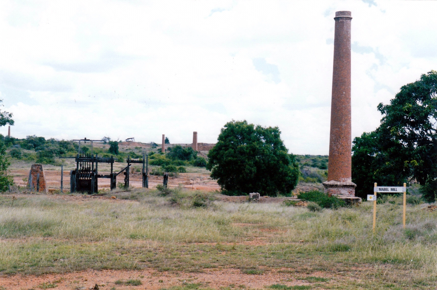
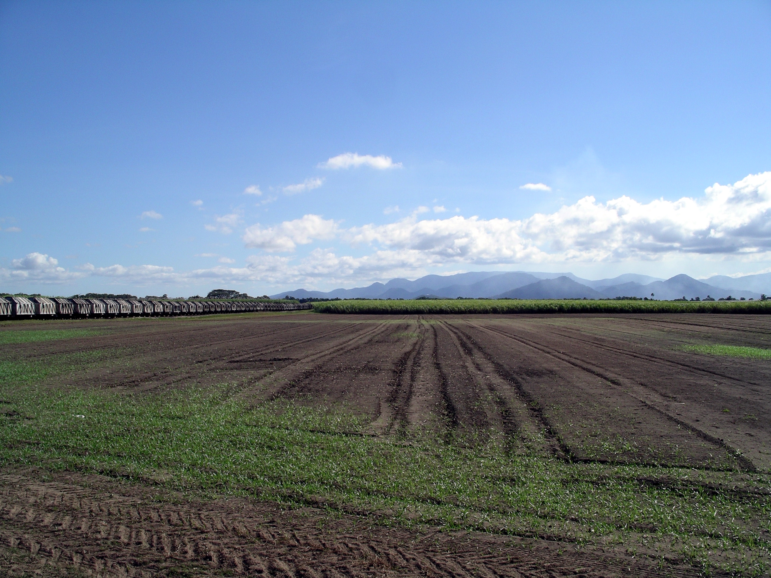
We would miss the sugar country, with all its interesting harvest activity, and the green-ness of it.

Goodbye to green cane fields and the backdrop of the mountains

The new Ring Road around Townsville made that section easy.

The climb up the Dividing Range from Townsville is the easy way to reach the inland. For much of the way the gradient is so gentle that the railway runs close to the highway.( Railways can only manage gentle gradients.)

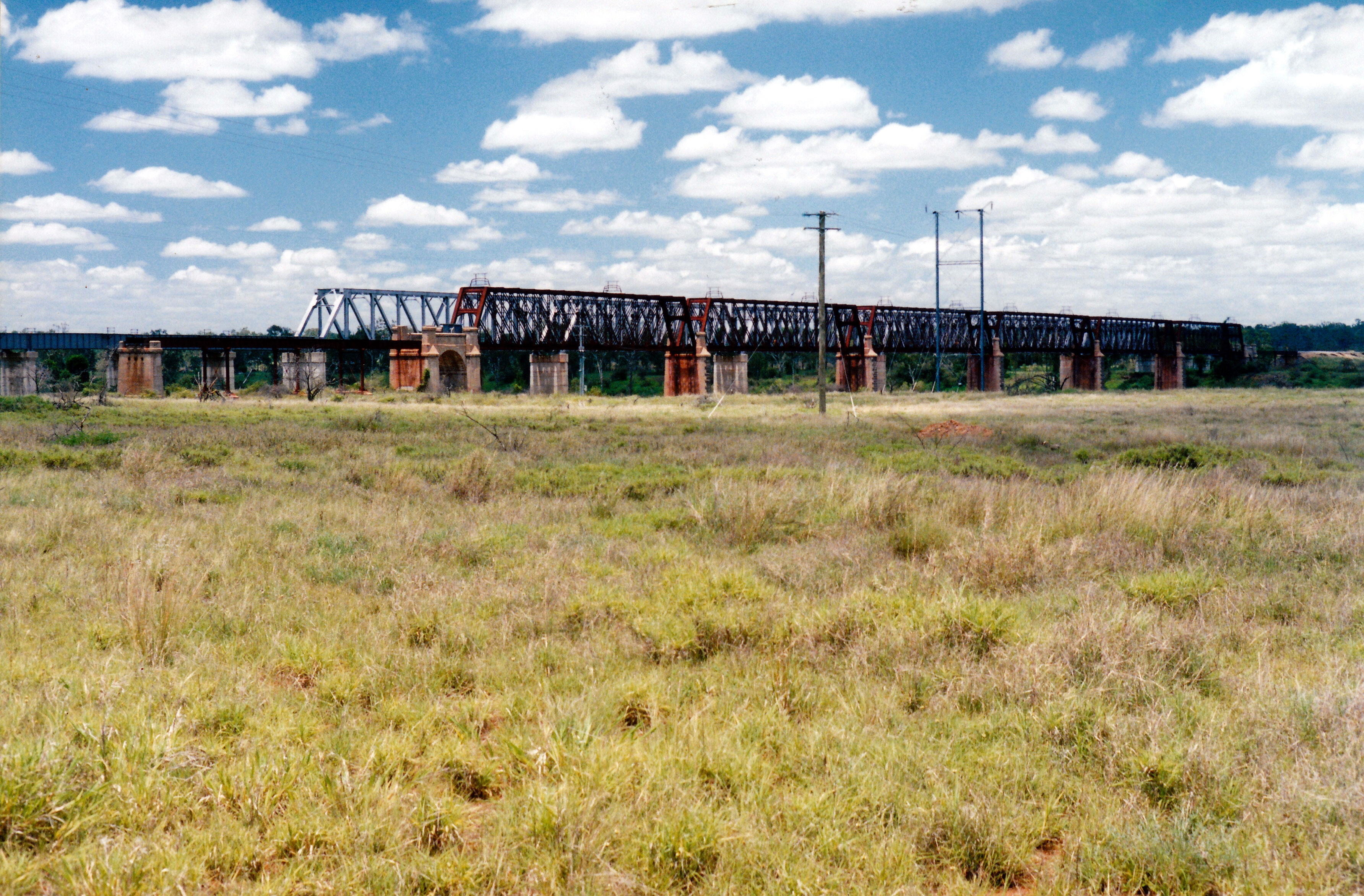
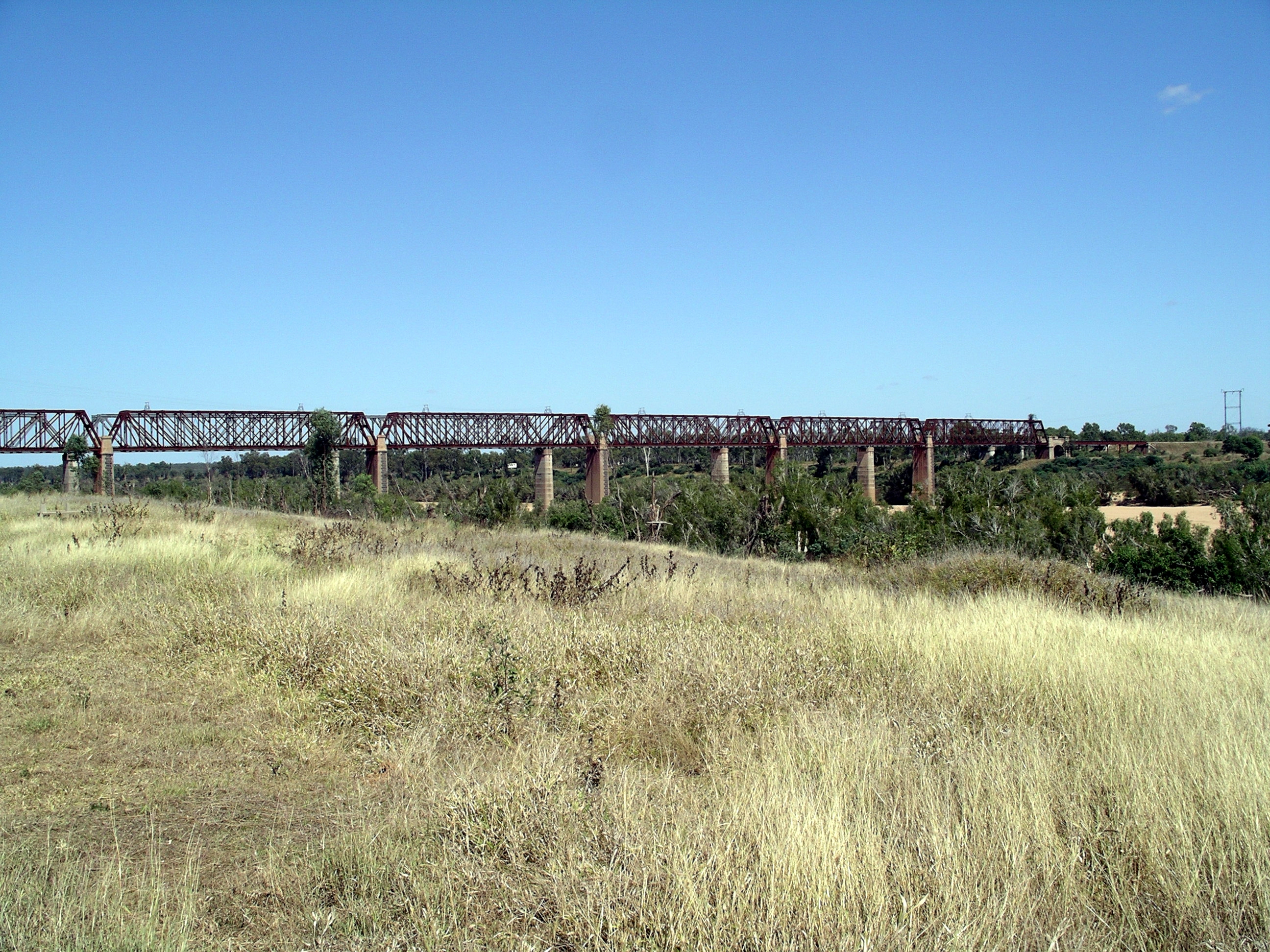
We stopped at Macrossan, by the bridges over the Burdekin River, for lunch – which I’d packed this morning – and a bit of a walk around.

Burdekin River bridges at Macrossan

The old and new railway bridges were close to each other and high above the river. The impressive old structure was built in 1899 and designed to be above the highest flood level recorded to that time. The fact that it is so high above the river bed level, showed what huge floods this river has.

The advent of new, heavier diesel engines created the need for a new bridge, which was built right next to the old one in the 1960’s.

Old bridge in front, piers of new bridge evident behind it

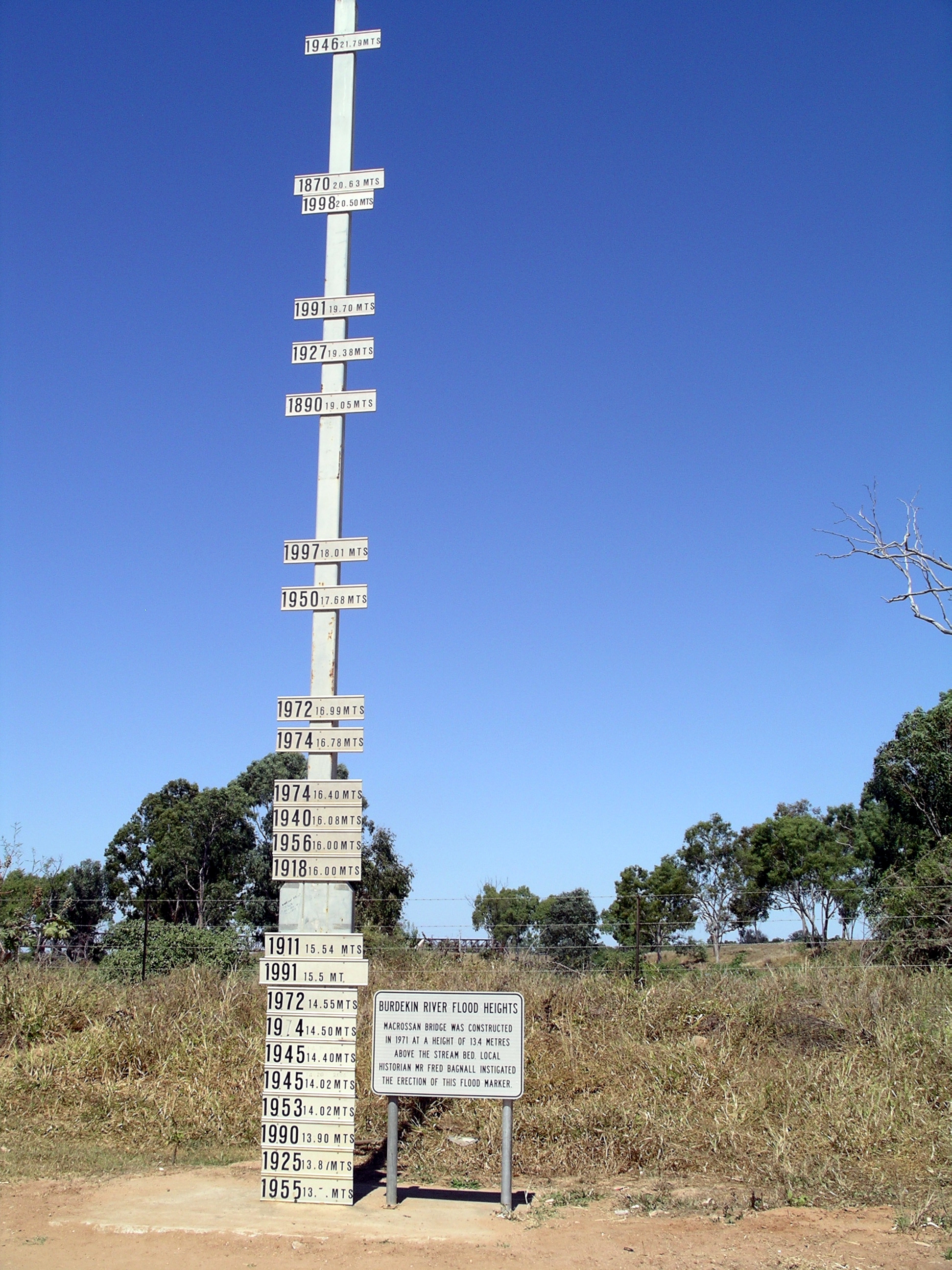
On the western side of the road bridge across the Burdekin was the flood marker – unique in the levels it showed.

The railway bridge in the background

Standing by the marker made us feel awed enough, by the water levels that reached well above where we were. But the marker itself stands some 13.4 metres above the bed of the Burdekin River – now that makes those floods truly awesome. I couldn’t begin to imagine how much water goes down that river in flood times.

The floods earlier this year reached  20.75 metres on this marker, a metre below the record flood level of 1946.

……and they left room at the top for a new record!

Refuelled on the way in to Charters Towers, then went on to the Dalrymple Tourist Park, where our powered site, after Seniors discount, cost $25.65. The site was partly shaded, and we were able to stay hitched up.

We were setting up by 1.30pm, after which John had a nap.

I defrosted the fridge again. The heat and humidity we’d had at Forrest Beach seemed to make it ice up faster than usual. At least, I hoped that was the reason.

The amenities block here was spotless, sparkling clean and modern – much appreciated after what we’d had for the last month!

It was hot – around 30 degrees in Charters Towers today. It was forecast to be warmer over the next two or three days. There was news of bushfires in the Brisbane area.

We had apostle birds around our camp – now we knew we were inland again……

Tea was threadfin salmon from the freezebox, in beer batter, with fries.


Leave a comment

1998 Travels December 2

WEDNESDAY 2 DECEMBER     CHARTERS TOWERS

Today we drove to Ravenswood, another former gold mining town, but this one largely derelict. It is 90 kms east from Charters Towers and predated it, having been established when gold was found there in 1868. When four prospectors discovered signs of gold at what was to become Charters Towers, it was to Ravenswood that they rode to register their claim.

On the way, we stopped at Macrossan, where the highway and railway both cross the Burdekin River. Both bridges are high, in deference to the flood scale of which this river is capable. The railway bridge, built at the end of the 1800’s,  is a massive structure. Next to it, and only visible from certain angles, is the new bridge that replaced this in the 1960’s. On the western side of the river is a signpost that shows previous flood heights; some were not far below the railway bridge decking! The Burdekin has a very large catchment area, and one that can be affected greatly by cyclones, as they move inland.

12-02-1998 11 burdekin rail bridge.jpg

Burdekin River and the railway bridges, seen from road bridge at Macrossan

We drove to near the base of the rail bridge, on the eastern side, where there is a rough picnic area. John reckons the steel work of the old bridge would not have been strong enough for today’s trains.

12-02-1998 01 old and new Burdekin rail bridges.jpg

The old and new railway bridges over the Burdekin

Leichardt camped near here, too, in 1845. It was he who named the Burdekin River.

Ravenswood is brilliant! There are lots of old mine remains and mill stacks. Old machinery lies around. Some buildings are being restored. There is now (since 1995) a Mt Isa Mines/Carpentaria Gold mine working again, so the town has revitalized somewhat. It was really picturesque and we spent much of the day wandering about.

12-02-1998 08 Ravenswood vista.jpg

View over part of Ravenswood with the grand Imperial Hotel prominent

12-02-1998-05-ravenswood-smelter-remains

Stamping Battery relics

I was really taken with the set of steps, that is all that remains of the Browns Hotel. They stand in splendid isolation, going nowhere. Judging from the steps, the hotel must have been a fairly grand building.

12-02-1998 09 browns hotel steps ravenswood.jpg

The former front steps of Browns Hotel. Thorp Buildings behind.

Drove out to the feature called the White Blow, about 5kms from the town. This is a large white quartz outcrop, unusual because quartz is usually in veins and this looked more like a hill of the stuff – could have maybe been the junction of two big veins?

12-02-1998 07 white hill ravenswood.jpg

The White Blow quartz outcrop

Then John just had to take on the challenge of driving down the signposted “Very Steep Descent” on the Ayr road, which we did easily. Of course, we had to turn around and come back UP the very steep descent! This challenged Truck only slightly more.

Went to the Ravenswood Cemetery and had our usual explore of headstones and markers.

12-02-1998 02 Ravenswood miners hut.jpg

A miner’s hut at Ravenswood, with smelter stacks in background

12-02-1998 03 mabel mine ruins ravenswood.jpg

The remains of the Mabel Mill and stamping battery relics

In our wanders, managed to identify two new birds – a babbler and a pippit – as well as see excellent “old” ones, including lots of koels. These migrate in from South East Asia in spring, to breed here over summer, and they have a distinctive call. The babblers get around in sociable, quite noisy groups, a bit like apostle birds. The pipit was a solitary fellow; he twitches his tail up and down. Technically, he is a Richard’s Pipit.

12-02-1998 06 Ravenswood relics.jpg

Mining relics lying about all over the place at Ravenswood

On the drive back to Charters Towers, we went through a heavy shower of rain. In all, we drove 224kms today.

Made a zucchini sauce to go with pasta, for tea. I used spiral pasta, which was a good choice with the rather creamy sauce.

We were both really tired after the day’s excursion, in the heat, so it was early to bed.