This Adventurous Age

Adventures travelling and working around Australia.


Leave a comment

2000 Travels March 6

MONDAY 6 MARCH     QUEENSTOWN

Early on, the day looked like there would be high cloud, maybe even some sun.

It was a public holiday in Tasmania – the 8 Hour day; perhaps a bit like our Labour Day.

After breakfast, and completing some odds and ends, we drove out along the unsealed track that follows the old ABT rail alignment. There is a 4WD track that follows this for some of the old route. At Halls Creek, behind the Bradshaw sawmills, there was a sign saying the bridges were unsafe for driving on, any further. To this point, the track had been rather rough, with a number of big, wide, puddles and a ford or weir to cross that was not too deep, but running. Guessed there would have been a bridge there in the rail times.

03-05-2000 old rail alignment near Queenstown.jpg

Road along the old railway alignment out of Queenstown

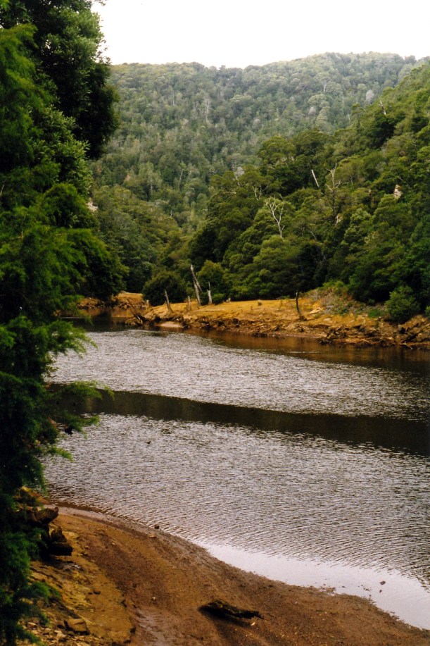
We ate our packed lunch by the Queen River, at that point, then left Truck parked and started walking.
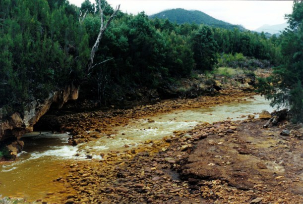
03-05-2000 Queen River near Queenstown.jpg

Queen River

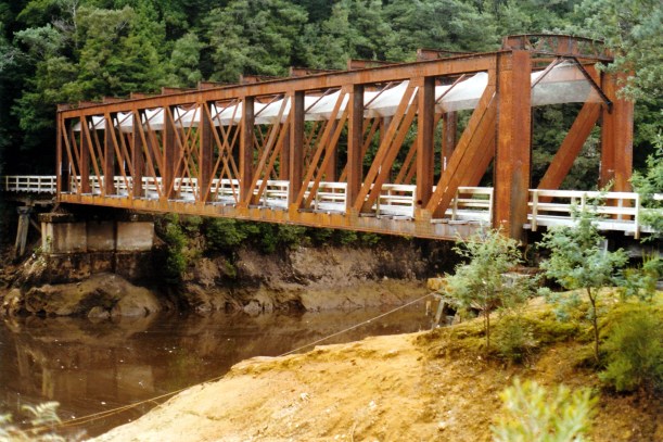
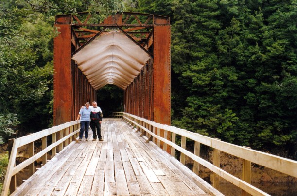
A few hundred metres from the start, we passed a parked ute, and then a broken bridge. We were able to cross this on a couple of laid planks, but vehicles had made a little side track that forded the creek, below.

03-05-2000 J on old ABT bridge

Narrow track and planks across a rickety bridge

Then we encountered a man picking blackberries. He said his dog had wandered off. Further along, we were passed by a man and a couple of kids on a 4 wheeler buggy.

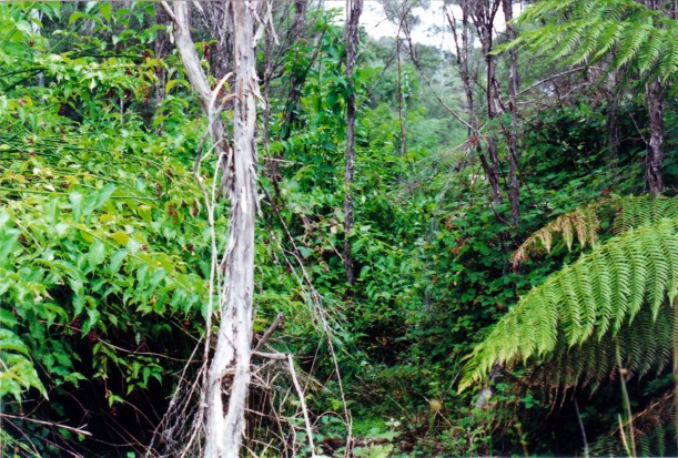
The track narrowed to normal railway width. We could hear the sound of the rushing waters of Halls Creek to our right, but the valley by then was too deep and forested to see it.

We crossed several bridges that had planks laid over them – obviously for the use by 4WD vehicles. We would never have attempted to take Truck over some of them, though! In one place, a landslip had been used to fill in a gully where a bridge had been, but it looked to be slipping away again.
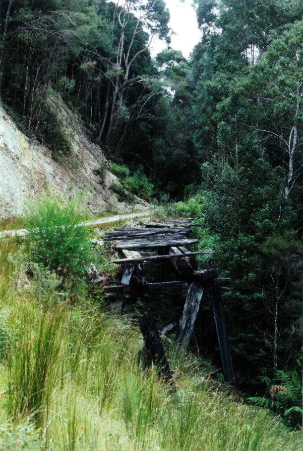
03-05-2000 old abt bridge

Broken bridge

We plodded steadily up the rising track. This was the 1:16 gradient that had used the ABT cog system – though the rails had long gone, of course.

Eventually we reached the Rinadeena site, that was the highest point on the old railway. There were a few traces of buildings here, if one looked closely, but the area was largely overgrown. It is less than forty years since all was abandoned, but the vegetation grows quickly it seemed.

03-05-2000 was rinadeena yards.jpg

This was open space and rail yards, some 38 years ago – Rinadeena station site

A work site for the railway restoration had been cleared – with a bulldozer there – and an access track coming in from the Strahan road. That was never there before!

There was  a little brown mouse-like creature coming out from the bushes to feed on the ground, and then going back in again. There had been quite a lot of bird life along the track – thrushes and the like.

We walked back to Truck. The blackberry man was gone, but his dog was there. Was nothing we could do about it, except to hope it knew its way home! Or that he would come back, looking.

I thought that, overall, we’d walked about 7 kms.

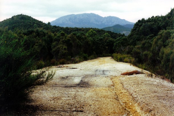
Drove the Anthony Road again, now that the cloud had lifted. This time, could see big vistas across lakes, to huge mountains. It was obviously a previously glaciated area and was quite awe inspiring, though not as spectacular as John had expected. At the junction with the Murchison Highway, turned around and went back to Queenstown on the same road.

Back in Queenstown, John parked outside a shop, while I went in to get milk. A lady driving a red people mover pulled in, to the No Standing area right in front of him, and in doing so drove too close and grazed the corner of our bull bar – which is solid steel. He was astounded. She actually denied hitting Truck and raced off to the shops. Unbelievable. No damage to us, but John reckoned that, in better light, she’d see the evidence down the side of her van. Her problem!

Drove 130kms today.

We packed up the awning and outside furniture. The lone traveller came over for a chat.

Tea was macaroni cheese.

The stay in Queenstown has been very pleasurable, because we have been able to access so much wonderful, wild, country.

03-05-2000 around qtown.JPG

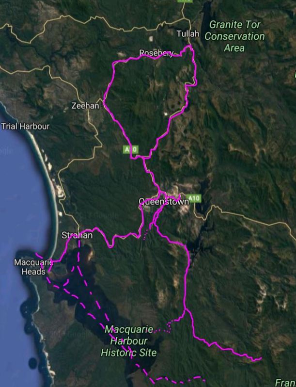
Assorted explorations from our Queenstown base


Leave a comment

2000 Travels March 2

THURSDAY 2 MARCH     QUEENSTOWN

There was a good warm drying wind this morning, so I washed, including the bedding.

Went to the Post Office, posted some letters and collected our bag of mail.

Took the flat tyre to be fixed. Turned out we must have had a faulty tube in there, because it had split. A new tube and the labour only cost us $15 – very reasonable.

Dealt with the mail. Was pleased to receive letters from V and my brother, and information on the family book launch and associated gathering. Brother had included a photo of my nephew, in his new Year 7 Trinity uniform. Nice of him. There were some bills, too, which we went back to the Post Office to pay.

I was concerned that the four packets of photos I’s been expecting, from the Glenorchy photo shop, were not in the mail bag. I’d mailed them the films  and negatives while we were still at Dover, and they were to send the completed photos home. I hoped that they’d not gotten too wet in our letterbox to send, or gotten lost.

After lunch, went to the Gallery Museum and browsed there. They had a huge collection of old photographs, painstakingly presented and explained. Included were photos and information about Pillinger and Crotty. It really was an excellent display – much better than we’d anticipated – and we spent a couple of hours there.

03-02-2000 new abt station.jpg

The building that would be the Queenstown terminus for the restored ABT Railway

We went and fetched a couple of containers of water from the standpipe, to put in the van tanks.

John left me at the van and went off to access some Internet for an hour, from 4-5pm. I read the papers we’d collected.

Tea was chow mein, which made John happy.

After tea I started writing a letter to V.


Leave a comment

2000 Travels February 27

SUNDAY 27 FEBRUARY     QUEENSTOWN

It was a bit misty this morning, and we were late getting up.

After breakfast, set out for Strahan.

We drove past the caravan park and had a look. It does appear to be in better condition than in ’93, but not by much. There are now some permanent amenity blocks at least. We are definitely better off in Queenstown.

02-27-2000 Strahan shacks.jpg

Strahan houses – colourful!

We spent some time in central Strahan. Booked ourselves onto a Gordon River cruise for Tuesday, as the weather forecast for that day looked ok. Bought a topo map – the Franklin sheet – that covers the Mt McCall area.

I put four rolls of film in for processing at the Kodak shop, after they assured me that their work would be good. I hoped I was not being gullible.

We drove out the King River Forest Drive – out along the Lowanna road beside Macquarie Harbour, then the dirt road alongside the King River. This took us to the old Iron Bridge, part of the former ABT railway, near the Teepookana locality. The road track followed the old rail alignment and was very narrow in parts, and with the King River right below.

02-27-2000 king river nr teepookana.jpg

The King River from the Drive

The King River still had the polluted sludge banks evident in piles alongside its channel – from the days when the Mt Lyell Mine and smelter in Queenstown used the Queen River water in their processes, and then discharged the untreated waste straight into the river. The Queen is a tributary of the King. Even though the mining practices have changed in recent times, these rivers are probably the most polluted ones in Australia. The sulphuric acid residues remain a major problem.

02-27-2000 King R Teepookana and mine sludge

The King River near Teepookana – and polluted mine sludge residue

Gold and copper mining began in the Queenstown area in the late nineteenth century, with smelting of copper commencing in 1895. Back then, there were no roads into the region and so, in 1897, a railway opened between Queenstown and Teepookana, near the mouth of the King River. This was to bring the mine products to a port there, for export.

The building of the 3’6″ gauge railway had to overcome major problems. The terrain was mountainous and heavily forested. There were many streams. Cuttings were dug by hand, some up to twenty metres deep. The original 35km long railway had 48 bridges, the longest of which was the “quarter mile” bridge – approximately 250 metres long. They had difficulty finding a firm foundation for this, having to dig down a great distance into the river silt. Even so, trains could only go at walking pace across this bridge, as any greater speed would cause it to sway too much and collapse! It was high up above the river.

The problem of the steep gradient from Queenstown up to Rinadeena siding – 1 in 16 – was solved by using the Swiss ABT rack and pinion system, for some 7kms. The train engine could engage with this central “rail” and pull itself up.

In 1899 the railway was extended from Teepookana to Regatta Point, near Strahan, where the bay was deeper. This necessitated the building of the Iron Bridge over the King River at Teepookana. Later, the railway extended right into Strahan. What had been a busy little port town quickly declined.

02-27-2000 iron bridge teepookana.jpg

The Iron Bridge, near Teepookana

The first road to connect Queenstown to the outside region was the Lyell Highway, in 1932. In the 1950’s, a road was built between Queenstown and Strahan, and this spelled the end for the railway, as the many wooden trestle bridges were too costly to upkeep, and there were increasing concerns about the Quarter Mile Bridge.

The last train ran in 1962. I was fortunate enough to do the return trip on the railway in May, 1962, and remember the Quarter Mile Bridge swaying quite noticeably as the train crawled over it. The bridge was virtually only the width of the rails, so one looked straight down from the open train windows – and the river was a long way below!

In 1964, with three friends, I walked the disused railway track, camping a night at Dubbil Barrel siding and even riding hand operated trolleys some of the way. These had just been left at sidings when the railway closed! Crossing the Quarter Mile Bridge on foot, high above the river, with no side rails, was very scary!

This bridge was, by 1972, partly washed away by floods and by the 1990’s most of the old track, bridges, sidings and station buildings had fallen down, been burnt in bushfires and overgrown by the lush vegetation of these parts.

Now, the decision had been made to rebuild the ABT Railway as a tourist railway and work was obviously  happening at both ends.

Because of this, the Drive was blocked at the Iron Bridge. It used to allow one to drive as far as the former Teepookana town site. We walked around the fence and across the bridge, with another Victorian couple who had fetched up there at the same time as us. They took a photo for us, on the bridge. When the former rail alignment here was set up as a tourist drive, wooden planking and side rails were added to the bridge, and mesh was slung between the top girders to stop flakes of rusty metal falling on cars and walkers.

02-27-2000 iron bridge mesh

The Iron Bridge altered for road traffic

It was a pity that we could not access the walk to the old Quarter Mile Bridge. Apparently, a tour operator can take customers up to the Teepookana Plateau, for $30 a head. John is not inclined to do that, at this stage.

John found a healthy looking Huon pine tree growing by the King River, and wanted a photograph with it.

02-27-2000 huon pine king r.jpg

John with Huon Pine at the King River

On the drive back to Strahan, we looked at the ABT Railway terminus at Regatta Point, which is being restored. This is where the new tourist railway will terminate.

02-27-2000 regatta pt abt terminus

Regatta Point Railway Station being restored

In Strahan, we went to the huon pine sawmill, and looked at the mill and associated gallery of timber pieces. They had some great products, bowls especially, and some very evocative wax painting by a local artist.

We collected my photos. They were beautifully done. It was not cheap, but he gives a replacement film “free”. For $1 a roll extra, I could upgrade from a 24 exposure to a 36, so I got 4 rolls of 400 speed for, effectively, $4. That shop also had huon pine wood products for sale. I liked the wooden cribbage boards – an idea for John to make sometime for Xmas presents: wooden board, Tasmanian illustrated playing cards, printed game rules, in a box. I also liked the shaped garlic bread dishes, with a natural edged top, about 1cm thick, and naturally curved, hand carved, I think.

At the Strahan bakery, I bought a loaf of damper bread and some rich, indulgent fudge.

After a full day, we drove back to Queenstown. The highway between the towns is 41kms, so it is not that far, but overall we managed 156kms for the day.

Tea was cold roast chook, the damper bread which was very nice, and the fudge which was yummy!