This Adventurous Age

Adventures travelling and working around Australia.


Leave a comment

1999 Travels May 29

SATURDAY 29 MAY   OODNADATTA TO MARLA   221kms

We got away early today. We will be pleased to leave.

Refuelled at the Pink Roadhouse – 90cpl. That is reasonable for such an isolated place. The driving conditions along the Track seem to be really eating up our fuel. We have gone from getting 8 or 9 kms per litre, to about 6kms, along here.

05-29-1999 as it says.jpg

We did not stop to look any further around the town, or go and look at the waterholes on the Neales River, near here, which may also have been a better place to stay.

About 17kms north of Oodnadatta, the road divides. The Old Ghan Track, proper, continues north, as the railway did,

This section of the track was much rougher than previous ones. There were a lot more corrugations. There was little to stop for, apart from a coffee break. I found the country interesting though, its vastness, the occasional low hills or creek lines, and the like.

We reached Marla at lunch time.

Booked into the Travellers Rest – sort of a caravan park that was part of the roadhouse. We were charged $18 for a powered site a night – but it is clean, has reasonable facilities, including drinkable water, and there is toilet paper! We paid for two nights because John has a plan for tomorrow.

Upon opening the van, I discovered that the door had come off the fridge and was lying on the floor, along with spilled capers, yoghurt and soymilk, that had been in the door shelf  – all mixed in with a thin layer of red dirt. The motor was running constantly, but the freezer had not defrosted, for which I was most thankful. The swivel attachment that the door opens and closes on, had given way – there must have been a lot of vibration from the corrugated road sections.

With some difficulty, John managed to remove some tight screws, and took the offending part off the door and to the roadhouse workshop. They welded it back together. John was most relieved that this could be done. He reassembled the door.

I had quite a lengthy cleaning up job to do. The spilt milk had seeped into cupboards, at floor level. Fortunately, soy milk will not smell as bad as ordinary milk would have, in time! The floor rugs would  have to be washed.

It is disappointing that the fridge did not hold together better; it is designed to be a marine fridge and I guess rough seas are not as severe as corrugated roads. Now that we were focussed on the fridge, it was obvious that the door was held on only three corners – the top and bottom hinge pins on one side and the top corner where the door fastener is, on the other. The lower corner on that side could flex and try to open when it was rough. John worked out how we could fasten that corner too, quite easily. There was already a little protruding bar, for use by the hinge if the opening side of the door was changed, so it had a pre-drilled hole in. John drilled a corresponding hole up into the bottom of the door, found a small bolt in his collection of oddments, and a small nut. It was a little fiddly, but the bolt screwed up through the hinge hole and the nut and into the door. The nut prevented the bolt unscrewing and the door was held firmly. We hoped this would prevent any future such accidents. Putting the bolt fastener into the door became part of the departure routine and with practice I was able to do it quickly and easily.

We walked over to the hotel part of the road house complex and bought a six pack of beer from the bar and some grocery items from the store section. The beer cost $12!

Sat outside the van and watched other campers arriving. This caravan section got really busy, later in the day. It does not have separately marked out sites – people choose where to set up – so it became rather Rafferty’s rules in the drive through sections, with people blocking others in.

Tea was the last of the curried soup, then salad, with hard boiled eggs for John and cheese for me. Our perennial staple of yoghurt for dessert.

05-29-1999 to marla


Leave a comment

1999 Travels May 28

FRIDAY 28 MAY   COWARD SPRINGS TO OODNADATTA   293kms

We were a little slow getting away this morning as the lass “next door” came and asked to have a look at the van. The guy was off to Coober Pedy for tyres – a 280kms round trip on rough roads. If it was his driving style that caused their flat tyres, I hope he has learned a lesson – otherwise he might not get to Coober Pedy! It is worrying for them, though, with the bulk of the Oodnadatta Track still ahead of them.

We did not make many stops today. The first was at Beresford Bore – another former siding. The fettlers’ cottage building there looked to be rapidly deteriorating. It was a similar style to Curdimurka. The Beresford Bore was still flowing.

05-28-1999 01 beresford fettlers cottages.jpg

Fettlers’ cottage at Beresford Bore siding

05-28-1999 02 J at Beresford Bore.jpg

Beresford Bore was still flowing

We took a track near Beresford Siding, for a short distance. This led to the remains of a rocket tracking emplacement – a reminder that rockets were test fired from the nearby Woomera Range; some came this way and landed in these parts.

05-28-1999 03 was rocket tracking emplacement nr Beresford.jpg

This was a rocket tracing emplacement

William Creek was our next stop, where there is a hotel. Apart from a rough camp area behind the hotel, nothing else! It claims to be the smallest town in the world.

05-28-1999 05 william ck pub.jpg

William Creek Hotel

Since just north of Coward Springs, we have been driving through Anna Creek Station – the largest operating livestock property in the world, and part of the Kidman cattle empire. William Creek is on the property. The hotel dates from last century and the building of the Overland Telegraph. I presume it was also a rather welcome stop for railway passengers too. Since the railway closure it must make a living from stockmen from the properties up this way, and tourists. It has become rather a tourist icon.

At the hotel, we bought a beer and a coke – have to do our bit for the local economy! We also topped up with fuel – the hotel sells this, too. $1 a litre!

Here, there is a display of some remains of rockets that have come down in the area.

05-28-1999 06 rocket remains william ck

Rocket remains. Something like this landing nearby could ruin a peaceful camp!

I took a photo of the quirky Pink Roadhouse sign at William Creek. The family that has, for years, had this  roadhouse at Oodnadatta has – in the interests of the travelling public – put up these signs where they felt directions/information is necessary. They are a real landmark item.

05-28-1999 04 sign william ck

Not far north of William Creek we stopped for lunch. Took a side track towards the creek channels – quite a pleasant spot. The flies were incredibly thick. One had to be careful to just get sandwich in the mouth!

05-28-1999 07 wendy driving.jpg

Bit of a dip, here

05-28-1999 09 Pink Roadhouse sign and track

Another of the Pink Roadhouse signs

Our next stop was at the Algebuckina Bridge – a long, high, steel structure that is very dramatic in this isolation and is the longest bridge in SA. Below it were the mangled remains of a car that had tried to use the rail bridge to cross the flooded Neales River – and met a train coming the other way!

05-28-1999 10algebuckina bridge.jpg

The train won! Algebuckina Bridge over the Neales River

05-28-1999 11drivers eye view.jpg

What the train driver saw – Algebuckina Bridge

Through today, we’d noticed several dry creek areas that would have made good overnight camp places, as well as the often used bush camping area at the Algebuckina waterhole. I would have liked to stay the night at the latter, rather than pushing on, but John wanted to keep going. With hindsight, we’d have been better off staying at one of these, instead of at Oodnadatta!

With the exception of the Neales/Algebuckina waterhole, the watercourses were all dry. The track was pretty good. I drove for a while, because John got tired. I felt quite comfortable towing the van on the dirt road, but we were not going very fast.

05-28-1999 08 Ood Tk nth of William Ck

The Oodnadatta Track

We noticed that the railway alignment criss crossed the road several times on today’s route.

05-28-1999 12 country sth of oddnadatta & mt dutton

Some distant hills – south of Oodnadatta

We got into Oodnadatta about 4pm and booked into the caravan park attached to the Pink Roadhouse. We paid $16.50 for a powered site. The amenities were in an Atco building and were not very clean. The toilet paper in all cubicles had run out and was not refilled.

After the basic set up, we went for a walk in the township. It is extremely ramshackle. There is one substantial building – the former railway station, made of stone and now a museum;  one has to obtain a key to go have a look in it, and we were too late. And that is about the “key” to Oodnadatta, from what we saw – lock up anything worthwhile, otherwise it will be broken or nicked!

We saw some falling-down houses. There are a number of indigenous occupied houses, some looking alright, others very damaged, all behind high tin fences. There was a lot of rubbish lying about.

Today was apparently pension day. There was a big group of aboriginals gathering under some trees in the centre of town. There were lots of kids riding bikes around, but we were pleased to see that most were wearing helmets as they tore around.

The Pink Roadhouse is a large establishment – a store and eatery too. But we found it abysmal on service and staffing levels.

We saw that there was an aboriginal school – named as such – and it seemed to be the only one in town. The existence of such a school was, we thought, an encouraging sign that some people are trying to get things together.

It is just a pity that the township has such a neglected, derelict, grotty atmosphere. I think I had formed romantic notions about Oodnadatta, from reading history and novels, so I was expecting a place I could react to positively.

Tea was soup, baked beans on toast, yoghurt.

We are both tired tonight, so we had an early night.

05-28-1999 to oodnadatta


Leave a comment

1999 Travels May 27

THURSDAY 27 MAY     COWARD SPRINGS

I got up at 7.15, not sure why I was wide awake at that hour! John slept until 9.30.

I went walking in the cool but pleasant early morning. Watched the lady proprietor water their camels – about seven of them. They get water every second day, otherwise they fill their stomachs too much. They were amusing to watch – and they have beautiful eyes.

I walked to the wetland area/bore overflow and looked at birds. Saw a spotless crake flitting about.

05-27-1999 01 Coward Springs bore outflow.jpg

The wetland created by the bore outflow at Coward Springs

It did not take long for the flies to descend in droves.

The sky looked like it could turn to rain, for a while in the morning, but it lightened off during the day.

After breakfast, John and I went walking along the wetlands and channel. We saw two more new birds – white fronted chat and black-eared cuckoo. This is a wonderful area in the otherwise dry country.

We wandered about and looked at the historical railway remnants here. There are two buildings, one of which appears to be the home of the owners.

05-27-1999 02 Coward Springs engineers cottage.jpg

The old engineer’s cottage – with new roof

After an hour or so of walking, we’d had enough of the flies, so retreated to the van for a while.

For lunch, made ourselves spam and cheese sandwiches, toasted on the open fire. Yum.

After lunch, went driving because John decided that he wanted to find some sleeper remains that he could cut and take home to make woodwork items. We found some lovely old red woods – two different kinds it seemed. Two varieties of red gum? Or red gum and something else? John cut a couple of pieces – obviously, we can’t take much, though. I have in mind a pepper grinder – would be great to have as a memento of the Track.

05-27-1999 03 wood for turning.jpg

John cutting up old sleeper for woodwork material

05-27-1999 04 old ghan rail remains.jpg

The old railway alignment, with the road to the left

A couple who came into the campground during the afternoon, and camped near us, had problems. They’d had three flat tyres between Marree and here! That seemed most strange to us but we did not like to quiz them about it. But we wondered: poor driving as in too fast? Too heavily loaded? Or just a really dud brand of tyre. They will have to leave their camper trailer here and go to William Creek tomorrow for repairs. We certainly had no tyre trouble on that stretch and it really did not seem the sort of surface, to me, that should cause issues.

I used the fire to make curried potato and tomato soup, for these cold nights. But I must use less curry next time!

05-27-1999 05 Coward Springs making soup.jpg

Making soup

Late in the afternoon, John went for a dip in the artesian spa, and enjoyed it greatly. I just had a shower, which was also great – nice warm water from the donkey heater.

05-27-1999 06 spa at coward springs

John in the artesian spa

The sunsets here are truly spectacular.

05-27-1999 07 sunset coward springs.jpg

Coward Springs sunset

We cooked sausages on the BBQ grill over the fire, for tea, with potatoes baked in foil in the coals. Followed that with yoghurt and bananas.

We sat round the fire again, after tea. There was a breeze, which was pleasant and it kept the mozzies away. The moon was bright, amongst a lot of small clouds.


Leave a comment

1999 Travels May 26

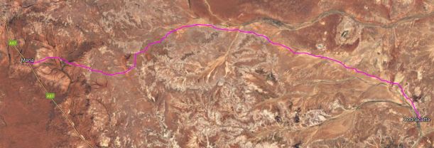
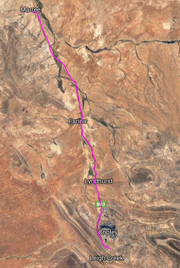
WEDNESDAY 26 MAY   MARREE TO COWARD SPRINGS   150kms

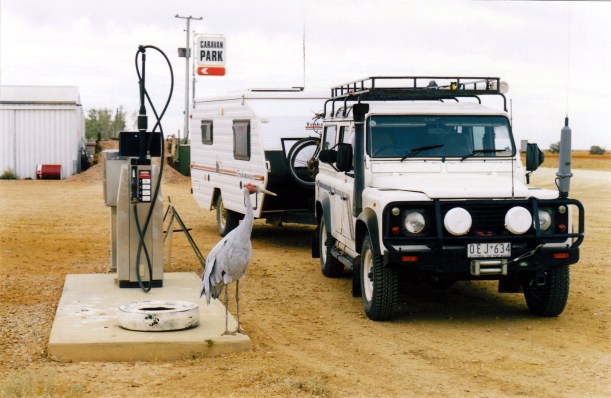
We had a leisurely pack up and departure from Marree, on a chilly morning. Before we left, got talking with Bev and Eric Oldfield – about tourism, caravan parks, the Internet, computers. Quite wide-ranging! Bev is trying to design a brochure; she said it was a pity she hadn’t chatted to John about it a day or two ago, as he could have helped her.

Refuelled – 85cpl.

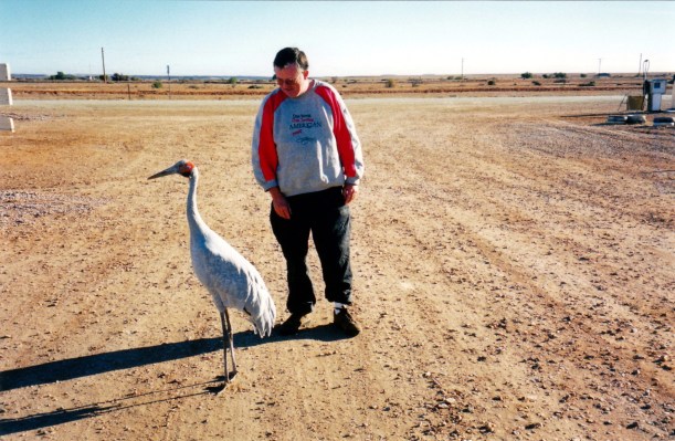
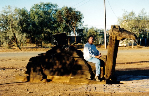
It was 11am when we left, seen off by Big Bird.

05-26-1999 01 rig and big bird.jpg

Big Bird was an interested onlooker as we refuelled

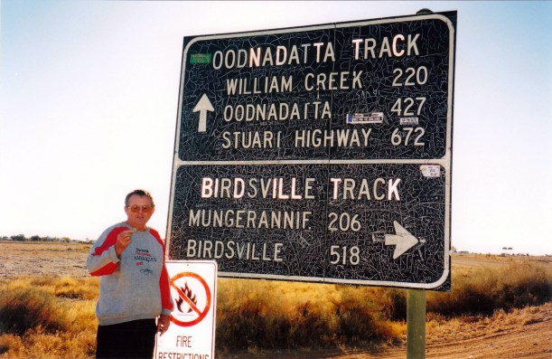
Our plan is to follow the Oodnadatta Track – also known as the Ghan Track – north to Oodnadatta. This track broadly parallels what was the route of the original railway from Adelaide to Alice Springs. We plan to leave this at Oodnadatta and head west to the main highway, as we want to visit Ayers Rock and Kings Canyon, before going to Alice Springs.

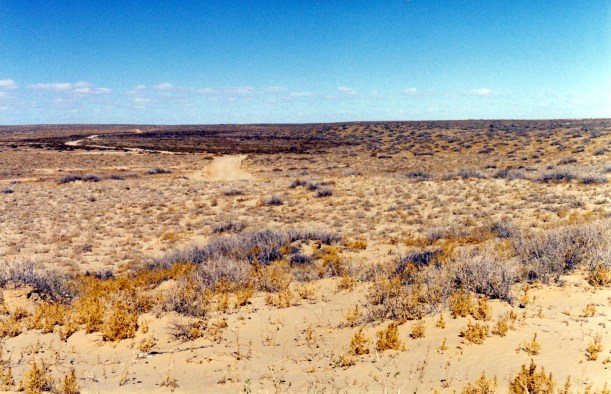
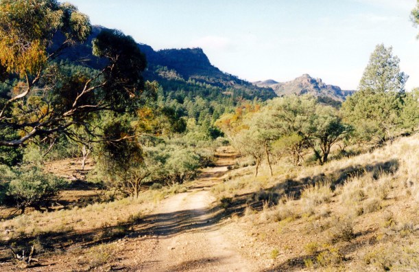
We took our time and had several stops along the way to look at interesting features. The road was quite good – some corrugations in places but mild ones, a few patches of shallow dust, some stony sections.

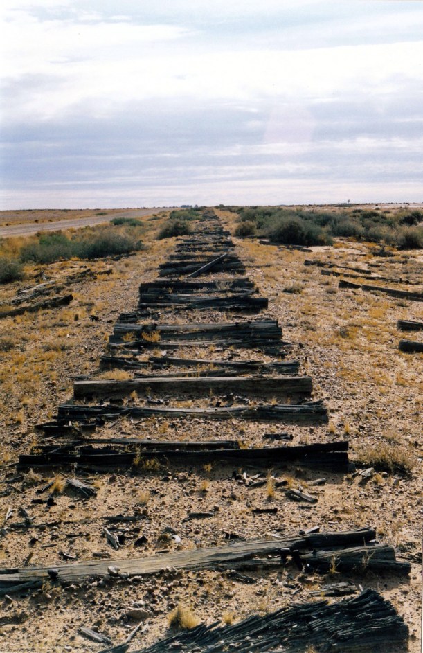
The line of the old railway paralleled the track, just to the west. There are no rails anymore, but in places there are sleeper remains, and bridges over creeks and washaways. Initially, the railway alignment was to our left, but just before the Lake Eyre lookout, it crossed the track and ran to the right.

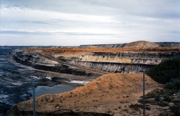
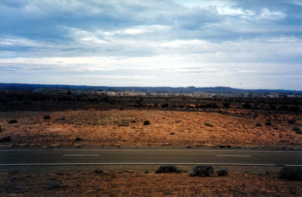
Passed the Borefield Road that goes to Roxby Downs and the huge Olympic Dam mine project. The borefield is a set of bores which tap into the Great Artesian Basin for water that is piped to the mine. It uses a great deal of water. one wonders at the ultimate effect of this on the Basin supply?

We pulled off the track at the Gregory Creek and went down a side track closer to the old railway bridge that is not far above the dry creek bed. It is exactly at sea level here. Had our packed lunch while we wandered about looking for birds and just enjoying the scenery. Wondered if this low bridge was one of the ones where floods used to periodically strand the old Ghan train?

05-26-1999 02 Gregory Creek old Ghan bridge 0m asl

The old railway bridge over Gregory Creek

John wanted me to drive for the next stage, to get some experience in such conditions. Fine by me, but I do not go as fast as he does!

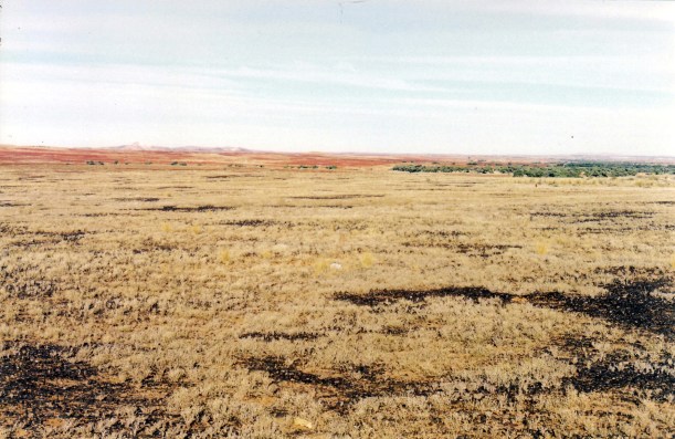
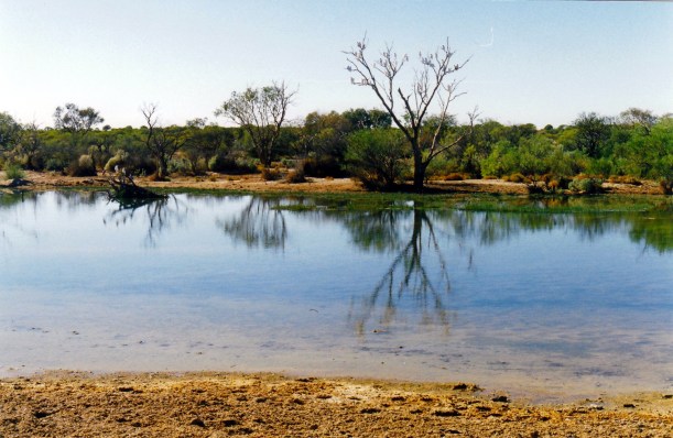
It was not long until we reached the lookout over Lake Eyre South. This is the one point where the Oodnadatta Track comes close to the lake. It was not as scenic or interesting as at level Post Bay. At this point, we were 12 metres below sea level!

05-26-1999 03 Lake Eyre sth

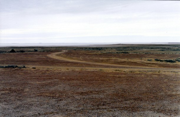
Lake Eyre South, seen from the Ghan Track

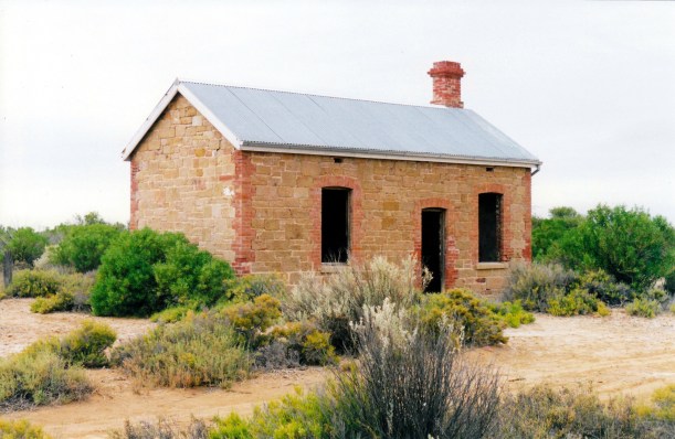
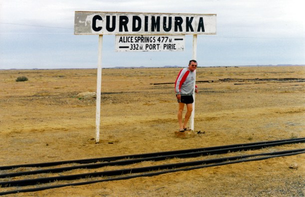
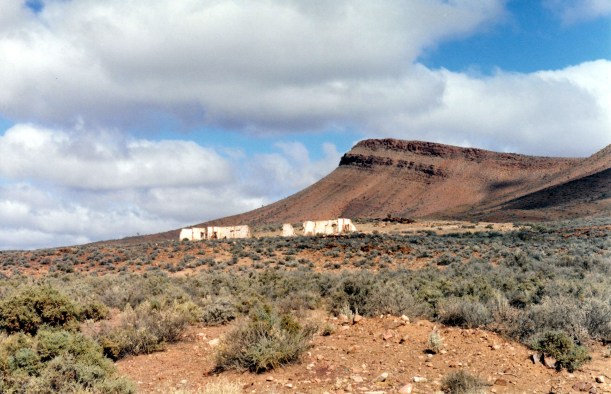
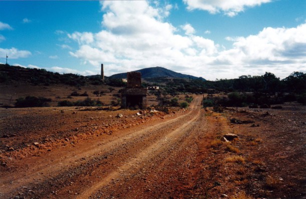
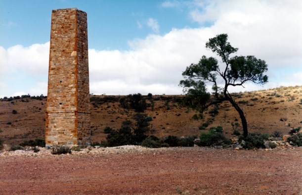
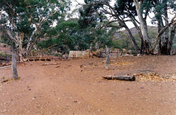
John took over the driving again and we continued to the old Curdimurka rail siding. This is fairly intact, compared to the remains of some other sidings we’d passed, where there were just some stone ruins. At Curdimurka, there was the building that housed the fettlers who kept up the line; a couple of sheds; and the spectacular water tower and softener, which dominates the flat landscape. There are still rail lines too.

05-26-1999 04 Curdimurka fettlers cottages.jpg

The fettlers’ accommodation at Curdimurka railway siding

05-26-1999 05 curdimurka

There are still rail lines at Curdimurka. The water purification tower

We spent some time wandering about, looking at Curdimurka. What a wonderful place. It contains so much history – I hope it can be preserved into the future.

05-26-1999 07 J at Curdimurka siding.jpg

Distances in miles!

The Overland Telegraph Line from Adelaide to Darwin was built in the 1870’s, along a route explored by John McDouall Stuart, which linked places where water could be found – often from mound springs related to the Great Artesian Basin. When the northern railway was constructed, starting in the 1870’s and reaching Oodnadatta in the 1890’s, it followed this same route. The steam trains of the time needed regular refills of water, so sidings were established where this was available. The bore and spring water usually needed the minerals removed to be suitable for the train, so water softening towers, like the one at Curdimurka, did this.

05-26-1999 06 Curdimurka ruins water softener tower

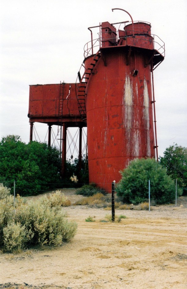
The water purification tower at Curdimurka

Although the route supplied the necessary watering points, it was in places subject to flooding and wash aways when there were heavy rains in this usually arid environment. One time, the Ghan was a whole three months late reaching Alice Springs! Sand drifts over the line were another problem. The train had a flat bed carriage at the back that carried spare sleepers and railway tools – passengers were known to work on the necessary repairs too.

It was not until 1929 that the extension of the line from Oodnadatta to Alice Springs was completed. Until that time, train passengers finished their journey north by camel.

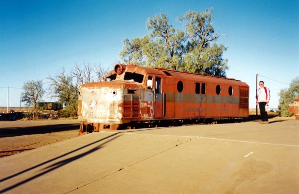
When diesel engines replaced steam, the need for watering points ended. Eventually a new wider gauge railway was built further to the west, away from flood country. The last train on the old Ghan line ran in 1980. So it is actually less than 20 years since the last train – diesel of course – came this way.

05-26-1999 08 Curdimurka and our rig

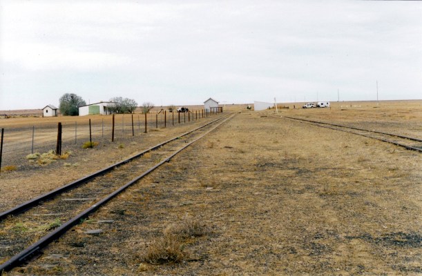
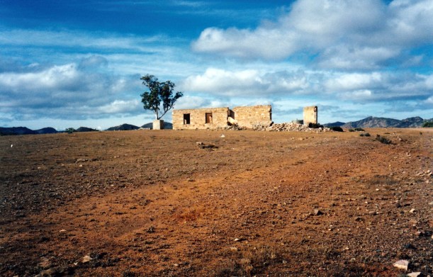
The buildings remaining at Curdimurka

John continued to drive, from Curdimurka. The Stuart Creek dry floodway was rougher than expected and the van did some bouncing over big bumps.

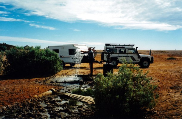
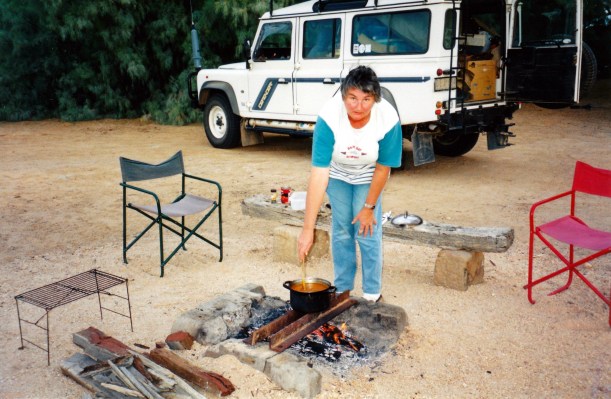
We got to Coward Springs about 3pm. So it took us four hours to explore the distractions over just 150kms! Booked into the unpowered campground here, for $10 a night. There were a number of gravelled camping bays to choose from and we picked a spacious area backed by some lovely big tamarisk trees. Our site had a fire pit and rustic seat by this. The campground has toilet and shower facilities – the latter with a strange kind of donkey water heater.

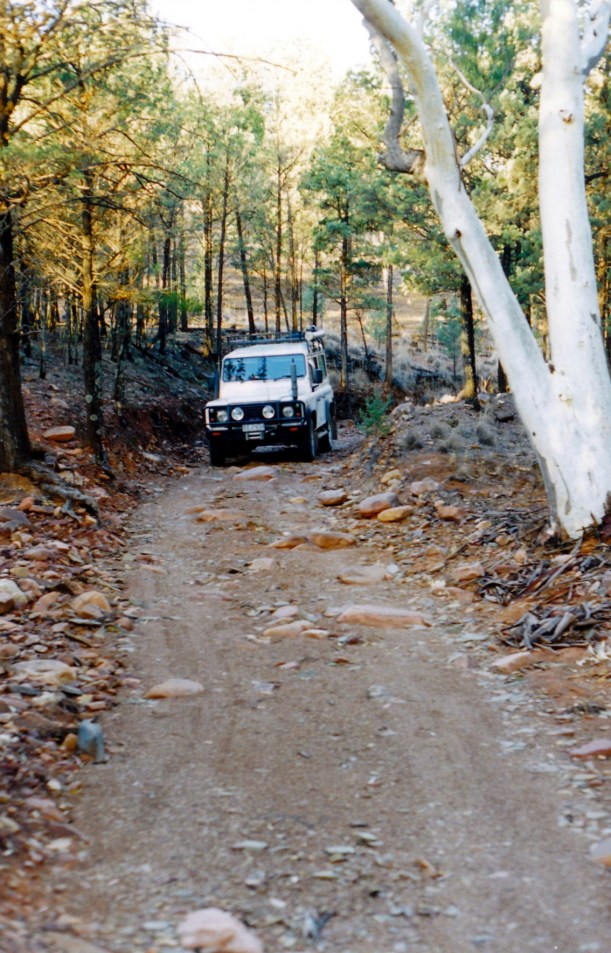
Took the van off Truck. The contents seemed to have travelled alright, despite the jolts back at Stuart Creek. There was very little dust inside – the vent that opens on the roof seems to have worked quite well to prevent it. This is, of course, our first real off bitumen venture with the van. Did a minimal set up – roof up, chairs out.

Drove back to visit the nearby mound springs. We had decided not to do so with the van on, in case the track in was really rough, or wet. We needn’t have worried, but it is nice to know that we do have a really pleasant camp site to return to – not that there is a great deal of tourist traffic competing for places.

05-26-1999 10 mound springs info.jpg

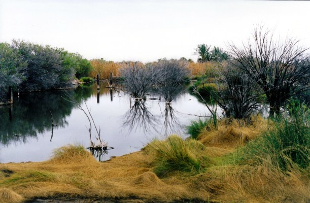
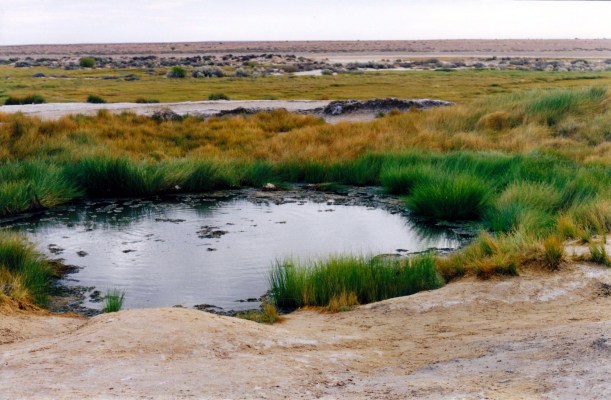
It was about 11kms to get to the Bubbler and Blanche Cup Mound Springs. Here, water from the Great Artesian Basin comes to the surface, of its own accord. The springs are fascinating. Through the clear water, one could see the sandy/silty floor of the Bubbler shifting and “boiling”, with small bubbles coming out.

05-26-1999 12 The Bubbler.jpg

The Bubbler mound spring

The emerging water in these springs carries some sediments and salts, and these, over time, form a mound around the spring. The nearby Hamilton Hill is an extinct mound spring from a different climatic time that allowed it to grow much bigger than the current mounds.

05-26-1999 11 blanches cup and mt hamilton

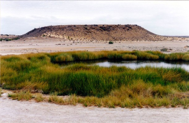
Blanche’s Cup mound spring and Hamilton Hill , an extinct mound spring

The springs are surrounded by little green oases of growth. The outflow forms a little creek that seems to dissipate into the sands before very far.

05-26-1999 13 country around Bubbler spring.jpg

The dry country around the mound springs

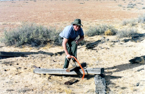
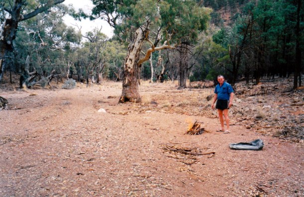
On the way back to camp, stopped where we could drive close to the old rail alignment, and picked up some firewood from sleeper remains of the Old Ghan railway.

Back at camp, we walked around the camp area, to explore it properly, and had a look at their artesian spa. Although there was a natural mound spring in the area, for the railway a government bore was sunk. This had a huge flow and a little wetland became established. The bore deteriorated with time and the warm water just bubbled up from the ground. Railway workers and train passengers used to enjoy the bubbling “spa”.  The bore was repaired and capped a few years ago and some flow allowed to go into and through the wooden lined “tub” that the owners here built, and still feed water into the wetland. By this time, the wetland here was well established as a bird and other wildlife habitat and so this decision to sustain it was sensible.

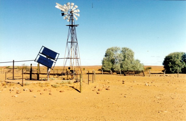
Our new solar panel seems to be working fine to keep our battery charged – the fridge is running from this, of course. We shall use the lights in the van as little as possible.

05-26-1999 09 camp at coward springs

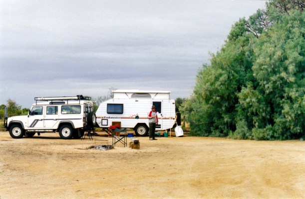
Our camp at Coward Springs

Tea was kumara soup, scotch fillet steak done on the BBQ grill over our open fire, potatoes cooked in foil in the fire and zucchini done on the BBQ too. It was very nice.

We sat round the fire till about 9pm, talking and drinking wine. The annoying hordes of flies of the daytime had departed when the sun went down. There were a few mozzies, though. Only to be expected, with the wetland nearby. There was lots of lovely silence, despite the presence of other campers about the place.

The nearly full moon was mixed up with clouds and we got glimpses of various sized pieces of it.

We decided it was so pleasant and peaceful here that we would stay another night.

05-26-1999 to coward springs

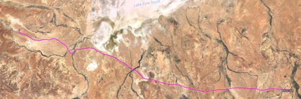
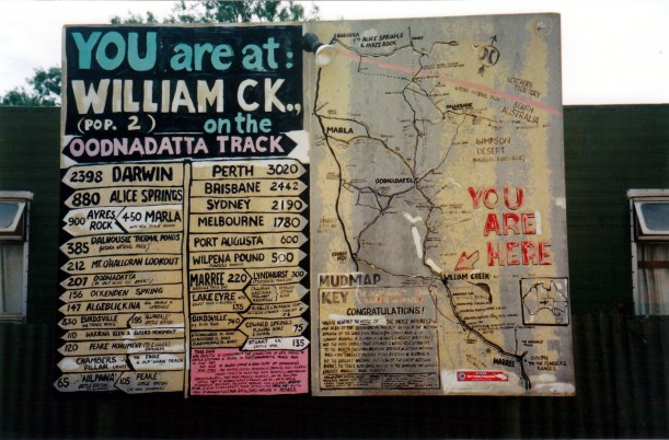
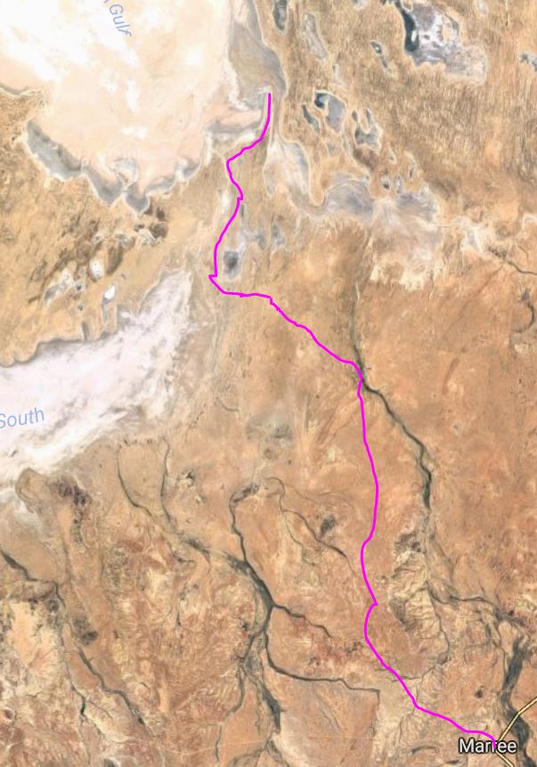
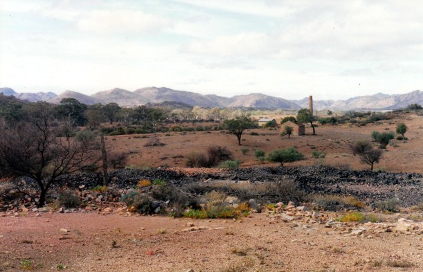
From Marree at the far right, to Coward Springs. Lake Eyre South.


Leave a comment

1999 Travels May 25

TUESDAY 25 MAY     MARREE

Today was not as windy, thus it felt warmer.

I posted the letter to K, wondering how long the mail will take to get there from Marree.

We had earlier decided that, whilst passing through here, we would take a day and drive out to Muloorina Station and on to Lake Eyre. One can access Lake Eyre  at Level Post Bay, on the Madigan Gulf section of the Lake.

It was a very interesting drive, in both directions, and well worth doing, on a good gravel formed track. The gate-opening passenger got a bit of a work out! The country was unremittingly flat, for the most part, with shrub and sparse tree lines marking out dry watercourses. This is certainly arid country.

05-25-1999 01 muloorina gate.jpg

Muloorina Station

Muloorina Station homestead is found by a very pretty waterhole on the Frome River – the same one that we had encountered at Angepena. It winds its way around the range country of the area, as a series of mostly dry channels,  and northwards past here enters Lake Eyre.

05-25-1999 02 muloorina camp waterhole

Wetland at Muloorina, formed by bore outflow. Lots of birds in trees.

The Muloorina waterhole and wetland results from a bore outflow. The force of the water exiting this bore hole powers the 240v power plant at the station! It has created an oasis of greenery in the dry country – a place obviously appreciated by the birdlife we saw.

From Muloorina, drove on a track that took us to the shores of Lake Eyre South, then alongside the Goyder Channel that links this with the main Lake Eyre, and finally to Level Post Bay, the end of the track. This section of track was rougher, and slower going, and sandy in parts – but not enough that we had to let down the tyres.

05-25-1999 05 track near Level Post Bay.jpg

The track near Level Post Bay

Lake Eyre was dry, of course, and we walked out on it, on the salt crust. It was so impressive, just to be there, in this salty immensity. We were below sea level by some 15 metres, here.

05-25-1999 03 j on l eyre south

John walking on Lake Eyre at Level Post Bay

05-25-1999 04 seen from Lake Eyre bed

Taken from out on the Lake, looking back to Truck and the Information Bay

After our walkabout on the Lake, drove back to the Goyder Channel section and ate our packed lunch there.

05-25-1999 07 Goyder Channel looking sth.jpg

The Goyder Channel that joins Lake Eyre South with the main Lake

We dawdled back to Marree, stopping sometimes to look at birds, and to take photos. Up close, as we wandered around a bit away from Truck, there were interesting aspects to the scenery – low hills, dunes, depressions and the like.

05-25-1999 08 high tech windmill.jpg

Interesting to see new technology arriving in the Outback

It was a great day out and an excellent drive. We covered 210kms.

05-25-1999 mulorina.JPG

The country we traversed on our day out at Muloorina and Lake Eyre

Back at the van, John settled in for an afternoon nap.

I read the Adelaide Advertiser paper, which I’d picked up from the shop earlier. Had an early shower and washed my hair – the local water is alright for that. I got talking to the only other campers here – a retired NZ couple doing a 4 month trip with a 4WD and camper trailer, going the same way as us.

John reported in to the 4WD Radio Network at the 5.30pm sched slot.

Watched the news on TV, and needed the heater on, even that early.

Tea was more of the kumara soup; bacon, egg, tomato and crumpets, followed by strawberries, which were awful.


Leave a comment

1999 Travels May 24

MONDAY 24 MAY   COPLEY TO MARREE   130kms

We took a gamble that the insurance paperwork we have been waiting for, will be at Leigh Creek today. So packed up and left the caravan park at 9.30.

The insurance documents were at the Post Office, so we filled them in on the spot, and sent them straight back Express Post. Whew!

Topped up the fresh food stocks at the supermarket, then headed north again. Stopped at Copley to top up the fuel – at 81cpl, we had been cross that we paid more in Leigh Creek, yesterday.

The hills became fewer, quite soon, apart from one low range in the western distance. There was a growing sense of vastness and openness. The vegetation became more sparse. North of the hamlet of Lyndhurst the sealed road gave way to gravel, and roadside fences ceased.

We could see the line of the old Ghan railway track, quite often, to the west of the road. The way was fairly featureless, apart from regular floodways – just very shallow depressions, if that, in the road.

Reached Marree about midday. Booked into the Marree Town Caravan Park which, despite its name is on the southern edge of town, about a km from the township proper. Cost $14 a night for a powered site. It seems a pleasant enough little park. No grass, of course, but some nice shade trees. Amenities in an Atco type building – adequate. The park is certainly not crowded!

05-24-1999 02 view from Marree CP.jpg

The outlook from the back of the Marree Caravan Park – Drover’s Rest

There is a rainwater tank for guests to obtain drinking water from. We had read a warning in a guide book that the Marree bore water has a strong laxative effect! John had made sure the van water tanks were filled at Copley.

The park owner is Eric Oldfield – renowned former boss drover on the Birdsville Track, and former owner of stations along the Track. We had quite a chat with him.

They have a pet brolga, found some seven years ago as a chick tangled in the wire of the Dog Fence. Called Big Bird, it dances with trees, cars, petrol pumps. Knows when it is being photographed too!

05-24-1999 03 big bird.jpg

John getting to know Big Bird

After basic set up and lunch, we walked the km or so into town and wandered about. It seems a sad little place. Much of it is becoming decrepit. There appears to clearly be two sides of “the tracks”. The other caravan park is opposite the aboriginal centre. There were no travellers in there. We saw several aborigines sitting drinking, in the central park area.

There are two stores. The Oasis appears to be the fast food outlet serving the indigenous population. The Oldfields have the Post Office and Store, over beside the main road – it seems to be the “upmarket” one.

There were some old former Ghan diesel engines on the old tracks – the basis for an historical display that needs a lot of work doing on it. There was also a wooden camel “statue” commemorating the role of the Afghans and their camels in the opening up of the interior.

05-24-1999 05 old ghan marree.jpg

The forlorn engine that once hauled the Ghan train north

Marree was originally called Hergott Springs, but the German name was dropped in World War 1, for the current name.  In the days of the old Ghan railway and the Overland Telegraph, and regular cattle drives down the Birdsville Track, Marree was a real hub of activity. There were two mosques.

05-24-1999 06 camel feature marree.jpg

The Afghan cameleers gave the Ghan train its name. Memorial to the Afghans at Marree.

I bought a postcard that depicted the “Marree Man”. This has been the subject of much mystery and debate. It was first “discovered” about a year ago, to the north west of Marree, a few kms north of the Oodnadatta Track.

It is a geoglyph – a man-made drawing carved into the earth. In this case, the carving appears to have been done by a bulldozer, presumably GPS guided. It is the world’s largest geoglyph. He “stands” about 4km tall and is 28kms in circumference.

05-24-1999 01 Marree Man

Marree Man – as depicted on a postcard I purchased

Obviously, this was not something that was created really quickly and some of the debate centres around whether any locals knew it was happening? Theories abound: made by the American Military (it is not far from the Woomera Prohibited Area); done by locals to be a tourist gimmick; done by aboriginals for an unknown reason – the figure appears to be an aboriginal man with a throwing stick; done by people from space!

Marree Man had been one of our topics of conversation with Eric Oldfield, but he had professed ignorance of its origins.

It can only properly be seen from the air – one needs to be at least 1100 metres up to get the full picture. It was discovered by a local pilot, flying between Marree and Coober Pedy.

Apart from the mystery of its origins, there is speculation over how long he will last – whether the seasons, weathering by the elements,  and vegetation growth will eventually obliterate him.

Our town walk was a pleasant enough one. There was a chill edge to the wind, though.

Marree is where two of the adventure drives of the outback diverge – the Birdsville Track heads north and the Oodnadatta Track ( the Old Ghan Track ) trends north west. That is the way we are going, to Central Australia.

05-24-1999 04 sign

We will be taking the Oodnadatta Track, this time

Back at the van, I got out the fan heater again, from storage under the bed.

Tea was kumara soup; curried steak and onions with rice;  banana and yoghurt.

I knew that our home water rates were due about now, so we phoned K on the Radphone and asked him to open the notice that was there. He gave us the total; I arranged to mail him a cheque and he would go pay them. That is all settled now, and I can relax for a while about overdue bills.

John gets some TV here.

It was a freezing night!

05-24-1999 copley to marreeJPG.JPG


Leave a comment

1999 Travels May 23

SUNDAY 23 MAY     COPLEY

John got up at 8.30, me half an hour earlier.

After breakfast, John checked over the van and filled the water tanks. I washed the van floor while he was outside, and packed a sandwich lunch.

Chores completed, we set out to drive to Beltana, some 30kms to the south. Got fuel at Leigh Creek – 84cpl.

Rather than go back down the highway we’d come north on, we opted to turn off some 10kms south of Leigh Creek and take the old road, through the Puttapa Gap – this was pleasant and interesting, on an unsealed road.

05-23-1999 01 ruins near Patawarta Gap.jpg

Ruins near Puttapa Gap

Beltana  was a settlement that dated from the 1870’s and the copper mining in the area. It was boosted by the Overland Telegraph being built nearby, likewise the northern railway (that became the old Ghan rail), and the road north. But the copper mining declined, technology rendered the telegraph obsolete, in the 1950’s the railway line moved, and the road was moved further west in the early 1980’s. Leigh Creek had become the main service town of the area and Beltana became a ghost town, almost. Today, there are some residents, and some upkeep of certain old buildings.

05-23-1999 02 old police station and jail at back.jpg

The old Beltana Police Station, with a little stone jail at the back

Beltana was not as intact as I had expected, but there were some interesting old stone buildings, and bits and pieces lying about. Didn’t see any signs of life, though.

05-23-1999 03 Old schoolhouse Beltana

The old school house at Beltana

After we’d driven around and walked and looked, we decided to continue on to Sliding Rock, 24kms to the north east, along a reasonable gravel road. The road crossed the wide and dry Sliding Rock Creek, and we stopped to eat lunch there, amongst some beautiful old red gums.

05-23-1999 04 sliding rock creek.jpg

The dry bed of Sliding Rock Creek, north west of Beltana

Copper was discovered at Sliding Rock in 1869 and mining began. The prospects were really promising, and smelters were built. A township was established there – Cadnia. But by 1901, the problems of water in the mine proved too much, and the mine closed, and the place was abandoned. A lot of investors lost a lot of money at Sliding Rock.

05-23-1999 07 more sliding rock.jpg

Sliding Rock Mine ruins from the former Cadnia town site

05-23-1999 08 Sliding rock ruin

Ruins at the former Cadnia township site

05-23-1999 06 old smelter Sliding Rock

Unusual square chimney at Sliding Rock

We found the ruins of the settlement and mining activity fascinating, including a big, square, smelter chimney and a round mine one. The stark, stone building remnants were evocative, in this setting, with the huge, grey face of Sliding Rock behind. We thought it much more special than Beltana.

05-23-1999 09 ruins at the Sliding Rock

Ruins of the hotel at Cadnia with the Sliding Rock face behind

Around the old smelter area there were lots of pieces of slag residue, some with a greeny copper residue on. We collected a couple of bits of this, as a memento.

05-23-1999 05 mineruins at sliding rock and slag heaps

The picturesque setting of Sliding Rock. Slag heap remains.

Drove further on the same track, to Warraweena Homestead. This had been mentioned to us by a Melbourne friend, who had been there, pig shooting, in recent years.

At the Homestead, the lady of the managing couple was home, and seemed to welcome some company. The house is in rather poor condition, with the front rooms termite and ant ridden. They sleep in an Atco hut. This property ceased being a sheep station in 1996; I think it may be intended to become a conservation area.

The lady said we could try to drive towards the Angapena diggings. She gave us a station map to use and some directions. She was not sure whether the tracks connected up to the ones we were on the other day. I don’t think they have been there for long – she was rather vague about it all. John was hoping that there was a through track and we would be able to see where we had gone astray the other day.

05-23-1999 10 track through Warraweena.jpg

Track through Warraweena

We found our way alright, through some picturesque country. Drove nearly 18kms from the homestead to the property boundary. It seemed that, although tracks might be running parallel on each property, there was no apparent connection through Warraweena. And, as so often happens to us, with our late starts, it was getting a bit late to keep wandering about exploring.

So, we had to backtrack. We took one wrong turn, but despite that, the GPS was really useful, for retracing our route.

05-23-1999 11 warraweena track.jpg

Parts of the Warraweena track were rough.

We called back in at the Homestead, to let the lady know that we were on our way out. We do not want to be the subject of any false alarm searches!

It was dark by the time we got back to Beltana, and almost 7pm by the time we got back to Copley, having driven 166kms today.

Had a tea of soup, chicken with water chestnuts stir fry, rice, followed by yoghurt.

It was an early night to bed – all this exploring is hard work!


Leave a comment

1999 Travels May 22

SATURDAY 22 MAY     COPLEY

Today was warm, but with much cloud cover.

I booked us in here for another two nights.

John slept in a little. After breakfast, he went to the local garage, who do tyres as well as serve fuel. They patched the tyre and put in a new tube, but it is basically dead, so is now the spare on the van, and we will need to buy a new tyre in Alice Springs. They have no tyres of that type here, and if we ordered one it would take at least until the middle of next week to come, so we will not wait. We had experience of waiting for ordered parts to come from Adelaide, in 1993, when we broke the Hilux axle at Port Augusta, and it was the most frustrating experience that took twice as long as promised!

The tyre work cost us $42. I kept the pointed piece of rock that was extracted from the tyre, and later wrote the cost of the new tyre on it, and kept it as a souvenir with a difference.

After lunch, we went on the tour of the coal mine, which I had phoned and booked this morning. This is put on by the mining company, at no cost. We drove to Leigh Creek, to the pickup point, where we were loaded into a mini bus and driven around to various points of interest.

It was interesting to be able to look up close at the operations, but the guide – a contract truck driver – was hopeless! There was no system to her commentary and much of it was inaudible.

05-22-1999 02 overburden hauler.jpg

Haul truck – you  would not argue with one of these!

The open cuts are so huge. And so deep. The haul trucks that cart the coal to where it is loaded onto the train, are so enormous. Just their wheels are huge – I took a photo of John standing by one, and he only came up to the axle mid point. The guide showed us the repair shop. A haul truck with a burst tyre was there – the tyres cost $20,000 each! It rather puts the cost of our dead tyre into a different light.

05-22-1999 05 leigh ck tour.jpg

The size of a haul truck compared to John

05-22-1999 06 $20,000 flat

A $20,000 flat tyre!

At one point, from the bus, we saw a bulldozer working on a slope that must have been at least 50 degrees. I didn’t  know they could even do that!

05-22-1999 04 Leigh Ck coalfield brave dozer.jpg

The driver of this bulldozer must have nerves of steel!

Men building the railway north in the 1880’s, originally found coal here; it was mined occasionally from that time, but only really got going with open cut mining after WW2, in the 1950’s to supply the new power stations at Port Augusta. The original Leigh Creek town was where there is now a very large hole. The current town was established in the early 1980’s, so the old one could be closed and make way for the expansion of the open cut.

05-22-1999 01 open cut Leigh Creek.jpg

The current open cut coal mine. Its scale dwarfs the haul truck on the top road.

After the mine tour bus dropped us off back at Truck, we drove out to the Aroona Dam, just south of Leigh Creek. We just had a quick look and did not explore the camping area that is supposed to be downstream of the dam wall. John was not really inclined to look around. It did not look attractive enough for us to wish we were out here instead of in Copley village – quite the reverse, actually.

Back at the van, John cut up the ruined tube to make padding for better packing the axe and shovel on the roof rack.

We did a quick walk before dinner, around the township, amid a few rain spatters.

Tea was fish and French fries.

In the evening, I sewed, while John listened to the football on the radio. He worked on the computer, to bring the finance records up to date.

Again, it tried to rain occasionally, through the night.


Leave a comment

1999 Travels May 21

FRIDAY 21 MAY     COPLEY

We woke to a warm day with some blue sky, some cloud – and a radio forecast for possible rain.

After a rather late breakfast, we packed the requirements for a BBQ sausage lunch.

Somewhere, John had come across mention of an old goldfield at Angepena, off the Copley to Balcanoona road, and he was determined to go find this, because it might prove to be a good fossicking area for his metal detector. I was rather less enthusiastic, in view of the possible rain, and only having a rather vague idea of where it was. I was not sure I was ready for another of John’s “little adventures”!

We drove to Leigh Creek to get the paper, then headed out the unsealed Balcanoona road towards Angepena Station homestead, some 55kms away.

We were not sure about being able to access the track to the old fields, through the station, even assuming we could find it. So we called in at Angepena homestead, but there was no one there.

Our map was not much help – no tracks were shown. Eventually, we guessed and took a track that headed south just before the Frome River – and we were right.

05-21-1999 01 frome river on angapena track.jpg

The Frome River and the track to the Angepena diggings

Drove about 20kms over quite a good bladed track and came to an area where there were some old diggings. We could only assume these were part of the old Angepena goldfields. There were a number of former digging areas, and tracks everywhere – all rather confusing.

05-21-1999 02 old diggings Angepena.jpg

The country in the area of the old Angepena diggings

We looked at old dirt heaps – really all that was there. But the area was a really pretty one, and worth visiting just for that.

We drove a bit further along the track to a creek bed and cooked our lunch there.

05-21-1999 04 bbq lunch.jpg

Our picnic lunch spot at the old Angepena diggings

John was not feeling all that well – he’s had some reflux lately. So he was rather touchy today.

After we had wandered about the area for a little while, we headed off again. John insisted on continuing to follow the track along the creek bed, because he was convinced it would take us through to the Warraweena-Beltana track, even though our compass  showed it was trending NW, rather than the SW we needed.

We came to an old square stone well/tank and troughs – empty – and the track deteriorated after that. Then we came to a gate with a “No Public Access” sign, so turned around and retraced our way.

05-21-1999 05 Angepena old well.jpg

Old stone well and troughs on Angepena

We saw some great Frome River spring and gorge country along the tracks today.

We’d had some spits of rain come on and it was getting quite late in the afternoon, so it was a relief to find our way back to the Balcanoona road.

Because of the time, John was probably going faster than he should have on the unsealed road, and it was not far from Angepena Homestead when we went too fast through a dip in the road, and got an instant flat tyre. A sharp stone had cut right into it.

We have not had to change a wheel before on the Truck so it took some messing about to find all the necessary gear and work out how to operate the jack that came with Truck. It is a high lift type and takes ages to get the needed height. So by the time we had changed the tyre and driven back to Copley – more slowly – it was dark. John’s mood had not improved! The day’s outing had cost us a tyre that was almost new!

We drove 222kms today.

Tea was soup and salad.

John wanted to phone S. He couldn’t get through on the Radphone – I am not sure we can do overseas calls on that. I suggested he try the pay phone up the street – he came back and told me it wasn’t working either!

There continued to be spits of rain off and on.


Leave a comment

1999 Travels May 20

THURSDAY 20 MAY     COPLEY

Last night was appreciably warmer than it had been at Wilpena – we are thankful. We slept with the windows at our heads  and feet, open, to catch the cross breeze. It is a nice change to be able to do so.

We were up early – before 8am. No reason, it just happened that way.

I did the washing. Then I followed up things resulting from the mail – went to the Post Office here and paid the shire rates and the Telstra bill. Had completed some shares paperwork and mailed that. I phoned Breastscreen because they had sent me notice of a time for the routine check up – arranged to contact them about same when I am next at home.

I got John to phone the insurance broker he deals with, because I realized that we should have had the renewal notice for our house insurance, in this batch of mail, and it had not come. The response was a real shock. The broker told John it is not insured through him. His records show that, this time last year, John was going to do some research and get back to him – and never did. The Credit Union, who were contacted next, claim that the policy was cancelled in 1997!!! I have a recollection of thinking that the place was not insured, a year ago, and John supposedly fixing the matter. So we really are not quite sure who stuffed up, and how. But it certainly requires urgent and definite fixing now. John phoned the Credit Union, arranged a cover note, and they are forwarding a policy document to us – express mail. We will have to wait here until that gets here, and then return same before we continue on. We will ensure that it is automatic debit each year, from now on, like the contents  policy is.

All business completed, we drove into Leigh Creek, for a paper and a box of beer. We saw a Trakmaster in the servo there, so pulled in and chatted with the couple – from Melbourne. They have the Nullarbor model – still a single axle, but 17 foot long. The layout is fairly similar to ours, but they have a microwave built in, likewise a flushing toilet. That is not something we have room for – or a water pump to supply the flush! The man told John that he’d had a problem with the brakes on a rough road. Their cupboard door catches broke on rough roads, too, and were replaced by Trakmaster with the newer press button ones.

After lunch, we drove to view/inspect the huge open cut coal mine, that is just north of Copley, and is Leigh Creek’s raison d’etre. It is enormous. There are great overburden and coal heaps everywhere and very deep pits. I remember how vast this mine looked from the air when I was en route to Jakarta a few years ago.

05-20-1999 01 Leigh Ck coalfield old cut.jpg

The old Leigh Creek open cut coal mine – now disused

05-20-1999 02 old overburden shifter.jpg

An old over burden shifter

John enjoyed himself at the lookout point, “playing” at the controls of an old over burden shifter that is now an historic item there. But basically, he has been out of sorts all day, because of the insurance debacle.

05-20-1999 03 drivers eye view

Driver’s eye perspective from the controls of the overburden shifter

05-20-1999 04 coalfields from main road

The open cut coalfield from the main road

Back at camp, I cooked barley and veg soup to last the next few nights. For tea, I made a shepherds pie and served it with cooked baby spinach. Then yoghurt after.

There did not seem to be any coal trains today – either way.

It was a warm evening, but with some cloud about. Might it rain?