This Adventurous Age

Adventures travelling and working around Australia.


Leave a comment

1999 Travels June 18

FRIDAY 18 JUNE     ALICE SPRINGS

The day was sunny and warm, after a rather chilly night. I remember learning, in high school geography, about the large diurnal range – hot days and cold nights – in the arid inland of Australia. They were not wrong!

John phoned the bank to check about the house insurance. They assured him all was well, just slow processing of paperwork at their end.

Finalized paperwork arising from our mail, related to shares. Had to set up the printer to do so – always a pain in the small space of the van.

Drove to the town centre, posted the mail, did some banking.

Wandered the shops. There are a number of galleries selling aboriginal art works and artefacts. Not all of the latter are genuine products – nor made in Australia! We browsed in a couple of the better-seeming galleries. There was some really attractive aboriginal art, especially a luminous blue dot “Milky Way” series, in one gallery. It was very hard to resist, but I did.

At an excellent gemstone shop, I purchased a small carved stone frog, for $20. That will keep my plaster one company on the shelf above the bed, along with the flawed sapphire.

At a bookstore, John bought a book on using Word Perfect and a little one for me on using Windows. I am such a novice – think it will be really helpful.

Checked out the cinemas – John is always keen to visit these. Did not see anything of note.

We did the grocery shopping.

Oven fried fish from a packet, and fries, for tea.

Cold night again.


Leave a comment

1999 Travels June 17

THURSDAY 17 JUNE     ALICE SPRINGS

This was my dad’s birthday – he would have been 89. Had he not died a couple of years ago, he’d have enjoyed hearing and reading about our travels.

After breakfast, drove into town. John found the Memorial Bowls Club and arranged to play this afternoon – a “fix” at last!

We went to the Information Centre and found the staff there very helpful. I collected quite a lot of reading matter and we spent some time looking at displays in the Centre.

Next stop was the Library, where I found I could borrow paperbacks for free. Wonderful. I would have to pay a $10 surety on each hardback book borrowed, though. That’s alright – I have no issues when I will get the money back. So I did a book stock up.

Then it was the Woolworths supermarket for a few food items. I found a film processor and put in four rolls of film to be done. We collected the mail from the Post Office.

Back to the van for a quick lunch and then John was off to bowls. I sorted the bag of mail. There was a letter from my brother and nephew, a card from John’s sister H, a card from friends C and H, travelling in India, written whilst on a train between Madras and Delhi. There was no other personal stuff. I received a Coles Myer discount card, now being a share holder.

Checked the bank statement received – am concerned that no deduction for the house insurance appears on it – surely that is still not a problem? John must check that out, tomorrow.

John came back saying he had not played well at bowls. Out of practice, I guess.

I made veggie soup and we had some for tea, folowed by chow mein and rice, and fruche, as a change from yoghurt.

John tried to phone S a couple of times today – left a message for her at work, and then there was no answer at home at night. I phoned K to let him know where we were and that we had received the mail.

John watched World Cup cricket on TV – no problems with TV here, although the stations are different; there is a local one, Imparja, that seems to replace Channel 9, with some elements of 10 as well. He stayed up till the cricket finished, in the early hours.

I went to bed early, with a book. It is so, so very good to have books to read again!


Leave a comment

1999 Travels June 16

WEDNESDAY 16 JUNE   KINGS CANYON TO ALICE SPRINGS   342kms

It was another beautiful sunny day with a cloudless blue sky.

We got away quite well, at 9.30am.

The Mereenie Loop Road was varied going, but always interesting scenery. There were some corrugated sections, some areas of road works. In places, surface runoff in storms has cut into the road and made channels and sections where only one vehicle can squeeze through. This damage does not look all that recent.

06-16-1999 04 meereenie tk.jpg

Gives a new meaning to “beware – soft edges”! Mereenie Loop Road


We stopped at a lookout point back over the George Gill Range.

Encountered a couple of different and amusing road “signs”, each end of quite a sharp bend: Lift um foot………..Puttum back down! Painted on old drums. Guess some of the locals had come to grief on that corner, over time.

06-16-1999 02 meereenie loop sign

Means there is a sharp corner coming up – slow down!

06-16-1999 03 meereenie loop more sign

Beyond the corner. Can speed up. Some punishing corrugations though.

We saw a drilling/bore crew setting up, not far from the road, and from that assumed that the Mereenie oil/gas field is producing. There were also pipeline markers as we got further along.

There was not much traffic on this road. We just took it steadily and carefully, but were passed by a Disco, towing a camper trailer, at speed. He threw up stones over our front.

Came upon a broken down rig – vehicle and trailer – with a couple and two young children. A bracket under the trailer had broken, affecting the axle and wheel. He was not in the NRMA – not that there is any easy way of summoning roadside assistance out here! John helped the guy chain the axle into place, using some chain we had, and we followed them as they drove slowly towards Hermannsburg.

Some time after the road swung back to the east, we could see, coming closer, the hills that mark the Gosse Bluff. This is an old impact crater – probably from a comet that hit the earth a very long time ago, and exploded. Back then, the hills that form the rim of the resulting crater, were very much higher, but erosion over time has worn them well down. But the feature still stands out, very strongly.

06-16-1999 05 gosse bluff

Gosse Bluff from the Mereenie Loop Road

The road deteriorated markedly after the junction with the Gosse Bluff road.

Just before Hermannsburg, we came around a bend – and there was the Disco and camper trailer, all flipped over with wheels in the air and the roof torn off the camper. Two men were getting things out of the interiors. One was the driver, the other was presumably someone from Hermannsburg. The accident had obviously happened a while ago, because it had been a while since he had passed us, and we’d had the other stop since then.

We stopped to see if help was needed. The driver said he was a doctor and his wife had been taken into see a doctor at Hermannsburg, with sore ribs. He seemed remarkably unshocked. It all looked a hell of a mess. He said that he had gotten into the soft sand on the shoulder of the road, lost control, snaked all over the road, hit the bank and flipped, finishing up facing back the way he’d come. He said he’d only been doing about 5kms an hour at the time – no way! Given the speed at which he’d passed us – and, likewise the young couple we were following, who said he’d been doing at least 80kmh – we found that extremely hard to believe. He also said it was a new rig, and he’d left Adelaide the day before. All the hallmarks of a traveller in far too much of a hurry and driving far too fast for these conditions.

06-16-1999 06 oops

Oops! How quickly it can happen

The driver said they were going to try to pull the vehicle back over onto its wheels – like he thought it might still be driveable!

We passed police coming out of Hermannsburg, but no sign of any tow or help equipment.

In at the Hermannsburg settlement, the young couple found they would be able to get welding done to fix their trailer, so we left them there and continued on our way to Alice Springs. Going in along the Larapinta Drive – which became a sealed road about 40kms after Hermannsburg – was really pretty, with the West MacDonnell Ranges looming.

06-16-1999 larapinta rd.jpg

Better road and West MacDonnell Ranges

After an eventful trip, we reached there at 4pm. Booked into the MacDonnell Ranges Caravan Park, at a cost of $113 a week, after Big 4 discount, for three weeks. John thinks we will need that long here, to explore thoroughly – and play bowls. I’d have been more inclined to book in for two weeks. We have been here before – briefly – and on that visit explored out to the east, as far as Trephina Gorge.

We were given a nice big site, with shade trees, looking out towards the ranges to the east. This caravan park is south of the town, through the Heavitree Gap that cuts through the range. We stayed here for a couple of nights on our LSL trip and liked its quiet and security, being out of the town, plus it is modern and very clean.

Just on dark, we drove into town, only a couple of kms away, to buy wine – which we have been out of for a while now – and to get a pizza for tea. Took this back to the van to eat, and it was very nice too.

John’s “good” hip is very sore today, after yesterday’s walk, and he took some Surgam today, to try to ease it.

06-16-1999 kc to alice.JPG


Leave a comment

1999 Travels June 12

SATURDAY 12 JUNE     KINGS CANYON

Rain began during the night and it continued raining steadily through the morning. This made it a day for vegetating around camp. It was cool as well as wet.

I knitted and listened to the radio. Bought some more postcards and wrote some.

John made Chelsea buns.

At least, with the gravel surface on this site, there is no mud problem – unlike at Yulara.

Later in the afternoon, the rain cleared away and the sun came out.

Tea was potato soup, chelsea buns, baked potatoes with a tuna filling.


Leave a comment

1999 Travels June 15

TUESDAY 15 JUNE     KINGS CANYON

Another sunny, superb day.

We decided to tackle this end of the Ernest Giles Track. John was feeling up to it. For once, we managed to get a reasonably early start.

Drove to the Kings Canyon carpark. The first part of the walk is up the “down” part of the Canyon Rim walk track, for about a km. Then our track branched off to the right.

06-15-1999 01 from tk up view across to Giles Tk.jpg

That is where we are going – taken from the Rim Track

The track went through absolutely brilliant dome terrain, for about 3kms. This was even better than the similar country encountered on the Canyon Rim walk. The domes just seemed to go on and on. The track wound around between them. In places, it went along little ledges, with quite a drop below.

06-15-1999 02 lost city domes.jpg

The track can be seen, winding through the domes

06-15-1999 03 on Giles Track in domes.jpg

The track was clearly marked

06-15-1999 04 giles track in domes.jpg

Erosion into the side of a dome

The red sandstone of the domes was broken up by little ravines in which ghost gums and shrubbery grew, providing green contrast.

06-15-1999 05 domes on giles tk.jpg

Little ravines provide shelter and moisture for trees and shrubs

I could have spent all day in this dome section – and used up a ton of film!

We emerged out onto a flatter section of the plateau, into shrub and spinifex country.

Walked as far as the 6.5km point. We had intended to have lunch at Penny Springs, shown on the rather vague track guide we had. But somehow missed these. Decided they must be lower down and off the main track. We certainly did not see any sign – or a viable side track.

Instead, we lunched at a high point near Reedy Bluff, where we could see out over the plains, and also behind us to more range country. That looks pretty interesting, too. I can believe the Resort staff who told us they have been shown places “out the back” that are even better than Kings Canyon! Hmmm – maybe this would be a more interesting place to work than Yulara? But, being much smaller, there would not be as many job openings – or the mod cons of Yulara.

06-15-1999 08 Kings Canyon Resort from edge of range.jpg

The outlook from the track onto the plains. The Resort is in the centre of photo

06-15-1999 09 watarrka lo and rim tks

Outlook from Watarrka Lookout, showing the canton entrances

06-15-1999 10 the domes beyond Kings Canyon

From Watarrka Lookout showing the domes and the country beyond

This top country was open and a bit hot from the high afternoon sun.

We came across some unusual small rock features – other than domes! The sediments that eventually formed these sandstones were originally deposited under inland lakes. In one place we found the solidified remnants of what looked like the leavings of some aquatic snail or crab.

06-15-1999 11 Giles Tk interesting rock.jpg

Unusual and suggestive rock

In another place, erosion had created an ultra small scale version of domes.

06-15-1999 14 Giles Tk rock patterns.jpg

Tiny domes. The grass clump gives an idea of scale

John’s hip was hurting by the time we stopped for lunch. He’d had a scheme for walking on to the Lilla Spur and following that down, then going back to the car park on tracks that paralleled the main road. But I felt this would be too far – I calculated somewhere around 16+kms, whereas we had walked almost 7kms to where we were. John agreed – reluctantly – to retrace our steps, though he toyed with the idea of trying to go straight down the escarpment from Reedy Bluff. I would not agree to that – really prefer not to do mountain goat if I can help it.

I really enjoyed the walk back through the domes – the afternoon light was superb.

06-15-1999 13 Giles Tk ghost gums.jpg

Back in the domes section of the Giles Track

Part-way down the main Rim Track to the car park, we met a lady resting on her way up. She was a professional photographer (Bette Devine) going up to the top to get sunset shots. We told her about the domes we’d been through today. After some chat, it was discovered that she had taught at a suburban primary school with John, years ago. They had not gotten on too well then! She has a camper van and travels on her own, taking photos. What an interesting life style! I would have liked to talk photography with her, but John talked school stuff with her, and then it was time to move on.

06-15-1999 15 corner Giles and Rim tracks.jpg

The corner of the Rim Track and the Giles Track

We walked about 14kms today – and it was excellent.

At the Resort, refuelled Truck – $1 a litre. Ouch.

Tea was rissoles and mashed potato.

We packed up as much as we could.

I am so glad that we made the effort to come this way – has been a wonderful place to experience, and one that I will long remember.


Leave a comment

1999 Travels June 14

MONDAY 14 JUNE     KINGS CANYON

Today was another beautiful, sunny day.

06-12-1999 camp kings canyon.jpg

Our scenic camp site at Kings Canyon Resort

John’s hip was rather sore after the uneven ground walking of the past couple of days.

We did not want to just spend the day around the camp ground, so took a packed lunch and drove to the Kings Canyon car park. It was our intention to walk the King Creek valley track again, much more slowly than on our first afternoon here, looking at plants and birds and just generally enjoying the place.

06-14-1999 01 holly grevillea.jpg

Holly Grevillea

We sat in the creek bed, not far from the end of the track, away from the track and the crowds, and ate lunch. John had a nap after lunch, while I sat and spotted birds. Didn’t manage to identify any new ones but saw a number of ones first seen in other places.

06-14-1999 03 Kings Canyon post lunch nap.jpg

John napping in the creek bed

Then we spent some more time by the track, unfortunately often being annoyed by the hordes from the touring coaches – some of them make such silly, dumb comments. I am afraid that I could not bear to travel in such groups.

John made a rather ambiguous statement to me, about some birds being more attractive than others. He was taken to task by a lady who overheard him! Possibly it served him right! But we were wearing binoculars and carrying a bird identification book at the time.

Then he got into a bit more bother, trying to be friendly and chat to another lady walking on the track, about the fact that she was limping. I think he thought that here might be a fellow hip replacement case. But she had an artificial leg. Whoops. After that, he stopped trying to be sociable.

06-14-1999 02 canyon rim from valley

The Canyon rim from the end of the Kings Creek walk track

Drove back to the Resort and, at Reception, obtained our permit to drive the Mereenie Loop Road. This unsealed road loops around the western end of the ranges here, then turns east, eventually leading, via Hermannsberg, to Alice Springs. We’d debated whether to go that way, or take the Ernest Giles Road east to the Stuart Highway. They are a similar distance – about 330kms. There is only 99kms of unsealed road on the Ernest Giles Road, as opposed to about 230 on the Loop Road – but the latter seemed potentially much more scenic. It is designated as a 4WD road.

Because the Mereenie Loop Road transits aboriginal lands, the permit is needed to travel it. The rules forbid camping, or stopping anywhere along the aboriginal land section, apart from at a couple of specified lookout/rest points. It cost $2 and we received an accompanying information booklet.

The staff people at Reception said they’d had to deal with several vehicle emergencies, recently, especially on the Ernest Giles Road – rollovers and the like. They commented that so many travellers do not seem to know how to drive safely on unsealed roads, and travel too fast.

The power had been off during the day. It is generated here. There were signs up around the place saying no EFTPOS, no TV, no radio. We think the satellite dish that brings these services must be not working. There were no telephones, either.

Tea was veggie soup that I made in the late afternoon, lamb backstrap – marinated in oil, lemon juice, garlic and dried oregano, then pan fried; potato and peas.

Just after we finished washing up from dinner, the power went out again. We were alright, because we have 12v lights that work from the battery, but plenty of other campers were scrambling about in the dark. It came back on after about 90 minutes.


Leave a comment

1999 Travels June 13

MONDAY 13 JUNE     KINGS CANYON

Today is my brother’s 50th birthday. I wonder what he feels about attaining this landmark?

The day dawned sunny, so we took a packed lunch and drove to the Kathleen Springs area – back eastwards some 23kms from the campground.

Kathleen Springs is, as the name suggests, an area where permanent water derived from springs, is found. Such a place, in this arid environment, was of great importance for wild life, aborigines and later, pastoralists.

06-13-1999 01 in spinifex ring.jpg

Perfect spinifex ring at Kathleen Springs

We walked the 1.3kms track to the Springs, looking at birds, and at the remnants of the pastoral industry: trapping yards, windmill site, and tank. The trapping yards were built in the early 60’s. As a natural valley, where cattle came to get water, it was an obvious point for catching cattle to send off to market.

06-13-1999 02 yards kathleen springs

Old cattle loading ramp at the trapping yards – note fence up gully side

06-13-1999 03 old fence Kathleen Springs

Cattle trapping fence at Kathleen Springs

It was a very pleasant walk, where we saw few other people. Quite a contrast to the main part of the Kings Canyon.

The springs themselves, and associated pool seemed rather dark and sombre. A creeping fern grows there that is found nowhere else in the world.

06-13-1999 04 creeping fern unique to Kathleen Springs.jpg

Kathleen Springs Creeping Fern

We walked back to the picnic area near the car park and ate lunch. Saw some spinifex pigeons on the way back to the picnic area, and watched them for a while. They are superbly camouflaged.

06-13-1999 06  Kathleen Ck valley where yards are.jpg

The Kathleen Springs valley – easy to see why it was a great place to catch cattle

After lunch, walked up the Giles Track. This is a 22km long track between Kathleen Springs car park and Kings Canyon. It roughly follows the edge of the plateau that is the George Gill Range. Track notes recommend an overnight camp somewhere along its length, but I suppose it could be done as a long day walk, if one did not spend too much time looking around. However, we do not have the requisite transport at each end, so plan to walk some of each end of it.

After the track climbed over some ridge tops, we got a good view back over Kathleen Springs canyon and the area of the trapping yards.

This was a very pleasant walk – not very hard – through varied country. We saw no other walkers.

I saw a strange plant – rather like a cross between cacti and broome – not sure if it is a native to the area, or a weed.

After about 4kms, we reached the Wanga Creek valley – mostly dry – and explored down the creek to where it drops precipitously off the escarpment. It was quite a deep and rugged little valley at this point. There were a few small waterholes. It was a lovely, peaceful place.

06-13-1999 07 Wanga Ck view downstream

The Wanga Creek valley

06-13-1999 08 exploring Wanga Ck.jpg

Scrambling down the Wanga Creek valley – dry waterfall

06-13-1999 10 wanga creek.jpg

The point at which the Wanga Creek drops over the edge of the plateau

It occurred to us that, when there is rain in these parts, there would be a number of waterfalls coming over the edge of the plateau – and over the walls of Kings Canyon, too. It could be a really interesting time to visit.


In our exploring, rather lost track of time, and finished up having to do a fast walk of the 4kms back to Truck. Reached there about 5.30pm.

06-13-1999 wanga ck upstream.jpg

Late afternoon at Wanga Creek

Back at camp, showered, then made tea of potato soup, crab and corn cakes – using tinned crab meat.


Leave a comment

1999 Travels June 11

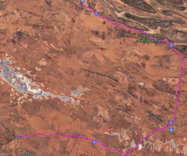
FRIDAY 11 JUNE     KINGS CANYON

We were up at 9am again.

There was a lot of cloud about, at first, and we thought it would not be a good day to do much. However, by about 10, it had broken up, the sun was shining, and we decided to tackle the full Canyon Rim walk.

We took a packed lunch, and water, and the little first aid kit, in the day pack. I forgot to take extra film, though, and ran out part way round the walk. Drat!

06-11-1999 01 start canyon walk.jpg

Starting out. Behind John is the spur that the track goes up to reach the top of the plateau

Drove to the carpark. Walked the sealed first section of the track – this section is shared with the walk we did along the creek valley. Then it branched, and the first part of the Rim Walk was a steep climb up to the top level. Much of the ascent was stepped and staged, so it was by no means the worst climb I’d ever done.

06-11-1999 02 carpark and plains from part way up canyon spur

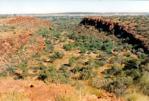
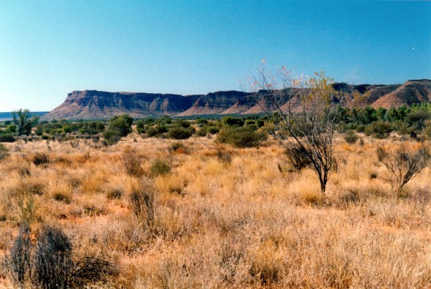
The car park and the surrounding flat plains from part way up the spur climb

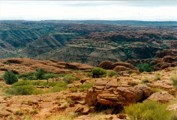
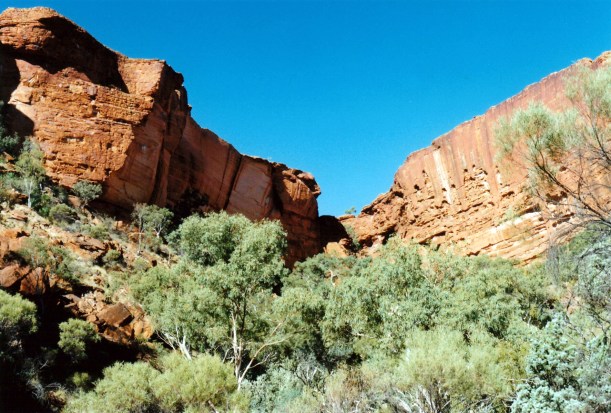
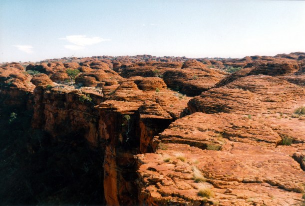
As we gained height, there were dramatic views up the adjacent big valley, along the main Canyon, and back over the carpark and the plains below. The plateau at the top of the Canyon  is 100-150 metres above the valley floor.

06-11-1999 03 next valley from spur track

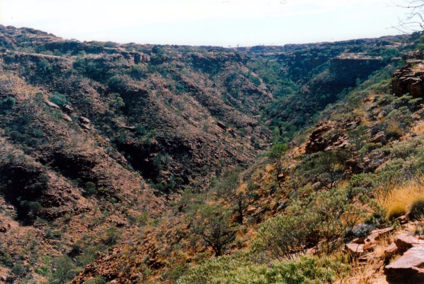
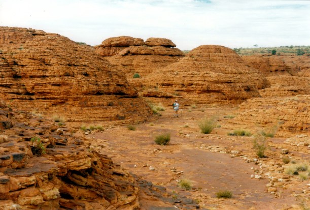
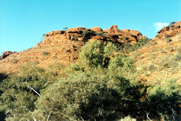
The next valley from the track up the spur. The flatter, top level is evident

06-11-1999 04 view up Kings Canyon.jpg

Looking along Kings Canyon as we climbed the spur track. We will be walking right around the top

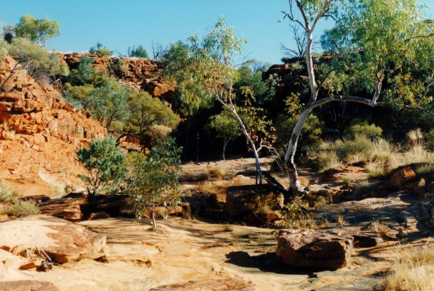
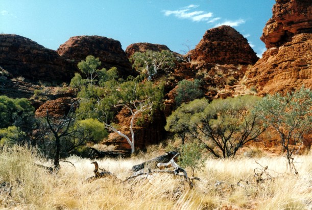
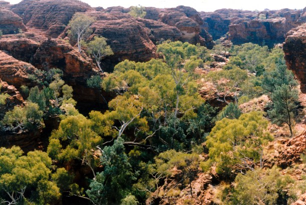
Once on the top plateau, the track wound along through lots of small dome, valley and chasm formations, that were quite unexpected and rather reminiscent of the much larger domes of the Bungles, in WA. The domes, according to local aboriginal lore, are native cat men.

06-11-1999 09 on the top scene.jpg

Valleys on the plateau, between the red domes

The sunlight on the red sandstone was brilliant.

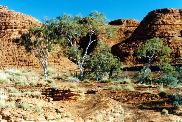
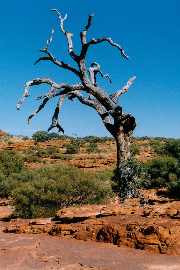
There was so much more variety up on top than I had expected. Little valleys had quite thick clumps of grasses growing, with shrubs, low trees and the occasional white trunked ghost gum contrasting strongly with the red rock.

06-11-1999 06 domes and gums on top of canyon rim.jpg

Red rock domes, ghost gums, thick grasses in the valleys between the domes

06-11-1999  10 collapsed rock rim walk.jpg

A place where a rock formation has collapsed

In places we were walking on bare rock sheets.

06-11-1999 07 track guide by domes.jpg

Track guide to stop walkers straying too close to the dome – or taking the wrong route

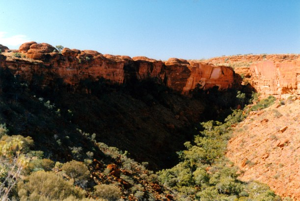
There were occasional lookouts with huge drops into the Canyon below. Sometimes we could see people across the other side, looking really tiny.

06-11-1999 11 canyon and rim.jpg

Lookout over the Canyon. There are people on the rim on the other side. The smooth rock faces are where slabs have fallen into the valley below. Note the pointy rock at top left.

06-11-1999 13 canyon edge

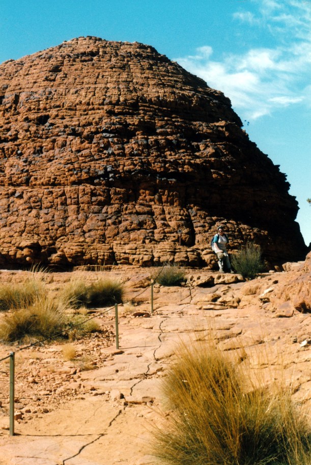
The unprotected plateau edge, beyond John – who is not going too close!

We came across a first aid box and stretcher arrangement, for case of emergency up there. Like the same sort of thing we’d seen on the Valley of the Winds Olgas walk.

06-11-1999 14 reality bites.jpg

Multi purpose emergency first aid box!

06-11-1999 15 Kings Canyon rim walk looking back.jpg

Looking back the way we have come on the track that weaves through the domes. The pointy rock form by the Canyon Lookout can be seen at left of photo

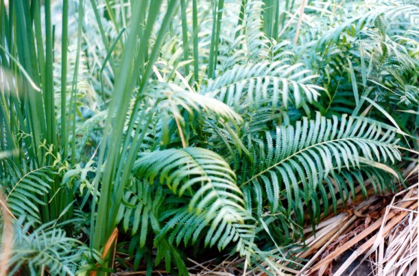
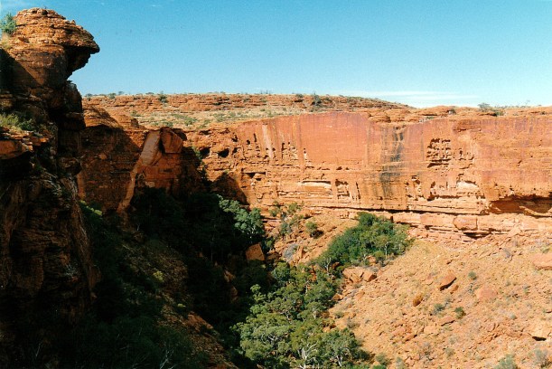
One side track that we took went to a lookout over the Garden of Eden. This is a deep, steep sided valley in the sandstone, formed by Kings Creek. Because of its depth and narrowness it stays rather permanently damp in there, from seepage out of the sandstone,  and so it is a little oasis, with palms, ferns and 400 year old cycads. Even when Kings Creek is dry, water remains in some deep pools down there.

06-11-1999 16 Valley of Eden Kings Canyon path and steps

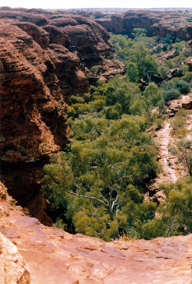
Looking over the Garden of Eden. The stairs down are at left

The lookout track crossed a deep ravine over a bridge and had some pretty vertiginous drops – but we gained an excellent view up the Garden of Eden.

After that, we went along and down into the Garden of Eden – on steps built down the rock face. Walked along to the permanent pools. There were a couple of ducks there, and a crow in a tree. Its call was magnified greatly by the rock walls – it seemed quite put out by the loud, echoing call, and kept repeating it, and acting puzzled. We thought it quite amusing.

06-11-1999 17 Valley of Eden

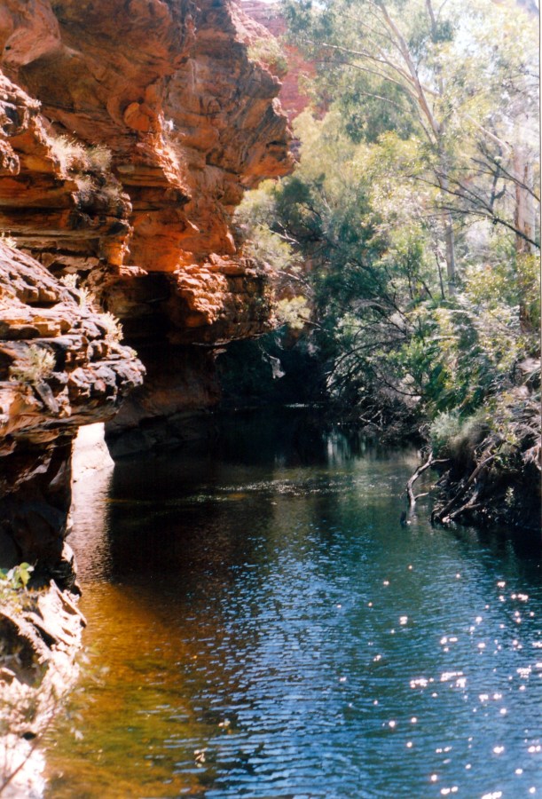
The pool in the Garden of Eden

We ate lunch sitting by the water. The ducks came begging for some. They were quiet enough to take pieces of crust from my fingers. It really was a lovely and serene place.

There were more stair cases to climb to get back up to the top level again.

06-11-1999 18 view over Valley of Eden.jpg

A final look back at the Garden of Eden

The path continued around, through more domes and clefts and with more outlooks across the Canyon. This side of the Canyon was not as rugged as the first had been. The track around the Canyon Rim goes in a big U shape, so a little after the Garden of Eden, we could see where we had walked this morning.

06-11-1999 19 above canyon.jpg

There was more flat rock surface on this side of the Canyon walk

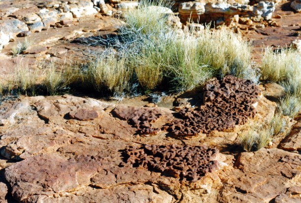
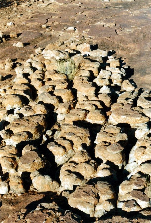
There were places where the red sandstone walls were broken by white patches – places where pieces of rock had broken away and the underlying light coloured sandstone had not yet been oxidised to red.

One intrusive note was the helicopters regularly flying sightseers  over the Canyon to look at it. They were quite low. One even landed up on top and we wondered if it dropped some walkers off to save them the climb up? They were just an incongruous presence in such a grand and awesome place.

Some people venture awfully close to the edge, but not this little black duck!

Eventually, we began a gradual downhill section and arrived back at the carpark.

The walk had been 6kms in total. We had left the carpark at 11am and returned to it at 4pm, without hurrying at any stage. In fact, we dawdled a lot!

I think it is one of the best day walks we have ever done – just a magic day. It was not too hot, and there was a little cooling breeze.  I imagine that being up on the Rim on a really hot day would make it really hard. There were quite a few other walkers, as one would expect in a place like this, but they were not intrusive, and much of the time we were walking alone.

We certainly felt a great sense of achievement from completing this walk.

We did not feel too tired after all the exertion and scrambling, though, back at the van, John had a nap.

I made potato soup and we had some of that for tea, followed by curried tuna and rice – and yoghurt, of course.

A fairly early night was called for.


Leave a comment

1999 Travels June 10

THURSDAY 10 JUNE     KINGS CANYON

We got up about 9am. We certainly seem to be sleeping in later these days, possibly because it seems to get light later. It is a big contrast to this time last year, in Qld, when I was waking so early.

After breakfast, I did three loads of washing, including the sheets. At $2 a load, it was 40cents each time cheaper than at Yulara. It was a sunny day with a strong breeze – good for drying.

It turned into a puddling about type of day.

John did some work on the TV aerial and checked the Truck batteries. I washed the van floor. We just relaxed in the sunshine and relative quiet of the camp ground.

Later in the afternoon we drove out to the west, on the unsealed Mereenie Loop Road, for about 25kms, to a little way beyond the National Park boundary. The country was interesting, with the dissected ranges in the distance. We spotted a brown falcon – a new bird for our records.

06-10-1999 george grill range.jpg

The George Gill Range, seen from Mereenie Loop Road

We were passed by a couple of carloads of aborigines, heading east towards the Resort – wondered if this was due to it being pension pay day? They seem to drive very fast.

We went back to the Resort and the shop. Newspapers here only come in on Wednesday and Sunday. Supplies at the shop are expensive. I bought a roll of film, which at $7.50 for 24 exposures, is much more than I am used to paying. Also bought postcards and magnets – one for me and one for P, who is collecting them.

Tea was tinned mushroom soup – which I managed to boil over onto the stove! Then chicken breasts done Greek style, potato and zucchini, followed by the ever reliable yoghurt.

06-09-1999 desert dusk light Kings Canyon.jpg

Dusk light on the Range from the campground – the gradation from pink through purple to blue is typical of Central Australian dusk

After tea, I wrote a letter to a friend. John tried to phone S, from the camp ground phone box, but couldn’t get through.

There was a large Britz hire camper parked behind us today, with Japanese occupants. Apparently, they were filming a feature or advertisement on Japanese camping in Australia. They had pre-cooked food, but filmed to make it appear they were cooking it! They set up the camp ground provided table for dining out – after moving it from near us – but soon abandoned that venture as the late afternoon chill set in. They were very noisy. They departed with their camper about 11pm. John said they came back later, after I was asleep and they were quite noisy then, too.

It was a cold night. I went to bed about 11pm. John played his computer game till 4 am.


Leave a comment

1999 Travels June 9

WEDNESDAY 9 JUNE   YULARA TO KINGS CANYON   330kms

Our departure was efficient, getting away  about 9.30.

The drive to Watarrka National Park and Kings Canyon was pleasant, interesting and varied.

We had to back track, of course, back east past Curtin Springs, before turning north on to the Luritja Road. There were low ranges evident to both sides of this road, and it also crossed some red sand dune country. There was considerable variation in vegetation growth levels, as well as in the scenery. We pulled over after about 50kms, and ate lunch parked just off the road. After 67kms, the Luritja Road intersects  with the unsealed Ernest Giles Road that goes east to the Stuart Highway. We turned west, staying on the sealed road.

Ernest Giles was an explorer who, in the second half of the 19th century, explored much of Central Australia and the western deserts. He gets commemorated a lot in these parts.

As we proceeded west along the Giles Road, the George Gill Ranges came into view, and the area became quite rugged, with lots of ravines and gorges evident in the ranges to our right. Passed the Kings Creek Station, which has a camping ground. We had debated about staying there, rather than what we expected would be the less atmospheric Kings Canyon Resort, but decided the 34kms from the Canyon was too much of a drawback.

Booked into the Kings Canyon Resort campground. They charged us $26 for the first powered site night, $21.50 for the second night, and $13.50 a night after that. This was rather better than we expected, at a total of $115 for a week. I presume the sliding scale is to encourage lengthier stays – or reward same, which ever way you want to look at it. We booked for a week.

It is quite a pleasant campground, not as big as that at Yulara – but then it does not get the visitor numbers either. I suspect that many bitumen only travellers are put off by the need to back track the 170kms from here, back to the Lasseter Highway. They miss out on something special, because this is a great area.

We were able to choose a site at the edge of the park, with a great view across to the range, which glows red at sunset. The amenities are modern, spacious and clean.

There are lots of birds about the place, especially miners, pigeons, mudlarks and some varieties of honey eaters – there’s quite a number of trees in blossom for them.

After setting up, we drove to Kings Canyon, a few kms back. The access road to the car park area is sealed, and there is a fairly large car park. We had decided to tackle the Creek Bed Walk, to get some exercise after the driving. It was only a 2.6kms return walk, fairly level.

It was fairly late in the afternoon, by this time. The walking was pleasant, and easy. There were lots of holly leafed grevilleas in flower, and heaps of birds about – it would have been their afternoon feeding time by now.

We had good views of the late afternoon sun on the Canyon walls as we walked. Passed the point where the Rim Track branches off to the left. The canyon seemed quite broad as we followed beside the dry creek bed. There was spinifex interspersed with bare ground, shrubs and low scrubby trees.

06-09-1999 03 in the Canyon late pm.jpg

The walls of Kings Canyon in the late afternoon

Unfortunately by the time we reached the viewing platform at the end of the track, some clouds had come over the sun, so the photos I took there were found later to be rather poor. There was a small pool at the track end. We could see people up on the Canyon Rim track.

06-09-1999 02 Canyon head from creek walk LO.jpg

The head of Kings Canyon  – late afternoon sun on the walls

After looking about at the end of the track, retraced our steps to the carpark.

06-09-1999 01 late pm in Kings Canyon

A ghost gum standing out amidst the scrub in Kings Canyon

Then we drove to the sunset viewing area and looked at the George Gill Range from there, for a while.

06-09-1999 sunset George Gill Range.jpg

Sunset on the George Gill Range

Back at the Resort, bought a 24 stubby slab of beer, for $40! They do not sell wine, damn it.

I made fried rice for tea, followed by yoghurt.

John listened to/attempted to watch the World Cup cricket. TV reception is not great, here.

Bed about 11pm.

06-09-1999 to watarrka.JPG