
A DAY OUT TO HEBEL AUGUST 10
Hebel is a very small village, some 70kms from Lightning Ridge. It is in Qld, just across the border. One activity promoted by the tourism brochures at Lightning Ridge is to go for a day trip to Hebel and have lunch there at the General Store.
We had passed through Hebel, on our 2009 trip north, but decided today to go for a drive up there and have a look at a couple of other places on the way.
Hebel began as a Cobb and Co staging point in the latter part of the 1800’s. Like many other villages along the border, it also became a customs duty collecting point, back in the days before Federation, when each State ran its own Customs and Excise laws. That function disappeared after 1901, when the new Australian Government took it over and ensured uniformity of these levies across the nation.
Since then, Hebel continued its existence as a small service centre for surrounding pastoral properties. The sealing of the Castlereagh Highway north to Hebel in the 1970’s laid the basis for it to become a tourist route.
Local lore has it that some members of the bushranging Kelly Gang lived in the area under assumed names – and Hebel’s original name was Kelly’s Point.
We first heard of the village in 2005, when we worked with a man who had, for a time, owned the General Store.
We took advantage of a pleasant, fairly sunny day for our trip.
Not long after turning north on the highway, I noticed what looked like a well trafficked gravel road, angling off to the NW, named Lone Pine Road. I wondered if it was the way to the Coocoran diggings, which we had never visited. Then the Nine Mile and Ten Mile diggings of the original Lightning Ridge diggings were on the right of the highway. We could see the Nettletons First Shaft area, up on a low ridge.
Maps show the large Lake Coocoran to the west of the highway and I wanted to go have a look at that, thinking there would maybe be water birds to watch. We turned off onto a promising looking dirt track. A little way in, it ended at a locked gate. We followed another track. In the distance, the lake appeared, looking as though it was full of reeds. I could see no open water.

Lake Coocoran
Our final track following attempt ended up being a power pole upkeep track, also ending at a locked gate.
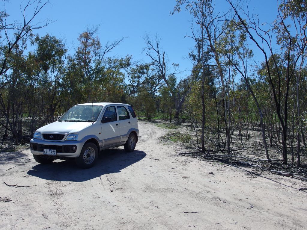
Following tracks that went nowhere
We had to be careful on those tracks as there was Hudson Pear growing beside some of them, and the thorns on those can go through a car tyre, let alone a human foot.

Hudson Pear
From a distance this plant looks deceptively pretty, but it is a major pest.
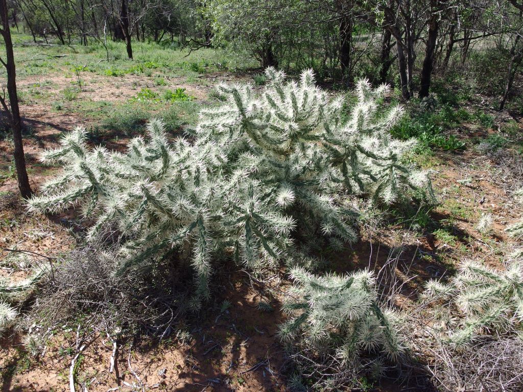
Not a bush to blunder into!
Back on the highway, noticed that on most areas of slight rises in the land, there were signs of little exploration drills having been done, for opal. Wonder how long it will be before the next big find in the area?
The rises were separated by a series of dry floodways with depth markers. There is a series of swamps and channels, trending to the SW, that obviously fill in flood times. Lake Coocoran is part of that chain, as is, I think, the Narran Lakes further down.
Turned off the highway to go see Angledool, another place where there were once some opal diggings. Apparently it was also called New Angledool, but I have no idea where the old one was.
As we turned off the highway to the east, there had been a sign saying opals for sale but we saw no further directions to same, or indications of any commercial activity of any sort in the area. It was a strange little locality – a few lived-in houses and a number of empty ones. We saw two churches, but no indications that either is still used.
Stopped at the old hall, a fascinating structure, now derelict but still photogenic.
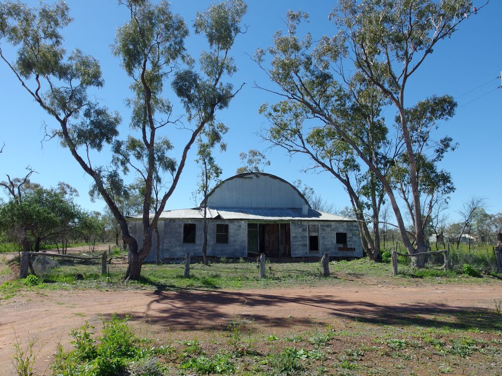
Angledool Hall
It had an unusual roofline – a hump running the length of the roof centre. A couple of old post and rail parts of the fence might once have been hitching rails for horses.
It was hard to work out what it was made from, apart from the obvious corrugated iron of the roof – maybe a form of mud bricks? Sad to see it falling apart, but I guess that is a story repeated many times over in settlements across the nation, made redundant by modern transport and farming developments.
A sad picture of abandonment
Gave Couey a run and ball chase on a track beside the old hall, That started dogs on the nearby farm barking, Oops.
Decided Angledool is really spooky.

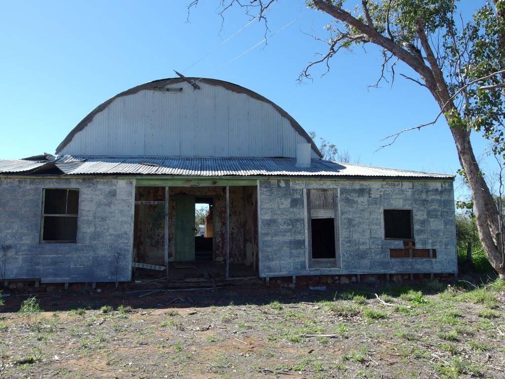
Deserted old house at Angledool
On to Hebel. A bot before the border, the road crosses several channels, one or two of which could make for pleasant bush camping locations.
Couldn’t see much change in the village, since our last visit. The hotel had a few cars parked outside but was not exactly doing a roaring trade.
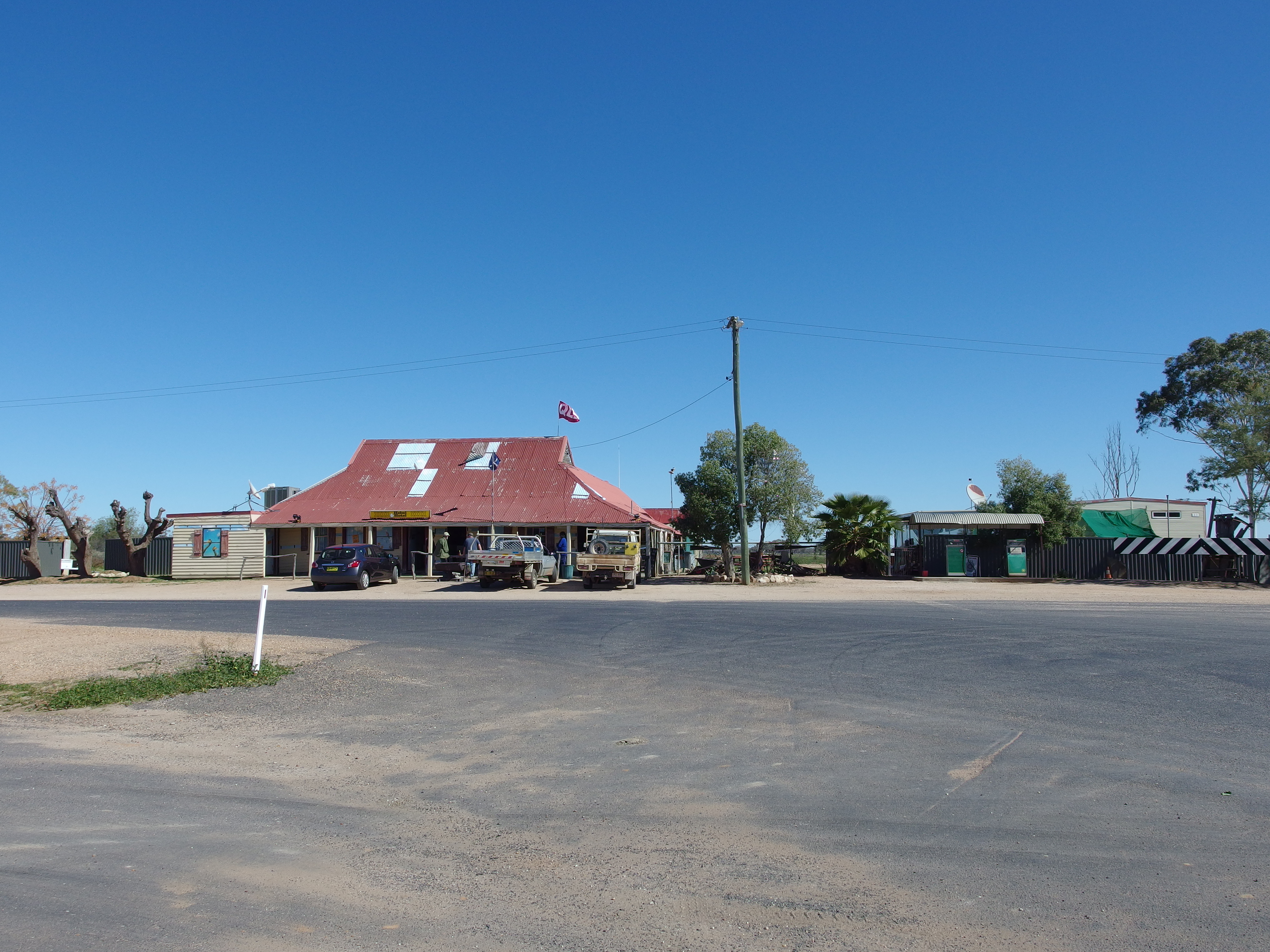
Hebel Hotel
Across the road, the General Store had been prettied up a bit more, was all, We went in and had a browse in there. About a dozen people were eating out on the veranda dining area. The Store info emphasized the home made food that it sells. John had been highly anticipating getting a lovely home made pie for lunch, but did not like the look of the ones on offer – most unusual for him. He got an ice cream. I bought a bottle of mineral water and a stubby holder.
The General Store and associated businesses – motel and small caravan park – were for sale, priced at $520,000, because the owners had been there for nearly twelve years and wanted to retire. It seemed to me almost totally dependent on passing traffic and this would be seasonal in nature. The Castlereagh Highway is not really one of the main north-south routes. To me, it would not be an attractive place to live.

Hebel General Store
We walked around the Historical Circle display, featuring historic facts about Hebel, trying to make the most of what there is. Example being the information about the old bottle dump that used to be by the hotel. This was so big that it was a navigation aid on the Sydney-HongKong plane route!
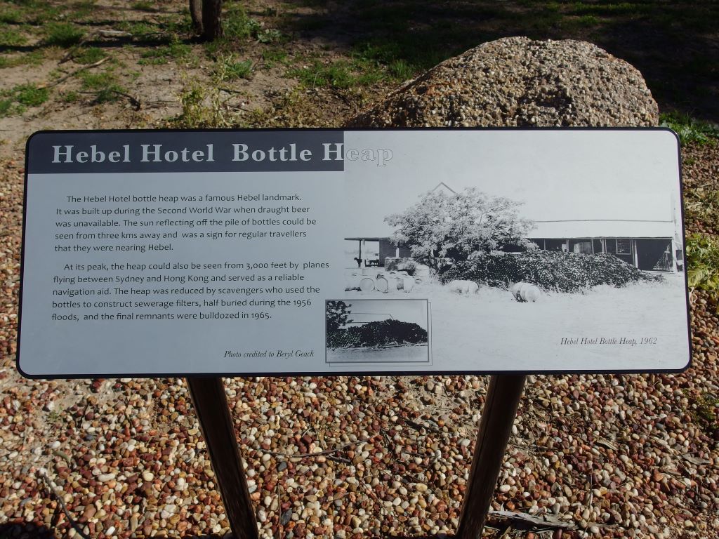
Hebel Hotel Bottle Heap
The historical display was quite well done and worth the browse around.
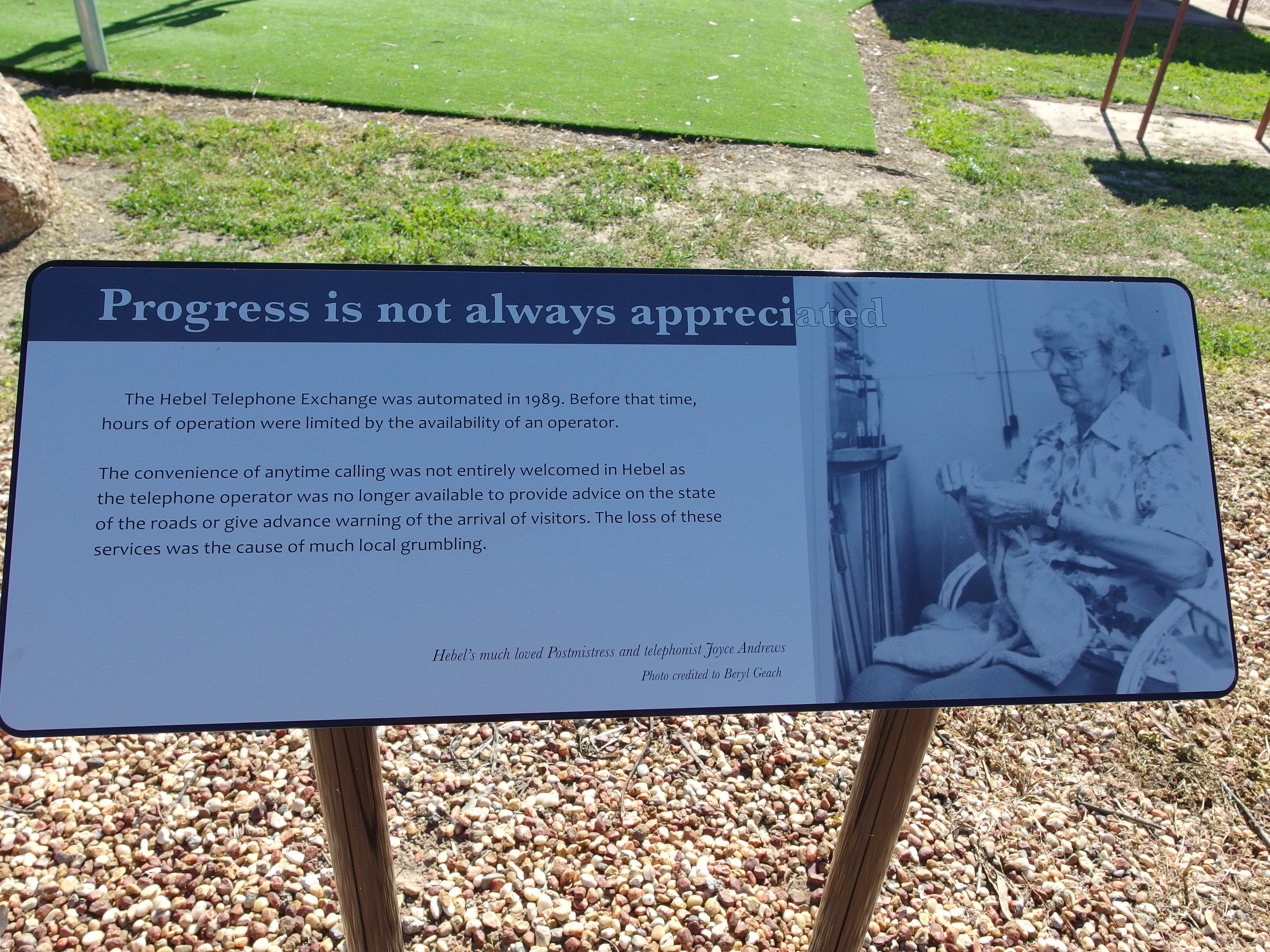
An interesting perspective…
Drove the very short distance to the Bokhara River picnic area, with its adjacent free camping area right by the river, and quite attractive. There were a couple of vans set up there and another pulled in while we were eating our packed sandwiches. The picnic area was very pleasant.

Bokhara River
Couey had to stay in the car though. I did not want wet dog in the car and there was no way we would be able to keep her out of the river. Took her for a short walk on the lead and she just kept trying to lunge and pull me towards the water.
While we ate lunch, chatted with some other travellers who were returning south after a trip to Cape York. They had taken a commercial tour up the Cape, from Cairns. Said they were relly glad they had not tried to take their own 4WD, as the roads were atrocious.

Rabbits not welcome in Qld!
On the way back to Lightning Ridge, took the turnoff on Lone Pine Road. Passed a couple of homesteads and some big fat sheep. The road deteriorated quite badly. It had previously been driven on whilst wet and had dried with big, deep, ruts. There were a couple of vague tracks leading off it. After maybe 7 or 8 kms, we turned around. I was pretty sure it did go to diggings, but there were no signs to same so presumably visitors were not welcome. I could see why the Visitor Centre in town did not have any information about it.
Our day out to Hebel was also our wedding anniversary. John didn’t realize.
