
TUESDAY 18 MAY WILPENA
We woke up a bit stiff after yesterday. This was surprising, because we have been doing a lot of walking. Must have been due to the gradients, I think.
We decided that a drive would be a pleasant way to spend the day, which is our final one here, for this trip.
We drove the Bunyeroo Gorge road again, with its superb views. Continued north from Bunyeroo Gorge, to intersect with the Brachina Gorge road. Drove west through Brachina Gorge, in places driving in the pebbly bed of the dry creek. Kept going on the track to meet the sealed Leigh Creek road, on the western side of the ranges. Drove north to Parachilna , then followed the unsealed road and track back east through Parachilna Gorge. We turned left just through the gorge to go have a look at the Glass Gorge and find somewhere pleasant for lunch.
The Glass Gorge track was the route used, until 1889, to cart copper ingots from Blinman to the railway at Parachilna. It follows a very winding creek bed.
The Glass Gorge Pastoral Access Route
Ate our lunch in the dry creek bed.
I had thought that we would continue on to Blinman and return to camp from there, but John decided on the spur of the moment – at nearly 2pm – to drive the Public Access Route to the Artimore ruins, to the north. This was just because I casually mentioned that it was there, and what a great idea these Public Access Routes are. I also said it was “too late this time – another time”. Me and my big mouth!
We took the track past “Moolooloo” and turned right where it was signed. Drove through the Hannigans Gap and along the Gap Creek valley and gorges. It was excellent scenery and somewhat challenging driving. The gorges were much better than those we had been through on the Skytrek route.

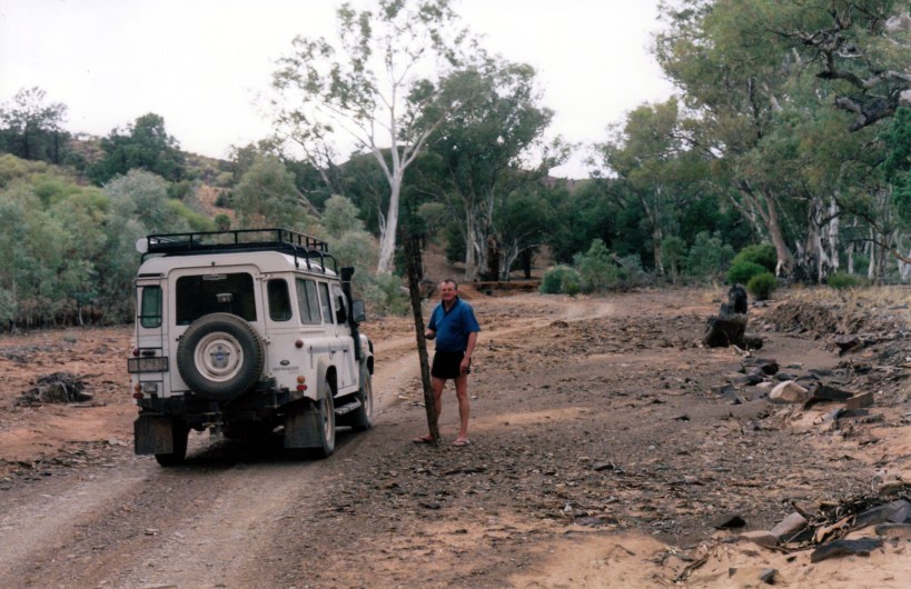
The PAR track in Hannigans Gap
We stopped and collected a small cypress pine log from there, to become woodwork timber and some sort of permanent souvenir.
After Hannigans Gap it was slow going, with lots of little gullies and channels to negotiate.
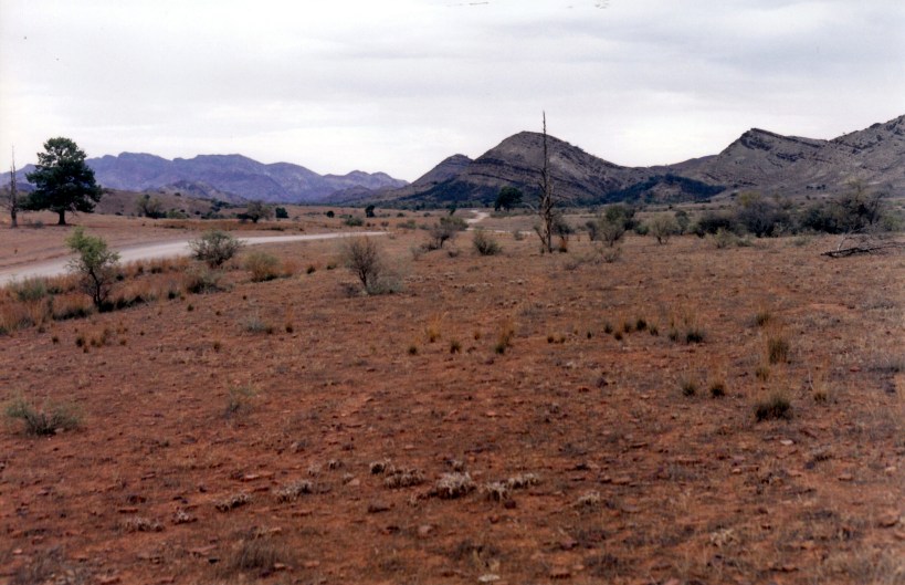
The PAR track in the Oratunga Creek valley
We reached the Artimore ruins. This was established as a sheep station in the 1850’s, but abandoned in the early 20th century, due to drought and the ravages of wild dogs and rabbits. Clearly, in its time, there were a number of quite substantial stone buildings here. There was enough left of these to make the drive worthwhile – and they were in a superb setting, in a valley amongst the rugged ranges.
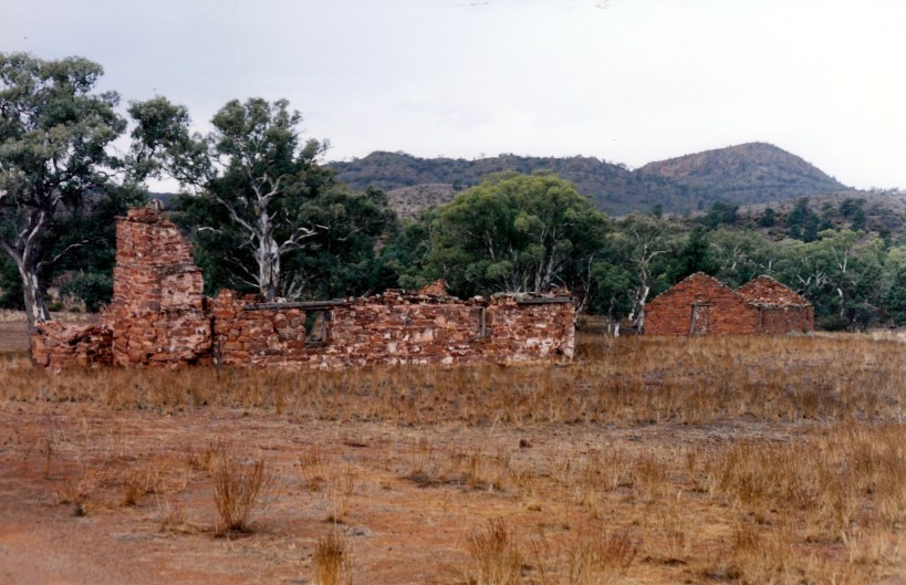
Artimore ruins – possibly the main homestead?
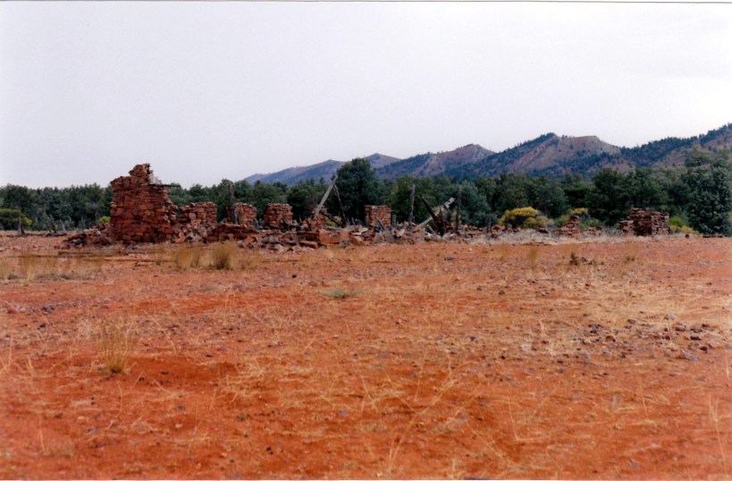
This may have been the workers’ quarters?

The Artimore ruins in their rugged setting
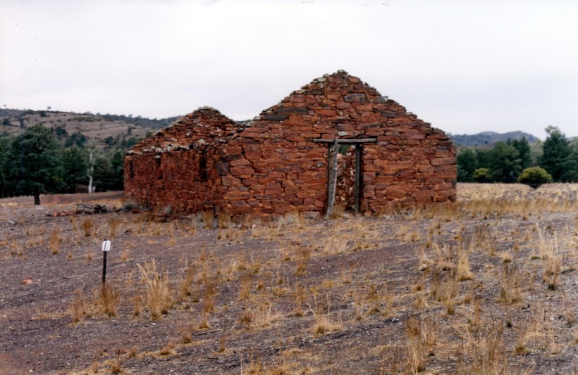
The workmanship is evident in this ruined building at Artimore
After looking around the ruins for a time – too short – we continued on. On my not very detailed map, a track was shown going south to the Blinman road. But there was a track junction not far from the ruins, and I was not sure which way to go. There was a rough Orantunga Station sign, pointing one way. We remembered the Willow Springs people saying that Orantunga had set up something similar to Skytrek, so thought we had better not go that way.
After quite a lot of very tense and rather rough kms, we came to a PAR signed gate, and knew that we were not going to end up in nowhere, or at a locked gate! We were unsure of the distance we still had to go, it was getting late, and it had been threatening to rain all day. We had only had a few drops, but the sky was dark.
We were very relieved when we then quite quickly reached what looked like the Angorichina road, turned right, and soon after met the Blinman to Wilpena road.
On the way back stopped at Stokes Lookout to watch the sunset – it was that late!
We got back to Wilpena just after dark, having driven 229kms.
Despite the anxiety at times, it had been a great day. One of John’s “little adventures”, and one which ended better than some!
Tea was packet soup, and a quickly made pasta, tomato and tuna dish – very good.

Our driving and walking routes in the Flinders Ranges, whilst we were based at Wilpena
