This Adventurous Age

Adventures travelling and working around Australia.


Leave a comment

1998 Travels July 6

MONDAY 6 JULY     KALPOWAR CAMP

It is already evident that the days are much hotter, away from the coast.

After breakfast, we went back to the Ranger Station to extend our stay here. Really like this campground, and there seems to be lots to explore in the Park. We registered for a total of four nights here and four at Hann Crossing, which is further north than here. They allocated us Site 12 there. There is a policy that tents can only stay in one place at Kalpowar for five days, so as to give the grass a chance to recover a bit. We figure that, with the time here and then at Hann Crossing, we will have enough time to explore the National Park well, and also to recover between moves.

07-08-1998 Lakefield National Park.JPG

Lakefield National Park.

We only felt like a small outing today, so drove to Mick Feinn Waterhole, on the Normanby River, upstream from Kalpowar. Spent some time here, bird watching. We found some Sarus cranes – like brolgas but with a different head marking.

07-06-1998 02 Sarus Cranes Kalpowar.jpg

Sarus cranes at Mick Feinn Waterhole

07-06-1998 04 mick finn whole tk.jpg

Crossing a small gully on the track to Mick Feinn Waterhole

07-06-1998 03 Mick Finn waterhole tk and line on trees.jpg

Typical Lakefield National Park country near Mick Feinn Waterhole.There is what appears to be a flood line mark across the trees.

Got back to camp for a late lunch.

Walked around the camp area and along the river, for a while.

The campground has remained almost full through today.

Tea was steak, fries and salad. Now that I am using the gas camp stove, am limited to two burners, so meals have to fit that parameter.

Used the radphone to call K – he confirmed that he had received the phone message we left before we left Cooktown, that he is to send mail to Weipa, and he said he would do so. The contact faded out after a while.

Another early night – tent camping away from electricity tends to encourage this


Leave a comment

1998 Travels July 5

SUNDAY 5 JULY   COOKTOWN TO KALPOWAR CROSSING   184kms

It took us two hours to pack up the camp, this morning!

It was hard on John’s leg – he did too much of the heavy lifting and bending. He wanted to protect my back, but he is also not good at standing by while someone else does the work. He expressed some doubts about continuing on, but we decided not to change our minds at this stage. Surprisingly, his leg eased somewhat with the driving, despite a heap of gear work. He let me do more of the heavy stuff when we set up camp again in the afternoon, though.

On the way out of Cooktown, we got diesel – 79cpl. It is a while since we have paid that much, but I suspect it will only get worse, further up the Cape.

We took the road out of Cooktown that goes along the Endeavour River, crossing it on a bridge, then passing the airstrip. There was a mix of scrub and farmed country. We passed the Endeavour Falls Caravan Park, some 30kms from town. We’d moved onto dirt road, and then came to our first creek ford for this expedition – but not the last. It was by Isabella Falls – a low cascade – and we parked and went to look at these.

07-05-1998 01 Battlecamp rd first ford.jpg

The first water crossing of the Cape trip – on the Battlecamp Road

07-05-1998 02 Isabella Falls Battlecamp Rd.jpg

Isabella Falls

Only a few kms beyond the falls we were into a patch of rainforest, and then climbing up into some range country, where the road was bendy. This lasted until the Normanby River ford, some 65kms from Cooktown.

Overall, the Battlecamp road was not too bad. There were some corrugated areas and some shallow sandy patches. There were some gates to open and close, but there were a couple of vehicles close behind us, so they got to close them!

Most of the way was through the savanna type wooded grasslands – quite tall, dry grass. For a while we ran parallel to the Battlecamp Range, which was a bit like some of the flatter parts of the Grampians, with shallow, cliff-like escarpments that seemed quite rugged. We could just glimpse parts in the distance.

The Battlecamp name comes from the 1870’s, when a group of people heading for the Palmer River goldfields were attacked by a large group of aborigines, somewhere along this route.

The Normanby River ford was shallow and easy. The Laura River was dry at the crossing, with a very wide, sandy (deep sand) bed – flattened by traffic, so it was not too hard if one followed the tracks of others. I would not want to try this crossing if there was much flow in it.

We were “ambushed” at the ford by a papaya fruit fly inspection point. We had heard there had been quarantine imposed up the Cape because of a fruit fly outbreak, but thought inspection would only be on the main road, so had not bothered to get the fruit we’d bought in Cooktown certified. So we declared our apples, pears, bananas and passionfruit. They allowed us to eat the bananas on the spot, then remove the cores of the apples and pears, and take the rest with us, plus the insides of the passionfruit. I forgot until later that we also had grapefruit, but don’t think they would have contained the problem bugs.

Ate our lunch at the checkpoint, chatting with the staff there. They recommended we camp at Kalpowar and told John to try detecting gold in the Mossman River, up from where it joins with the Laura River (but I could not later work out on the map where she meant!).

Just beyond the ford was the historic Old Laura Homestead, which we stopped to inspect. This dates from around 1900, and was built using termite resistant ironwood timber – thus it is still standing! It is a great example of the pioneer style architecture of these parts – using timber and corrugated iron, with shutters and wide verandas. As well as having to try to provide some comfort and cross ventilation for cooling, the early settlers felt they had to have their dwellings fortified against aboriginal attack.

07-05-1998 03 old laura.jpg

Old Laura Homestead – typical of Cape pioneer style

Just beyond Old Laura, the Battlecamp Road ended at the Lakefield Road, where we turned right. We intended to call in at the main Ranger Station, further on, but that was closed – being Sunday, I guess. So we continued on to the Ranger Station at the old Lakefield Homestead, crossing an increasing number of little dry creek beds.

At Lakefield, we were told that the only vacant site left was Number 10, Kalpowar, so we booked that – but for two nights only. We want to do some exploring of the Lakefield National Park, but thought Number 10 might not be a good site, and we might be able to change later. But it turned out to be lovely – a huge grassed area on which to put the tent, high on a bluff overlooking the Normanby River and the Kalpowar Crossing, where a rough track goes across the river to Kalpowar Homestead and on towards the coast.

We had a big area, even though there were neighbours on both sides. It was much better than the commercial site we’d left this morning, and only $7 a night! Behind where we put the tent there is quite a thicket of scrubby trees, vines and shrubs.

Our site has a fireplace, too, and there is a tap not far away. There is an amenities block with flushing toilets and even a shower – cold – but we were to find this refreshing, after the initial shock.

We set up camp, with the big tent, without rushing it, then relaxed over tea of cold chicken – the last of it. I had to stew the peeled apples and pears.

Found that, at night, we could hear the water rushing over little rapids in the river, quite clearly – wonderful. We are very happy!

07-05-1998 cooktown to kalpowar.JPG


Leave a comment

1998 Travels July 4

SATURDAY 4 JULY     COOKTOWN

It is still really windy. I washed a few things.

I did a quick final shop for supplies. Bought the Weekend Australian – I am really impressed that it reaches Cooktown on Saturday.

I repacked some of the plastic crates to even out for the foodstuffs we have used here.

John went to bowls after lunch. My back is definitely healing, but not yet up to bowls. I am also conscious that packing up tomorrow may test it again. I read the paper and pottered.

The day became more overcast and there were a few drops of rain.

I cooked John’s fish for his tea. He found the Long Tom extremely bony, but ploughed on valiantly. I had cold chook.

The week in Cooktown has been very pleasant. I like this town. But can’t believe the price of real estate here. Ordinary houses are more expensive than our place at home! In a town that has lousy summer weather, can be cut off in the wet season, has only unsealed road access, and has cyclones. Unreal!


Leave a comment

1998 Travels July 3

FRIDAY 3 JULY     COOKTOWN

It was still very windy in the morning – really strong gusts with that loud roaring noise. It becomes wearing after a while. It seems to actually happen in narrow bands – can hear it coming, and brace for the onslaught, but then sometimes it blows in a nearby area and where we are is still. Very strange.

Lazed around camp in the morning – recovering from the marathon of yesterday.

After lunch, drove out to Archer Point – the track out there leaves the main road before Black Mountain.

Archer Point is a scenic place. There are huge hills coming down to the sea in both directions. A lot of tracks comb the headland. It is stony, low scrubby country. There is a light station up on the headland; there was a set of old cement stairs, unattached to anything, that were quite incongruous. Maybe they were remnants from an earlier lighthouse structure?

07-03-1998-02-archer-point-wendy

Staircase to nowhere at Archer Point

07-03-1998-01-archer-point-johns-pic

At Archer Point

John fished and caught a small something, and a long, thin fish we later identified as a Long Tom – had not seen one of those before.

07-03-1998-05-archer-point

John with Long Tom and something else

While we have been travelling north, there has been much publicity and drama over two American divers who were “lost” by one of the charter boats operating out of Port Douglas, back in January. There seemed to be a degree of mystery attached to the disappearance of the honeymooning couple. A couple of days ago, a diver’s slate that may have belonged to one of them was found washed up here at Archer Point. There is now argument over whether this was “for real” or planted there.

07-03-1998-04-sth-view-from-archer-point

Outlook south at Archer Point – into the Daintree

I cooked a roast chook tea – a last treat for John and to make up for the egg debacle.


Leave a comment

1998 Travels July 2

THURSDAY 2 JULY      COOKTOWN

Today was warm and dry.

After much agonizing, this week, about the dilemma of the eggs left in the caravan pantry, today we set out to drive back to the van at Wonga, via the Bloomfield Track. This route is shorter – about half the distance – than the inland route. We had intended to come back this way, after the Cape trip; this is just an earlier experience of it! We will see the Track from both perspectives – coming and going.

We left Cooktown at 9am. Once we turned onto the unsealed road and passed the Lions Den Hotel, we were on new ground. And soon into the scrub and forest country for a while. Then we descended to the Bloomfield River and the tiny Ayton settlement. Just on from that, by the Wujal Wujal community, crossed the Bloomfield River on the dry causeway. This used to be a problem point on the Track, crossing the tidal stretch of the river, but with the causeway it is not an issue in the Dry. Then it was back into forest country and the Bloomfield Track proper.

07-02-1998 01 Bloomfield Track.jpg

On the Bloomfield Track

Whilst there was an access road from the north, to Ayton and Wujal Wujal – i.e. as far as the Bloomfield River, that was it, until the early 1980’s when local councils wanted to put a road from the south to the river – to aid tourism and development. Because of the pristine nature of the rainforest, north of Cape Tribulation, there was a major environmentalist protest about the road. It was put through, anyway, although to minimize disturbance of the environment, it did not wind about as much as would be normal on some of the steep gradients. To prevent development of the newly opened area, the environment movement managed to have it declared a World Heritage Area.

07-02-1998 03 bloomfield tk.jpg

A steep section of the Bloomfield Track

So – south of the causeway over the Bloomfield River, the road was narrow, often bendy, and with a couple of really steep gradients. The Cowie Range was really steep. One tricky section had concrete like blocks laid up it, to ensure traction and prevent the track being churned up or eroded.  It is regarded as 4WD, so tourists can’t bring hire cars up here – only 4WD’s.

07-02-1998-02-daintree-alexandra-lo

Lookout over the mouth of the Daintree River

When we arrived at the caravan park, T was surprised to see us – then amused! P – a fellow camper we had gotten to know a bit, came charging over to see what was wrong.

We spent all of about 15 minutes at the van! Returned John’s printer and paper, having decided that a million corrugations may not be healthy for it. Collected forgotten items – THE EGGS, the small radio, a camera battery.

Got diesel at Wonga Beach servo. 71cpl.

Then headed back across the ferry and up the Track. Rather a costly lot of eggs, all things considering.

We got back to Cooktown at 5.45pm. So, we actually had about eight hours of driving on the Track! It is a slow road.

07-02-1998-ckt-to-wonga

My back now does seem to be improving, despite all the sitting in Truck today, and the jarring at times. John’s leg has been hurting a lot, due to the rough driving and innumerable gear changes the road demands. So I got to do some driving: Thornton Beach to Wonga on the way down – including onto the ferry! Then Wonga to the start of the 4WD stuff on the way back, then from Ayton to Cooktown.

I guess it is now “official” that we are going to try to complete the Cape trek.

It was still windy in Cooktown when we got back.

We bought fish and chips for tea.

It was a very tiring day.


Leave a comment

1998 Travels July 1

WEDNESDAY 1 JULY     COOKTOWN

The start of the new financial year.

My back was very tight, this morning, to the point where it hurt to sit and to drive. I went to the chemist for a repeat on my Brufen script and checked with him its compatibility with my blood pressure medication, Gopten. The Brufen may diminish its effectiveness – so be it! Without the anti-inflammatory, the pain would send my blood pressure up, anyway.

We have a sense that we will probably never return to Cooktown, and so want to see as much as possible whilst here.

We drove to Quarantine Bay. Saw another snake on the road. We have seen more reptiles here in two days than for the whole of the trip to date! Don’t like it.

Quarantine Bay was a pretty beach, with bush right down to the sand – which we are getting used to, here. Did not walk on it, due to back.

Drove back to the Annan River, where John wanted to try fishing off the bridge. I sat round in Truck and watched him. He could not stay too long, because of bowls this afternoon.

07-01-1998 annan bridge.jpg

The bridge over the Annan River

07-01-1998-john-fish

John fishing from the Annan bridge – and vehicle crossing the single lane bridge

I did not go to bowls – John was not too happy about this, but I really am finding movement hard. I rested my back, in the tent. It was improving by night time. John was pleased with his bowling – and enjoyed meeting some of the locals at the club.

The wind came up again in the afternoon.

Tea was sausages served in slices of bread, with salad, followed by stewed apple and yoghurt.


Leave a comment

1998 Travels June 30

TUESDAY 30 JUNE     COOKTOWN

We had a touring day – another fine, sunny day.

Took a picnic lunch and drove to Keatings Lagoon, beside the main road, between the town and the Annan River. Purpose – bird watching. Took a short road from the main road to the carpark, then walked the 800metre track, via the bird hide, to its end at a picnic point.

06-30-1998 03 Keatings Lagoon.jpg

Keatings Lagoon from inside the bird hide

We made slow progress, stopping to look at birds in the bush, through the binoculars, pointing them out to each other, and slowly seeing how close we could get, to identify same.

At one point, whilst doing this, we were rushed at by a snake – maybe a metre long, thin, with a browny top and lime yellow belly. It stopped short of us – mind you, we skipped back pretty fast – then it waited by the track as we walked quickly past, as far from it as the vegetation would allow. Hoped it might prefer us to speed away, rather than try to inch past! It was a pretty aggressive message and we got a fright. Another life lesson – it is best to lower binoculars from eyes, when advancing upon a bird, and pay some attention to the ground level as well as the treetops.

At the Lagoon, we saw Jacana birds, amongst others. These birds have huge feet and can walk on slightly submerged lily leaves, and the like – giving them the appearance of walking on water. Hence, they are also called Jesus birds. Overall, there was not the populations of water birds here that I had expected.

Back to Truck and our next stop – at Black Mountain. Crossed back over that single lane bridge over the Annan, on the way.

06-30-1998 downstream from Annan Bridge.jpg

The Annan River and Mt Cook – looking downstrean from the bridge

At Black Mountain, we looked at the information boards, but did not go scrambling up amongst the boulders. The mountain consists of large, loose, jumbled, granite boulders; a type of algae growing on their surface makes them look black. As there is no soil or similar between the rocks, it looks a bit like some giant hands have dumped them there. I found it an eerily unpleasant place and can see why the legends of lost people and the like have grown up. Apparently, there are big hollows, caves and passages amongst the jumbled boulders that might account for some of the strange noises that have been heard here, and maybe the missing people also. I didn’t like it at all!

06-30-1998 04 Black Mt.jpg

Black Mountain

06-30-1998 06 Black Mt explanation.jpg

We drove on to the “little” Annan River, which is simply that river, but in a smaller form, where the road crosses it, some 30kms from Cooktown. I wanted to come here to look at the falls, upstream from the bridge, and the gorge, downstream. This was a pleasant place, with a  few potentially good bush camp spots. We had our lunch there and walked to both features. The gorge is a very narrow little chasm through the rock.

06-30-1998 07 falls on Little Annan R.jpg

Falls on the Little Annan River

06-30-1998 08 Little Annan Gorge with road bridge.jpg

The gorge on the Little Annan River – and the road bridge

Between the Little Annan and Black Mountain is where the Bloomfield Track route emerges onto the main road. A little way along this road – here the Helenvale Road – is the Lions Den Hotel. This hotel dates from the Palmer River gold rush days, and is a “must do” for travellers on the Bloomfield Track – and for other travellers in these parts. We each had a beer – expensive at $6.60 for us both – but we can now say we’ve had a drink at the iconic Lions Den Hotel!

06-30-1998 10 lions den.jpg

The iconic Lions Den Hotel

We saw a big, thick, slaty coloured python (we think) sunbaking by the side of the road near the Lions Den.

It has been very much a wildlife day, today. This morning, I got a real fright when I went to open the back door of Truck. That recessed handle area is an attractive hidey place for all sorts of undesirables, it seems – in this instance, one nasty looking spider that did not like being disturbed! Got to remember to be careful in the future, and look first before going to open door.

06-30-1998 01 look.jpg

Back in Cooktown, I had another film processed – from the “instant” camera – because the shop here seems to do such a good job. Having had some batches of photos processed rather unsatisfactorily, I am a bit fussy these days. The business is for sale for $130,000, as the owner wants to retire. That seems a lot to me, for a place where the trade has got to be very seasonal, but he says his profit is about $50,000 a year.

I bought some meat for tea and a few other grocery items.

Tea was camp-made hamburgers.

The wind that was around earlier in the day dropped in the afternoon. There were many flying ant type bugs around the camp, so many that we sat out in darkness after tea, as they were everywhere and the light brought them in. Seems the wind serves some purpose – what a choice: a noisy gale that threatens to bring down trees, or a plague of bugs!


Leave a comment

1998 Travels June 29

MONDAY 29 JUNE     COOKTOWN

We had a relaxed day, today, enjoying the sunshine and the laid-back air of the town. Watched the many birds that inhabit the caravan park.

This is the start of the 26th week of our trip – half a year, already!

We went for a walk around some of the streets and tracks near the caravan park, which is on the eastern edge of the town, where it merges into the forested slopes of Mount Cook. The neighbourhood is a mix of houses, vacant blocks, and bush.

Drove to the shops for bread for lunch, to the PO to check and where there was a letter from R. I found a camera shop/film processor and put in the roll of film I finished up on Grassy Hill. Went to the bowls club, where there was life, after all, and John booked us in for bowls on Wednesday afternoon.

After lunch, went for a drive to Finch Bay. That road skirts the southern side of the Botanic Gardens – which appear to be mostly bushland. At Finch Bay, we walked on the little beach.

Then drove back into town again, parked Truck and walked along some of Charlotte Street – the main street – looking at some of the beautiful old buildings there. Cooktown began, as a port, when gold was found at the inland Palmer River, in the 1870’s and there are a few substantial buildings that have survived from those times.

06-30-1998 02 historic building Cooktown.jpg

Some of Cooktown’s grand old buildings

We browsed in the Croc Shop, where I bought a Cape York map. There is no shortage of tourist souvenirs up this way! Apparently there is another Croc Shop, too – on the Cape, half way between Bamaga and the Tip. There is a sign in the window of the Croc Shop that warns of a million corrugations in the road between Cooktown and the Tip of Cape York! I hope not.

Collected my photos – the man did an excellent job – which covered the time from our day at Wangetti Beach, till here.

Drove up Grassy Hill again, to watch the sunset. Was worth doing. Being on the east coast, this was not a sun set into the ocean, but a fading of the light to soft pinks, greys, blues, very muted and gentle.

06-29-1998 03 Grassy Hill dusk view nth.jpg

Looking along the coastline at dusk, from Grassy Hill

06-29-1998 09 dusk from grassy hill cooktown.JPG

The sun setting over the Battlecamp Range – from Grassy Hill

There was no wind at the caravan park tonight, so it is not a daily event, after all.

Tea was a risotto – pumpkin, sage, olives and parmesan. Not bad – but probably more to my taste than John’s! It was followed by some paw paw I bought today.

My knee seems a bit better – at least I have managed today’s fairly modest activities – and the back seems to be improving.

John is cross that we did not bring the caravan up here and so have more comfort here. But we had to take to the tent sooner or later, and I am very happy with our secure Wonga van storage.


Leave a comment

1998 Travels June 28

SUNDAY 28 JUNE      COOKTOWN

We had a very slow start to the day. My lower back was sore, from yesterday’s mishap, so I took a couple of the Brufen pills that I carry for this eventuality.

Drove down town to the newsagent, for a paper. Drove past the bowls club – naturally – where John checked out a sign that gave the details of their playing times. One of these was Sunday afternoon at 1pm, so he decreed that we would bowl – despite my sore back!

Then drove up Grassy Hill, to the lookout on top. We were absolutely amazed – there was the most incredible panorama over the town and the Endeavour River. This would have to be one of the best views in Australia! The river is a big one, and winds off in the distance towards ranges.

06-28-1998 04 endeavour r.jpg

Endeavour River and Battlecamp Range from Grassy Hill

We are conscious that, in a short while, if things work out, we will be heading into those ranges.

The town’s buildings cluster beneath the hill, between it and the river. There were lots of boats moored in the river.

06-28-1998 01 cooktown.jpg

Central Cooktown from Grassy Hill.

There was a strangely shaped cloud hanging over Mt Cook, behind us, looking for all the world like a flying saucer! The film “Independence Day” came to mind.

06-28-1998 03 independence day.jpg

The Space Invaders have arroved!

There is much Cook memorabilia around the town, for obvious reasons. It was in the Endeavour River, here in 1770, that Captain Cook beached his damaged Endeavour ship, for repairs after it was damaged on a reef further south. One can see how the Endeavour River provided him with such a great, sheltered place to carry out his ship repairs. However, it does not answer one question that bothers historians: did he just get lucky when he continued on north, apparently into unknown waters, after the Endeavour was holed – or did he know from a secret Portuguese map made by de Medonca in 1522, that there was this ideal careening place ahead?

The historian in me looked down from Grassy Hill and tried to imagine the encampment of British sailors, down beside the river.

Back to the tent, for a rushed lunch, so we could get to the bowls club by 1pm. There was no one else there, thus it was deduced, no bowls. Can’t say I was disappointed.

Left Truck at the bowls club and walked along the river foreshore area – the harbour, I guess. There were boats there advertising charters, both out to sea for fishing, and up the river sightseeing. There were also some rather decrepit looking boats and some rather rough looking people. It crosses my mind that, if one does not want to be found, Cooktown is probably a pretty good place to hide away – and life on an old boat would be cheap.

We followed the waterside road around as far as the old Powder Magazine (explosives store), on the northern base of Grassy Hill. This dates from the 1870’s, when there were explosives being brought in for use on the Palmer River goldfields, and there was need for safe storage of same. It is being restored.

As we walked, looked at houses perched up on the slopes above the river, saying what unsurpassed views they had, looking north along the coast, or west up the river towards the ranges. Reckon I could live with those, though one might feel a tad exposed in a cyclone?

Walked back to where Truck was parked by the bowls club, then drove to the supermarket, in the main street, for a few groceries and – principally – half a dozen cans of cold beer. The weather is making this seem like a desirable drink!

Back to camp. About 4pm, with a roar like an express train, which really startled us, the wind arrived! It blew strongly into the night. This was happening when we arrived yesterday, too, and we started to wonder if it was a daily event. It was really loud through the big paperbarks around us.

06-28-1998 08 Wendy CooTown.jpg

The big tent set up at Cooktown. The awning has attachable side flaps for extra shade or shelter from the elements. The front door is full width – here partly tied up

Despite the wind, John went fishing, just on dark, down at the Esplanade area. No joy.

Tea was squid in a lime/chilli ginger sauce, with rice.

The knee that I landed on when I tripped yesterday is swollen and sore, as well as my back. The latter is really stiffening up, making movement uncomfortable. I need to think before making any move! I am really cross that I have done this, and can’t help thinking about Tasmania in 1993, when back landed me in hospital. I couldn’t bear it, if this stuffs up this part of our trip!


Leave a comment

1998 Travels June 27

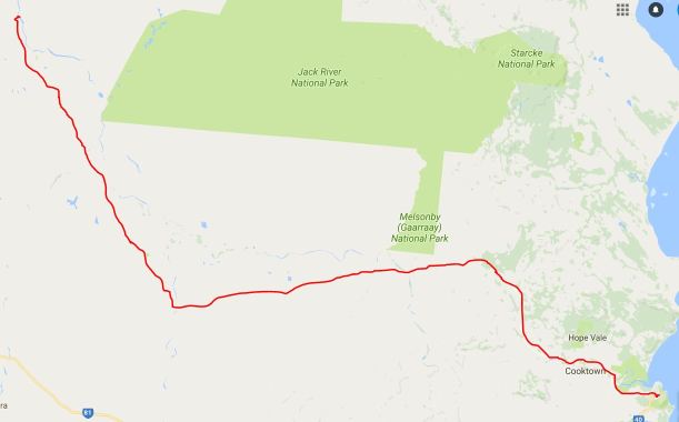
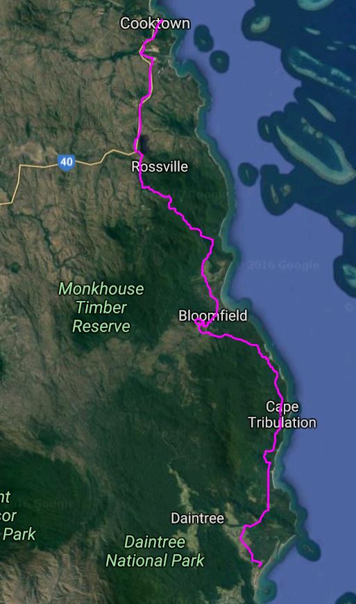
SATURDAY 27 JUNE   WONGA BEACH TO COOKTOWN   297kms

We were up at 7am, as there was still so much packing to do. At least, we had a lovely fine, warm day.

We packed up the van, put away the awning inside the van, and John backed the van into the storage space allocated by T, next to another stored van, and right by his and C’s camp. Squeezing into this tight space was managed easily with T’s directions. John then took off the heavy hitch from the back of Truck – another item to go in the van.

Truck seems very full! It was a wrench to leave the van for such a potentially long time – maybe a couple of months. The last bit of packing was to put the bikes inside the van, standing up in the central aisle. We figure the nature of Cape tracks will not encourage their use.

We left at 11.30am. We are finally away on this year’s big adventure. I feel a mix of trepidation and anticipation. We are stepping out of what has become our comfort zone.

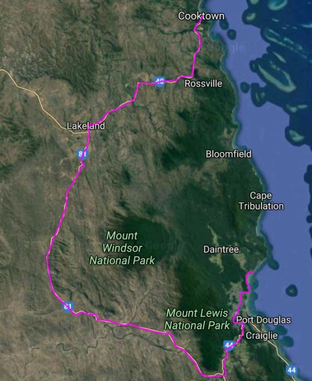
Our first destination is Cooktown, the isolated town on the coast to the north of here. It is of tourist interest, mostly due to its history, and will be a good place to stay for a short time, to make sure we are ready to continue on.

We drove to Mossman, stopping at a fruit place near there, to buy some fruit and vegies, then in the town itself, for cash money, a phone card and a paper. Got diesel – 72cpl.

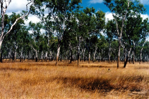
Just south of Mossman, took the link road, through Julatten, to the Peninsula Development Road. The road climbed the forested range – the usual winding, fairly narrow, but sealed, road up the mountains. It levelled off after Julatten, by which time we were in farmland. Just north of Mt Molloy township, we joined the road north.

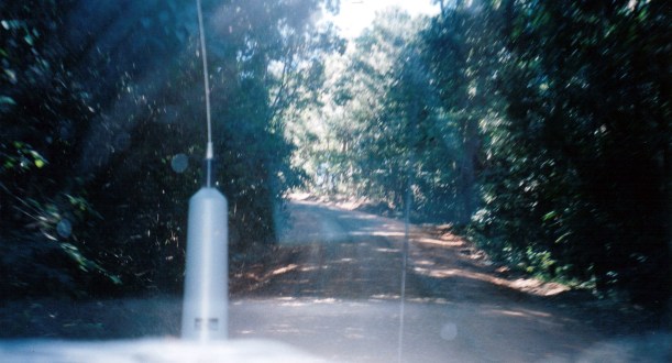
We stopped for lunch at the McLeod River, a few kms north of Mt Carbine. It was a pleasant spot by a little flowing stream, with the only facility being a rubbish bin.

06-27-1998 01 mcleod r. away.jpg

Our lunch stop at the McLeod River – and the loaded-up Truck

Our next stop was at the Palmer River Roadhouse. This was most interesting. It is run by a fairly adventurous type who had been a croc hunter. He has collected a varied lot of bits and pieces, typical of the area. There were a few van spots there, overlooking the Palmer River.

We bought a cold drink each, and I bought a fridge magnet. I like these unusual ones from places most people have never heard of!

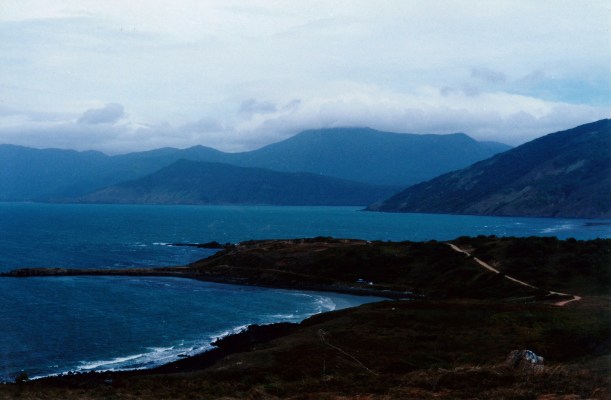
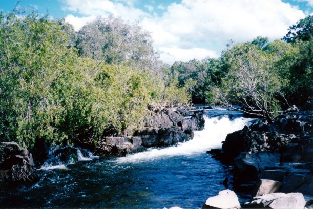
After Palmer River, the road was unsealed for most of the way, but mostly reasonable going. Up and over the Byerstown Range was a bit rough, and we got stuck behind a mustering truck, so it was slow – and dusty! We did stop at a lookout point that gave a huge vista over the vast and rugged countryside.

06-27-1998 02 Country round Byerstown Range.jpg

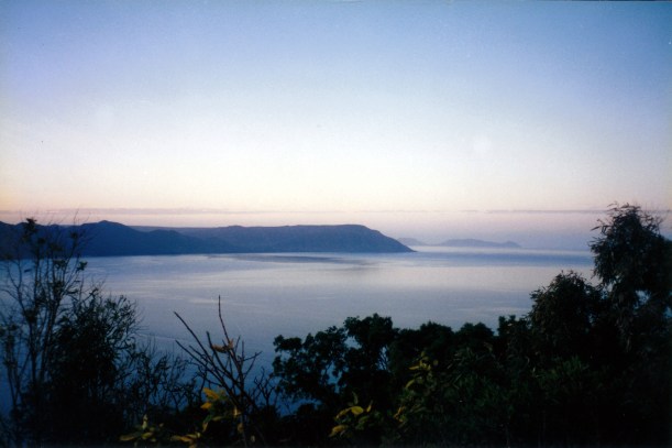
The country north of the Palmer River – from the top of the Byerstown Range. That’s where we are going.

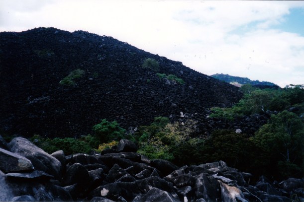
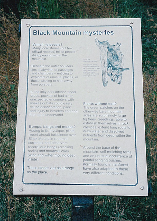
We did not stop at Lakeland – a small settlement, where the road up the Cape turns off from the Cooktown road. Nor did we stop at the striking looking Black Mountain.

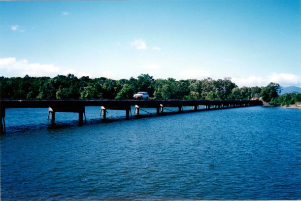
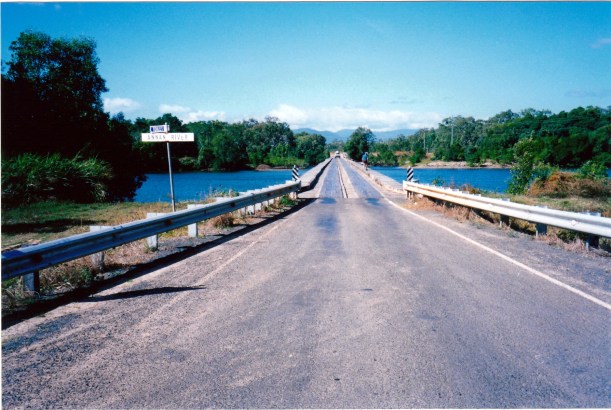
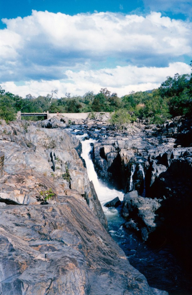
The bridge over the wide Annan River, not far from Cooktown, was a single-lane, elevated causeway-like affair, and quite long.

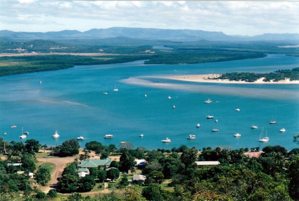
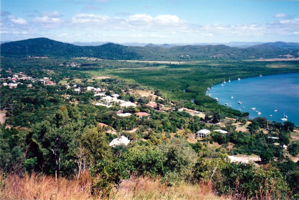
In Cooktown, we went straight to the Peninsula Caravan Park, which is the only one described in any detail in my Cape York “bible” – the book written by Viv and Ron Moon. It mentions two other parks by name only, but recommends the Peninsula as shady and pleasant. It cost $15 a night, with the 7th night free. We took a week, because we need to see if John’s hip will be ok for us to continue on. He is still not sure.

I found the park to be a very sprawling and rather strange place. There were lots of large, tree-sized paperbarks. There was a part that was kind of formally laid out, but mostly it was scrappy; there were some cement slabs around, but with little seeming order. The amenities were older and a bit scruffy.

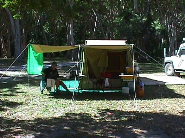
We found a spot that seemed alright, in amongst the melaleucas, but with a bit of a walk to the toilets!

We set our camp up fully – and it was well after dark by the time it was done.

Whilst carrying the fridge from Truck to tent, I tripped on the edge of a slab, hidden amongst leaves and debris. I went down hard, managing to protect the fridge, but twisted my back, and shook myself up a bit.

Tea was the chicken marylands I cooked yesterday, and salads.

I realize that I have forgotten our small radio – which can be a means of keeping in touch with the world, but which may not receive much out in the wilds. So that is no big deal. More serious is the realization that I have left a dozen eggs in the van’s pantry cupboard! We discuss what the van will be like if these “cook” in the tropical heat in the sealed-up van, and explode. This is not good – with hindsight, maybe we should have left some keys with T. We will think more about it tomorrow!

We now have no TV, of course, but we really need an early night, after the efforts of the past couple of days, so we head for bed not long after tea. Back on the lilo!

06-27-1998-wonga-bch-to-cooktown