This Adventurous Age

Adventures travelling and working around Australia.


Leave a comment

1998 Travels August 5

 WEDNESDAY 5 AUGUST     SEISIA

Today was another hot one.

Tomorrow is the “date” anniversary of John’s hip replacement, last year, today is the “day” anniversary. Last year, when he was so ill and in hospital, we promised ourselves to go stand on the northern tip of Australia in a year’s time! I am superstitious that, if we wait until tomorrow to go, something will go wrong, so after lunch, we decided to go today.

Got fuel at Seisia – 93cpl.

Drove back to Bamaga, then took the track north. The way from Bamaga to Lockerbie ruins is VERY rough. At Lockerbie, there is a Croc Shop – a tent – with a very gregarious operator with a BIG dog. He has to pay Cairns-level rental to the Injinoo, to be here, and is definitely less than impressed with the locals. He says the Badu and Murray Islanders are the really bad ones. We got the impression the dog was for more than company! He caretakes the resort at Punsand in the Wet  Season, so is up here year round.

Also at Lockerbie are the remains of the old homestead, made of corrugated iron. Lockerbie homestead was established by Frank Jardine, the Cape pioneer, in the 1860’s. The Holland family lived here from about 1930, until the land was handed over for the aboriginals in the 1960’s. The local main elder is building a new home on the site now – a political statement, we wonder?

North of Lockerbie ruins and the junction with the Punsand track, the way goes through the Lockerbie Scrub. This is definitely not scrub, but a rather unique area of rainforest. It is very different from the usual savanna woodland up here – dense, green, tall trees, vines – lovely. It made the final stretch of driving to the Top, very pleasant.

We parked at the end of the road, at the Pajinka camp area. I am very glad we did not try to camp here! The Pajinka Wilderness Lodge – only 500metres from the Tip – was a luxury tourist venture built in the mid 80’s, by Bush Pilot Airways at a cost of over $1million.  As The Top of Australia Wilderness Lodge it passed through ownership by Ansett Airlines and then Qantas, offering a really unique and beautiful place to stay, go on fishing trips – and access the Tip. There was a campground there too. In 1992 it was bought with government funds for the Injinoo people to run as a tourism venture that would earn them money. It is now very run down, verging on derelict. The campground toilet is totally grotty – a very long time since that has been cleaned! The shower is locked up – that also looks awful. We wonder what standard the rest of this one-time luxury resort is in, under this Injinoo management? Another waste of taxpayers’ funds?

We set out to walk the 600 or so metres to the Tip. The first 400 metres was through rainforest, on a nice, newish boardwalk – obviously part of the Resort infrastructure. There were numbered signs by some features – but no interpretative pamphlets to show us what the numbers referred to.

We saw a huge spider hanging in a web across part of the track – by almost walking into it!

08-05-1998-02-large-spider

Hanging just at face level!

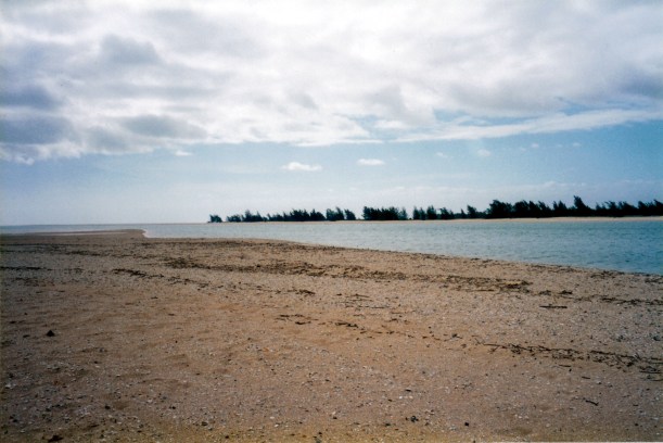
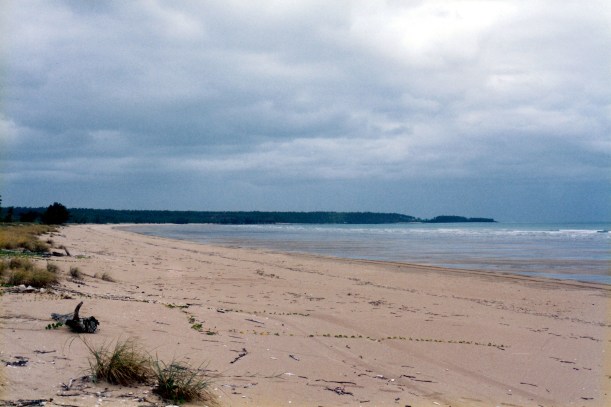
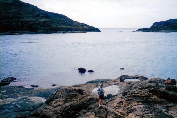
We chose to go via Frangipani Beach track, rather than straight along the low ridge track. After emerging onto the very pretty beach, we walked around a stand of mangroves at the end of the beach – it was low tide – and then up a track onto the rocky promontory that is the Tip, and along to the end.

08-05-1998 03 track to tip.jpg

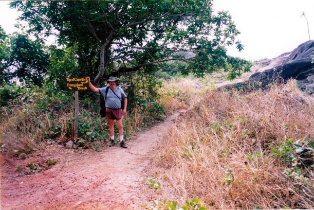
We went the long way round – via Frangipani Beach

08-05-1998 05 tk to tip from beach.jpg

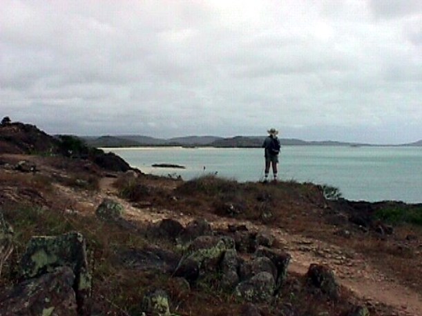
Climbing up to the ridge from Frangipani Beach

08-05-1998 06 looking down on tip.jpg

Our goal – the tip of Cape York

WE DID IT!  It is excellent to just be here, after the trauma of a year ago.

However, the place is not as I envisaged. Instead of standing here, looking out across the ocean towards Asia to the north, the view is across a fairly narrow channel to a couple of large islands – York and Eborac Islands – that block any further view. However, we stood and gazed north for a while. Some other people there said they had seen a croc cruise by, below, not long back. We did see a large turtle putting its head up, at intervals.

08-05-1998 07 top.jpg

The northern most point of the Australian continent

We took photos. Apart from the sign about standing at the northernmost point of the Australian continent, (just in case someone got here without realizing it) the coastal views to the west are brilliant.

08-05-1998 10 Cape York Wendy.jpg

The view west, from the ridge track to the Tip

We walked a little back from the Tip, along the more eastern side, to where there is a cairn pointing directions and distances to main places. As the crow flies, we are a tad over 3000kms from home, here.

08-05-1998 13 melb thatway.jpg

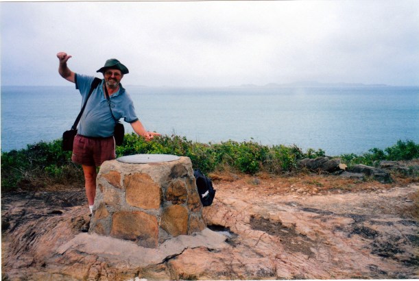
Melbourne that-a-way – 3000+ kilometres

08-05-1998 14 Wendy at Tip.jpg

Behind Wendy lie the Torres Strait Islands and, eventually, Asia

There were similarly great views from up there, along the top part of the Cape.

Walked back along the ridge to the rainforest boardwalk and thus back to Truck.

08-05-1998-15-frangipanni-beach-from-tip-track

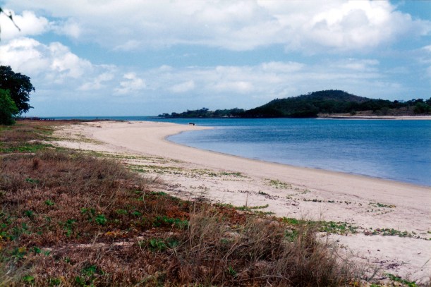
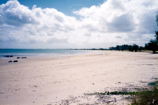
Frangipani Beach and the view towards Punsand at low tide

It would have been rather special, in the days when the Lodge and camp area were functioning, to be able to walk from there to the Tip, at sunset and sunrise.

08-04-1998 aerial card view of Tip.jpg

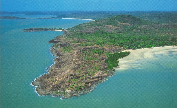
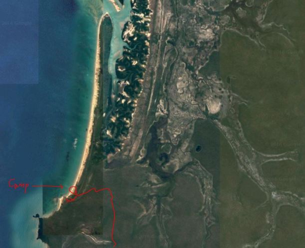
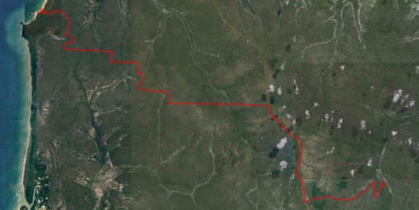
Aerial view of the Cape, showing the ridge track and track up from Frangipani Beach (from a card)

So – main goal for 1998 achieved. It feels good.

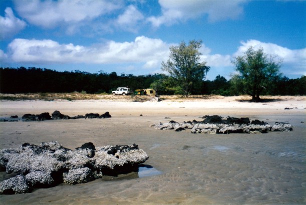
We drove back to Seisia, stopping again at the Croc Tent, where we bought cards, a car sticker (must boast sometimes!), a t-shirt each, and icy poles. The man there told us that the direct route to Seisia that leaves the main track south of the Tent, is not as corrugated as the main track, but slow because it is narrow, winding. We decided, as it was getting late in the afternoon, to go back through Bamaga on the way that was familiar.

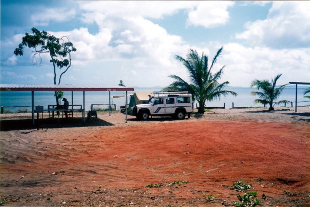
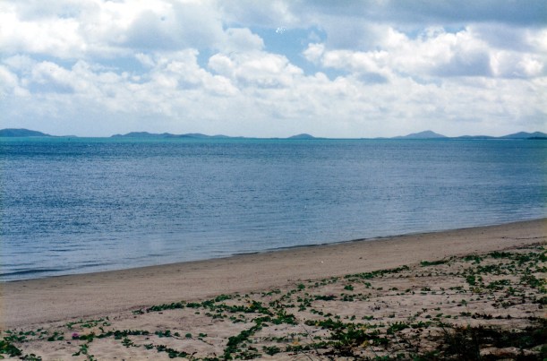
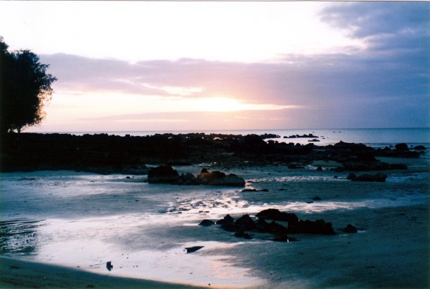
At our camp, the views out to the islands, and the colour of the sea, is always changing and different. We spend a lot of time just gazing out at it! The stretch of water between the top of the Cape, here, and Prince of Wales Island is called Endeavour Strait. Captain Cook certainly got around.

08-06-1998 02 seisia panorama 1.jpg

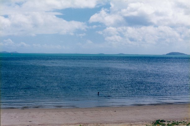
The Endeavour Strait and islands from our camp

Tea was fried rice.

In the evening, we played Scrabble with R and another, young, guy, who is also camping nearby.

We drove 92kms today.


Leave a comment

1998 Travels August 4

TUESDAY 4 AUGUST     SEISIA

We did not do a great deal today, but there was a lot of enjoying just being here.

I did do the washing – machine at amenities. $3.60 a load. Wow.

John’s “boat” disappeared sometime during the night. It must have slid away quietly – or else the wine we drank while moon watching helped us sleep very soundly!

08-06-1998 05 Red Island Point,Seisia.jpg

Red Island Point from Seisia camp. The empty barge landing is just around the corner of the beach.

We strolled up to the barge landing/jetty and watched some people fishing. Saw a Jeep Cherokee parked there that looked like that of our broken down neighbours at Weipa, so left a note under the windscreen wiper.

Drove into Bamaga and bought lunch rolls at the bakery – they had multi-grain because the bread mix came in on yesterday’s barge. There is a list up on the bakery wall of people who owe the shop more than $400 each. How long does it take to run up a bill that big?

I have noticed that the shop staff we have encountered are locals – but Islanders, who seem very  efficient and capable. They seem to be dominant over the aborigines up here.

John went fishing after lunch, off the barge landing,  and caught a long tom and a sweetlip.

The Jeep did belong to the people from Weipa. They came into the landing after a day trip on a boat to Thursday Island, saw John and went and spoke to him. They then came round for a chat. Said the TI trip was a bit boring. It took an hour on the boat each way, and the sea was rough on the way back. It took a day under 3 weeks of waiting for them to get the Jeep repaired in Weipa! They came up the Bypass Roads then! They are staying at Umagico campground. They said the Punsand/Pajinka road is very rough.

The people we saw at the Jardine Crossing came in and camped near us. They went to the Top yesterday, and camped overnight in what they said were filthy conditions at Pajinka, which is really no longer functioning, then came on here today. They have to go back to the Top again, though, because their video camera battery went flat. No power at Pajinka to charge it. They are rather slaves to that camera.

08-06-1998 01 seisia camp.jpg

Our Seisia camp

Later in the afternoon, the man who was camped, with dog, at Vrilya, also came in and camped at the other side of the shelter – R and dog Portia. We all got talking.

08-04-1998 late day seisia.jpg

Late afternoon outlook from our camp – low tide in the Gulf

I cooked John’s catch for his tea, with fries. I had a tin of tuna.

It is coming up to a full moon. Doing the long walk at night, to the amenities block, is thus very pleasant.

There do not seem to be many biteys around here.


Leave a comment

1998 Travels August 3

MONDAY 3 AUGUST   VRILYA POINT TO SEISIA   130kms

Our packing up was done reasonably efficiently, considering the deep sand all round us.

Retraced our previous route, back to the Bypass Road. I am quite amused by the way these tracks take little deviations to their otherwise straight lines, because a tree has fallen at some stage, or someone has made a bog hole – just barge around same, through the bush!

08-03-1998 01 Vrilya tk goes round fallen trees.jpg

The Vrilya Point track goes around fallen trees

The bridge at Crystal Creek was no easier this way. I got out first and walked across, to try to guide John with the wheel placement. Despite this, he ran the rear back wheel up on top of the raised log that marks the side of the structure – and I held my breath, hoping Truck would come down again on the right side of it. Which it did. Then he needed two attempts to get round the corner at the far end, due to the big hole there. It was all very tense.

We had a smoko there, to relax a bit. Then, onwards, turning left at the Bypass road, and on to the ferry over the Jardine River. The Bypass Road was corrugated. There were some sandy areas and dust drifts and exposed bars of rock. It needed a very careful watch of the track, as we drove.

There was a time when travellers had to ford the Jardine, which is about 140metres wide, in the Dry season, by vehicle, just like for the other stream crossings further south. This river was a major obstacle, impassable for much of the year. Even when low enough to drive through, it has the problems of a soft and sandy bottom, and a very soft sandbar that moves around, towards the middle. Walking it to check is a risky undertaking because of the large crocs in the river, there. About five years ago, someone was taken by a croc, here.

There was a bridge put over the river, near the ford, during WW2, when there was much defence activity around the Top – with over 10,000 troops up there  when invasion was feared. This bridge got washed away by floods.

But these days there is a barge/ferry, like on the Daintree. This has operated for a bit over a decade, now. Travellers are asked to use the ferry – but some still attempt to drive through. It is operated by the local people – encouraged by the Federal Government – and is thus a source of local employment and income. However, they are not the most reliable of operators, and some days no-one turns up to work the ferry, or they are very late. Apart from inconvenience to travellers, this has been causing big problems to the tour operators, who have schedules that may include meeting the Thursday Island ferry, or a plane. There was talk by the Qld Govt of putting in non-indigenous ferry operators, but it is said that Canberra threatened to reduce funding if this was done.

08-03-1998 03 jardine ferry.jpg

The ferry over the Jardine River

We struck a good day. Paid our $80 at the little office shack by the ferry. Cash only taken – and no receipt issued. One wonders how much is pocketed by the operators. This fee also “entitles” us to actually BE north of the Jardine, and also (a bit late) to camp at Vrilya Point. With no receipt, can’t prove we have paid – but then again, we are unlikely to have gotten here without doing so. We were then loaded and taken across – it took all of about 2 minutes!

08-03-1998 02 jardine ferry.jpg

Just us on this ferry trip

There is a fairly new set of Mobil fuel pumps near the ferry office. These no longer operate, though, so no fuel to be had there. It was a short lived venture of aboriginal enterprise. We were told later that there were two reasons it shut down: failure to pay Mobil for fuel deliveries, and because the fuel point became a gathering point for petrol sniffers. We had worked on the assumption that there would be no fuel between Weipa and Bamaga, anyway, and have our two jerry cans.

We stopped by the Jardine, ate our lunch of stale pitas,  and watched the ferry bring over another couple, with a Subaru. They had to video each step and thus were slow driving the car off, holding up a party of aboriginals who were heading south.

About 5kms from the ferry, we turned right, down the side track that is the OTL Track north of the Jardine, because we wanted to have a look at the old crossing point. We agreed there was no way we would ever have risked Truck in that! There has to be a line between adventurous and foolhardy.

Then backtracked and headed north towards Bamaga. The road was corrugated – still! In parts, it is cut quite deeply below the original surface. It rather looks as though whoever grades the road does not do it properly. There are no run off gutters made to the sides. This way, in the Wet season, the road must become one long watercourse!

Not far from Bamaga, we stopped to look at the wreckage of a DC3, that did not quite make it to the airstrip – then called Higginsfield. It was en route to Port Moresby, left Brisbane on 4th May, 1945 and crashed in the early hours of the 5th, hitting trees on approach in poor light, and burning, killing all six people on board.

08-03-1998 05 wreck DC3 parts.jpg

DC3 wreck from 1945, near Bamaga – the plane burnt on crashing

08-03-1998 06 dc3 wreck.jpg

A fence prevents access to the wreck, which is surprisingly intact still

On to Bamaga, the only real township north of Weipa and its administrative centre.

We checked out the bread shop but there were only white loaves, and went to the supermarket/store and bought some soy milk. I was rather surprised to find this there. We were also able to buy a cask of wine – cost $20! Ouch.

Then drove on to Seisia, a further 6kms on – a bitumen road!! Bamaga is not by the sea, but Seisia is. Both Bamaga and Seisia are Islander settlements – administered from Thursday Island. Seisia  is where the barge landing is – and so where goods destined for Bamaga are unloaded – hence the sealed road.

We booked into the Seisia camping ground, for $17 a night, with the 7th night free. We were to pick our own spot. Found that the sheltered and shaded part of the camp ground was quite crowded, especially the parts closest to the sea and the amenities block, so we went down to the other end, where it was more sandy and exposed, but where we were able to set up by a roofed shelter structure and plug into power from that. Have to put the Truck into low range to get through the sand to the shelter and our camp.

We put the big tent up just behind the narrow beach. We have the most fabulous view from the front of the tent – across the sea to a myriad of islands, and along the beach with distant peaks in the background. It is breathtakingly beautiful. To our left, the barge landing is not far; the weekly barge was unloading there as we set up camp. John started saying there was a big boat in his campground! The cost of our superb view is that the amenities are a long walk away, at the busy end of the camp ground.

08-06-1998 03 Pan 2 view from Seisia to northwest.jpg

The outlook from our camp at Seisia – towards Prince of Wales Island

Tea was fettucine with tomato sauce.

After tea, we sat at the front of the tent and watched the moonlight reflecting on the water – beautiful. This place is so lovely.

08-03-1998 vrilya to seisia.JPG

Vrilya Point to Seisia


Leave a comment

1998 Travels August 2

SUNDAY 2 AUGUST     VRILYA POINT CAMP

This was another hot, exposed day.

John did some more bait net practice in the morning. His technique may have improved, somewhat, but still no bait fish!

08-02-1998 02 Vrilya John with net.jpg

John trying to master the use of bait net

I cooked pita breads for lunch, using the frying pan on the gas stove. Too damn hot to slave around the camp fire!

After lunch, John drove along the beach to the big inlet to fish. I really did not want to go back there, so pottered about camp. Later in the afternoon, I walked about 5kms along the beach and met him coming back. I enjoyed the walk. Great solitude.

08-02-1998 beach at Vrilya Point.jpg

The beautiful beach north of Vrilya Point

John did not catch anything and – more to the point – nothing caught him!

08-02-1998 vrilya point.JPG

The Vrilya coast, showing the long beach and big inlet to the north

We had a long talk with the friendly family camper. They hail from the Gold Coast. He was saying how they had to do a big clean up of the area before they set up camp – mostly collecting lots and lots of dirty nappies, and discarded food cans and taking them all to the tip pit. Seems it is used a lot by the aborigines for camping. He gave us his phone number to catch up with him on a future visit to the Gold Coast.

Tea was tinned tuna, potatoes, carrots with honey and some sesame seeds. I carry some fancy items with me!

We did some packing up before heading for bed – because John has decided that we can move on tomorrow. I am grateful.

08-01-1998 05 vrilya sunset.jpg

Sunset over the Gulf of Carpentaria, from Vrilya camp


Leave a comment

1998 Travels August 1

SATURDAY 1 AUGUST     VRILYA POINT CAMP

This was a hot, humid and sunny day, especially in our exposed position.

08-02-1998 01 vrilya camp.jpg

Our Vrilya Point camp, behind the beach. Our tin sheltered fireplace is at the back of the sand.

We walked around and explored the beach around the far side of the Point. There were rocky areas that had once had oysters, but they were now all gone. We found a hole dug in the sand to be a fresh water soak. A man from the larger camp group – big family – came and introduced himself and was friendly. He said it was ok to get water from the soak – he learned about it from the aborigines and pumped from it each day. He had a little portable pump. His family group had been there for a couple of weeks, as had the guy, with dog,  further across in the other grove of she oaks. They had a boat. He seemed quite cultured – maybe a bit of an alternative lifestyle type?

John tried fishing from the beach, for a while, and tried to learn how to use his cast net. It provided some entertainment! But no bait – nor fish.

After lunch, we drove north right along the beach to the river mouth and inlet there. It is about 12kms. It was a big, deep, inlet with mangroves on the far side. John marked it for fishing and was sorry we had not come up here to camp. There were seemingly good camps in the she-oak grove on the point there, but I am not sure how “croccy” this area might be. The sand of the beach in front of the possible camp area goes straight into what looks like deep water. I feel a bit strange, here, for some reason – instinct sending alert signals!

08-01-1998 03 river mouth nth of Vrilya Point.jpg

The mouth of the inlet to the north of Vrilya Point

On the way to the inlet, we’d looked at the rusting ship hulk on the beach. It was once a light ship – gas light ship CLS2 Carpentaria, to be precise. A number of these were built in the early part of this century, designed to be moored where needed, but not manned. This one was placed at the Merkara Shoal, to the west of Thursday Island, but storms or a cyclone in the early 1980’s set it drifting, and it washed up here.

08-01-1998-02-vrilya-lightship

The light ship CLS2. Some vestiges of its red paint still show through the rust

The other camper back at our camp area told us that there was a croc around the corner from Vrilya Point – it had been seen on the beach to the south. That is not a very comfortable thought. We shall build the campfire up tonight and hope it stays away!

At dusk, there were great views north along the beach from our camp, and a pleasant, soft, sunset light across the Gulf.

08-01-1998-04-vrilya-dusk

Dusk light at Vrilya Point, looking north

It really is a pretty place – I just wish our camp was better.

For tea I made potato rosti and a tomato sauce, using tinned tomatoes.


Leave a comment

1998 Travels July 31

FRIDAY 31 JULY   ELIOT FALLS CAMP TO VRILYA POINT CAMP   83kms

It was a hot and humid morning.

After packing up, we walked back to the falls for a final swim – don’t know when we will get a swimming chance again.

Once back on the OTL Track, almost immediately we had to negotiate Canal Creek – upstream from the falls where we’d been swimming. It was very rough and with substantially deep potholes in it. We could see two options for crossing, and chose the most upstream one – considering it to have the fewest nasties to negotiate. But there were still a couple of deep holes where the exhaust was under water and blowing bubbles. Then, the exit was deeply eroded and gullied, and not really passable, so we rolled back to the creek edge where we found that an alternative exit had been made – and not too long ago, it seemed.

This section of the OTL was really badly eroded, bumpy and rough, and showing places where previous travellers had gotten bogged when it was wet. Driving terrain like this is really slow going.

Then Sam Creek was another difficult crossing – in a gully, with a rock in the middle, and deep holes. The crossing was just on the edge of a waterfall, with a long drop from the ledge, so there was limited room to manoeuvre. Again, the exhaust blew bubbles. And, again, the exit was badly channelled. Previous travellers had put boulders in the gullies to assist.

07-31-1998 02 Sam Ck pristine.jpg

Sam Creek – looks rather deceptively easy

07-31-1998-03-sam-creek

Truck blowing bubbles in the deeper hole

07-31-1998-04-sam-ck-exit

Up and out

We were getting sick of all the difficult creek crossings at this stage. John had decided that he really wanted to go and camp at Vrilya Point. The only sensible way now to get to that was to cut across to the Northern Bypass Road on a track that followed the ridge between Sam and Mistake Creeks. This would mean that we missed the somewhat notorious crossing of Cannibal Creek and the others with washed-out “bridges” that we had heard about. No thanks – I didn’t want to tackle those, anyway! We had even passed a sign warning that ahead was a  “Bridge Under Repair”  – a bad omen on a track that otherwise has no signs.

So we turned west onto the linking track for a few kms, then right onto the Bypass Road. Found the turn off for Vrilya Point, to the west, with no problems. It is definitely a 4WD road!

07-31-1998-01-otl-track

This section of the  Bypass Road is slow going, too.

What did I say about not tackling makeshift bridge crossings? A few kms along this track, we came to a truly tricky – and scary – crossing of Crystal Creek. It is bridged. The “bridge” spans a deep and narrow gully, with major erosion gullies down the sides of the approaches to the bridge. Logs had been cut to span the gully, but these appeared to have shifted a bit, and also been undercut at the bank edges, by the previous wet season, or five. I suspect such structures do not survive all that long in these places. So, there were sizeable gaps between the logs. There might once have been dirt or clay on top of the logs, but this was mostly gone.

07-31-1998 05 vrilya bridge approach.jpg

Discussing the bridge crossing – and how it looked from the approach side

I am not sure that we would have tackled this one – it looked a bit much for even John’s adventurous spirit – had there not been another vehicle on the far side, who had obviously managed it. One of the men and John had a little conference about the best (only?) way to tackle it. A complication was that there were bends at each end to negotiate, as well, and slopes up and down. The trick was to keep to the side where the gaps between the logs were the least. Very scary it was. John had to drive down the hill, start across the gappy logs on the left, then swing round and run along the logs to the far side – trying to ensure that a wheel did not drop into the space between the logs! Then there was a sharp swing to the right at the other end. There was a slightly raised log at each side that might act as a warning if one was too far over – might not, too!

07-31-1998-06-vrilya-bridge-and-truck

Crossing the bridge on the Vrilya Point track

It was a very slow crawl across, that I do not think John enjoyed one little bit. Fortunately, it was a short one.

Once over the bridge, parked Truck so we could fill a container of water from the creek. Down in the steep gully, it was very hard for me to reach the water, and I ended up standing in it to fill the container.

The other men were intending to drive south from Vrilya along the coast, to the next river outlet, for the fishing.

The rest of the way to the coast was not particularly hard – or interesting. The trees were quite thick, the soil red. Clearly, the bauxite earths extend up this way too.

There was a maze of tracks at the end of the road in. We passed an open air rubbish dump, of sorts, which seemed to contain a lot of used disposable nappies.

We took a little track to the left, which took us to a low lookout over the Point and the beach each side of it. There was a one-camp site up there, which we left because it was away from the beach and there might be something better. Going back down the track, met a guy coming up to camp there. Too late for us, then! He told us there were some good camp sites further south, by a little creek, but was vague about directions.

08-02-1998 03 vrilya point.jpg

Vrilya Point. The main beach is at the rear. The good camps in the trees behind the point are all taken

Back at the Point, there were three sets of campers in place, and nowhere left with any shade or shelter, that we could see. So we drove north along the firm sand of the beach, for a few kms, and found a good looking spot in a she-oak grove behind the beach, but the sand at the back of the beach was too deep to get Truck in there.

We were amazed at the amount of rubbish littering the beach along here. Just about every bush behind the beach had fishing net draped all over it; there were lots of spotlight globes, plastic rubbish, thongs, remains of polystyrene boxes. Mostly rubbish from trawlers, it appears. They must treat the Gulf as a garbage disposal unit! I found it very confronting.

08-01-1998 on vrilya beach.jpg

On the beach to the north of Vrilya Point

We did not want to go right up to the river mouth and inlet to camp, because of the risk of crocs. We were also unsure of whether the beach would be passable at high tide, as the sand seemed pretty soft.

So, we went back to the Point, and pitched the tent just at the back of the beach, on a slight rise overlooking the sea. There were lots of rocks and rocky outcrops in the sea here, close to the Point, and I hoped that would help deter crocs from coming in, as it felt awfully close to the water. I did feel rather vulnerable throughout our stay here. Our camp was fully exposed to the sun – no shade at all – and was on quite soft sand. It was not a great camp site at all, which was a pity, in an otherwise attractive area. I was so envious of the group camped up on the Point, in amongst some shade.

08-01-1998-01-vrilya-point-from-beach

Looking back to Vrilya Point from up the beach

John was determined to stay here for a while, so we pitched the big tent, and unpacked most of what we’d need, from Truck.

John used a sheet of corrugated iron that was lying about, to make a wind break to shelter a fire, between our tent and the sea, at a safe distance from the tent. We had to constantly plough our way through the soft sand between the tent and the fire – not the easiest going.

There were lovely views along the beach towards the north.

On our drive along the beach we had seen the wreck of a ship in the distance, a bit like on Fraser Island.

By the time we were set up, it was getting quite late in the afternoon. There were some mozzies and sandflies about, meaning we needed long trousers and windcheaters, from late afternoon, on. It was quite windy, though, and that reduced the numbers of biteys.

Being an Injinoo camp place, there were tin shelters with 44  gallon drum toilets, scattered about. They were not facilities we were particularly inclined to use – God knows what was in them! For me, they brought back memories of the large king brown snake, curled up in the drum of just such a toilet, at the Karslake camp, on Melville Island, in 1990.

At the Point, there were low, red, bauxite type cliffs behind the beach, with some she-oak stands. Around the Point was another little sandy cove.

At high tide, the water was well up the beach.

For tea, John had left over sausages from last night, with a couple of fried eggs. I wasn’t hungry.

Despite the soothing sounds of the little sea waves, at night, I did not sleep well in this camp.

07-31-1998-falls-to-vrilya

From Twin Falls on Canal Creek to Vrilya Point


Leave a comment

1998 Travels July 30

THURSDAY 30 JULY   DULHUNTY RIVER TO ELIOT FALLS CAMP   80kms

This morning, we had a good, quick pack up; there was really only tent and bedding, stove, table, chairs and lamp. The rest of the gear stays in the Truck and I clamber into the back to access it.

An older man – and I – had an altercation with some young people in four vehicles – the ones who had camped on the north bank last night, and done lots of chain sawing. They bought their vehicles over the river this morning, then went down to the rapids and proceeded to have baths – using soap, shampoo and toothpaste – IN the river. The other man reproached them – nicely – and they became abusive and threatening to him. I pointed out that it was very poor behaviour because downstream could be the water supply for somewhere – and that it was normal camper behaviour to wash away from water courses. One of them told the man who first spoke to them that he should be careful because there were 6 of them (men) and only one of him! I wrote down their rego numbers – they made us feel ashamed to be Victorians, like they were. The ugly face of 4WD travellers, for sure. Unfortunately, there are too many of them desecrating the countryside in the same way as these idiots.

Across the Dulhunty – easy, on the new exit route that avoids the two eroded ones. On up the Track, where every creek crossing coming up on the map promised a fresh adventure.

It was only about a km to the first of these – Bertie Creek – where we had to go into the creek on a rock platform, drive along it parallel to the bank, then do a zig and a zag through the water to the other side. We had others behind us, but took it at our pace, and it was ok.

Not long after that, we detoured off to the right, to go to Heathland Ranger Station, some 12kms away, where we booked a night’s camp at Eliot Falls campground. Paid $7 for this.

The heathland country we drove through to get to the Ranger base was very different to what we had been going through. Heath lands is an appropriate name. This area used to be Comalco’s beef cattle operation, in the 70’s and 80’s – meat for Weipa, mainly – but then they moved that to Sudley, near Weipa. This area was more like that of the plains country of Lakefield.

07-30-1998 01 heathlands view.jpg

The heath land plains to the east of the OTL Track

We drove back to the OTL Track, rejoining it just north of the notorious Gunshot Creek, neatly avoiding having to tackle that. We never intended to even try it – too much risk of major damage to Truck, with an almost vertical drop into the creek in a gully. It has become an ego thing for morons like those at the Dulhunty this morning, and is causing major damage to the creek itself. My guide books says that the Injinoo people are considering closing that section of the Track altogether, because of the moron factor. Since there is an alternative route available, via Heathlands, why do it?

We did go and have a look at it though. Quite a mess, with four eroded and boggy routes through it now.

Cockatoo Creek was the next challenge and we had no choice but to do that one. It was a bitch! The route through was an arc, with lots of potholes in the water, and some very sharp edged drops from rock ledges. We scraped something underneath on one of those. It was another where I walked ahead, trying to point out the worst obstacles and the (slightly) better path.

07-30-1998 03 cockatoo creek.jpg

The ledges and pools of Cockatoo Creek

The remaining creeks before we reached the Bypass Road were badly eroded in places. Sailor Creek had just a bare vehicle width, with steep gullies on each side – and another rocky ledge.

Soon after Sailor Creek, we intersected with the Southern Bypass Road, which follows the old route for about 12kms, so that was better going. Then we turned right off this, back onto the OTL Track.

Soon turned right again, to go to Fruitbat Falls, on Eliot Creek. This was a beautiful place, and we’d thought we might have a swim here. But there was a bloody tour group here! Whoever invented 4WD buses should be shot. They were having lunch and swimming and it all felt a bit crowded! So we looked, then continued on.

07-30-1998 05 fruit bat falls.jpg

Fruit Bat Falls

Scrubby Creek provided us with one very nasty creek crossing to finish off the day. There was a narrow gully leading to the water – with a thigh deep hole in its middle. I got out and walked into the gully to try and see if we could somehow find a shallower bit of the hole. While I was looking, John assessed a really steep track that a few vehicles appeared to have taken, up the gully wall – really steep. Looked like a 45 degree angle, at least, to me. He gunned Truck up this – and it climbed up beautifully – to the amazement of both of us, I think. Then it was an easy way down to the creek crossing itself.

The Eliot Falls camp area was alright – bare ground, shade trees, rotaloos, tap water. The nearby Twin Falls swimming area was just brilliant. Also there are Indian Head Falls, but they are too risky for swimming. They were rather raging, and apparently there is a suction hole. We saw a couple of men with snorkels and wet suits exploring down Eliot Creek, further down from the Indian Head Falls – there are some really deep holes there, it seems.

07-30-1998 06 swim twin falls.jpg

Swimming in Twin Falls

07-30-1998 08 Twin Falls view downstream.jpg

The outlook downstream at Twin Falls

07-30-1998 09 twin falls.jpg

Twin Falls

Set up minimal camp again, in the heat. Then went to Twin Falls and swam for over an hour. Wonderful! Cool and clear. Twin Falls are actually on Canal Creek, just above its junction with Eliot Creek.

Tea was soup, then sausages in bread.

This is a good camp site. Despite the guide book warning of its popularity, it was not all that busy. There were only a couple of other lots of campers. We were visited by a small group of scrub turkeys who were very entertaining.

We might not have covered huge ground distances over the past couple of days, but they have been exhausting ones! So much bracing over rough roads. So much concentration for John – who has done so well. There is no temptation to stay up late. This camp site is quieter than last night’s, without the noise that was made by the hoon group over the river. Much better.

07-30-1998 dulhunty to twin falls.JPG

Dulhunty River to Eliot Falls camp, via Heathlands.


Leave a comment

1998 Travels July 29

WEDNESDAY 29 JULY   MORETON TO DULHUNTY RIVER   77kms

We got up at 8am to an unexpectedly misty morning.

Spent some time wandering about, bird spotting, and found a blue cheeked rosella and a lemon breasted flycatcher.

John phoned Telstra, from the phone box at the Moreton gateway, to extend our Radphone Direct Dial  service for another 4 months – paid the $230 cost on credit card over the phone.

We left Moreton at 11am.

As we were leaving, saw the mail plane come in – Cape York Air. John likes the idea of a mail plane flight over all or part of Cape York, so I will investigate that as a possible birthday present for him, in September.

It was only about 40kms to the start of the OTL Track – the little maintained track that follows the route of the old telegraph line and once was its maintenance track. North of Bramwell Station, the main route does a big loop to the east and north, before turning west again and intersecting the old track. This takes it over easier terrain, avoiding the many creek and river crossings that are one of the challenges of the old track, with its straight line route.

The stretch between Moreton and the track junction was very corrugated and had patches of bulldust. From the many crests, the straight line nature of the original telegraph route was obvious.

07-29-1998 01 corrugations n of wenlock.jpg

The Peninsula Development Road – corrugations, and a bulldust patch coming up. The roller coaster nature of the straight road is evident.

We found we could usually tell where there was a bad bulldust patch – because there would be a “wiggle” in the width of the road, caused by drivers trying to go round it – as in the photo above.

At the junction of the OTL Track and the Southern Bypass Road, we committed ourselves to the OTL Track. Even at the junction, it was obvious that the nature of the two routes is different.

07-29-1998 02 choice.jpg

Committing to the OTL Track. The different nature of the two routes north is pretty obvious.

About 4kms along, the first creek crossing we came to was Palm Creek. This was enough to give us second thoughts about continuing on this route: a steep, eroded drop in and rise out, but not much water at the bottom, though.

07-29-1998 03 first view Palm Ck.jpg

First view of Palm Creek. Do we really want to go this way?

John decided to empty the 20 litres of diesel from the roof rack before doing this crossing, to reduce top heaviness, given some of the slopes we were facing. Very wise!

07-29-1998 04 Palm Ck driver's eye view.jpg

What the driver saw dropping down into Palm Creek. Turn left in the water……

Truck and John did the crossing well, with me recording it on film, for posterity – and also because walking it scares me less than being in the vehicle! I was to walk a lot of crossings on this track!

The path down went into the gully from the side, over a bit of a drop, then he had to turn left through the water to reach the way out on the other side.

07-29-1998 05 palm creek.jpg

What the passenger saw from her vantage point!

07-29-1998 06 palm ck leaning.jpg

Quite a lean on truck there

John wanted a photo from the water level, looking up the far bank to the Truck on top. He backed Truck into position and got out. Truck started to roll backwards – whoops, forgot the handbrake! It gave us both a hell of a fright. John clambered in and stopped it before it hit the really steep downhill drop. A close shave!

07-29-1998 07 palm ck exit & no handbrake.jpg

Up and out of Palm Creek – almost a disaster site

The OTL Track was narrow, winding and rough. There are some corrugations, some sand patches, some rock outcrops. It winds, because where trees have fallen, or the track deteriorated, some traveller has just pushed a path around the problem. It is essentially just two wheel tracks, so passing a vehicle going the other way can be tricky.

07-29-1998 08 telegraph track.jpg

The narrow Telegraph Track, and an old pole

In places, there were old telegraph poles, but missing the ceramic insulators and fittings – souvenired?

Ducie Creek was wide and looked easy – no steep sides. I walked it before we committed and found quite a deep hole in the centre. Another vehicle had come up behind us and John felt pressured to go, so he did not take proper note of what I was calling to him, which was “turn right  at Wendy” as I stood there in the middle. He ploughed straight on past me and through the deeper section. I guess that is what happened to our Weipa neighbour with the drowned engine – but we have a snorkel, and only a few trickles of water seemed to get into Truck.

It was about at this point that it dawned on us that turning back was probably not an option – recrossing those couple of creeks would be harder than going on!

The remaining crossings today presented few problems – we just needed to take care and look first.

It took us until 2.30pm to get to the Dulhunty River crossing, and we called it quits for the day. We were the first campers there and had the pick of the sites on the southern side of the river. We chose a site perched above the rapids in the river – the noise of the river would be great to go to sleep by.

07-29-1998 10 Dulhunty R crossing.jpg

The Dulhunty River Crossing

It was horrible, though, at this lovely camping place, to see long streamers of toilet paper strewn around – there have been some very filthy campers in this place.

07-29-1998 11 Dulhunty R view down.jpg

The beautiful Dulhunty River, downstream from the crossing

The Dulhunty looks like it will be an easy crossing in the morning.

07-29-1998 12 dulhunty exits.jpg

Three different exits from the Dulhunty – the effects of vehicle traffic on the track

After we set up the small tent, I did some paddling around in the river and we eventually donned bathers and had a “spa” in a small pool in the rapids. It was most enjoyable sitting in there, with no worries about crocs  – and we got clean.

07-29-1998-09-dulhunty-spa

Dulhunty River spa bath

There were some clouds round during today, and even a few spits of rain. It has been quite humid and hot.

By tea time, there were 3 or 4 other sets of campers here and some more over the river. We could hear them using a chainsaw! Why do people have to have big fires when it is so hot and humid?

Tea was soup, steak, fries and some salad.

We did not stay up long, after tea. Travelling such tracks is very tiring. The sound of the river lulled us to sleep beautifully.

07-29-1998 moreton to dulhunty.JPG

The straight line Telegraph Track from Moreton to the Dulhunty River. The Bypass Road can be faintly seen, curving to the east, around the headwaters of the rivers.


Leave a comment

1998 Travels July 28

TUESDAY 28 JULY   WEIPA TO MORETON TELEGRAPH STATION   148kms

John had letters to write and we had share matters to arrange, so it was nearly midday when we left Weipa. Had to go to PO and newsagency first. The girl in the newsagent told us that Stone Crossing was a real problem. Some people who came through yesterday about 1pm got a lot of water in their vehicle. Not for us then – but I bought a tide times book for in case we decide to come back that way.

So we headed out of town the way we came in.

07-28-1998 01 leaving weipa.jpg

Leaving Weipa – slowly!

Some 65kms back along the road, we turned left and took a short cut, through Batavia Downs. It was a rough and corrugated road. Going along that, we began to smell beer. Got out to investigate and saw beer running from under the wheel arch, so we obviously have a beer can problem, due to the rough roads! Will sort it out when we stop for the night – no way are we unpacking the back of Truck by the side of the road.

We did eat lunch by the road side – packed sandwiches.

Turned left when we reached the Peninsula Development Road, at Batavia Downs. A couple of kms further on, passed the Frenchmans Track, to the right, which is one way to get to the east coast and Portland Roads. The main road was better than we’d come across on, but still with lots of corrugations.

John gave me a driving spell after lunch. We were not looking forward to the Wenlock River crossing, which has a bad reputation for causing problems for travellers – strong current, sandy bottom, deep water to one side. Travellers sometimes have to use a raft made from 44 gallon drums to float their vehicle across! My plan was to stop before the Wenlock so we could check it out, and John could drive it. Well, I came to a little shallow sort of creek and drove straight through, with no problems. It wasn’t until we came to the entrance to the Moreton Telegraph Station, a hundred metres or so further on, that I realized I’d driven across the dreaded Wenlock, without knowing it! Too easy. Found out later that it now has a firm, gravel base, courtesy of Telstra crews, who got sick of getting stuck there and arranged for big drops of concrete and gravel into it.

07-28-1998 03 wenlock.jpg

The not so fearsome Wenlock River crossing

It was nearly 3.30pm by this time, so we decided to stop the night at the old Moreton Telegraph Station campground. It cost us $10 – not powered. There were only 5 or 6 other lots of campers in, but they were occupying the shady spots in the really grassy area – there is not a lot of shade there – so we set up away from them.

The buildings here are a bit ramshackle. There are several buildings, including some donga type accommodation units. From our guide book it would appear that it is only 2 or 3 years since a group of tour operators took this place on, to try to start an accommodation business, so I guess they had a lot of restoration to do.

In the 1880’s a route was surveyed for an Overland Telegraph Line, that would go from Laura to Thursday Island, and thus, via Morse Code telegraphy, link Brisbane with parts north and through Asia to the rest of the world. The line surveyed basically followed a straight line. Telegraph relay stations were established near water sources – both for the people manning the stations, and because transport horses needed water. Moreton Telegraph Station was built in 1887. It was built of iron, and like the other stations designed for protection from hostile natives, with shutters that were bolted from the inside, and little gun turrets.

In 1987 Moreton ceased to have any communication and administrative functions.

As we did the minimal set up in the small tent, found that the leaking beer came from only one can – so that was a relief! I wrapped the rest of the slab of cans, individually, in newspaper, to see if the cans travel any better.

Went for a walk back to the Wenlock crossing to have a good look at it, and walked around the station grounds. We found what we assumed was a remnant of the telegraph line – but it was quite strangely on a very short pole.

07-28-1998-02-moreton-telegraph-station

Did John grow or did the pole shrink? At Moreton Telegraph Station.

We had welcome warm showers.

Tea was spag bol.

I couldn’t find any mantles for the Coleman lamp! The one that was on it disintegrated on the corrugations since it was last used at Silver Plains.

Some travellers arrived about 9.15pm and set up camp. I would not like to be driving these roads in the dark!

07-28-1998-weipa-to-moreton

Weipa to Moreton. In this 2016 image, the bauxite mining areas are much more extensive than they were in 1998, and the visible airstrip at Moreton has been much upgraded.


Leave a comment

1998 Travels July 27

MONDAY 27 JULY     WEIPA

Today was a getting ready to go day. The barge is due in later today, and we are working on the assumption that our mail must be on it! Nearly three weeks for the Express Mail bag to be flown to Cairns, sent by road to Karumba, then barged here – ridiculous.

In the morning, shopped – a stock up on groceries and supplies for the Cape. $93 worth. John bought more fishing gear  – $77 worth! I bought a pair of thongs for spare. Picked up my photos. Filled a gas bottle.

07-27-1998 shopping weipa camp.jpg

Home delivery! See how crowded the Weipa campground is.

Got diesel – 77cpl. That’s better! Also filled one of the metal jerry cans as an extra spare supply – not sure of the fuel situation further north, or of our movements!

I finalized letters and postcards and mailed them.

I did a load of washing. Cooked up a batch of soup to use up the old vegies, which were looking rather sad. I wrapped the new vegies individually in newspaper, to help them keep – a time consuming process. Did some packing.

Went to the PO at 4.30pm – our mail was in! Hallelujah. Weipa has become boring. In fact, it became boring several days ago!

Spent some time reading and sorting the mail. There were two letters from V and one from K – the latter amazed me as he is not known to write letters! It was so good to hear from the family. One of V’s letters was a huge, photocopied, account of their doings in WA. We had some share stuff to deal with, group certificates to put with tax papers, and so on. Our health fund charge has risen to $59 each a month – an expensive necessity.

John phoned S – she is getting excited about her coming departure for posting at Port Moresby in PNG. I phoned K to report our plans and we had a good talk.

We had soup, fries and salmon for tea – the salmon was given to us by a nearby camper, who goes out from here with a boat, fishing.

Another neighbouring couple told us that Stone Crossing on the Wenlock is tidal, and can only be crossed at low tide. Even then, it is rough. We had been thinking of going that way as a short cut across to the main road north – it would bring us out north of the Wenlock crossing. But low tide tomorrow is 3pm, which is a bit late.

These people are on their third trip up the Cape. They have travelled extensively. They recommend a Xmas holiday on Lady Musgrave Island, or on islands in that group, which is National Park, where you have to take all you need over, including water. Hmmm….