
MONDAY 9 FEBRUARY PORTLAND
Bit more blue sky today, but not all that hot.
In the morning, we drove to the town centre, where we banked John’s cheque. Then to the Post Office, where we paid shire rates and the Truck rego. It is very pleasant not to have to worry about funds!
I put in a roll of film for processing and got it back after we’d done some grocery shopping, and filled in an hour. It was the Reala film used in my little automatic camera (as opposed to my “good” Pentax SLR one), and I was very pleased with the results.
After lunch drove back to Bridgewater, parked at the end of the road again, and did the walk to the Springs. This walk track goes north from the carpark for some 2.5kms and is now part of the Great South West walking track. When I used to come here in the late 70’s, the Springs were really only known to some of the locals, one of whom showed us. The then politician, Andrew Peacock, had just bought a property at Bridgewater and it was through this that we used to access the Springs – in fact, we showed him the feature.
The Cape area had long been used for cattle grazing, but that was not without its challenges. Farmers noticed that, if cattle were left on these pastures for any length of time, they went “coasty”, as it was called, and their growth, development and overall health were affected. So the Bridgewater pastures were used for short periods by farmers with properties further inland and the cattle moved around. Eventually more modern science established that the pastures were low in some essential trace elements, so the problem could be corrected.
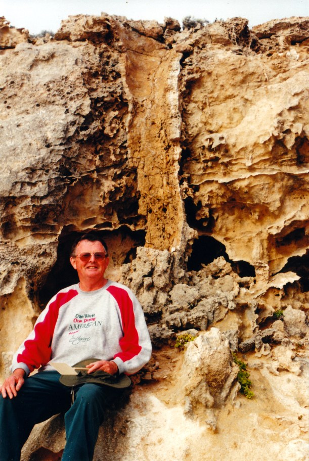
On these limestone and sandy soils, fresh water supply could be a problem, too. The Springs are formed in an area of the coastal cliffs, where erosion has cut back the top limestone layers and exposed the underlying basalt, as rock shelves. Groundwater flows along the junction between the two types of rock and runs out as fresh water springs onto the basalt ledges. In places, where there were gas bubbles in the basalt, the water now pools in the resultant holes. The old time farmers built a ramp of rock and earth, down the eroded limestone cliff face, to allow cattle to get to the fresh water spring fed pools.
John going down the old ramp to the basalt ledge
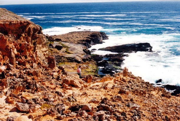
We used to walk to the Springs, when the children were young, and allow them to play in the pools. It was very spectacular, with the big waves of Discovery Bay breaking against the basalt cliff close by, but knowing we were quite safe up on the ledges. Back then, you had to know where to go, through the farm, navigating by fence lines and clumps of shrubs, as there were no markers to show where the top of the ramp was, and it was not visible until you were right on it. These days, one can walk there from the other direction.

One of the fresh water pools, seen from the cliff top
Not far from the start of the walk, we came to the “petrified forest” formations. These formed, it is thought, when a lot of Moonah trees were buried by a moving dune. Rainwater seeping down formed sandstone crusts around the outside of the trunks, making them bigger than they were originally. At the same time, the interior wood was eaten away, making hollow sandstone tubes. So it is not petrified wood, as was once thought, just sandstone. But they are quite unique, and we spent a little time looking at these before resuming the walk. It is obvious to me that people have, over the years, removed or broken down many of the tube formations – they are nowhere near as impressive as they once were.
One of the tubes in the “Petrified Forest”
There is no problem now in finding the old ramp to the Springs – it is signposted! We went down it onto the basalt platform.
The ramp is like it used to be, with a couple of tricky places, except the cliffs look a bit more fragile and there have been some small rock falls.
It could be a bit dangerous now and I suspect it may not be open much longer, unless some restoration work is done.
We followed the shelf around to the rock pools I knew. Just beyond these, to the south, was a place we called the Slippery Fall – where the shelf is narrow and the water flowing from a spring has formed a slippery deposit. John took a bit of a risk crossing that – one needs to be very careful there.

John by the Slippery Fall – fresh water pool in background
We spent some time exploring the Springs and sitting watching the waves breaking along the cliffs. They were a moderate size today – I have seen it much rougher, from there. It really is a very special and unique place and I was so pleased to have been able to come back. The time to leave and walk back to Truck came too quickly!
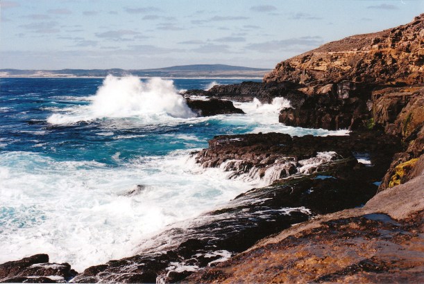
Discovery Bay and waves breaking below the basalt shelf
Returned the way we had come, and then back to camp.
Tea was late – home made hamburgers.
We drove 73 kms today.
