TUESDAY 17 AUGUST RIG ROAD CAMP TO KNOLLS TRACK CAMP 115kms
It was almost 8am when we woke up, after an excellent rest. Of course, there was absolutely no human noise to disturb us, which is pretty rare, these days.

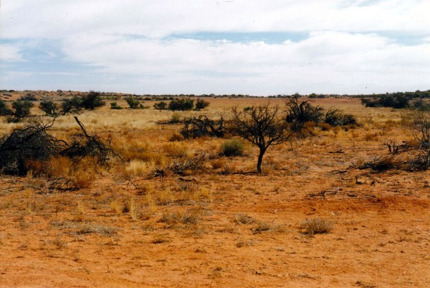
Our Rig Road camp amongst the dunes, in the morning
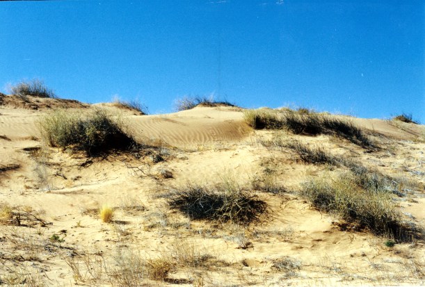
On the dunes by our camp, in the morning
I went for a short walk in the dunes by camp. Saw a plant with an unusual green, kind of pea-shaped flower, and wondered if it was native or not. ( Followed this up, eventually, some time later and found that it was the native Crotolaria, or green bird flower).
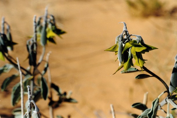
Green Bird Flower
There were also lots of little animal tracks on the dunes and it was fascinating to look at these and try to work out who was going where and the sequences.
While I was examining the desert, John phoned his old school on the radio -just because he could!
We were packed up and away by 10am.

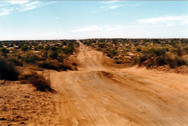
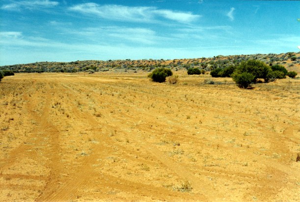
Rig Road dunes getting higher and more complex
I started off the driving. Eastwards again. The dunes got higher. On an increasing number, there were side tracks towards the top, where travellers had made tracks to avoid the blown-out dune tops, where the clay capping had long gone.

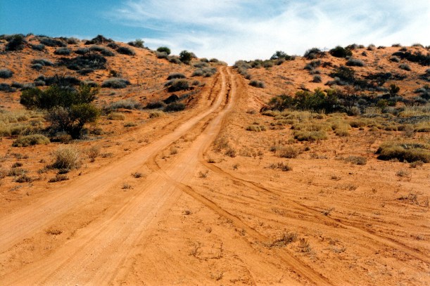
A side track around a dune crest – but with sand already blown over it
Eventually, there were a couple of dunes where I had to back up and make a second attempt. We let the tyres down further. John was trying not to have the tyres deflated to the point where they might roll off the rim. Then, I decided that John should drive the rest of the way to Walkendi Corner.
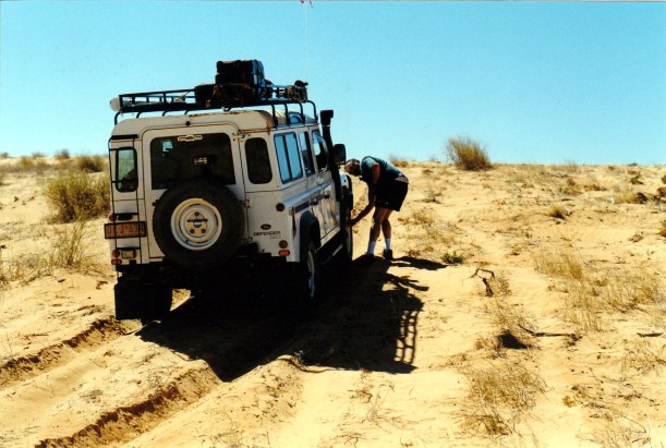
Tyres need less air from this point on – but we don’t want them too flat
Made it over this dune
I then took over again – there was a lot of gear work and we were trying to keep John’s leg comfortable. I drove the 12kms or so on the NW trending section to the Lone Gum Tree.
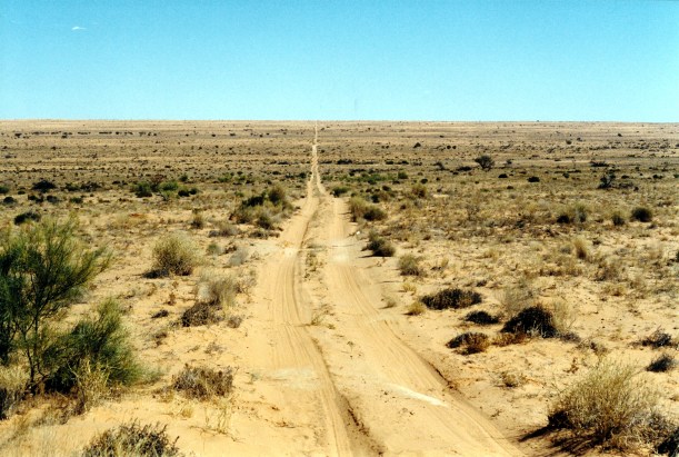
The Rig Road line goes on and on to the horizon – and looks deceptively flat
We stopped there for a look. This fair sized coolabah tree is a long way from the watercourses where these are usually found, and it is a mystery how it got to be here. It is a real anomaly in this country.

The Lone Gum Tree by the Rig Road
Not far from the Lone Gum, near the junction with the Erabena Track, we passed a party of two vehicles, each towing camper trailers, going the way we had come. I thought they were fools to be towing in this country. We stopped, briefly, and chatted, of course. They told us that the French Line section they came across, was hard. Given our experiences on the track, this morning, I thought to myself: Ha – wait till you see what’s ahead when you turn west again! If you don’t already regret towing your campers, you will!
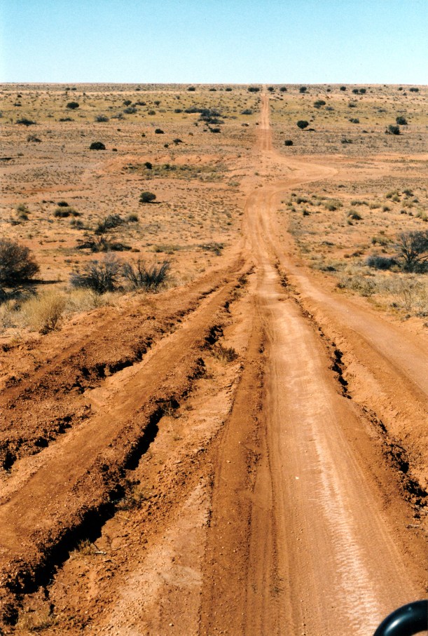
Erosion of the one-time clay capping of the Rig Road
Shortly after we parted, a solo driver passed us, who we thought was going too fast for safety in the conditions. He stopped briefly, to tell us there was another vehicle going west to east, like us, about 70kms in front. I very much doubt we will be catching up to that! John got on the CB to warn the people we’d been talking with, that he would be coming up behind them, at a too-fast speed. Unfortunately, the guy was listening in! He made some comment about each doing things their own way.
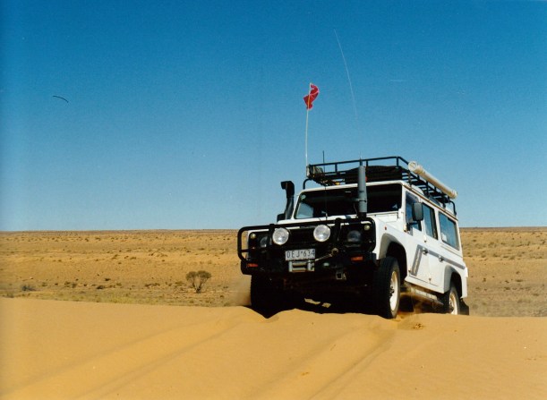
There was yet another eastwards section, with increasingly high dunes. We were getting pretty good at driving these by now. The key was to select the right gear and speed before heading up the dune, to avoid having to change down part way up.

The driver’s eye view coming up a sand blocked dune – with a bypass track to the left

Taking the side track around the sand blow
We saw a couple of groups of camels today. At one stage, coming up to a dune, there was a group of about ten, silhouetted along the crest. We had to wait for them to take their time, ambling across the track, before continuing.
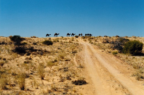
Camel right of way
Our lunch break was taken in an interesting inter-dunal clay pan area. It was getting quite hot by now. We were moving towards the part of the Simpson Desert where there are large areas of playa formations – places where temporary lakes form between dunes when it is wet, then dry out, leaving salt and clay pans behind.

A salt pan and a sandy side track

Lunch stop on a clay pan – Rig Road
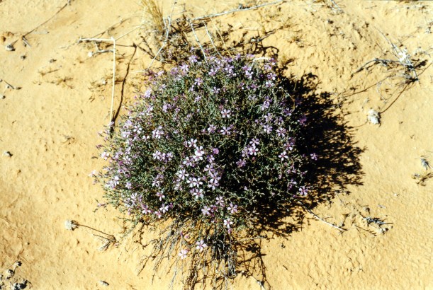
Desert wildflowers
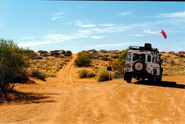
Soon after lunch, we reached the junction of the Rig Road and the Knolls Track. Also known as the WBY Line, or the AAK Track. Here, the Rig Road turns south east, eventually after some 100kms to meet up with the Warburton Track and then the Birdsville Track. That section of the Rig Road was supposed to have some very steep drop-offs from the dune tops. Our way was to the north again on the Knolls Track, and we would be on the Rig Road no more. We wanted to visit the Approdinna Attora Knolls, to the north.
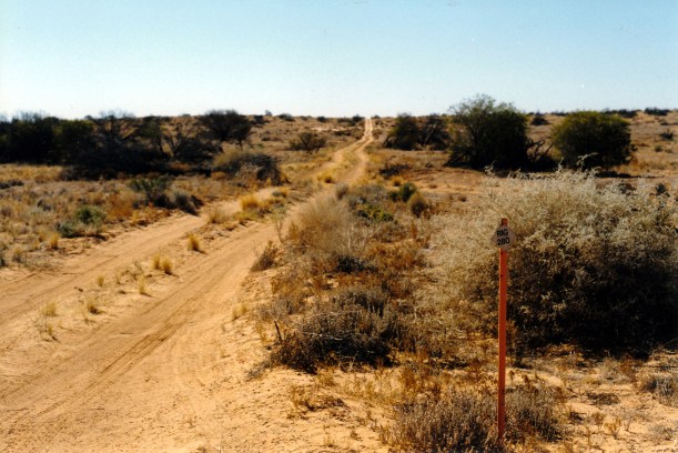
The Last Rig Road marker that we will see
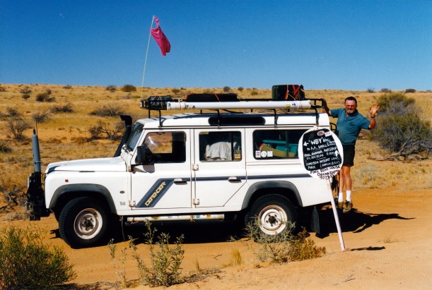
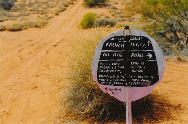
Another Pink Roadhouse signpost
This section of track was very undulating and like a roller coaster.

Roller coaster AAK Track
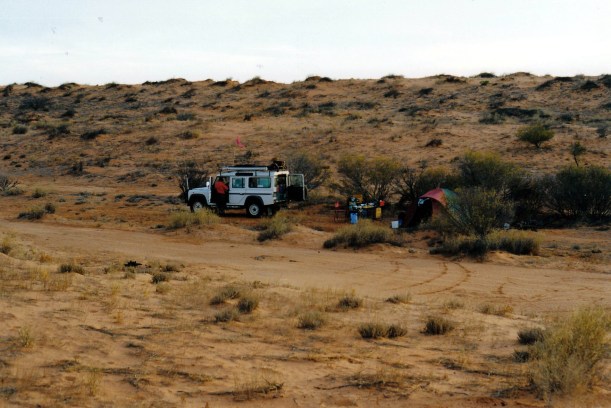
We stopped to gather some firewood, then at 4pm, stopped roughly 10kms short of the Knolls. We set up camp near a clump of Georgina gidgee trees, a bit of a distance off the track. This area had been used as a camp before – there was even some firewood left. We figured that most other travellers would camp at the Knolls, since it is a landmark, and our spot would give us more solitude.

Georgina Gidgee trees
After setting up camp, John did the radio sched with Alice Springs base, then called his brother C. As always, he was pleased to hear from us and I could just picture him getting out the maps to work out where we were.

Camp by the AAK Track
Tea was a packet soup, pasta with curried tuna and pineapple. I am using a small amount of water to cook the pasta, so it is a bit gluggy, but can’t be helped. That water then gets added to later, for the washing up!
We ate just on dark. As we were clearing up, heard a vehicle noise, saw lights, and two vehicles went past on the track, heading south at a fair speed, seeming very purposeful. We watched/listened to them fade into the distance. I felt a bit uneasy, but they did seem to keep on going. Later, as we sat round our campfire, we speculated that they may have been a recovery crew, out of Birdsville, going to some “event” behind us. It seemed rather unlikely that travellers such as ourselves would drive at night.
The night was not as cold as the last ones have been.