This Adventurous Age

Adventures travelling and working around Australia.


Leave a comment

2016 Travels September 2

FRIDAY SEPTEMBER 2     HOME TO MARONG   240kms

Bus had been ready to go for a while. The hold up had been waiting for three weeks before John could have the stitches removed from his leg. I’d ben doing some leisurely packing over the previous days.

It seemed timely to start a short trip now – maybe three weeks? The obvious first stop was Bendigo, where we hadn’t been in over a year. Grandson had a semi final coming up, in his hockey, and daughter’s partner a netball grand final. We could earn some family brownie points by attending these events.

Departed home at 10.30am. There were always last minute things to do, like packing those last fridge items, and filling rolls for lunch, and we were not in a hurry.

This morning, an added complication was a call informing John that his sister died earlier this morning. We had known this was coming, so it was not a shock. It was thought that the funeral would be late next week, so we decided to continue with at least the Bendigo part of the trip.

There was definitely an emerging pattern to our trip departures – that we have to stop at the park a couple of kms away, down the bottom of the range, to make some adjustment or another to the rig. In this case it was – again – the tyre pressure monitors. John had put them back on the Bus front wheels. He hadn’t ever gotten around to investigating solid sleeves for the inner rear tyre valve extensions, so we didn’t have the monitors on those, which had been the source of an unpleasant flapping noise on their first trip. But it was evident, as soon as we got up to any speed, that the front ones were making that noise now and would have to come off.

The monitor things are fiddly and hard to remove, which is probably a good thing. He swore a lot. The metal edges of the monitors were chopped about from flexing and hitting on the wheel rims, even over that short distance. Clearly, for this system to work on the Coaster, most wheels would have to have some modification to the tyre valve posts. It might make sense to just keep the system on the Terios, which was what I’d intended in the first place.

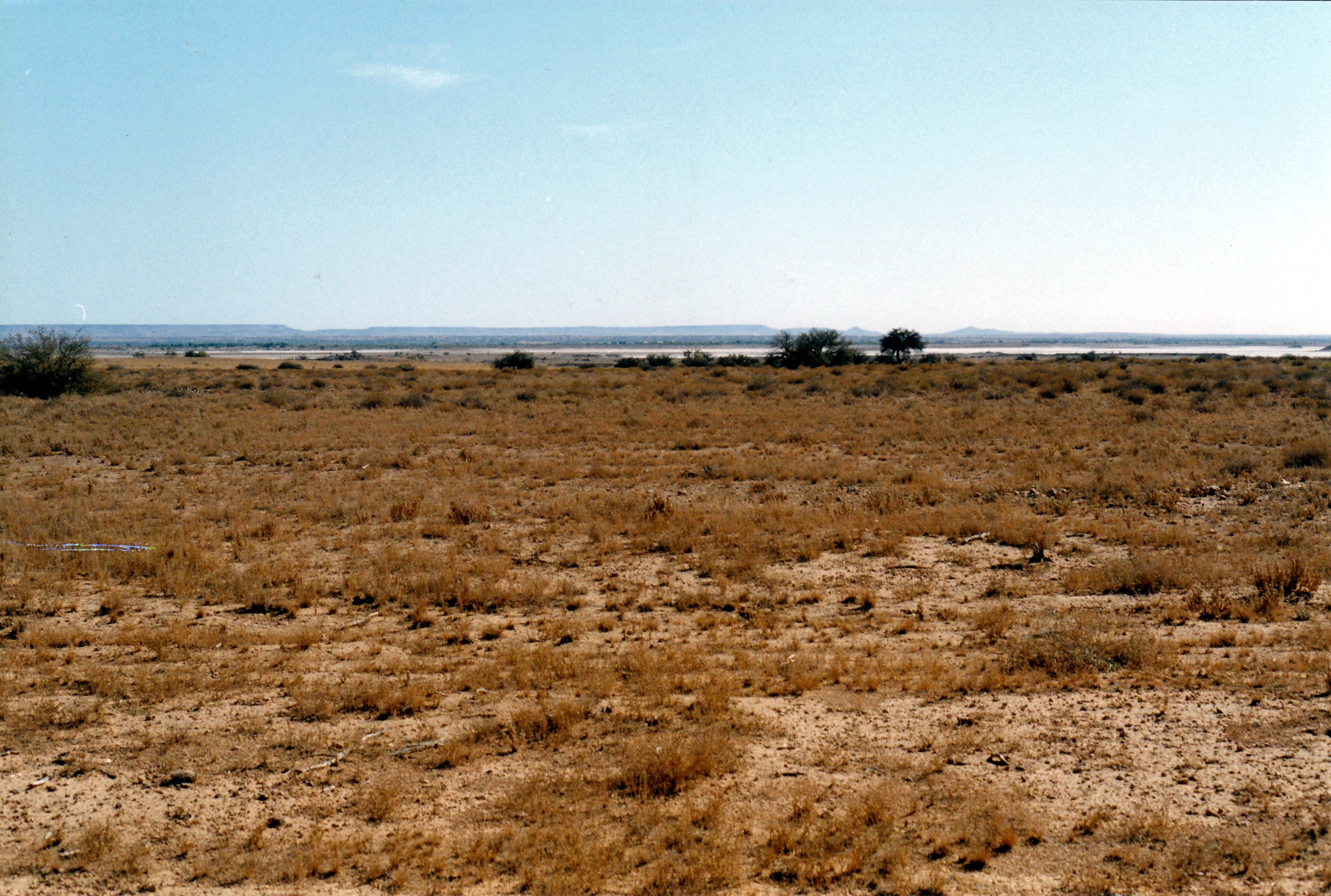
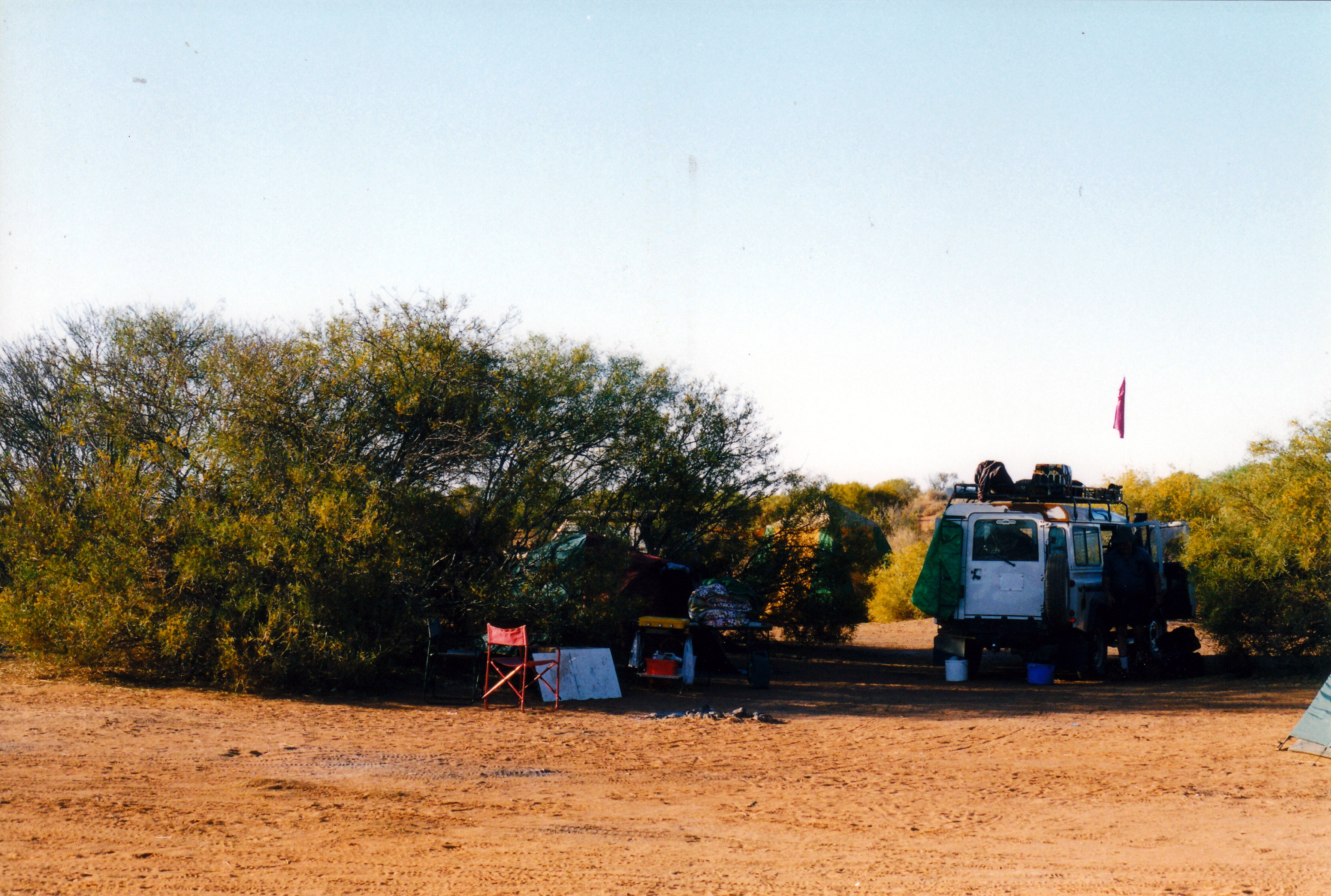
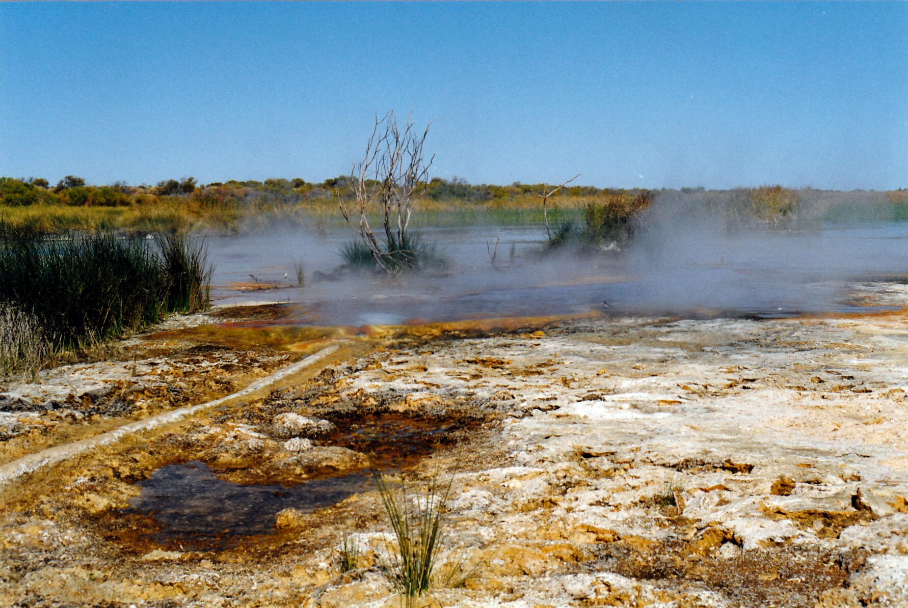
While John was working on the wheels, I watched a group of Little Corellas – of which we have a lot in the area these days – playing in a big gum tree a short distance away. They were taking it in turns to swing on “ropes” of bark hanging down and clearly just doing so for fun. They really are entertaining birds to watch. I know they are noisy and can be destructive, but I do like them. Had such a vivid memory from when we were camped at Purni Bore, on the edge of the Simpson Desert, some years ago, and there was a large dead tree containing a huge flock of corellas. A noise startled them and they rose all at once, like a great raucous cloud. Once, we would only see them in places further north – along the Murray, Coopers Creek and the like. But now they are well and truly present south of the Divide. Climate change?

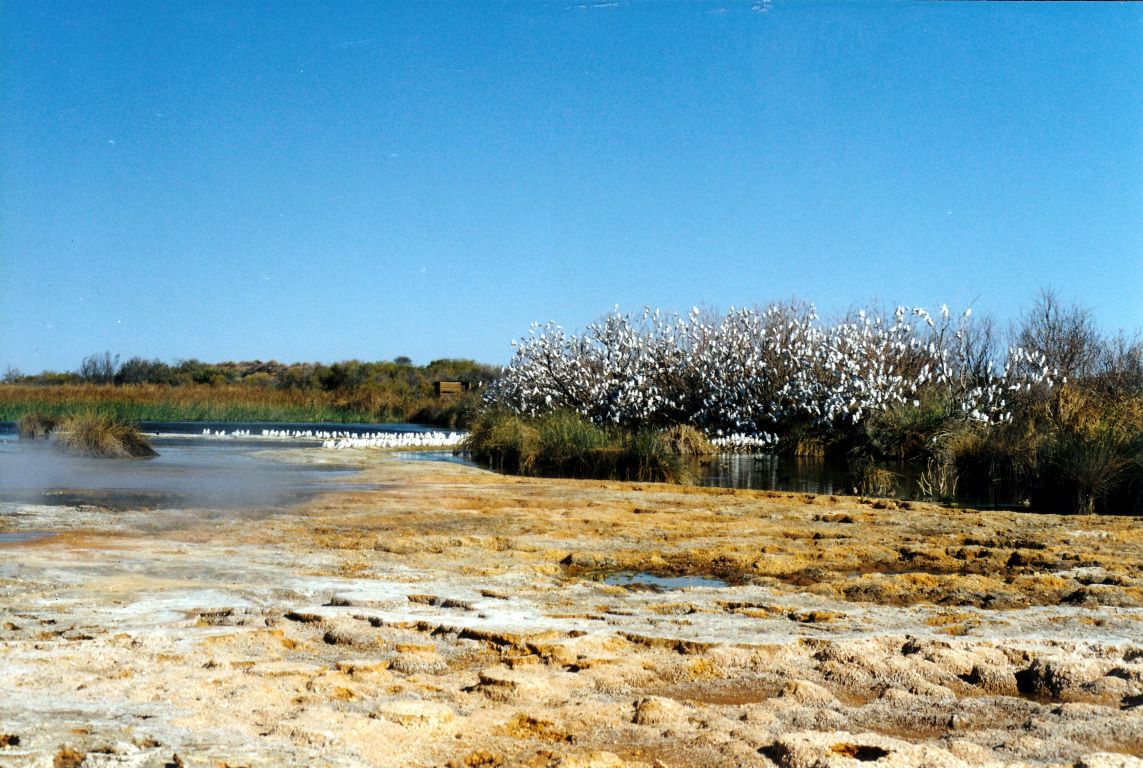
Corella trees at Purni Bore, Simpson Desert

It was 11am by the time we got going again, taking our usual route via Yea and Seymour, to Bendigo. Also, as usual, the GPS was fixated on taking us back to Melbourne first. The only route it seems to recognize to Bendigo is via the Calder Highway.

On the large farms approaching Yarra Glen, workers were busily harvesting crops of Brussels sprouts.

Brussels sprout farm Yarra Glen

Along the bypass route around Yarra Glen, there is one roundabout where the route to the Melba Highway is straight ahead, and the road to Healesville off to the right. John took the latter, then had to find a place to turn around, before playing circles on the roundabout to the correct exit. This is something else that now seems to happen every trip – it gets him every time, and sometimes even on the return journey.

The many hectares of grape vines around Yarra Glen and Dixons Creek had all been neatly pruned and looked very tidy. In one of the vineyards there was a red helicopter parked. I wondered if it was tour related, or someone’s private transport?

As we churned our way up the Divide, some cars coming down towards us were flashing their lights at us. Of course, our initial reaction was to think “police ahead”. Then, when there weren’t, to worry if they were spotting something wrong with the rig. The reason became apparent not far from the top – a broken down 4WD and large caravan, parked partly in the oncoming lane. Traffic cones had been set up around it and there was obviously someone helping.

There were a lot of caravans heading towards Melbourne – the return of the grey nomads…

It was a very pleasant day for driving. Fine, blue sky, cool but not cold.

Yea-Seymour road

Topped up the fuel at the servo at Glenburn – $1.149 cpl.

Stopped at the Rotary Park at Seymour to eat lunch and give dog some exercise. I wanted her kept on the lead, to keep her away from water, but he who learns slowly let her off for a run. She promptly found the nearest large muddy puddle and wallowed in it. That undid all the good work of the dog groomers! Wet, muddy, smelly dog now. I was not happy. She was.

Lunch stop Seymour

I don’t think we had ever seen the country between Seymour and Bendigo so green and lush. There were lots of full dams and flowing creeks. Part of Lake Eppalock was visible  from the road near Axedale, so it had to be pretty full.

I took a phone call and John was able to pull over to talk. It was to tell him that the sister’s funeral would be on Tuesday – sooner than we’d been previously told. We decided to keep going. Dog and I would stay in Bendigo and John could drive the Terios back to Melbourne for the day. I was pleased that we had set off today and were not now waiting around at home for the event to be over.

The Garmin had finally caught up with where we were, and directed us on the usual Over Dimensional Route through Bendigo. Only one glitch, when John seemingly couldn’t count to three and took the wrong exit from a round about. Again! Naturally, we’d managed to time our passage through the city to coincide with school let-out time…

It was 3.45 when we reached the Big 4 Marong Holiday Park, some 14kms west of the centre of Bendigo. We had not stayed here before, but were still trying to find a really good dog friendly park in the area. By initial impressions, this could be it.

I had previously phoned the park and booked us an en-suite site from today until Tuesday morning. Now, in view of the funeral, they were able to extend it for an extra night. After discount, we paid $36 a night, which I thought was very reasonable for a place of the quality that this turned out to be.

Set up on en-suite sites, which had ample room for us. The bathroom was compact, but clean and  quite adequate. I was most impressed with the nearby roofed BBQ area and adjacent camp kitchen room, which was very comprehensively equipped.

Left Marong again at 5pm to drive back to Bendigo for grandson’s hockey match. It was cold, and we had to stand for the whole game, which was murder for the legs and lower back. “Our” team lost, so that was the end of the boy’s hockey season for this year. But he appeared to play well – I think? I would appreciate the game more if I knew something about the rules.

After the game, the boy headed off to spend the weekend with his father, who had come up from Melbourne to watch the match, so we wouldn’t see him again until Sunday afternoon.

Drove back to Bus, stopping at Marong to order fish and chips from the general store’s attached shop, which John drove back to collect at the appointed time of 8pm. Very nice they were too.

We certainly needed the little electric fan heater to warm up Bus.

John watched football on TV. I did some hand sewing of the quilt project.

Bed at 11pm. We were both tired. For some reason, not long after getting into bed, I got a really nasty cramp in one leg. Unusual for me and it sure woke me up again! Was very careful how I moved that leg for the rest of the night.


Leave a comment

1999 Travels August 15

SUNDAY 15 AUGUST   DALHOUSIE SPRINGS TO PURNI BORE   75kms

We were up at 7.30. It was a day with blue sky but was not hot.

Left Dalhousie at 9.30am.

The country we passed through today varied a little. We had claypan bog areas to begin with – the claypan Spring Creek delta, with the evocatively named Gluepot Bog. There was some sandy plain country, stony in parts. There were the occasional jump ups, just to be different. It was not really hard to drive.

08-15-1999 03  Spring Ck delta and Dalhousie mound springs 2.jpg

Spring Creek Delta and extinct Dalhousie mound springs

08-15-1999 05  Glue Pot bog Spring Ck Delta Tk.jpg

The Gluepot Bog

Not far from Dalhousie, there was a dingo beside the track. He was quite a big one. We were able to get quite close to him, for photos.

08-15-1999 04 dingo near dlahousie

One of the locals – good looking dingo near Dalhousie Springs

We trended north east across the flood-out country for much of the way.

At Freeth Junction, where the closed Macumba track comes in from the south, there was a display board with emergency contact details, and instructions for radio use. Here, we really began to feel isolated.

08-15-1999 07  freeth junction.jpg

Sign at Freeth Junction

It is around Freeth Junction that the Finke River disappears into a salt pan in the Simpson Desert.

08-15-1999 06 Freeth Junction where Finke ends in desert salt pan

The ancient Finke River ends in a salt pan near Freeth Junction

We used the HF rdio to phone K, from here. It was a clear call, for once. He confirmed that he had received our instructions and understands the seriousness of reporting to authorities, if we have not contacted him by the date specified. He is our safety net, along with the trip plans we’d left with Alice Springs Base.

08-15-1999 08  Freeth Junction looking back.jpg

At Freeth Junction. The track we came in on trends to the upper right of the photo

Beyond Freeth Junction, sand dune country gradually began. By the time we reached Purni Bore, were definitely in dune country.

The long parallel dunes of the Simpson extend in a general NW-SE line. There are over 1100 dunes from Birdsville, stretching up towards Alice Springs. Some are 200kms along. It is the largest sand dune desert in the world. Before finding out more about the place, I had envisaged something like the Sahara, but the Simpson dunes are vegetated enough to be, largely, fixed in position.

08-15-1999 simpson desert pic.JPG

What the Simpson Desert looks like from space

We do not have to cross all 1100 dunes, as some only begin to the north of here. But we will tackle several hundred of the things. I will not be counting! Going the way we are, we start with the lowest dunes – maybe 3 metres or so – and gradually build up to the bigger ones in the east, around30 metres high. By then, we will have had plenty of practice at climbing dunes. Also, going this way, we will be going up the less steep side of each dune. They have been shaped by westerly winds, so the east side is the more steep drop-off side.

The tracks that we will be following now, were put in by companies exploring for oil and gas in the 1960’s and 70’s, and sinking wells.  Reg Sprigg – of Arkaroola fame – surveyed the first seismic line across; this became known as the French line, because the French Petroleum Company did the first geological survey along this. Essentially, it runs in a broadly straight line from Purni to the Qld-SA-NT border at Poeppel Corner. It is the route most commonly taken by Simpson travellers, partly because it is the shortest, partly because of its reputation for challenging dunes.

We planned to be different and take a more roundabout route. This would enable us to see more of the Desert, hopefully for some of the time be away from the more popular parts, and also be somewhat easier, as for some of the way we would follow the Rig Road. This route was developed to service oil and gas operations; it was graded and clay capped, to be able to carry trucks. Much of this has broken down in the years since it was used, and it is 4WD only, now.

As well, our route would take in some N-S tracks, in between the parallel dunes, rather than always going across them as the French Line does. We still will have to cross the things, but the inter-dune tracks will provide variety.

08-15-1999 simpson desert

Our planned route across the Simpson Desert

I was expecting that there would be more travellers on this first part of the way, where we are on the French Line route, and the more popular E to W way. But it was a surprise that in the 75kms from Dalhousie to Purni, we passed only three vehicles coming towards us.

We were the first to set up camp at Purni Bore – another surprise. So we were able to pick a spot where there were some low bushes around us. The camp area here was not dusty like Dalhousie was.

08-15-1999 15  Purni Bore camp.jpg

Our camp at Purni Bore

While we were setting up the tent, several vehicles from a Melbourne 4WD club came and set up nearby – guess we must have picked the most attractive part of this fairly extensive area! Later, another four vehicles arrived. One lot, with children, camped right behind us, despite there being lots of other space around! There are times that I hate other travellers….. At least, the group with the feral kids, from Dalhousie, did not appear – we had dreaded them tagging us this far.

Purni was beautiful, in a surreal way. The water from the bore is so hot that it steams for a while after it runs into the pool area. Dante’s Inferno came to mind.

08-15-1999 11  purni bore.jpg

The steaming outflow water at Purni Bore

08-15-1999 10 Purni the bore

The bore at Purni

There are no pools to swim in, here. The water is too hot and too polluted by feral camels and donkeys. But there is a hot shower and a laundry tub with hot water, along with the long drop toilet. It is all kind of anachronistic amongst the dunes.

There were lots of birds – water birds, bush birds and hundreds of corellas clustered in one area of trees. We spotted crimson chats – hadn’t see those before.

08-15-1999 09 Purni Bore & emus

Purni wetlands and emus

After camp was set up and lunch was had, we walked around the perimeter of the wetland area. Like at Coward Springs, this is here because of the bore outflow. Purni Bore has been capped, in recent times, to limit the outflow, so the wetland is not as extensive as it once would have been.

On our walk, saw a mob of about eight camels. Later, near sunset time, these appeared on the dune skyline.

08-15-1999 16   camels Purni Bore.jpg

The extra vegetation, and the water, attracts camels

We wanted a photo of the corellas rising from the trees, so John walked around that way to see if some would take flight. He made a noise and there was a mass takeoff. It was a pity I couldn’t capture the very loud and raucous noise they made, as well as the image! It gave John quite a fright.

08-15-1999 13  purni corellas.jpg

Corellas taking fright

08-15-1999 14 view over Purni Bore to camp area

Looking over the Purni wetlands to the camp area, ar right

By the time I’d gotten things organized for tea, there was a queue at the shower, so I gave up on that, because we did not want a late tea. Then John got fiddling with the GPS and didn’t want to stop, so tea was late after all!

We ate tinned soup, a stew made from chick peas, kumara, spinach and tomatoes. So tea used quite a few tins and we lightened the load in Truck.

After tea, went and sat round the campfire (bonfire!) of the 4WD club. Talked with them. They had, between them, had a lot of varied experiences. They had just come from the Canning Stock Route – a trip that took them two years to plan. They seem very well organized. It was a pleasant, convivial evening, if somewhat cold.

The fridge did not work again, this afternoon, so we have finally given up on it.