
SATURDAY 22 AUGUST CHILI BEACH TO HANN RIVER ROADHOUSE 416kms
We decided this morning to move on. The incessant wind blowing here is uncomfortable and keeps one on edge. It really prevents much in the way of proper relaxation, and the events of last night haven’t helped us feel secure, camped here. We made an efficient pack up.
It took us four hours to get back to the main road, as we detoured to look at the rainforest, the Pascoe crossing on the Frenchmans Track, and the remains of a WW2 bridge in the National Park.
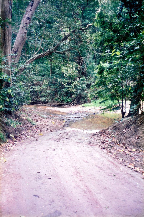
Road through the Iron Range National Park

The rainforest of the Iron Range National Park

Remnants of WW2 road bridge in Iron Range National Park
At one point in our explorations, John dropped me off where I wanted to take photos, then continued on to find a place to turn around. Then a carload of aboriginals came along, and stopped. I explained to them that there was no problem and I DID have transport. I was very pleased that John and Truck hove into view, at that point!
The Frenchmans Track Pascoe crossing looked quite daunting and was certainly not one we would have attempted.
Thus we got back to the corrugated and “dippy” main road. There are so many “DIP” signs along the way and passing travellers with imagination, time to stop, and black paint, have amused themselves by adding to the signs, in very creative ways. DIPsomaniac. DIPerdimenico. Big DIPper. DIPstick. DIPlomatic, and so on. I am not sure whether the one we photographed was poor spelling, or ultra-creativity….

Was it intentional?
We ate lunch parked on the sandy bed of the Archer River. Could see where it floods in the Wet – there would be no getting through then. A couple of cement culverts take the Dry season flow under the road, but they would be a long way under water in a really wet spell.
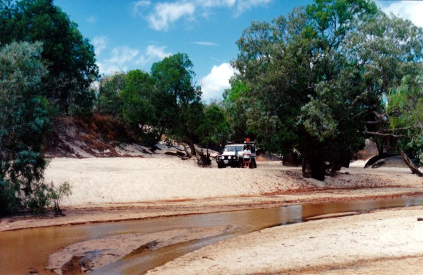
Lunch stop at the Archer River

Archer River – dry season mode. The trees leaning downstream are an indication of the force of wet season flows

Peninsula Development Road crossing of the Archer River
Stopped at Musgrave Roadhouse for fuel – 86cpl. (We’d topped up from a jerry can whilst at Chili Beach.) Treated ourselves to a can of Coke each at the roadhouse, and bought some port – it is a long time since we’ve had any of that! At Musgrave, was where we came in from Lakefield National Park, so the road south from here is new ground.
By the time we reached Hann River Roadhouse, we’d had enough for the day, so set up in their campground, at a cost of $10 for a powered site – very reasonable.
There was a large grassed, and fenced, area, quite a bit of shade and the shower area was immaculate. I really enjoyed that shower! The trees and regular watering ensured there was plenty of bird life around. John got up close and personal with a kookaburra that came to inspect his setting up work, though it was probably hoping we had food lying around. This is a very pleasant place for a short stay.
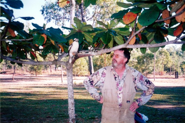
John and friend at Hann River Roadhouse camp ground
Tea was fettucine with bottled pesto.
As this is our last night on the Cape proper, we reflected and commented to each other on the aboriginal issues here. We have certainly found a great deal of anti-aboriginal feeling amongst the whites who live up here, who have a strong belief that the aboriginal agenda is to get rid of all whites from the Cape. The whites feel discriminated against, in that some laws they must obey are not enforced for aborigines. There is a belief that policy and laws are made “down south” by idealists who have no idea or first hand experience of the realities up here. The remaining pastoralists are resentful over the buy back/hand back of leases, the demands for more National Parks, and what they see as neglect of those that exist, in relation to things like feral animal control.
The aborigines seem happy to take the tourist dollar wherever they can, but have a very poor concept of service, or value in return. A hearsay story doing the rounds is that a recent meeting proposed an access charge to the Cape of $1200 a person! Presumably, wiser heads will prevail over that one.
It seems that governments are beginning to “audit” local council accounts in aboriginal communities up here – due to the extent of rorts that can no longer be ignored, and the fact that over $10million is currently owed by locals to their councils. That represents a lot of money per head. From what we have seen on the Cape, any half-way reasonable auditing should produce some pretty shocking results.
It has also become evident to us that the nation is pretty porous in the borders up this way. Locals talk of the easy movement between the Top and PNG, by small boat. The threat of insect – and people – borne disease from the north, seems real, especially those carried by mosquitoes.
It has been an interesting experience, unique, and rather depressing in some ways. I do not think we will come this way again though.
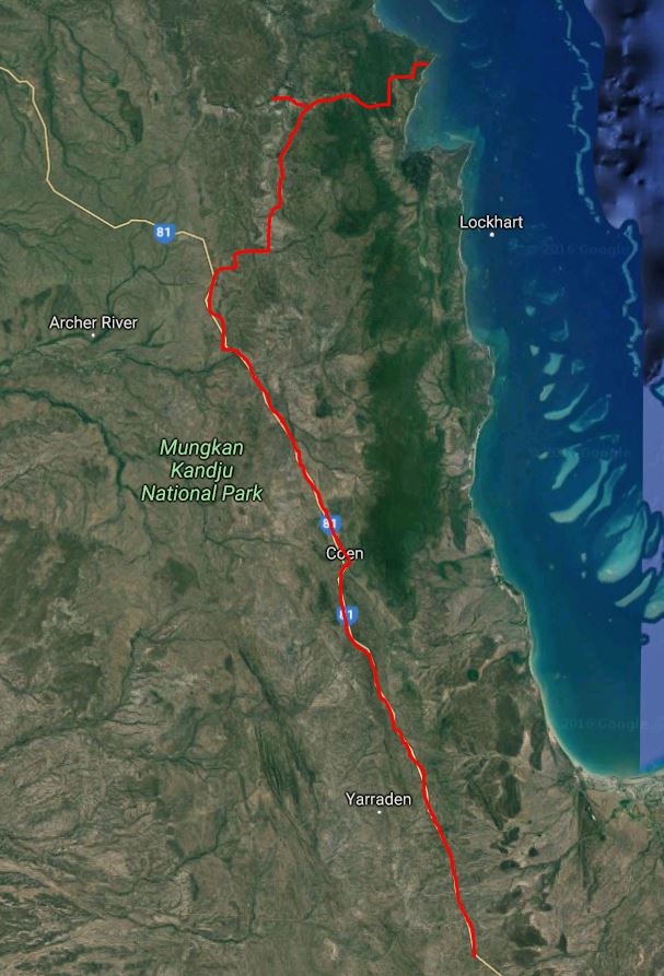
From Chili Beach to Hann River Roadhouse


