WEDNESDAY 19 AUGUST SEISIA TO MORETON TELEGRAPH STATION 341kms
We had a light breakfast – basically just a cup of coffee and some crispbread from the lunch supply in the picnic basket carried on Truck back seat. I was not going to unpack any of the back of Truck to get at anything more substantial.
While we had that, out on the deck/walkway outside our room, got chatting to a rather attractive looking woman, from Thursday Island, who was also staying here. She was over from the Island, doing a TAFE course – she did not say whether it was here at Seisia, or in Bamaga. She did not seem to have had a great life, but it may have been a rather typical one. Was very young teens when she started having children. I got the impression she was now a single mum. But at least she had the drive to improve her life – and was doing something about it.
John topped up the fuel tank with a jerry can.
We were away by 9am.
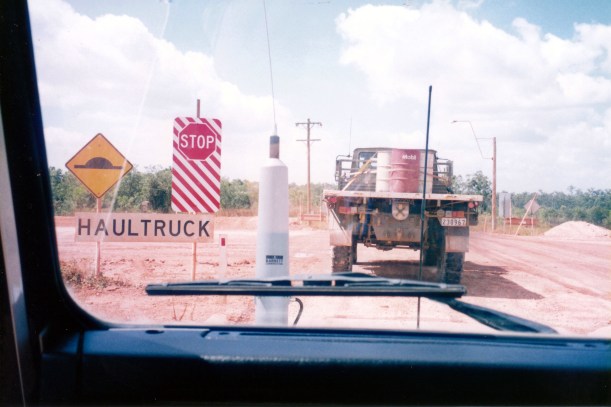
Stopped briefly in Bamaga to buy bread.
The road from Bamaga to the ferry is quite rough. It appears that the local method of road working is just to grade out the bumps and push the material to the road sides. The result is that, in places, the road is cut down quite deeply. Because there are no run off channels at the sides, the road becomes a creek when it rains, thus creating gullies in the road. In other places, the surface deteriorates suddenly into big patches of bulldust. Our little adventure to Ussher Point has caused us to drive this lousy section of road three times in three days!
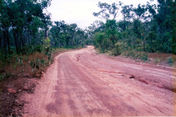
Pretty typical section of the Northern Bypass Road
Crossed on the ferry. The price we paid on the way up includes the return fare as well, so we did not have to fork out any more cash.

The Jardine River from the ferry – looking towards the section where some people try to drive across!
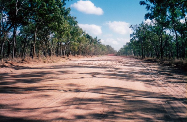
The Northern Bypass Road was very much worse than when we came up, with erosion gullies, bulldust and corrugations.
We stayed on it to the OTL track junction, then turned left and took the track to Fruit Bat Falls. We planned to have lunch there – and a swim (finally!). I’d hoped for a couple of days camping at Elliot Falls, but John was not keen on tackling the track there again, with the couple of nasty creek crossings. So it was going to be a swim here, then continue on to Captain Billy Landing to camp.
There was a convoy of nine vehicles at Fruit Bat Falls, and we heard some of the people saying that they were going to head off after their swims, to camp at Captain Billy Landing. So we left quickly, so as to be ahead of them, rather than eating the dust from that many. Also wanted to be sure of getting a camp spot, as we did not know how many rigs could fit there.
We decided not to do the big extra track to Heathlands Ranger Station for a camp permit, so just continued on to Captain Billy for lunch. The road from the Bypass Road into there was really good.
It is a very pretty place, but it was really windy.

At Captain Billy Landing
A couple had parked their camper van inside the campers’ shelter shed that was there – very selfish of them.
The convoy arrived as we were eating our lunch while walking on the beach.
The camping area was quite large, so there would have been ample room for us and the convoy, but of course we did not know that in advance. Not having a camping permit, and because of the wind, we decided to push on south. I think we have just about had enough of the Cape, since Ussher Point, and are starting to think about having a little more comfort. We are just about “Cape-d out”
We did enjoy the beach explore at Captain Billy. There was a sensational view to the north, of the long sandy beach and headland after headland, receding into the distance. Some adventurous (foolhardy?) souls used to drive from Ussher Point to here, sometimes on the actual beaches, sometimes on the ground behind the cliffs, but that has been banned now, after too many rescues were needed and some vehicles lost altogether.
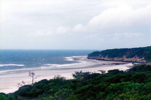
At Captain Billy Landing – view south

At Captain Billy Landing – view north
To the south, around the first point, was a rocky cliff face with a number of caves, containing bats. It was definitely an interesting place.

Cliffs with bat caves at Captain Billy Landing
We tracked back to the Southern Bypass Road. This was in really good condition, now, so we made good time going south. The section between the OTL Track junction and Moreton must have been graded since we came this way before. John actually got Truck into fifth gear, for the first time, we think, since leaving Cooktown!
We camped, again, at Moreton Telegraph Station, just north of the Wenlock River – $10.
We had a very pleasant night’s camp there – put up the little tent. We were near a couple who had camped in Bay 9 with us at Punsand. They had broken something on their vehicle and had needed to get parts flown in from Cairns on the mail plane. It cost them $15 for freight, which we thought was pretty reasonable.
The hot shower here was the best I’ve had since we were here last – and that’s a while ago!
I think our gear is getting “Cape-d out” too. The kero lamp has gone back to not working properly. The gas stove has one blocked burner, so only one to cook with! I guess the sand and dust are taking their toll.
From the phone box at the entrance, phoned K to get him to send mail on to Wonga Beach PO. He already had!
Tea was fettucine with a creamy kumara sauce – the creamy part was tinned evaporated milk. John was not enthusiastic about this meal. Kumara is not one of his favourite vegetables, but it does have the benefit of keeping quite well in these conditions.
We slept well – it was needed.
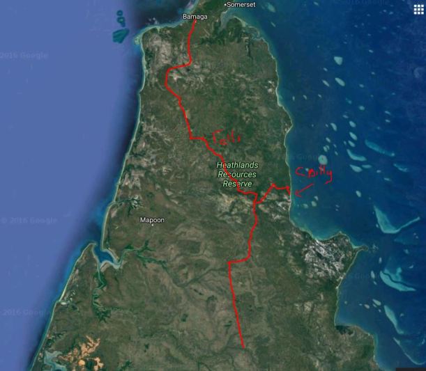
Bamaga to Moreton Telegraph Station, via Captain Billy Landing