This Adventurous Age

Adventures travelling and working around Australia.


2 Comments

2007 Travels July 26

THURSDAY 26 JULY     MITCHELL PLATEAU CAMPGROUND

M and I had said, last night, that we would be doing the walk to the Mitchell Falls today, so John made the effort to get up early. He really didn’t feel like walking, but said he would force himself.

First thing, while John was still getting going, M and I walked to the shelter where bookings were being taken for the scenic helicopter flights. M wanted to do one of these, “catching” a flight back from the Falls to the campground, this afternoon. She hoped to do the extended flight, which would take her over parts of the surrounding countryside as well as the Falls. There was only one place available, on a 2.45pm flight back. Whether it would be the longer flight or a direct one back to camp would depend on the wishes of those who had already booked that flight. Seemed to me that commercial tour groups rather monopolized the helicopters, and that visitors like ourselves had to take what was left. A couple of commercial tour operators had seasonal camps not far away, and brought in steady numbers of visitors.

Features along the walk track from campground to Mitchell Falls (Zoom image)

In the morning light, John investigated the broken lamp. Some part had been broken when he dropped it, yesterday, so the lamp was out of action for the rest of the trip, and maybe forever! This did not put him in a good mood.

The track to the Falls is 4.3kms, each way, very scenic and has lots of interesting features, so it takes quite a while to do – hence wanting to get an early start. It was also definitely a bush walking track, rather than a stroll in the park, so one must keep a careful watch whilst walking.

Walking track and marker


Changing levels

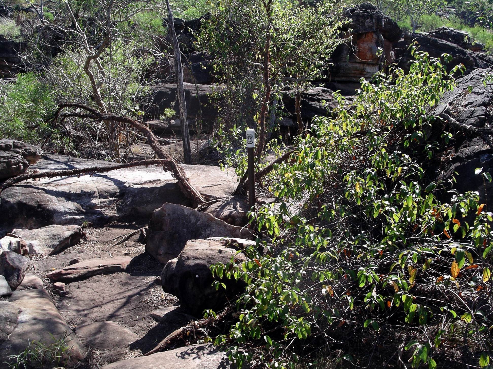
It took us nearly an hour to get to Little Mertens Falls. Although the track was clearly defined, in parts it was quite narrow, with tall grass each side. There were places where rocks in the path required stepping up, or down. Little Mertens Falls was reached down a short side path.

Mertens Creek

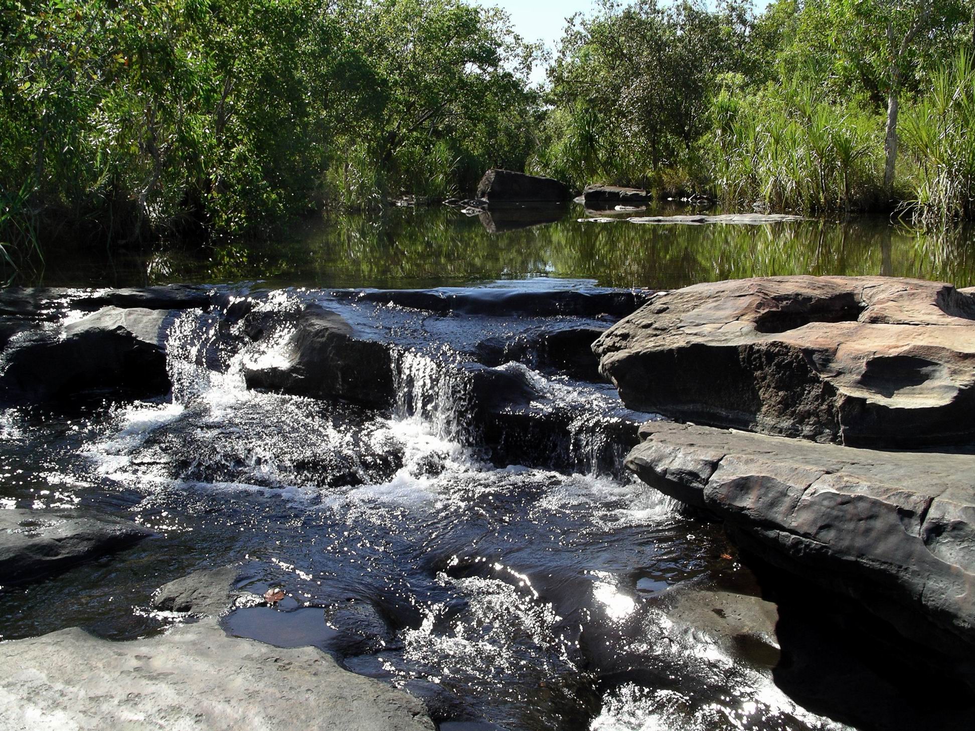
Despite the name, it is a distinct waterfall, into a plunge pool, from which the creek made its way in narrow channels in the rock. The view across the plateau from these falls indicates they mark a real change in the level of the terrain. Unfortunately, one does not get a decent view of these falls from any distance – it is all close up.

Looking across the Plateau from behind Little Mertens Falls

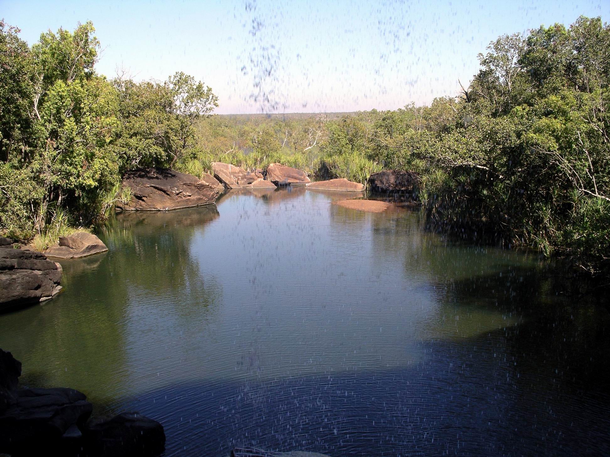
A great feature of Little Mertens Falls is being able to walk in behind them, on a fairly flat ledge, where erosion over time has created a cave like structure. The dampness had turned it into a sort of grotto, with ferns growing.

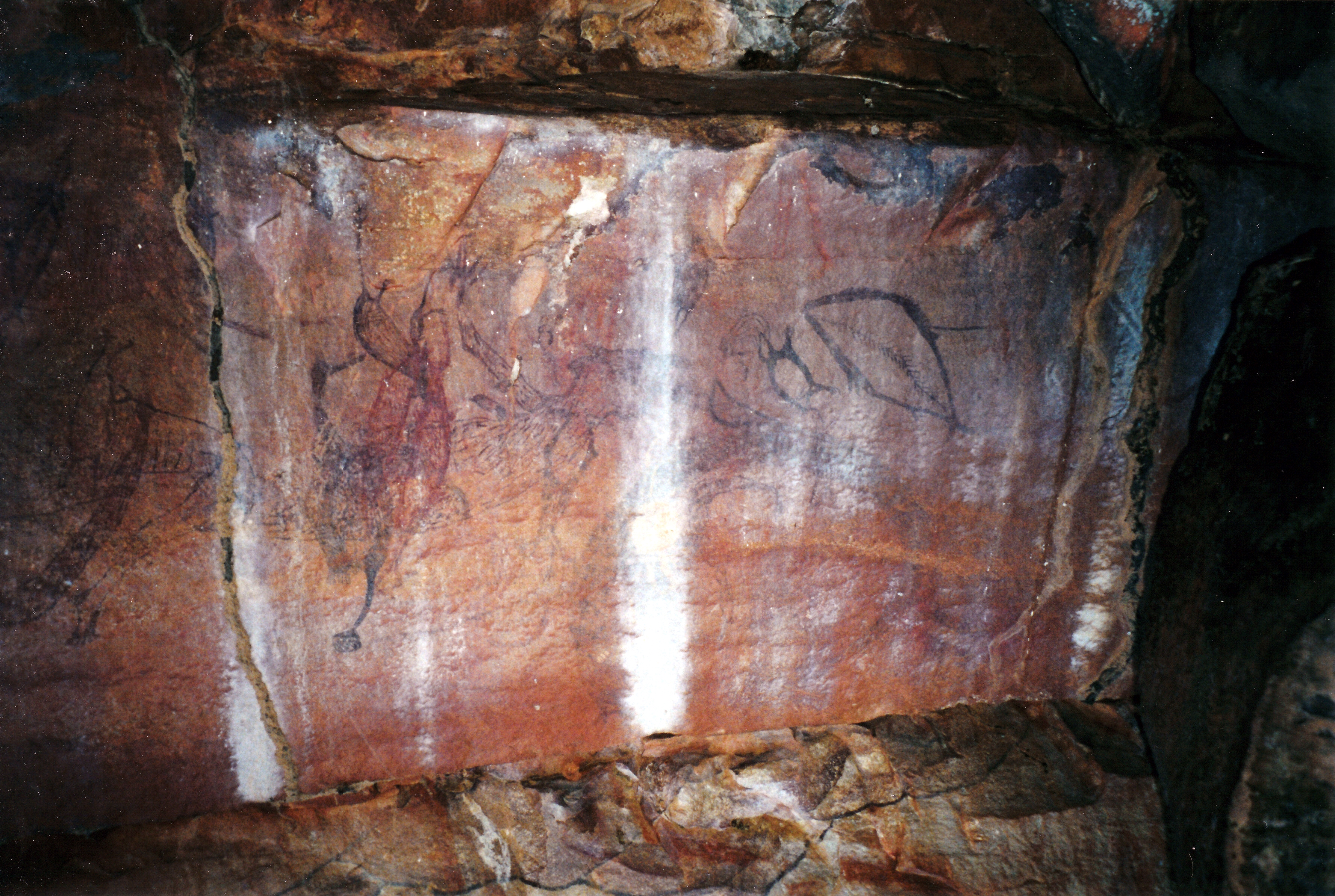
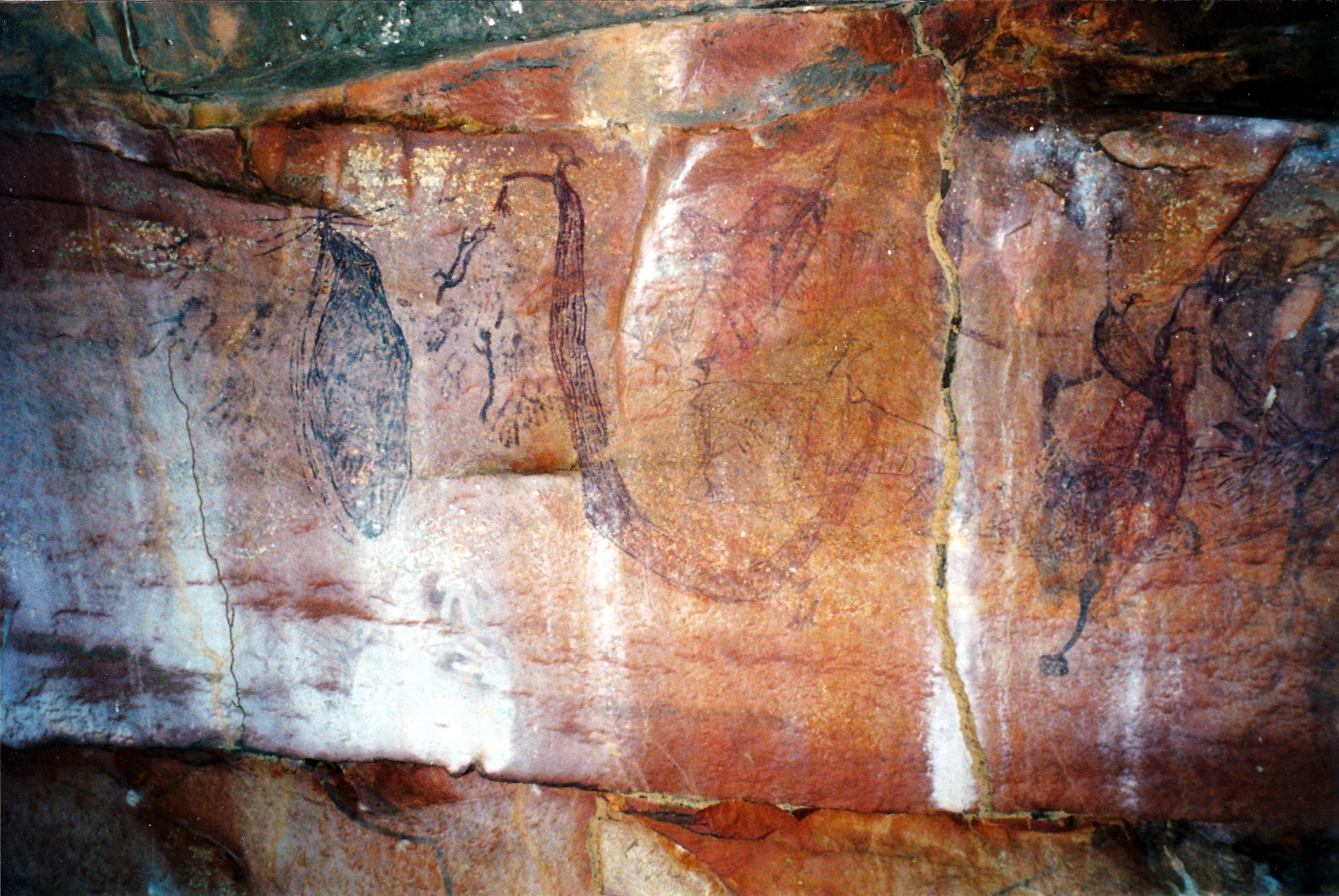
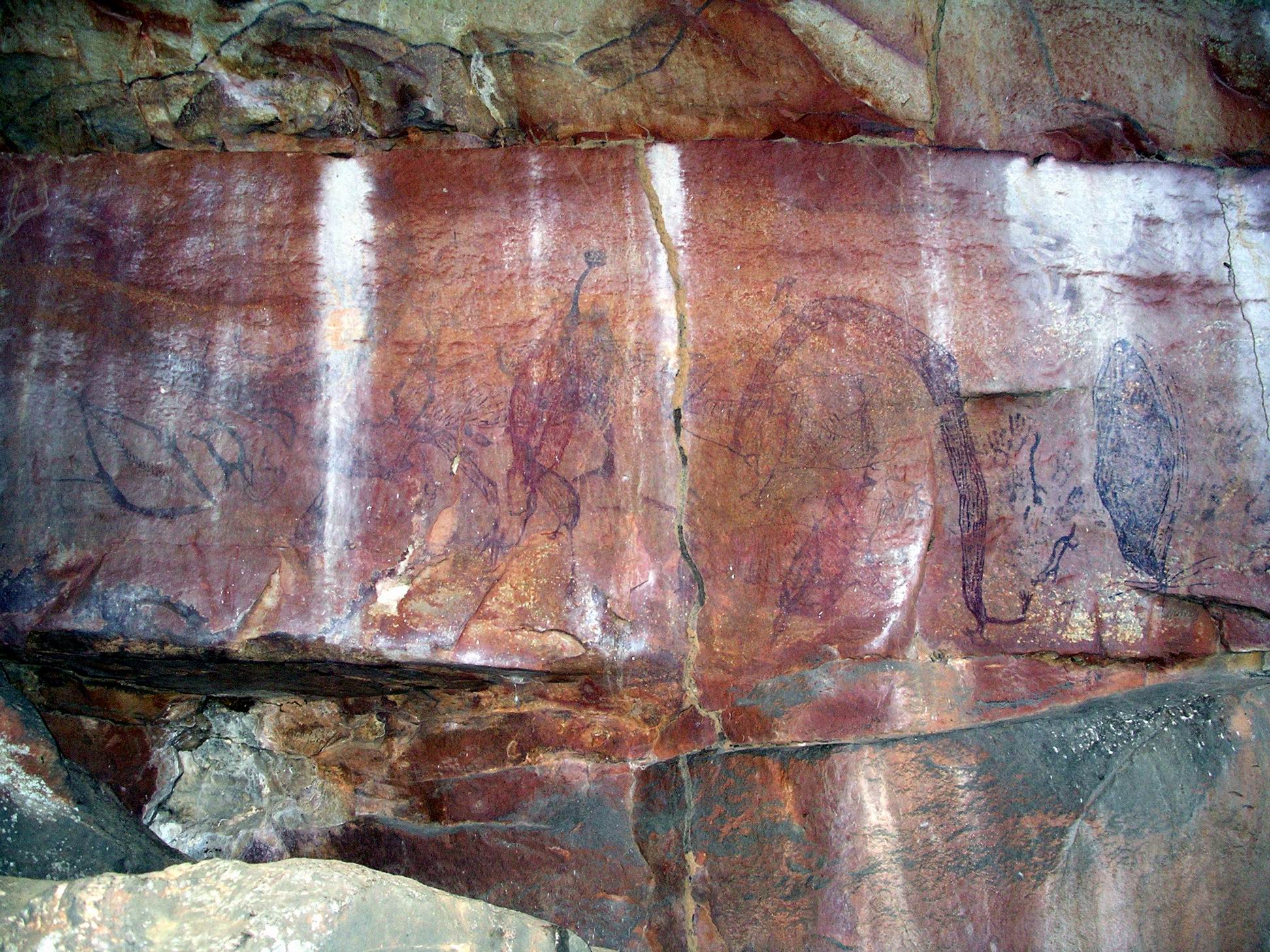
Under the overhanging roof, and on some of the rocks surrounding the Falls, were some good examples of aboriginal rock art. I was intrigued by one shape that could have been the sails on a ship. It was interesting that the art here was of varied styles and subject matter.

Shape near the leaves could be a representation of a sailing ship?

We spent some time here – more than most of those who bothered deviating from the main track to come here. It was cooling to be able to look out at the view, through the falling water.

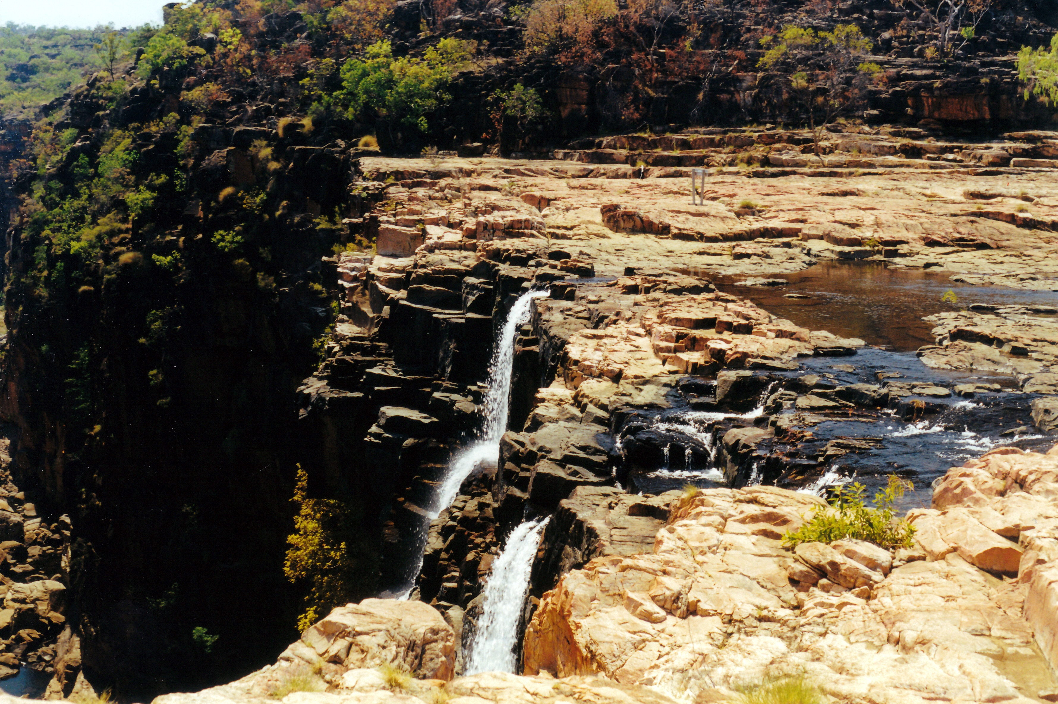
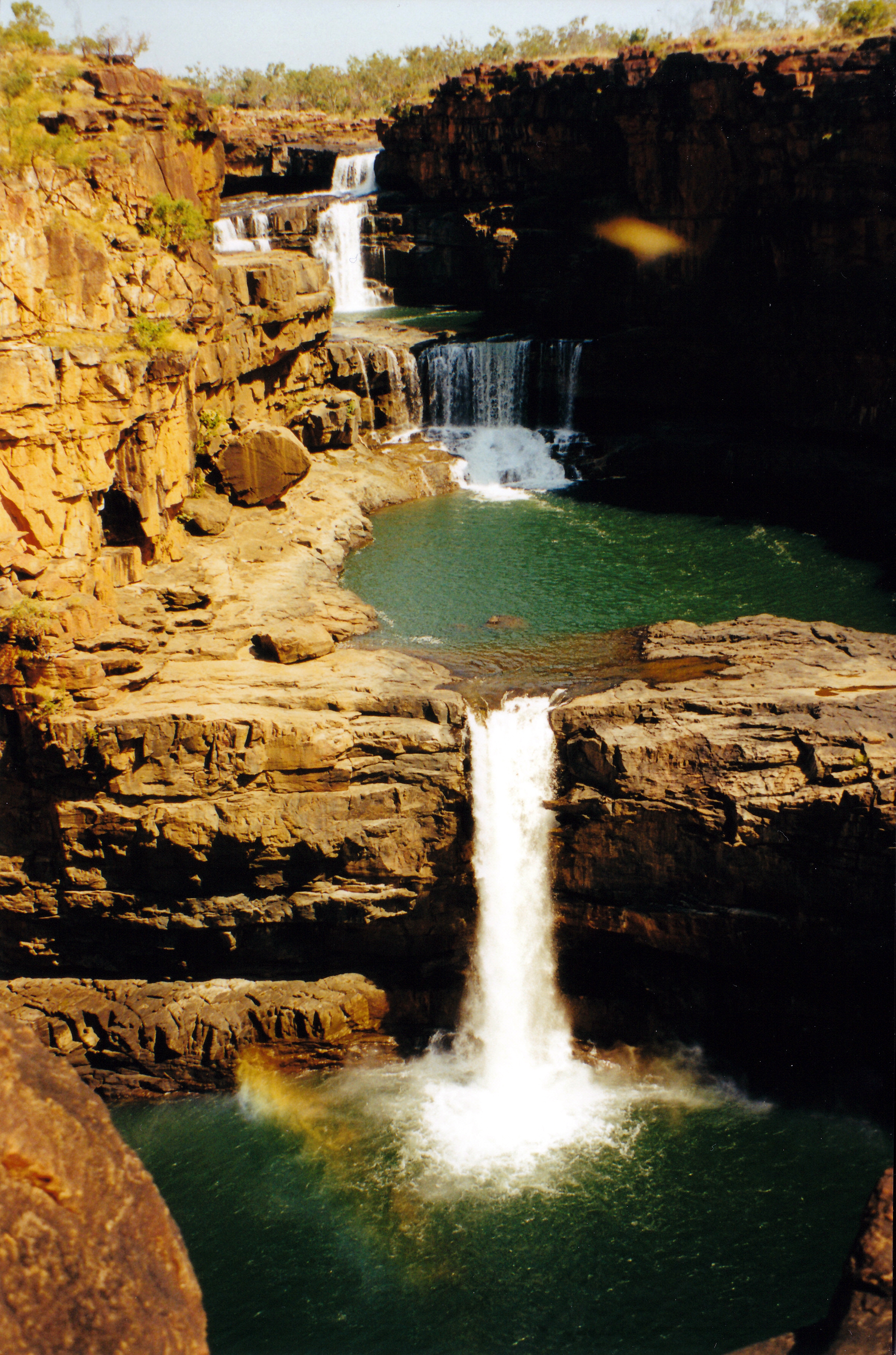
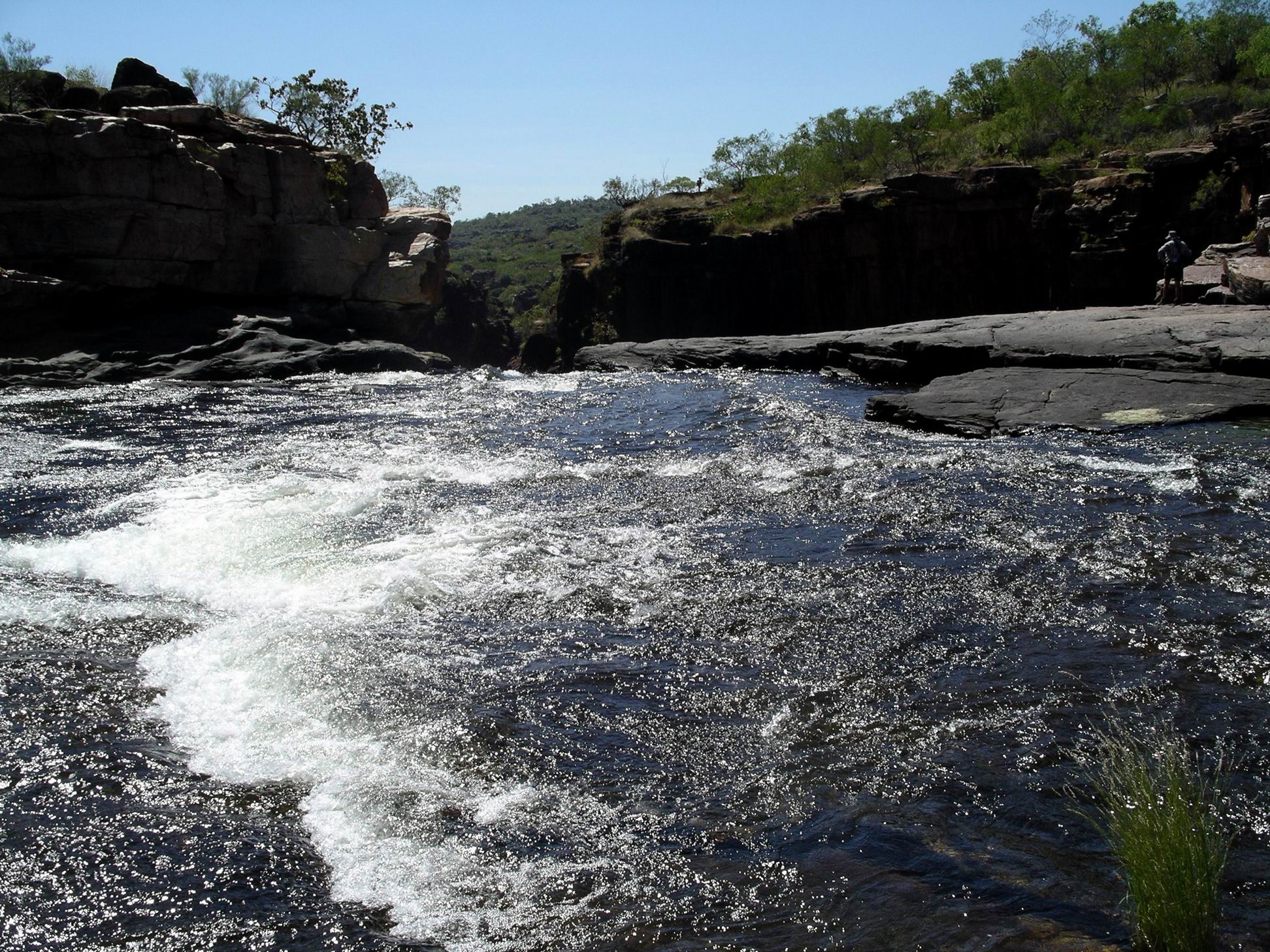
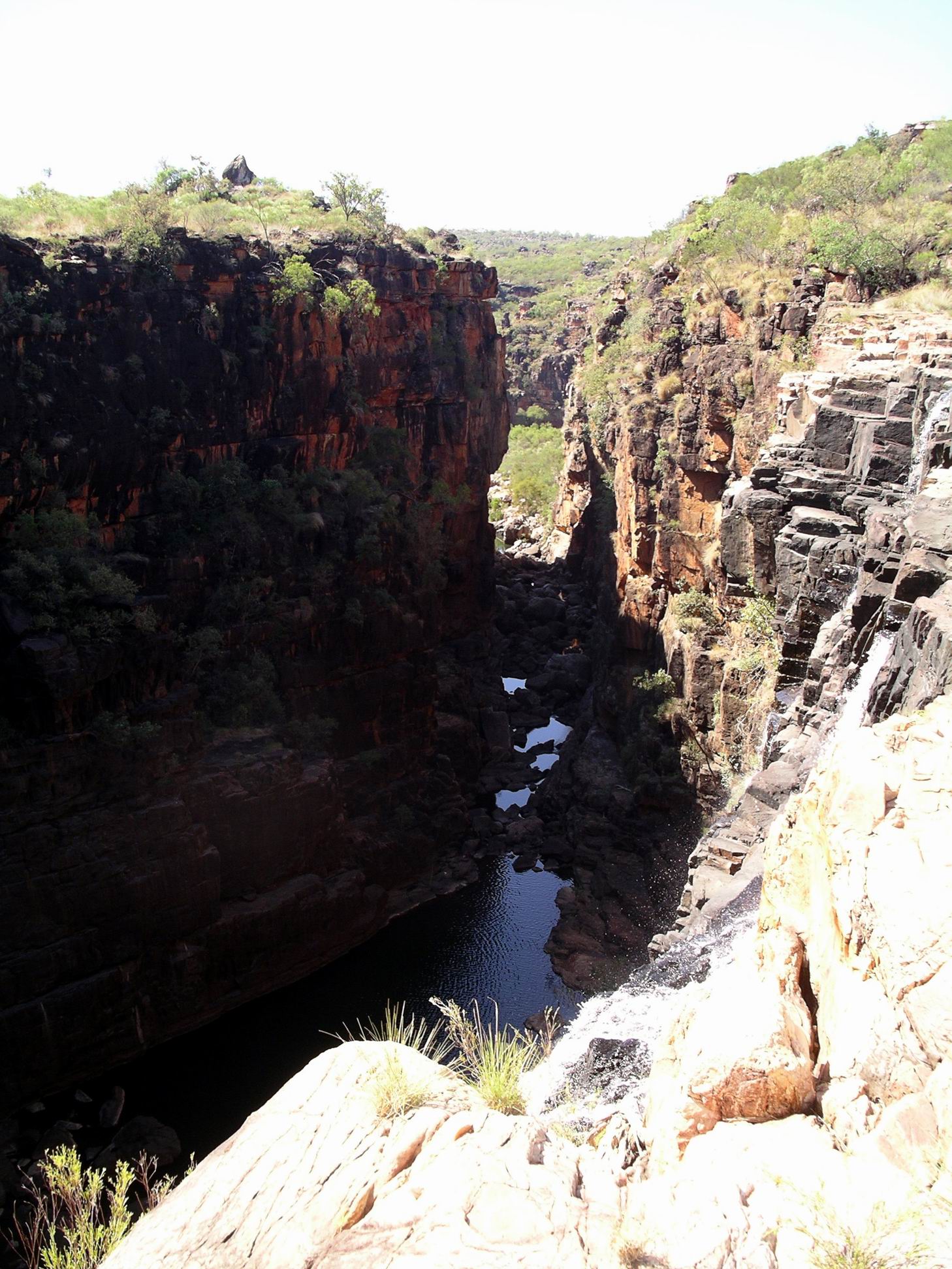
The next landmark, after more trudging along, was the Big Mertens Falls.

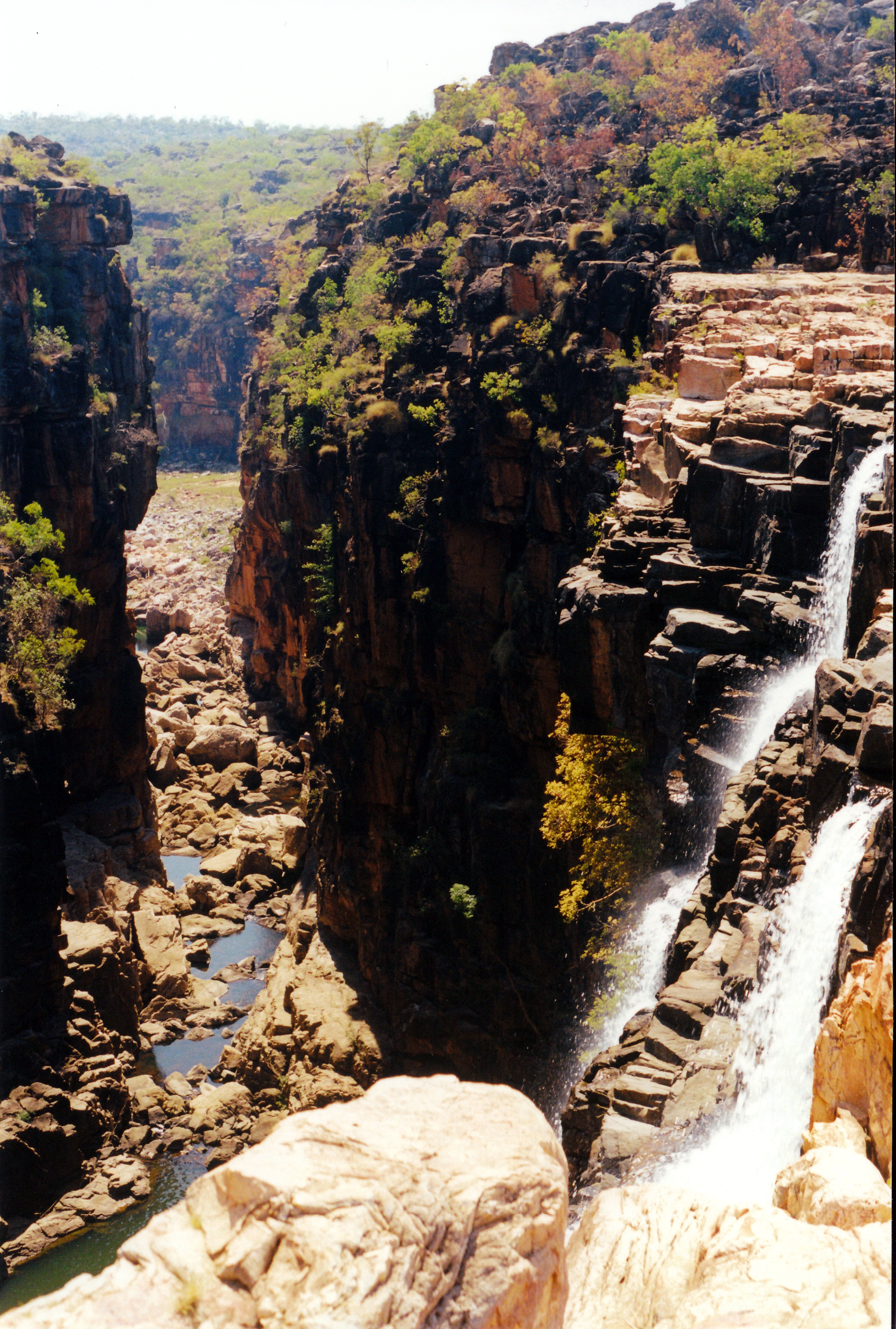
Here, the Mertens Creek plunges over a high cliff and into a deep, very narrow gorge, to join the Mitchell River below the Mitchell Falls. Great views, but that bit of the walk track was not great for someone who does not like heights, because it crossed not far from the lip of the falls and with no protection from that edge.

Mertens Falls

There was still a respectable amount of water going over the Big Mertens Falls.

Gorge of Mertens Creek – and helicopter

The walk track crossed Mertens Creek just behind the Falls – just a little bit too close to the enormous drop for my comfort.

Walk track crossed the top here

A final section, mostly up and over rock outcrops, shelves and ledges, brought us to a vantage point overlooking our destination, then we descended to the level of the Mitchell River.

Mitchell River – waterhole above the Falls
Looking down to the crossing point above the Falls

Most people crossed the river above the Falls, to gain the best access for swimming in the pool above the top of the Falls, and to reach the helicopter landing area. Because of the flowing current and slippery rocks, the crossing was rather treacherous. There was that awareness that one was only just above a series of big drops!

We almost had a disaster. John dropped his trusty walking stick and it briefly swirled away in the current, before getting stuck between rocks, from where it could be retrieved. That prop had been with him since he cut and made it, in 1998, when we were camped at Silver Plains, on Cape York. It had helped him trudge over 1000kms by now. It would have been almost like losing a part of himself!

Quite a current going over the first of several drops that make up the Mitchell Falls

All safely across, we wandered around, looking at the river and falls from various vantage points, had a wonderful swim in the calm pool. had lunch.

It was very pleasant, even though there were too many other people there. Their numbers were augmented every so often as the helicopters brought in groups of two and three, who had opted to arrive the easy way. Some of these would later walk out, others would travel both ways by chopper.

John and I always intended to walk back to camp, having taken the helicopter back on our 2000 trip – a terrifying experience I would never forget.

It was the hot early afternoon when we began the trek back, leaving M to wait for her flight.

On the walk back….can see where the birds sit!

I found the walk back really hard. Something was wrong. When we reached Big Mertens Falls, I was feeling sick and giddy. I didn’t think I was dehydrated. Found that I needed lots of stops on the way back, but could not regain energy, or a normal feeling, for long. It was quite strange, worrying and frustrating, because it made the walk seem so long. John had to take over carrying my camera and the daypack for the last part of the walk back – normally I did the pack carrying because of his hip problems.

That’s deep….

We were very glad to reach camp. We had taken so long that M was already back. She’d ended up doing only the direct $90 “taxi” flight, as that was what the others booked had wanted. But she said that had been enough to give her great views of the Mitchell Falls and the surrounding Plateau.

By the time I’d rested back at camp for an hour or so, was feeling reasonably alright again. We just relaxed around camp for the remainder of the afternoon, and discussed the day’s experiences.

The NZ birdwatcher group, who’d had the vehicle problem at Charnley, arrived in camp today. The hire company had ferried out a replacement vehicle for them.

We heard there had been an accident this morning, on the track between here and the airstrip near Camp Creek. A tourist, going too fast on a corner, went off the track, spun round, hit a tree and bounced back and hit a CALM vehicle on the track. Oops! He must have been really steaming along. The CALM vehicle was still operable, but the tourist vehicle was quite mangled and would be a recovery job. A very expensive recovery job! It was not a hire vehicle either, but a private one. We did not hear where the people in it got to – or how.

Such mishaps were fairly common on this track, unfortunately – avoidable though they mostly were. Too many travellers – like this one – make the sensible decision to leave their campers or offroad vans at the King Edward River. But because they do not have camp gear, they decide to try to make the trip to the Falls and back in one day – and the track conditions do not lend themselves to safely travelling fast. Then, of course, they have to rush the trip to the Falls, as well. I reckoned that if one made the considerable effort to get here, the place should be savoured….not just ticked off a “did that” list. I guess “savouring” sums up our approach to travel, most of the time.


Leave a comment

2000 Travels August 6

SUNDAY 6 AUGUST     MITCHELL PLATEAU

For some time now, our lilo has been steadily going down through the night. John has to pump it up again in the middle of the night – he gets that job – and then it is down again by morning. Does not make for a really great night’s sleep.

We were up about 6.30am, to a hot, sunny day.

We began our walk to the Falls at about 8am, before it got too hot. John was in a hurry to leave, and worried that we seemed to be the last walkers to leave. He’d gone to the pilots’ base about 7am to book our flight.

It all became a great rush to get lunch ready and get going, and in the flurry I could not find my bathers – knew they were in the bottom of my clothes bag, somewhere.

The track was pleasant walking – single file for the most part, and needing care because of rocks and tree roots. In a few places we needed to scramble over rocks.

08-06-2000 07 mitchell falls tk.jpg

Walking track to the Mitchell Falls

It did not take us long on the track to reach the Little Mertens Falls, where there were very attractive rapids, and small falls, upstream, and a long fall downstream of a plunge pool.

08-06-2000 02 rapids little martens falls.jpg

Rapids on Mertens Creek

08-06-2000 06 from behind Little Mertens Falls

Plunge pool at Little Mertens Falls

We admired the pool and falls for a little while, and then John found the way down the side of the small falls to their base. There was some aboriginal art work on the overhanging ledge beside and under the falls. It was interesting – using mostly colours of brown and black, like we’d seen at Kalumburu. There must be so many art sites throughout the Kimberley. I ondered to what extent they had been documented and analysed by white scholars?

08-06-2000 03 rock art under Little Mertens Falls.jpg

08-06-2000 04 art little mertens falls.jpg

Rock art in cave behind the Little Mertens Falls

It was very cool and pretty behind the falls, with ferns growing in the moisture.

08-06-2000 05 behind little mertens falls.jpg

A fernery in the micro climate behind the Falls

We continued on the walking track, past some more art work beside Mertens Creek, to the Big Mertens Falls. These were a huge, single drop down into a narrow, very deep gorge. The sides of this were vertical and there was a long view down the ravine.

08-06-2000 12 Big Mertens Falls & walk track.jpg

Big Mertens Falls

08-06-2000 11 big mertens falls at walk tk

Looking down the gorge of the Big Mertens Falls

We explored around the top of the falls area for a short time, then had to cross the top of the falls to continue on the walking track. The way across felt uncomfortably close to the edge of the ravine.

08-06-2000 10 tk at Big mertens falls.jpg

The track crossed the top of the Big Mertens Falls

From there we skirted round a low hill, then it was a bit of a scramble over a slabbed rocky area and down to the Mitchell River, above the Falls.

08-06-2000 13 approach to mitchell falls.jpg

The Mitchell River, seen from the approach track to the Falls area

It was all absolutely spectacular.

08-06-2000 20 a view down Mitchell R Gorge.jpg

Looking down the Mitchell River Gorge

We had a look around the top of the falls, before taking off our boots to cross over, through some small rapids.

08-06-2000 18 crossing at mitchell falls.jpg

Crossing above the Mitchell Falls

We had a swim in the pool back a little from the top of the falls. John had his bathers; I swum in my clothes – it was too tempting to pass up. It was beautiful and cool and it was lovely to feel clean again. It took me a while to drip dry though!

We ate lunch sitting on the rocks by the pool.

A guide brought two women near us, and we talked. He had tentatively arranged for them to go back on the same helicopter flight as us, but they now said they’d walk back. Him doing that meant that there was no other chance for the remaining two seats on our flight to be sold, so we ended up having to pay the full $100 each. I felt this was a bit unfair to us.

After lunch we went walking and scrambling around the top of the falls and downstream a little, to see what perspective of the falls we could get from there. Did some rock hopping. Managed to get down a little gully that gave us good falls views.

08-06-2000 23 mitchell falls 3 tiers.jpg

Mitchell Falls – the top three tiers seen from the side of the gorge

We got some excellent views back upstream, of three, then four, drops of the five drop falls.

These have to be the BEST falls we have seen in Australia.

There was a lot of water coming over, too – they would be immense in a big wet season. Of course, the only way to see them then would be from the air.

We filled in time around there, taking photos and just admiring the whole place, until it was time to make our way back to the little plateau by the top of the falls, that the helicopters used, for our 2pm flight.

The pilot actually came about 2.20pm. He was a very taciturn young man, with an attitude that we were just a chore to be managed, rather than welcome customers. John went into the back seat behind the pilot, and I was put in the front seat. There was no front door on the helicopter – to enable a better view.

The pilot did not give any assistance with getting set up for the flight. I was left to work out how to do up my harness myself. He did not help, or check it, just shoved some headphones across at me. He was focussed on some girls who were sunbaking topless further across on the rocks. Because I was trying to put those on, and do up the harness, I finished up with the mouthpiece digging uncomfortably into my neck. I still was not sure about the harness when we suddenly took off and dropped straight out into space above the falls. I was petrified that I’d fall out, so hung onto the door frame – very tightly!

08-06-2000 27 mitchell valley chopper flies down.jpg

The valley of the Mitchell River

I did not feel secure or at ease during the entire flight, much of which was on a sideways slant, to give us views, but which put me on the “downhill” side.

I managed a few – one-handed – photos – but it was a pity I could not do it properly.

We flew over the falls for a bit, then went up high enough to get a good perspective right back over the river, the falls, the plateau, and where the gorge of Big Mertens Creek meets the Mitchell River, downstream from the falls.

08-06-2000 26 falls from helicopter

Mitchell Falls seen from the helicopter

Then we flew downstream, over the lowest falls, to where the tidal influence meets the fresh water.

The plateau nature of the area was more evident from the air, as was mile after mile of dissected sandstone block country. It looked so vast, with just the slash of the river course through it.

08-06-2000 29 falls and river.jpg

Mitchell Falls, Plateau and River. A helicopter is on flat area in photo centre

There would be so many scenic places that we do not get to see, because they are only accessible from the air,  if at all.

08-06-2000 31 falls.jpg

A vast area of wilderness

The pilot gave almost no commentary. He did much fiddling with his radio and there was a lot of static noise from that. He talked at length on the radio with someone about bring back a forgotten towel. So we did not feel that we got any value in the way of informed commentary. We had been expecting something like a mini aerial tour, but what we got was just an aerial taxi service!

Coming in over the campground to land was interesting. The camp area was much larger than was evident on the ground. We could see Truck and our tent.

08-06-2000 32 camp area and us.jpg

The campground at the Mitchell Plateau. Our red and green tent is in photo centre

Even though we had to pay the full amount, seeing the area from the air was worth it. That was a great anniversary present.

I felt quite exhilarated after the flight. Maybe it was just relief at surviving! My first helicopter flight. Pity about the attitude of the pilot, though.

We relaxed at camp for the remainder of the afternoon, reliving the experiences of the day.

Tea was potato rosti, egg and bacon.

The moon was beginning to be evident again at night, after some dark ones.