
SATURDAY 9 MAY LAKE MCKENZIE
We were woken early by the loud bird chorus – mostly crows redefining their territory with the dawn. After waiting in a bit of a queue for the amenities, walked down to the lake and saw mist rising off it – quite beautiful. I attempted some bird spotting, but they were all very busy doing their morning things, and did not keep still enough for me to have much success.
Had our breakfast, then packed things we thought might attract dingoes, back into Truck.
We drove back to the western side of the island, on a road that goes from near our lake, to McKenzie Jetty, which is north of where we landed yesterday. Timber used to be loaded and shipped from here, but now the jetty is a set of derelict, but photogenic, ruins. This is an island site that a lot of tourists, apparently, do not visit.
There was also an old boiler and tractor on the beach, part buried in sand. Oysters were growing in all the crevices of the tractor, but its rubber tyres were still in place – a strange sight.
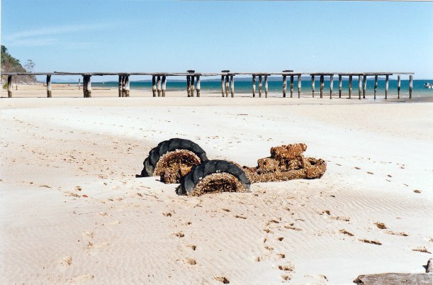
McKenzies Jetty and old tractor
It was a lovely little beach, with the mainland clearly in view in the distance. In places, little mangroves were trying to establish themselves in the sand.
We walked about a km along to where the old settlement used to be, in the days when the jetty was used.
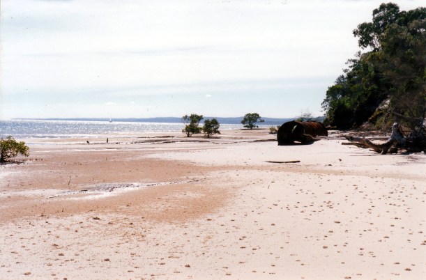
The beach near McKenzies Jetty, old boiler, little mangroves
After that walk, drove back, on inland tracks, to Kingfisher Bay, the newest resort, also on the west coast. This resort complex is designed to blend into the environment and the developers seem to have done a good job of making it unobtrusive, yet still quite upmarket. It has its own pier and barge landing facility. There were several yachts moored in the bay – owners taking a break at the resort?
We walked out along the pier and from its end could look back at the Resort, tucked away in the bush.

Kingfisher Bay Resort is in there! Seen from its pier
I was surprised to be able to buy the Weekend Australian paper at the jetty kiosk there, for only 50cents extra to its normal charge. At the resort store, we were able to buy some meths for the lamp, and treated ourselves to a coke and cheezels. Junk food indulgences are creeping in!
From Kingfisher Bay, we churned our way across the island, on another of the inland “roads”, to Lake Wabby. This lake has been formed by a big sand blow dune that has blocked a creek. Basically, over many millions of years, the entire Fraser Island has been formed by such sand blow dunes, moving sand from where it has been deposited on the east side, westwards. Through time, fresh dunes formed over older ones, so it is a really complex sand island.
Lake Wabby is the deepest lake on the island. It is a deep green colour, framed by the yellow sand of the encroaching dune. We walked about a km to a lookout over the lake, where we ate lunch and watched people swimming. We decided against going swimming there ourselves, feeling that the effort to walk to the swimming section would be too great, and we would get awfully sandy.
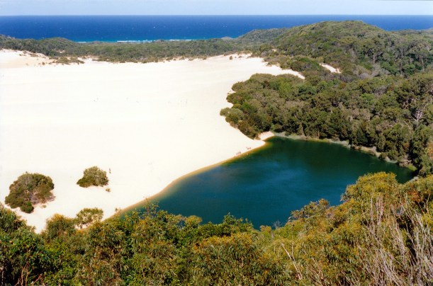
Lake Wabby and the sand blow that formed it. There are several people on the sand by the water – to give an idea of its scale.
Back at the car park, there were big goannas foraging around the picnic tables. One looked as if it must have had a huge lunch – it was draped over a big log, seemingly too replete to move.

Too comfortable to move!
During the trip across the island, earlier, we had driven through tall, true rainforest; and medium forest with eucalypts and banksias dominant in different sections. The diversity of this island is remarkable.
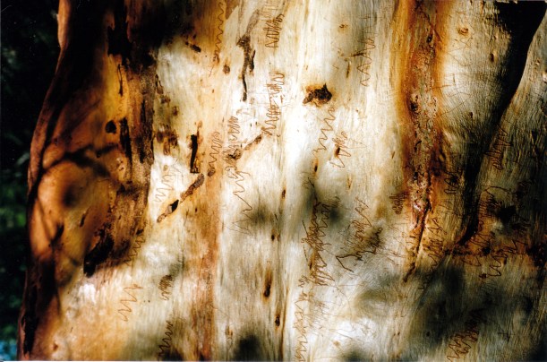
Detail on a scribbly gum. The markings are natural, hence the name
From Lake Wabby, we continued east, and drove onto the famed east beach, for the first time, over a boarded section intended to stop bogging.
The views along the beach were wonderful.
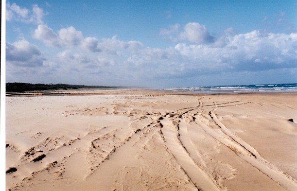
The east coast beach, showing some of the driving conditions
It was about 3.30pm by now and we were conscious of the early sunsets in this part of the world, so turned south and drove to the Eurong settlement, some 6kms along the beach. At Eurong, found there was an hotel, various sorts of accommodation (no camping) and quite a well stocked general store. I was able to buy some mantles for the lamp, a battery for the big torch, and some postcards. There is no shortage of great views on postcards here!
Then it was onto the main inland track back to Central Station and thence back to camp. The driving on this section was reasonable, mostly one way, because this is the main route across the island. Our first experience of east beach driving had been reassuring, too. The sand was firm, and because low tide had been at 1pm, there was still plenty of firm sand for driving and passing on. Key exit places were signposted. To date, the travel on Fraser Island has not been as horrendous as some material I had read, suggested.
Even the Troopys full of backpackers did not seem to pose a hazard during our driving time there – maybe the huge deposit they have to pay makes them more sensible? However, we did pass several with flat tyres. They carry so many people and with tyres partly deflated for sand driving, seem to be prone to flats from driving over tree roots or staking. John did not deflate our tyres by very much and Truck did fine, only faltering the once, at the Indian Head bypass.
It was almost dark by the time we got back to camp. We drove 65kms today.
Did a quick walk down to the lake to see what mood it was in. Purple and mysterious.
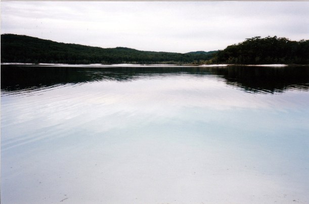
Lake McKenzie in mysterious mode
The camp ground was full – still mostly back packers. We feel outnumbered!
I made fish cakes for tea. Main ingredients potato and a large tin of tuna, and thus well suited to my limited cooking facilities here.
We lit the Coleman lamp for the first time. It gives a brilliant light, excellent for reading by, which the old gas lamp is not. I wrote some post cards, listened to the dingo chorus, and turned in.
