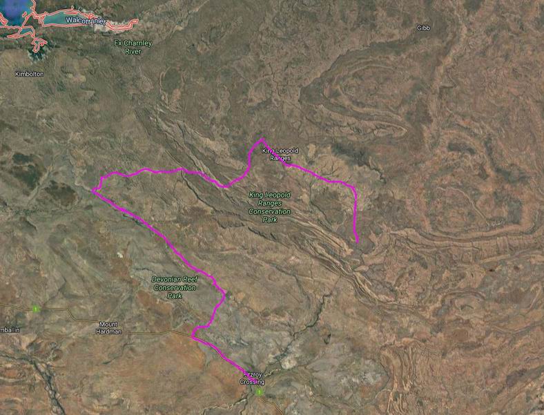
We got ourselves organized reasonably early, with prepared lunches, and set off for Grevillea Gorge and Lillie Pools. These were some 30kms to the north and then west of the homestead, on Plain Creek. This was a tributary of the Isdell River, which flowed NW to the sea at Walcott Inlet. In coming from Mornington, we had crossed the water shed between the river systems that flowed south and west, like the Fitzroy, and the northward flowing ones. The Gibb River Road tended to follow this water shed a lot of the time.
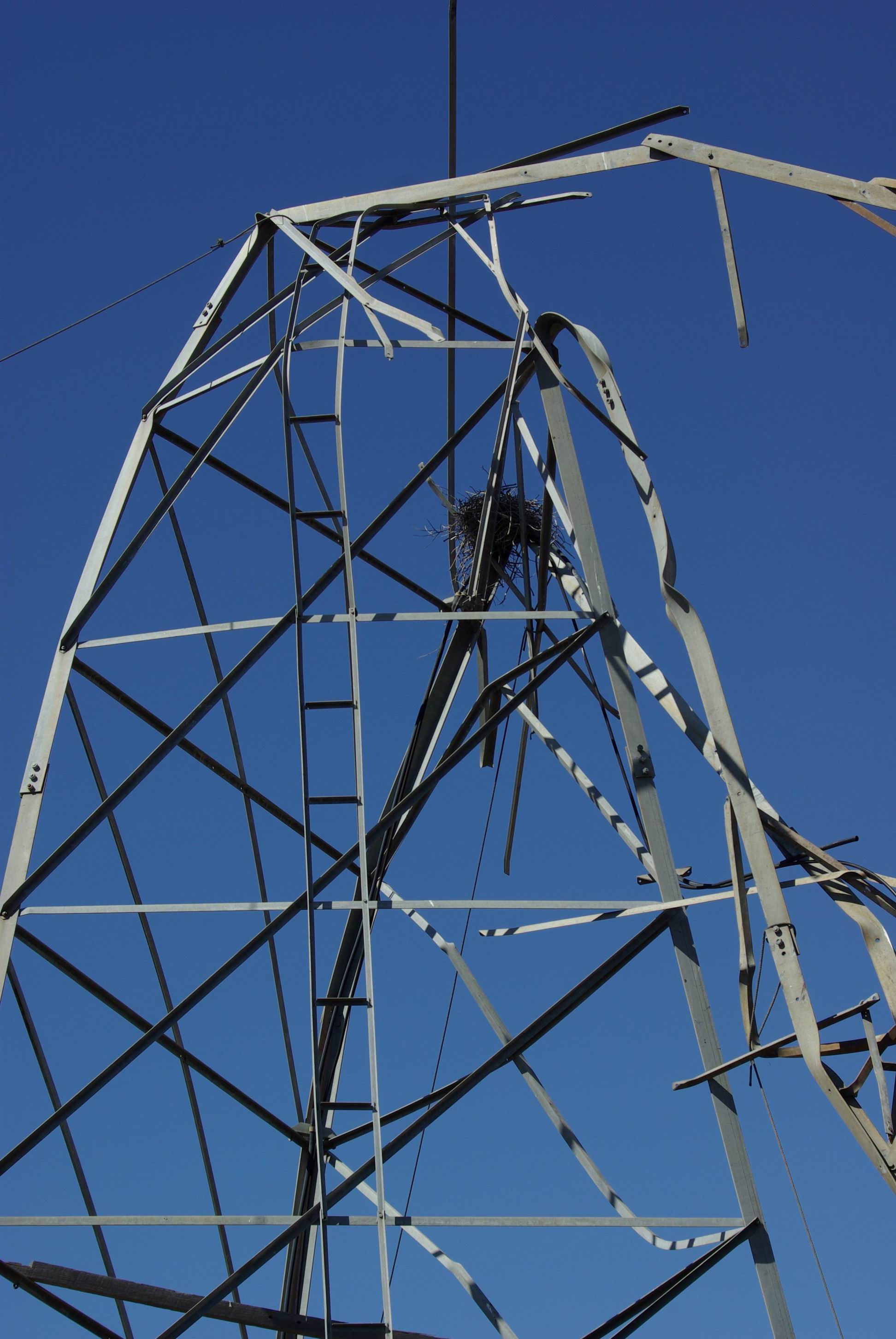
Along the way, we had a wander around an open grassed area where there was a derelict windmill structure that was all stark and twisted up. Presumably, it had succumbed at some previous time, to a cyclone – or two?
Cyclone damage?
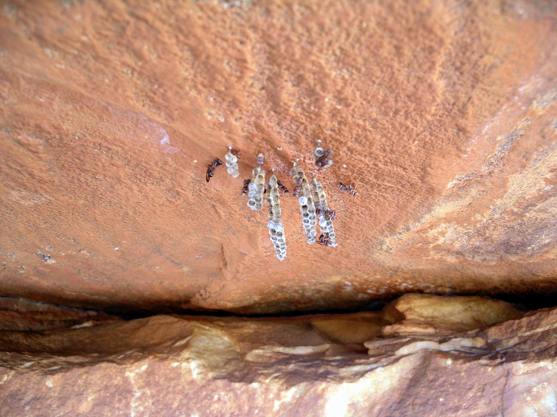
An enterprising bird – a kite maybe? – had built a rough nest in the framework.
Better than a tree?Charnley country…
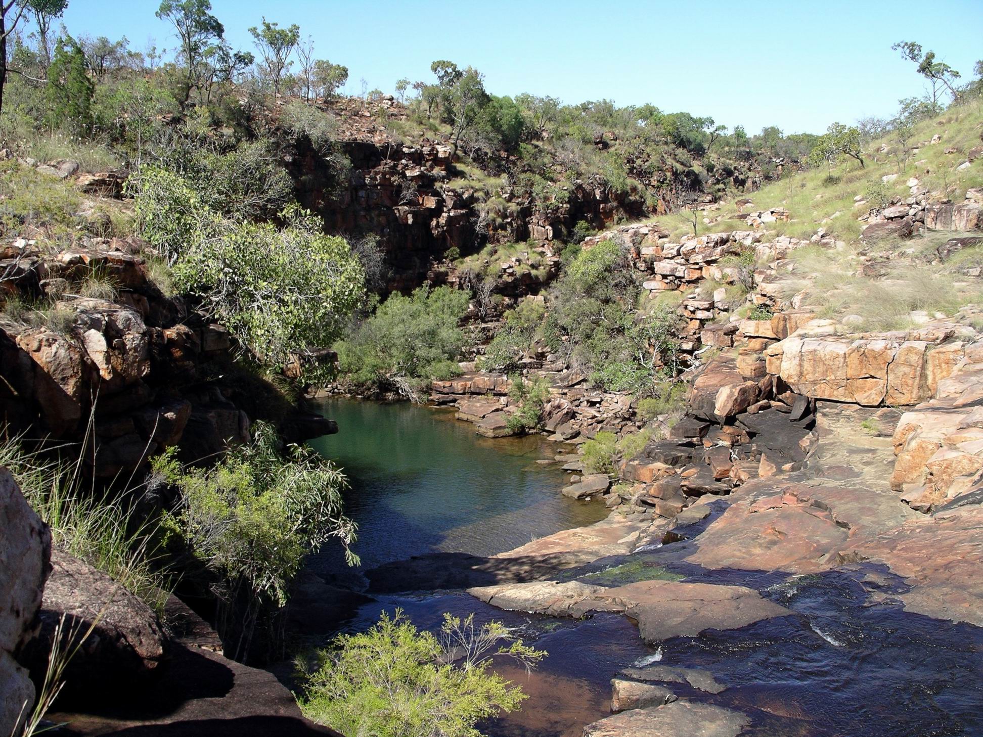
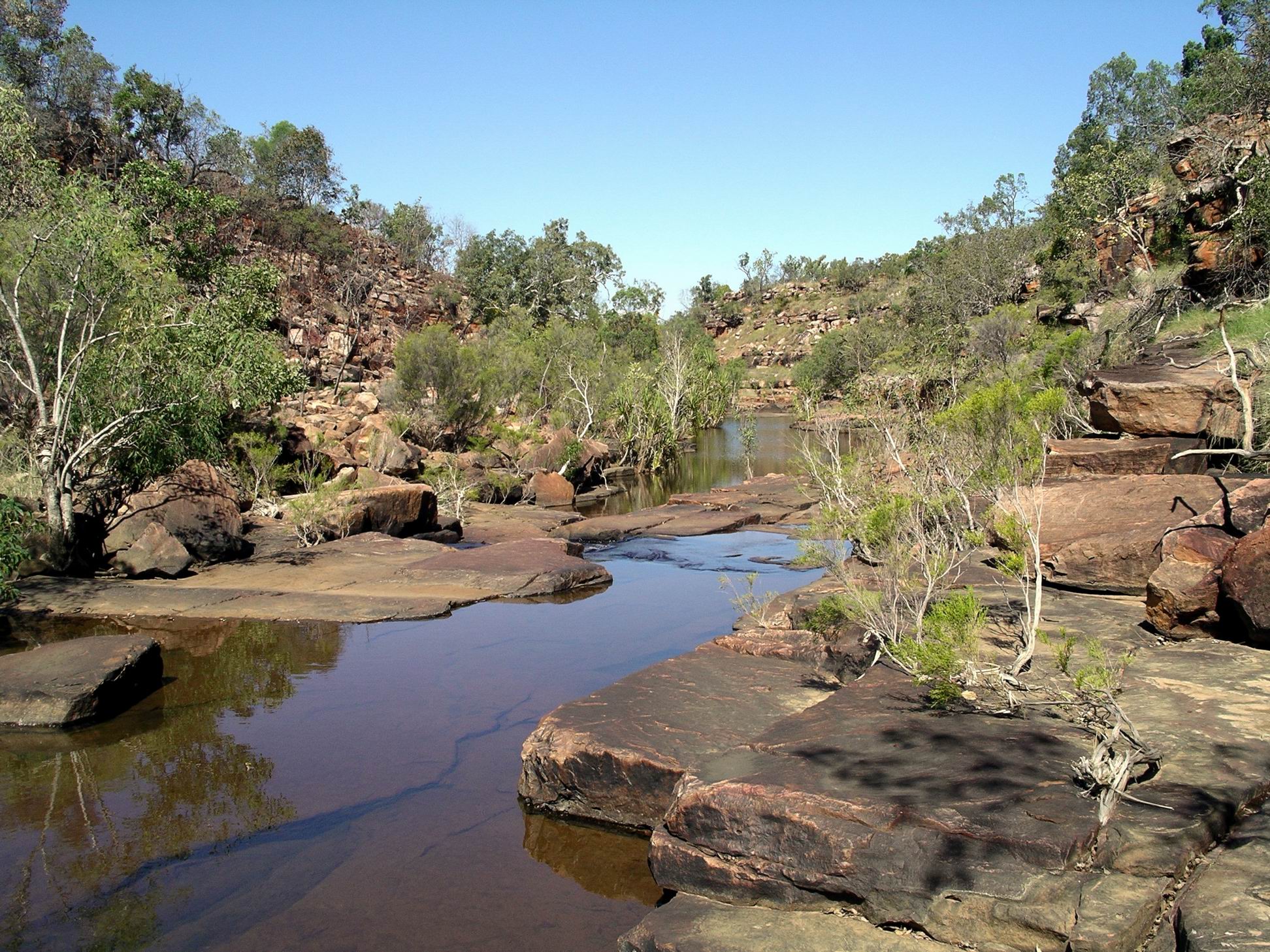
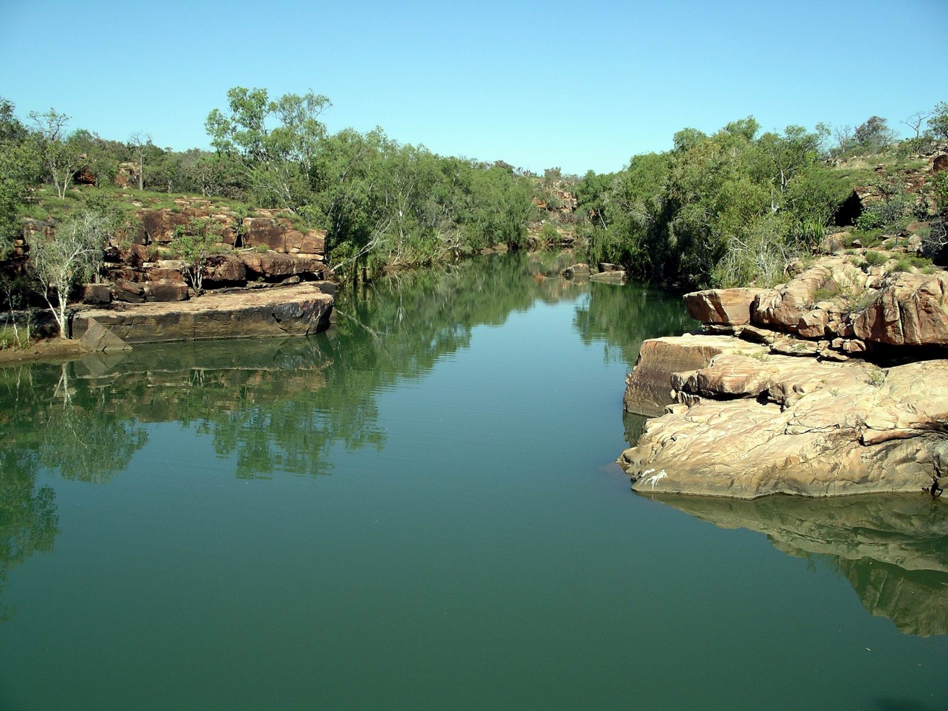
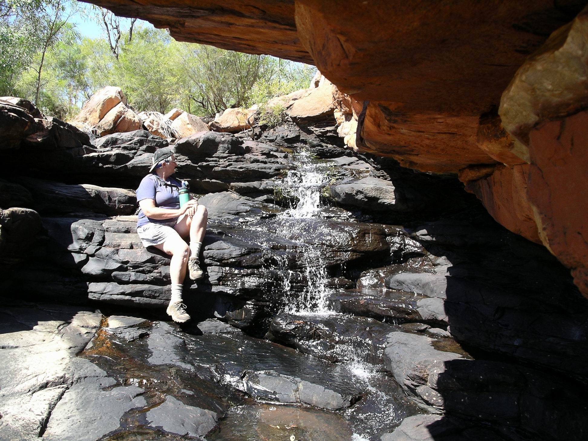
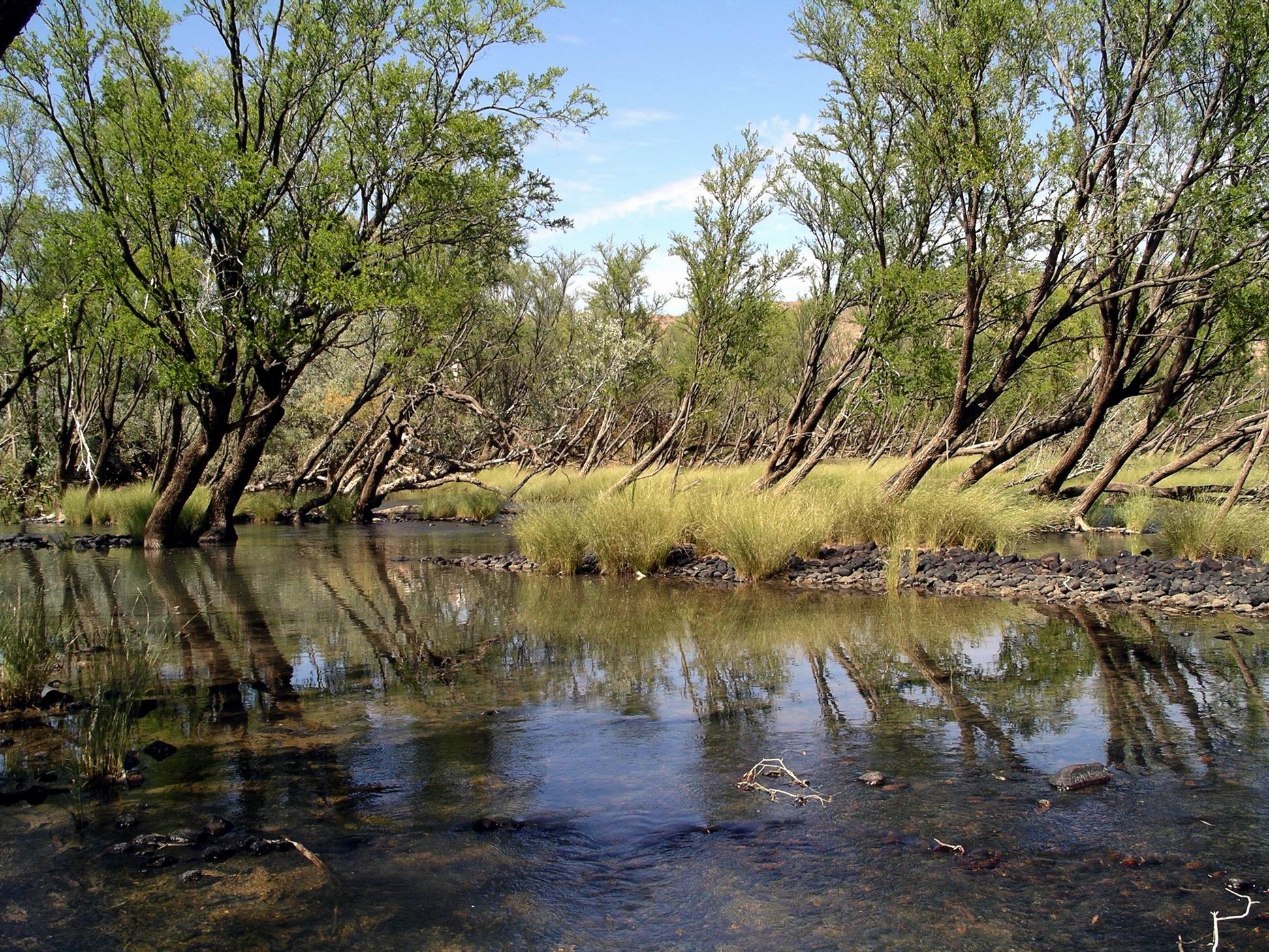
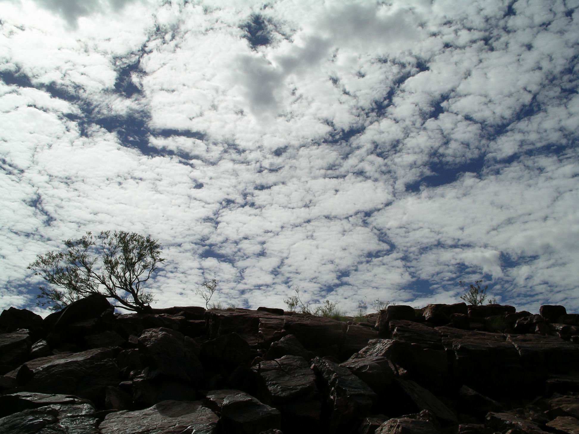
From the end of the access track we had to walk over a series of rock ledges – almost like a giant staircase – to reach a ladder that led down to the water level in Grevillea Gorge. The ladder was anchored – sort of – to a steel post cemented into the rock wall.
Nature’s stairway…Looking down on Grevillea Gorge and Plain CreekThe way down…
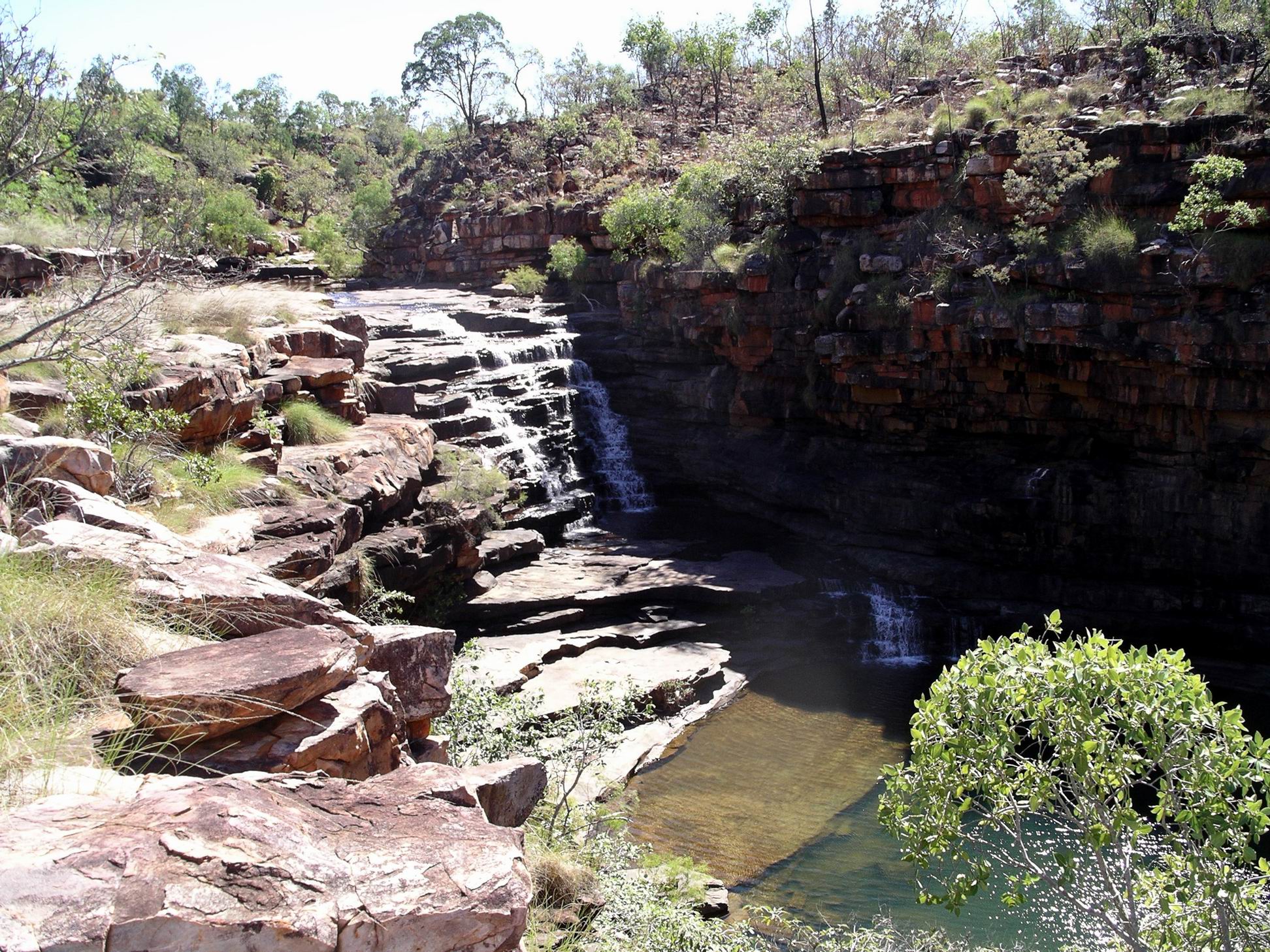
Found ourselves by a pool above a substantial two part waterfall.
The top of the waterfall….
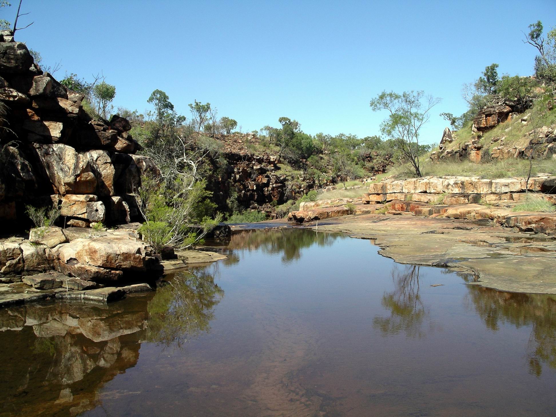
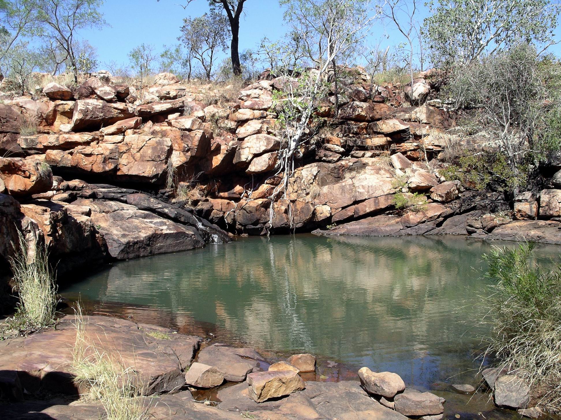
Below that was another pool and more falls, but there was too much rock climbing involved for us to follow the stream down.
The lower part of Grevillea Gorge
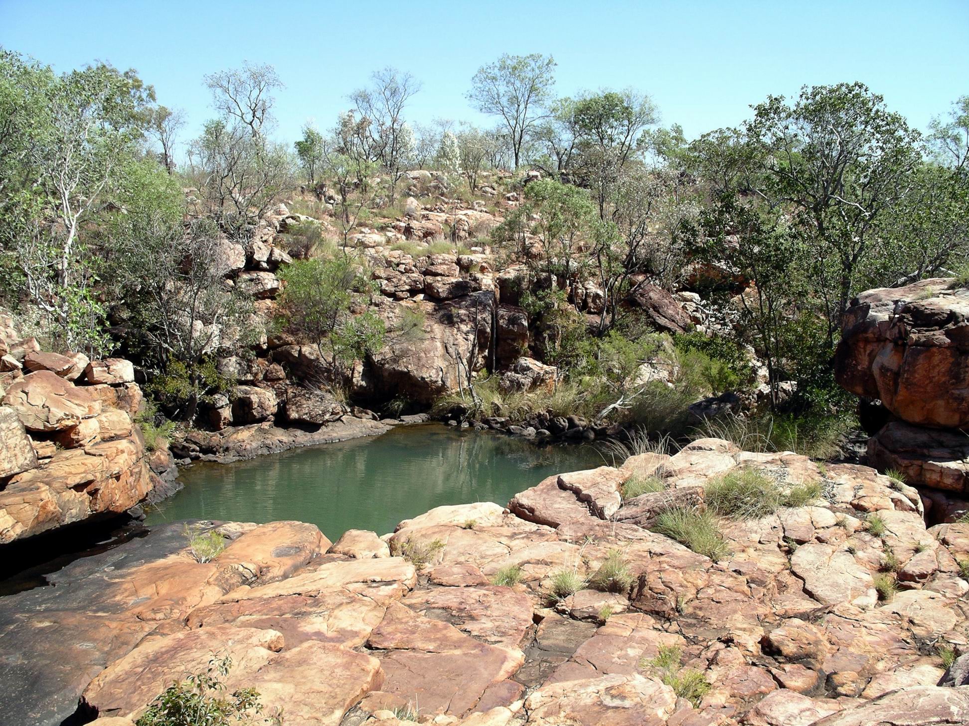
After spending some time around the ladder pool and falls, we followed rock shelves and ledges upstream for some distance along the creek. Although it was hot this was really enjoyable – the noise of the water in shallow areas, and the lush greenery along parts of the banks, made it feel cooler.
At nearby Lillie Pools, more scrambling over rock shelves was involved.
There were no waterlilies in the series of small pools here – they had been washed away in the last Wet season.
Near the Lillie Ponds
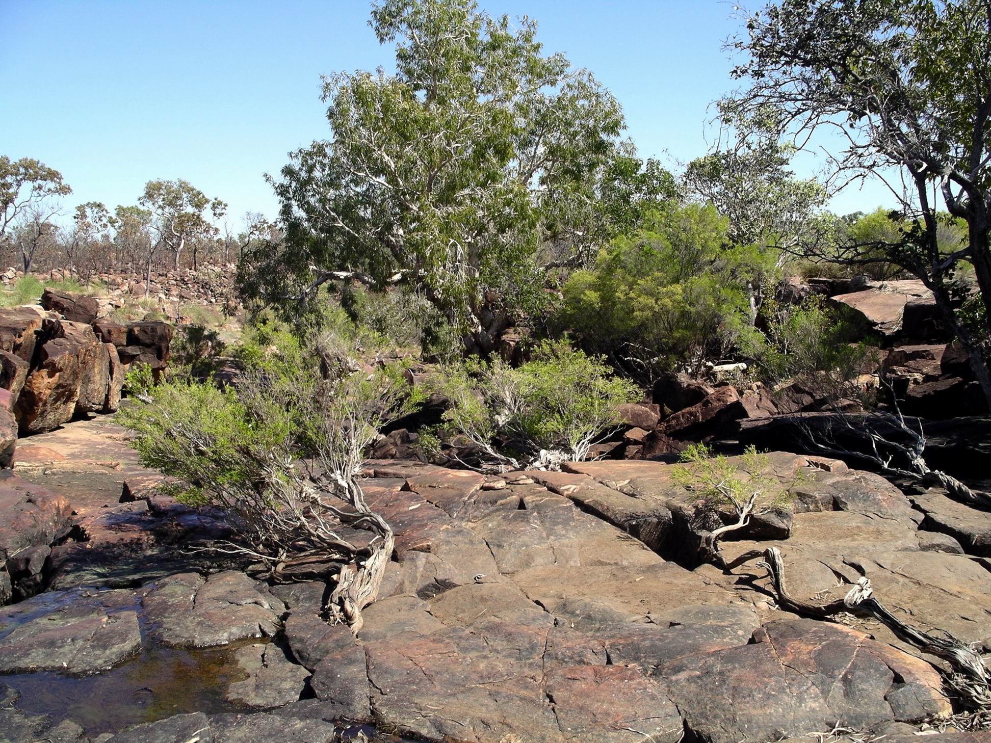
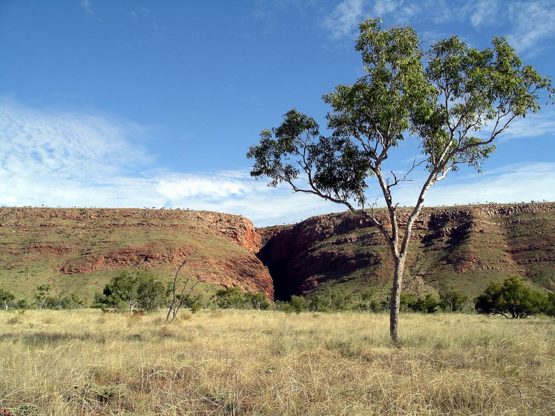
We were able to cut south, to Dillie Gorge, further downstream on Plain Creek. The grading and opening of the access track had only been completed yesterday. It was still rough in parts. In one place we stopped to pull some old barbed wire off the track.
Dillie Gorge down amongst the rock jumble, somewhere….
More scrambling down the rocky and rugged slope was required, to get to the water level. The boulder slope here was unusual – like a giant hand had just picked the rocks up and thrown them down in a random jumble.
Dillie Gorge
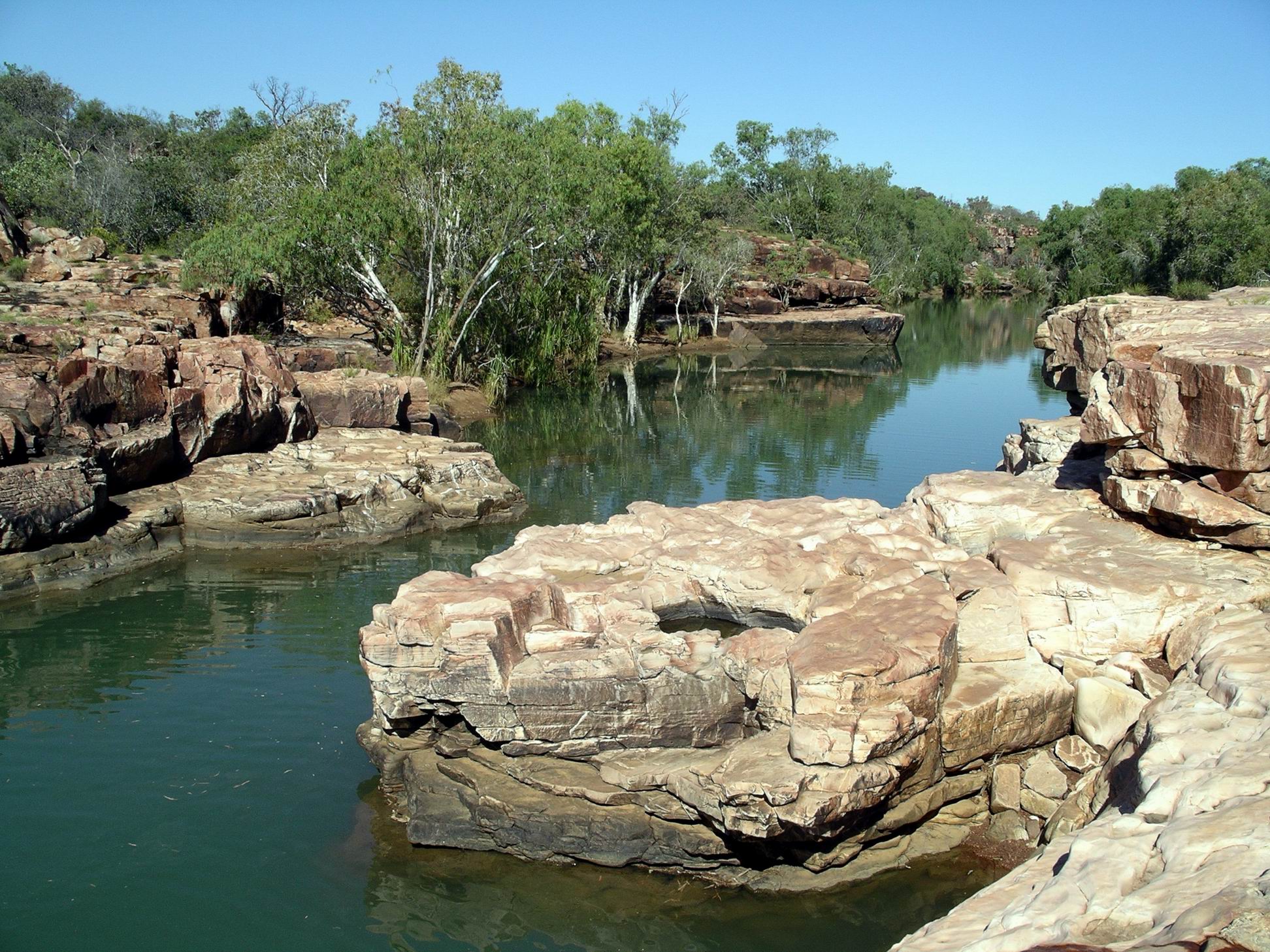
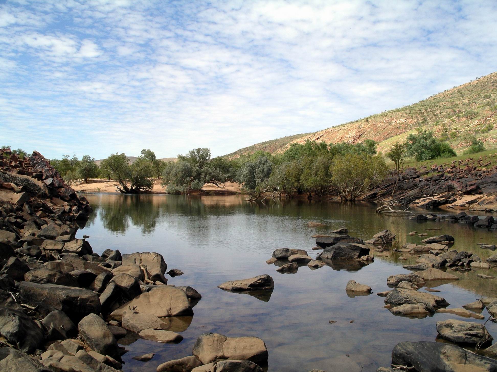
The effort was worthwhile – Dillie Gorge was the best of the lot! It was quite a deep and extensive gorge.
Again, we spent some time exploring along the creek and gorge – and enjoying our total solitude.
Dillie Gorge was extensive enough to make us wish that we’d had a canoe to explore with.
We would have really liked to be able to explore the track further to the north – to Junction Waterhole and the old homestead, but it was not going to be open any time soon. Charnley was another less visited but so scenic part of the Kimberley.
As we’d been coming out of Mornington, the other day, we’d encountered six couples, from New Zealand, in rented motorhomes – the types that were allowed to be on unsealed roads. They were on a bird watching holiday, and we had talked birds, and destinations, briefly. They came into Charnley this afternoon. One of their vehicles had lost its brakes, so they were in a bit of a dither about what to do next. Our advice was to simply phone the rental company – there was a public use phone up at Reception – and let them sort it out.
The funniest event of the whole trip. to date, happened this afternoon – at least, it was funny for John and me. M walked across to Reception to make a phone call, to check on a friend’s welfare. As she wandered back, the aggressive gander started to follow her. M walked a bit faster. The gander started to waddle faster. M speeded up, gander too. Within a minute, M was running across the open space, hotly pursued by gander at full speed, neck stretched out, wings flapping. It was one of those events that would have looked hysterical on video – except we were laughing too much to even think of recording it. M arrived, hot and offended – at us laughing as much as at the bird. He retreated, no doubt considering he’d won the encounter.
John had now concluded that the reason the lamp was playing up was that he had not been putting enough fuel into it. So it may not have needed pulling apart at Mornington, after all.
It was a freezing night. I finished up putting on both a windcheater and a beanie as extra sleepwear, and was still cold. So much for my theory about closeness to the coast.
A rooster started up at dawn, just to add to the misery. It had a funny crow – there was no “doodle” in it. More like one loud squawk – a very loud one!
From what we could gather, in talk overheard around the camp ground and ablution block in the morning, most campers here had arrived yesterday, and were planning to visit Grevillea Gorge today. So, we decided to wait a day before we did that visit.
Instead, we did the walk that was a circuit from the camp ground. This went to Paradise Pool, on to Tower Hill, and back to the camp ground – about 5kms. The walking was over stony ground to the pool, but was a bit less rocky on the way back from Tower Hill.
On the way to Paradise Pool
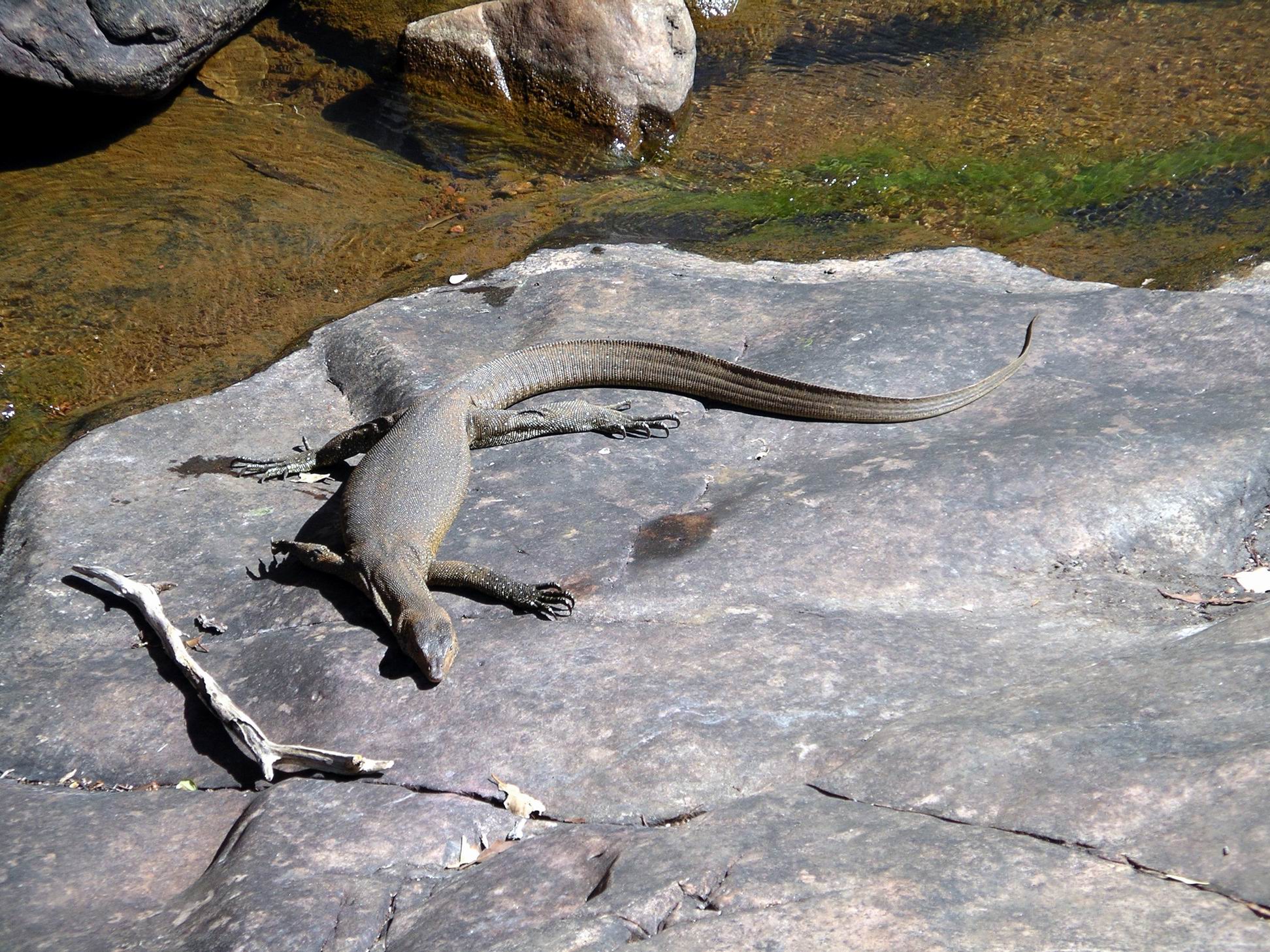
The pool area was quite pretty, albeit small scale. There were a couple of little lots of rapids coming down into a series of small plunge pools.
One of the pools was home to a large water monitor, who did not seem particularly perturbed by our presence, but just kept sunning himself on his rock shelf by the water.
Water monitor
The walk was enough – it got rather hot during the walk. Our crowd avoidance strategy worked – there was no one else on the walk.
What was left after something hatchedWas this an unusual type of wattle?
After that effort, and a late lunch, we were happy to laze around camp for the rest of the afternoon.
Now the sites had dried out, they were not as bad as they seemed yesterday, although there was no respite from the afternoon sun on the front of the tent. We were actually very pleased to be away from the large numbers of mosquitoes that were infesting the desirable sites close to the creek!
One of the free ranging ganders was quite aggressive. I was walking back from checking some information at Reception, across the large expanse of open ground to the camp area, and it started to hiss and make little runs at me as I walked past the group of geese.
WEDNESDAY 18 JULY MORNINGTON TO CHARNLEY RIVER CAMP 190kms
We were up at 6.45am., packed and away by 9. John really wanted to get ahead of other departing travellers with camper trailers, and not be held up by them and following a cloud of dust for long distances. He didn’t really know how many of such would be departing, just assumed there would be some!
A little way down the track, M’s CB radio suddenly decided it was going to work again, after having been U/S for some time. Seemed she might have hit the right bump? Anyway, now we could communicate when going along, again, if need be.
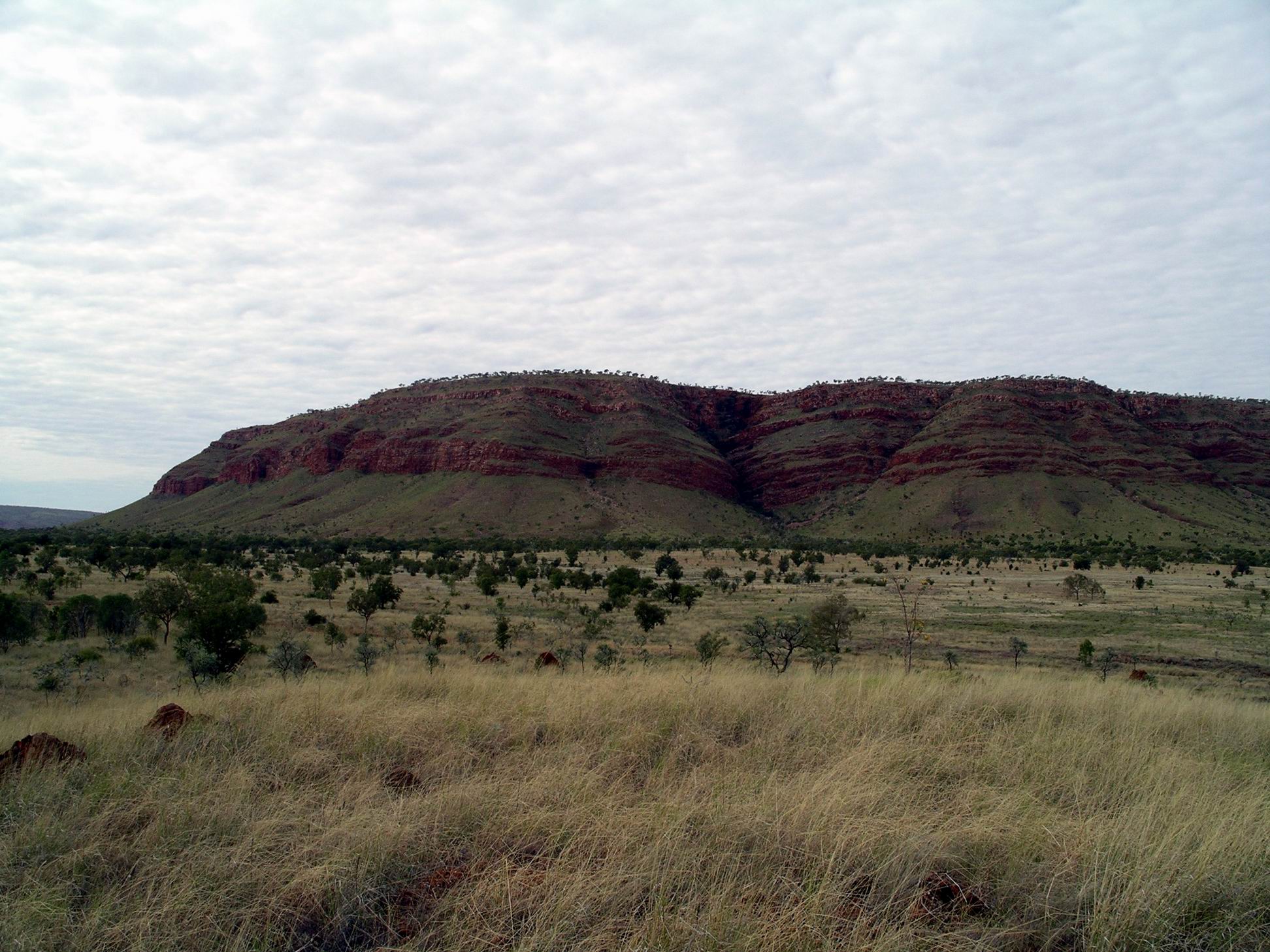
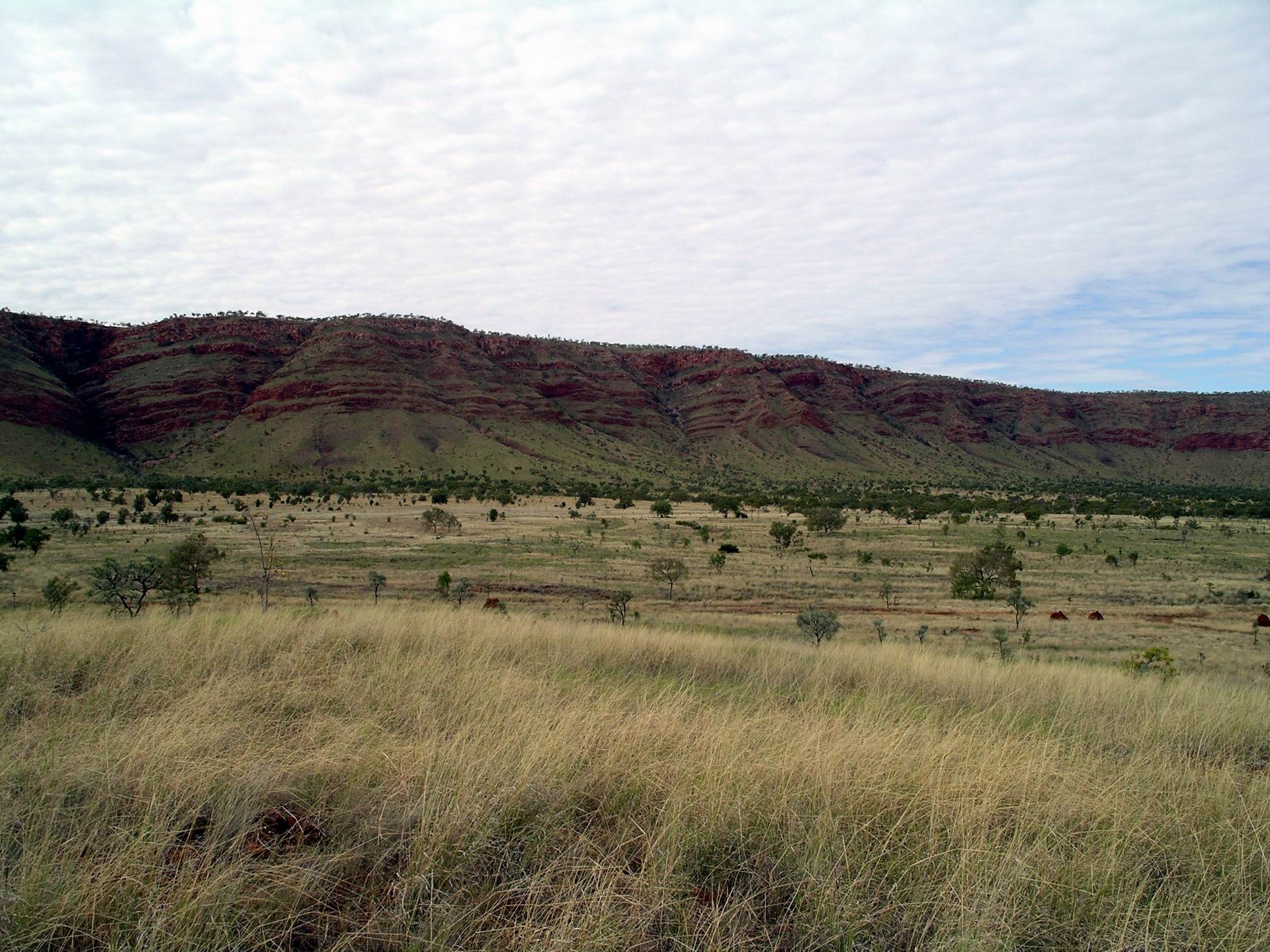
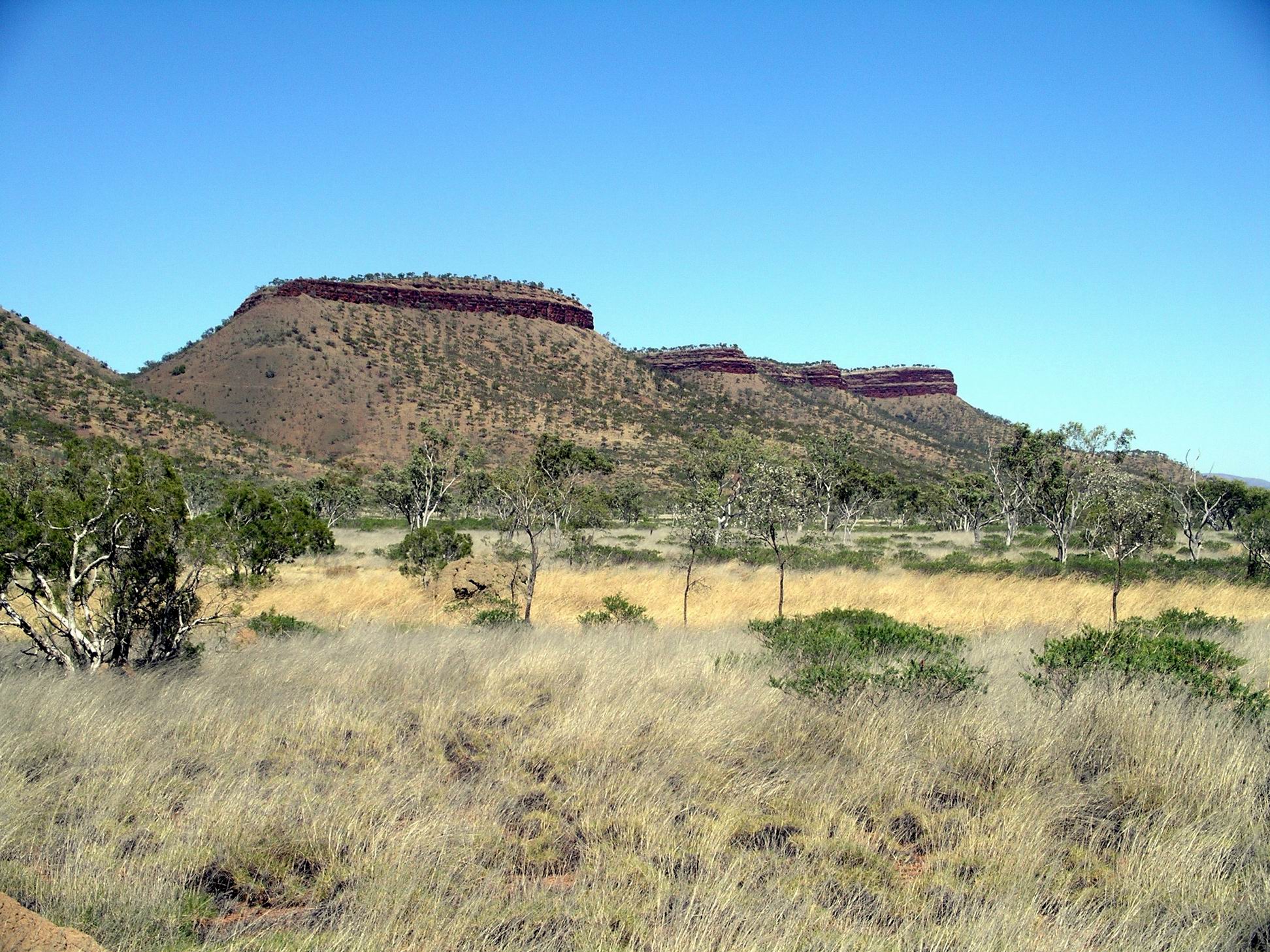
I loved the drive back to the Gibb River Road, with the King Leopold Ranges sometimes visible in the distance, and the majestic flat topped peaks near Mt House.
At the junction with the Gibb, turned to the west, to go back to Imintji Store, 25kms away, where we had noticed, the other day, they did tyre repairs. It meant backtracking, but doing all that was reasonable to ensure we had two functioning spares, seemed the sensible thing.
Tyre was repaired, after a fashion. The problem seemed to have just been wear on the tube – it might have been getting a bit old. Sometimes, we’d had new tubes put into older tyres, and part used tubes put into new tyres, and John had lost track of the age of the tube in this particular tyre. Fortunately, the wheel size was a common one, and the Store was able to supply a better tube.
The rough and rocky crossings of Fletcher Creek on the Bungles track had quite possibly created the problem.
M had elected to do the doubling back bit to Imintji with us, rather than go on ahead. We were able to do a little stock up at the Store – margarine, which we were just about out of and hadn’t been able to get at Halls Creek! Bought some frozen meat, packets of cup-a-soups, bread, fresh tomatoes (what a luxury), and a sandwich for John’s lunch.
Topped up the fuel again. We’d done 350kms since last here. It was still $1.85cpl.
Best of all, the wife part of the couple running the Store for the season, was a hairdresser by trade. Because the Store was not busy, I was able to get a hair cut. Bliss. I had definitely reached the uncomfortably shaggy stage.
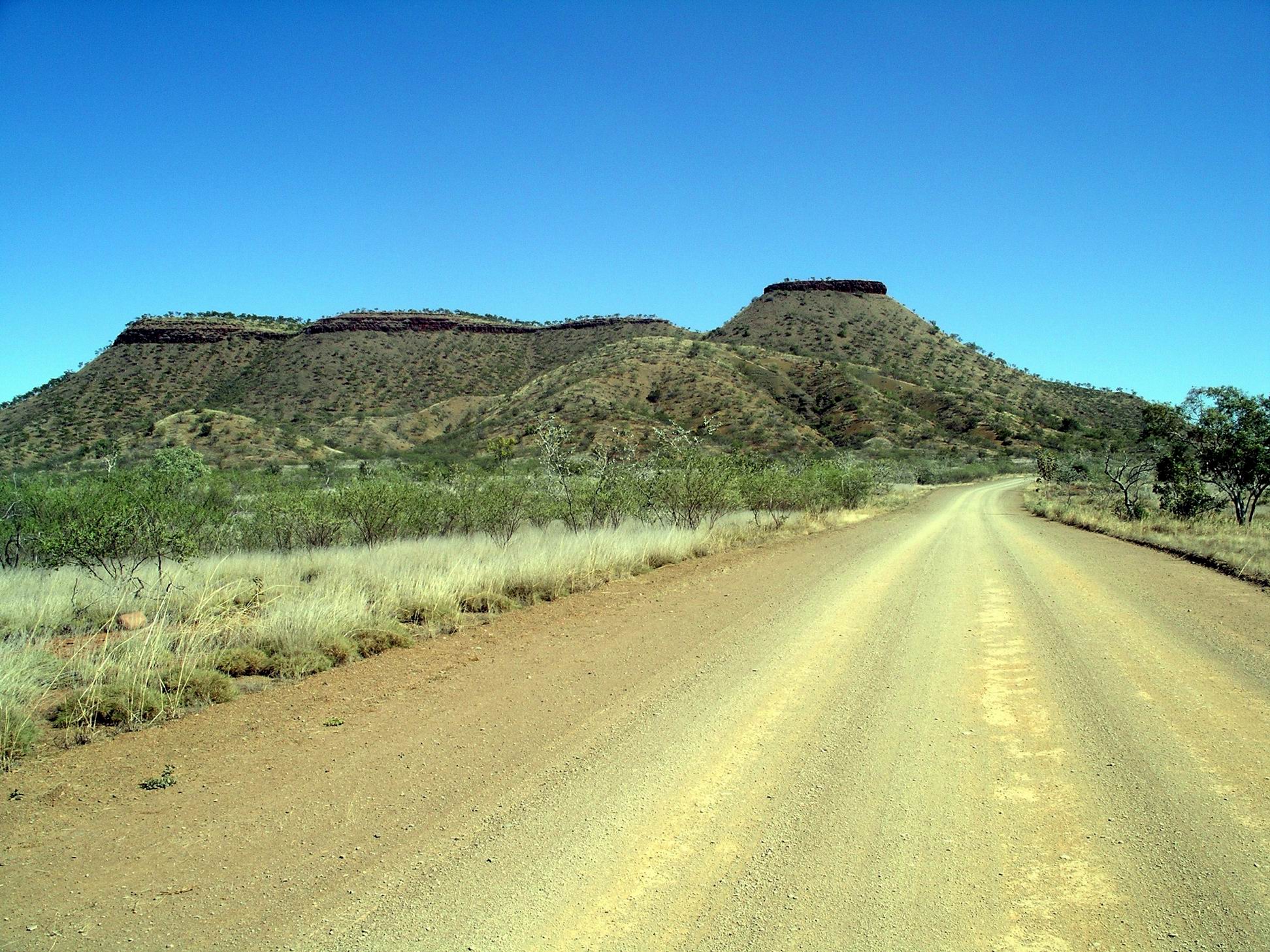
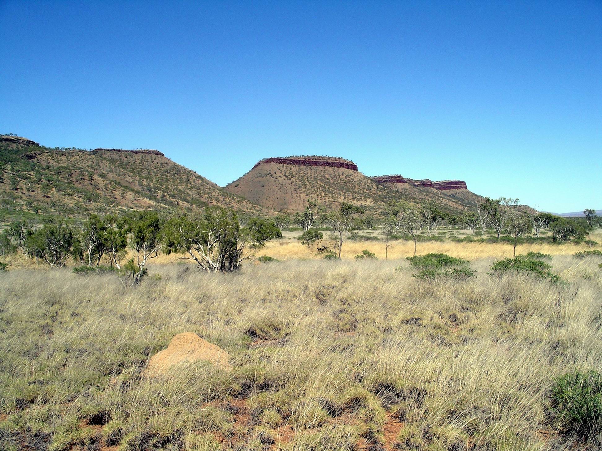
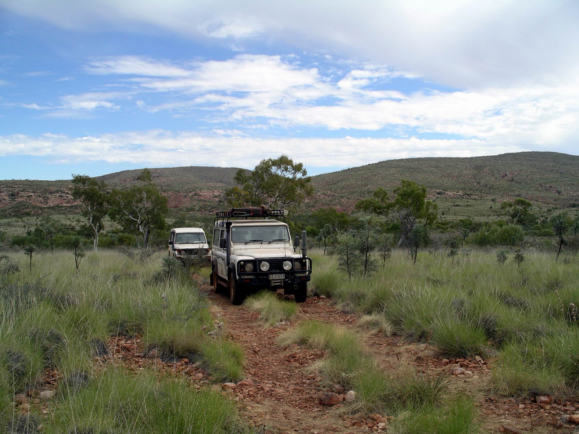
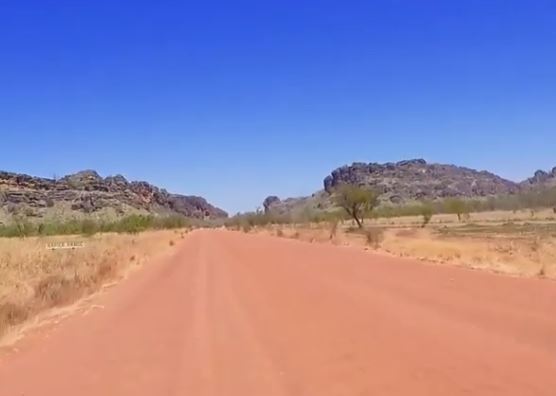
The access track to Charnley River Homestead (Beverley Springs Track) was only just to the east of the Mornington one we’d come up this morning. It was nearly 50kms from the Gibb to the Charnley River Homestead and camp area. The track was quite rough, and rutted in parts where it had obviously been driven on wet. So it was fairly slow going. There were a few little creek fords with mud and low water in.
Charnley River/Beverley Springs track
About 7kms in from the Gibb, we stopped to view a boab tree where the explorer Frank Hann (of Cape York notoriety) had carved his initials when he explored through this area in the 1890’s. I guess that what would be considered graffiti, if done today, served a purpose then, in that his route could be found by others.
Frank Hann tree
The campground fees here were $30 a night. Unpowered of course. The amenities were adequate, if a bit rough and bush style, compared to Mornington.
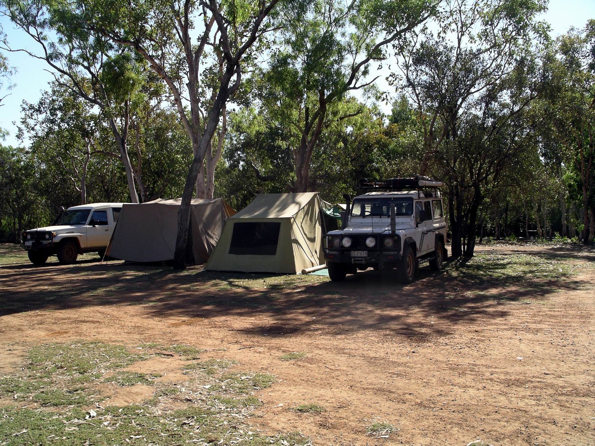
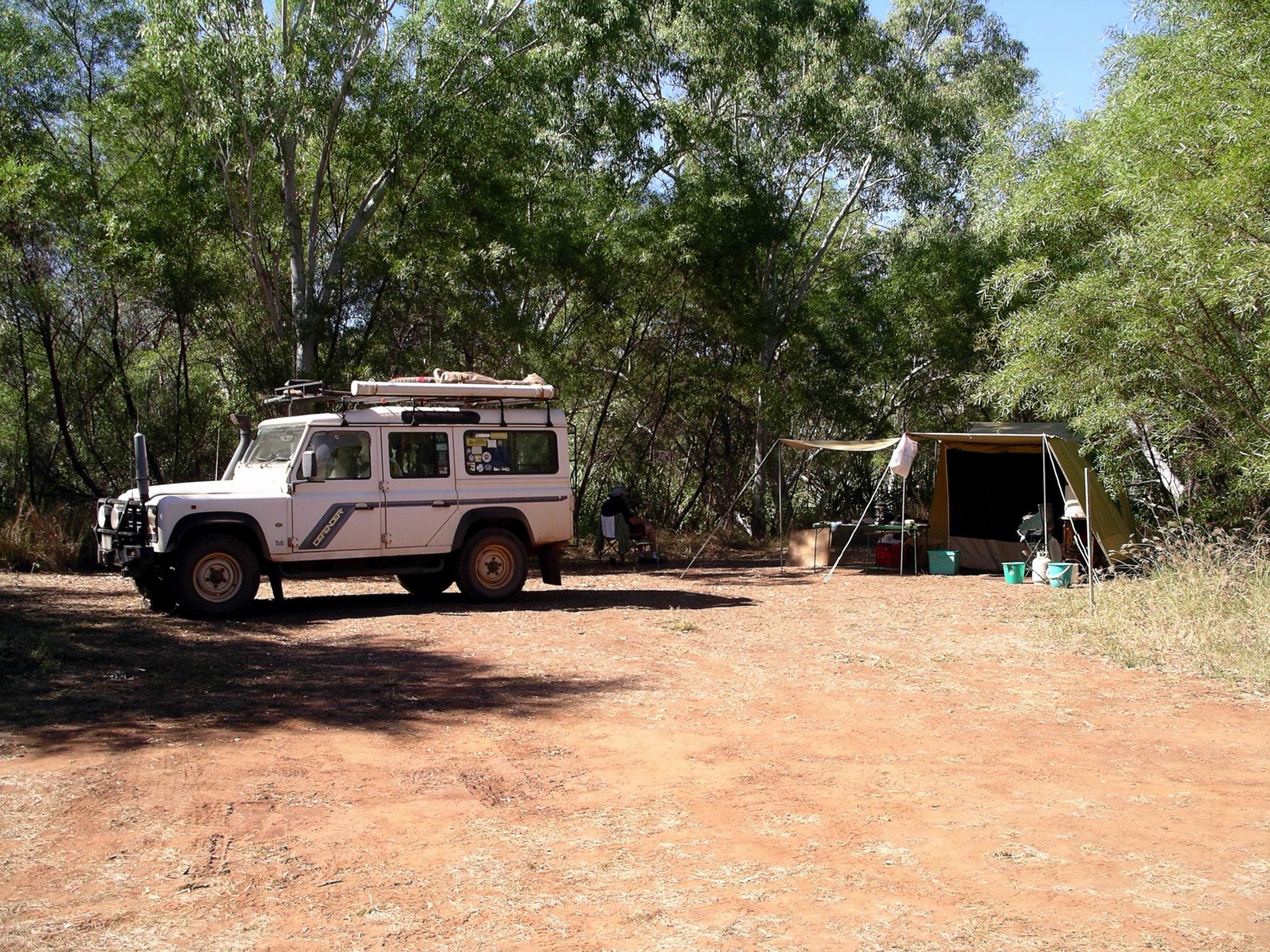
It was hard to find a good spot to pitch the camp. We were comparatively late getting here, due to the detour to Imintji. The really nicely shaded places, beside the little creek that edged one side of the camp area, were occupied. The area we ended up on had been watered, so was a little muddy in places, and with lots of ants going through it. Although we’d managed to find a place with some trees for shade, this would be in the mornings, so in the afternoon the tents would get hot. Couldn’t be helped. I resigned myself to a not so great camp spot.
Charnley River Homestead camp
After the rough track in, the left rear tyre was slowly going down when we arrived at the Charnley camp area. Another tube? Maybe it was a similar age to the one we’d just replaced? At least that justified the detour we’d done back to Iminitji!
From the information given to us when booking in, there was quite a bit to do here, although the access track to the north, to Old Beverley Springs Homestead ruins, was closed. Like Mornington, it was new ground for John and me.
Charnley was a working cattle station. There were some calves wandering about the place, plus a baby donkey, chooks, a little mob of geese, some peahens and peacocks.
At least our rather exposed camp spot was not very close to any other campers, which meant John could run the genset for a while so he could play computer games! No comment from me…
M and I did washing. John tried to fix the lantern – took it apart, put it back together again – but it still was not working much at all. I wrote some cards to grandchildren, and a letter to son about his possibly joining us up in these parts, at some stage.
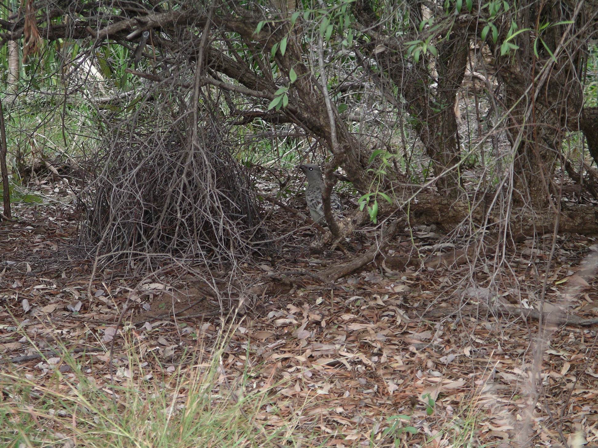
We spent some time watching the nearby bowerbird constructing his bower, and practising his dancing near it. John was inspired to try to use the video function on the big camera, to record some of the bird’s antics.
He is in there!
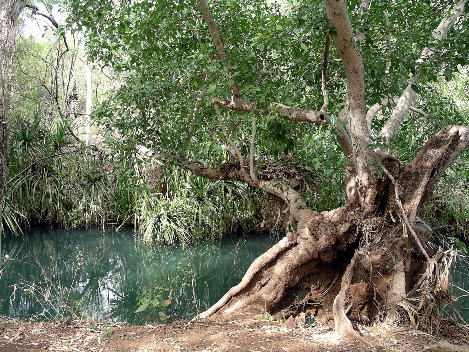
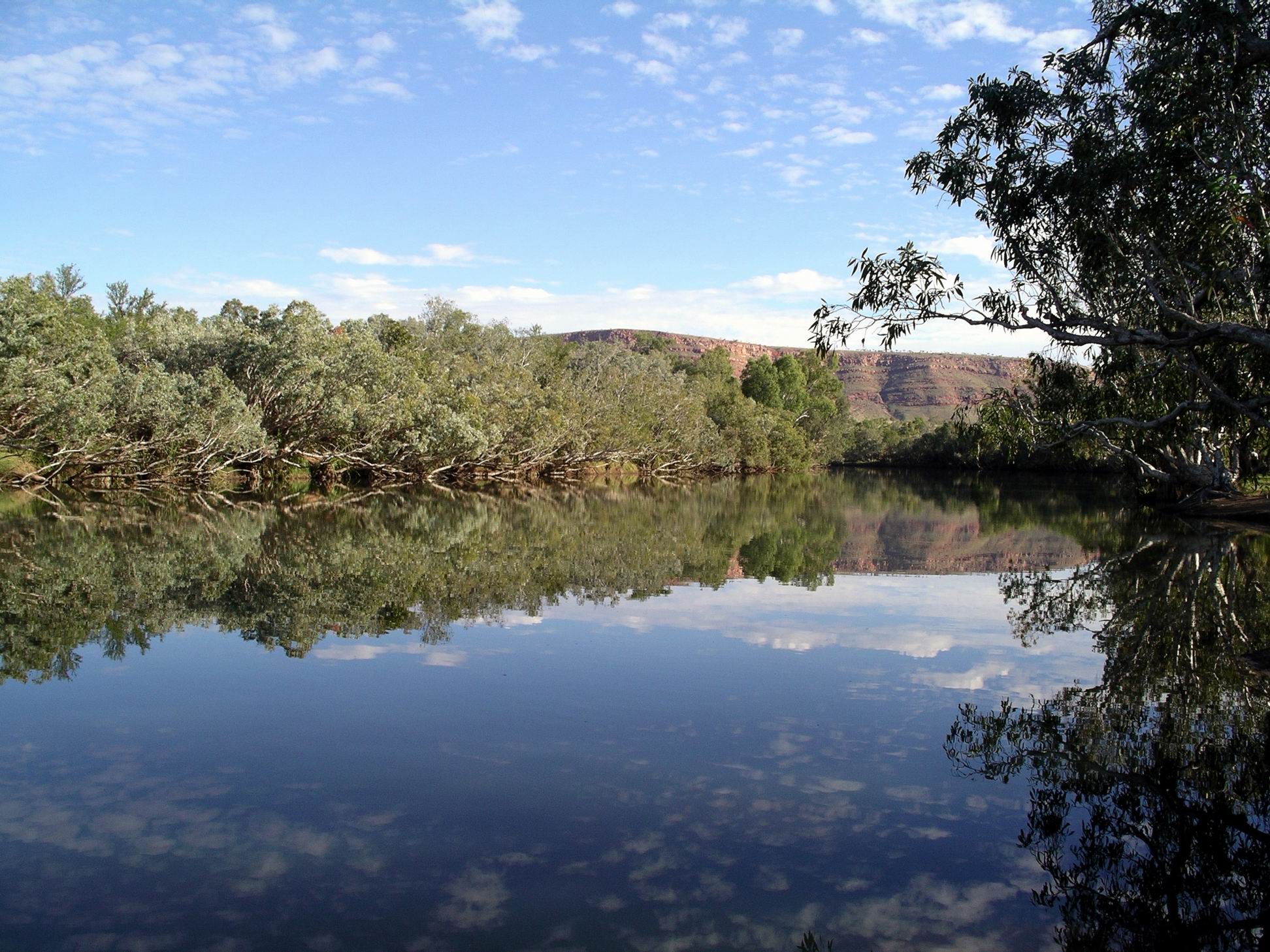
I went for a wander along the lovely little Annie Creek, near our camp, taking photos.
Reflections in Annie Creek
I tried to phone Charnley Station, to book us in there, but could not raise them.
Our rowdy neighbours departed this morning, so their stay had been brief. If they visited Sir John Gorge at all, yesterday, it must have been before we got there, as we hadn’t seen them at all. A quick rush-about stay?
Old Strangler Fig tree by Annie Creek
I was so pleased that we had made the effort to come down here. It was quite different to other parts of the Kimberley that we had previously visited. I had wanted to visit here since I first read that a campground had been set up. It was just unfortunate that our 2000 planned trip from here across the now-closed Tableland Track, did not happen. It was now one of those forever-lost opportunities.
Today’s activity centred mainly on Sir John Gorge – further upstream on the Fitzroy River from where we were yesterday.
First, we stopped en route, to walk the Termite Trail, which had been set up in an area where there were a lot of bulbous shaped termite mounds. These were very different in appearance to the ones we were more used to, from places like Litchfield National Park and Pungalina.
A walk track meandered around, past various termite hills where information boards gave all sorts of unexpectedly interesting information about the termites and the roles they play in the savanna grassland ecosystems.
Essentially, termites recycle dead plant matter to provide nutrients for more growth, so enhancing the productivity of the area. They also improve water penetration.
We spent longer there than anticipated, finding it so interesting.
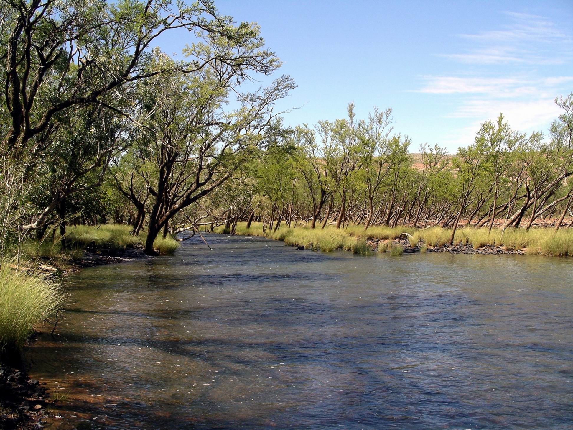
Next stop was at Bluebush Waterhole – another large waterhole on the Fitzroy River – where we wandered about for a while.
Fitzroy River at Bluebush Waterhole
There were some large sandbank areas there – the product of deposition by the river at flood times.
Here, the leaning tree effect of Wet Season high water flows was very evident.
Washed downstream by floods, but still alive….
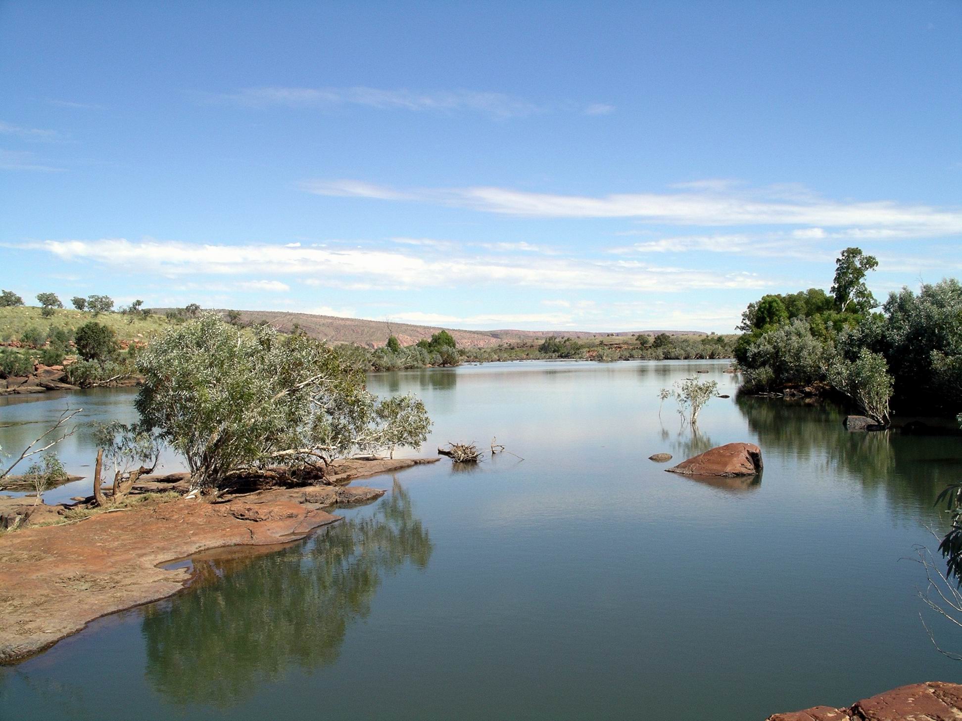
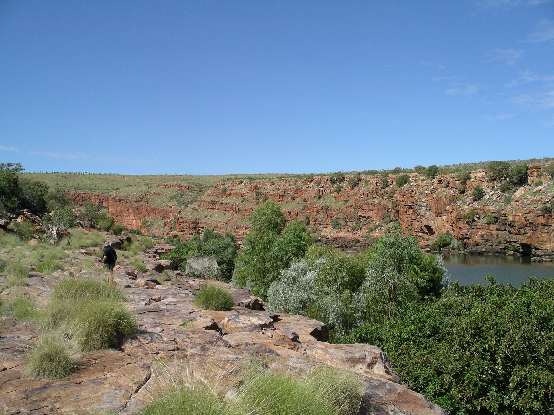
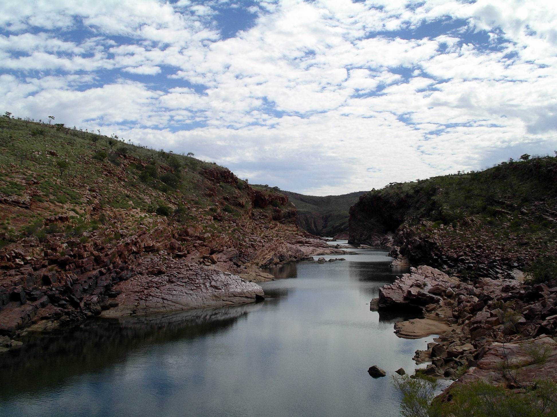
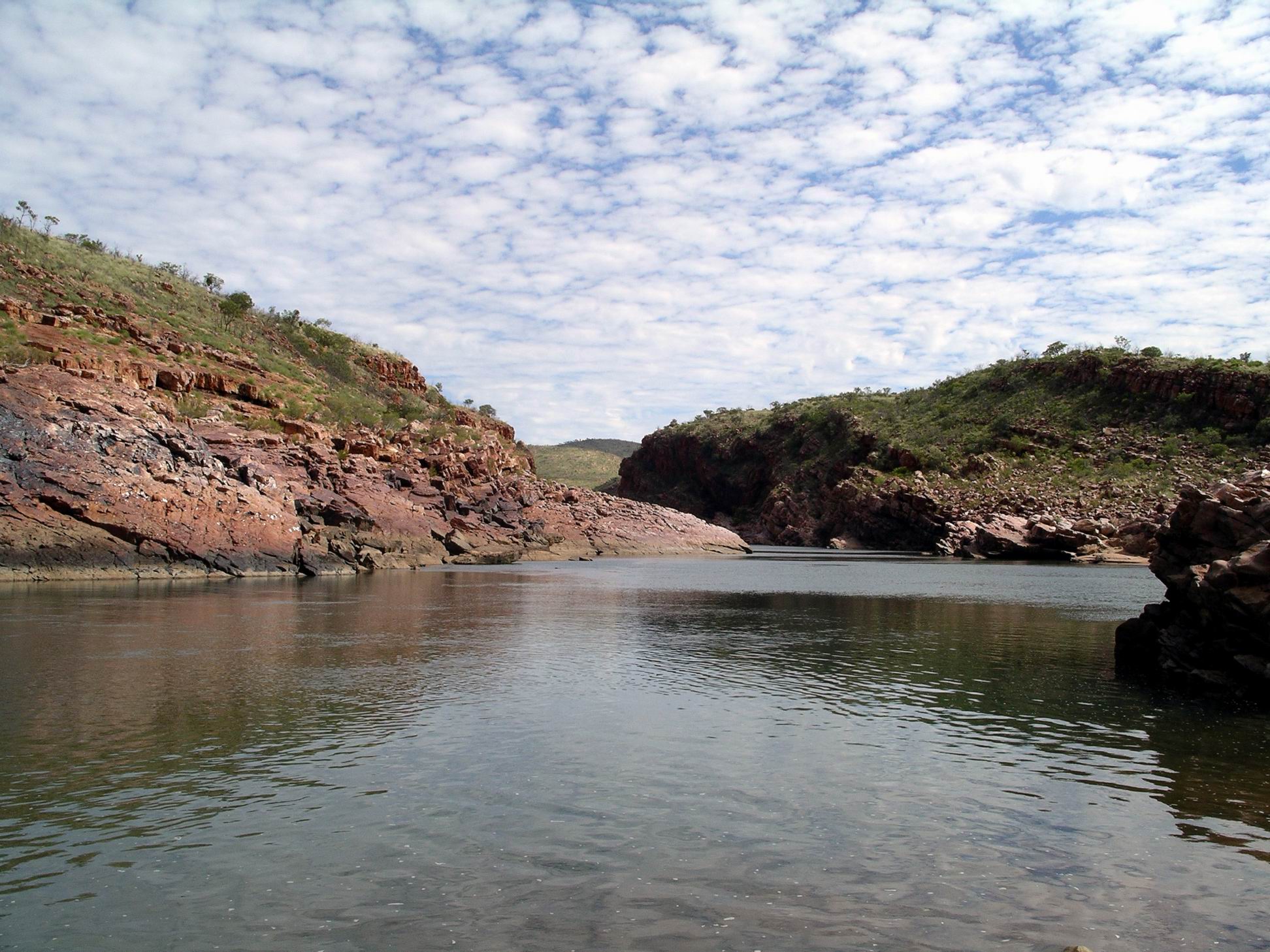
Finally, it was on to Sir John Gorge. The character of this was very different to that of Dimond Gorge. The latter just cut straight into the King Leopold Ranges, making the deep gorge. At Sir John, there were great flat slabs of rock beside the river and the start of the Gorge was more gradual.
Fitzroy River at Sir John GorgeDeeper section of the Gorge in the distance
The Gorge did not seem as deep, at least in the small part of it that we could access. It was also more open and broad, which meant we could walk up into it for some distance.
River wider here….Further into the Gorge….
We had not been prepared to pay $200 for the exclusive use of the only canoe at Sir John Gorge, but decided to do what we could on foot. However, as the Gorge is 23kms long, we didn’t see a great deal of it!
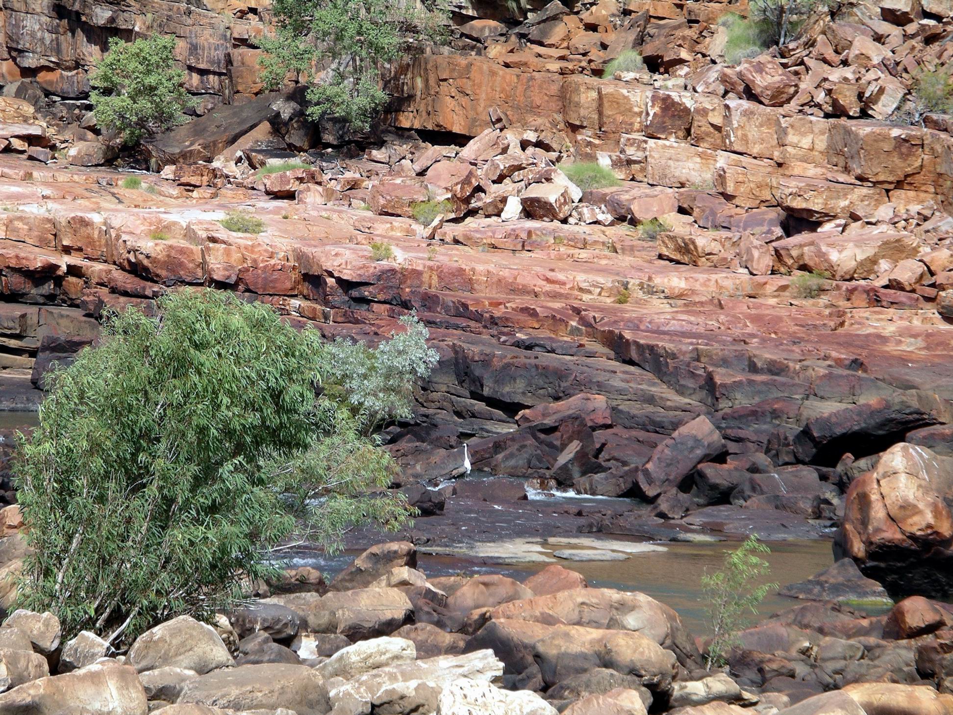
The scrambling around on the rock shelves was enjoyable, and we were able to do some bird spotting. Saw a Sandstone Shrike Thrush – a hard bird to find. There was a Great Egret fishing in the river at one point.
Great Egret
Ate the lunch I’d packed, sitting by the river, enjoying the solitude and scenery. At one stage, there were a couple of other people visiting there, too, but mostly we were alone.
Sir John GorgeThe tenacity of some trees…..
Eventually made our way back to camp. We were enjoying this place so much that we decided to stay an extra day, and walked up to the Reception/bar area to make the booking for that.
The men who set up camp nearby last night, were a very rowdy group. A lot of alcohol consumption seemed to be happening. They also stayed up quite late – much more than us. So they were not the greatest neighbours.
Our camp lantern was playing up. It was a good quality kerosene fuelled one that normally lit our camp brightly. Now, it was sputtering and faltering and the light was dim. I thought it might have been blocked somehow by dust.
After breakfast, at Reception, we paid $60 to hire a canoe to go paddling at Dimond Gorge, on the Fitzroy River. That fee entitled us to use the canoe for as much of the day as we wanted. We were given paddles, mud map and lifejackets. The canoes were permanently in place at the Gorge, for the season.
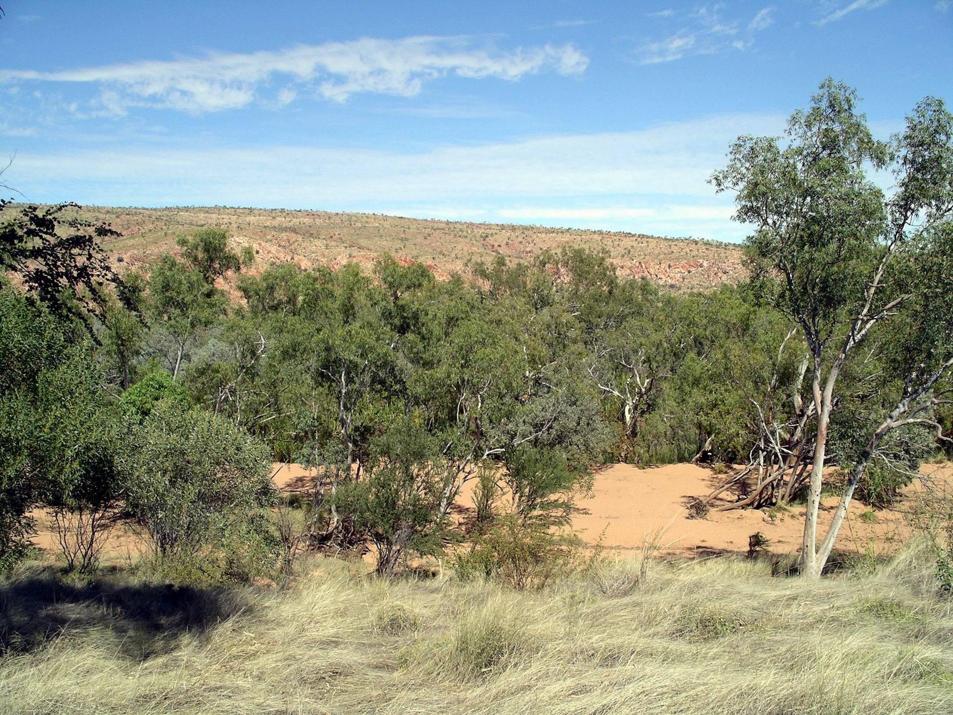
Followed a rather roundabout route the 23kms to Dimond Gorge. The track had to follow valleys through the rather grand ranges.
Spectacular range country
On the way we took a short side track to a low rise that was a lookout, giving an elevated outlook onto the surrounding ranges.
Track down below the Lookout
At Dimond Gorge, it is about 80kms down the river to the town of Fitzroy Crossing, where we were a few days ago. Not really far at all, but there are no roads through that rugged country.
Dimond Gorge – Fitzroy Crossing about 80kms that way!
It was a bit of a hike from the car park, across sand banks and rocks, to where the canoes were stowed, close to the river bank.
Dimond Gorge
M and John did the first paddle in the open, two man canoe, downstream and into the gorge.
While they paddled off into the distance – and back – I wandered about, rock hopping, taking photos, and enjoying the chance to do so in my own time.
Eventually they reappeared and paddled back to the starting point. Then M and I did the same paddle – she was quite happy to repeat the experience.
It was possible to paddle a fair way along the river, which was a series of long waterholes here, interspersed with narrow rapids areas and rock platforms.
The first part of Dimond Gorge, where we canoed, was essentially a long and winding waterhole. The water was calm and the paddling was easy. The solitude was wonderful.
By the time M and I got back to John, another couple of campers had appeared and were organizing a canoe. It felt quite privileged to be able to enjoy such places with so few other tourists around. Amazing the difference 90km of side track makes!
Rock banks scoured by Wet Season floods
Ate our packed lunches, sitting on rocks at the gorge, then started back the way we’d come.
Detoured up a side track to visit Waterfall Gorge, which could be seen from a distance as a very narrow valley going back into the range.
Track to Waterfall Gorge
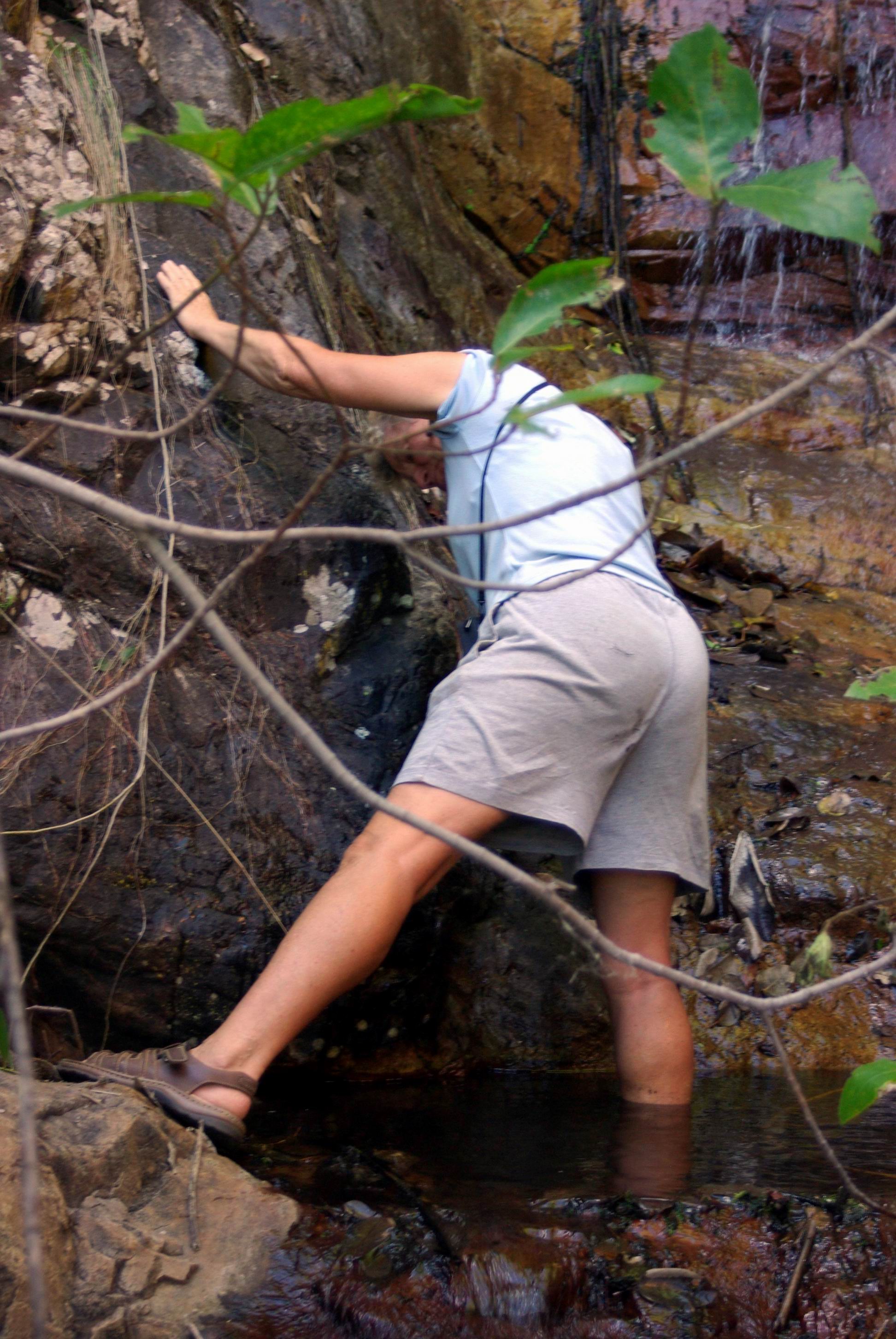
Parked the vehicles at the end of the rather rough track, then followed a faint track up beside the creek, to a little waterfall that was as far as we could go.
There was some boulder hopping and scrambling involved. M managed to slip on a wet rock beside the creek and finished up with one soaked walk sandal and a wet derriere.
Oops……
Further back towards the Camp, took another side track that led down to Cadjeput Waterhole, further upstream on the Fitzroy from Dimond Gorge. Cadjeput is a name for the big paperbark trees found along many northern rivers.
Cadjeput Waterhole
This was a serene place, with lovely reflections on the water.
Trees are pointing downstream
The trees beside the waterhole had a distinct downstream lean, indicating the force and huge volume of water that could come down the river in the Wet season. We were seeing it at a deceptively tranquil time.
After walking around, exploring there, for a little while, returned to camp.
Outback Spirit had a tour group in, staying in the safari tents, further down the creek. Their tour groups are not large ones. As we relaxed back at camp, could hear, and catch brief glimpses of, some of the tour members doing the Riparian Walk on the other side of the creek from us. We decided that, for people who did not have the equipment or confidence to drive themselves in remote parts, that sort of small group, ethical, specialist tour was a good option.
Right on dark, a party of three men arrived in “our” camp clearing and set up their camp a little further along from us – close enough to be heard.
Last night did not seem as cold. Maybe it was due to the beanie I wore all night?
We had a real sleep in. The area around us was quiet, and there was no early bird M waiting impatiently to get going on the day’s adventures!
Mornington camp
John changed the Truck wheel and put on one of the spares. We had – in line with previous trips away from the van – put the van’s spare wheel, which matched Truck wheels, up on the roof rack, so we had two spares.
I read, sewed, did some Sudoku. We both spent time photographing a little group of crimson finches that were flitting about in the undergrowth near our tent.
Crimson Finch
Later in the afternoon, we did the Riparian Walk. This was along Annie Creek, basically bird spotting. Mornington had so many different species of birds. AWC was leading efforts to save the Gouldian Finch in the wild, here at Mornington.
Along the creek – cicada moult shells
Near us, along the creek, were purple crowned fairy wrens. Not far from us, a Great Bower Bird was constructing a bower, and watching him kept us entertained for over an hour.
After tea, we walked the few hundred metres up to the Office/bar area for the advertised 7.30pm free talk, only to find that this had been rescheduled to tomorrow night. I was pleased about that, thinking that M might be here then, for that.
We did Sudokus until about 9.30, then sat for a while, in the dark, looking at the stars, and listening to the night noises of the occasional birds and critters.
Mornington had a no campfire policy. Also no generators. Both quite sensible, really, in environmental terms.
THURSDAY 12 JULY FITZROY CROSSING TO MORNINGTON WILDERNESS CAMP 428kms
The time at Fitzroy Crossing did not improve any.
Took my morning mug of coffee, intending to sit in my camp chair with it and watch the departing campers. As I sat down, the seam on the canvas seat split and I dropped right down into the metal framework of the chair. It hurt like hell and I was quite bruised. And I spilt my coffee!
The chair was 14 years old, and had been much used and exposed to the elements over its lifetime, so I probably should not have been too surprised. Better me than John – an accident like that could really cause him some hip damage.
Morning at Fitzroy Crossing camp
It was 10am before we departed camp. John had to go and refill the spare fuel jerry can, which meant a big repack of back of Truck.
From Fitzroy Crossing, drove 43kms west on the highway, then took the Fairfield-Leopold Downs Road – unsealed – for 124kms, to link us through to the Gibb River Road. This road was quite corrugated and rocky in parts and was fairly slow going.
We did not stop at either of the National Parks along this road – Tunnel Creek and Windjana Gorge. John and I had camped at Windjana Gorge in ’93 and explored both. M had visited them on her previous only trip to these parts – a short tour from Broome, undertaken on a tour package with her mother, a few years back.
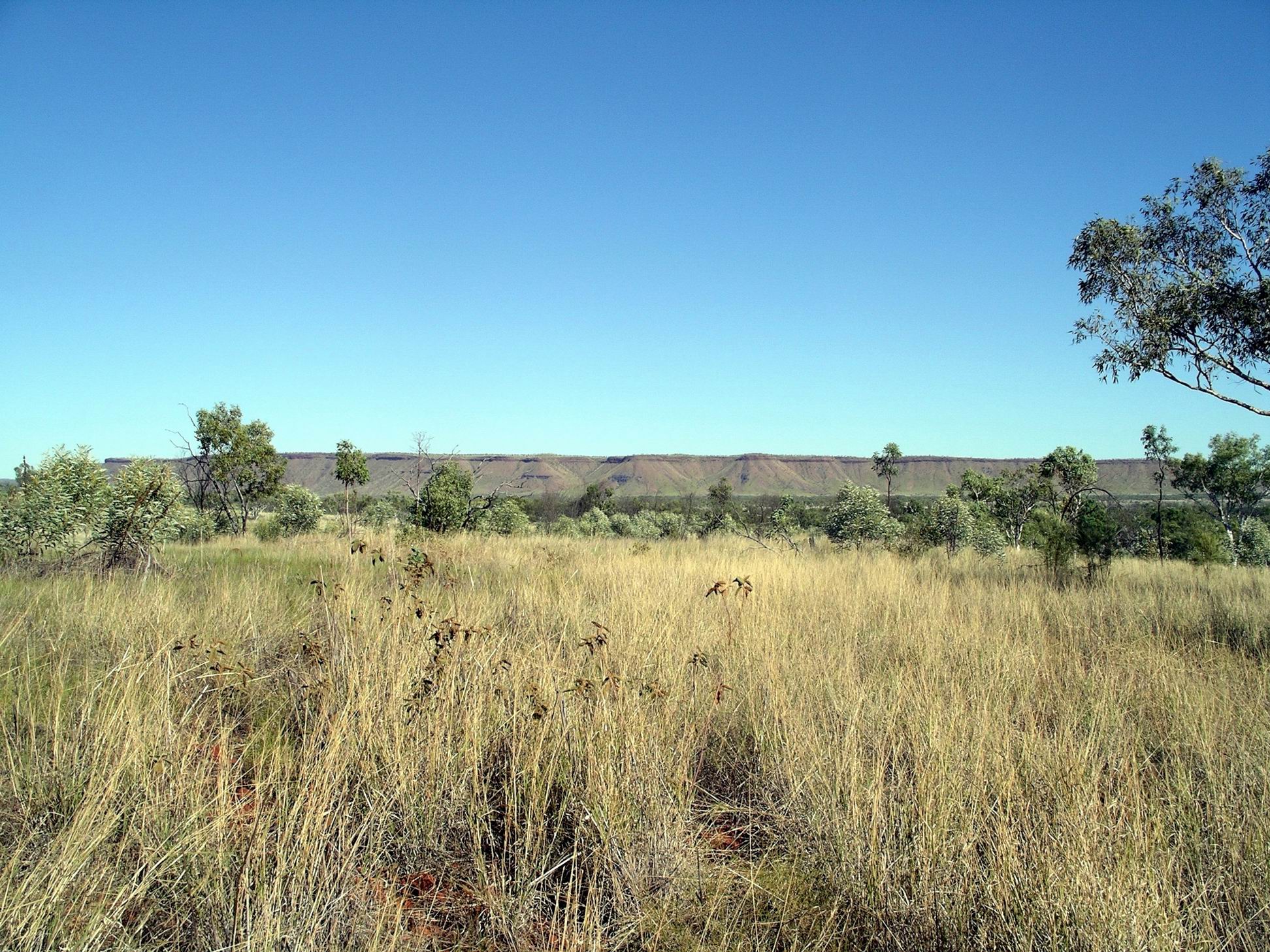
Today’s was a very scenic drive. This western end of the Kimberley is all former Devonian Reef ranges – quite rugged.
Australian Bustard seen along the way
After we turned onto the Gibb River Road and headed east, these ranges were in front of us. It didn’t take long before we passed through the first of several gaps in the ranges – Yammera Gap, with its big rock formation on one side, very aptly named Queen Victoria’s Head.
Approaching Yammera Gap
A couple of the steeper sections through the ranges, like Inglis Gap, were sealed. There were some good outlooks from some of these, over the wild country ahead.
Through this section, there were several pleasant creeks and we noticed people setting up camps by some of these – even where they were clearly signed “No Camping”.
There was regular traffic along the Gibb. Too much of it was travelling too fast. 4WD’s towing camper trailers seemed to be the worst – even more so than the dreaded overseas drivers of hired 4WD campers. They pass oncoming traffic at great speed, with no thought about the stones and rocks they throw up at others.
At one point, we had slowed right down to go through a small creek ford in a little gully. A 4WD with trailer came up behind and sailed past us – didn’t slow down at all for the creek. I swear his camper trailer got airborne! These are the travellers who later complain about poor quality roads wrecking their vehicles and tyres – we have seen and heard it all before.
It seems to be an unfortunate fact that, these days, any area/road that is designated “remote” ” an adventure” ” challenging” brings out the most moronic of the idiot drivers – a scary number of them. I don’t give a damn if they spoil their own rigs, and holiday plans, but object mightily when their stupidity affects the sensible minority.
Some 95kms along the Gibb, we parted company with M for a couple of days. She took the side road to Silent Grove and Bell Gorge and planned to catch up with us later, at Mornington. John and I had previously camped at Bell Gorge and it was now one of several places along the Gibb that was very popular, and hence often crowded.
Only a few kms after the Bell Gorge turn off, was the Imintji Store. This had not been here the last time we were at this end of the Gibb, and was linked to the nearby little community of the same name.
We’ already done 300kms since filling last at Fitzroy Crossing, so refuelled here – $1.85cpl. Bought an icy pole for John and a cold drink for me. Chatted a bit with the very nice lady behind the counter – she and her husband had been contracted to run the place for this season, on behalf of the community.
Another 25kms brought us to the turnoff we wanted, to the south east. A hundred metres or so down this road (which also went to Mt House Station), was a roofed shelter, housing a two way radio. All prospective visitors had to use this to call the Wilderness Camp, some 90kms distant, to see if there was a vacancy in the campground . This was very sensible of them – it was a long way to go, only to find one was turned away! There was no other legal camping until back on the Gibb. As they strictly limited the number of campers at any one time, to 25 vehicles/50 campers, there was a very real chance of the campground being full.
We were fine, there was room, and we proceeded southwards, on a route that was new to us.
The track was quite reasonable. It took us an hour and a half to do the 90kms. The scenery was really wonderful, particularly when we were running alongside a group of flat topped, mesa like peaks.
There were a number of dry creek channels to be crossed, and occasional ones with a little water in. For the most part, these had been smoothed out by the road grader.
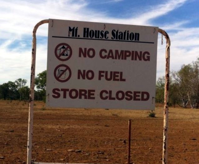
Passed the turnoff to Mt House Station – a cattle operation that did not welcome visitors.
Navigating from a map with a scale of 10km to the cm definitely involved a degree of guess work, given the myriad of station tracks, not marked on the map. I thought I’d identified the turn offs to Moll Gorge and then the Tablelands Track. The latter, in particular, gave me some angst because, if I was wrong, we could have veered right when we should have gone left!
So, I was quite relieved, shortly after, to recognize the site of the old Glenroy Meatworks. We were still on track. This had been the focal point of the Air Beef Scheme, set up after WW2. Cattle from quite a wide radius were brought into the abattoirs/meatworks at Glenroy Station, slaughtered, and the carcasses flown, soon after, to Wyndham, where they were frozen for shipping onwards. So there had been a large airstrip at Glenroy. The making of the Gibb River Road, in the mid-60’s, provided the alternative to cattlemen, of road transport of stock to markets, and so the Air Beef Scheme closed down.
For the final few kms, were winding back and forth across stream tributaries of the Adcock River, an upper tributary of the Fitzroy River. Annie Creek, beside which Mornington Wilderness Camp is located, is one such tributary.
Drove through the campground area and found the main building a bit further on. There, we booked in for five nights. Sites were $30 a night – no power, of course. Had to pay a $20 entry fee to the property, too.
There were really good, thick, woollen beanies for sale, with the Australian Wildlife Conservancy monogram on. I bought one – $20 – thinking it might help keep my head warm at night, when trying to sleep.
It hadn’t been hard to spend $190 here, in just a few minutes!
We then had to drive back to the camping area, which was strung out along the creek, and pick out our own site from amongst the empty ones. Sites were mostly just clearings in the bush, some of them off an access track that ran parallel to the road in. Probably about half the sites were occupied – the very best of the secluded, shadiest ones, at the northern end, were taken, but we found a good place to set up in the more southern section.
The Wilderness Camp was within the Mornington Sanctuary – a former pastoral lease owned since 2001 by the Australian Wildlife Conservancy. This private conservation group was doing great work on a variety of environmentally significant properties across Australia, underpinning their conservation efforts with really thorough scientific research.
I didn’t mind paying these sorts of fees when any profits went to support the work of such a group.
When we had been travelling in the Kimberley in 2000, I had planned for us to stay at Mornington, where the then station owner had set up a campground, like others that were springing up across the region, in response to growing traveller numbers. The remoteness of the place – being off the usual traveller route – had appealed to me. From there, we were going to try to drive the Tableland Track, back eastwards, to the Bungles area. But the fates intervened and that part of the planned Gibb River Road trek didn’t happen. When I read, the following year, that AWC had bought Mornington, I was sure the chance to explore that area was gone. But, the organization decided to keep a camp operation going – and here we were.
The campground amenities were very good, with flush toilets and warm showers.
There was also some safari tent accommodation in a different section further along the creek. There is only one commercial tour group allowed to access the property – Outback Spirit, and their tours use the safari tents. I believe that policy reflects a positive view about the environmental credentials of Outback Spirit. When we had worked at Adels Grove, that company had brought tour groups through; I always found them the best groups to deal with.
So, with limited numbers, the place never feels over run by people – unlike some places along the Gibb.
It was getting dark by the time we were fully set up. John found a small piece of board in Truck, that he normally used for packing between things. He was able to place that across the framework on my broken camp chair. With the addition of an old cushion – also used for packing – this would do me for the time being. The actual framework of the seat was quite sound, it was just the canvas seat that had weakened. We inspected John’s chair but the canvas showed no signs of tearing. However, he will be very careful when sitting down, to lower himself very gradually. I also had the option of using a little folding stool that occasionally saw use when John was fishing.
John also found that one of the front tyres was going flat – a slow leak.
We’d parked Truck in a way that would ensure there was still room for M’s rig, in case any other campers decided to set up in our little clearing.
The rain eased off during the morning. The sky was still that dense grey colour, and there were occasional showers. There were big pools of water on the ground in the caravan park – it was very slow to dry. I guessed it was all so saturated. That sensation of dampness in everything was back.
From the veranda of the amenities block – that’s the back of our van on the right
There had been two inches of rain overnight!
However, the forecast was that his weather would clear away through this week. I hoped!
The amenities block floors got really mucky as grass and leaves and mud were tracked in. The staff did their best to keep it clean, with repeated visits through the day – but it just could not be helped in these conditions.
There was talk that food drops were being organized for campers stranded on the Mitchell Plateau. Probably by helicopter rather than plane. Campers were stranded in the Bungles too. There would probably have been other pockets of campers having to stay put in places along the Gibb River Road, but at least the campgrounds there had, for the most part, stores nearby.
Sleeping Buddha under cloudy skies
John went out with a purpose, and found a local firm that would sandblast and paint our roof rack, which was getting quite rusty where paint had peeled off. He reckoned the time here might as well be used productively, and he liked using businesses in such towns. At least he had help there to get the rack off the roof – it is a pig of a job when there is just the two of us!
I went to the Park office and through them booked an Ord River trip for Saturday, with Triple J. I was being optimistic that the weather would be fine by then. We would travel both ways from here to the Ord River Dam/Lake Argyle, by boat. Travellers most commonly did the boat trip one way, then a sunset cruise on Lake Argyle, travelling back in the dark by bus. But we had done the sunset cruise on a previous trip. I thought the river would look different coming back, anyway. M wanted to do the combined trip but could only get a place for Thursday next. She gambled that the weather would be on her side.
The weather might be going to clear?
Whilst I was out and about in the Park, and having a bit of a walk around, Telstra phoned John, and managed to convince him to order a Next G phone – with a more costly plan, of course! He also changed over the computer internet card. I wished he would have left any changes to our current technological set up, until we were at home. I had some memories of several previous efforts to upgrade things, or get things working, whilst on the road. It was never as seamless as the sales people promised.
The new phone and computer card would be mailed here, he told me. Well, we had a week until we were due to leave here – what could possibly go wrong?
Unpacked, washed, tidied away our stuff. Reckoned the only use I would have for my boots now, would be gardening!
The place seemed strange without a resident cat. We were missing Spook cat. M had to have him euthanized while we were away this time. We had been expecting that. He lived to a very old age, for a cat. She had buried him by the climbing roses, beside the pool.
It was a great relief to be home. John could sleep and rest, and try not to have the shingles get any worse. He had a bad dose of it.
The three of us started throwing around ideas for this year’s extended trip. I’d long had house sitters booked for five months – May to September….. M had not yet been to the Kimberley, so that seemed an obvious destination – more of WA!
PILBARA POSTSCRIPT
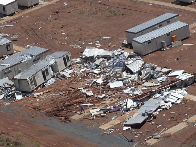
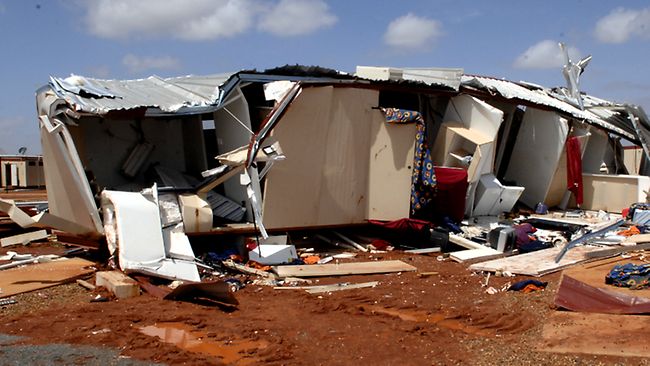
A month later, on March 8, Category 4 Cyclone George caused major damage and destruction at RV1, two people died and a number of others were severely injured. One of the people killed was sheltering in the same donga we’d slept in, the previous month. Our manager friend was injured, but survived.
Cyclone destruction (from media)
The winds were so strong that there was even some damage at RV 2, so much further south.
The resultant enquiries, inquests, law suits went on until 2015. They basically took two lines – why the damage was so severe, and why the camp had not been evacuated before the cyclone hit. (For anyone interested, assorted reports can be found via internet)
RV1 was rebuilt for the duration of the rail building project – but not by the company we’d worked for.
In mid-2007, we received a phone call from WorkSafe WA, about interviewing us as part of their enquiry into the disaster. We were travelling at the time, in the Kimberley, and said we would be back home in Melbourne, later in the year. We heard no more from them.
I could not help but think that this ancient and superb country had taken some revenge for its destruction by mining.
ANOTHER PILBARA POSTSCRIPT
Late last year, at RV1, when Fortescue shares on the Stock Exchange were only a few dollars, John wanted me to buy some of those shares. I did not take the opportunity, because I felt that so much money was being expended, in a way that seemed quite reckless. The image stuck had stuck in my mind of one day at RV1, when a plane was doing repeated low passes over the site. R said it was “just” Twiggy Forrest having a look at progress. I’d wondered what it had cost for him to do it that way?
So, I couldn’t have faith then in the iron ore mining venture actually making money. What did I know? It wasn’t long before those shares hit $80.