
FRIDAY 17 DECEMBER COLES BAY
This was the day to do the big circuit walk! The weather was supposed to be fine, although there were some clouds about through the day.
The circuit we wanted to walk would take us up to a lookout over Wineglass Bay, then down to the Wineglass Beach, across to Promise Bay, then back around the coast to the car park where we started. It was about 11kms, so quite a decent walk.

We began the walk at 10.55am – not early starters, us – after driving in to the carpark at the walk start.
From there, the track climbed steadily up to the Wineglass Bay Lookout, which gave great views over that Bay and the Isthmus, the narrow neck of land that joins the two mountainous sections of Freycinet Peninsula. The view from the Lookout, though great, was not quite as good as the ones I remembered from the top of Mt Amos, just to the east, which I climbed in 1970. But this one was a lot easier to get to!
On the Wineglass Bay track

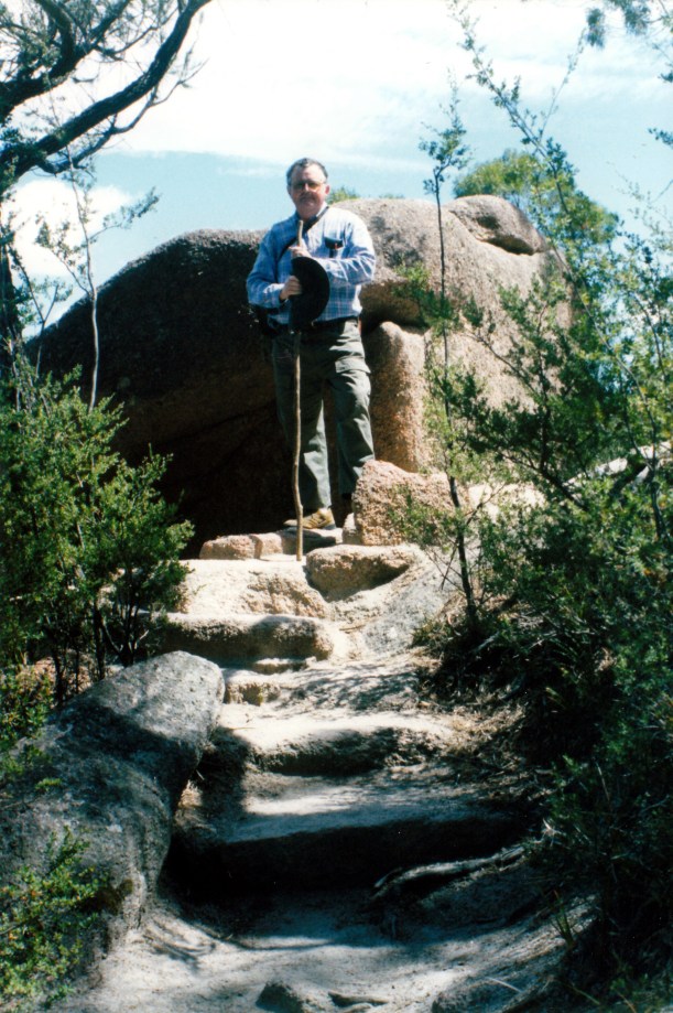
I hate uphills!

Wineglass Bay from the lookout
From on top, we descended steadily to Wineglass Bay, which is just so beautiful. The climb up to the Lookout, and the descent to the beach were both steep, but manageable. John did really well.
We had not been alone on the walk up to the Lookout, but no other tourists came beyond that point, so we had the beach to ourselves.

On the beach at Wineglass Bay – turquoise water and white sands
We walked up and down the beach for a while, just enjoying the place. Then ate lunch, sitting and drinking in the views, to Mts Graham and Freycinet to the south, and to the Hazards and Mt Amos, to the north – the way we had come.
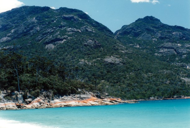
The Hazards, including Mt Amos, from Wineglass Bay Beach
Took the track that crosses the Isthmus to the western side of the Peninsula. The track was fairly flat and through scrub, to The Hazards Beach. This beach was much rougher and more open to the weather than Wineglass Bay, and without its turquoise water and headlands of orange lichen-coated granite.

Hazards Beach looking north – the way we were going
As we walked north on The Hazards Beach, saw several huge shell middens. Clearly, these were the rubbish dumps from the aborigines who used to camp here and feast on the shellfish to be found.

Shell midden
The walk track followed the coastline back around to the carpark. This was scenic walking – at one point we could see south to Maria Island. I found it very reminiscent of walking on Wilsons Promontory. This coastal section of track was less groomed than the Wineglass Bay one and we had some steep scrambles up and down gullies, so it was quite tiring.

From the coastal track
We reached the car park about 3.45pm, so it took us near enough to 5 hours to do the 11kms.
It was an excellent walk – not too totally strenuous, but demanding enough to make me weary by its end. In other words – just right! It was a walk I had long wanted to do, and that was satisfying.
It was fish and chip night, too! The local seafood takeaway was mainly a cafe with pretensions, and expensive. John bought fish and chips for himself – a generous serve – for $6. I bought $2.50 worth of chips and went and bought frozen oven-bake fish from the supermarket and cooked myself a couple of pieces of that. I did better than John, at a much cheaper cost – and it was nicer!
