WEDNESDAY 18 AUGUST KNOLLS TRACK CAMP TO QAA LINE CAMP 107kms
Our night’s sleep was broken by a dingo, prowling close outside the tent. At one stage, it seemed to almost be sniffing my head, with only the tent fabric between us! Not pleasant! We had not left anything edible outside – everything was securely packed in Truck. However, in the morning, our washing up gear was scattered about – sponge, scrubber, brush. They must have smelled of last night’s curry! We had heard that the dingoes were doing it tough, because of the effects of calicivirus decimating the rabbit population.
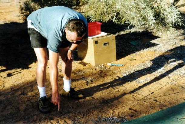
John pointing out dingo paw prints amongst our scattered washup gear
We woke at 7.45. The sky was clear and it was already hot. Left camp at 9.30 – an improvement. Before leaving, we put in the second jerry can of fuel from the roof rack.

Breakfast time in camp
We were actually further south of the Knolls than we’d thought.
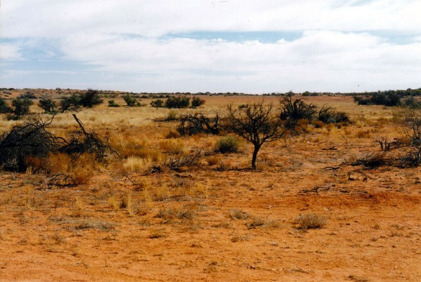
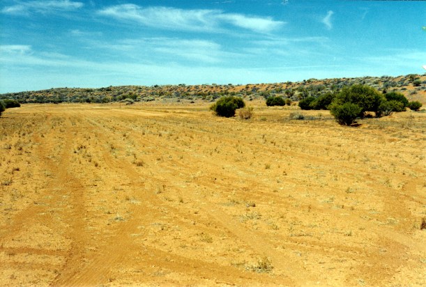
The track was slow going – bouncy, with some rough gypsum outcrops. Several times the track crossed small dry clay pans – the track was a bit smoother there. It took us over an hour to reach the Knolls.
The Knolls gradually appeared in the distance as two small, low, flat topped mounds. They were formed when a gypsum crust formed in a couple of places and then over much time, the surrounding land eroded, but the hard crust protected the tops of these two areas. We parked by them and walked up to the top of one. We did not stay very long – the outlook from the top was just a broader expanse of what we’d been seeing from down below. However, the white crust of Lake Tamblyn added some interest.

Outlook from top of Knoll towards Lake Tamblyn

Another outlook from Knoll
This morning, two vehicles had passed us while we were packing up camp, presumably having come from the Knolls. There were two camps still here, so we were glad that we’d decided to camp in the solitutde where we did.
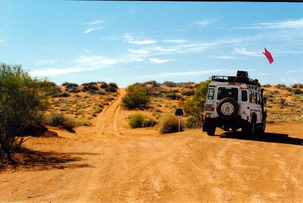
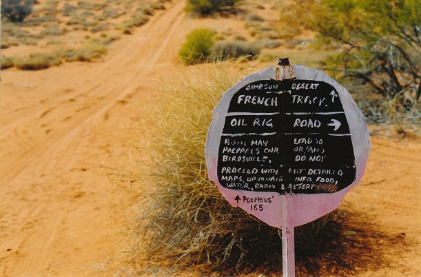
It did not take us long to reach the next landmark – the corner of the Knolls Track and the French Line – again!
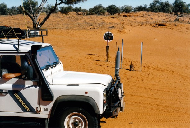
The corner of the AAK Track and the French Line track
We turned to the east – and back onto the dune crossings.
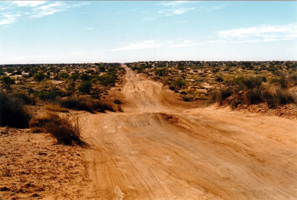
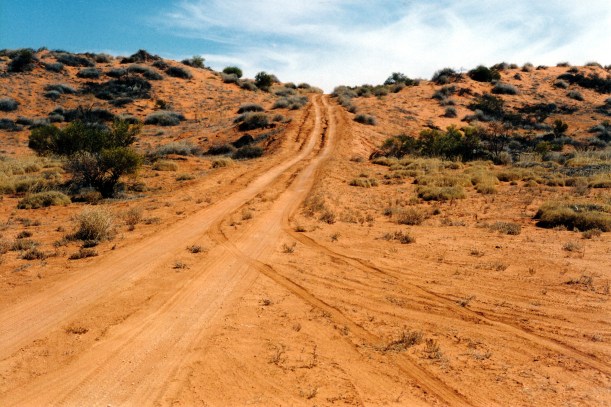
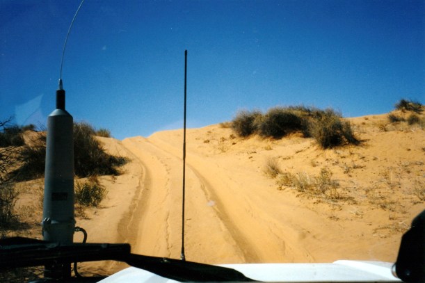
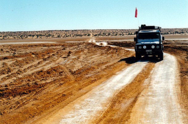
Immediately, the track became more sandy and bouncy, and the dunes higher and closer together. These were sometimes fairly challenging. Because of their steepness, there were not the slightly flatter tops of the Rig Road dunes; instead, it was really steeply up and immediately over and steeply down again. This is really where the sand flag becomes relevant.
We could clearly see, in the sandy centre of the track, where those who had been towing were dragging their tow hitches in the sand, as they bounced. No wonder some trailers fall apart out here! The effects of both drag and sand abrasion would be severe. It really is taking a risk, because breakdowns must be retrieved. The penalty for just leaving a broken down trailer or vehicle is far greater even than the huge cost of retrieval.

On the French Line – trailer coupling drag marks in the sand between the wheel lines
We both drove sections again today.
The increased traffic on the French Line really gave us an insight into how limited, or stupid, some fellow travellers are. We encountered two vehicles travelling towards us, in tandem, where the women in each were using the CB radio to keep count of the sand dunes as they crossed them. We heard them gradually come into radio range, counting every few minutes, pulled over to let them pass, then heard them fading away into the distance. How boring would that be, over a few days? It was boring just listening to them!

Slow going on the French Line
Another incident was potentially more dangerous. I was driving, and John was coaching me in managing the increasingly higher, sandy, dunes. We had been in radio contact with others that we had been hearing for some time. The woman, on the radio, said that they were crossing west to east – just like us. John was getting curious, because after some little time, they seemed to be getting louder, but we couldn’t see any sign of them behind. As I crested a dune, there was suddenly an oncoming vehicle about 2 metres in front of me, coming up! I took my foot off the accelerator causing us to immediately come to a stop in the sand. John yelled at me to gun it, not bog it – his focus as we got to the crest was on the next dune, not what was actually right under us. A little misunderstanding occurred, until he realized what I was seeing! It was very close.
The other vehicle had no choice but to back down the dune and we passed at the bottom. The stupid woman passenger said “Oh, silly me, I always get east and west mixed up”! I don’t know if she had enough intelligence to realize how close she came to causing a head-on collision. They had no sand flag.
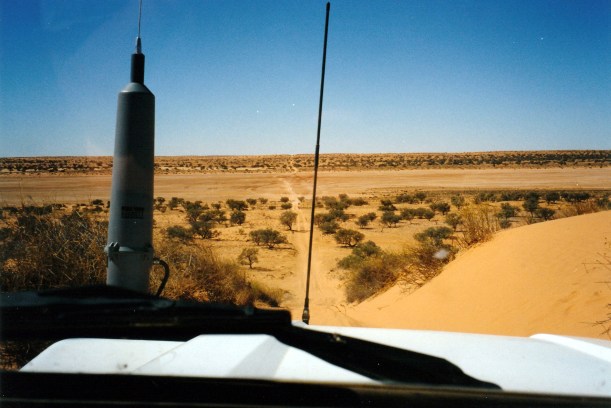
What it looks like, climbing up a dune…….

All one sees at the crest is sky……..
Over – and down we go again
Another phenomenon we noticed, now that we were fairly regularly meeting other travellers, and stopping usually to exchange a few words about the experience we were having, was that the invariably male drivers seemed not to know how to cope with a female driver doing the “tough stuff”. We would pull up alongside each other, they would talk across me, to John, and ignore me! Maybe it was no wonder that some women resorted to dune counting? It actually amused John no end – I think he was quite proud that his wife was capable of such driving.
We nearly came to grief a second time today. John was driving, crested one of the steep dunes, there was a deep hole on one side of the track just over the top, and we crunched down into it. Truck came very close to rolling onto its side, but we had just enough momentum to keep it going forward rather than over. We just had to hope no damage had been done – it was a hell of an impact.

John standing in the deep hole made by something bogged – where we nearly rolled
We stopped lower down and went back to look. It looked like someone had gotten bogged coming up the dune, had to dig themselves out, rather than rolling back down the dune, and then had not filled in the resulting hole. We thought it had probably been one of the morons towing the trailers, the day before. I was glad John was driving when that happened and not me. It was very sobering.
On a section of sandy dunes, for some kms, we had noticed dog prints in the tyre track, and eventually overtook a single, very thin, dingo, plodding eastwards. It moved off as we got close – seeming rather reluctant to do so.

Dingo highway
We reached Poeppel Corner at 1.30, in time for a late lunch. We had aimed to get here before stopping again.

Whilst we were there three other vehicles came in, from the Birdsville direction. Two were travelling together and told us they had camped last night at the old vermin fence remains. The other was a solo traveller (who must have changed his mind about the crossing and returned to Birdsville, because he passed us, going back that way, as we were later setting up camp.)

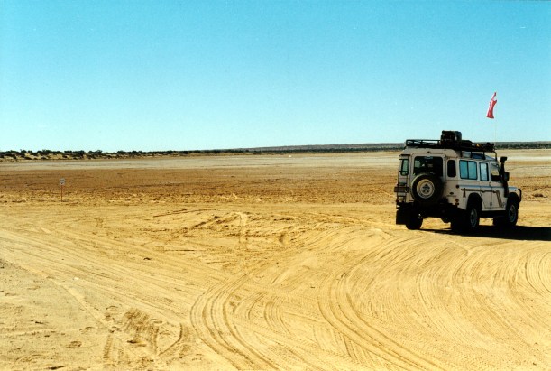
Poeppel Corner and Lake
There were some big salt pans in the Corner area: Lake Poeppel, by the Corner, and the next one to it.
Poeppel Corner marks the junction of Qld, SA and NT. The exact location was surveyed by Poeppel around 1880. He placed a marked log upright in his surveyed position, in the salt pan, the log having been brought from Eyre Creek by his camels. Later he found that his surveying chain had stretched a little, and a few years later, the post was moved to its correct position by the side of the salt pan. In the 1960’s Reg Sprigg removed this post and it was replaced with a cement one, but there is also a replica of the original wooden one. We took the obligatory photo of ourselves with this. And performed the other ritual here – trying to stand with feet in three states at once.
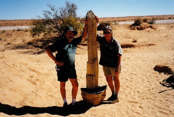
The old corner pole at Poeppel Corner
I drove the first leg after lunch. Northwestwards, skirting the lakes, along the K1 Line. This section took us very briefly into Qld, then into the NT for a few kms. Then we turned east again, onto the QAA Line, where we crossed what would obviously be a nasty bog in a clay pan, when wet.
Claypan on the QAA Line
Back into Qld for the rest of the run to Birdsville.
Corner K1 and the QAA Line
It was the roller coaster track again, sand dunes, chugging along in low range.
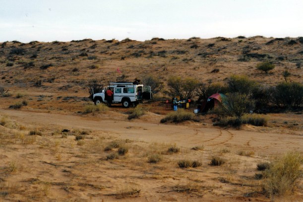
John drove for the last half hour or so, before we pulled off the track, to the side of a clay pan, for a little way, to camp. It was 4.30pm.
We had long since realized that we were going to take a day longer than planned, to get to Birdsville. The going was just too slow. Even then, tomorrow would be a long day. Those people who boast that they “do” the French Line route, with just one overnight stop, must take some incredible risks, not ever stop to look around. They are probably the ones who churn up the track for the rest of us.
Our claypan camp was between two quite high, red dunes.

Camp by the QAA Line
After we set up camp, John did the radio sched with Alice Springs base, and amended our schedule with them. He “phoned” K to let him know we are running a day late, but that all is well.
Today’s churning going up and down the dunes has really used up the fuel – we could just about see the gauge dropping. We will get to Birdsville ok, but will not have much surplus.
Tea was tinned soup, a packet risotto, oranges.
John looks for the evening star, most nights. Can’t see it out here, and that upsets him.